


![]()


Durata
 6:20 h
Distanza
 13 km
13 km Ascesa
 982 m
982 mDiscesa
 982 m
982 mH Max
 2324 m
H Min
 1406 m
Monte Piana from Lake Landro
DESCRIPTION
Very interesting excursion both from a landscape and historical point of view.
Monte Piana is a mountainous ridge located in the Val di Landro. Due to its strategic position it was the theater of war during the First World War. The fighting on the summit was very bloody and it is now an open-air museum. A curiosity: Monte Piano, the northern peak, was occupied by the Austro-Hungarian army, while Monte Piana which is the southern peak was garrisoned by the Italians.
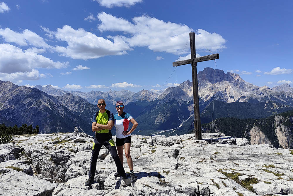
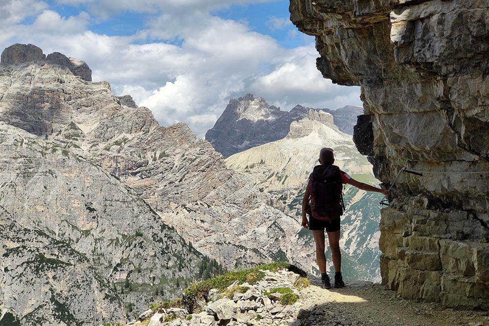
The particular position of the mountain offers wonderful views of the Tre Cime di Lavaredo, Monte Cristallo, Cadini di Misurina and Croda Rossa d’Ampezzo.
ITINERARY
From Lake Landro / Dürrensee (1406 m) take path no. 6 for Monte Piano. At the crossroads, take the Sentiero dei Pionieri / Pionierweg, always n. 6 and climb up to Monte Piano (2306 m) where the Croce di Dobbiaco / Toblacher Kreuz Cross (2305 m) is located. Now follow the historical path and go towards Monte Piana passing among the remains of the fortifications of the First World War. At the Forcella dei Castrati (2272 m) take path 111 up to Monte Piana (2324 m) and the large wooden cross (2310 m). Return to Lake Landro by taking the Tourist Path no. 6A. Arrived at the plain (1460 m) turn right following path 6B and then with path 6 you return to the starting point.
EXCURSION DATE
July 18, 2022
STARTING POINT
Landro Lake
REFRESHMENT POINT
Nobody
AUTHOR’S SUGGESTIONS
Be careful in some downhill stretches of the Tourist Path.
SAFETY TIPS
The viability of the proposed itinerary, like all mountain morphology, is subject to environmental changes due to natural events and weather conditions. Therefore, before leaving, consult the competent tourist offices and / or the refuges of reference.
Our GPX tracks are only indicative, that is, the route was carried out at best with the conditions of the trails and weather of that day. So always consider what to do on site.
Also remember to evaluate the route based on your physical abilities, training and the equipment you have.
You should leave someone the route you intend to do told.
Remember that the emergency number is 112.
EQUIPMENT
It is recommended to have the appropriate equipment for the route, weather conditions and season: windproof and / or rain jacket, map and / or GPS device, goggles, sunscreen, boots, first aid kit, specific clothing, gloves, backpack with food and drink.
RECOMMENDED MAPS
Tabacco 010 DOLOMITI DI SESTO/ SEXTENER DOLOMITEN
INTERESTING LINKS
https://www.frontedolomitico.it/Luoghi/piana/piana.html
HOW TO ARRIVE
From Dobbiaco take the SS51 of Alemagna towards Lago di Landro (about 12 km).
PARKING AREA
Free along Lake Landro, near the Lago di Landro Restaurant.
GPS coordinates: 46.633855, 12.230888
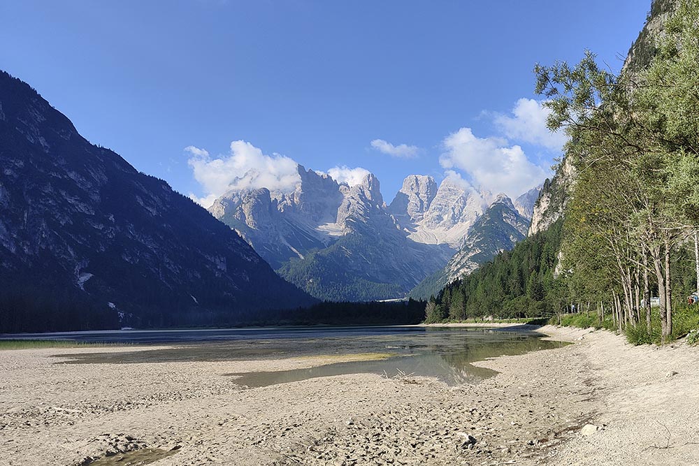
Lago di Landro
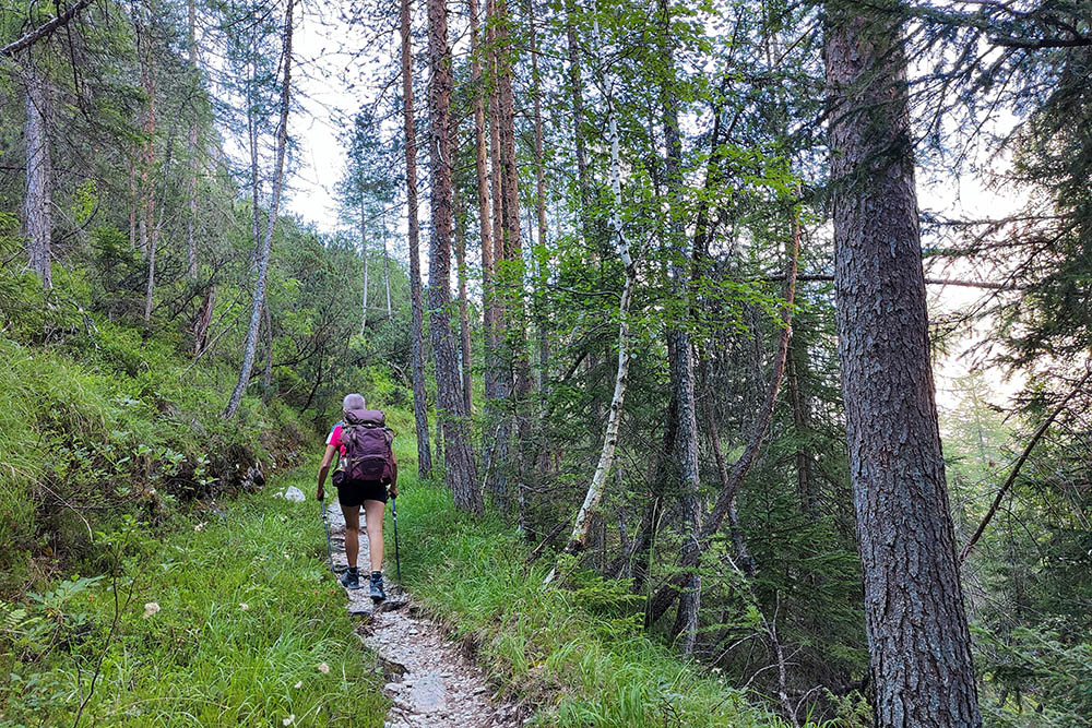
Sentiero dei Pionieri
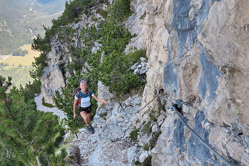
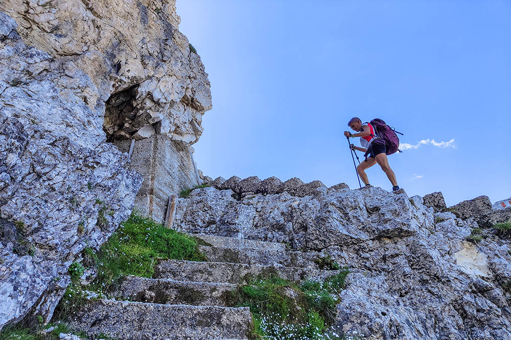
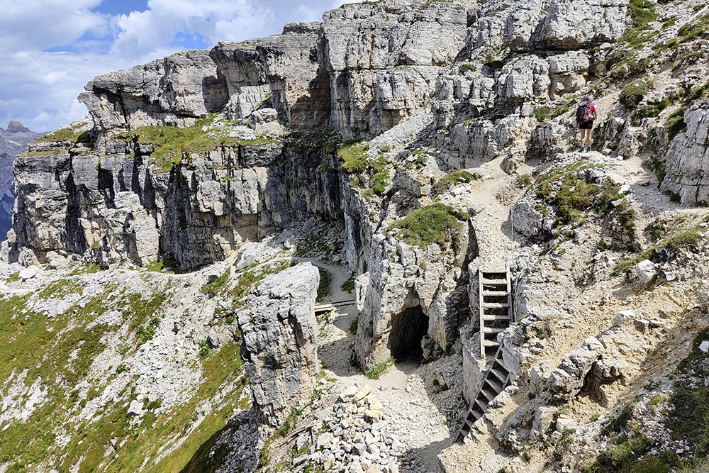
Breve tratto attrezzato
Piccolo cimitero austroungarico
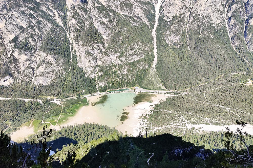
Vista sul Lago di Landro
Manca poco alla vetta
Croce di Dobbiaco - Monte Piano
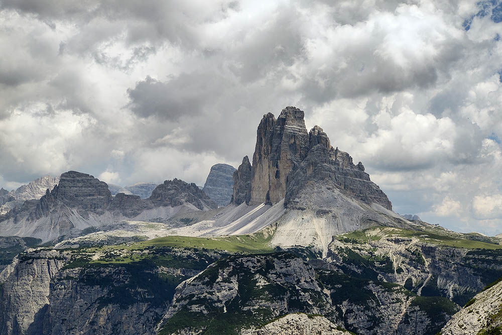
Vista sulle Tre Cime di Lavaredo
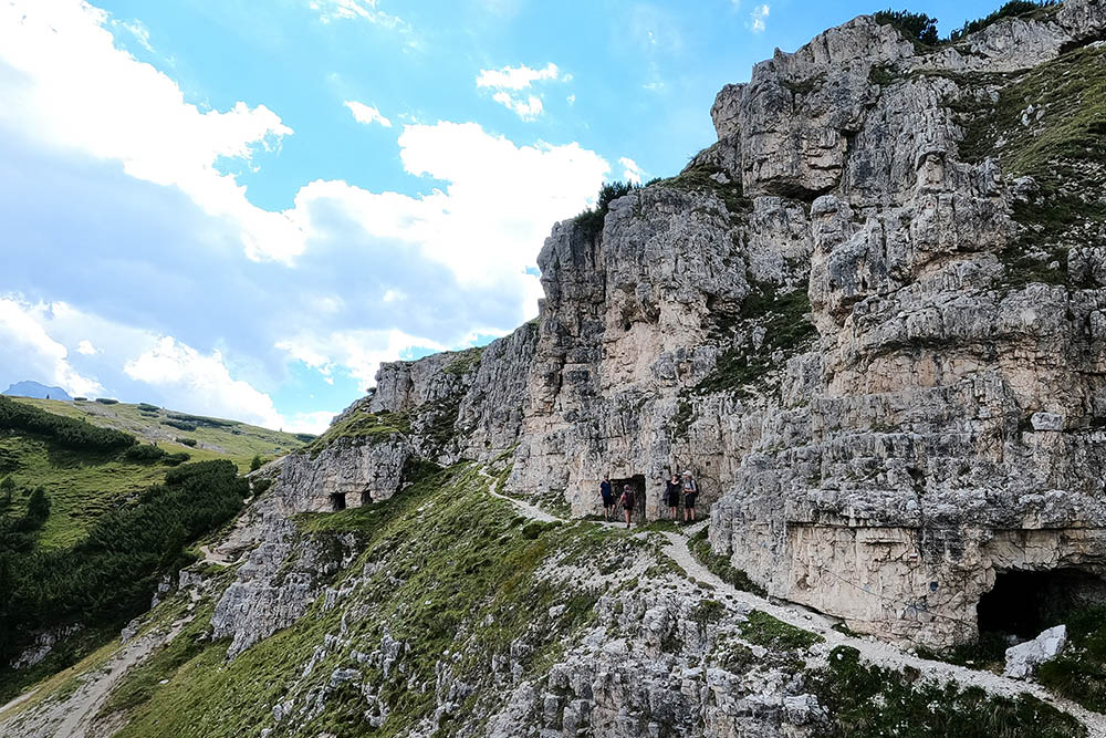
Camminamenti militari tra il Monte Piano e il Monte Piana
Camminamenti militari tra il Monte Piano e il Monte Piana
Camminamenti militari tra il Monte Piano e il Monte Piana
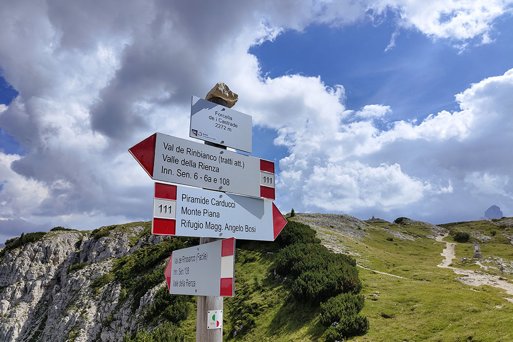
Forcella dei Castrati
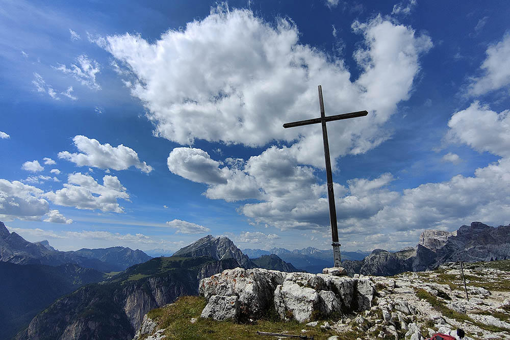
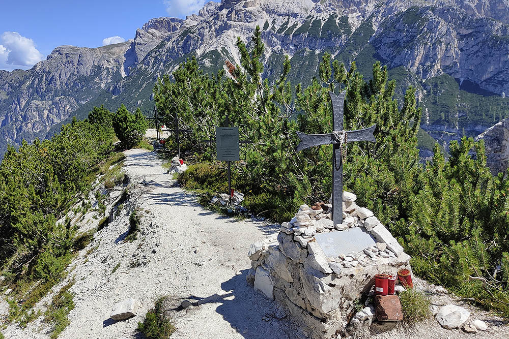
Croce di Monte Piana
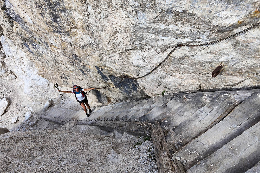
Sentiero dei Turisti
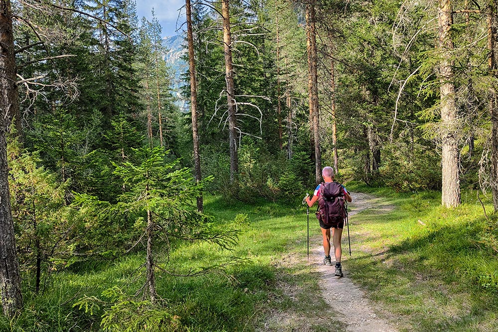
Si va verso il Lago di Landro


