


![]()


Durata
 6:25 h
Distanza
 16,1 km
 Ascesa
 1300 m
Discesa
 1300 m
H Max
 2598 m
H Min
 1361 m
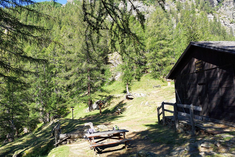
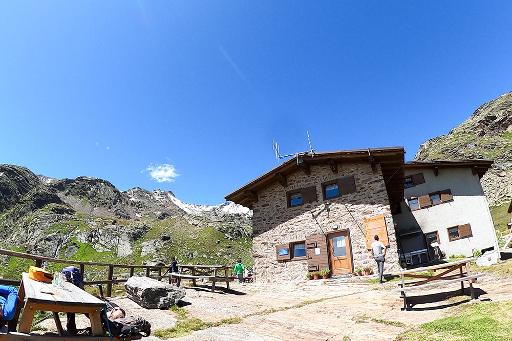
Rifugio Silvio Dorigoni
DESCRIPTION
Excursion in Alta Val di Rabbi among huts, waterfalls and lakes.
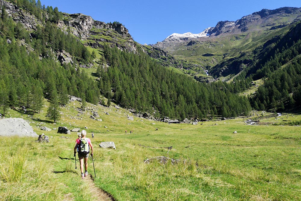
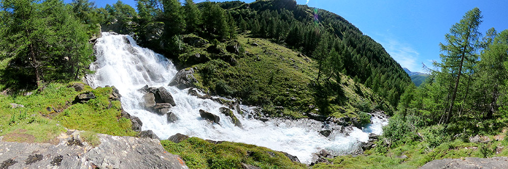
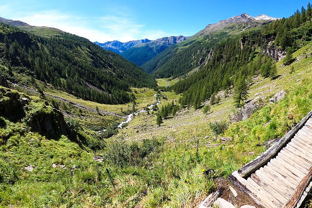
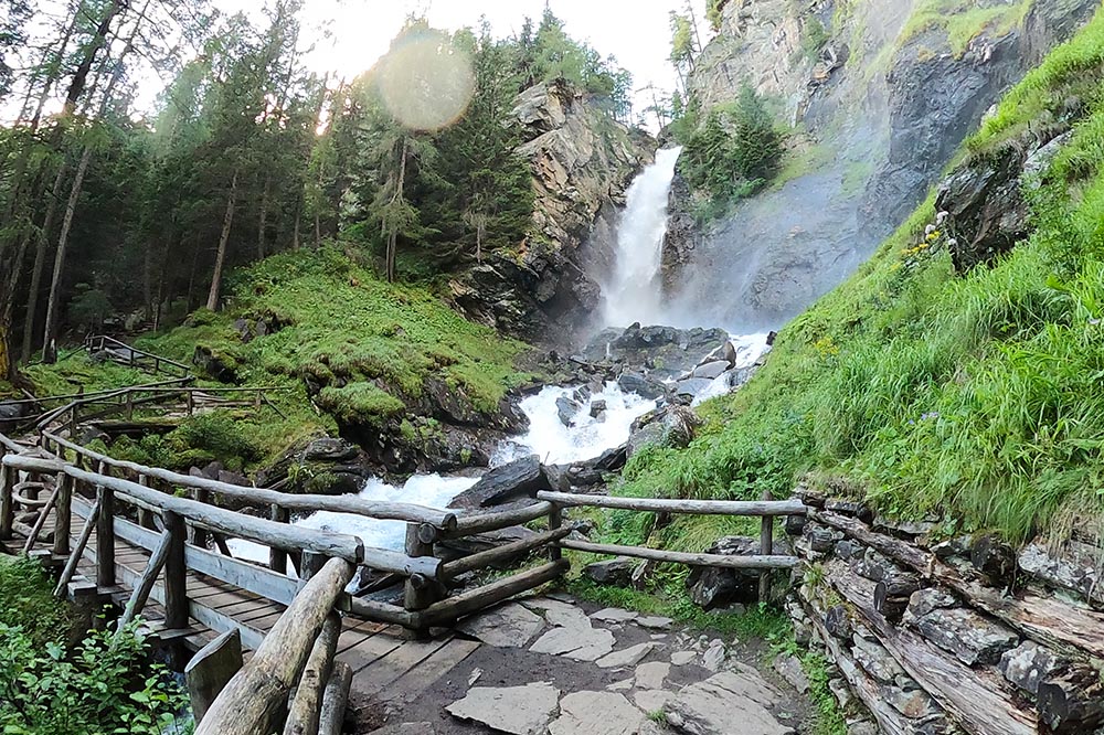
We are located in the Stelvio National Park at the bottom of the Val di Rabbi, on the border with South Tyrol on one side and with Lombardy on the other. Along the path leading to the refuge there are beautiful natural attractions: the Saent Falls, real forces of nature. Do not miss the first Lake of Sternai either, because it is very characteristic with an accentuated turquoise color. The route is a bit challenging due to its length, but you can rest at the refreshment points.
In summer the access road to the car park is not always open, ask the tourist offices for closing times.
ITINERARY
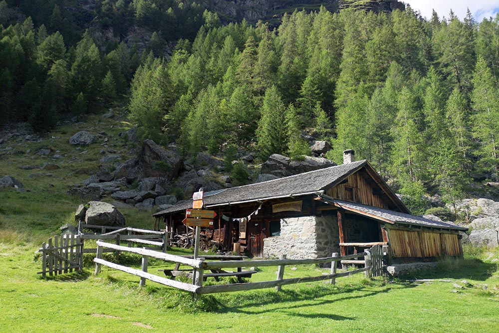
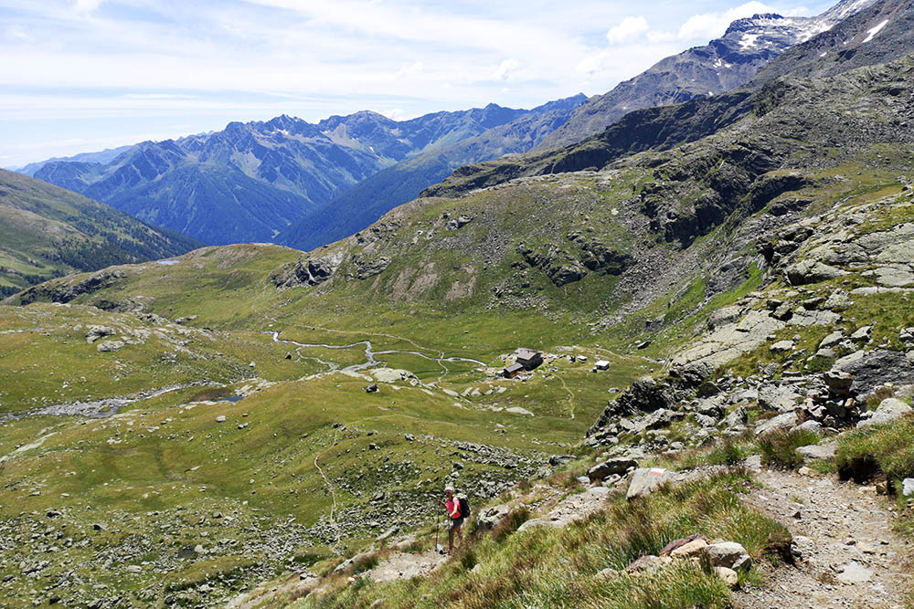
From the car park, take the orographic right of the valley and follow trail 106. You pass the Rifugio Fontanin (1388 m), the Malga Stablasolo (1543 m), Malga Pra di Saent (1778 m), the Alte di Saent waterfalls (1850 m) and you arrive at the Rifugio Silvio Dorigoni (2436 m). Here you go up to Lake Sternai (2596 m) on an unnumbered path. Now you return along the same path up to Plan de le Scalace (1730 m). Take the Geological Path and pass on the left orographic side. You pass the Cascate Basse di Saent and return to the Coler car park.
STARTING POINT
Coler parking
REFRESHMENT POINT
Rifugio Fontanin (1388 m), Malga Stablasolo (1543 m) and Rifugio Silvio Dorigoni (2436 m)
AUTHOR’S SUGGESTIONS
If you still have some strength in your legs, go up to the first Lake of Sternai.
SAFETY TIPS
The viability of the proposed itinerary, like all mountain morphology, is subject to environmental changes due to natural events and weather conditions. Therefore, before leaving, consult the competent tourist offices and / or the refuges of reference.
Our GPX tracks are only indicative, that is, the route was carried out at best with the conditions of the trails and weather of that day. So always consider what to do on site.
Also remember to evaluate the route based on your physical abilities, training and the equipment you have.
You should leave someone the route you intend to do told.
Remember that the emergency number is 112.
EQUIPMENT
It is recommended to have the appropriate equipment for the route, weather conditions and season: windproof and / or rain jacket, map and / or GPS device, goggles, sunscreen, boots, first aid kit, specific clothing, gloves, backpack with food and drink.
RECOMMENDED MAPS
Tabacco 048 VAL DI PEIO - VAL DI RABBI - VAL DI SOLE
INTERESTING LINKS
https://www.rifugiodorigoni.it/
HOW TO ARRIVE
From Cles - Val di Non - follow the SS43, take the Val di Sole SS42 and before Malè take the SP86 on the right. Go up to the bottom of the valley until you find the Coler car park.
PARKING AREA
Coler pay parking
GPS coordinates: 46.417242, 10.776820
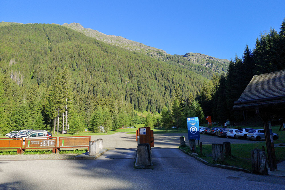
Parcheggio Coler
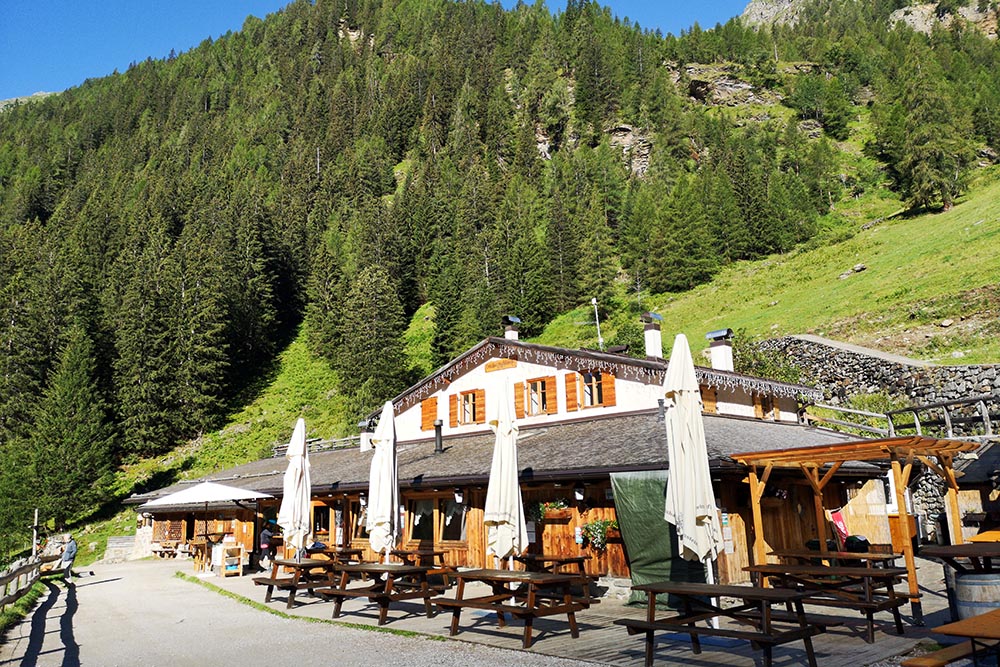
Malga Stablasolo
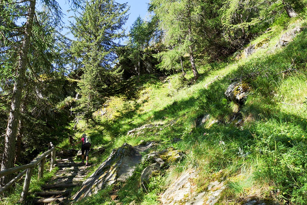
Si sale in un magnifico bosco
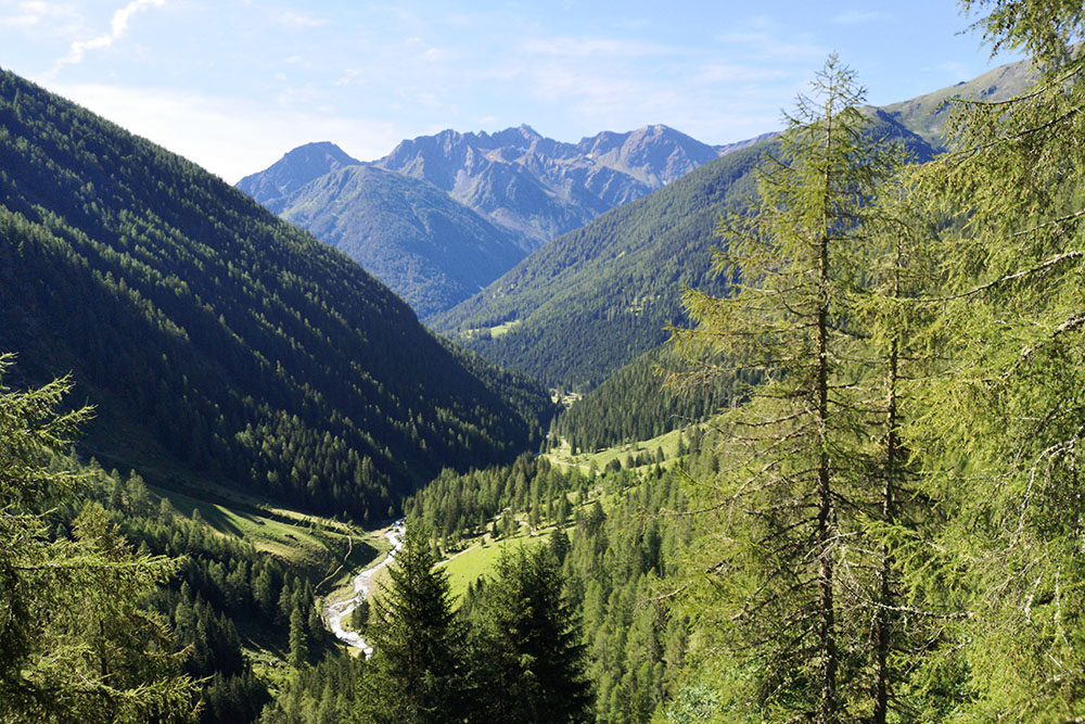
Panorana sulla vallata
Siamo arrivati al Doss dela Cros
Siamo arrivati a Pra di Saent
Malga Pra di Saent
Le bellissime Cascate Alte di Saent
Volgendo lo sguardo indietro si vede il percorso che abbiamo fatto
Arrivati al Rifugio Dorigoni
Salendo al Lago si ha una bella vista sulla vallata e sul rifugio
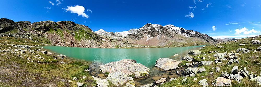
Il Lago di Sternai con il suo color turchese
Le Cascate Basse di Saent
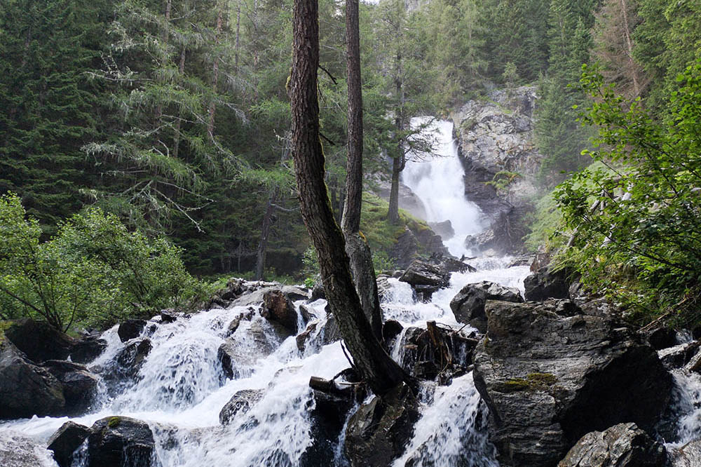
Le Cascate Basse di Saent


