


![]()


Durata
 3:10 h
Distanza
 9,5 km
 Ascesa
 522 m
522 mDiscesa
 522 m
522 mH Max
 1521 m
H Min
 1046 m
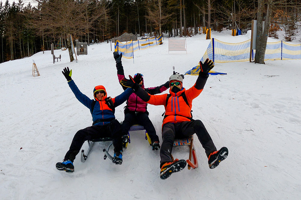
By sledge from the Rifugio La Montanara
DESCRIPTION
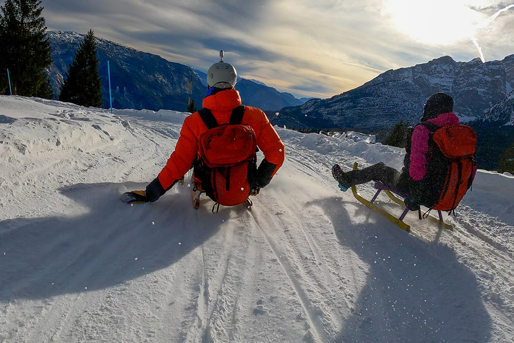
Experience the emotion of the snow with a spectacular descent on the 4.5 km sled run in Molveno!
The toboggan run of the Skiarea Family Pradel Adventures awaits you for an adventure in total relaxation. Reach it by taking the two sections of the lift from Molveno or on foot starting from Andalo. The Pradel plateau is the ideal place for novice skiers and for families who want to enjoy the snow without stress. Enjoy an enchanting view of the Brenta and Molveno Dolomites.
The track is made up of two sections: one starts from the Rifugio La Montanara (1510 m) and arrives in Pradel (1367 m), while the other goes from Pradel to the Chalet Plan dei Sarnacli (1120 m). The total height difference is about 400 meters and the length of the track about 4.5 km. If you took the lifts from Molveno, a free shuttle will take you back from Sarnacli. If you want to rent sledges, a rental point is located in Pradel.
ITINERARY
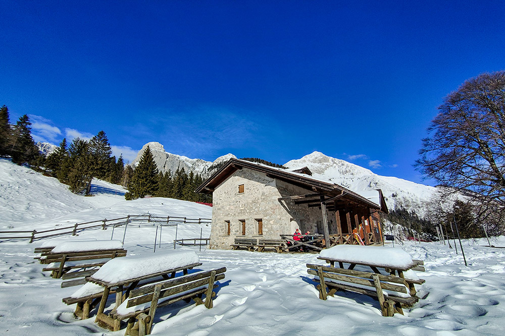
From the parking area in Sarnacli di Andalo, and precisely near the Chalet Plan dei Sarnacli (1120 m) and the Church of the Madonna di Loreto, follow the paved road backwards to the crossroads. Now go right and go up to the Val Biole car park (1180 m). Here begins the dirt road that will take us first to Baita Pineta (1300 m), then to Malga Tovre (1460 m) and finally to Rifugio La Montanara (1510 m). Go in the direction of the Monte Pradel chairlift station and position yourself at the entrance to the slope, easily identifiable by the writing BIG HERO. Go down the “Scoiattolo” section reaching Pradel (1367 m) and then continue on the “Bambi” slope arriving at the starting point.
EXCURSION DATE
January 21, 2023
STARTING POINT
Locality Sarnacli of Andalo
REFRESHMENT POINT
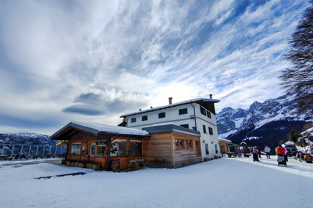
Rifugio La Montanara (1510 m), Baita Pineta (1300 m) and Albergo del Brenta (1367 m)
AUTHOR’S SUGGESTIONS
You can go up from Molveno with the ski lift and return to Molveno with the shuttle.
SAFETY TIPS
The stability of the snow cover is subject to sudden and unpredictable changes. For your safety, always consult the avalanche bulletin because the snow cover is subject to rapid changes, ask for information from the competent offices of the place. Our GPX tracks are only indicative, that is, the route was carried out as best as possible with the snow and weather conditions of that day. So always evaluate locally what needs to be done.
In addition, remember to evaluate the route based on your physical abilities, training, and equipment that you have.
It is advisable to tell someone the itinerary that you intend to do.
Remember that the emergency number is 112.
EQUIPMENT
It is recommended to have the appropriate equipment for the trail, weather conditions and season: sled, windbreaker and/or rain jacket, map and/or GPS device, sunglasses, sunscreen, hiking boots, first aid kit, specific winter clothing, crampons, gloves, backpack with food and hot drinks.
RECOMMENDED MAPS
Tabacco 067 Altopiano della Paganella - L. di Tovel - C. Brenta - Trento
INTERESTING LINKS
https://www.rifugiolamontanara.it/it
HOW TO ARRIVE
A22 exit San Michele all'Adige, SS43 up to Rocchetta. SS421 and continue up to Andalo. Here, turn right into Via Crosare and then left into Via Pradel. At the first fork, take a right and go up to Sarnacli.
PARKING AREA
Free in the Sarnacli area of Andalo.
GPS coordinates: 46.163040, 10.987808
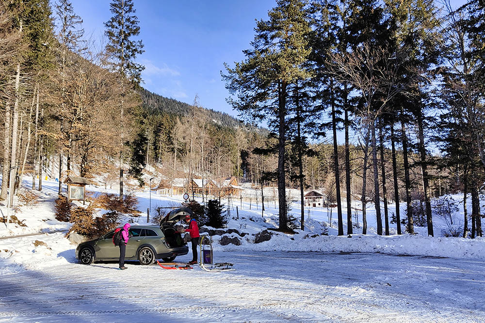
Parcheggio località Sarnachi

Si sale sulla strada asfaltata
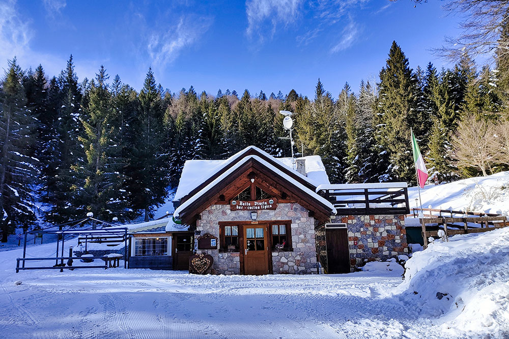
Baita Pineta
Malga Tovre
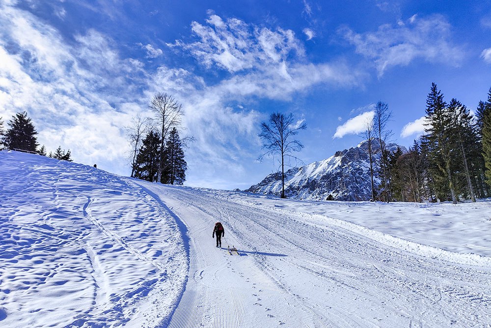
Ultimo tratto in salita
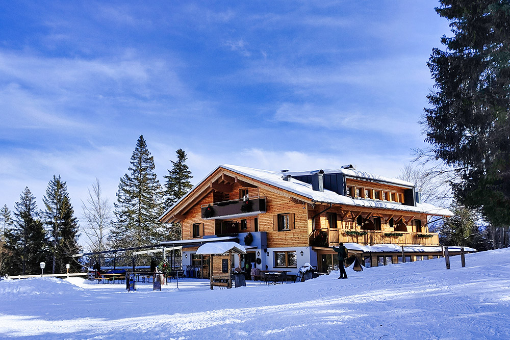
Rifugio La Montanara
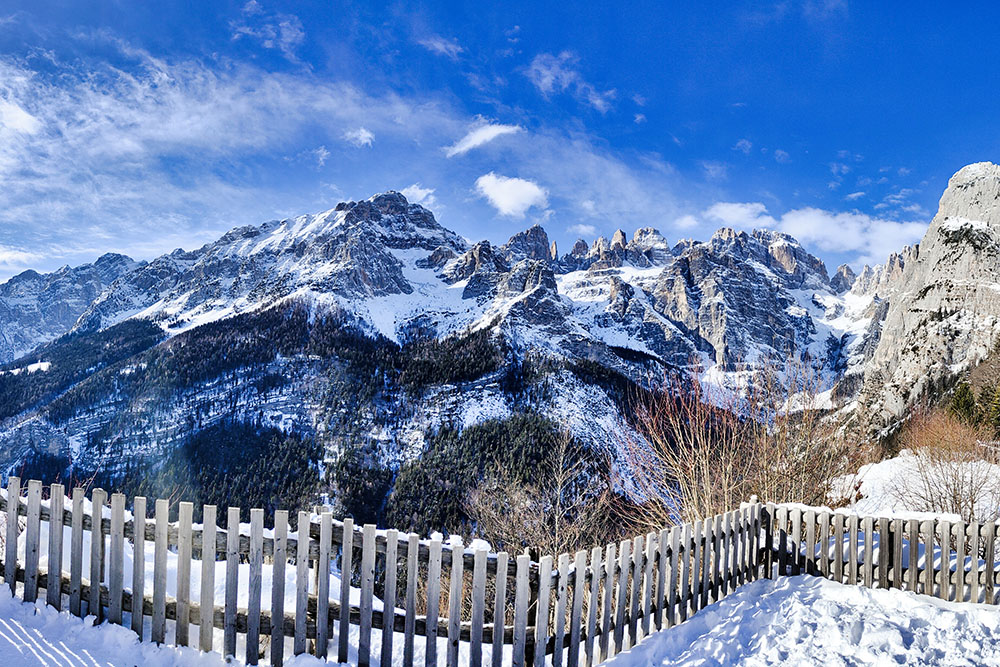
Panorama verso il Gruppo del Brenta
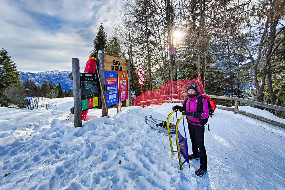
Inizio della Pista Scoiattolo
Si parte
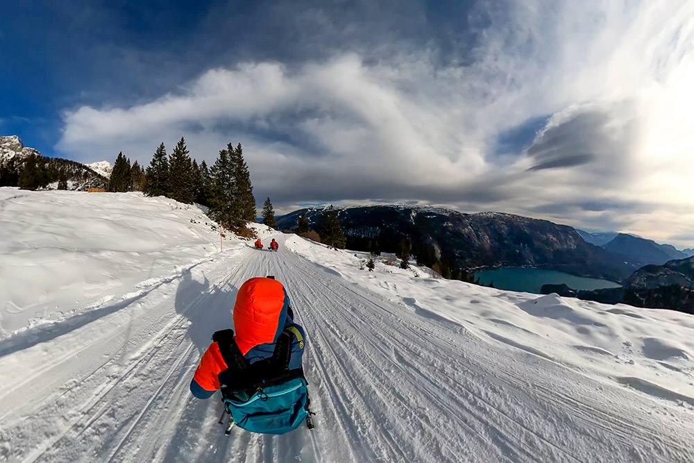
Scendendo si ha una bella vista sul Lago di Molveno
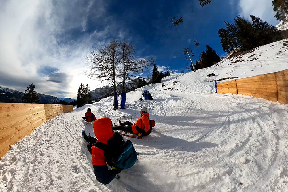
Il tratto di pista Scoiattolo
Albergo Ristorante Del Brenta
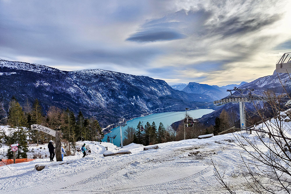
Panorama dal Pradel verso il Lago di Molveno
Al termine della pista
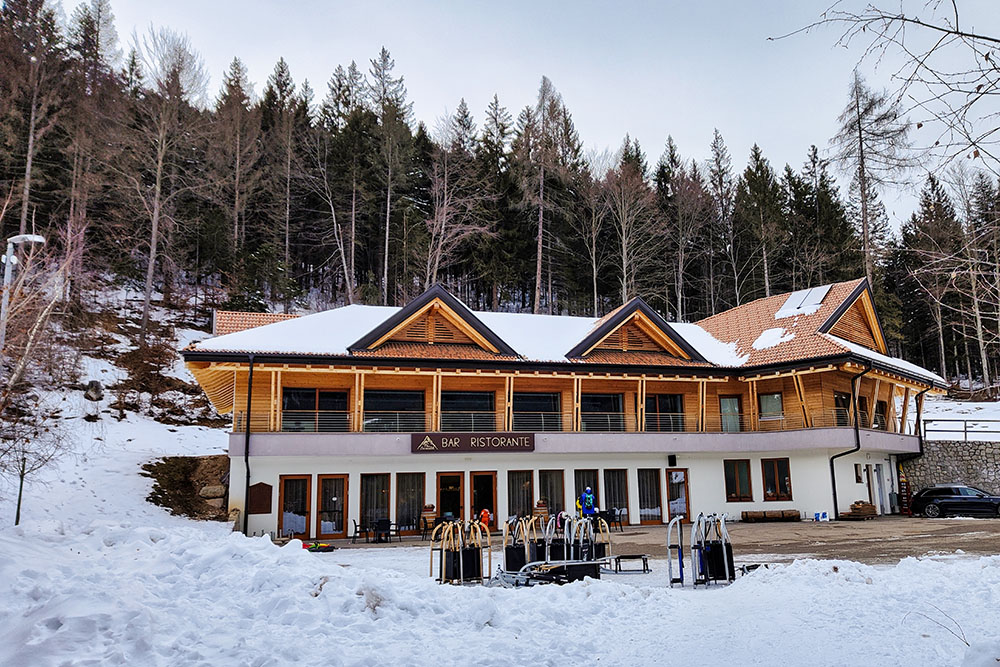
Chalet Plan Dei Sarnacli


