


![]()


Durata
 4:55 h
Distanza
 12,6 km
 Ascesa
 779 m
779 mDiscesa
 779 m
779 mH Max
 2716 m
H Min
 1968 m
Rifugio Larcher al Cevedale
DESCRIPTION
Magnificent excursion on the slopes of the Cevedale starting from Malga Mare.
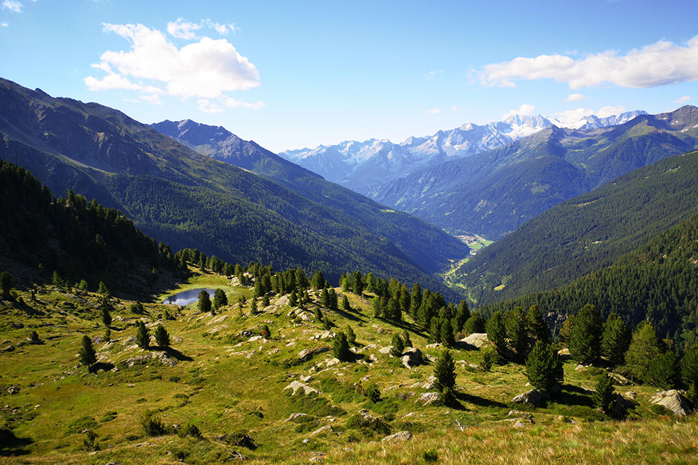
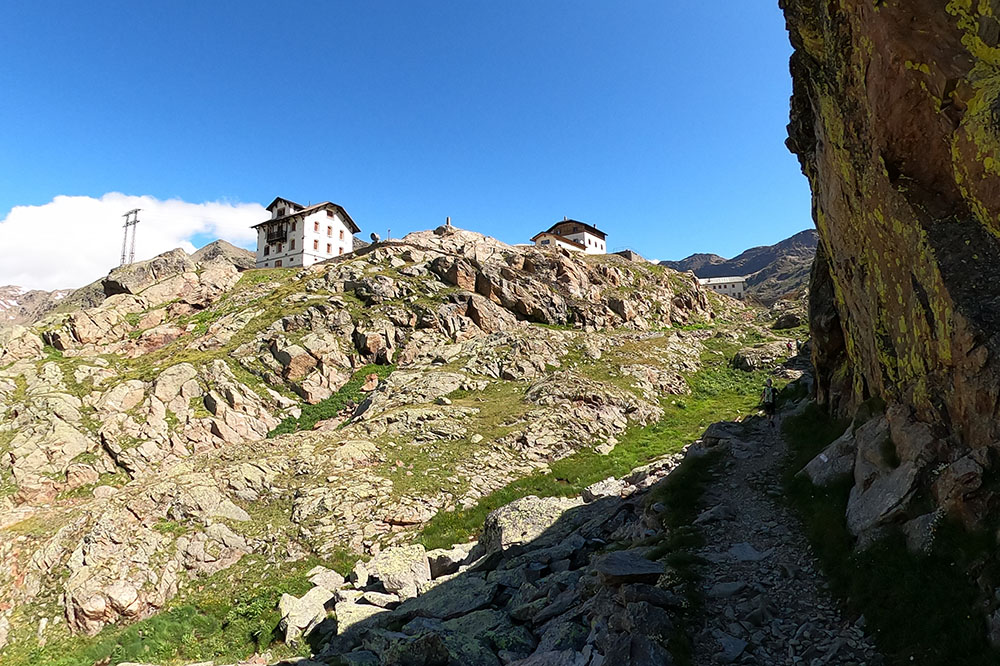
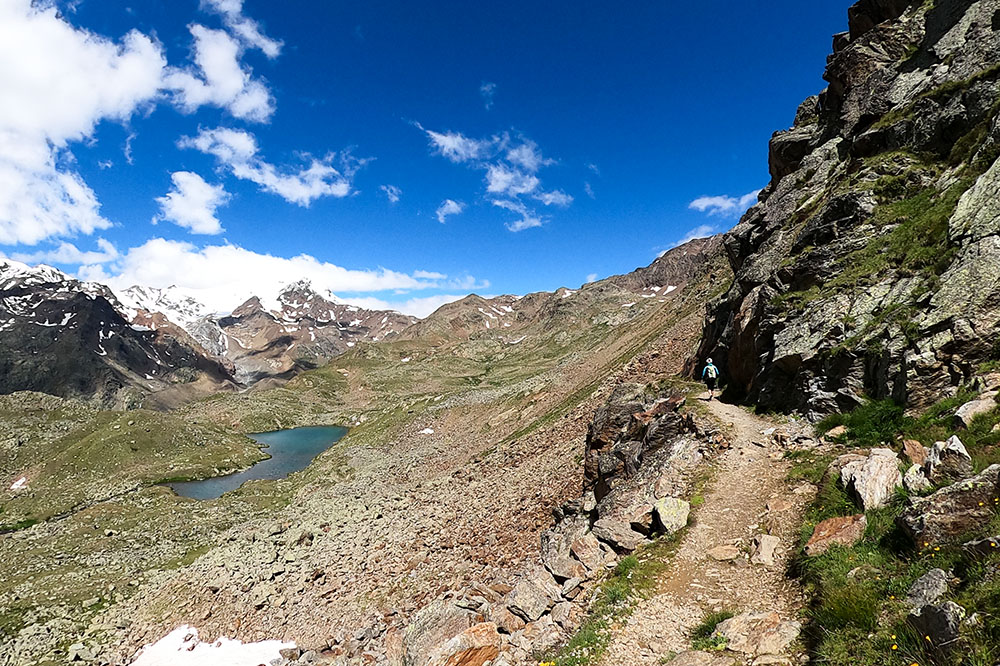
The itinerary that we propose is a circular itinerary in the municipal area of Peio. Starting from Malga Mare you go up to Lake Careser - an artificial basin built in 1931 in order to exploit the waters coming from the Careser glacier to produce electricity. Then, before arriving at the refuge, there are two other beautiful mountain lakes: Lago Lungo, Lago Nero and Lago delle Marmotte. During the crossing there is a spectacular view of the glaciers in front and in particular of Mount Cevedale, one of the most important peaks of the Ortles-Cevedale Group. The Rifugio Larcher al Cevedale is located in Val Venezia, in the presence of the Vedretta de la Mare, the Cime del Cevedale, Zufall, Palon de la Mare and Viòz.
ITINERARY
From the Malga Mare car park (1968 m) go up the path 123 - the Path of the Lakes - up to Lake Càreser (2600 m), pass the dam, arrive at Lago Nero (2623 m) and pass over the lake Long (2552 m). At the first junction, take path 104, make a small detour to Lago delle Marmotte (2706 m), and arrive at the Rifugio Larcher al Cevedale (2611 m). Now return to the starting point by taking path 102 and passing through Malga Mare (2032 m).
STARTING POINT
Parking at the Malga Mare power station
REFRESHMENT POINT
Rifugio Larcher al Cevedale (2611 m) and Malga Mare (2032 m)
AUTHOR’S SUGGESTIONS
We recommend taking the excursion counterclockwise, to have the best light for photographs or filming.
SAFETY TIPS
The viability of the proposed itinerary, like all mountain morphology, is subject to environmental changes due to natural events and weather conditions. Therefore, before leaving, consult the competent tourist offices and / or the refuges of reference.
Our GPX tracks are only indicative, that is, the route was carried out at best with the conditions of the trails and weather of that day. So always consider what to do on site.
Also remember to evaluate the route based on your physical abilities, training and the equipment you have.
You should leave someone the route you intend to do told.
Remember that the emergency number is 112.
EQUIPMENT
It is recommended to have the appropriate equipment for the route, weather conditions and season: windproof and / or rain jacket, map and / or GPS device, goggles, sunscreen, boots, first aid kit, specific clothing, gloves, backpack with food and drink.
RECOMMENDED MAPS
Tabacco 048 VAL DI PEIO - VAL DI RABBI - VAL DI SOLE
INTERESTING LINKS
From Cles - Val di Non - follow the SS43, take the Val di Sole SS42 and after Pellizzano turn right and go up the SP87. In Cogolo, keep right and go up to the top of the valley where the Malga Mare car park is located.
HOW TO ARRIVE
From Cles - Val di Non - follow the SS43, take the Val di Sole SS42 and after Pellizzano turn right and go up the SP87. In Cogolo, keep right and go up to the top of the valley where the Malga Mare car park is located.
PARKING AREA
Parking at the Malga Mare power station
GPS coordinates: 46.415405, 10.681061
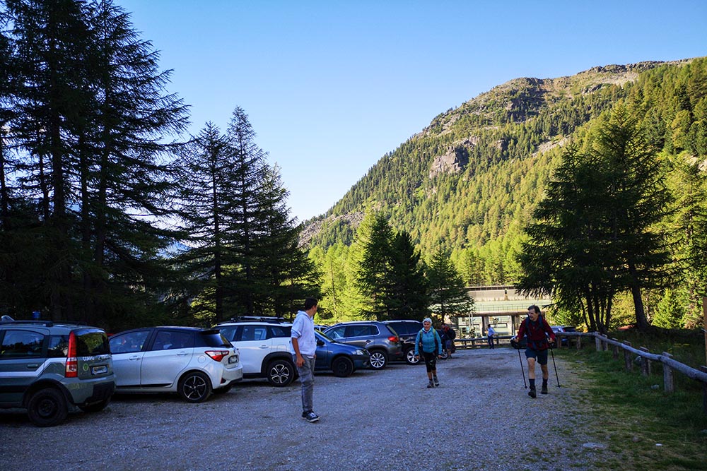
Parcheggio alla Centrale di Malga Mare
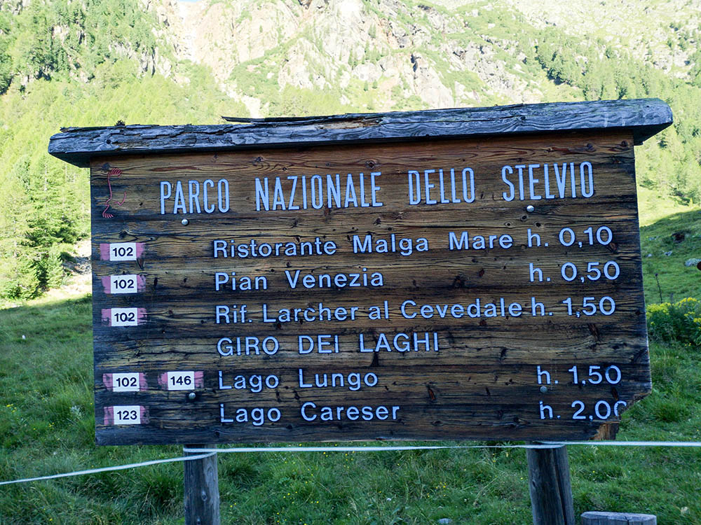
Pannello informativo alla partenza
Si sale sul sentiero 123
Siamo quaso arrivati al Lago Càreser
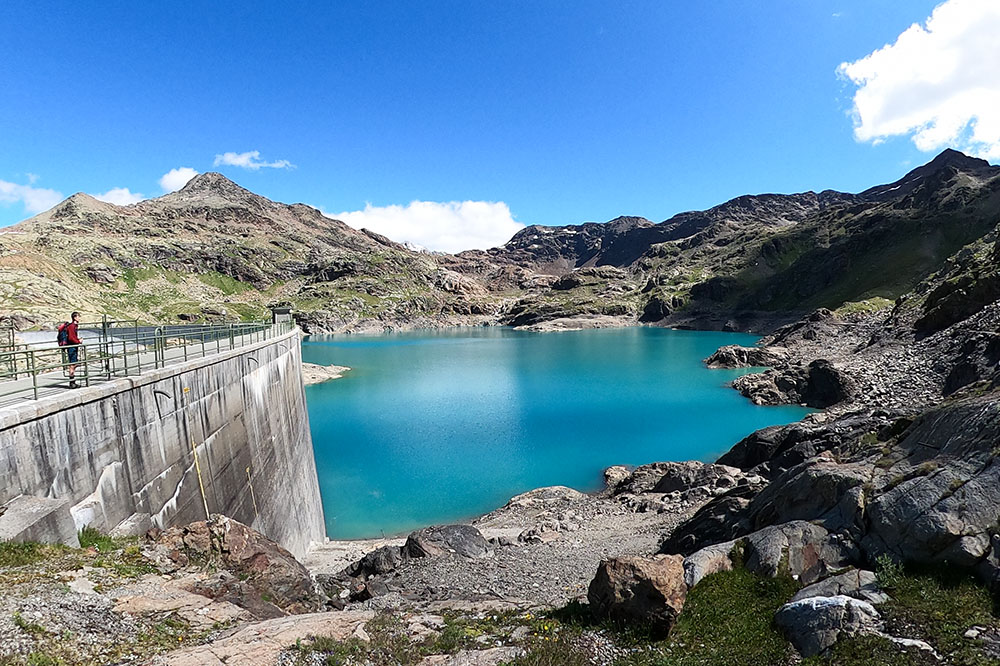
La diga di sbarramento del Lago Càreser
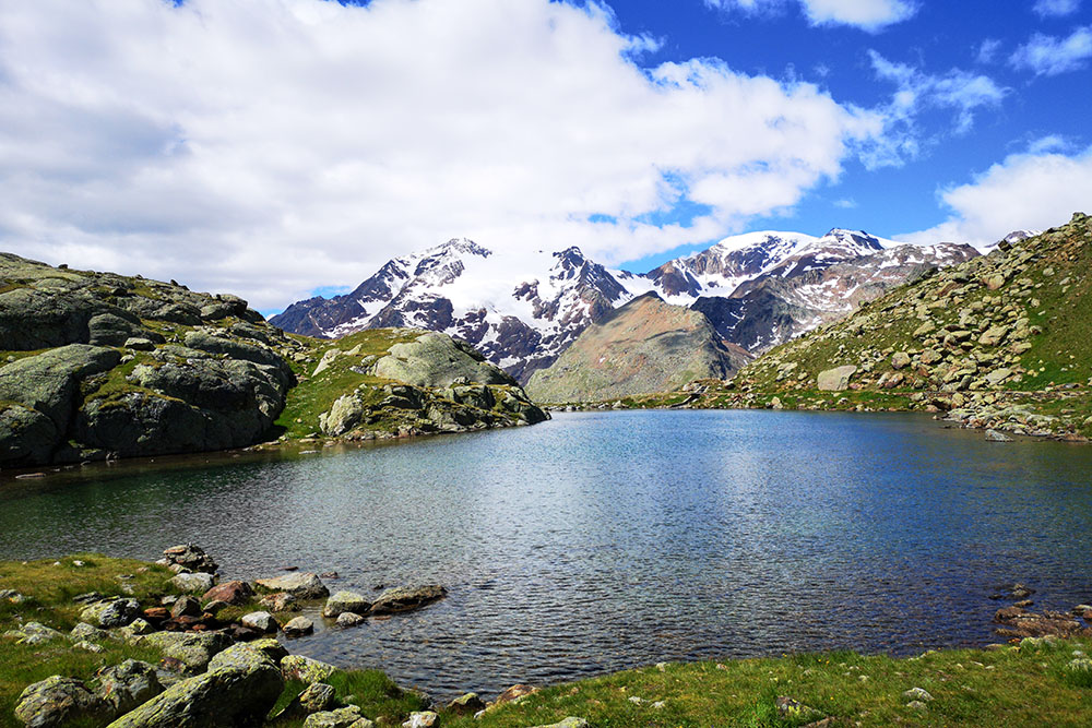
Il Lago Nero
Il Lago Lungo
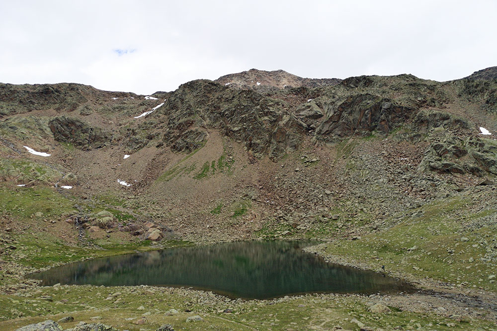
Il Lago delle Marmotte
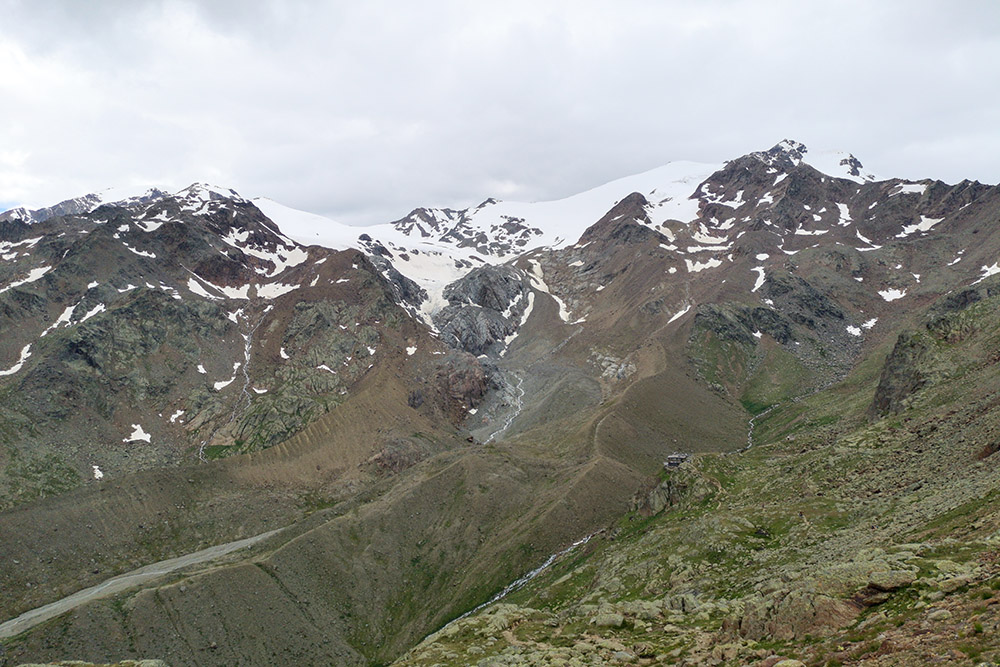
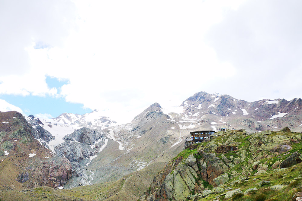
Il Rifugio Larcher in lontananza
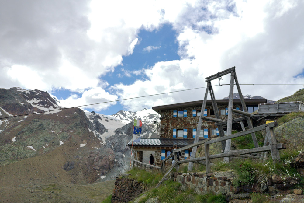
Il Rifugio Larcher Al Cevedale
Il Rifugio Larcher Al Cevedale
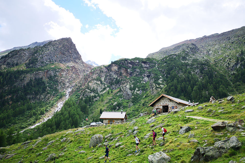
Malga Mare


