


![]()


Durata
 4:00 h
Distanza
 7,6 km
 Ascesa
 800 m
800 mDiscesa
 800 m
800 mH Max
 2258 m
H Min
 1465 m
Cima Orenknott and Rifugio Giggelberg
DESCRIPTION
Cima Orenknott: the secret belvedere above the Merano Basin.
Geographical location
Cima Orenknott (2258 m) is located in the Texelgruppe Nature Park, in the Vinschgau/Val Venosta valley, in the province of Bolzano. It rises on the southern slope of the mountain group, in a dominant position over the towns of Parcines/Partschins and Rablà/Rabland, on the eastern edges of the valley.
The starting point for this hike is Hochforch Farm, reachable by car from Naturno. Alternatively, you can take the Texel cable car (Texelbahn).
Hike
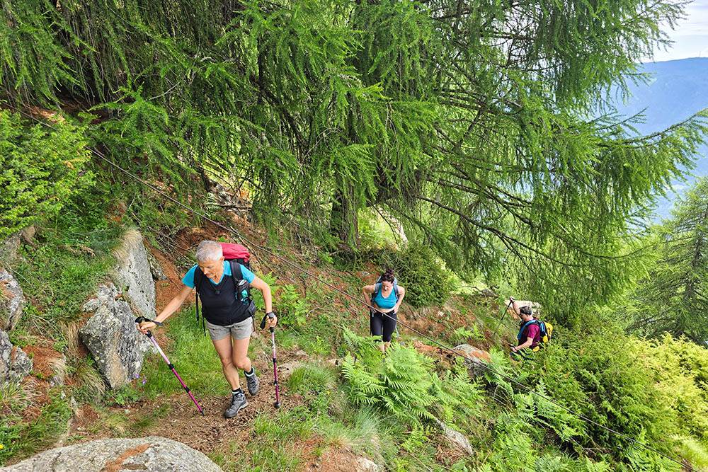
The Orenknott loop does not present any particular technical difficulties, but the trails are consistently steep and require a good basic level of fitness. It is a route suitable for trained hikers seeking a high-altitude destination without mountaineering challenges.
The Vinschgau/Val Venosta valley, famously sunny and arid in summer, makes the exposed trails difficult during the central hours of the day. Those who set off early in the morning will find more pleasant temperatures and, along the way, the Rabensteinerschupf fountain offers fresh water to hikers. Rifugio Giggelberg, on the other hand, is the refreshment stop in the final part of the loop, ideal for a break before returning.
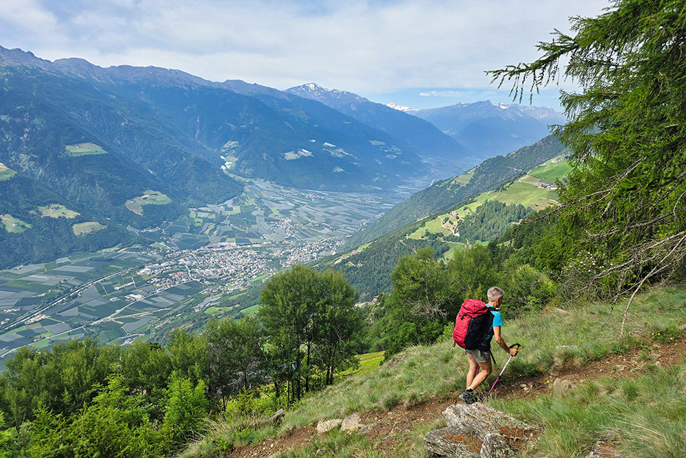
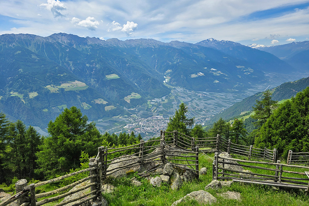
The summit and the entire ridge offer sweeping panoramic views: the Merano Basin opens up before your eyes in all its elegance, framed by the first part of the Vinschgau/Val Venosta valley. On a clear day, your gaze can reach as far as the Dolomites.
History and curiosities
The name Orenknott is of Germanic origin: Knott in Tyrolean German indicates a rounded rocky height or a mountain node, while Oren could be linked to the ancient term for ear or derive from the name of the Orenalm/Malga Oren below.
Malga Oren (Orenalm, 1947 m) is now abandoned: what remains of the original structure is visible along the ascent trail, almost 300 metres below the summit cross. It is a silent presence that recalls the long tradition of summer grazing on these pastures, a practice still alive in many other malghe in the park.
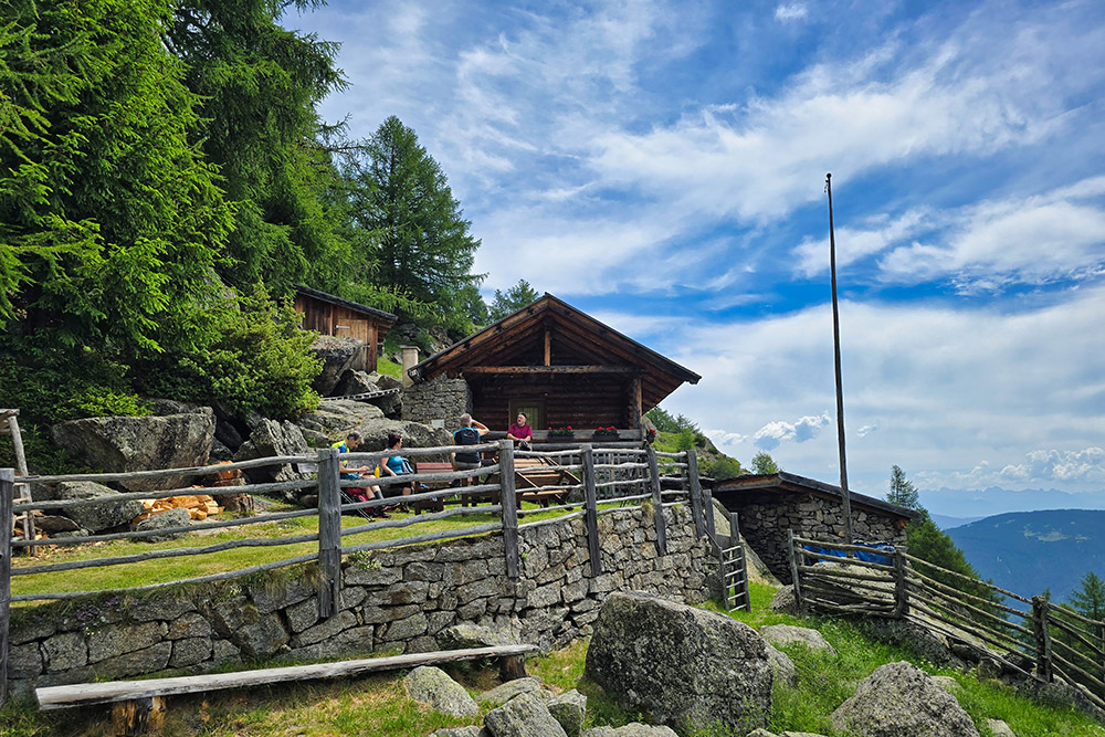
Rifugio Giggelberg (1565 m) is a restaurant with accommodation, located just above the mountain station of the Texel cable car. Although it is not an alpine mountain hut in the technical sense, it is an established support point for hikers on the Merano High Trail (no. 24) and offers rooms for those wishing to stay overnight. Its panoramic terrace is one of the most appreciated viewpoints in the whole Parcines area.
ITINERARY
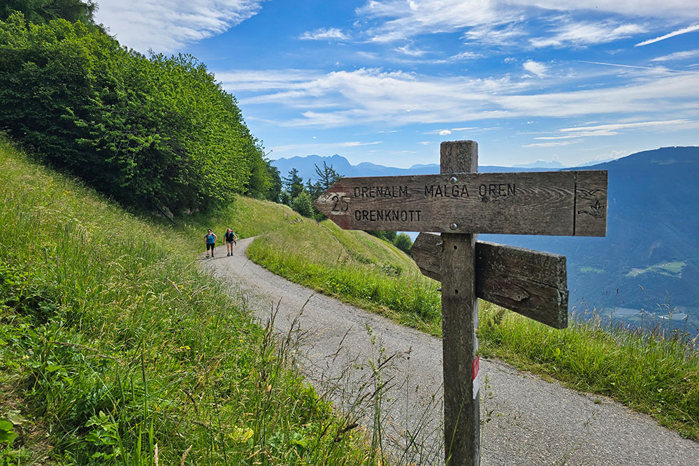
From the small parking area (1488 m), proceed left along the paved road for about 700 metres. Then take trail marker 25 and, passing by the lower Stierberghütte mountain hut (1855 m) and Malga Oren (1947 m), ascend to Cima Orenknott (2258 m). Retrace your steps to the junction and turn left, descending along the Schindelbach Valley, which in Italian is called Rio di Colle. At the next junction, turn left onto trail marker 25A, then onto trail 2: you will pass by the Rabensteinerschupf fountain (1850 m) and reach Rifugio Giggelberg (1565 m). From the mountain hut, follow the Merano High Trail, trail marker 24, back to the starting point.
EXCURSION DATE
21 June 2026
STARTING POINT
Small parking area
REFRESHMENT POINT
Rifugio Giggelberg
AUTHOR’S SUGGESTIONS
Do the route clockwise.
SAFETY ADVICE
The practicability of the proposed itinerary, like all mountain terrain, is subject to environmental changes due to natural events and weather conditions. Therefore, before setting off, consult the relevant tourist offices and/or the reference mountain huts.
Our GPX tracks are only indicative, meaning that the route was completed based on the best trail and weather conditions of that day. Always assess the situation on site.
Also, remember to evaluate the route according to your physical abilities, training, and the equipment you have.
It is advisable to inform someone of the itinerary you intend to follow.
Remember that the emergency number is 112.
EQUIPMENT
It is recommended to have equipment suitable for the route, weather conditions, and season: windproof and/or waterproof jacket, map and/or GPS device, sunglasses, sunscreen, hiking boots, first aid kit, appropriate clothing, gloves, and a backpack with food and drinks.
RECOMMENDED MAPS
Tabacco 011 Merano and surroundings / Meran und Umgebung
INTERESTING LINKS
https://giggelberg.com/
HOW TO ARRIVE
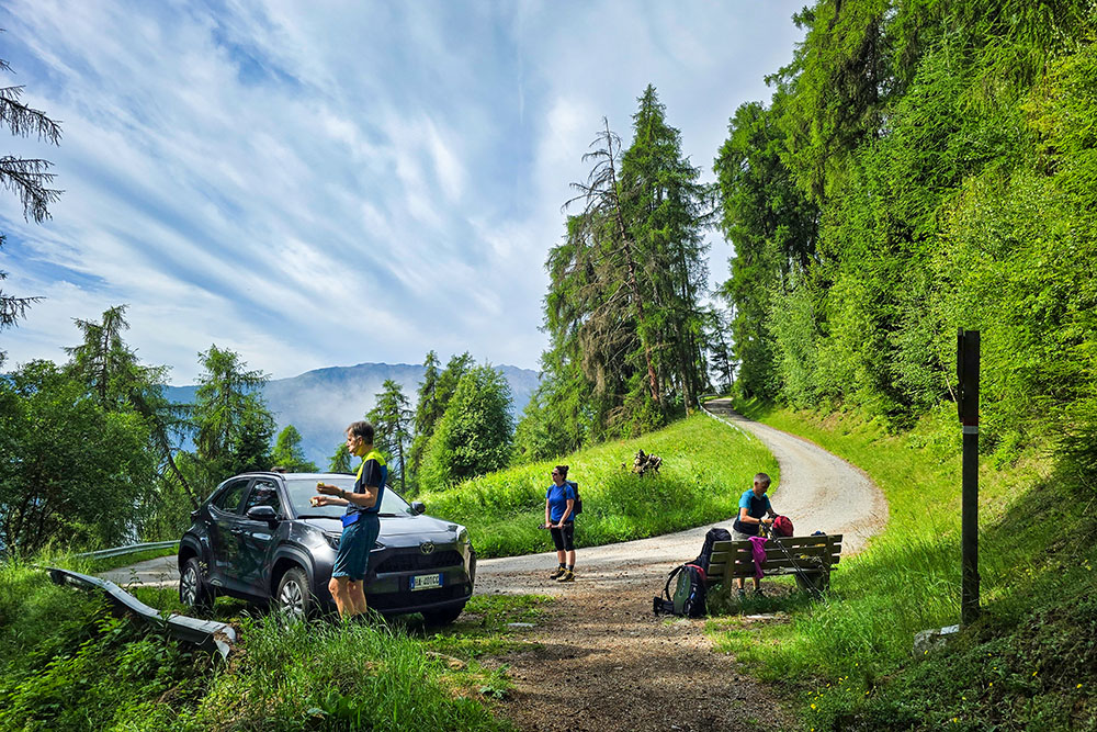
From Naturno, take Via Castello and then Via Monte Sole. The very small parking area is located on a bend, about 900 metres from Hochforch Farm.
PARKING AREA
A very small parking area about 900 metres from Hochforch Farm
GPS coordinates: 46.678075, 11.037283
Parcheggio nei pressi del Maso Hochforch
Primo bivio, perndiamo il segnavia 25
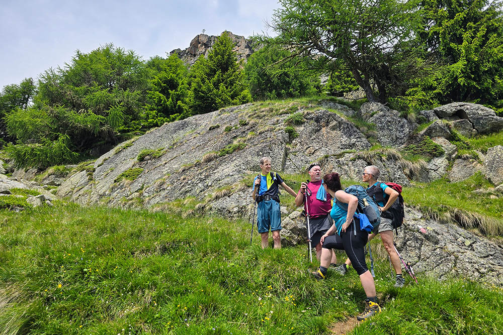
Si sale con un bel panorama
Il sentiero è ripido
Baita Untere Stierhütte
Panorama dalla baita
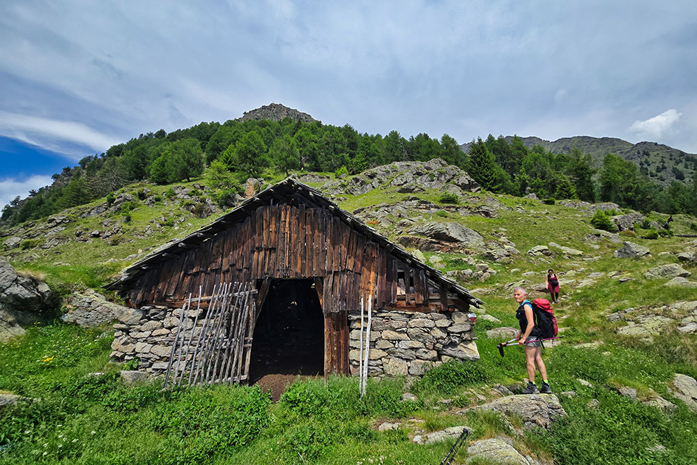
Malga Oren
La croce di vetta è ben in vista
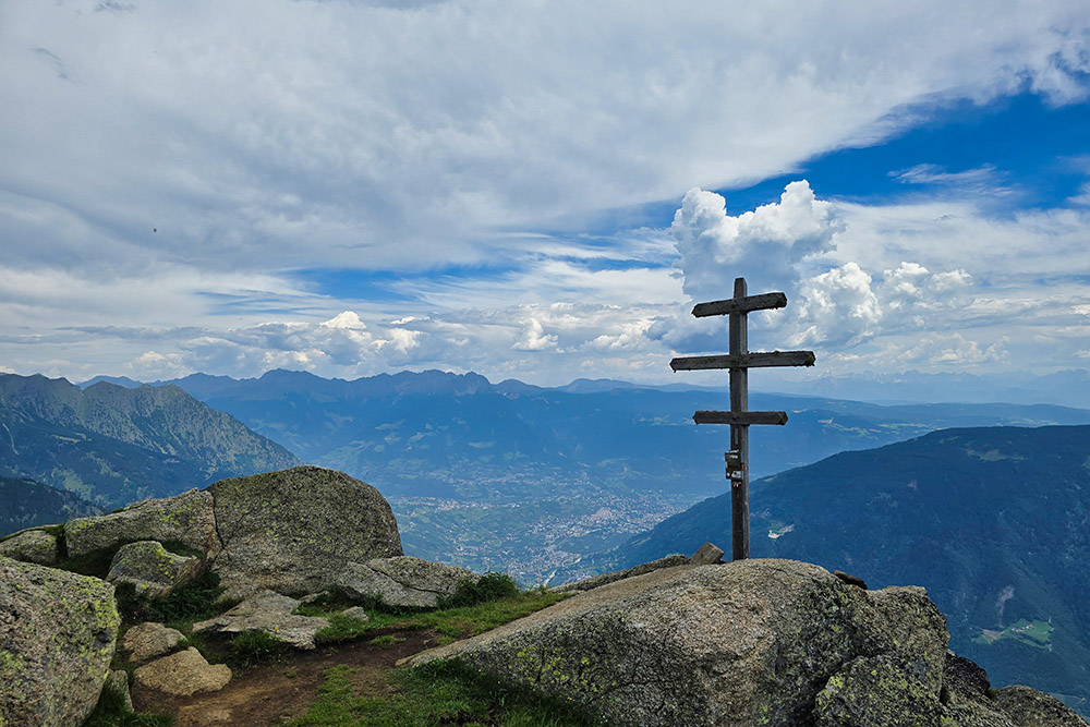
La croce di vetta di Cima Orenknott
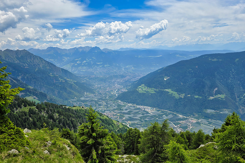
Panorama verso Merano
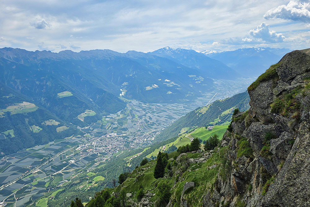
Panorama verso la Val Venosta
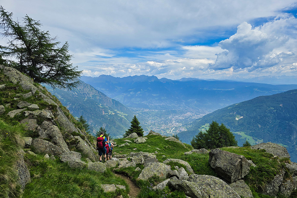
Si continua l'anello
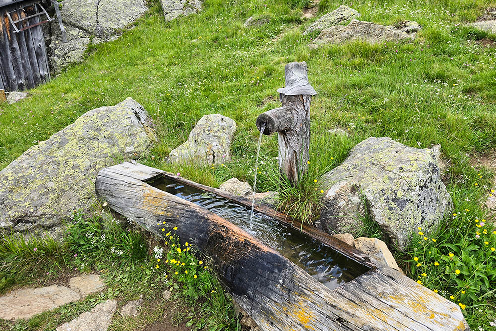
Fontana potabile Rabensteinerschupf
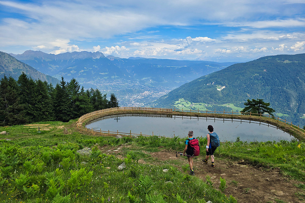
Un piccolo laghetto artificiale
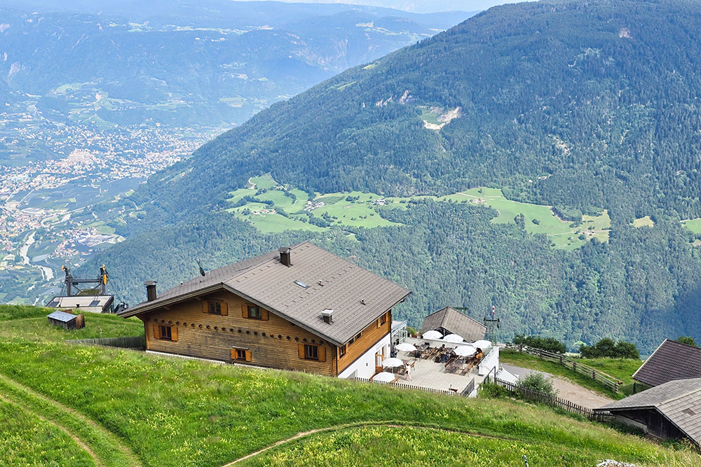
Il Rifugio Giggelberg


