


![]()


Durata
 6:15 h
Distanza
 11,6 km
 Ascesa
 1244 m
Discesa
 1244 m
H Max
 2150 m
H Min
 1097 m
Becco di Filadonna and Cornetto di Folgaria
DESCRIPTION
On the ridge among stone giants: the great loop of the Vigolana.
Geographical location
The Becco di Filadonna and the Cornetto di Folgaria are two of the main peaks of the Vigolana Group, a massif located southeast of Trento, at the southern entrance of the Valsugana. Geologically, it belongs to the Venetian Prealps ; administratively, the group is divided among the municipalities of Altopiano della Vigolana, Folgaria, and Besenello. The peaks drop steeply on the north and northeast sides, while on the south and southwest slopes they descend more gently, covered with mountain pines.
Hike
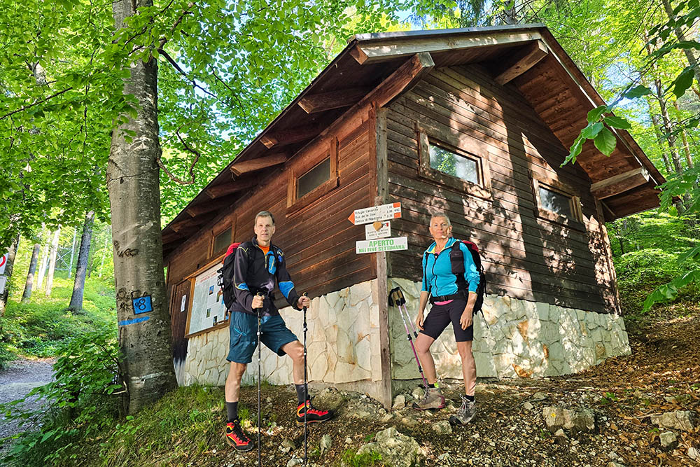
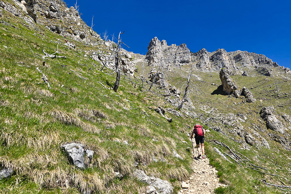
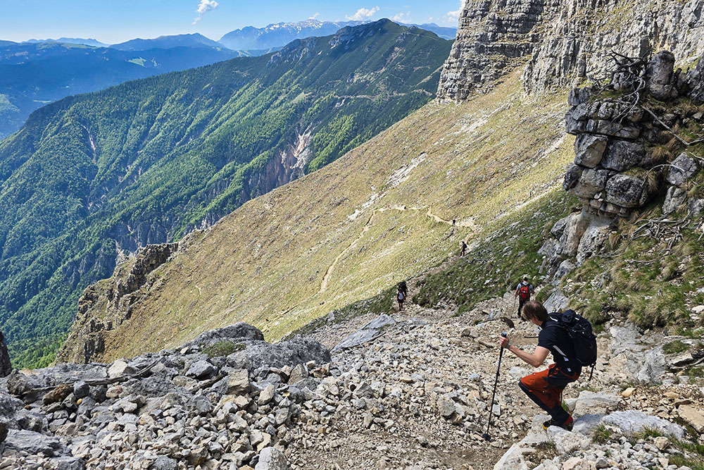
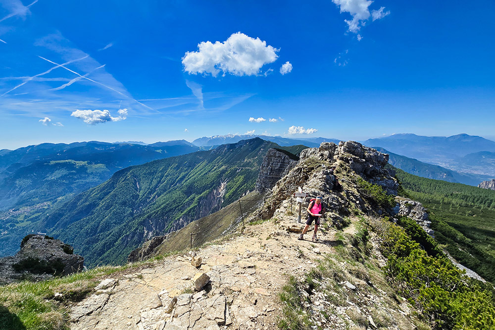
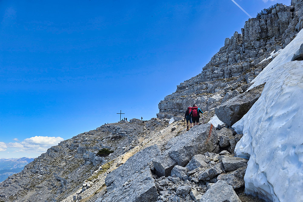
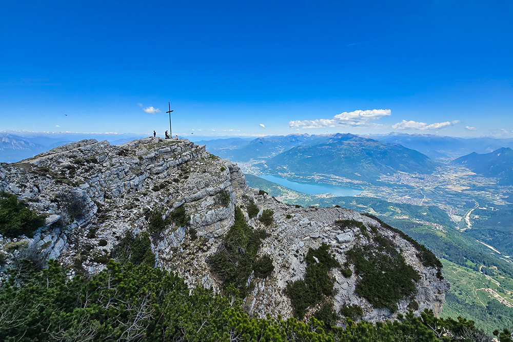
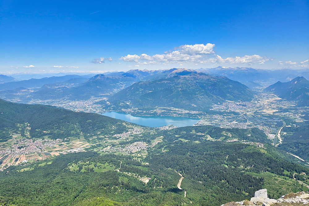
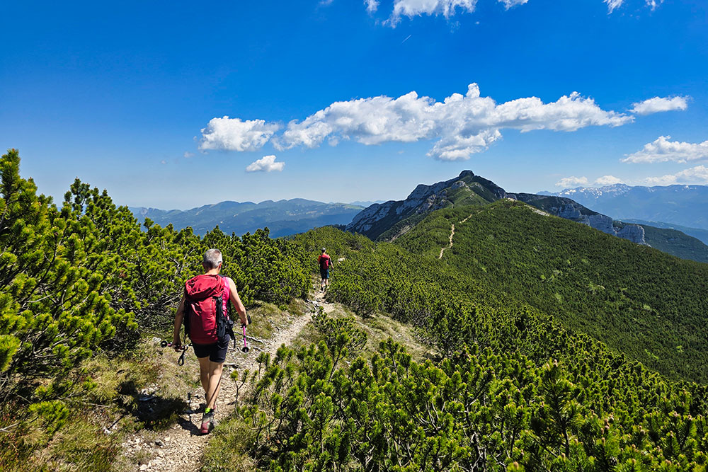
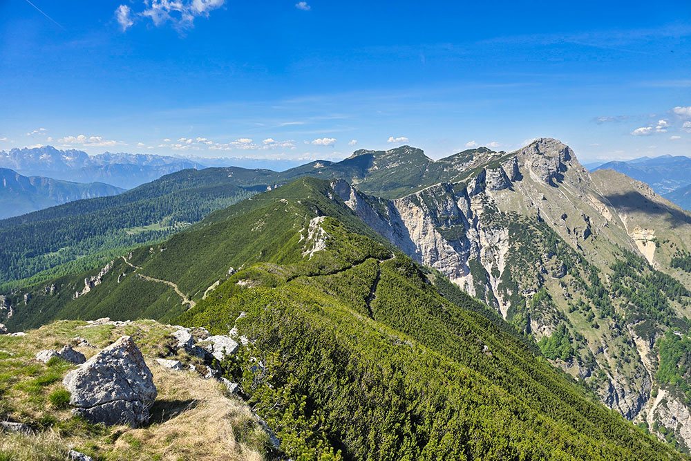
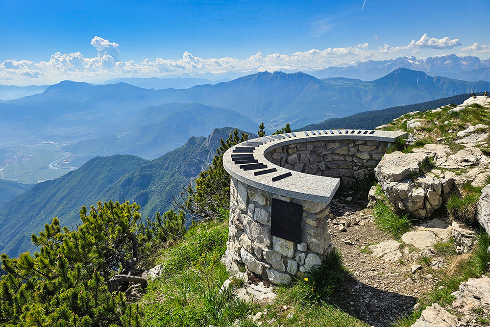
The Sindech – Becco di Filadonna – Cornetto di Folgaria – Sindech loop is one of the most beautiful and scenic routes of the Alpe Cimbra and the entire Vigolana Group. You start immersed in the forest on a path that is immediately steep, quickly gaining elevation without giving any respite. The first stage and the only refreshment point along the route is the Rifugio Casarota Livio Ciola, managed by the SAT of Centa San Nicolò: here the first glimpse of the Alpe Cimbra opens up, and for those coming with children, there is a pleasant surprise — a small alpaca farm living near the mountain hut . The mountain hut is open continuously from mid-June to the end of September and on weekends during the rest of the year. Continuing beyond the hut, you gradually leave the forest and the landscape changes character: vegetation gives way to rock and scree, and the horizon widens in an increasingly spectacular way. From Bus de le Zole onwards, the panorama is 360°: the view extends over much of southern Trentino, with Lake Caldonazzo in the foreground, the Brenta Dolomites, Mount Adamello, Monte Altissimo, the Mount Baldo Group, the peaks of the Lagorai, the Adige Valley with Trento and Rovereto, the Mocheni Valley, and Valsugana. The hike presents no particular technical difficulties, but it requires good physical preparation: the elevation gain exceeds 1200 m and the total distance is about 11.6 km.
History and curiosities
During World War I, the Alpe Cimbra was the scene of very harsh clashes: the front that separated the Austro-Hungarian Empire from the Kingdom of Italy crossed these very plateaus, making the area one of the main scenarios of the so-called War of Forts. On the slopes of the Cornetto and around Folgaria, traces of trenches, rock tunnels, and military structures still remain. Among the Austro-Hungarian defensive works built in the area before the conflict are Forte Dosso del Sommo, Forte Sommo Alto, and Forte Cherle.
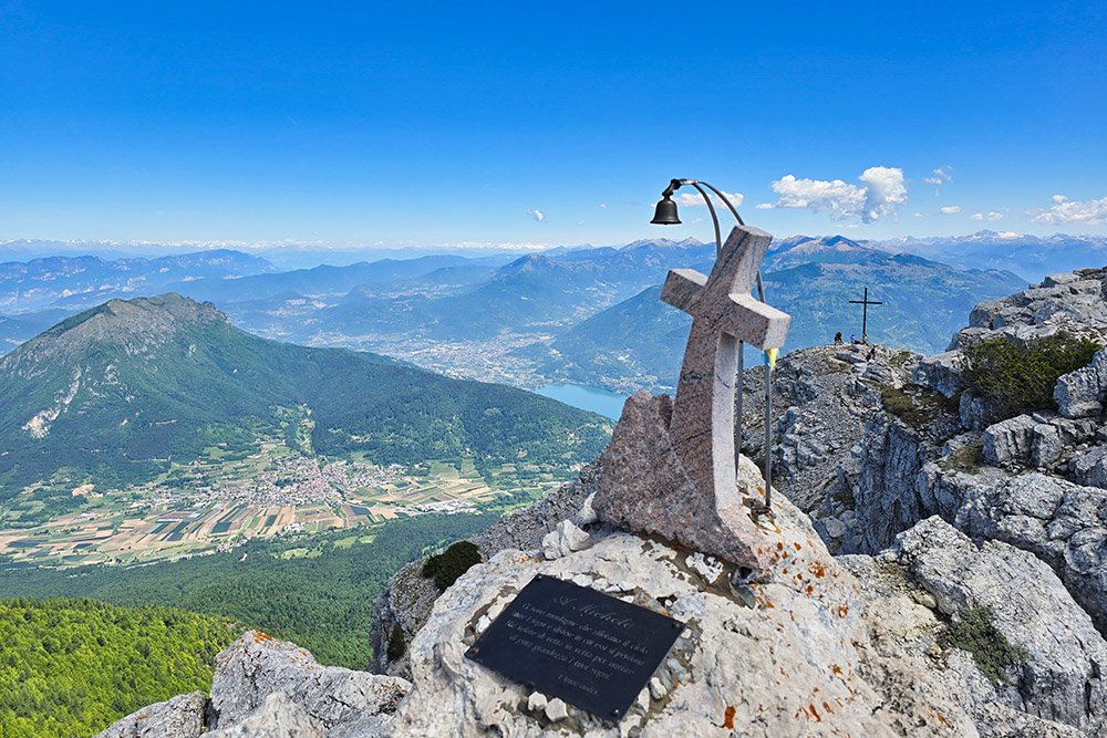
The name Becco di Filadonna has its roots in a local popular legend, of which several variants exist in the area of the Folgaria and Vigolana plateau. The most widespread version — collected by the Pro Loco of Nosellari-Oltresommo — tells of a giant and his wife who lived in a rough house on the mountain and instilled terror in the inhabitants of nearby villages. The wife spun wool for the villagers, always keeping a little for herself; one day a poor widow, who could not afford to protest, complained to heaven about the injustice she had suffered. The prayer was answered: the two giants were turned to stone. The two rock formations that would be the result are still visible and are called la Madonnina and il Frate.
ITINERARY
After parking the car at the Ristorante Sindech (1097 m), take path 442 which in about 1 hour and 20 minutes leads to Rifugio Casarota (1572 m) . Continue uphill to Bus de le Zole (2070 m), a small gap. From here continue on path 445 to the summit of Becco di Filadonna (2150 m) and then to the Croce (2133 m). Return along the same path to Bus de le Zole and take an unnumbered path which, following the ridge, leads to Terza Cima (2018 m), Seconda Cima (1999 m), and finally to Cornetto di Folgaria (2060 m). From here, go back slightly and descend to the right on path 439: pass through the Pra Longo locality (1713 m) and reach the provincial road of Passo della Fricca at the Ponte delle Zente locality (1100 m). The last 800 meters are covered along the road northward until returning to Sindech.
EXCURSION DATE
May 24, 2026
STARTING POINT
Sindech locality
REFRESHMENT POINT
Rifugio Casarota
AUTHOR’S SUGGESTIONS
Apart from the Rifugio Casarota, there are no other supply points along the route: starting with enough water is essential.
SAFETY TIPS
The feasibility of the proposed itinerary, like all mountain morphology, is subject to environmental changes due to natural events and weather conditions. Therefore, before leaving, consult the competent tourist offices and/or the reference mountain huts.
Our GPX tracks are indicative only, meaning the route was carried out under the best trail and weather conditions of that day. Always assess what to do on site.
Also, remember to evaluate the route based on your physical abilities, training, and the equipment you have.
It is advisable to inform someone of the itinerary you intend to follow.
Remember that the emergency number is 112.
EQUIPMENT
It is recommended to have equipment suitable for the route, weather conditions, and season: windproof and/or rain jacket, map and/or GPS device, sunglasses, sunscreen, boots, first aid kit, specific clothing, gloves, backpack with food and drinks.
RECOMMENDED MAPS
Tabacco 057 Levico - Altopiani di Folgaria Lavarone e Lusern
INTERESTING LINKS
https://www.sat.tn.it/rifugio-casarota-l-ciola/
HOW TO ARRIVE
From Trento follow SS349. Pass Pian dei Pradi, after about 5 km on the left you will find the Albergo Bar Ristorante Sindech and the parking area.
PARKING AREA
At Ristorante Sindech
GPS Coordinates: 45.950119, 11.210978
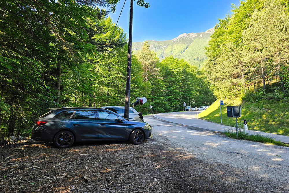
Parcheggio al Sindech
Punto di partenza
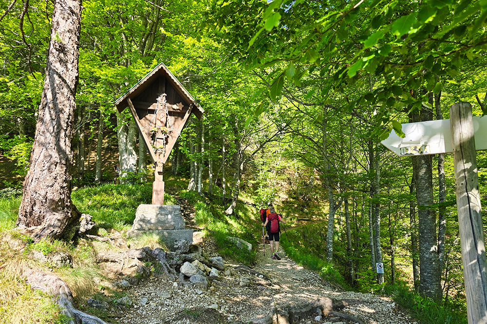
Si incontra un grazioso crocifisso
Arriviamo al rifugio
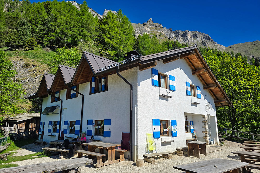
Il Rifugio Casarota
Si sale su un aspro sentiero
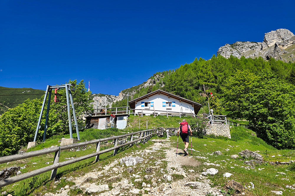
Siamo saliti da là
Bus de le Zole
In vetta al Becco di Filadonna
Andiamo verso la Croce
La Croce con un bellissimo panorama
Vista verso i laghi di Caldonazzo e Levico
In cresta verso il Cornetto di Folgaria
Sguardo verso il Becco di Filadonna
In vetta al Cornetto di Folgaria


