


![]()


Durata
 9:10 h
Distanza
 27,6 km
 Ascesa
 1210 m
Discesa
 1210 m
H Max
 1162 m
H Min
 65 m
65 mRiva del Garda - Malcesine, Garda Tour #1
DESCRIPTION
Between lakes and forests: the first stage of the Garda Lake Tour.
Geographical Location
Riva del Garda and Malcesine are both located on the Upper Lake Garda area. The former lies in Trentino, overlooking the northernmost end of the lake, while the latter is on the Veronese shore, along the north-eastern side. The itinerary therefore connects two regions—Trentino-Alto Adige and Veneto—crossing a constantly changing landscape, from the lively lakeside promenade of Riva to the quiet beech forests of Monte Baldo.
Hike
This is the first stage of the Garda Lake Tour: 27.6 kilometres with 1,210 metres of elevation gain, a long and demanding route that requires good physical fitness and careful planning. During summer, the heat can make the day particularly strenuous, especially along the long central ascent. It is advisable to start early in the morning and carry plenty of water.
The itinerary is divided into three distinct sections. The first, from Riva del Garda to Torbole (5.6 km), is flat and follows the lakeside promenade: a scenic stretch with no technical difficulties, ideal for warming up before the climbs. The second, from Torbole to Navene (16.4 km), is the heart of the hike: almost all the elevation gain is concentrated here, in a predominantly wooded environment with occasional clearings offering spectacular views over the lake. The third section (5.6 km) leads back towards inhabited areas, partly along the lakeside and partly on secondary roads until reaching Malcesine.
Those who do not wish to retrace the same route back to Riva del Garda can take bus number 484.
History and Interesting Facts
Forte San Nicolò stands on the slopes of Monte Brione, the hill separating Riva del Garda from Torbole. Built between 1860 and 1862, it is a first-generation fortification known as a “valley barrier fort”. Its purpose was to control the lake and the traffic along the lakeside road between Riva and Torbole. An iron gate fitted with firing ports blocked the road, while the fort also served as a coastal battery equipped with powerful searchlights for monitoring the waters at night. It formed part of the larger Austro-Hungarian defensive system protecting the border with Italy.
The Church of Madonna del Faggio, located at an elevation of 750 metres, is a small religious building surrounded by forest. It was erected in 1991 as a permanent memorial to the soldiers who fell on Monte Baldo during the First World War. These mountain slopes witnessed clashes between Italian and Austro-Hungarian troops, and the church remains a place of reflection along the route.
The Scaliger Castle of Malcesine is the final highlight of the stage and one of the lake’s most iconic landmarks. Over the centuries, the castle passed through the hands of the Lombards, Franks, Scaliger family, Venetians, Visconti family, French and Austrians. It also became famous through the sketches and descriptions of the German writer Goethe in his Italian Journey. Today, it houses a museum dedicated to the German poet and the Monte Baldo and Lake Garda Natural History Museum. Its irregular pentagonal keep rises 31 metres above the base and dominates both the town and the lake.
ITINERARY
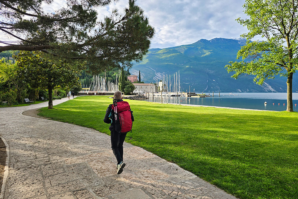
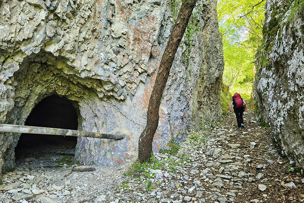
From the parking area on Viale Trento in Riva del Garda (81 m), head towards La Rocca. From here, follow the lakeside promenade for approximately 4.5 km to Torbole (66 m). Continue uphill towards Nago following the signs for “Scalinata”. Pass through Busatte Park (167 m) and, at the San Giuseppe shrine (230 m), turn right and follow trail marker 601 for a short distance, then continue on a path that passes near a climbing crag.
Rejoin trail 601 and continue to the Church of Madonna del Faggio (750 m). Proceed along the gravel road known as Bait della Selva until reaching the Bait della Selva mountain hut (1,084 m). Continue for a short distance to the highest point of the hike (1,162 m), then begin the descent along the Bassa Via del Garda trail, passing Dosso dei Roveri (1,057 m) and the Dosso Spirano Shelter (873 m), before reaching Navene (67 m).
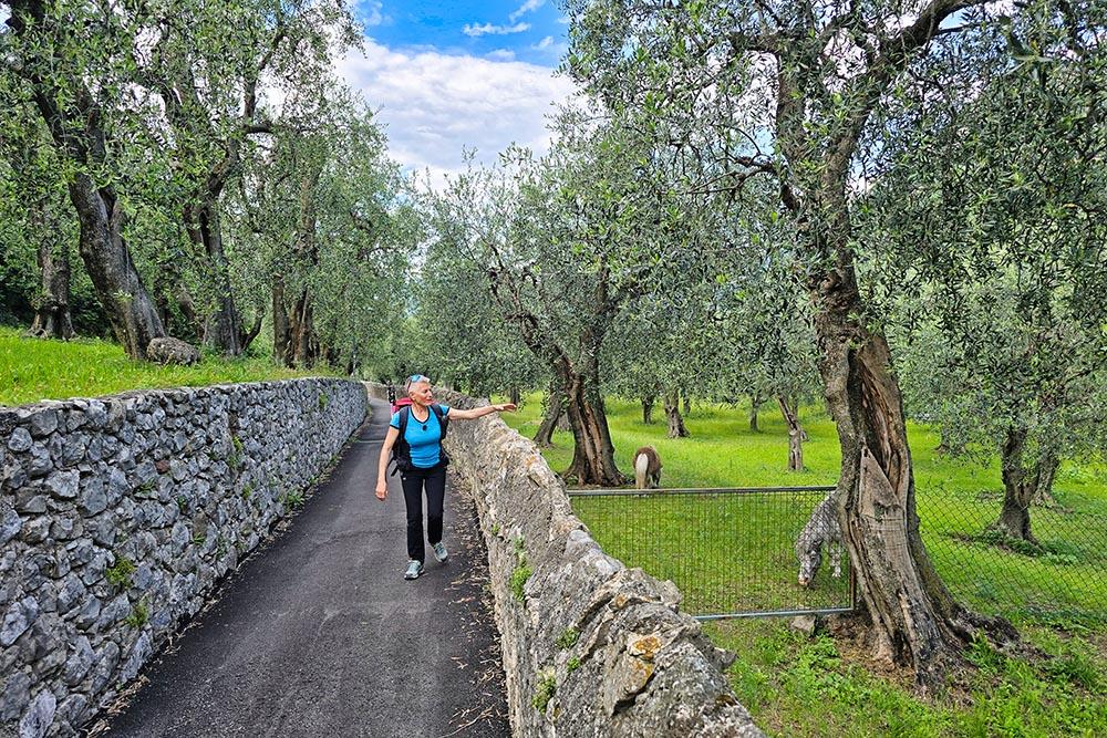
From Navene, follow the lakeside route to Campagnola (67 m), where an inland road leads to Malcesine (89 m).
EXCURSION DATE
17 May 2026
STARTING POINT
Riva del Garda, Viale Trento parking area, Riva del Garda.
REFRESHMENT POINT
Available in Riva del Garda, Torbole, Navene and Malcesine.
AUTHOR’S SUGGESTIONS
This stage is demanding; carefully assess your fitness level and energy reserves before setting out.
SAFETY ADVICE
The accessibility of the proposed itinerary, like all mountain environments, is subject to environmental changes caused by natural events and weather conditions. Before departure, consult the relevant tourist offices and/or the reference mountain huts.
Our GPX tracks are provided for guidance only. The route was completed under the specific trail and weather conditions of that particular day. Always assess local conditions before proceeding.
Remember to evaluate the route according to your physical abilities, level of training and available equipment.
It is advisable to inform someone of the itinerary you intend to follow.
Please remember that the emergency number is 112.
EQUIPMENT
It is recommended to carry equipment suitable for the route, weather conditions and season: windproof and/or waterproof jacket, map and/or GPS device, sunglasses, sunscreen, hiking boots, first-aid kit, appropriate clothing, gloves, and a backpack with food and water.
RECOMMENDED MAPS
Tabacco Map 061 – Alto Garda, Ledro, Monte Baldo North
INTERESTING LINKS
https://www.gardatrentino.it/en/outdoor/trekking/garda-trek
HOW TO ARRIVE
Take the A22 motorway and exit at Rovereto Sud/Lago di Garda Nord, then follow the SS240 road to Riva del Garda.
PARKING AREA
Viale Trento parking area in Riva del Garda, free of charge.
GPS coordinates: 45.892268, 10.847368
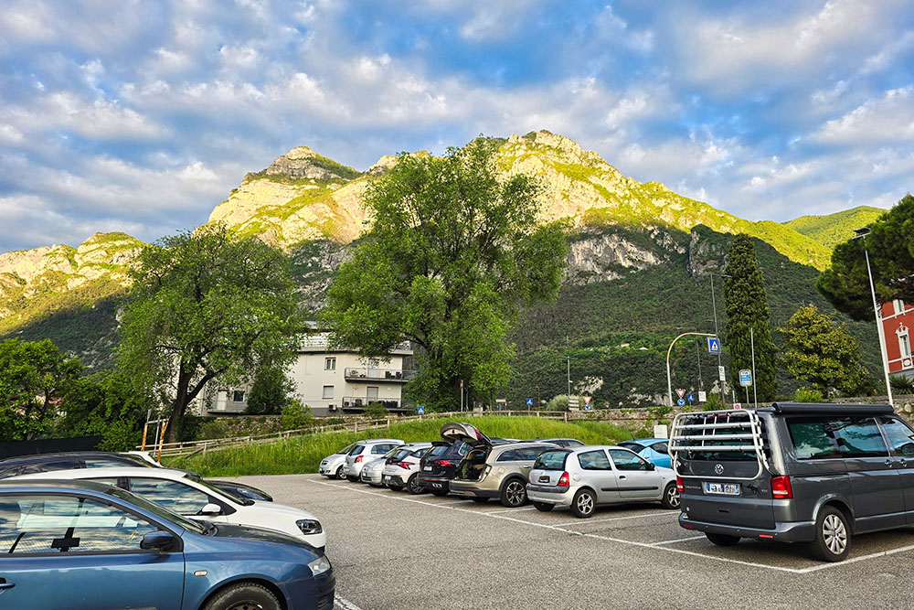
Parcheggio in Viale Trento
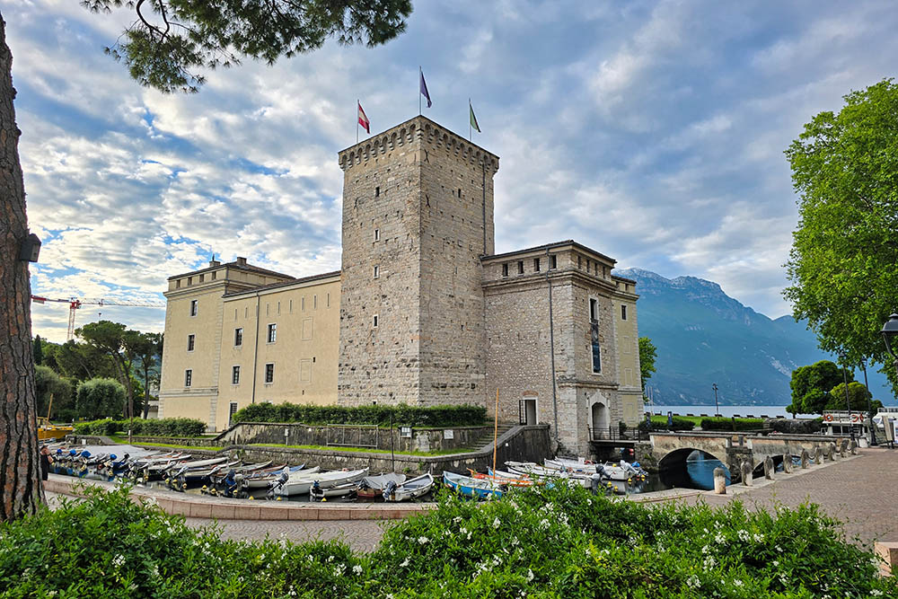
La Rocca di Riva del Garda
Lungolago a Riva del Garda
Il Forte San Nicolò
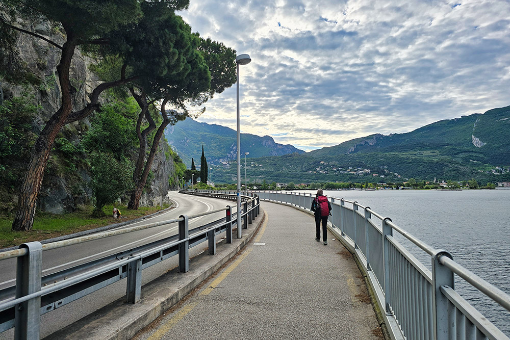
Lungolago Riva-Torbole
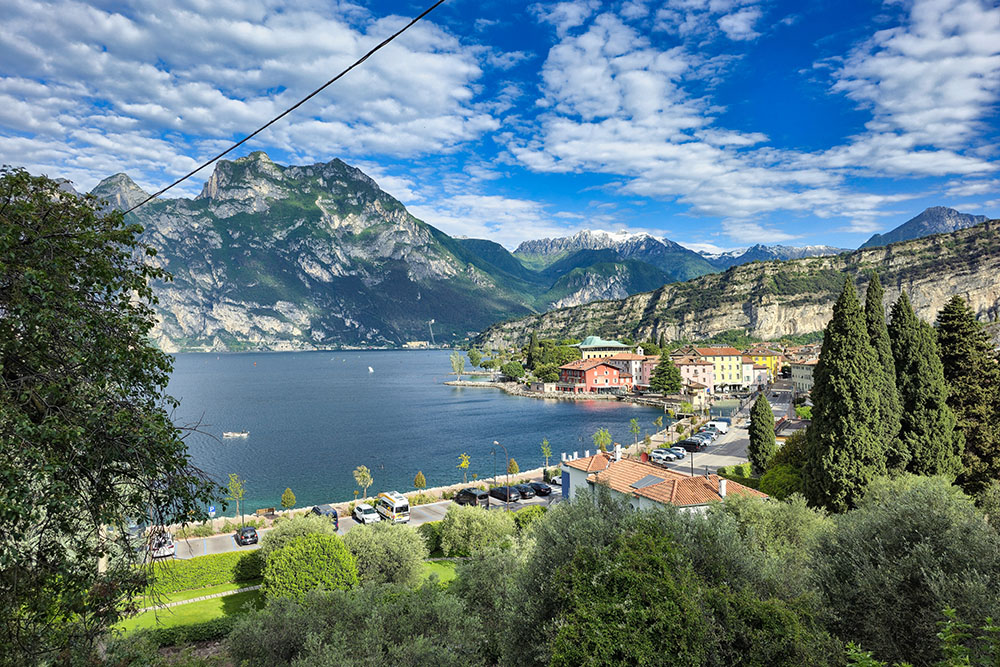
Saliamo con un bel panorama su Torbole
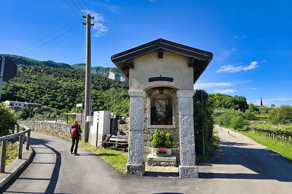
Capitello San Giuseppe
Si sale verso la Chiesa Madonna del Faggio
La Chiesa Madonna del Faggio
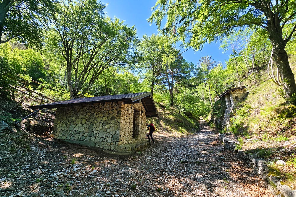
Il Bait della Selva
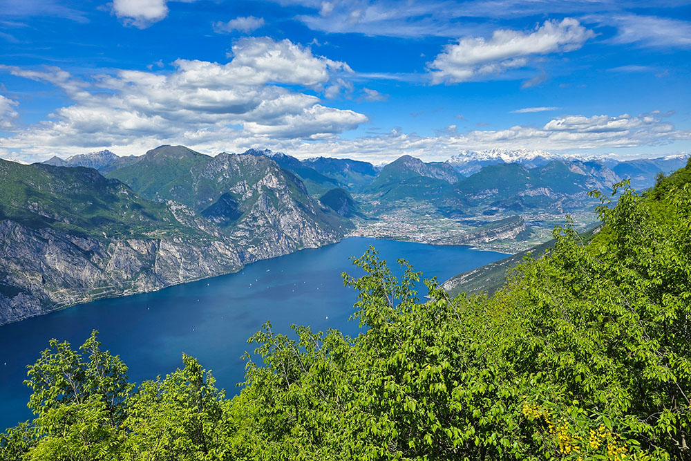
Vista sul lago verso nord
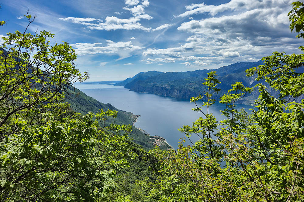
Vista sul lago verso sud
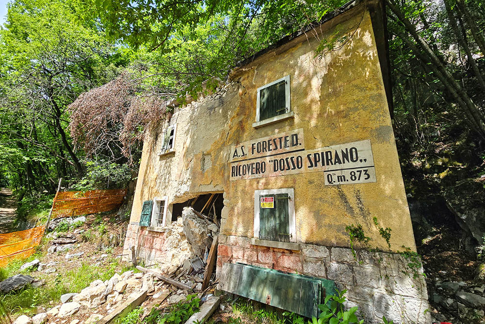
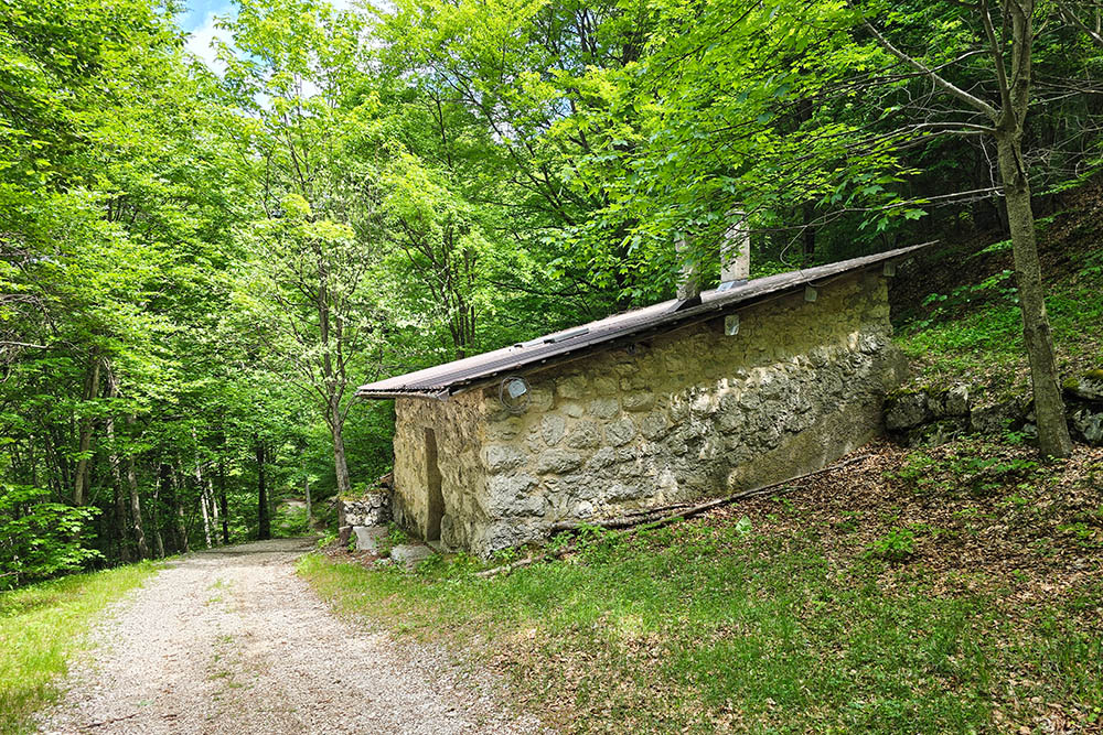
I ruderi del Ricovero Dosso Spirano
Stradina interna che porta a Malcesine
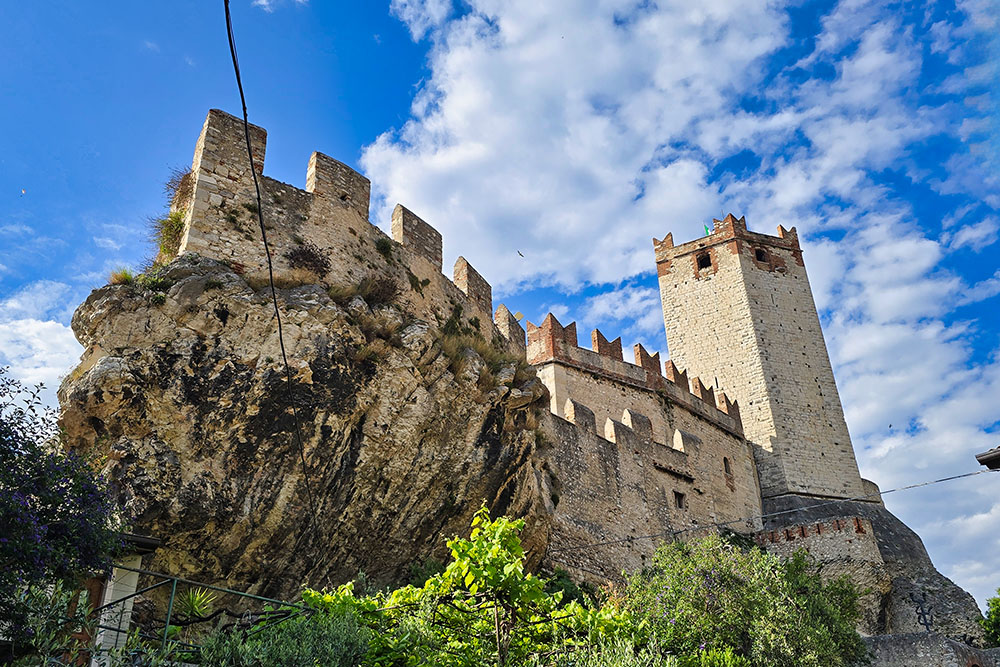
Il Castello Scaligero di Malcesine


