


![]()


Durata
 5:15 h
Distanza
 9,7 km
 Ascesa
 1030 m
Discesa
 1030 m
H Max
 2433 m
H Min
 1433 m
Lago di Costa Brunella and Forcella Segura
DESCRIPTION
Granite, war, and silence in the Cima d'Asta Massif.
Geographical location
Lago di Costa Brunella is located in the Cima d'Asta Massif, a granite island in the heart of eastern Trentino. It is geographically adjacent to the Lagorai chain but geologically distinct: while the Lagorai is mainly composed of reddish-brown porphyry, the Cima d'Asta Massif is entirely granitic. The area extends between the Tesino Plateau, Valsugana, and the Vanoi Valley. The starting base is Malga Sorgazza, in Val Malene, reachable from the municipality of Pieve Tesino, in the province of Trento.
Hike
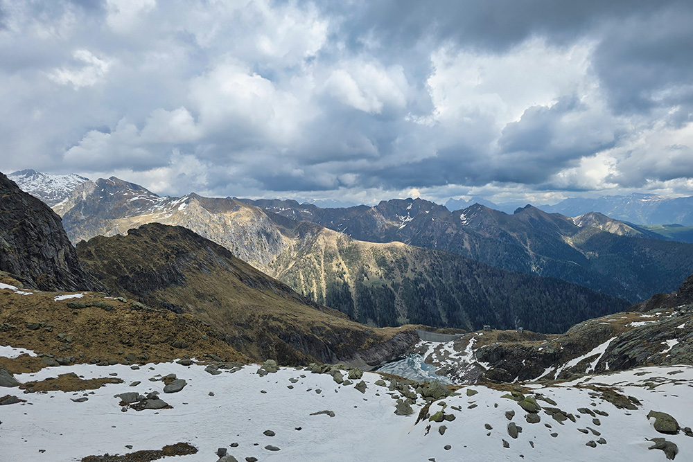
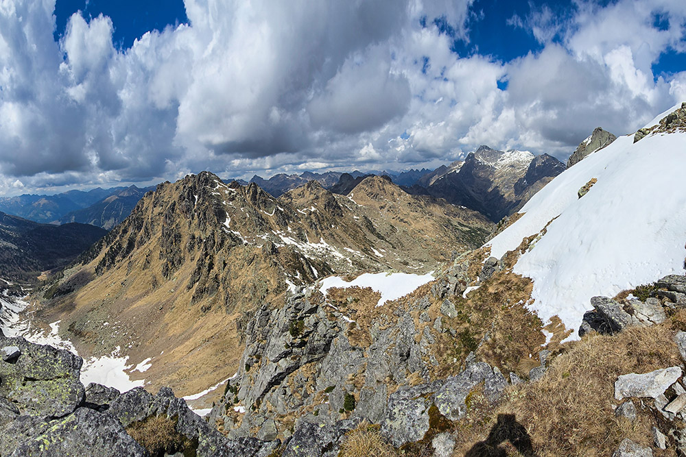
A highly satisfying route in a wild and sparsely visited area of the Cima d'Asta Massif. The itinerary crosses very varied environments - fir and larch forests, abandoned alpine pastures (alpeggi), scree fields, and granite ridges - with increasingly expansive views as you gain altitude. The nearby Lagorai Group offers a striking panorama, especially from the two mountain passes (forcelle) reached in the upper part of the route. Despite its artificial origin, Lago di Costa Brunella fits naturally into the landscape, set in the rocky basin at the foot of Cima Segura, Cima Brunella, and Cima Costa Brunella.
There are no open mountain huts along the route, but Malga Sorgazza offers agritourism services at the start.
History and interesting facts
The area crossed retains traces of two of the most intense historical periods of the twentieth century.
The Great War. From the very first meters of the path, you encounter the works of the Italian Military Engineers dating back to the First World War. Trenches, shelters, cave positions, and paved mule tracks run through the highest altitudes, testimony to a conflict that here - as on the entire Lagorai chain - deeply marked the landscape.
The Resistance. Lago di Costa Brunella also preserves a more recent and equally significant memory. The basin was created by the construction of a dam in the 1930s, which expanded a pre-existing natural reservoir to feed a hydroelectric power plant that came into operation in 1941 and is still active, albeit with reduced production due to the lowering of the water level, a phenomenon linked to climate change. During the Second World War, the Giorgio Gherlenda Partisan Battalion found refuge right on the shores of this lake, a Garibaldi formation active between August and October 1944 in the territories of Tesino, Lamon, and the lower Valsugana. On September 14, 1944, the battalion carried out a sensational action by storming the CST barracks in Castel Tesino; the following day, September 15, a German force of about three hundred soldiers launched a major raid that reached as far as Costabrunella. In the fighting, the commander Fumo, Isidoro Giacomin from Fonzaso, lost his life. Among the partisans of the Gherlenda were also two young women, Ancilla Marighetto Ora and Clorinda Menguzzato Veglia, both of whom fell in the following months and both of whom were awarded the Gold Medal for Resistance.
ITINERARY
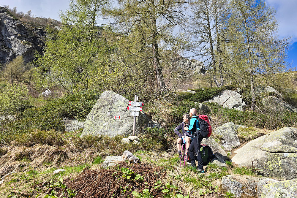
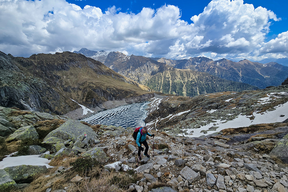
From the parking area (1420 m) you reach Malga Sorgazza (1450 m) in a few minutes, then take the trail marker 328 - Alta Via del Granito - which leads to the artificial lake of Costa Brunella (2033 m). The path climbs steeply through the woods, and around 1800 meters, the vegetation thins out, revealing increasingly open glimpses of Cima d'Asta. After passing the ruins of Malga Val del Lago, you go under the dam wall and reach the lake.
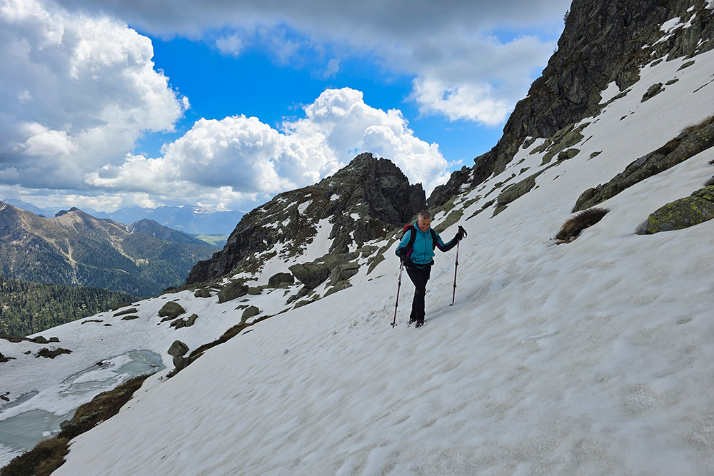
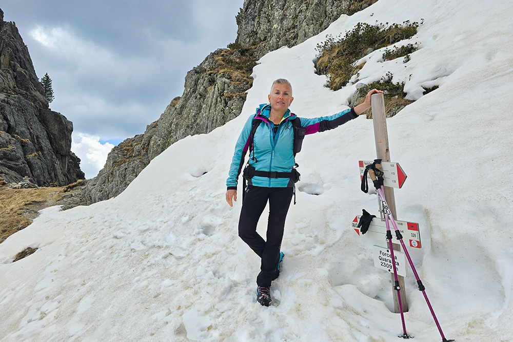
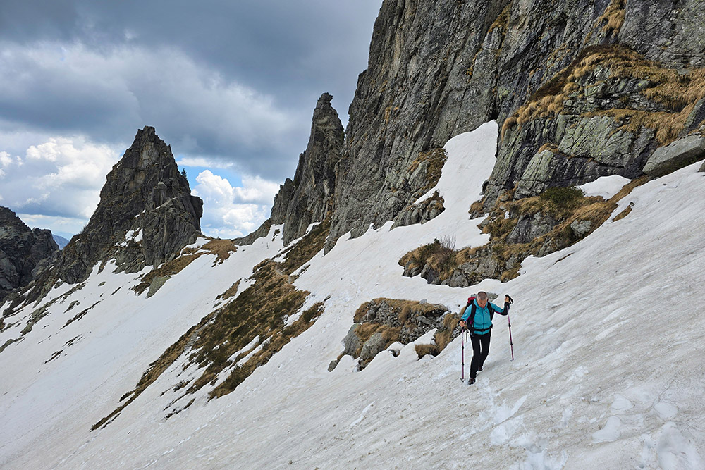
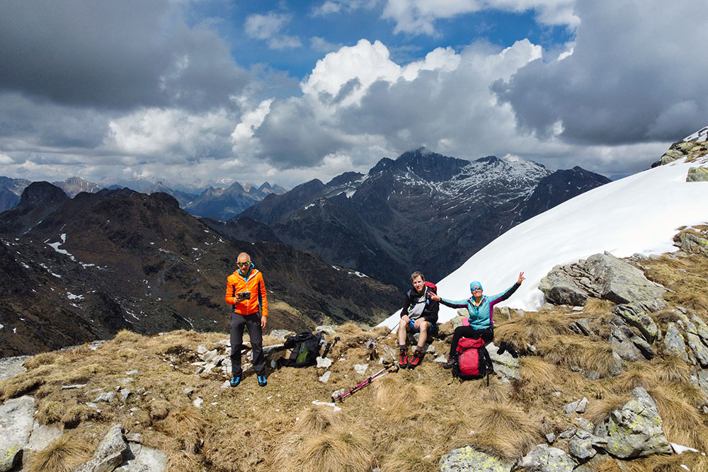
From here, with a progressive climb that is never too demanding, you reach Forcella Quarazza at 2309 m. Leave the trail marker 328 and take the 373, which in about 30 minutes leads to the narrow notch of Forcella Segura (2380 m). The return is via the same route.
EXCURSION DATE
May 9, 2026
STARTING POINT
Malga Sorgazza Parking Area
REFRESHMENT POINT
Malga Sorgazza
AUTHOR'S SUGGESTIONS
If you do it like us in the spring, be careful of snow.
SAFETY ADVICE
The practicability of the proposed itinerary, like all mountain terrain, is subject to environmental changes due to natural events and weather conditions. Therefore, before setting out, consult the relevant tourist offices and/or the reference mountain huts.
Our GPX tracks are only indicative, meaning the route was carried out under the best possible trail and weather conditions of that day. Therefore, always evaluate what to do on the spot.
Also, remember to assess the route based on your physical abilities, training, and the equipment you have.
It is advisable to let someone know the itinerary you intend to follow.
Remember that the emergency number is 112.
EQUIPMENT
It is recommended to have equipment suitable for the route, weather conditions, and season: windproof and/or rainproof jacket, map and/or GPS device, sunglasses, sunscreen, hiking boots, first aid kit, specific clothing, gloves, backpack with food and drinks.
RECOMMENDED MAPS
Tabacco 058 Valsugana - Tesino - Lagorai - Cima d'Asta
INTERESTING LINKS
https://www.visittrentino.info/it/trentino/destinazioni/pieve-tesino_md_43
HOW TO ARRIVE
From Valsugana, exit at Agnedo or Strigno and go up to Pieve Tesino. Here, at a gas station, turn following the signs for Val Malene and drive for about 8 km on a narrow, winding road. Halfway along, you come to a junction: keep left until the large parking area at Malga Sorgazza.
PARKING AREA
Malga Sorgazza Parking Area
GPS Coordinates: 46.134596, 11.598895
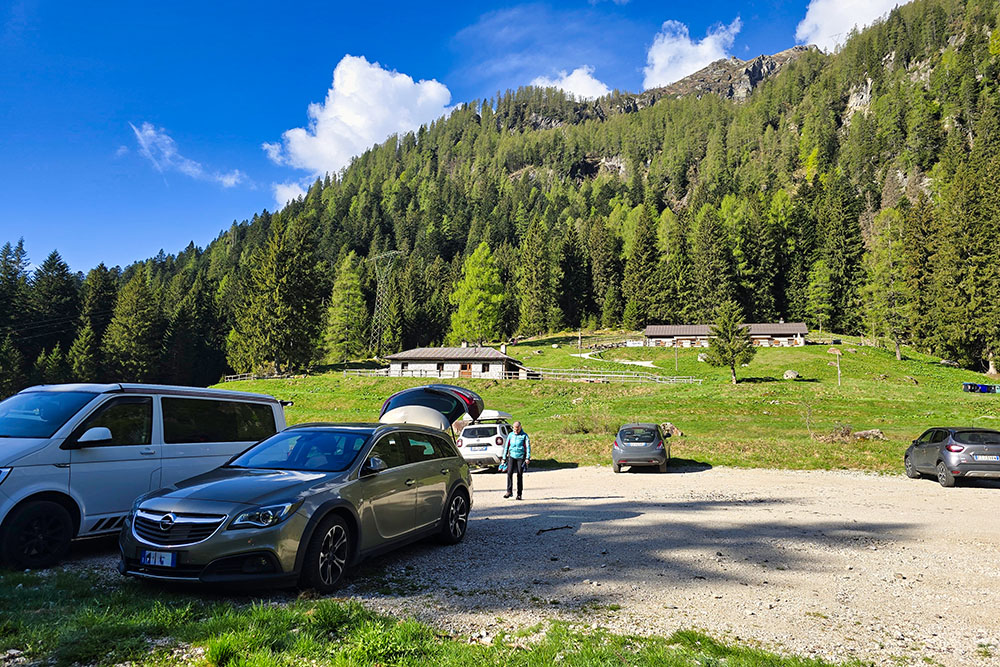
Parcheggio di Malga Sorgazza
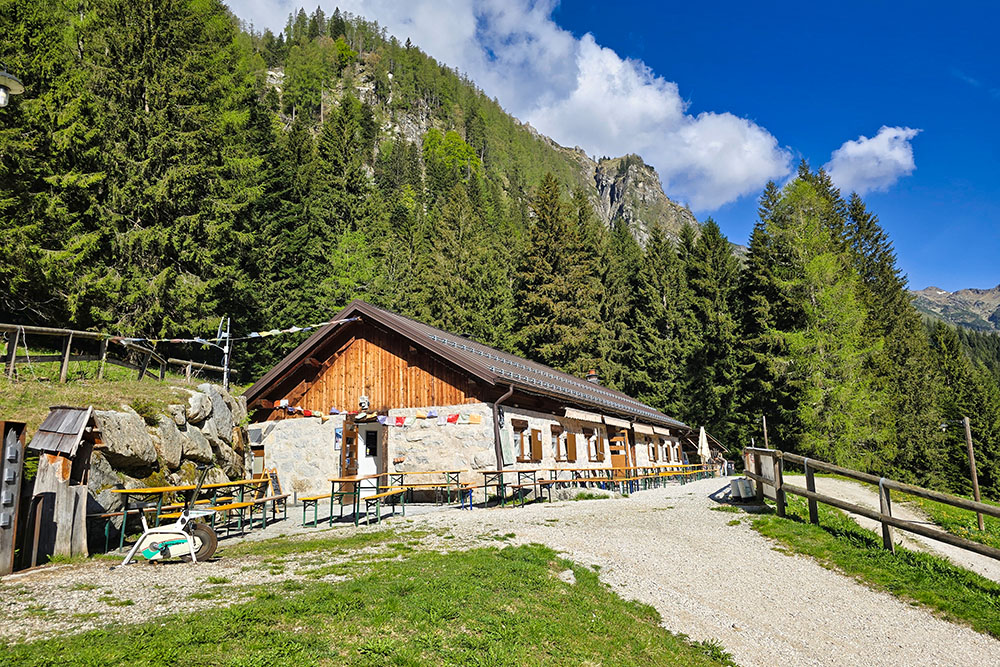
La Malga Sorgazza
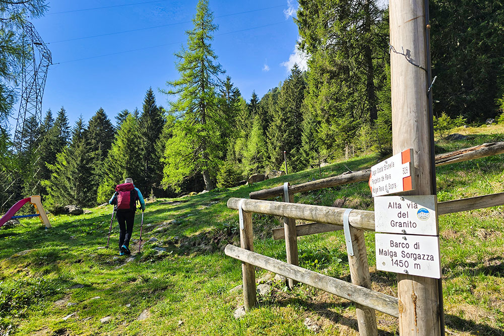
Si inizia sul segnavia 328
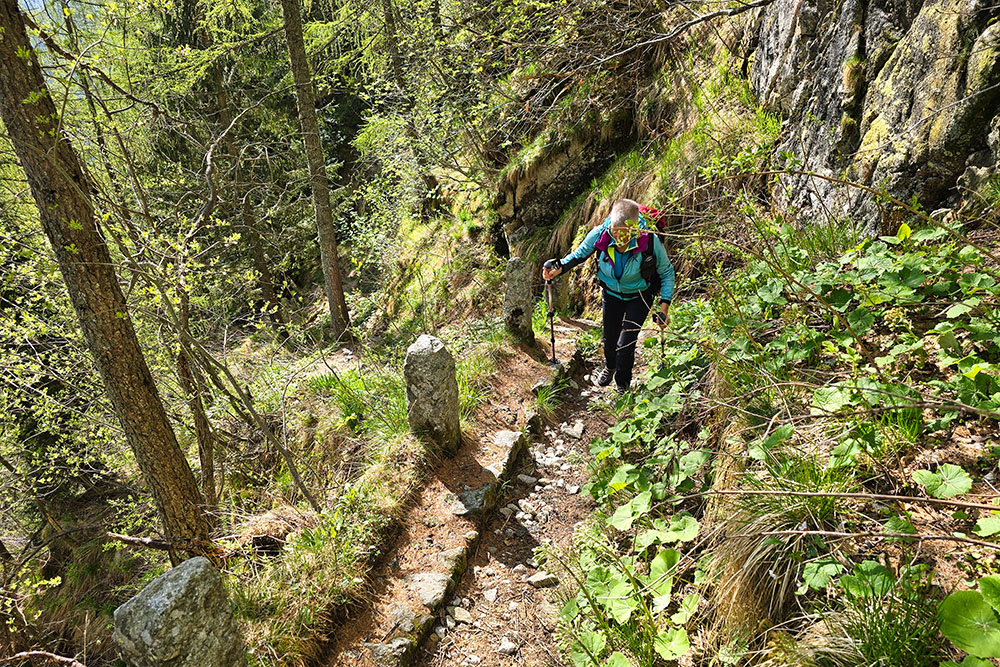
Si sale su antiche mulattiere della Prima Guerra Mondiale
Arrivati a Val del Lago
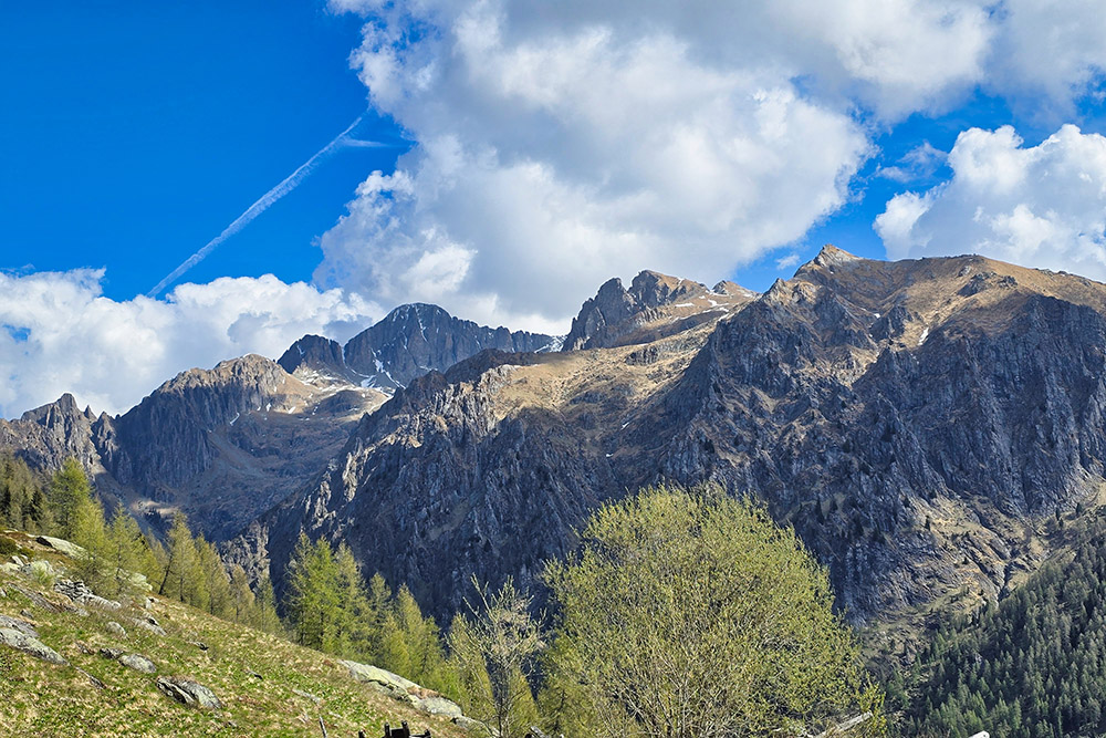
Vista verso Cima d'Asta
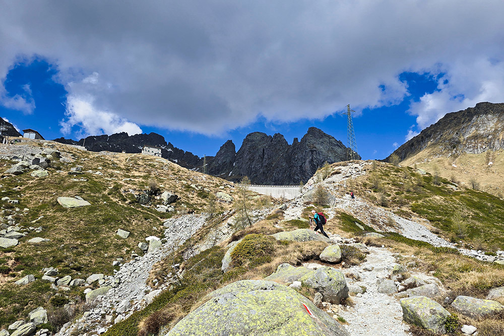
Manca poco al lago
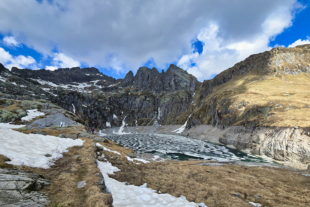
Il Lago di Costa Brunella
Si continua verso Forcella Quarazza
La neve ci rallenta il passo
Arrivati a Forcella Quarazza
Si riparte alla volta della Forcella Segura
Vista verso la valle
La Forcella Segura
Panorama dalla forcella


