


![]()


Durata
 4:30 h
Distanza
 12,1 km
 Ascesa
 430 m
430 mDiscesa
 266 m
266 mH Max
 1292 m
H Min
 1093 m
Hike: Posta Trail - from Laion to Ortisei
DESCRIPTION
Troi da la Posta: Val Gardena at a slow pace, just like in the old days.
Geographical location
The Posta Trail is located in South Tyrol, in the autonomous province of Bolzano. The route connects Chiusa (Klausen) in the Isarco Valley (Eisacktal) with Ortisei (St. Ulrich), the main town of Val Gardena (Gröden). The section described here – the most scenic and popular – runs entirely within the municipality of Laion (Lajen), passing through the hamlets of Ceves (Tschöfas) and San Pietro (St. Peter), before reaching the valley floor of Val Gardena. Laion sits on a sunny hill at an altitude of approximately 1,100 metres, at the entrance to Val Gardena.
Hike
The Posta Trail – Troi da la Posta in Ladin, Poststeig in German – is one of the most beloved historic routes in South Tyrol. It runs along the sunny side of lower Val Gardena and is ideal in spring or autumn, seasons when the summer heat and winter snow give way to colours and temperatures perfect for walking.
Here we propose the final part of the original route, the richest in open landscapes and characteristic villages: you start from Laion and, without ever facing challenging elevation gains, you reach Ortisei passing through the hamlets of Ceves and San Pietro. The minimal elevation change along the 12 km route is a rarity in Val Gardena, making it comparable to the irrigation channel trails (Waalwege) of other South Tyrolean valleys.
Only a short passage through the steep woods of Croda della Porta (Törwand), after San Pietro, requires a sure footing: the mule track narrows to a path, but presents no technical difficulties. For the rest, the walk is constantly pleasant, among open meadows, rural villages, and silent woods.
The peaks of the Sciliar (Schlern), the Sella Group, the Sassolungo (Langkofel), the Sassopiatto (Plattkofel), and the Resciesa provide a backdrop along the entire route. Along the way there are two refreshment points: the Gasthaus Pedrutscherhof and the Überbacher bar & restaurant. For the return to Laion, the number 351 bus line is recommended, which passes approximately every hour.
History and curiosities
The trail's name tells its story. Before the valley road was built in 1856, the postman used this route to deliver mail on foot from Chiusa to Ortisei. The postman covered the entire journey twice a week, climbing from Chiusa railway station to the heart of Val Gardena. For centuries, this was the only regular link between the Isarco Valley and the villages of Val Gardena.
Along the route, San Pietro di Laion stands out, whose baroque bell tower with a red dome is visible from afar and has become the visual symbol of the hamlet. The parish church of San Pietro preserves valuable baroque altars and is worth a stop.
ITINERARY
From Laion (1,093 m), always follow the P sign for the Poststeig. Start by heading towards Ceves (1,207 m), then towards San Pietro (1,210 m) and finally to the Gasthaus Pedrutscherhof (1,267 m). From here, you walk along the most naturalistic part of the trail and descend into Val Gardena as far as Ortisei (1,234 m).
EXCURSION DATE
May 2, 2026
STARTING POINT
Laion
REFRESHMENT POINT
Restaurant Überbacher and Gasthaus Pedrutscherhof
AUTHOR’S SUGGESTIONS
The best time to walk it is spring and autumn, without a doubt: the trail is exposed to the sun and at low altitude, so in summer it can become quite hot.
SAFETY TIPS
The practicability of the proposed itinerary, like all mountain terrain, is subject to environmental changes due to natural events and weather conditions. Therefore, before setting off, consult the relevant tourist offices and/or the reference mountain huts. Our GPX tracks are for guidance only, meaning the route was completed under the best trail and weather conditions of that day. Always assess what to do on-site.
Also, remember to evaluate the route based on your physical abilities, training, and the equipment you have.
It is advisable to let someone know the itinerary you intend to follow.
Remember that the emergency number is 112.
EQUIPMENT
It is recommended to have equipment suitable for the route, weather conditions, and season: windproof and/or rainproof jacket, map and/or GPS device, sunglasses, sunscreen, hiking boots, first aid kit, appropriate clothing, gloves, backpack with food and drinks.
RECOMMENDED MAPS
Tabacco 05 Val Gardena - Alpe di Siusi / Gröden - Seiseralm
INTERESTING LINKS
https://www.valgardena.it/
HOW TO ARRIVE
From Ponte Gardena (Waidbruck), take the SP82, then the SS242d and finally the SP139.
PARKING AREA
In Laion, near the tennis courts, free parking.
GPS coordinates: 46.610572, 11.567138
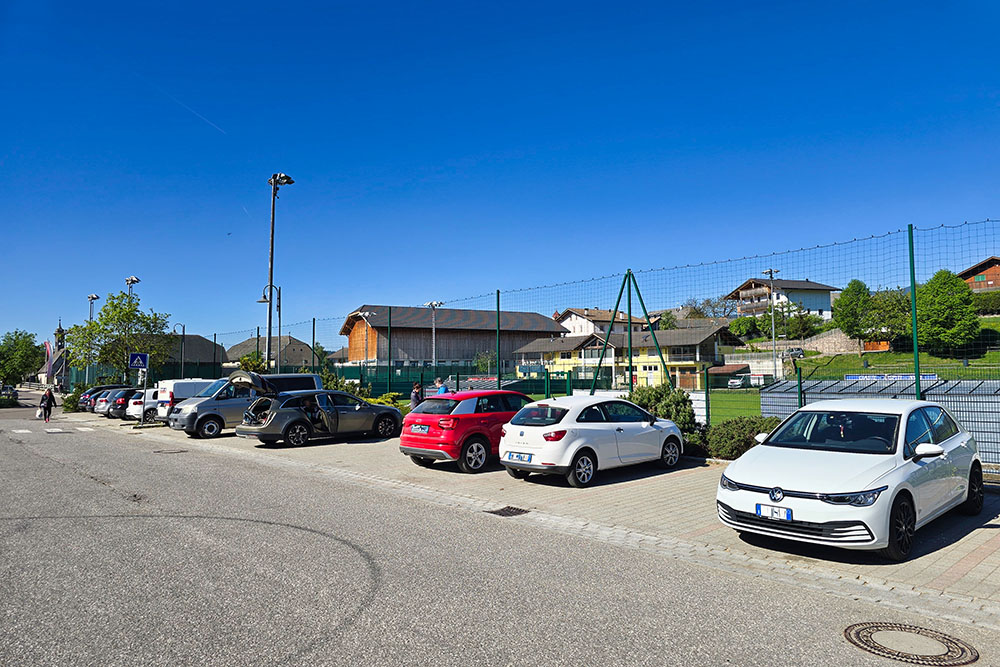
Parcheggio a Laion
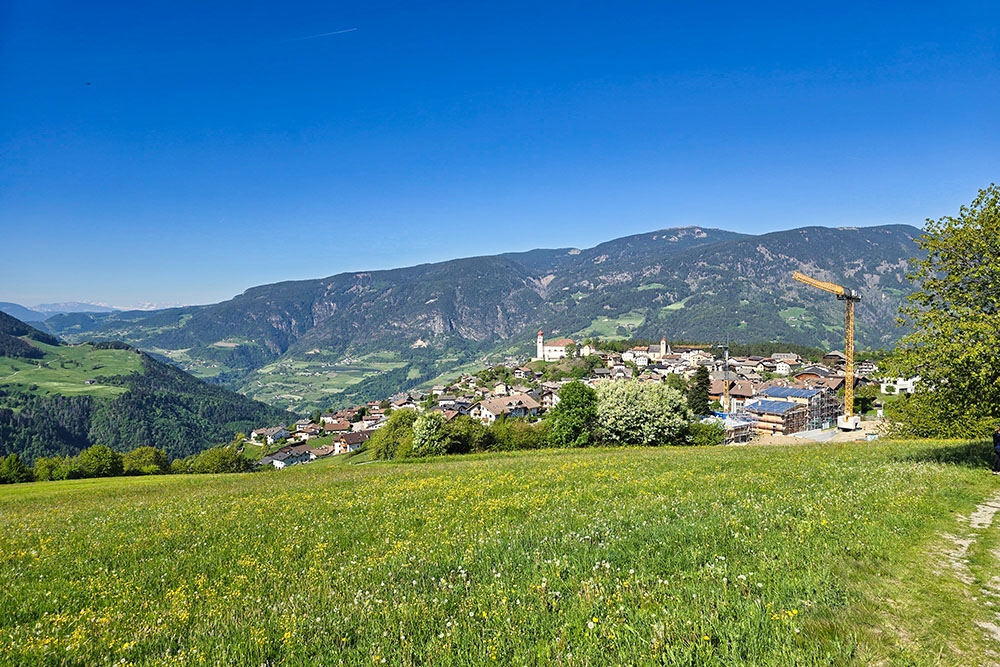
Lasciamo Laion
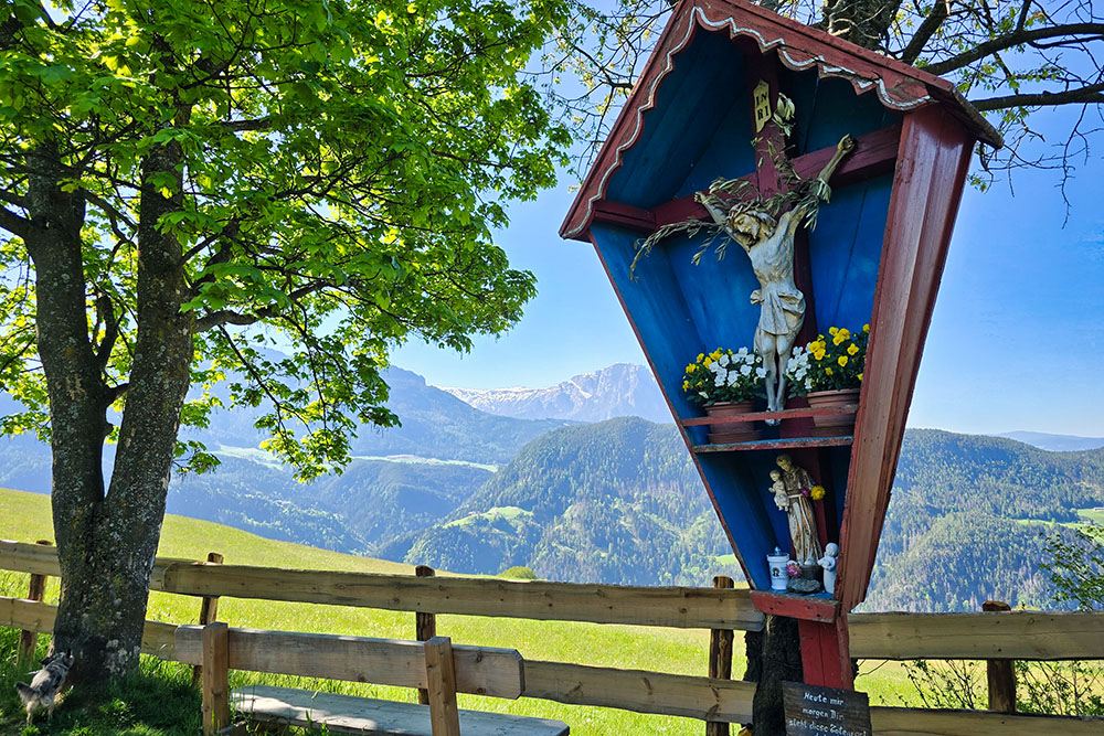
Un bel crocefisso
Arrivati a Ceves
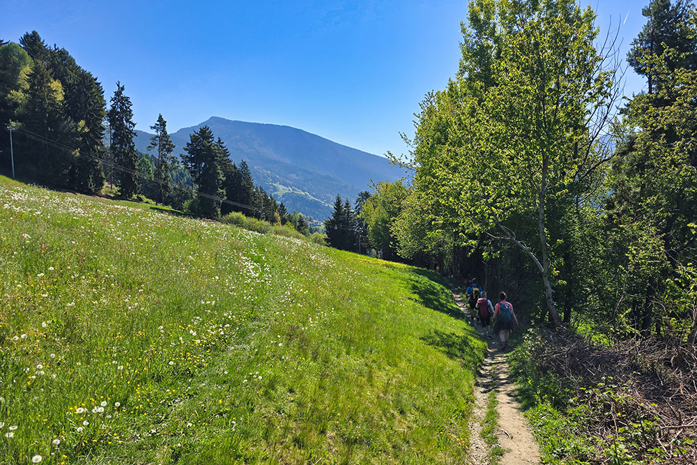
Prati fioriti
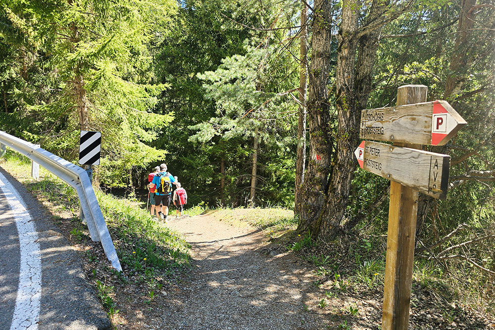
Bivio per San Pietro
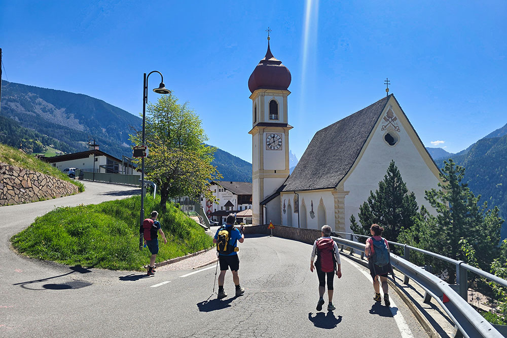
Arrivati a San Pietro
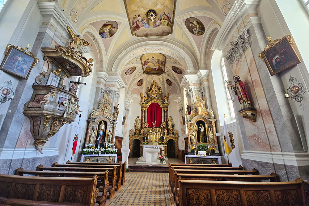
All'interno della chiesa di San Pietro
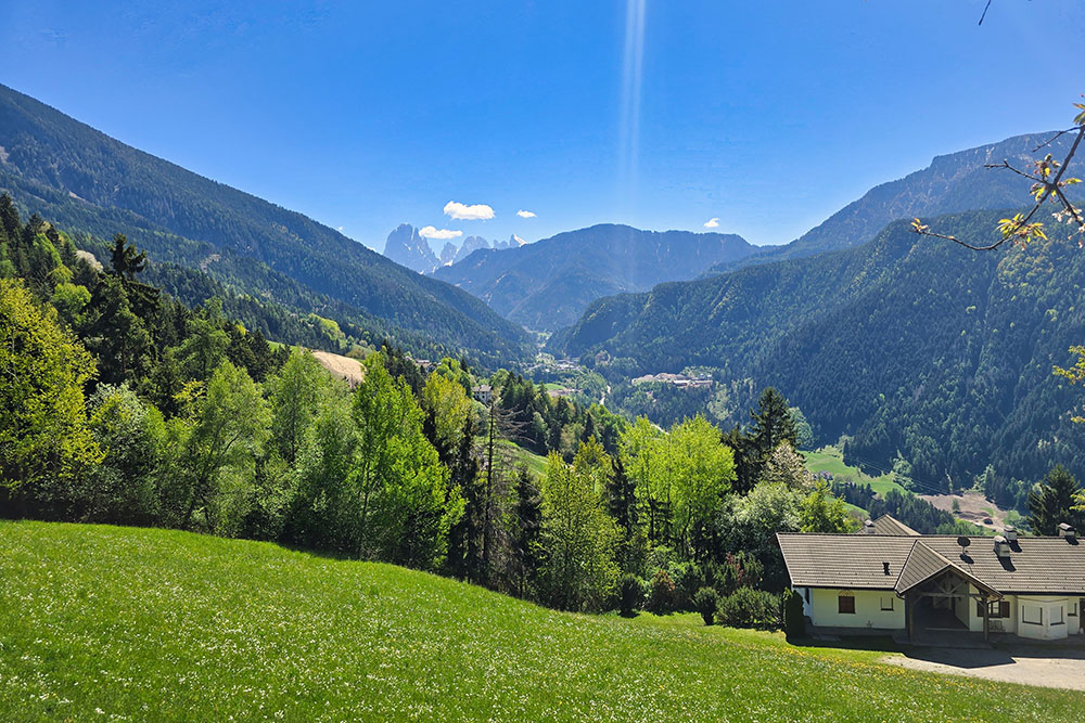
Panorama verso il Sassolungo
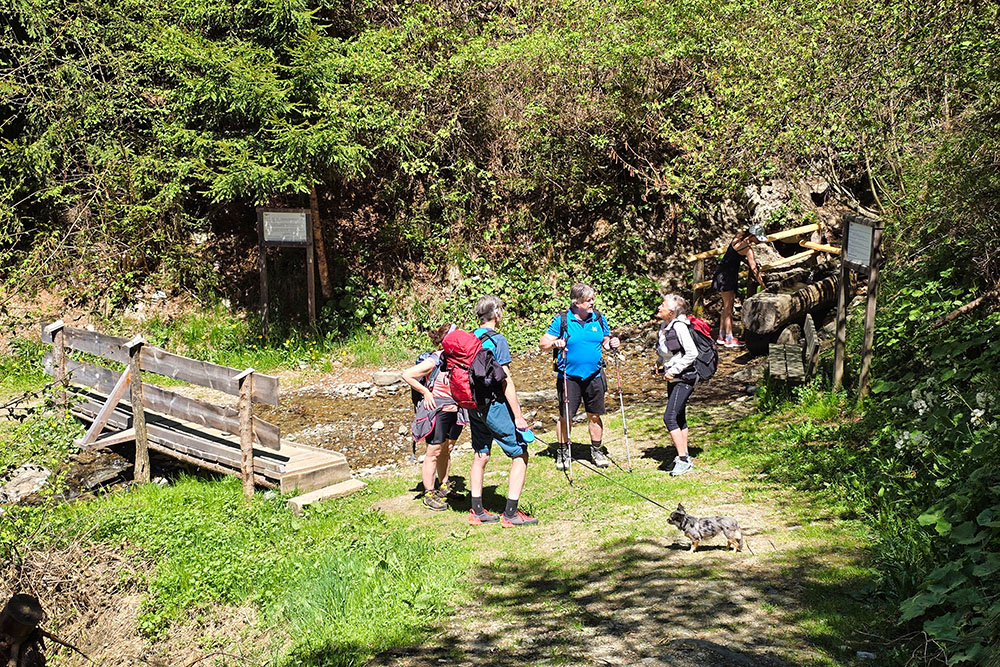
Punto kneipp
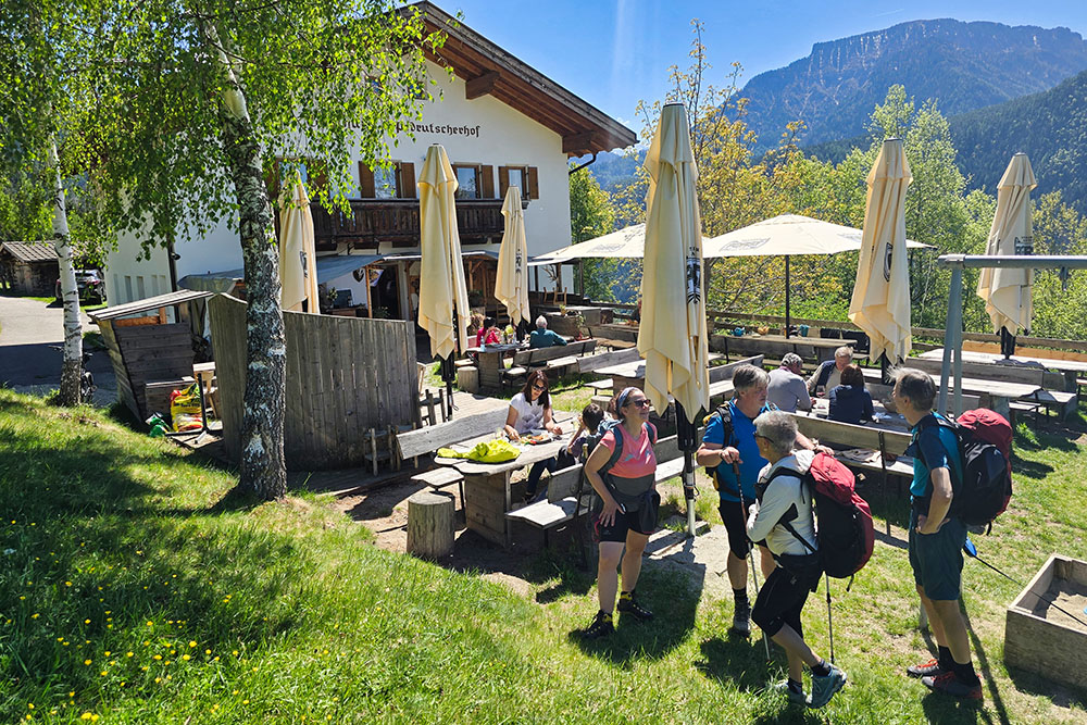
Punto ristoro Pedrutscherhof
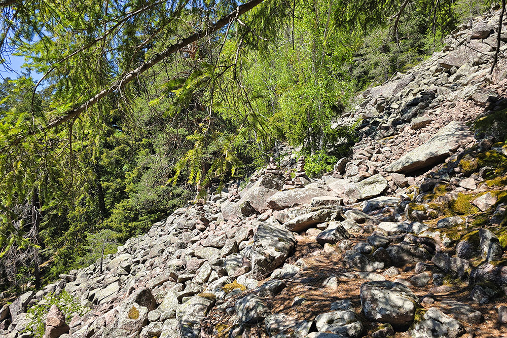
Passiamo un tratto pietroso
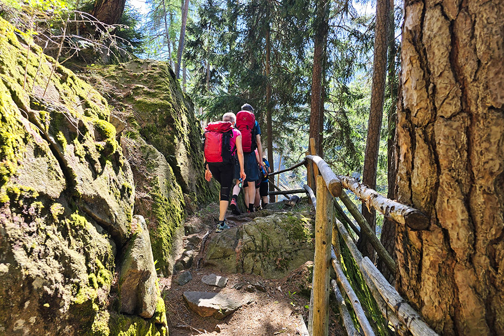
Il sentiero diventa un po' più impegnativo
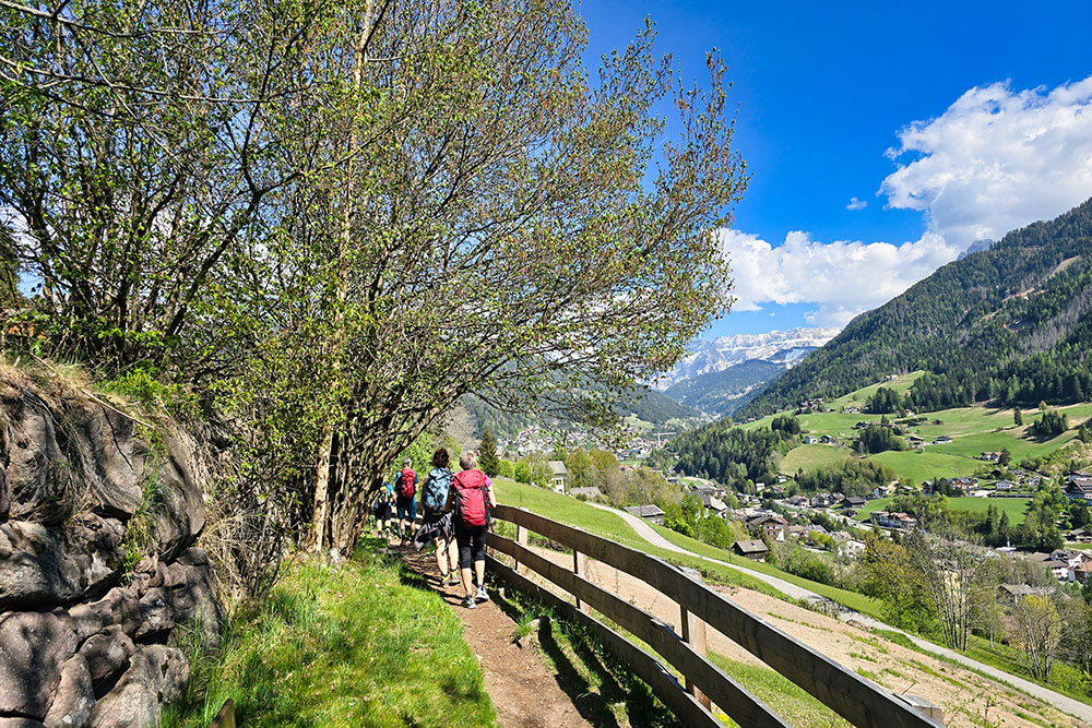
In Val Gardena
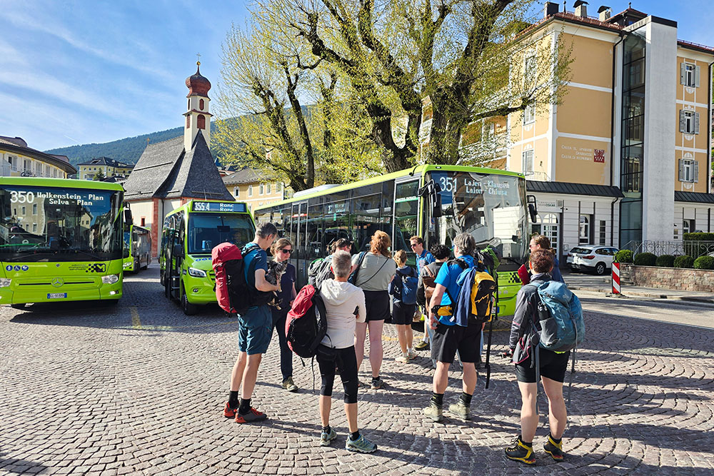
A Ortisei prendiamo il bus 351


