


![]()


Durata
 4:50 h
Distanza
 13,8 km
 Ascesa
 680 m
680 mDiscesa
 680 m
680 mH Max
 868 m
868 mH Min
 275 m
275 mCastles and Vineyards in Bolzano
DESCRIPTION
From the Talvera River to Santa Maddalena: a walk among medieval castles and vineyards.
Geographical location
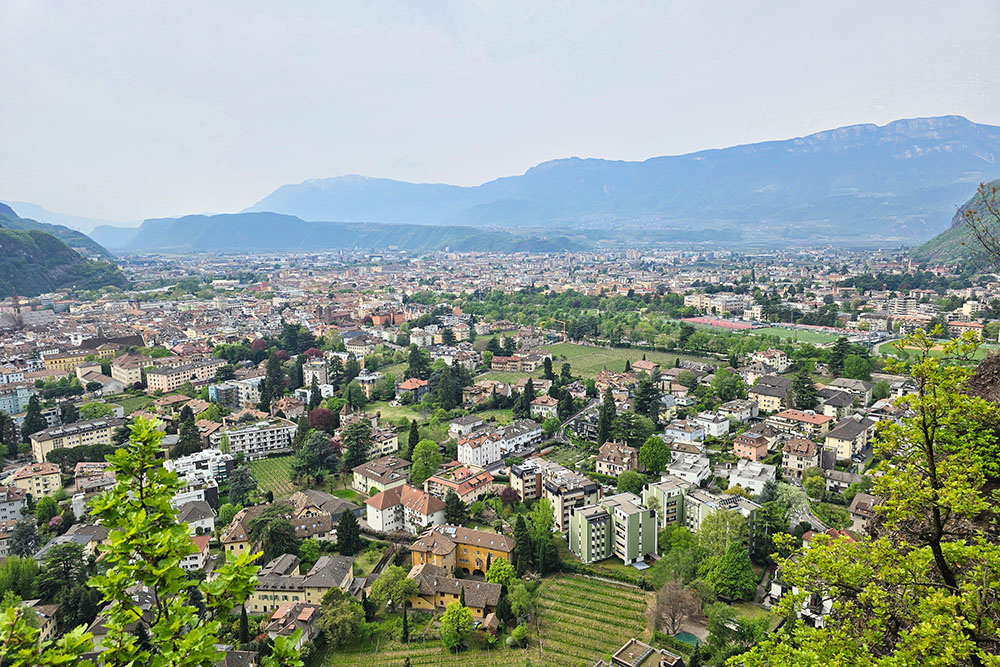
Bolzano, capital of the Autonomous Province of Bolzano – South Tyrol, is located at 265 m in the eastern part of the wide basin formed by the confluence of the Isarco, Sarentina, and Adige valleys. The basin is bordered to the west by the Mendola chain, to the north-west by the Salten Plateau, to the north-east by the Tondo Mountain, a lesser offshoot of the Renon, and to the south-east by the Pozza Mountain.
Hike
A loop trail in the northern part of Bolzano, ideal in spring or autumn when the light is soft and temperatures invite walking. The route is of low difficulty, suitable for hikers of all levels, with one exception: the section that climbs from Santa Maddalena towards the Laste area has a steep gradient requiring a good level of fitness and careful footing.
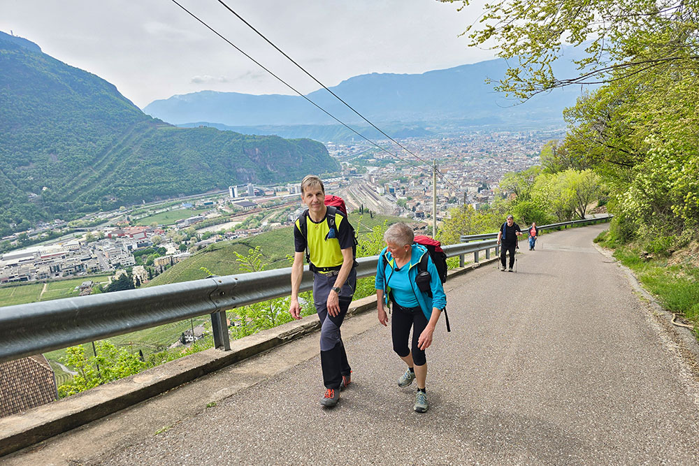
What makes this loop particularly enjoyable is its variety: you start from an urban setting, follow the Talvera River through parks and sports areas, pass by well-preserved medieval castles, climb among the terraced vineyards of Santa Maddalena, and walk along a panoramic trail overlooking the Bolzano basin and, on clear days, the Dolomites of the Catinaccio group. An itinerary that harmoniously combines history, nature, and the urban landscape.
History and curiosities
The Talvera Meadows (Talferwiesen)
The walk begins along the Talvera Meadows (Talferwiesen), Bolzano's main recreational area, which extends on both banks of the river of the same name. The Lungotalvera Promenade runs under large shady trees; on the meadows there are playgrounds, benches, football and basketball fields, a skate park, and a minigolf course. In winter, an ice skating rink is set up on the right bank.
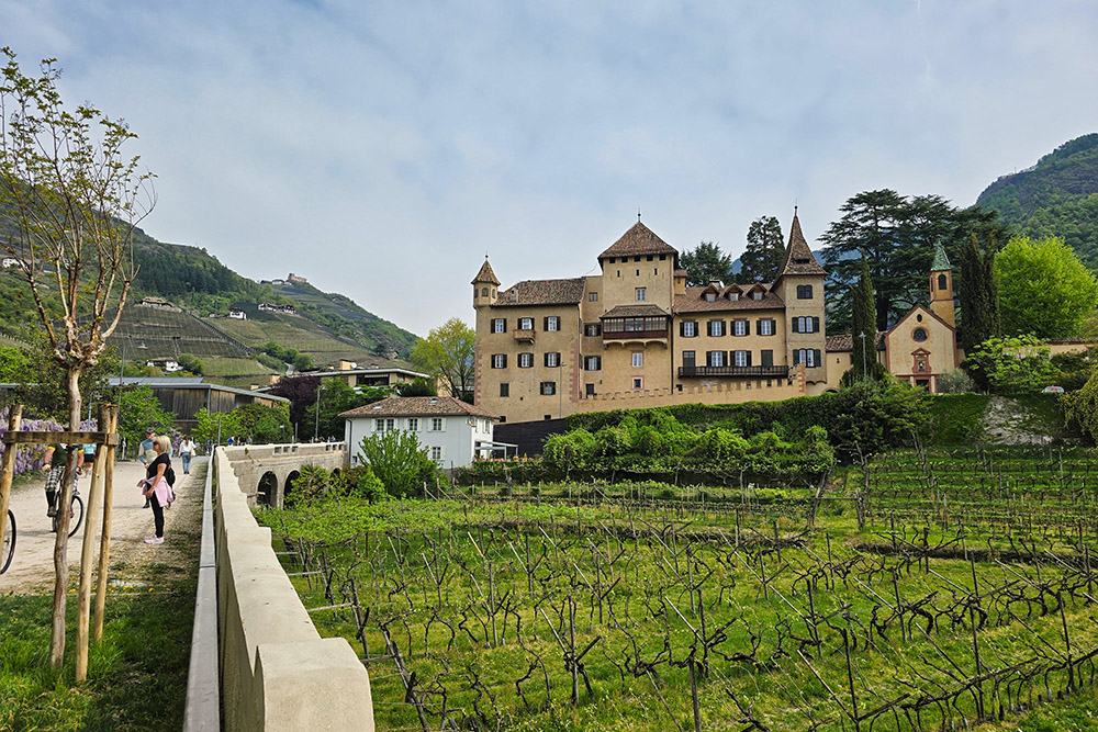
Mareccio Castle (Castel Mareccio)
First mentioned in 1273, Mareccio Castle was originally a small Romanesque fortress belonging to the von Maretsch family, members of the Bolzano bourgeoisie who were later ennobled. In the following centuries, substantial structural changes were made, turning it into a Renaissance residence. After several changes of ownership, in 1974 the Tourist Board purchased the structure and converted it into a conference centre.
Klebenstein Castle (Castel Sant'Antonio)
Klebenstein Castle, sometimes Italianized as Castel Sant'Antonio due to the Baroque church dedicated to the saint located at the end of its boundary wall, is situated at the entrance to the Sarentino Valley. The original nucleus dates back to the 13th century, originally called Karnol, and over the centuries it was expanded into a noble private residence. The Italian name was imposed with the Prontuario dei nomi locali dell'Alto Adige (Directory of local place names in South Tyrol), made official by the fascist regime in 1923. Today, the building is inhabited by the von Aufschnaiter family.
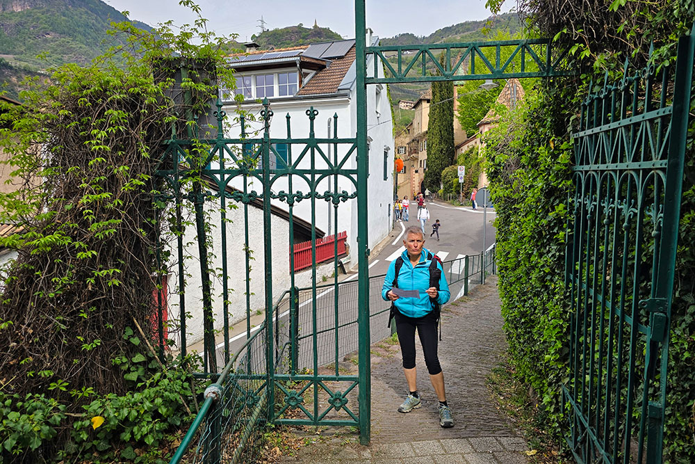
The Sant'Osvaldo Promenade (Passeggiata di Sant'Osvaldo)
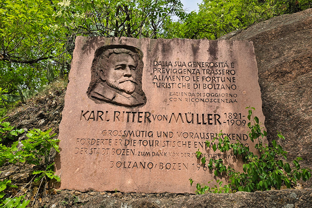
The Sant'Osvaldo Promenade owes its name to a small late Romanesque church dedicated to St. Oswald, which once stood at its entrance. It was built thanks to a bequest from the engineer Karl Ritter von Müller and inaugurated in 1908. The church of Sant'Osvaldo, destroyed during an aerial bombardment in 1943, is now reduced to its load-bearing walls only.
Karl Ritter von Müller (1821–1909) was a German engineer and architect who settled in Bolzano in 1889, living in the Villa Girasole in Gries. His legacy made it possible to build the promenade, of which a memorial along the path preserves the memory.
The Church of Santa Maddalena (St. Magdalena)
The church, located in the Rencio district in the Santa Maddalena area, was first documented in 1295 with the Latin name ecclesia sancte Marie Magdalene de Placedelle. The Romanesque style and position among the vineyards make it one of the most characteristic spots in this part of the city. Santa Maddalena is the production heart of the red wine of the same name — the St. Magdalener — one of the most renowned in South Tyrol.
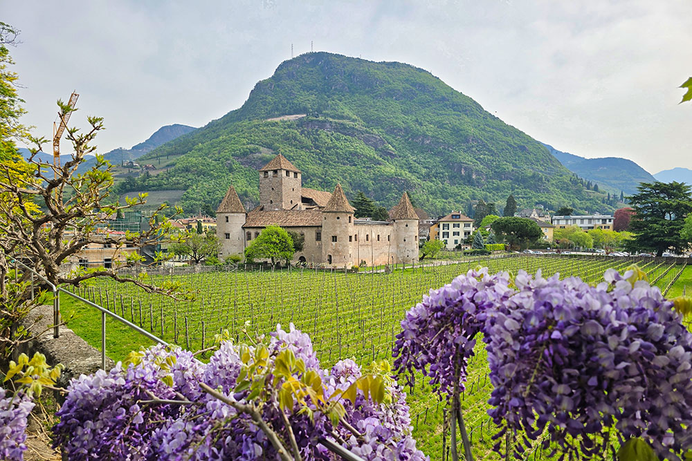
Runkelstein Castle (Castel Roncolo)
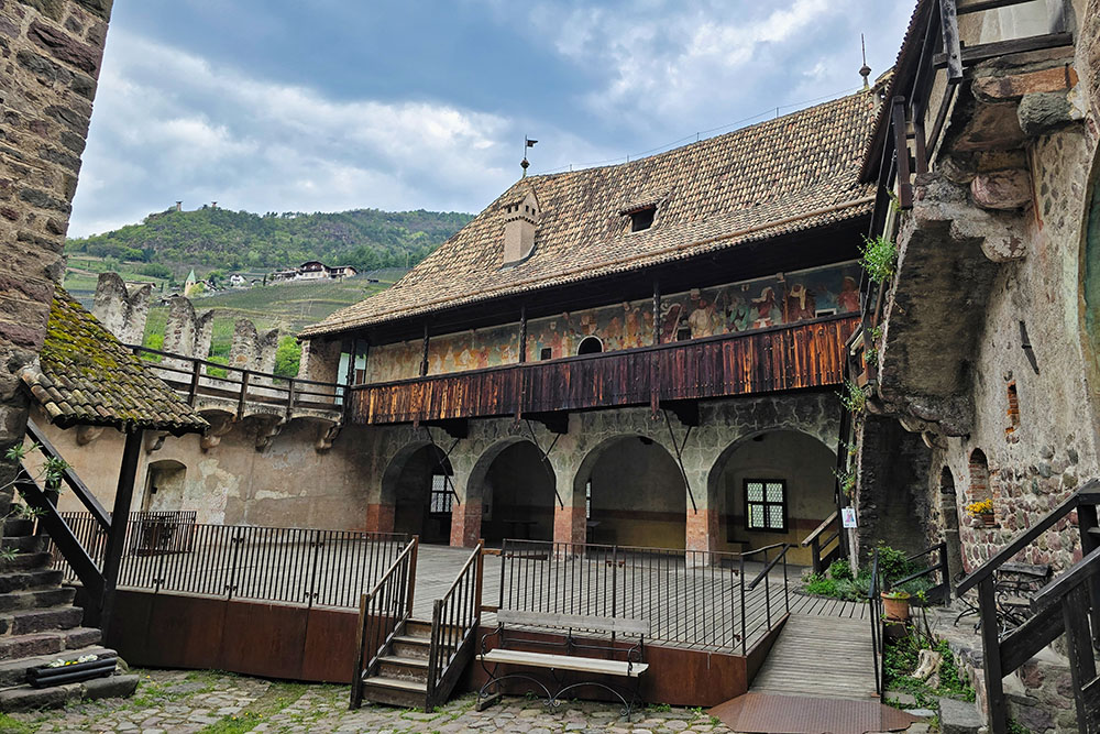
Built as a stronghold in 1237 by the Vanga family, Runkelstein Castle was transformed into a summer residence by the brothers Niklaus and Franz Vintler in 1385. The largest cycle of secular frescoes from the Middle Ages was created between 1388 and 1410 at the behest of Franz Vintler, who wished to portray the courtly world of the late Middle Ages. The walls depict hunting scenes, knightly tournaments, dances, and famous literary stories such as those of Tristan and Isolde and the Knights of the Round Table of King Arthur, earning the castle the nickname of Illustrated Castle (Bilderburg). At the end of the 19th century, the castle passed to Emperor Franz Joseph, who had it restored and, in 1893, donated it to the city of Bolzano.
ITINERARY
From the parking area (300 m) at the San Genesio cable car, follow the cycle-pedestrian path towards the city centre. Take the Lungotalvera promenade to the bridge located before Ponte Druso (275 m); cross the river, go back up on the other bank, always along the Lungotalvera, pass by Mareccio Castle (282 m) and reach Sant'Antonio Castle (305 m). From here, take the Sant'Osvaldo Promenade and climb up to Santa Maddalena (370 m). Continue uphill towards the Laste area (790 m) and, following the Chestnut Trail (Sentiero del Castagno), descend passing by Runkelstein Castle (361 m), finally returning to the starting point.
EXCURSION DATE
April 12, 2026
STARTING POINT
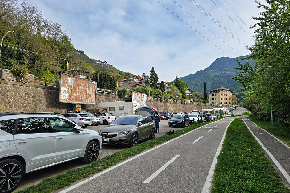
San Genesio cable car parking area
REFRESHMENT POINT
Many along the route.
AUTHOR’S SUGGESTIONS
To be done in spring or autumn, when the summer heat is not yet – or no longer – a problem.
SAFETY ADVICE
The practicability of the proposed itinerary, like all mountain terrain, is subject to environmental changes due to natural events and weather conditions. Therefore, before setting off, consult the relevant tourist offices and/or the reference mountain huts.
Our GPX tracks are for guidance only, meaning the route was taken in the best possible way given the trail and weather conditions of that day. Always assess what to do on the spot.
Also, remember to evaluate the route based on your physical abilities, training, and the equipment you have.
It is advisable to inform someone of the itinerary you intend to follow.
Remember that the emergency number is 112.
EQUIPMENT
It is recommended to have equipment suitable for the route, weather conditions, and season: windproof and/or rainproof jacket, map and/or GPS device, sunglasses, sun cream, boots, first aid kit, appropriate clothing, gloves, a backpack with food and drinks.
RECOMMENDED MAPS
Tabacco 034 Bozen - Ritten - Salten / Bolzano - Renon - Salto
INTERESTING LINKS
https://www.runkelstein.info/en/
HOW TO ARRIVE
A22 motorway, Bolzano Nord exit. Head towards the Sarentino Valley.
PARKING AREA
San Genesio cable car parking area
GPS coordinates: 46.513612, 11.351506
Parcheggio presso la Funivia San Genesio
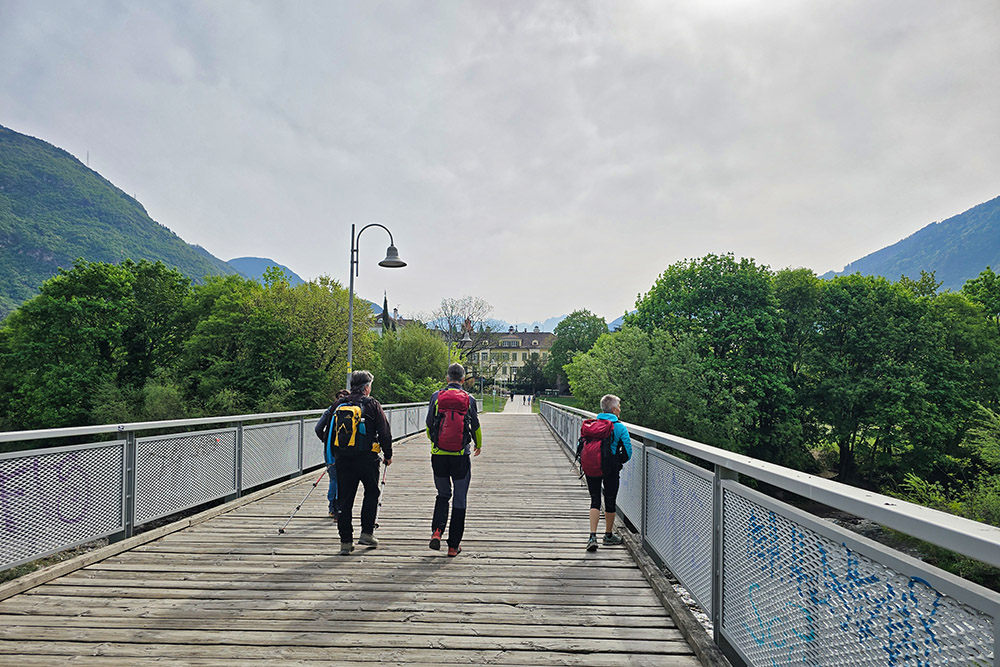
Si inizia sulla ciclopedonale
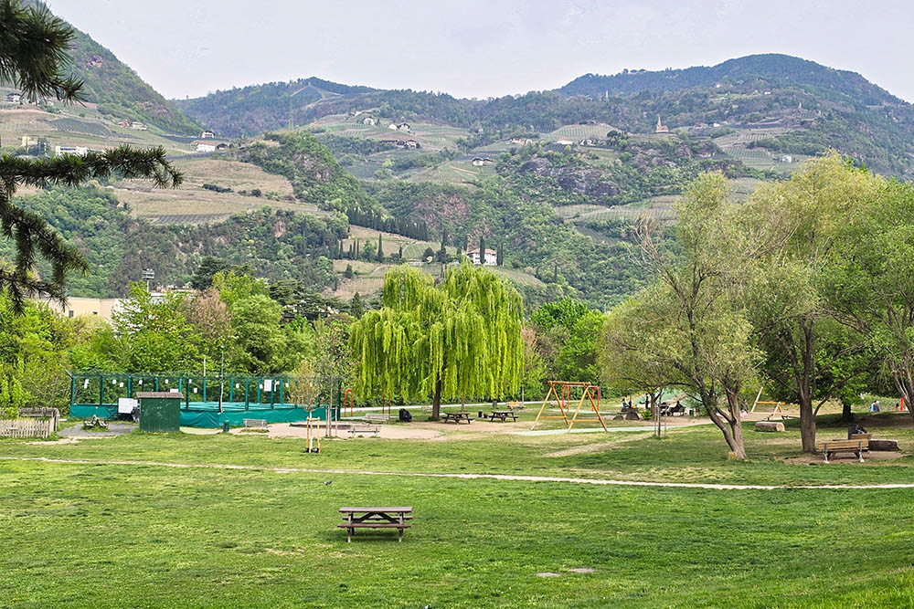
I Prati del Talvera
Il Castel Mareccio

Momento di relax
Castel Sant'Andrea
Inizio della passeggiata di Sant'Oavaldo
Panorama su Bolzano
Targa commemorativa a Karl Ritter von Müller

Chiesa Santa Maddalena
Salita ripida
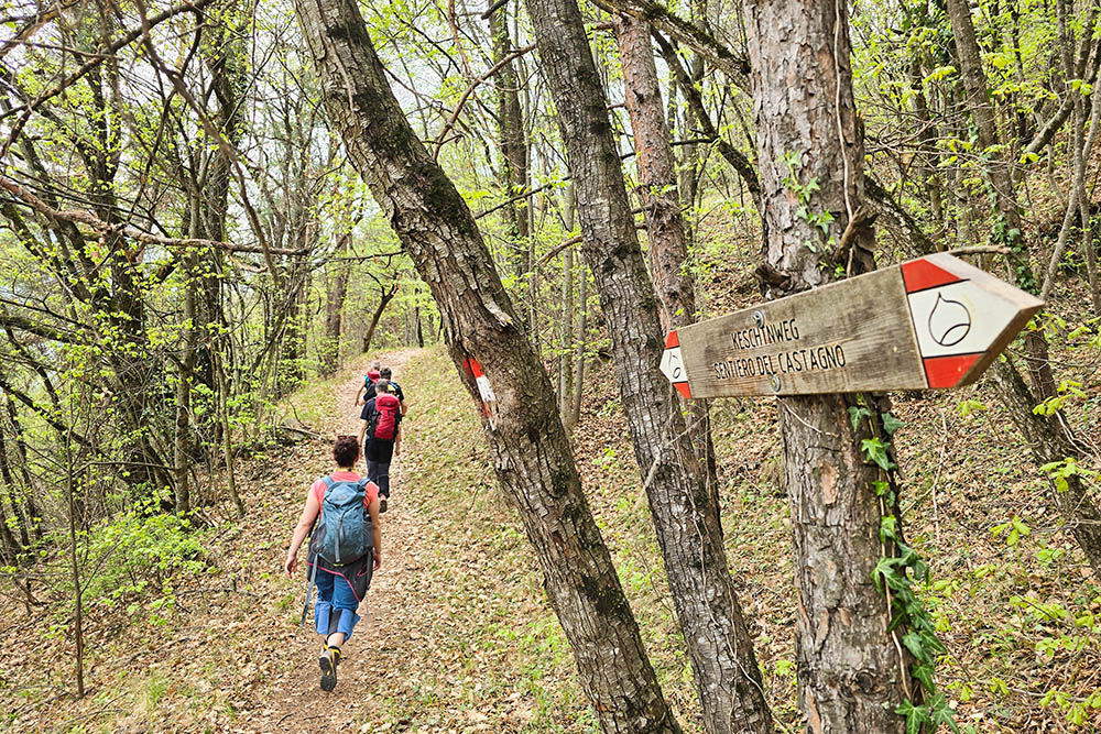
Si segue il Sentiero del Castagno
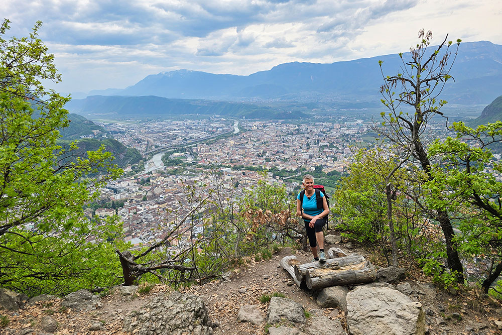
Punto panoramico
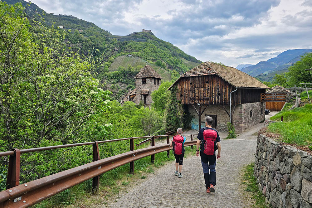
In prossimità di Castel Roncolo
All'interno del Castel Roncolo


