


![]()


Durata
 4:00 h
Distanza
 8,4 km
 Ascesa
 500 m
500 mDiscesa
 500 m
500 mH Max
 440 m
440 mH Min
 65 m
65 mFrom Campione del Garda to Pieve di Tremosine
DESCRIPTION
From the Gorge to the Village: adventure between water and rock from Campione to Pieve.
Geographical location
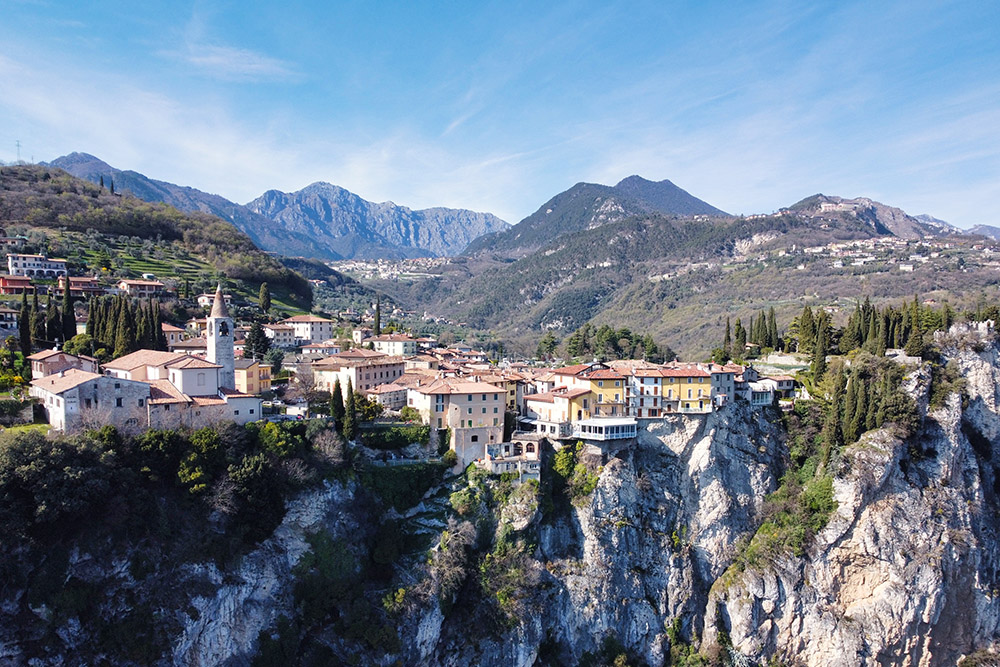
Campione del Garda is a hamlet of the municipality of Tremosine sul Garda, in the province of Brescia, within the Alto Garda Bresciano Park . The village stands on the western shore of the lake, squeezed into a small strip of land between the waters of Lake Garda and the high rock face that towers above it. Right behind the town, before reaching the lake, the San Michele stream has carved a steep limestone gorge over the centuries: the Forra di San Michele. Pieve di Tremosine, the destination of the hike, is located at about 420 m above sea level, on a natural terrace overlooking the lake from above, just a few kilometers in a straight line but almost 400 meters in altitude above Campione.
Hike
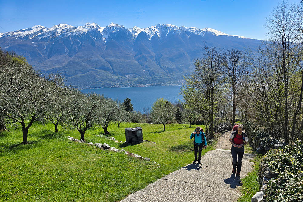
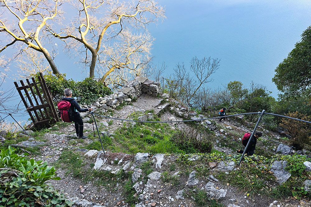
Among the itineraries of the Brescian Alto Garda, the one connecting Campione del Garda to Pieve di Tremosine is one of the most beautiful and scenic on the entire lake. The loop route, lasting about four hours, alternates very different environments: the wild gorge of the San Michele stream with its vertical walls and ancient hydraulic infrastructures, the sections equipped with steel cable along the rocky bastion, the gentle ridges with views of the lake and surrounding peaks, and finally the relaxing return on the old Gardesana road. The highlight of the itinerary is Pieve di Tremosine, a medieval village perched on a rocky spur and listed since 2009 among the Borghi più Belli d'Italia (Italy's Most Beautiful Villages) . Gazing out over Lake Garda from here, with Monte Baldo in the background, is one of the most intense spectacles on the entire Brescian shore.
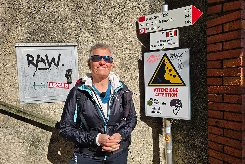
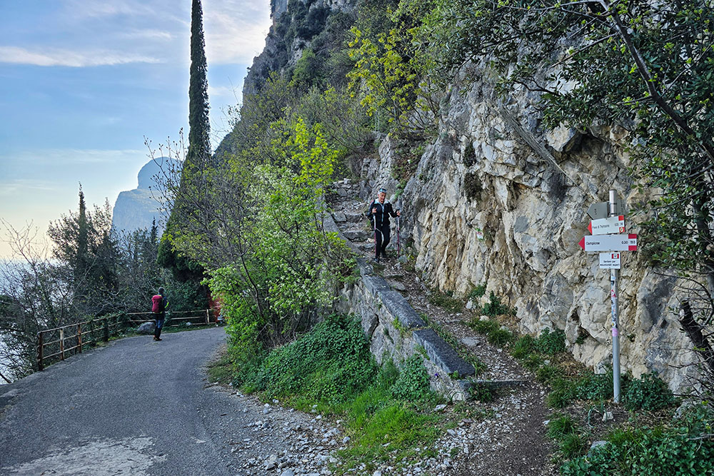
The hike is reserved for experienced hikers: both the ascent through the gorge and the descent from Pieve feature steep and exposed sections. In some points, the path is equipped with a steel cable to hold onto; it is not recommended for those who suffer from vertigo. The route can be walked in all seasons but should be avoided in case of rain, snow, or strong wind.
History and curiosities
Campione del Garda has an industrial history dating back to the 16th century, when the village was already home to paper mills, grain mills, and forges. During the 18th century, the Archetti family, wealthy merchants from Brescia, acquired the entire village, opened a silk spinning mill, and built Villa Archetti (1730–1740). A flood that hit the area in 1807 destroyed the ancient workshops, leaving Campione almost uninhabited for nearly a century.
The turning point came in 1896, when Giangiacomo Feltrinelli and later Vittorio Olcese built a cotton mill and a workers' village that included a church, a theater, a boarding school, and a grocery store, and the town was repopulated with families employed at the new facility. The cotton mill exploited the hydraulic power of the San Michele stream, whose water catchment works are still clearly visible in the gorge. The plant closed permanently in 1981 due to the economic crisis of the 1970s, and from that moment Campione went through a long period of abandonment. Only in recent decades has the village regained vitality thanks to tourism redevelopment projects.
Pieve di Tremosine, the final destination of the hike, is the main village of the municipality of Tremosine sul Garda, a scattered municipality of eighteen hamlets. The village is famous for its Terrazza del Brivido (Thrill Terrace), a platform suspended about 350 meters sheer above the lake, accessible from the Hotel Paradiso .
ITINERARY
From Campione del Garda (69 m), take the Forra San Michele towards Pregasio, following path marker 110, reserved for expert hikers. Upon reaching the top of the bastion, the route becomes significantly easier; in the hamlet of Lo (424 m), leave the route for Pregasio and turn towards Pieve di Tremosine following path marker 142, with a moderate slope.
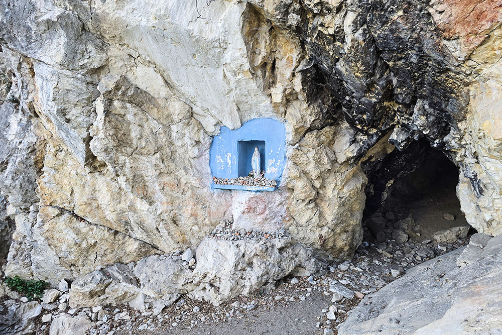
Arriving at Pieve di Tremosine (420 m), begin the descent towards Campione along path 141, also for expert hikers. During the descent, you pass in front of a cave with a small blue Madonna, then reach the old Gardesana road. From here, continue on path marker 150 and, in about 30 minutes, return to Campione del Garda.
EXCURSION DATE
28 March 2026
STARTING POINT
Campione del Garda
REFRESHMENT POINT
In Pieve di Tremosine
AUTHOR'S SUGGESTIONS
Given the low altitude difference and full sun exposure, it is preferable to do the hike in spring or autumn.
SAFETY TIPS
The practicability of the proposed itinerary, like all mountain terrain, is subject to environmental changes due to natural events and weather conditions. Therefore, before leaving, consult the relevant tourist offices and/or the reference mountain huts.
Our GPX tracks are only indicative, meaning the route was taken under the best conditions of the trails and weather of that day. Therefore always assess what to do on site.
Also remember to evaluate the route based on your physical abilities, training, and the equipment you have.
It is advisable to let someone know the itinerary you intend to follow.
Remember that the emergency number is 112.
EQUIPMENT
It is recommended to have equipment suitable for the route, weather conditions, and season: windproof and/or rain jacket, map and/or GPS device, sunglasses, sunscreen, hiking boots, first aid kit, specific clothing, gloves, backpack with food and drinks.
RECOMMENDED MAPS
Tabacco 063 Monte Baldo - Malcesine - Garda
INTERESTING LINKS
https://www.tremosinesulgarda.it/it/pieve
HOW TO ARRIVE
From Riva del Garda or from Salò: SS45bis.
PARKING AREA
In Campione del Garda
GPS Coordinates: 45.753234, 10.750464
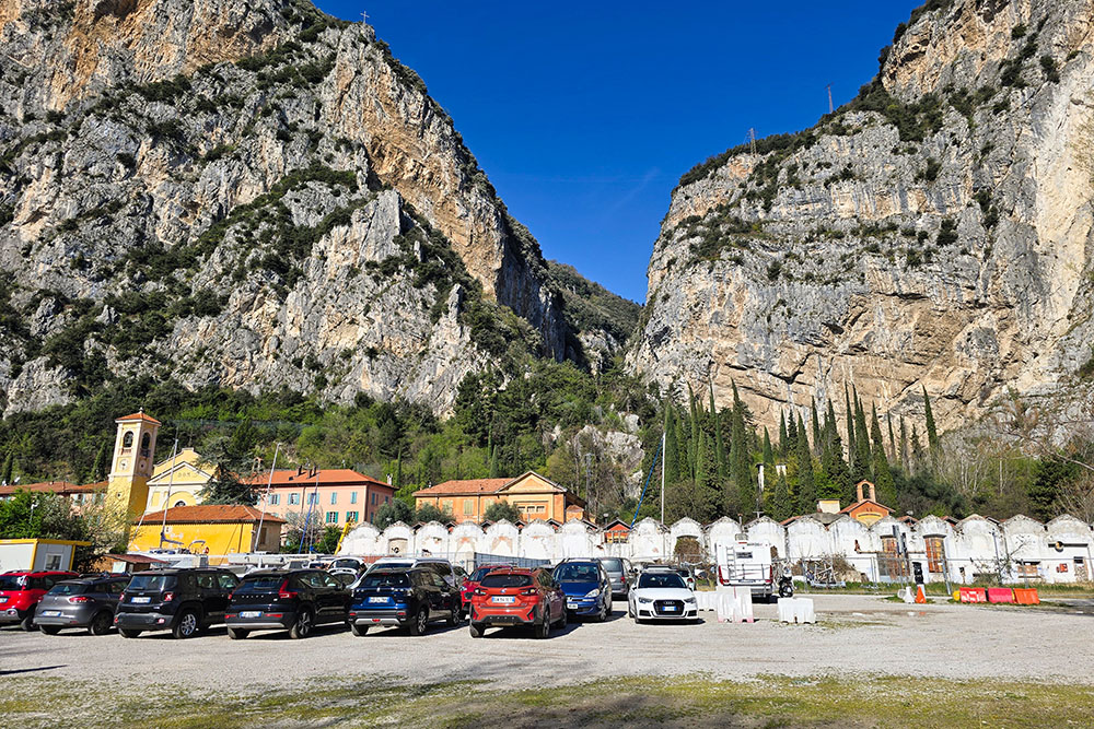
Parcheggio a Campione del Garda
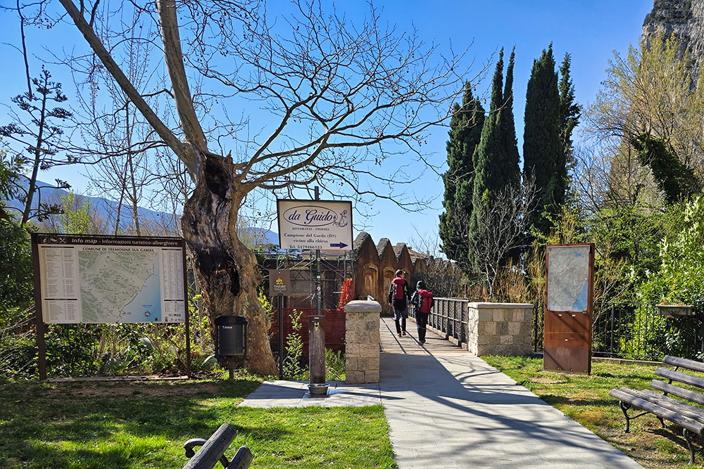
Inizio del sentiero 110
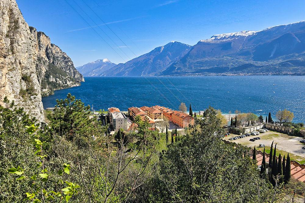
Vista verso nord
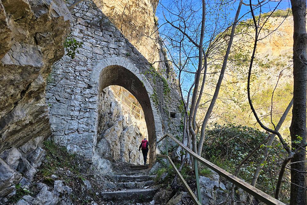
Saliamo la Forra di San Michele

Gallerie della forra
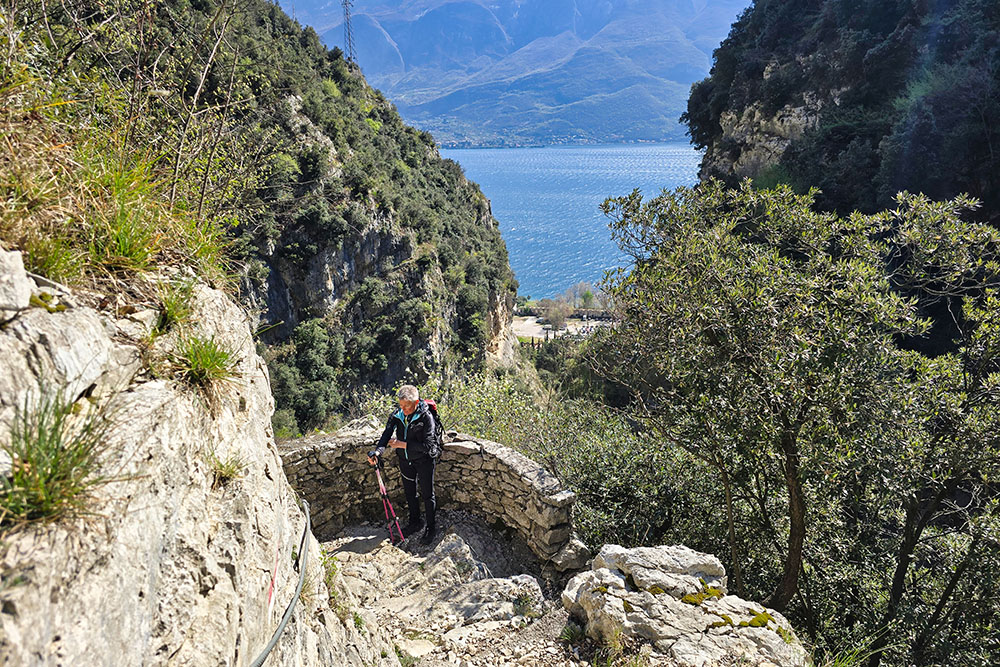
Siamo passati sul versante sinistro orografico
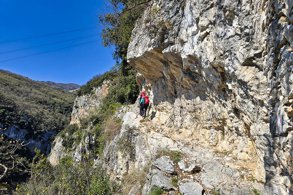
Il sentiero è scavato nella roccia
Siamo usciti dalla forra
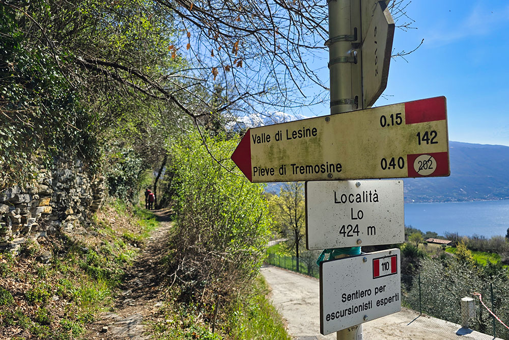
Ora prendiamo il segnavia 142
Arrivati a Pieve di Tremosine
Scendiamo per il sentiero 141
Il sentiero è ripido ed esposto
Siamo alla Madonnina
Terminato il sentiero 141
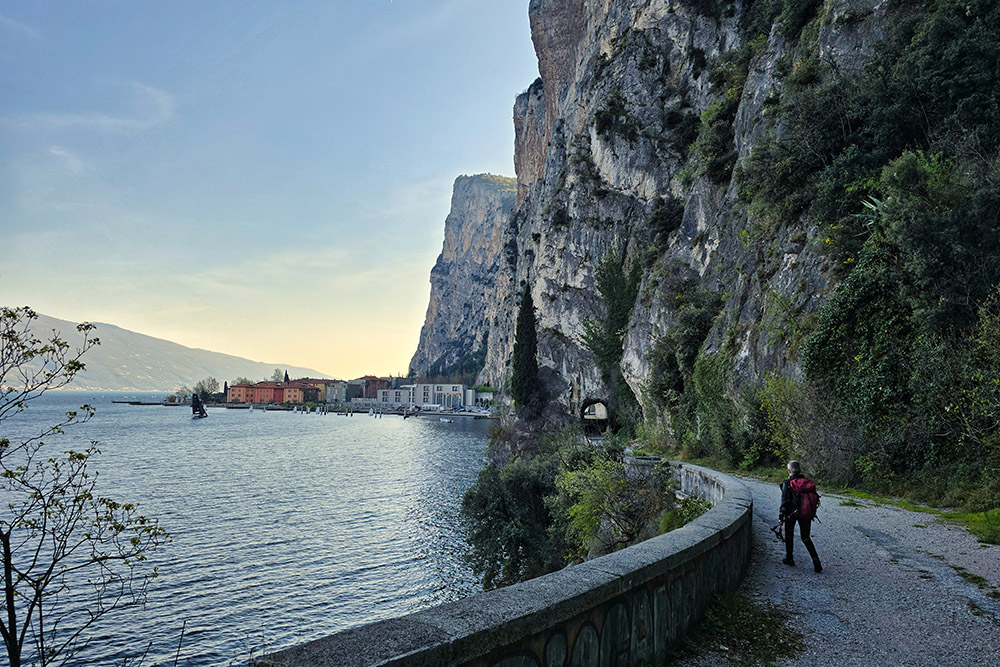
Ritorniamo seguendo la vecchia strada della Gardesana


