


![]()


Durata
 5:30 h
Distanza
 10,8 km
 Ascesa
 1190 m
Discesa
 1190 m
H Max
 1246 m
H Min
 77 m
77 mFerrata dell'Amicizia in Riva del Garda
DESCRIPTION
Ferrata dell'Amicizia: ladders, exposure and a breathtaking view.
Geographic Location
Cima SAT rises in the Garda Prealps, the mountain range that looks directly onto the north-western shore of Lake Garda, in the Trentino region, in the municipality of Riva del Garda. It is a rocky spur with near-vertical walls that tower almost straight above the town, making it clearly visible from the lakefront promenade. From the summit, after 1,200 metres of elevation gain, the view stretches from south to north: from the Lake Garda basin to the entire Sarca Valley.
Hike
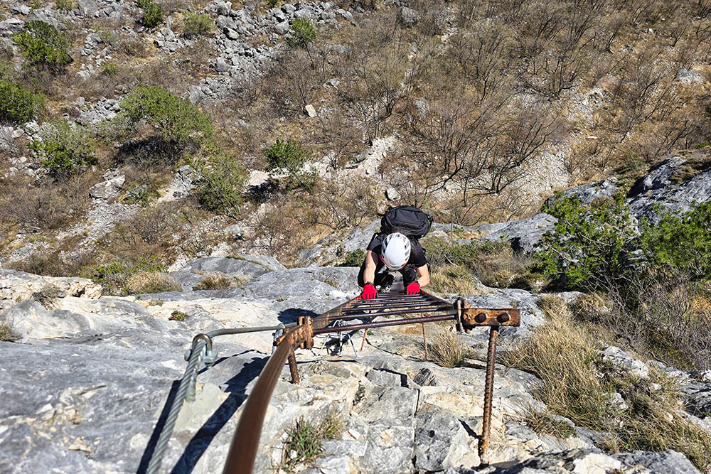
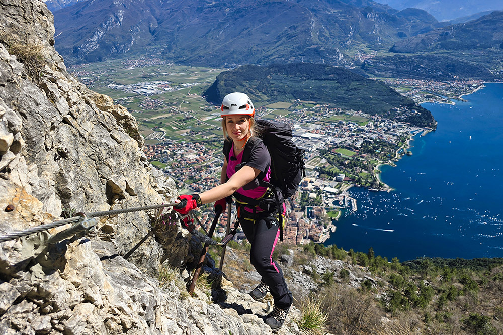
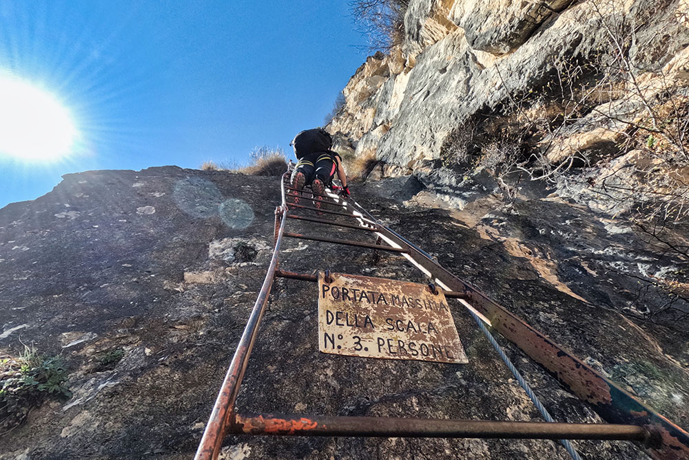
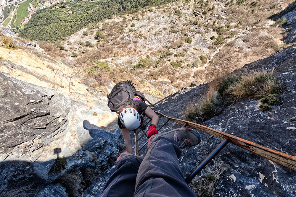
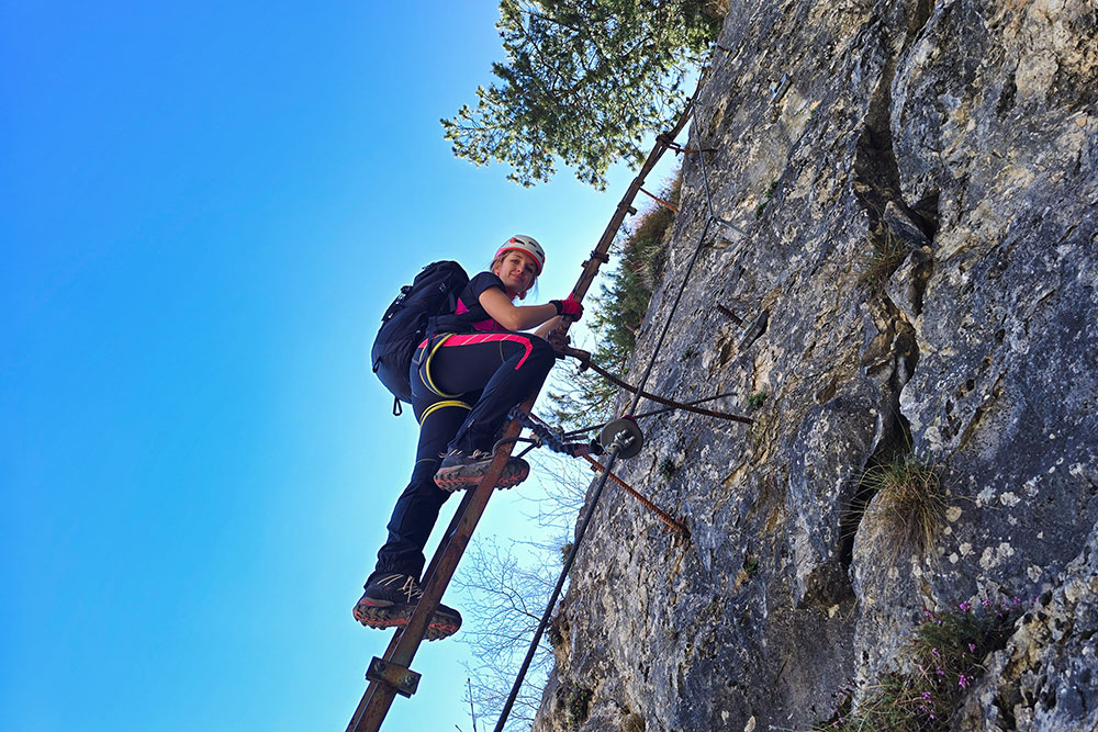
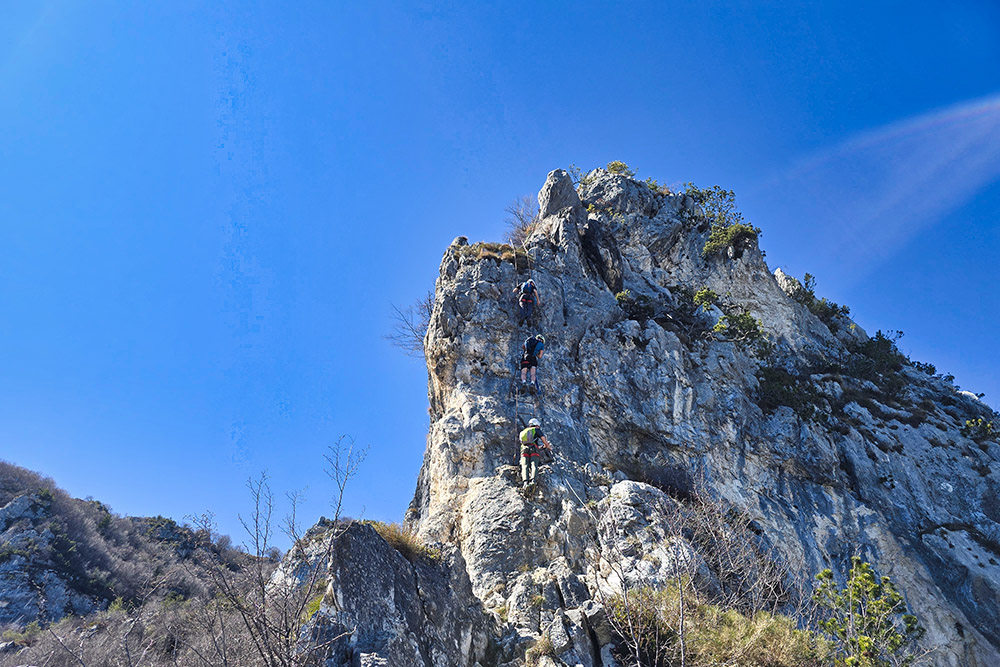
The Ferrata dell'Amicizia at Cima SAT – also known as the Via del Centenario SAT – is a long and demanding route, primarily due to the considerable elevation gain: 1,200 metres from the centre of Riva del Garda to the summit. From a technical standpoint, the difficulty remains moderate: the equipped section does not feature complex alpine passages, but it requires one fundamental and non-negotiable condition: a complete absence of vertigo. The defining characteristic of this via ferrata is, in fact, the extreme exposure of the long metal ladder sections – approximately 150 linear metres in total – which climb vertical walls with nothing but air beneath your feet. The most significant ladders measure 40 and 70 metres respectively, and become overhanging near the top. It is a physically tiring route – all the ladders are climbed vertically – and it also requires attention to rockfall, particularly on the most exposed sections.
Tackling this via ferrata in the summer months is strongly discouraged: the heat can be truly oppressive, made worse by the high humidity from the proximity of the lake and the relatively low altitude of the route. The itinerary is instead ideal in the shoulder seasons, when it offers more favourable weather conditions and serves as a great alternative to Dolomite via ferratas still covered in snow. The views that open up from the summit, unusual and close-up compared to more famous alpine routes, more than make up for the effort.
A complete via ferrata kit is essential for this route: harness, helmet, via ferrata set (lanyard with energy absorber), gloves and appropriate footwear.
History and Curiosities
The Ferrata dell'Amicizia was created on the initiative of the Riva del Garda Climbing Group (G.R.A.M.) and inaugurated in 1972 to celebrate the centenary of the Società Alpinisti Tridentini (S.A.T.).
The Capanna Santa Barbara, encountered along the ascent route, takes its name from the church of the same name built in past centuries by the miners who worked in the area. According to the official report of the SAT section of Riva del Garda, the hut is open on Sundays from October to May.
The Bastione, a small circular fortress visible just above Riva del Garda, dates back to 1508 and is generally open to visitors.
ITINERARY
From the car park in Riva del Garda (81 m), head to Via Monte Oro (87 m), where you follow the trail marker Passeggiata al Bastione. Climbing along a paved lane, you reach the Bastione (210 m). Continuing, you arrive at a junction: turn right, trail marker 404, and climb up to the Capanna Santa Barbara (560 m). From here, follow the path southward until you find, on the left, a turn-off onto trail 404B, which shortly leads to the start of the via ferrata (613 m). Just below the via ferrata start sign, the metal fixtures begin, leading up to Cima SAT (1,246 m). The return route follows trail 418, known as the Sentier dei Crazidei, then trail 402 and finally the Strada Santa Maddalena, rejoining Riva del Garda and returning to the starting car park.
EXCURSION DATE
3 April 2026
STARTING POINT
Riva del Garda
REFRESHMENT POINT
At the Bastione
AUTHOR'S SUGGESTIONS
This route is obviously not recommended for people who suffer from vertigo.
SAFETY TIPS
The accessibility of the proposed itinerary, like all mountain terrain, is subject to environmental changes caused by natural events and weather conditions. Therefore, before setting out, consult the relevant tourist offices and/or local mountain huts.
Our GPX tracks are for guidance only: the route was completed under the best possible trail and weather conditions on the day. Always assess the situation on the ground before proceeding.
Also remember to evaluate the route based on your physical fitness, training level and available equipment.
It is advisable to let someone know the itinerary you plan to follow.
Remember that the emergency number is 112.
EQUIPMENT
It is recommended to carry appropriate gear: technical mountain clothing, boots with Vibram soles or similar, via ferrata set, harness, helmet, via ferrata gloves, sunglasses, sunscreen, backpack with drinks.
RECOMMENDED MAPS
Tabacco 061 Alto Garda – Ledro – Monte Baldo Nord
USEFUL LINKS
https://www.gardatrentino.it/it/outdoor/trekking/garda-trek
HOW TO ARRIVE
Take the A22 motorway to the Rovereto Sud/Lake Garda Nord exit, then follow the SS240 to Riva del Garda.
PARKING AREA
Car park in Viale Trento, Riva del Garda. Free of charge.
GPS coordinates: 45.892419, 10.847196
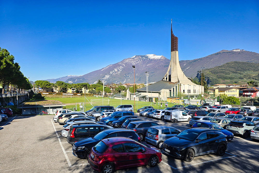
Parcheggio in Viale Trento
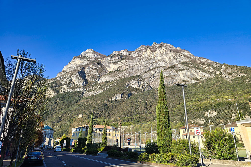
Vista di Cima Sat dal parcheggio
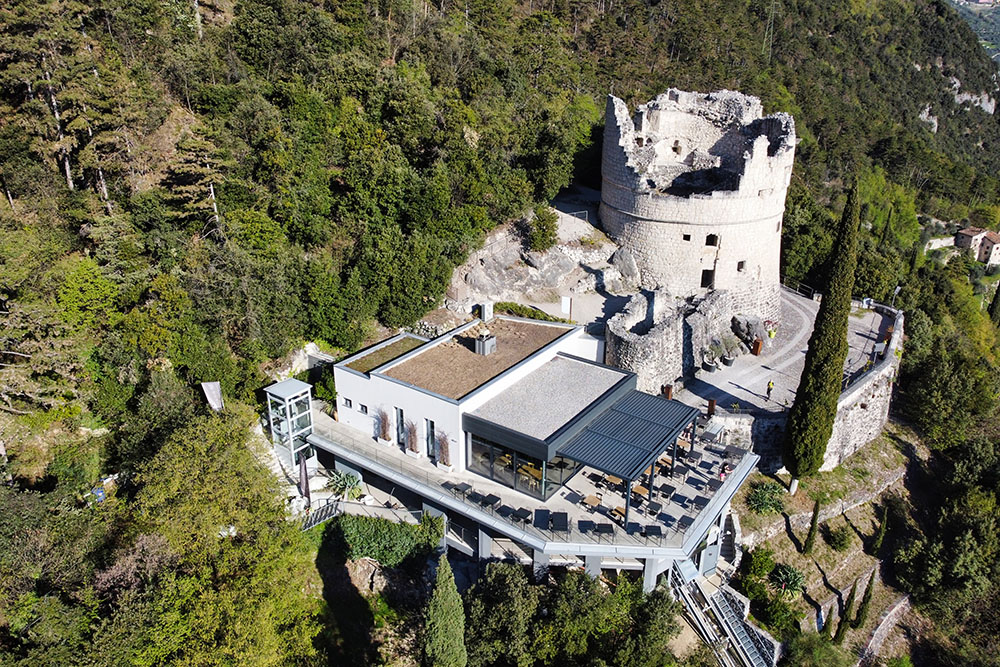
Il Bastione
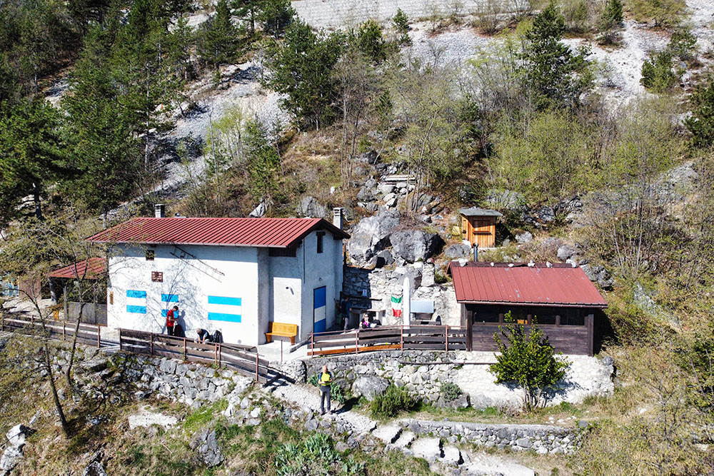
Capanna Santa Barbara
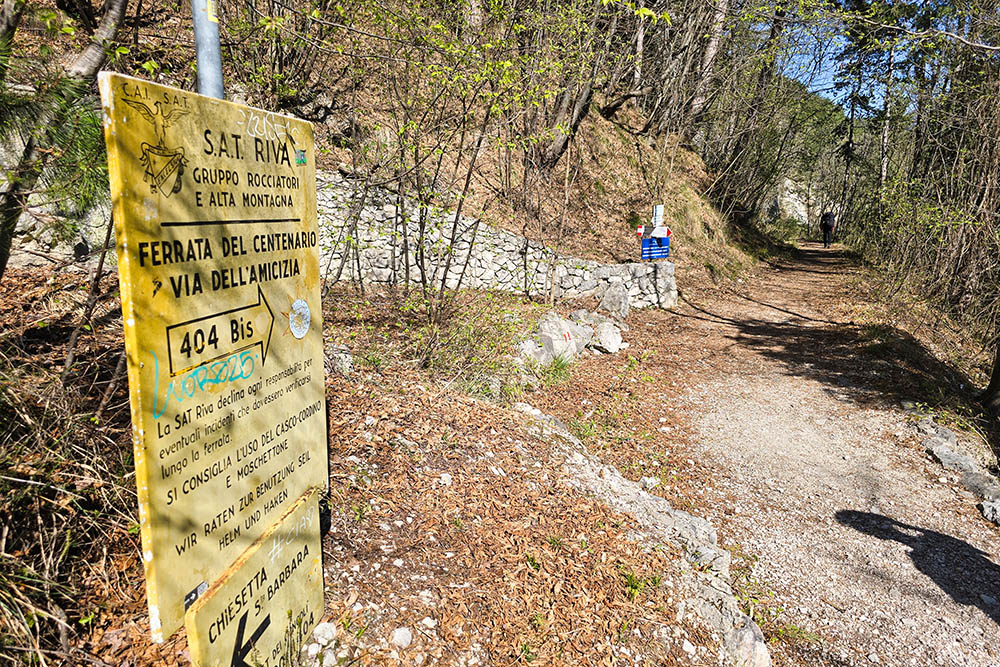
Bivio per la ferrata
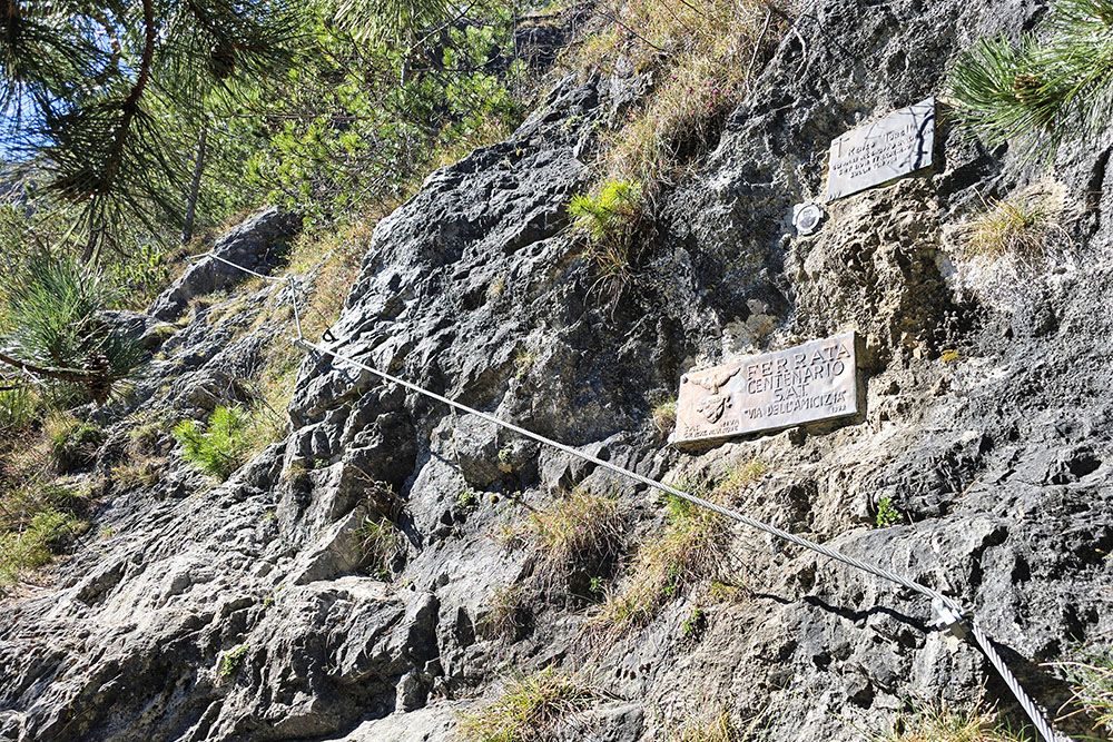
Attacco ferrata
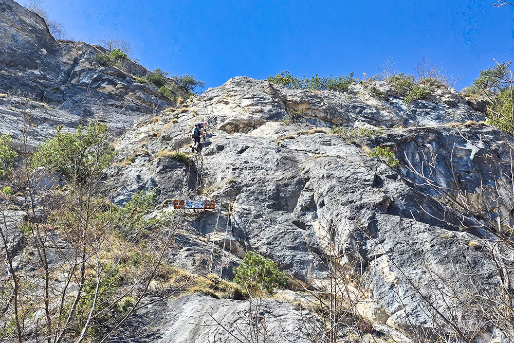
Prima scala
Saliamo
Alle nostre spalle sempre un bellissimo panorama
Terza scala
Terza scala
Terza scala
Ultimo tratto
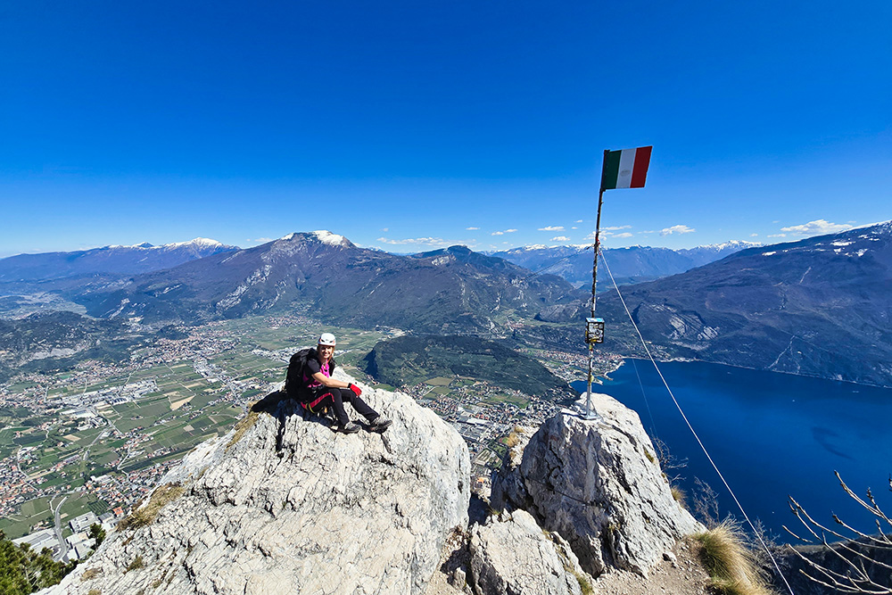
Cima Sat
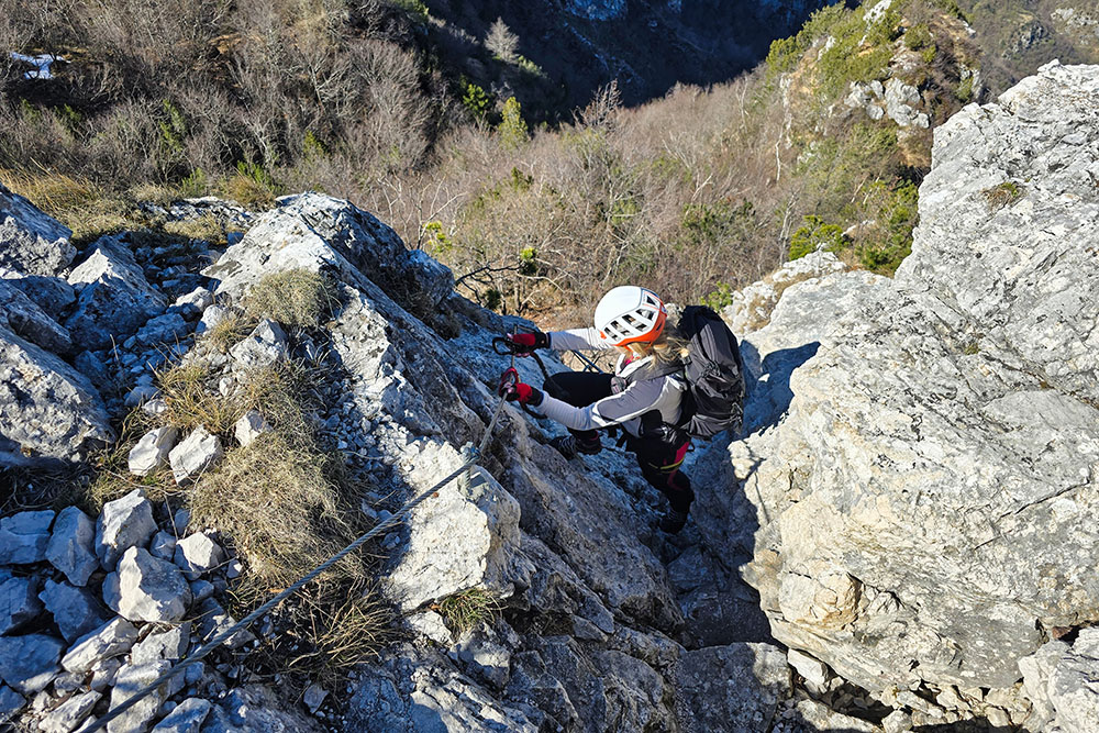
Si scende per un tratto ferrato


