


![]()


Durata
 4:00 h
Distanza
 8,3 km
 Ascesa
 497 m
497 mDiscesa
 497 m
497 mH Max
 530 m
530 mH Min
 102 m
102 mScaloni Trail, Cavre Trail, and Anglone Trail
DESCRIPTION
To the Cavre of Dro: an easy via ferrata with a view of the Sarca River.
Geographical Location
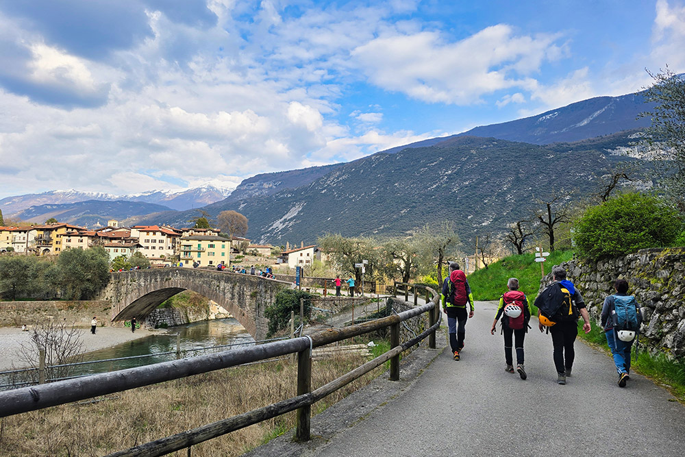
Ceniga is a hamlet of the municipality of Dro, located in the Alto Garda area of Trentino, in the lower Sarca Valley, about 5 km north of Arco and a short distance from Lake Garda. The area extends over the alluvial plain carved by the Sarca River, framed by the rocky walls that mark the boundary between the valley floor and the surrounding peaks. The rock face that rises on the right bank of the Sarca, between Ceniga and Dro, is the natural setting for this route.
Hike
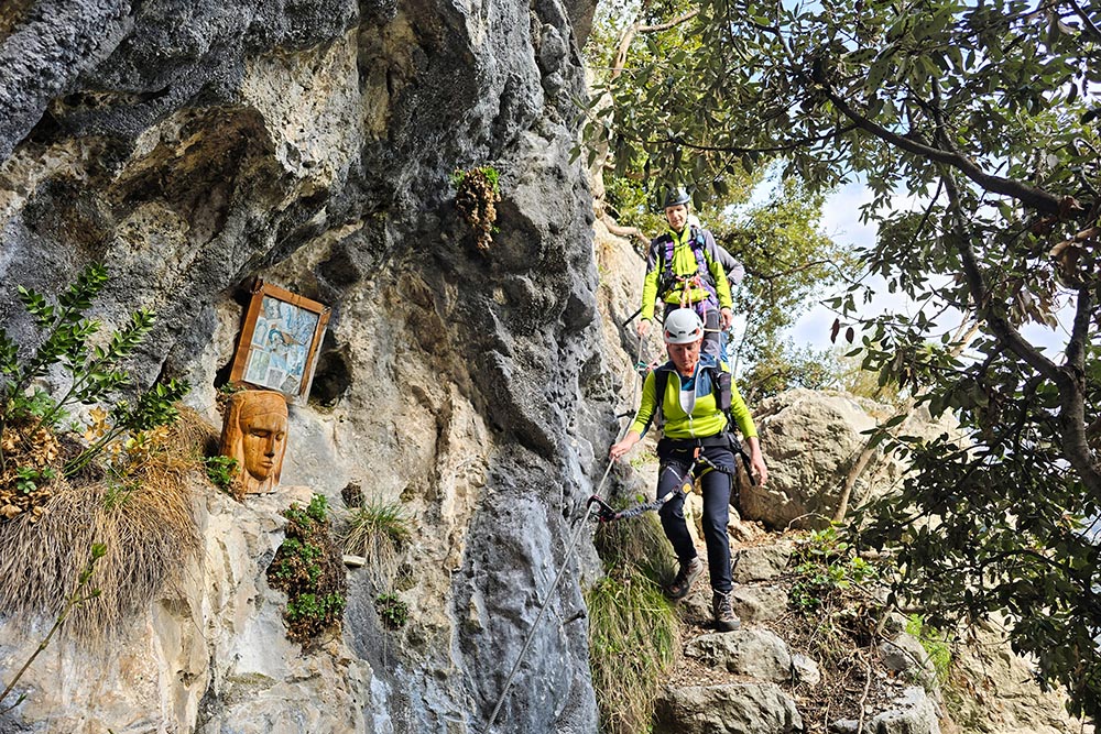
The Cavre Trail is a loop that combines three distinct sections: the Scaloni Trail (equipped, ascending), the Cavre Trail (connecting through the woods), and the Anglone Via Ferrata (descending). With a length of about 8 km, an elevation gain of 471 meters, and a walking time of 4 hours and 40 minutes, this is a hike accessible even to those approaching via ferratas for the first time.
The route is ideal for those who want to gain experience with cables, ladders, and walkways without facing high technical difficulties. The safety equipment is abundant and in excellent condition. It is also suitable for families with children aged 7-8 and up, provided they are in good physical shape. Despite the moderate difficulty, it is still advisable to bring a helmet, harness, and via ferrata set.
Thanks to its low altitude (between 114 and 530 m above sea level) and south/east exposure, the route is passable in all seasons; during the hottest months, it is best to start early in the morning. Those who wish can also do the loop counterclockwise: the overall difficulty remains substantially unchanged.
History and Curiosities
The name Percorso alle Cavre has nothing to do with goats: the cavre were wooden portal frames that supported the cableways used to transport logs and bundles of wood from the forests down to the valley floor. Until the post-World War II period, woodcutters and charcoal burners would climb these steep slopes to gather wood, sending the material down via these rudimentary but effective structures.
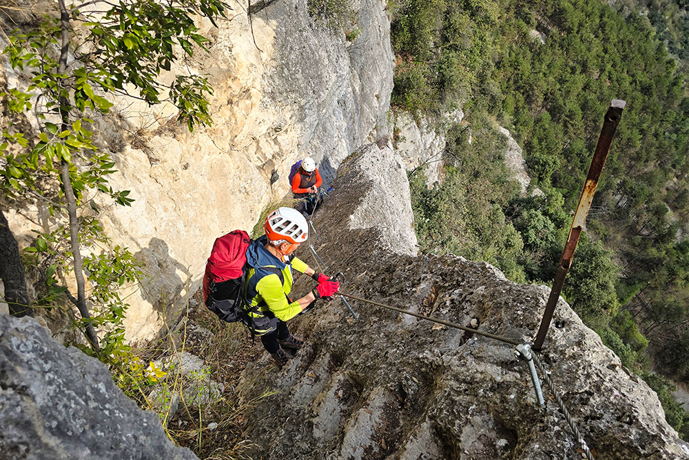
The Scaloni Trail dates back to 1909, when it was built as a military trail by the Austro-Hungarian army to supply timber. The date is still engraved at the base of the wall, a silent testament to that era. The scaloni (large steps) that give the trail its name are steps carved into the rock – and partly made of iron – that facilitate progress along the steepest sections.
The Roman Bridge of Ceniga is one of the area's iconic landmarks. The origins of the so-called Roman Bridge are uncertain, although it seems plausible that in ancient times it served to cross the Sarca where ancient routes from Arco and Laghel reached the hamlet of Ceniga. The inscriptions walled into the parapets recall that the bridge was rebuilt in 1719, after a flood, and again in 1868, following its demolition ordered by the Austrians during the Third War of Italian Independence. The demolition was decided to prevent Garibaldi's advance into the Ledro Valley, though he never actually reached Riva del Garda.
ITINERARY
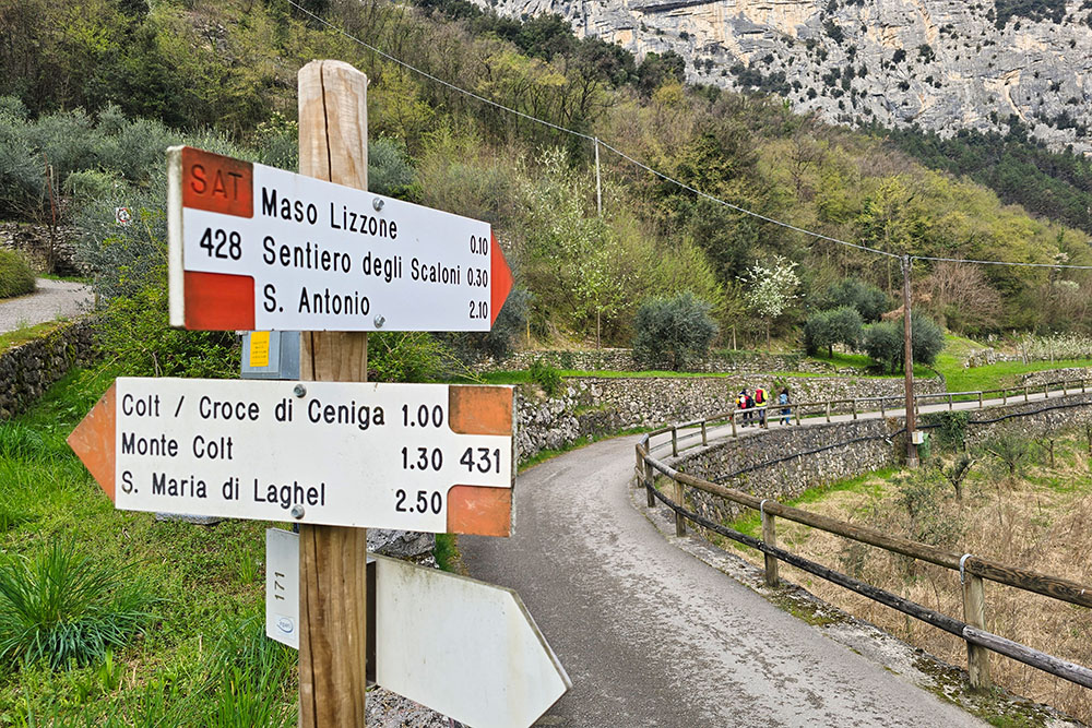
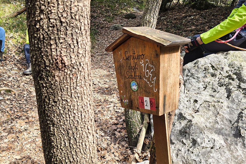
From the center of Ceniga (114 m), take Via Ponte to the Roman Bridge. Continue on trail marker 428. From the start of the Scaloni Trail (230 m), ascend the equipped section until you reach a mailbox containing the guestbook, which marks the end of the trail (475 m).
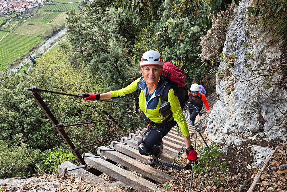
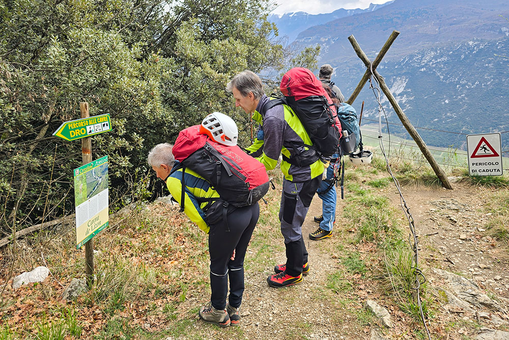
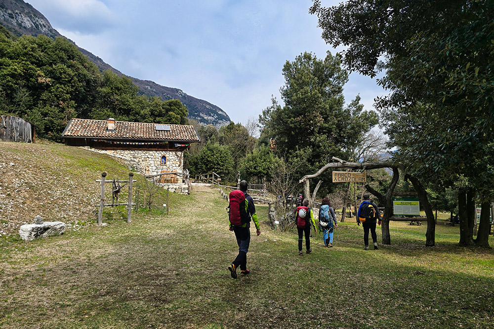
Continuing on trail 428, you pass by the Cavra de Lizon (480 m) and reach Dos Tondo (507 m), where you turn right onto trail 428B, the Cavre Trail. After a section of ups and downs, you reach the Baita Crozolam (505 m). Continuing the loop, you descend to the Lastoni area (445 m), where you turn right and continue downhill: the trail marker changes to 425, the Anglone Via Ferrata. After completing the equipped section, you arrive in the valley near Dro. The return to the starting point is along the dirt road on the right bank of the Sarca stream.
EXCURSION DATE
March 22, 2026
STARTING POINT
Ceniga di Dro
REFRESHMENT POINT
None
AUTHOR'S SUGGESTIONS
This route is obviously not recommended for those who suffer from vertigo.
SAFETY ADVICE
The usability of the proposed itinerary, like all mountain terrain, is subject to environmental changes due to natural events and weather conditions. Therefore, before setting out, consult the relevant tourist offices and/or the reference mountain huts.
Our GPX tracks are for guidance only, meaning the route was taken under the best possible trail and weather conditions on that specific day. Always assess the situation locally.
Furthermore, remember to evaluate the route based on your own physical abilities, training, and equipment.
It is advisable to inform someone of the itinerary you intend to follow.
Remember that the emergency number is 112.
EQUIPMENT
It is recommended to have suitable equipment: technical mountain clothing, boots with Vibram or similar soles, via ferrata set, harness, helmet, via ferrata gloves, sunglasses, sunscreen, and a backpack with drinks.
RECOMMENDED MAPS
Tabacco 055 Arco - Valle del Sarca - Valle dei Laghi
INTERESTING LINKS
https://www.gardatrentino.it/it
HOW TO ARRIVE
From Arco, take the SS45bis northbound. After 3.6 km, follow the sign for Ceniga on the left.
PARKING AREA
In Ceniga di Dro
GPS Coordinates: 45.950977, 10.901198
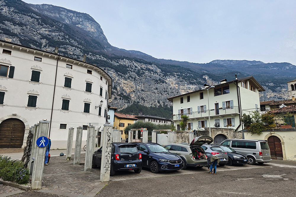
Parcheggio a Ceniga
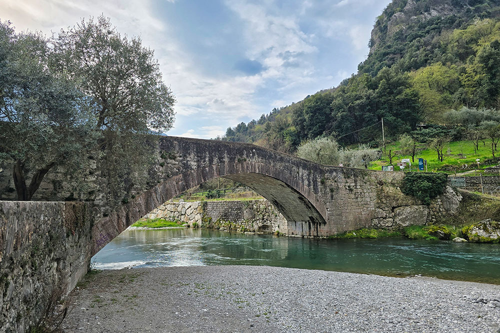
Ponte romano
Seguiamo il segnavia 428
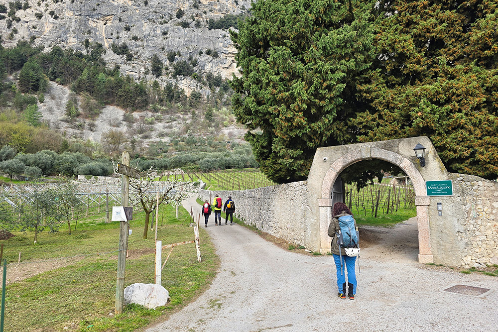
Bivio presso l'agriturismo
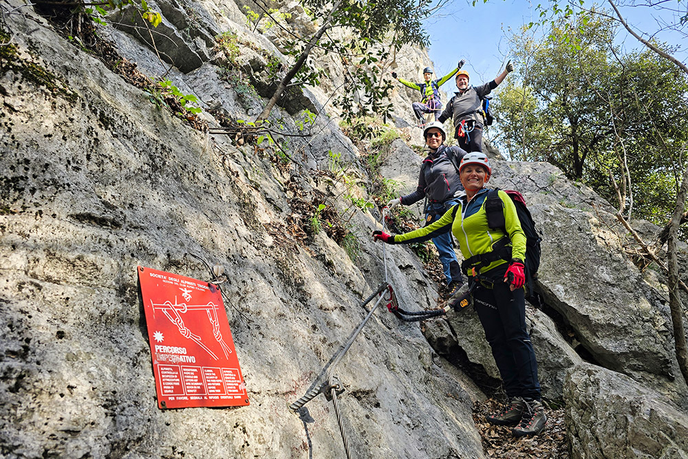
Attacco del Sentiero degli Scaloni
Si sale
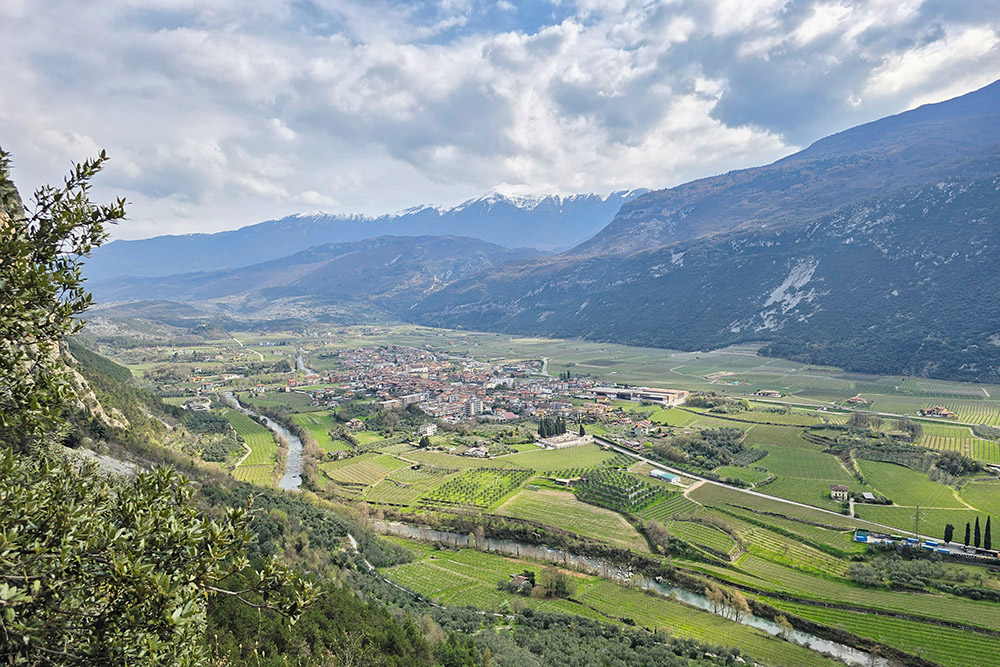
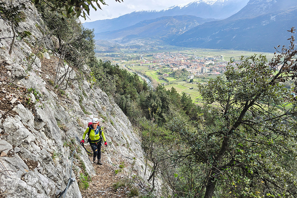
Panorama verso la Valle del Sarca e Dro
Eccoci sugli scaloni
Altre scale
Termine del Sentiero degli Scaloni
Cavra de Lizon
Arrivo alla Baita Crozolam
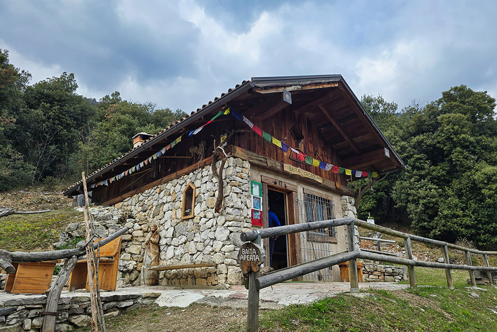
Baita Crozolam
Ritorno sul Sentiero Anglone
Si ritorna a Ceniga


