


![]()


Durata
 4:00 h
Distanza
 8,2 km
 Ascesa
 630 m
630 mDiscesa
 630 m
630 mH Max
 1534 m
H Min
 914 m
914 mVellauer Felsenweg Trail
DESCRIPTION
Sheer cliffside trails and ancient farmsteads: the great Vellau loop above Merano.
Geographic Location
Velloi (German: Vellau) is a hamlet in the municipality of Algund (Lagundo) in South Tyrol. It is located at the entrance to the Vinschgau Valley on the left orographic side of the Adige River, at an altitude between 914 and 940 meters. The village lies in the heart of the Burggrafenamt, a few kilometers from Merano, and is situated within the Texel Group Nature Park. The landscape is dominated by the majestic Mutspitze and Rötelspitze peaks of Sopranes, which tower over the village.
Hike
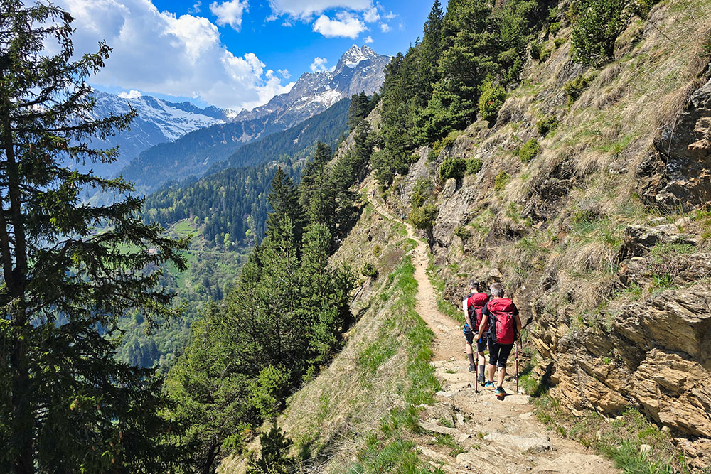
A highly rewarding circular tour, suitable for experienced hikers with sure footing and - an essential requirement - no fear of heights. The route mainly develops along two fascinating trails: the Vellauer Felsenweg and the Hans-Frieden-Weg. Both wind along rocky ledges with moderate elevation changes but require constant attention. In certain points, the trail runs along sheer cliff faces that drop over 200 meters, and a moment of distraction can have serious consequences - due to both the risk of hitting the rock and losing balance. The trail is not recommended in snow, ice, rain, or high temperatures; when it rains, there is also an increased risk of rockfall.
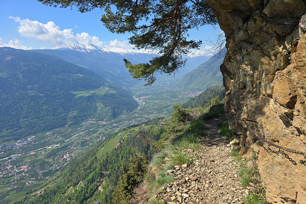
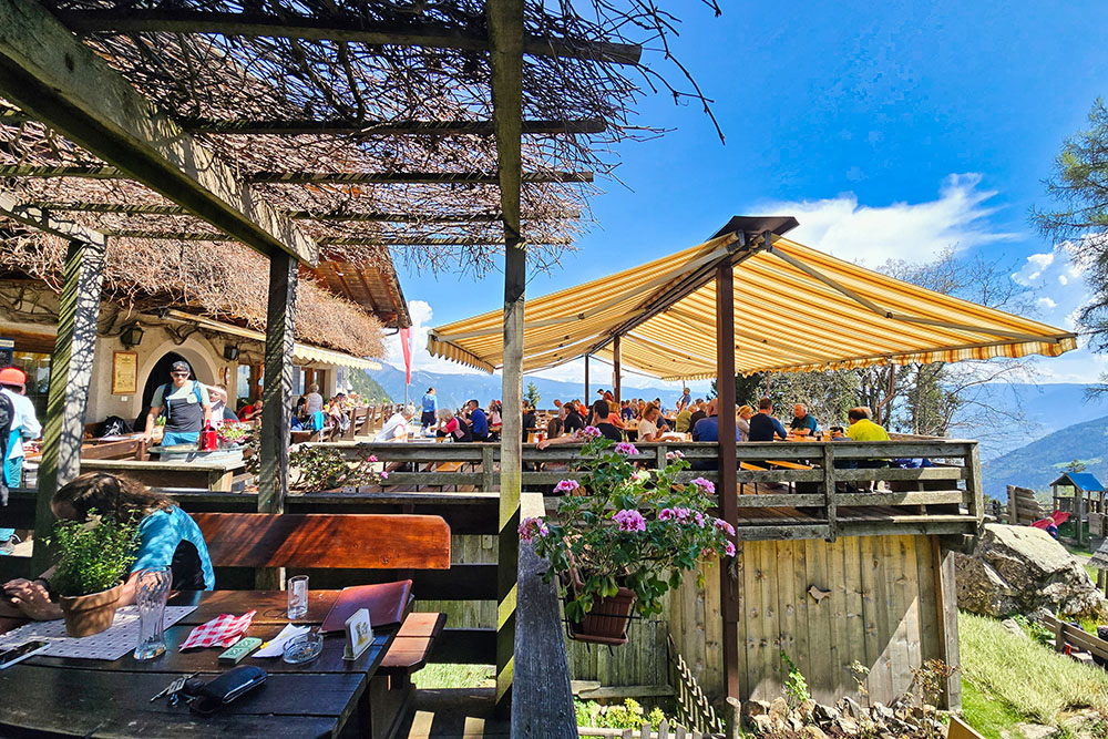
Throughout the loop, you can enjoy spectacular views of the Adige Valley and the Merano basin. Refreshment points are well-distributed along the route and offer opportunities for a rejuvenating stop.
History and Curiosities
One of the highlights of the itinerary is the panoramic platform located on the slopes of the Mut, near the Steinegg Hotel in Hochmut. The structure takes the shape of a stylized basket: a direct reference to the hard work of the farmers who once cultivated the steep lands of the Muthöfe farms.
In Hochmut are the so-called Muthöfe, farms considered among the oldest in South Tyrol. Their history dates back to the Middle Ages: in 1285, they were first mentioned in documents from the time of Meinhard II, when they paid tribute to the Counts of Tyrol, who resided at Tirol Castle below. Today, some of them have been converted into inns that are very popular during the summer months.
ITINERARY
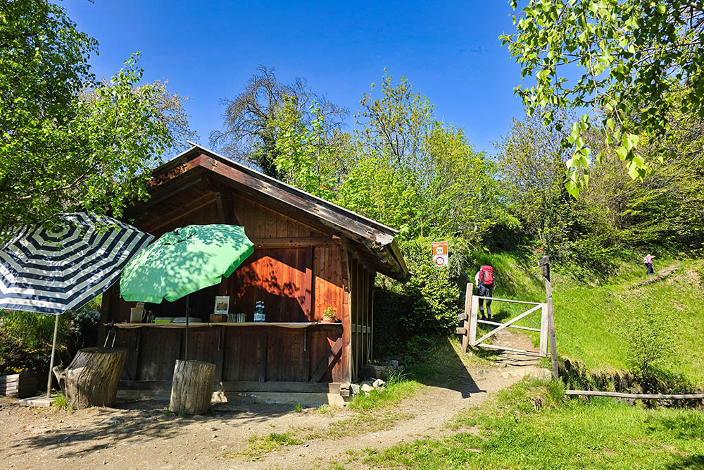
From Velloi (914 m), follow trail marker 22 to reach the Church of the Holy Trinity (965 m), where the Vellauer Felsenweg begins, leading quickly to Hochmut (1361 m). Some sections of the trail are equipped with chains. From Hochmut, ascend to the Gasthaus Leiteralm (1432 m), where you join the Hans-Frieden-Weg as far as the Leiteralm mountain hut (1520 m). Then continue along trail 25, which leads back to Velloi, completing the loop.
EXCURSION DATE
May 1, 2025
STARTING POINT
Velloi (Vellau)
REFRESHMENT POINT
Berggasthaus Hochmuth, Berggasthof Oberhochmuthof, Gasthaus Steinegg and Gasthaus Leiteralm
AUTHOR’S SUGGESTIONS
Do not hike in bad weather.
SAFETY ADVICE
The practicability of the proposed route, like all mountain terrain, is subject to environmental changes due to natural events and weather conditions. Therefore, before setting out, consult the relevant tourist offices and/or the reference mountain huts.
Our GPX tracks are for guidance only, meaning the route was taken under the best trail and weather conditions of that day. Always evaluate the situation on site.
Also, remember to assess the route based on your physical capabilities, training, and equipment.
It is advisable to inform someone of your intended itinerary.
Remember that the emergency number is 112.
EQUIPMENT
It is recommended to have equipment suitable for the route, weather conditions, and season: windproof and/or waterproof jacket, map and/or GPS device, sunglasses, sunscreen, hiking boots, first aid kit, appropriate clothing, gloves, backpack with food and drinks.
RECOMMENDED MAPS
Tabacco 011 Meran und Umgebung - Merano e dintorni
INTERESTING LINKS
https://www.steinegg.it/
HOW TO ARRIVE
From Merano, take the SS38 Stelvio Pass Road to Tell. Then take the Via Strada Vecchia SP52 uphill and turn left towards Velloi, continuing to the Ladurner Restaurant.
PARKING AREA
In Velloi, at the Merano-Vellau bus terminal near the Ladurner Restaurant
GPS coordinates: 46.695338, 11.112468
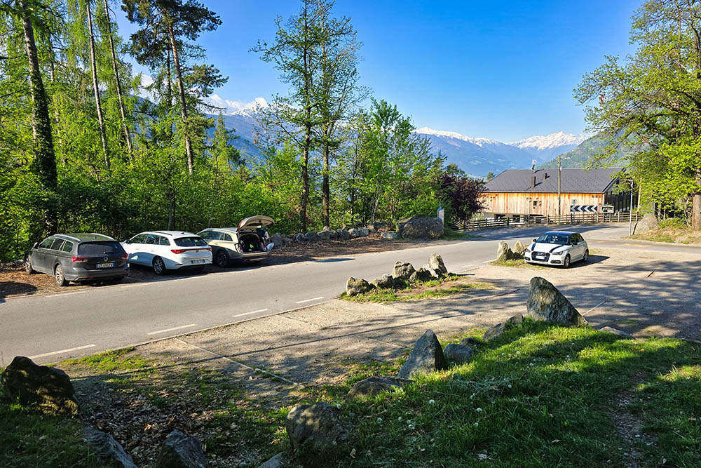
Parcheggio a Velloi
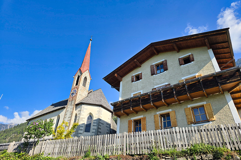
Chiesetta della SS Trinità
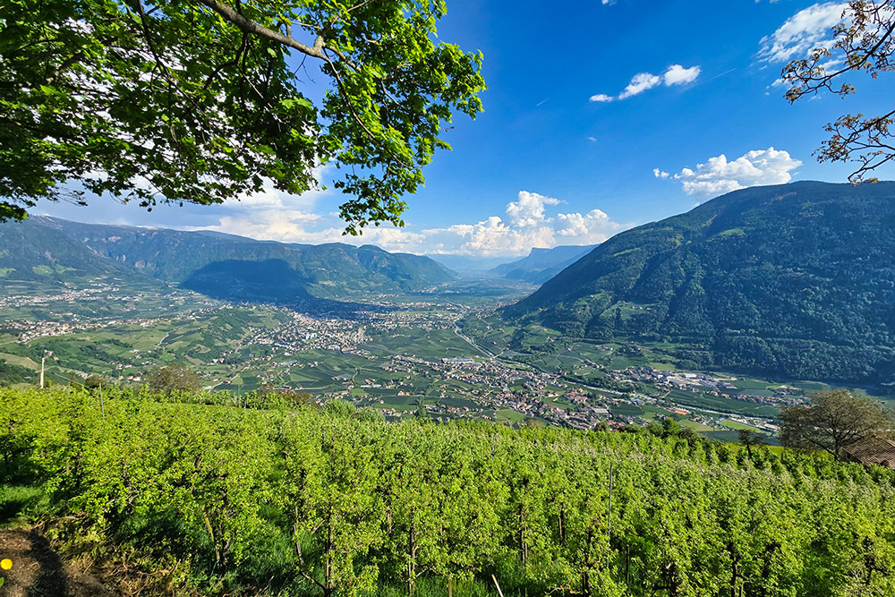
Vista verso Merano
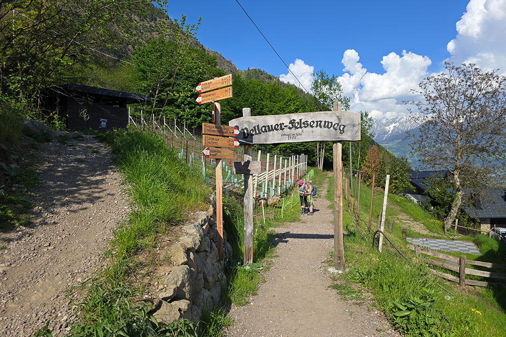
Inizio del Sentiero delle Rocce
Primo ristoro
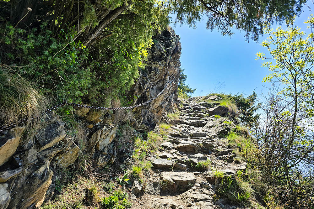
Tratto con catene del Sentiero delle Rocce
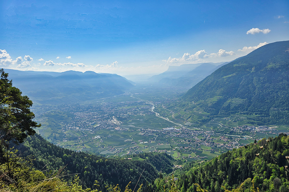
Vista verso Merano
Tratto con catene del Sentiero delle Rocce
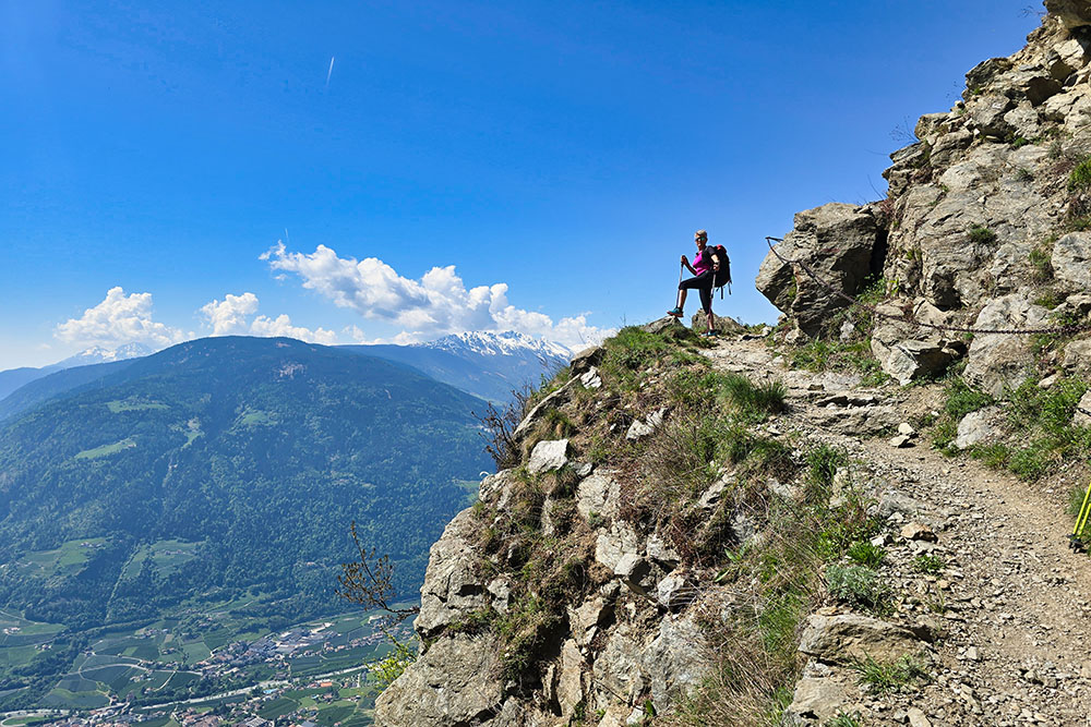
Sentiero delle Rocce
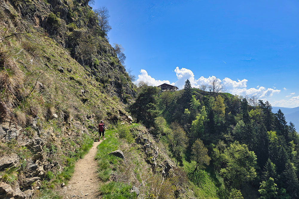
Siamo vicini alla località Alta Muta
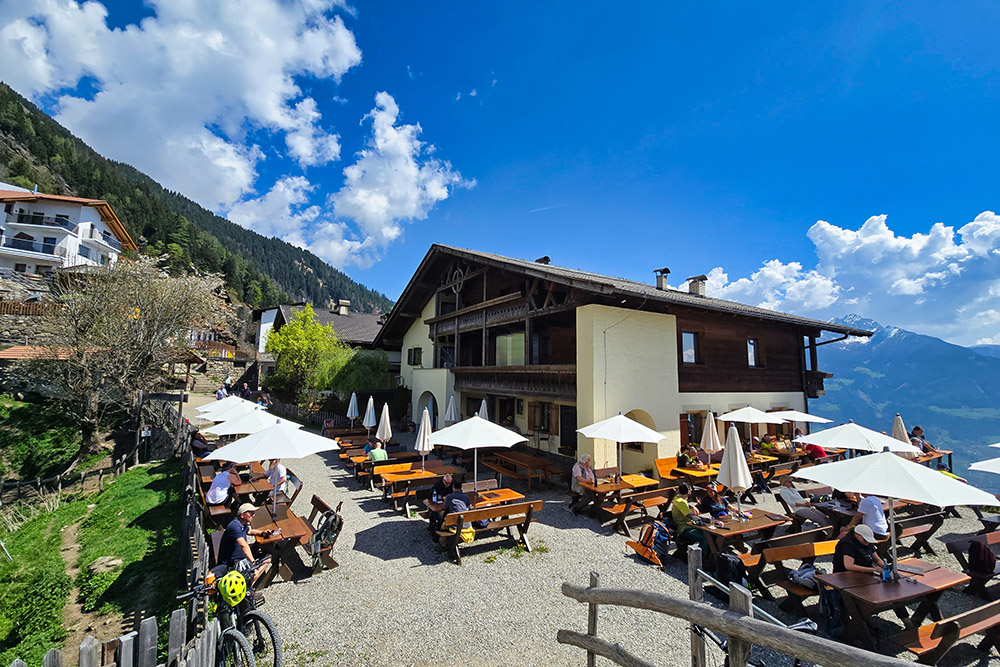
Berggasthaus Hochmuth
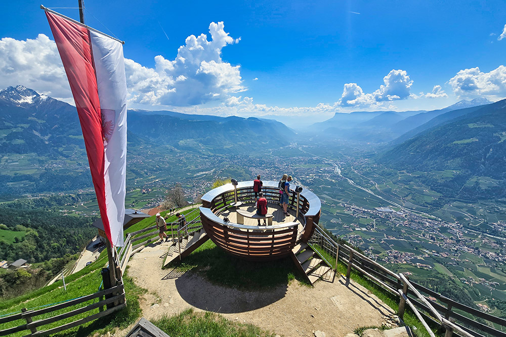
Piattaforma panoramica ai Masi della Muta
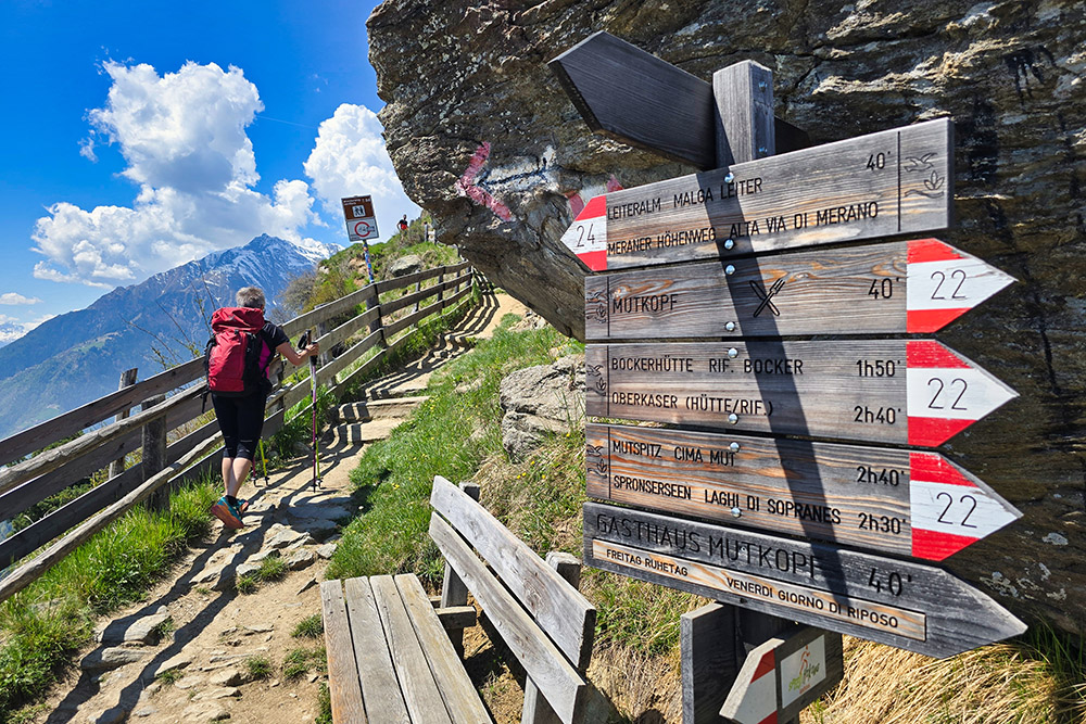
Prendiamo il sentiero 24
Sul Sentiero Hans Frieden
Malga Leiter


