


![]()


Durata
 4:00 h
Distanza
 11,1 km
 Ascesa
 393 m
393 mDiscesa
 393 m
393 mH Max
 430 m
430 mH Min
 178 m
178 mArt Trail: from Volano to Calliano
DESCRIPTION
A route through the woods and villages of Alta Vallagarina, rich in culture, history and nature.
Geographical location
Vallagarina is the valley crossed by the Adige river in the stretch between the Murazzi - the narrow rocky gorge just north of Besenello - and Ceraino, on the border with Veneto. The Art Trail develops in the Trentino part along the left orographic side of Alta Vallagarina, in the stretch between the municipalities of Volano, Besenello and Calliano.
The Hike
The Art Trail is a route of about 11 km through the woods and villages of Alta Vallagarina, with a positive elevation gain of just under 400 meters. The trail - mainly on dirt roads and easy paths - is also suitable for families, but not for strollers.
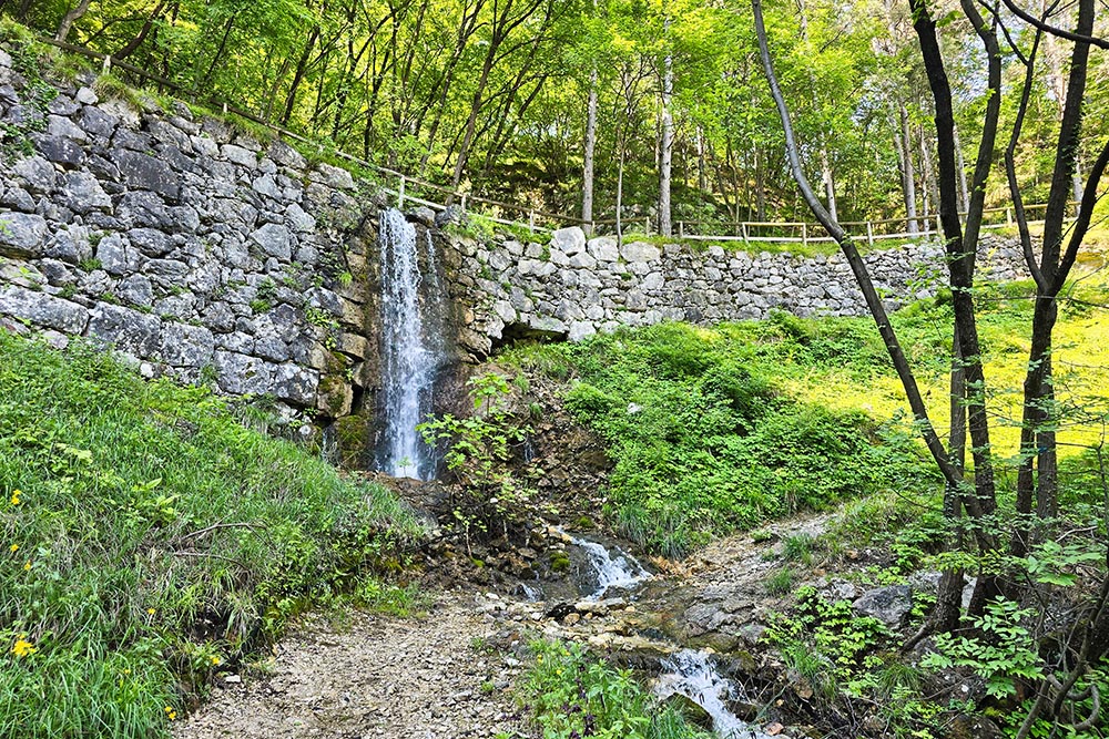
The name of the route faithfully reflects its nature: the itinerary intertwines history, art and landscape in a successful balance. It starts with the Church of San Rocco in Volano, an authentic late 15th-century frescoed jewel, and then reaches two imposing medieval fortresses: Castel Pietra and Castel Beseno. The naturalistic component is equally interesting: the walk winds mostly through the woods, with detours towards the Albiolo springs and the picturesque Zambel Waterfalls, where in summer it is possible to take a dip in the waters of the Rio Cavallo.
History and curiosities
Church of San Rocco in Volano
Built in the second half of the 15th century - probably between 1485 and 1502, the year of its official consecration - the church is considered one of the most interesting fruits of the early Trentino Renaissance. The upper facade is frescoed with a refined depiction of the Last Judgment, protected by the characteristic protruding roof; only the upper part survives today.
Castel Pietra
It stands on enormous boulders that detached from the Cengio Rosso, from which it takes its name. Dependent on Castel Beseno since the 13th century, it was a fief of the Da Beseno family. Its position is far from random: for a long time it marked the border between the Prince-Bishopric of Trento and the Republic of Venice, making it the scene of bitter conflicts. The castle is still inhabited and houses a restaurant: the courtyard is generally open to visitors.
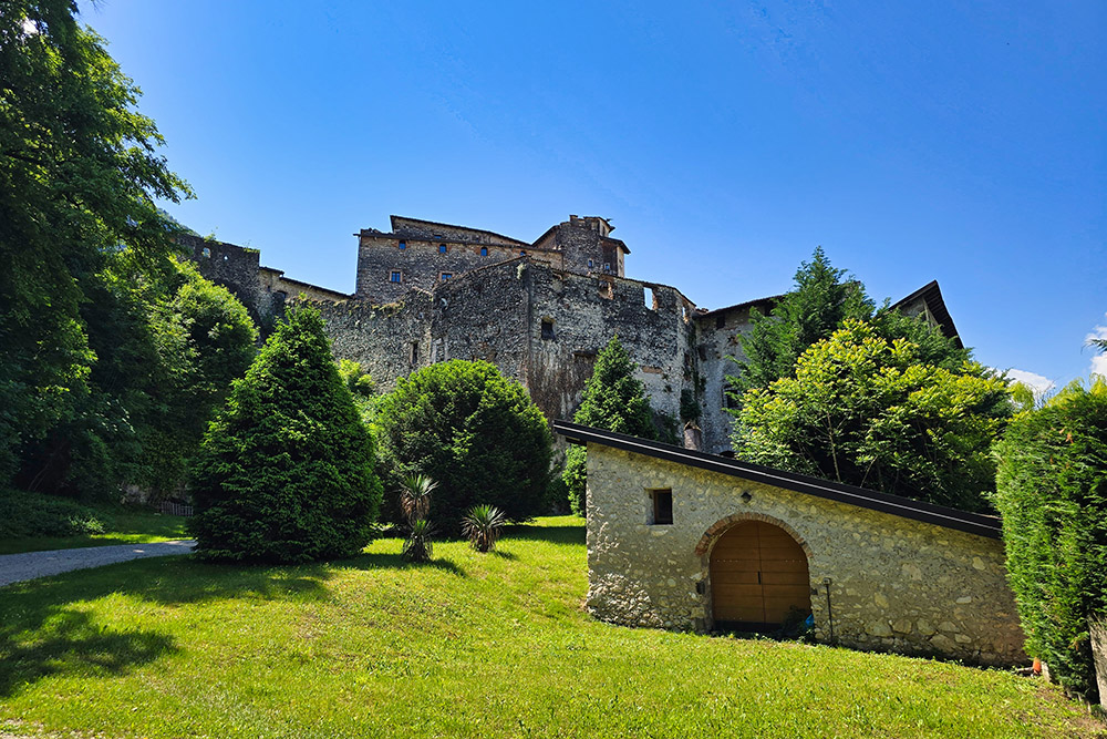
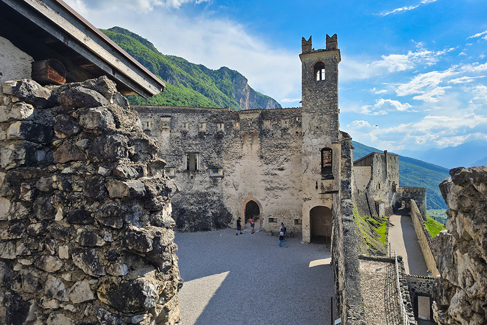
Castel Beseno
It is the largest fortified structure in Trentino-Alto Adige, with a double elliptical wall that extends for about 250 meters in length. The first certain news dates back to the 12th century, when it was a fief of the counts of Appiano and residence of the noble Da Beseno family. At the beginning of the 14th century it passed to the Castelbarco; in 1470 it was granted as a fief to the counts Trapp, a noble Styrian family very close to the Austrian imperial circles.
Right under its walls, on August 10, 1487, the famous Battle of Calliano took place: the troops of the Republic of Venice, led by the condottiero Roberto da Sanseverino, attempted to advance towards Trento, suffering a resounding defeat and losing their commander, who met his death in the Adige.
After a devastating fire, the Trapp family transformed the manor from a medieval fortress into an elegant Renaissance residence. Abandoned during the 19th century - and partially dismantled to avoid property taxes - in 1972 Oswald and Hans Trapp donated the castle to the Autonomous Province of Trento, which began its restoration, transforming it into one of the detached sites of the Buonconsiglio Castle Museum.
ITINERARY
From the Church of San Rocco in Volano (182 m), follow Via Roma north for 120 meters, then take Via Salenghi for 340 meters; finally, take a small asphalted road on the right and then a dirt road on the left, arriving in Località Grolla. After a stretch, leave the path and walk a short stretch of asphalted road to the hairpin bend Svoltàa de la Biol, where you take a dirt road that leads first to the Albiolo spring and then to Castel Pietra (200 m). From here, follow the signs for Castel Beseno: passing through Località Campagnole (225 m), the Zambel Waterfalls (233 m) and Dietrobeseno (342 m), you reach Castel Beseno (430 m). The descent is via the Sentiero del Gac; passing under the Zambel Waterfalls you arrive in the village of Calliano (188 m).
EXCURSION DATE
May 11, 2025
STARTING POINT
Church of San Rocco in Volano
REFRESHMENT POINT
At the start or at the arrival.
AUTHOR'S SUGGESTIONS
We recommend taking some time to visit the historical structures you encounter along the way.
SAFETY TIPS
The practicability of the proposed itinerary, like all mountain morphology, is subject to environmental changes due to natural events and weather conditions. Therefore, before leaving, consult the competent tourist offices and/or the reference mountain huts.
Our GPX tracks are only indicative, meaning the route was done in the best possible way given the trail and weather conditions of that day. So always assess what to do on site.
Also remember to evaluate the route based on your physical abilities, training, and the equipment you have.
It is advisable to let someone know the itinerary you intend to follow.
Remember that the emergency number is 112.
EQUIPMENT
It is recommended to have equipment suitable for the route, weather conditions, and season: windbreaker and/or rain jacket, map and/or GPS device, sunglasses, sunscreen, hiking boots, first aid kit, specific clothing, gloves, backpack with food and drinks.
RECOMMENDED MAPS
Tabacco 057 Levico - Altopiani di Folgaria Lavarone e Luserna
INTERESTING LINKS
https://www.buonconsiglio.it/castel-beseno/
HOW TO ARRIVE
A22 Rovereto Nord exit. At the roundabout, take Via Degli Alpini. At the second roundabout, pass the Stadio Quercia and head north towards Trento. Follow SS12 to Volano, at the beginning of the industrial area.
PARKING AREA
In Volano on Via Roma, free of charge.
GPS Coordinates: 45.917187, 11.070129
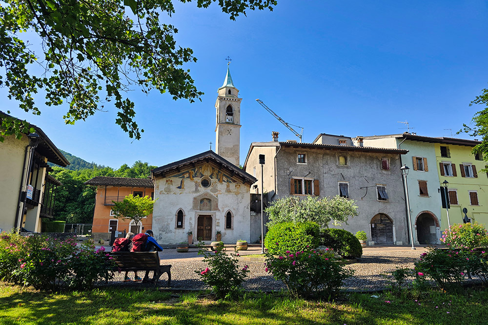
Volano - Chiesa di San Rocco
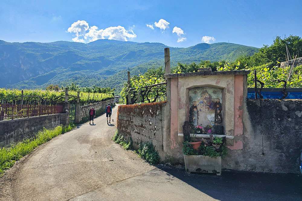
Seguiamo il Sentiero dell'Arte
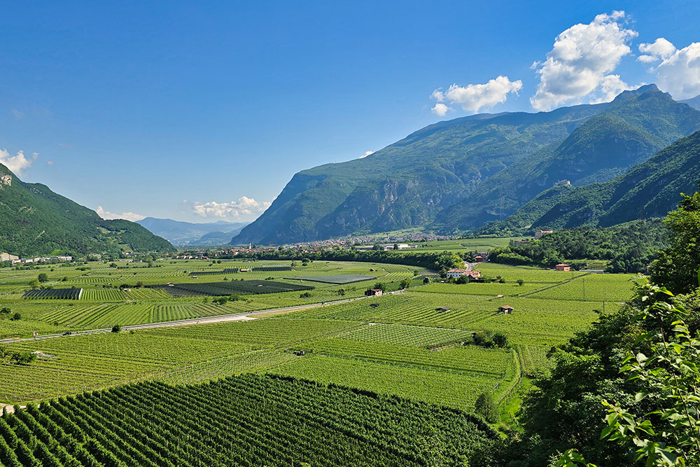
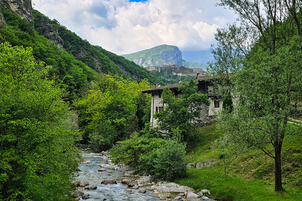
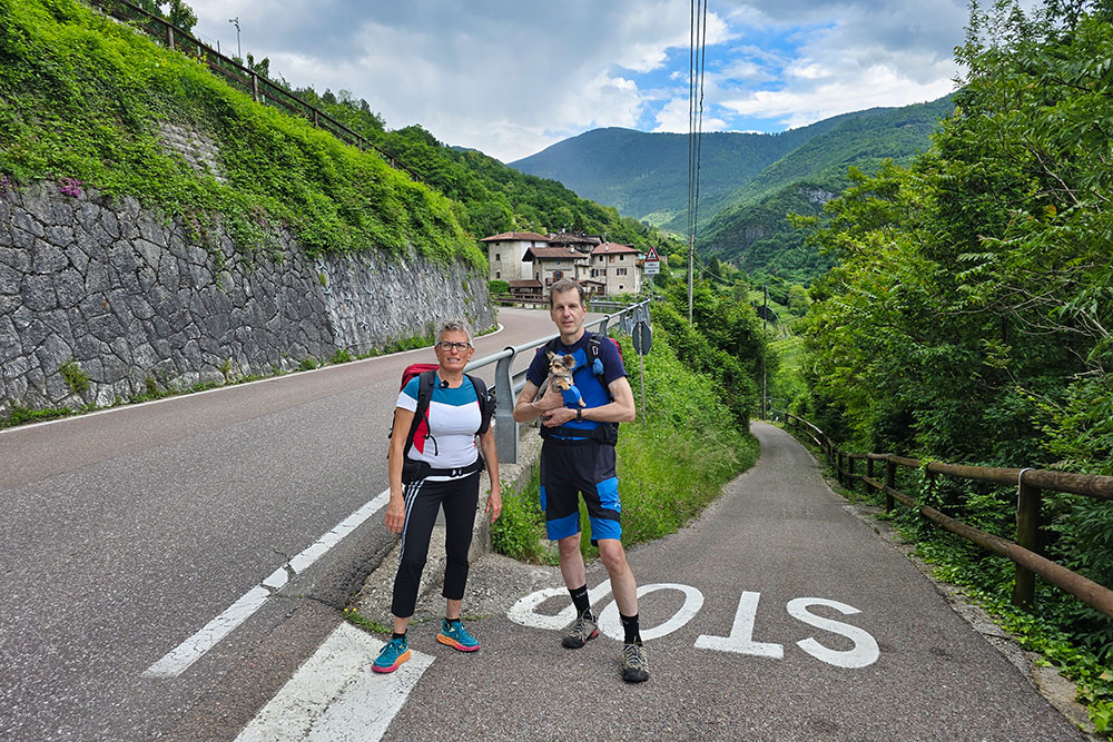
Vista verso Calliano
Sorgente di Albiolo
Castel Pietra
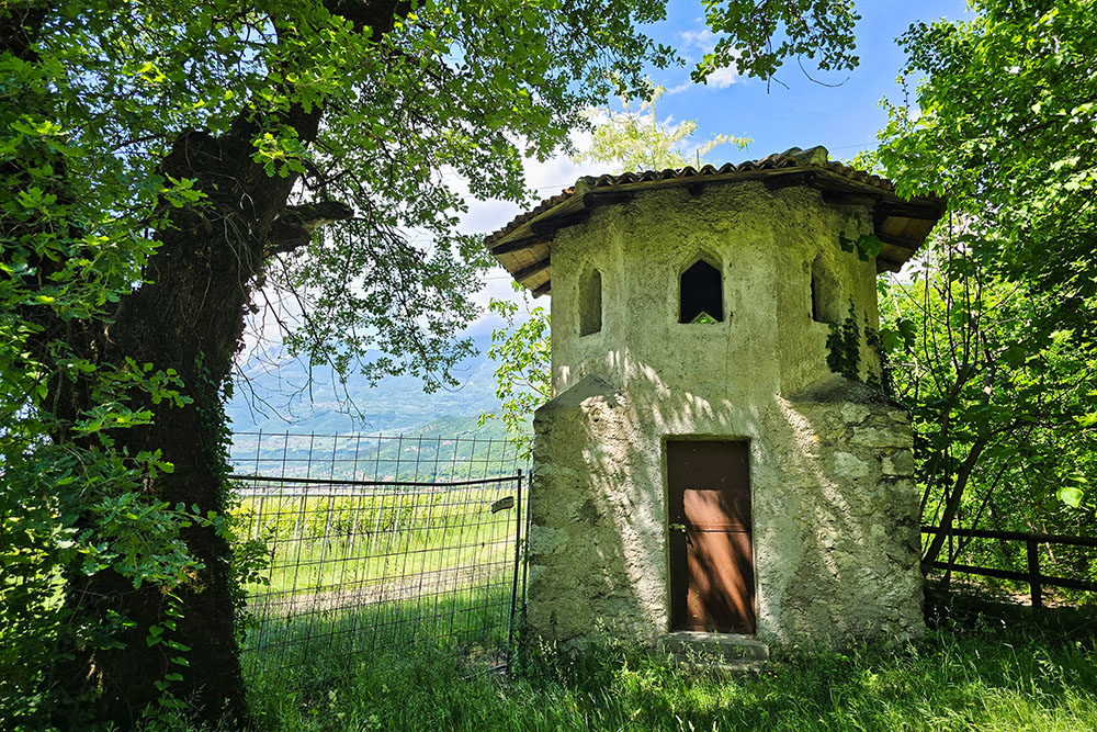
Guardiola ottagonale
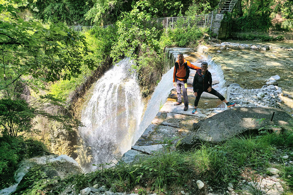
Le Cascate Zambel
Saliamo lungo il Rio Cavallo
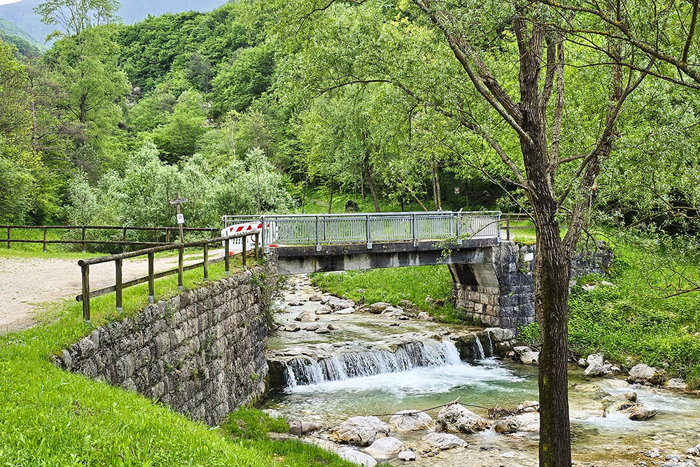
Ponte presso il Vecchio Mulino
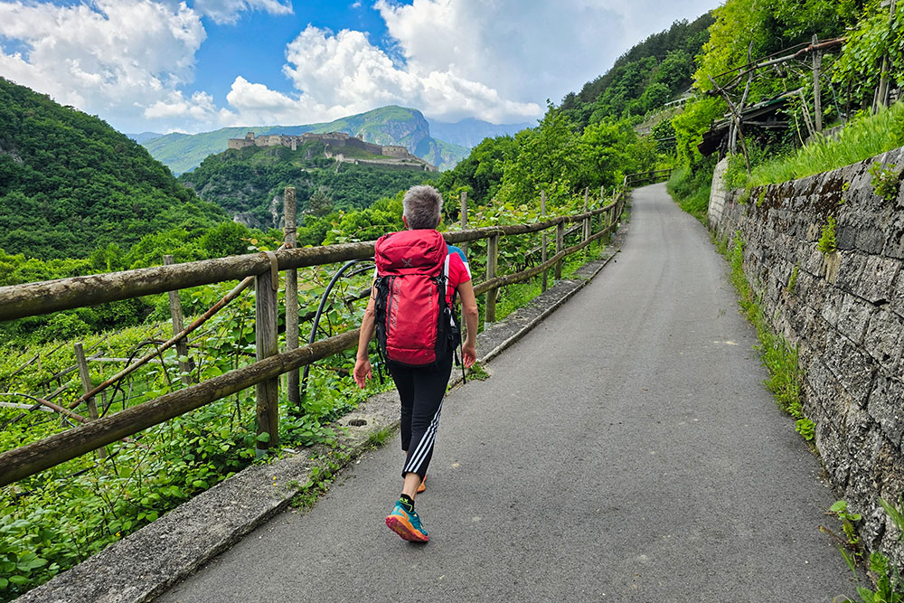
Il Castel Beseno è ben in vista
Arrivatii a Dietrobeseno
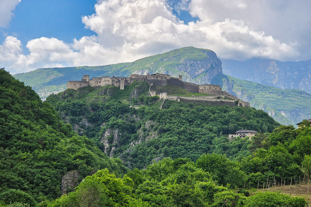
Il Castel Beseno
All'interno del Castel Beseno
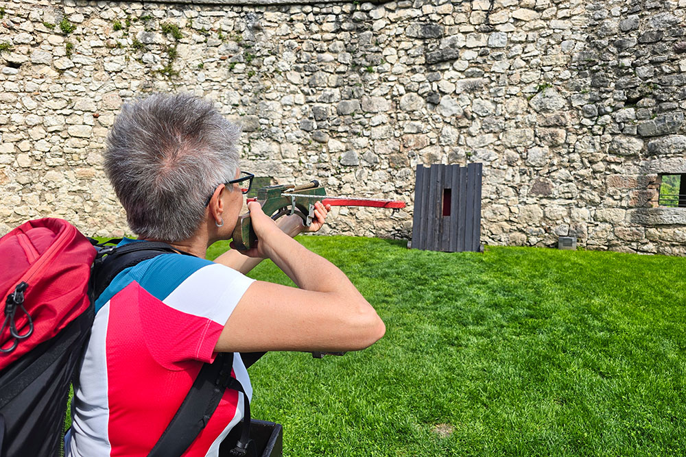
Il gioco della balestra
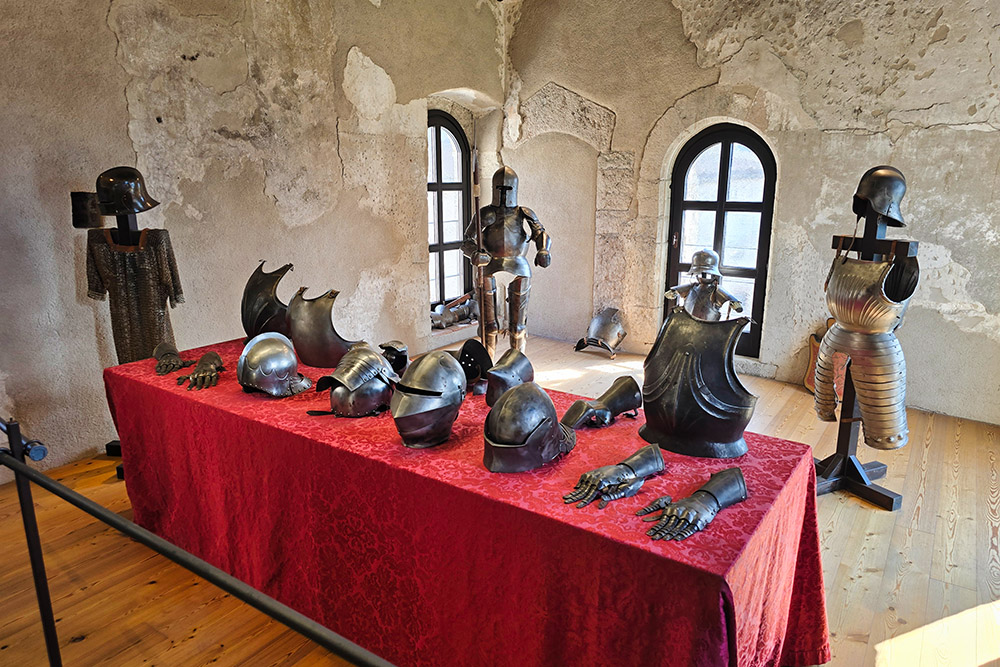
Armature


