


![]()


Durata
 4:00 h
Distanza
 8 km
8 km Ascesa
 507 m
507 mDiscesa
 507 m
507 mH Max
 1630 m
H Min
 1173 m
Rifugio Treviso in Val Canali
DESCRIPTION
From Cant del Gal to Rifugio Treviso: exploring Val Canali at a leisurely pace.
Geographic location
Val Canali is an alpine valley in eastern Trentino, within the municipality of Primiero San Martino di Castrozza, a short distance from Fiera di Primiero. It stretches between 1,000 and 2,900 metres in altitude, nestled at the foot of the Pale di San Martino and crossed by the Canali stream, which flows through it until it meets the Cismon valley. The entire valley lies within the Paneveggio - Pale di San Martino Nature Park. The Park's visitor centre for the Val Canali area is located at Villa Welsperg, a historic noble residence near Castelpietra.
Hike
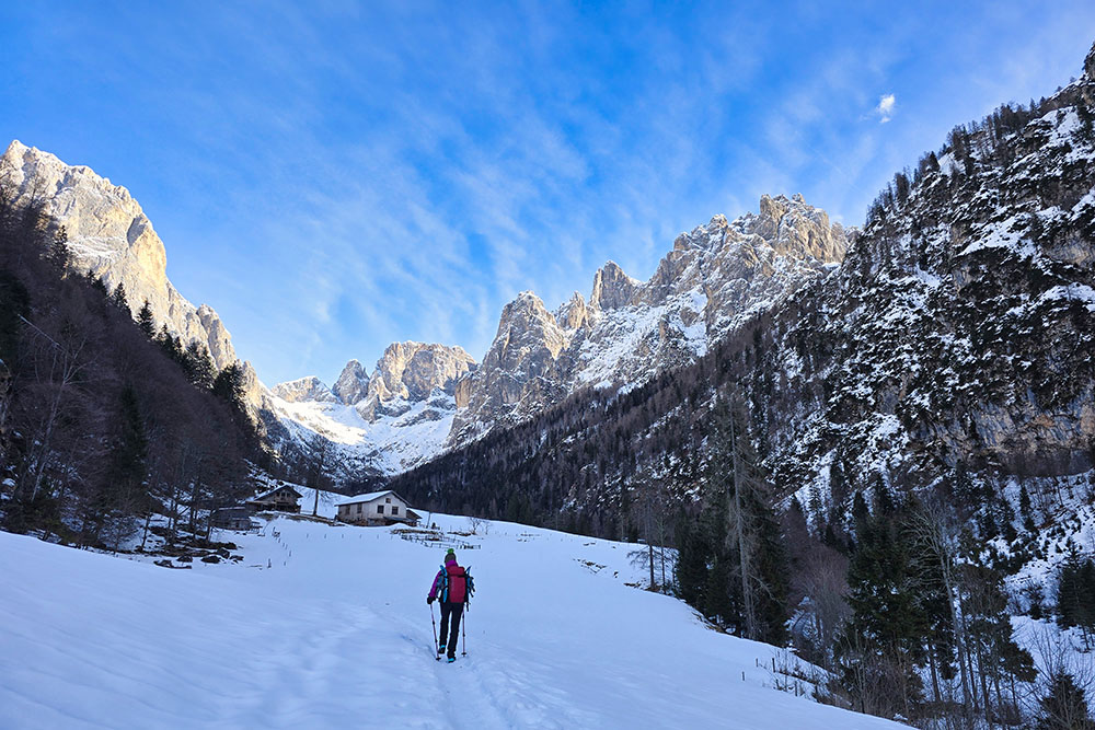
Rifugio Treviso in Val Canali, at 1,630 m, is one of the most classic and rewarding destinations in this valley. In summer it serves as an excellent base for more demanding hikes and climbs on the southern Pale di San Martino; in winter it becomes a pleasant and accessible destination, reachable with or without snowshoes. Technically, this is an easy hike with no difficult passages, suitable for those with a basic level of fitness and adequate physical preparation. Throughout the route, hikers are treated to magnificent views of the southern walls of the Pale. The mountain hut is generally open from early June to late September; the winter room, with 4 beds, remains accessible year-round. It is advisable to check actual opening times by contacting the facility directly.
Malga Canali, encountered along the ascent, is closed in winter. In summer, however, it is one of the most popular spots in the area: it is a working malga that also operates as an agritourism farm where visitors can taste locally produced cheeses and other dairy products.
History and curiosities
Rifugio Treviso was originally built as Rifugio Canali in 1897 by the Dresden Section of the DÖAV (Deutscher und Österreichischer Alpenverein), the Austro-German alpine club of the time.
At the end of World War I, the mountain hut was handed over to the SAT (Società Alpinistica Tridentina) as war spoils. Ownership subsequently passed to the Treviso section of the Club Alpino Italiano, which renamed it Rifugio Treviso in Val Canali.
ITINERARY
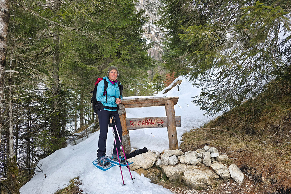
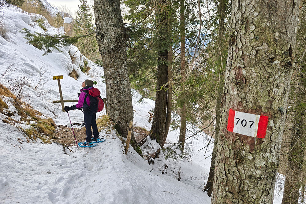
From the locality of Cant del Gal (1,180 m), follow the unnumbered trail towards Malga Canali. Upon reaching the malga (1,310 m), continue in the direction of Rifugio Treviso. Shortly after, take trail no. 707 which, passing through Pian dela Baracca (1,393 m) and Pian dei Orti (1,393 m), leads to the bottom of Val Canali; from here, ascend in zigzags up to Rifugio Treviso in Val Canali (1,630 m). The return to the starting point follows trail no. 707 exclusively.
EXCURSION DATE
21 February 2026
STARTING POINT
Locality of Cant del Gal – San Martino di Castrozza
REFRESHMENT POINT
None in winter.
AUTHOR'S SUGGESTIONS
In winter, always check the avalanche bulletin before setting out.
SAFETY ADVICE
Snow stability is subject to sudden and unpredictable changes. For your safety, always consult the avalanche bulletin, as snow conditions can change rapidly, and seek information from local authorities. Our GPX tracks are for guidance only — the route was completed under the best possible snow and weather conditions on that particular day. Always assess the situation on the ground before proceeding.
Also remember to evaluate the route according to your physical fitness, training level, and available equipment.
It is advisable to let someone know your planned itinerary before departing.
Remember that the emergency number is 112.
EQUIPMENT
Appropriate gear is strongly recommended: avalanche self-rescue kit (comprising ARVA/avalanche transceiver, shovel, and probe), snowshoes, trekking poles, crampons, goggles, sunscreen, hiking boots, winter clothing, gloves, hat, and a backpack with hot drinks.
RECOMMENDED MAPS
Tabacco 022 Pale di San Martino
USEFUL LINKS
https://www.caitreviso.it/rifugi/rifugio-treviso/
HOW TO ARRIVE
From Fiera di Primiero, head towards Passo Cereda. A few kilometres before the pass, turn left into Val Canali and continue to the locality of Cant del Gal.
PARKING AREA
Locality of Cant del Gal – San Martino di Castrozza
GPS Coordinates: 46.217486, 11.877758
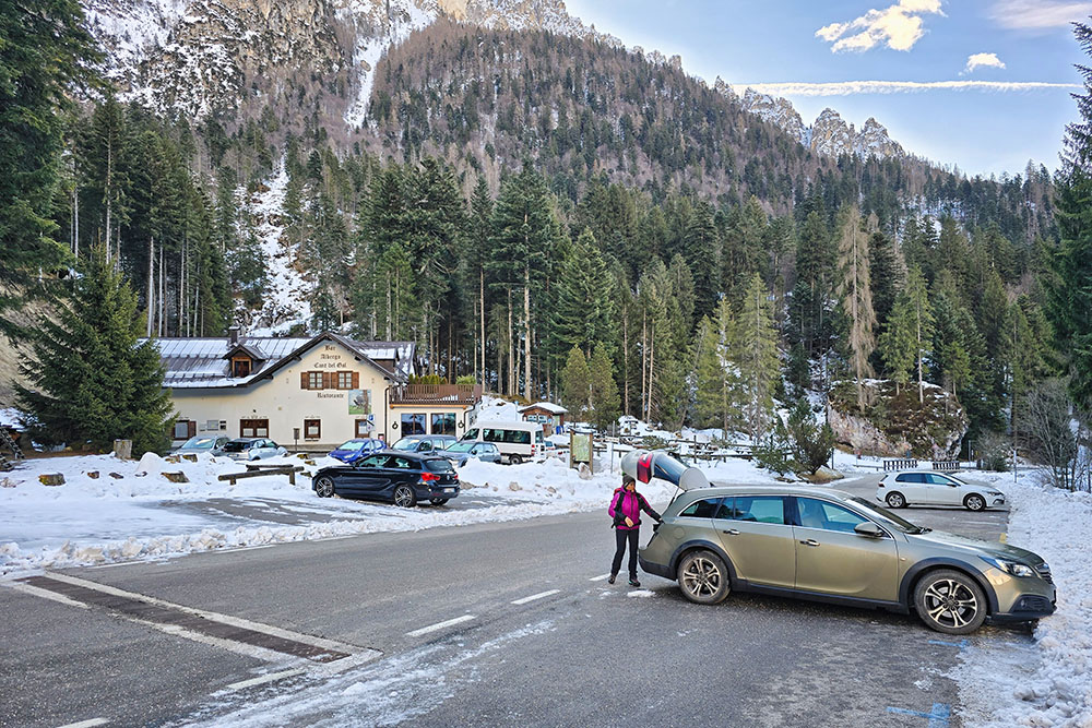
Parcheggio in Località Cant del Gal
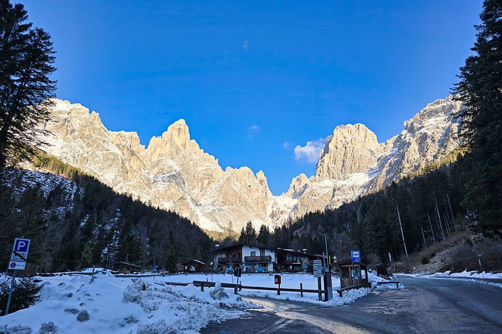
Panorama sulle Pale di San Martino
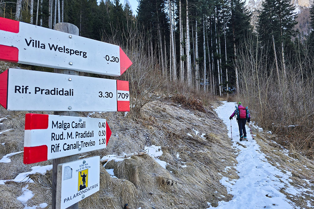
Si parte per la Malga Canali
La malga è in vista
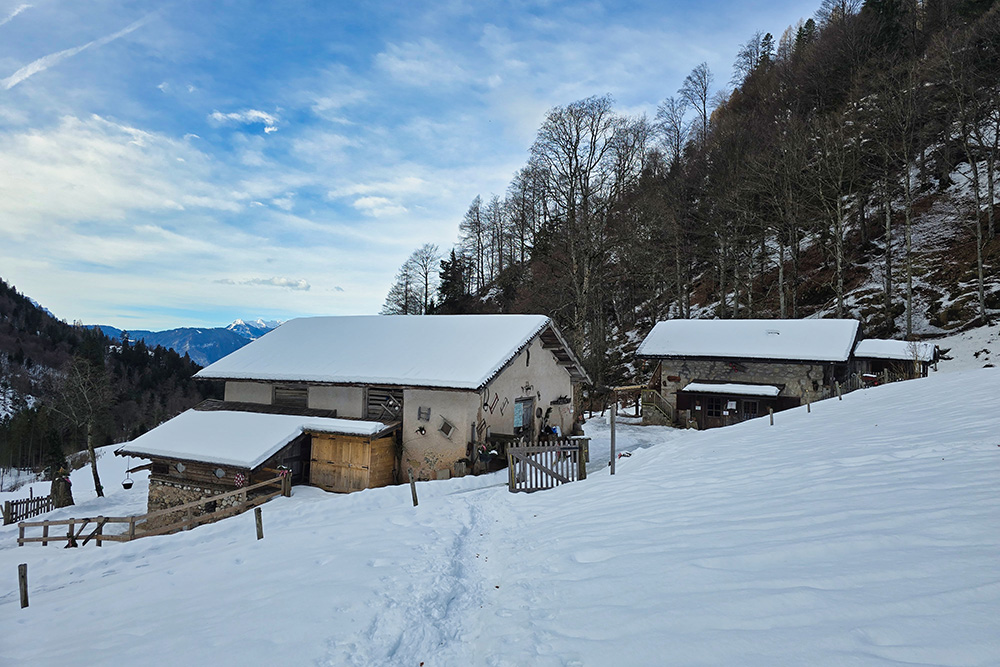
La Malga Canali
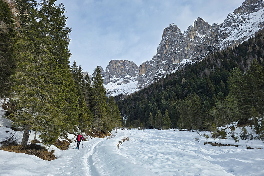
Si sale per la Val Canali
Inizia la salita
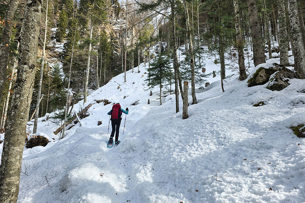
Si sale a zig zag
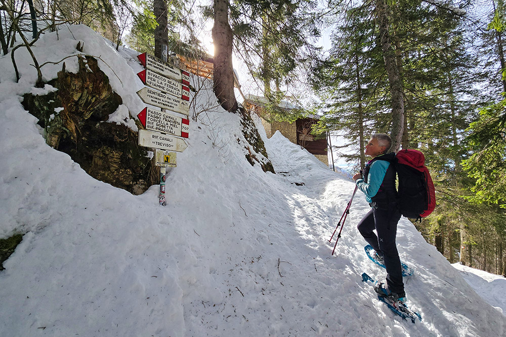
Arrivati al Rifugio Treviso in Val Canali
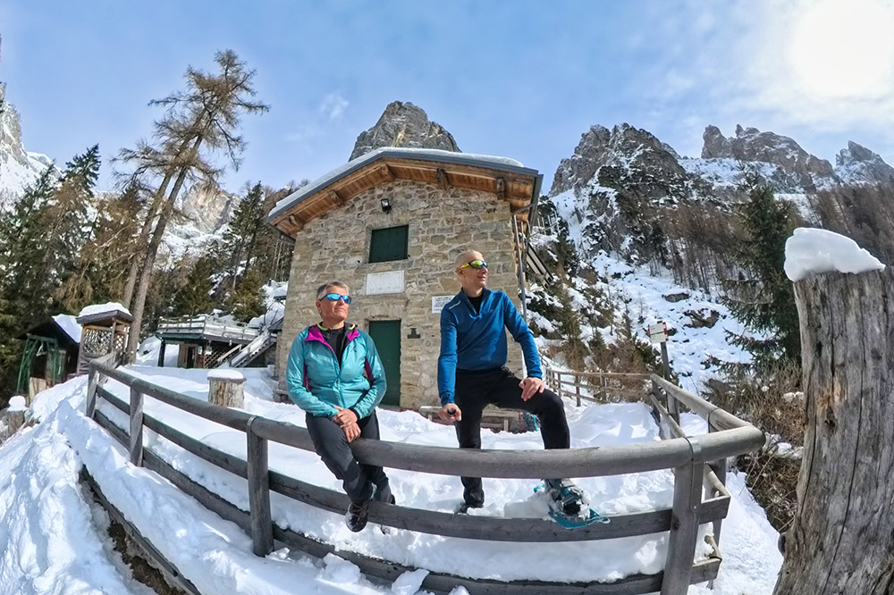
Rifugio Treviso in Val Canali
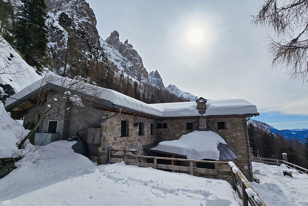
Rifugio Treviso in Val Canali
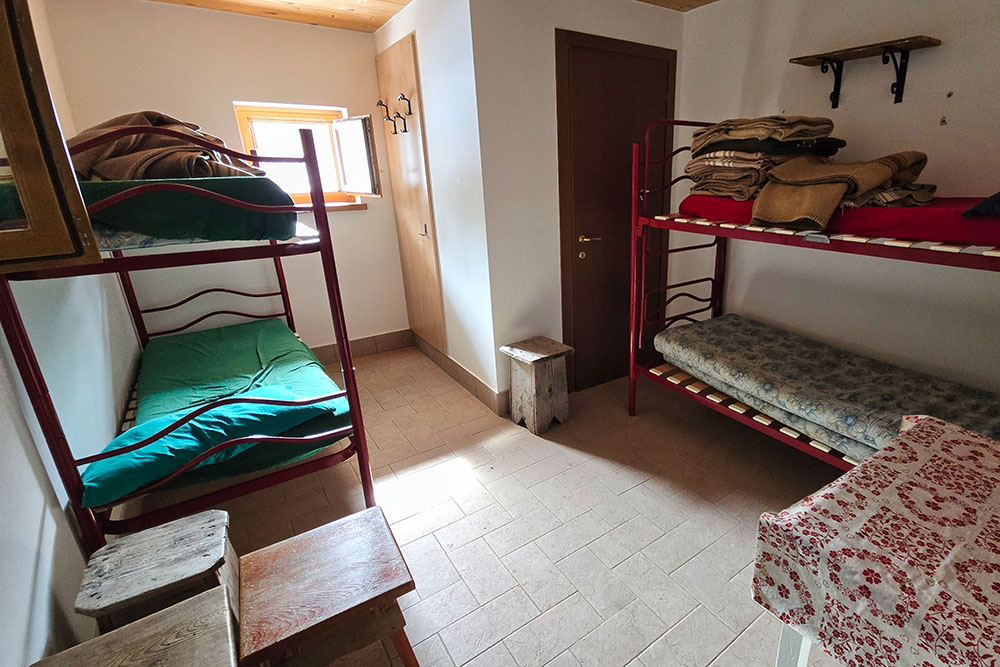
Il locale bivacco aperto d'inverno
Si ritorna sempre sul 707
Si passa sulla destra orografica della valle
Ultimo tratto su asfalto


