


![]()


Durata
 4:15 h
Distanza
 11 km
11 km Ascesa
 699 m
699 mDiscesa
 699 m
699 mH Max
 1834 m
H Min
 1167 m
Tschafon Mountain Hut and Völsegg Spitze
DESCRIPTION
Völsegg Spitze and Tschafon Mountain Hut: a hike for all seasons in the heart of the Dolomites.
Geographical Location
Monte Balzo (German: Völsegg Spitze, 1834 m) is the highest peak of Monte Cavone (Tschafon), a south-western offshoot of the Sciliar group, within the Sciliar-Catinaccio Nature Park in South Tyrol. It is located in the municipality of Fiè allo Sciliar (German: Völs am Schlern), in the Autonomous Province of Bolzano, a short distance from the border with Tires al Catinaccio (German: Tiers am Rosengarten). The mountain is also visible from Bolzano and is easily reachable from both Fiè and the Tires Valley.
The Hike
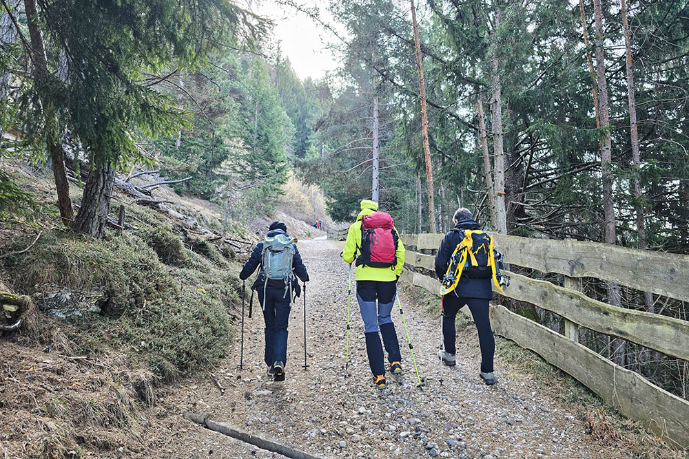
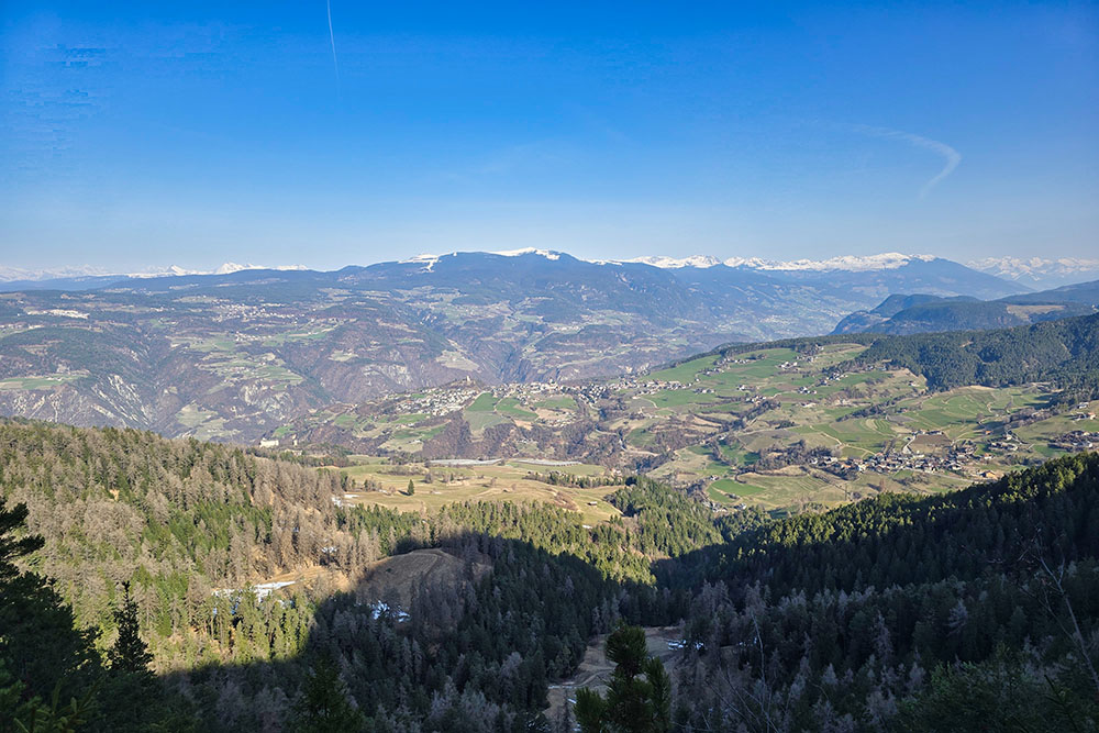
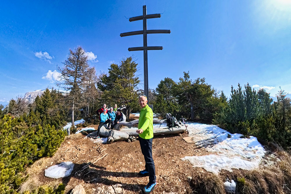
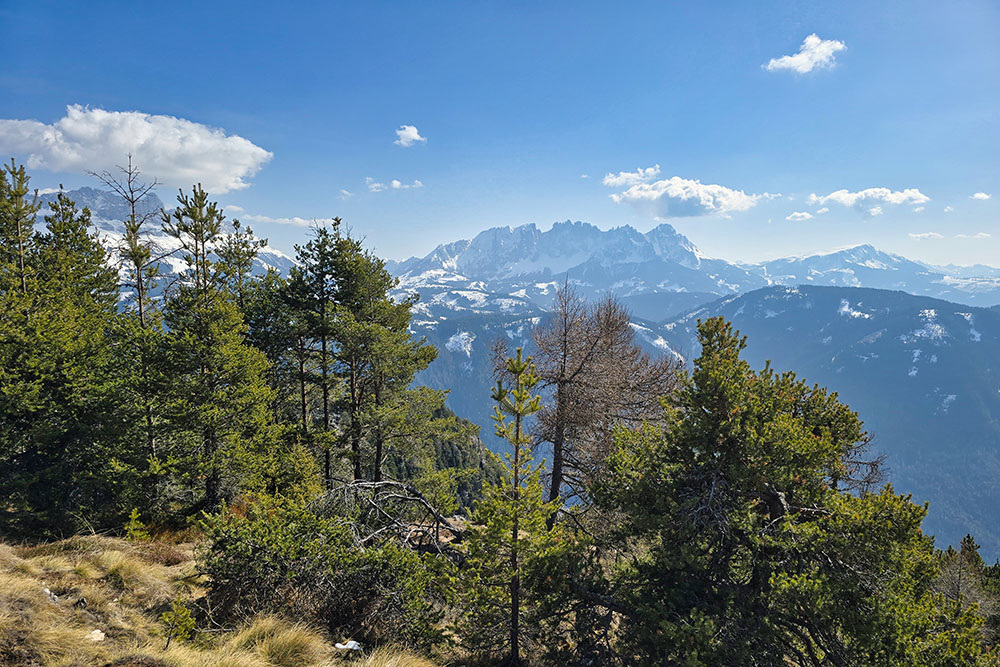
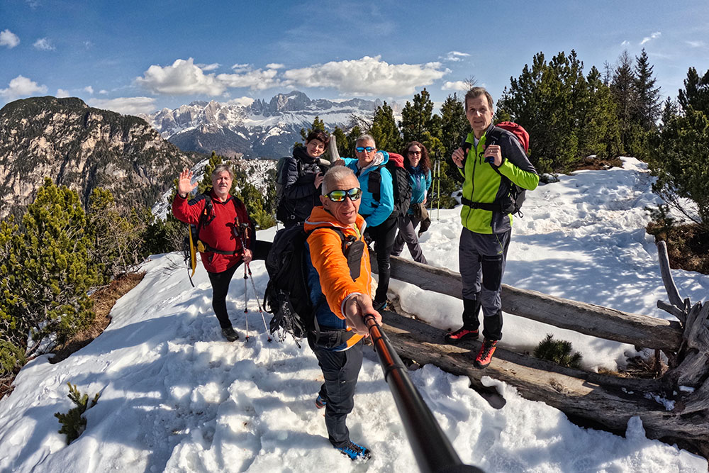
The itinerary to Monte Balzo / Völsegg Spitze is passable in every season of the year. In winter, with snow blanketing the woods and Dolomite ridges, the route offers a particularly evocative landscape: the Catinaccio, Latemar, and the Sarntal Alps stand out clearly on the horizon, while the silence of the forest accompanies almost the entire walk. The route develops between the 1167 m of the starting parking lot and the 1834 m of the summit, with a total elevation gain of about 700 m. The difficulty is classified as E (Hiking) according to the CAI scale: no technical difficulty, but some steep sections are present, particularly in the woods towards the summit. The route takes place predominantly in the woods, which makes it safe even in winter thanks to the reduced exposure to avalanche danger. The three most significant panoramic points are: the summit of Monte Balzo / Völsegg Spitze, the Tschafon Mountain Hut, and the Wuhnleger Lake.
History and Curiosities
Monte Balzo / Völsegg Spitze and the Tschafon Mountain Hut are located in the Sciliar-Catinaccio Nature Park, the oldest nature park in South Tyrol . Established in 1974, it was expanded in 2003 to also include the Catinaccio group .
Legend is at home on this plateau: the Schlernhexen, the witches of the Sciliar, are the protagonists of a body of local legends that tells of sabbaths and nightly gatherings on the Sciliar rocks. In nearby Castel Presule (German: Schloss Prösels), some witch trials were held at the beginning of the 16th century. Medieval atmospheres intertwine with the nature of these mountains, making their charm even more vivid.
ITINERARY
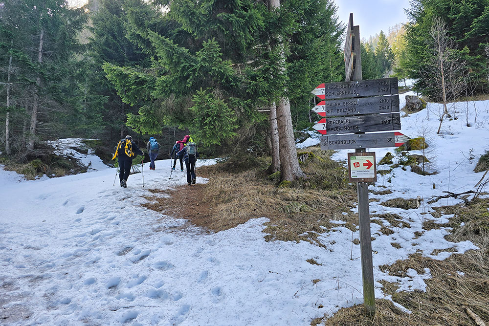
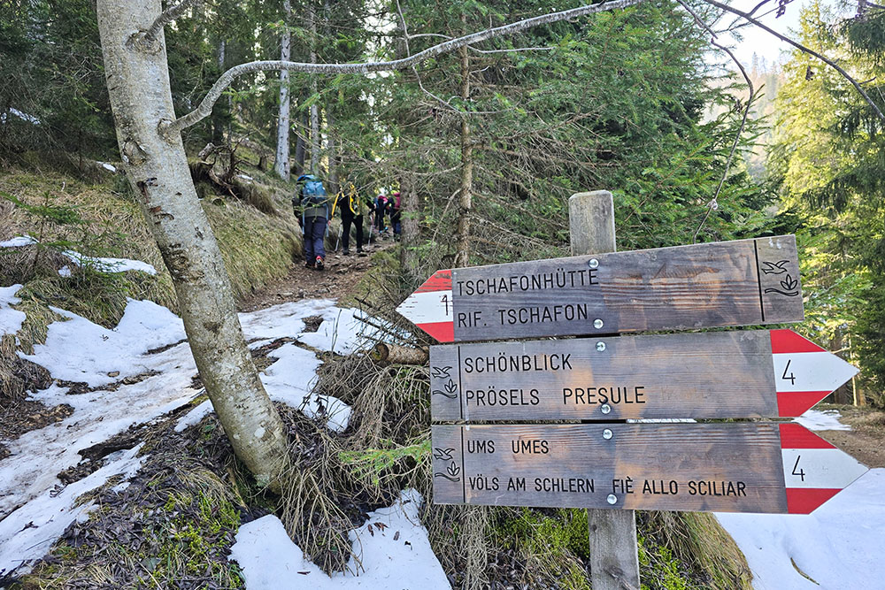
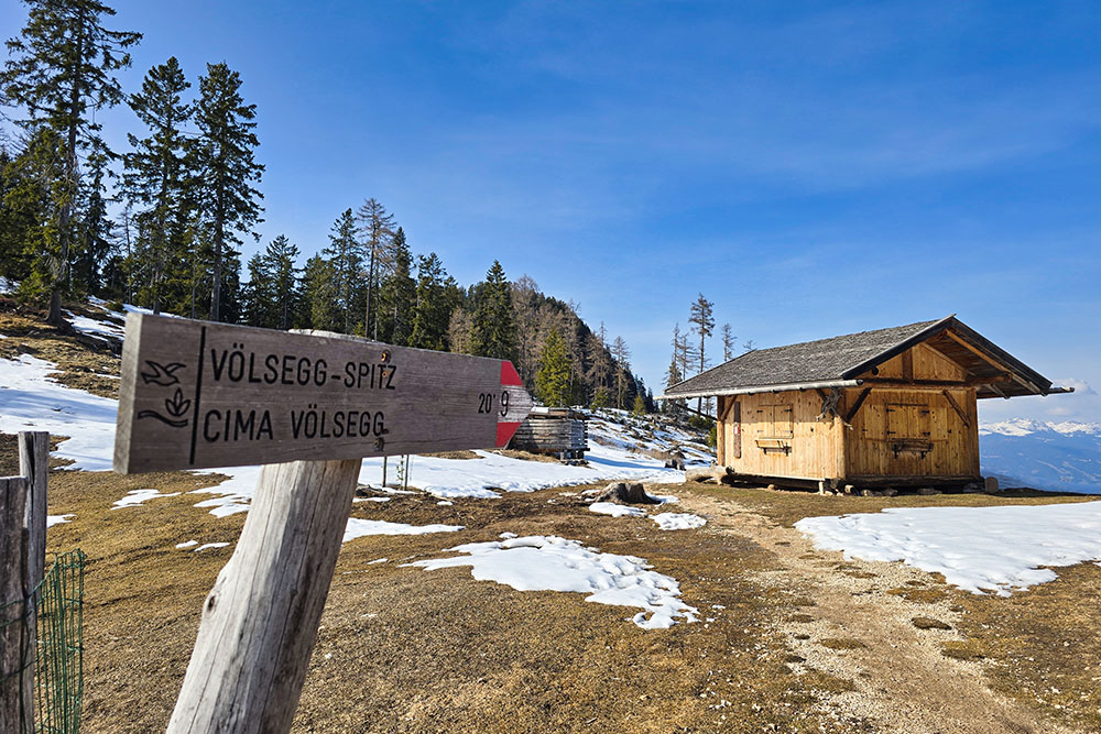
From the Wanderparkplatz parking lot (1167 m), follow trail marker 7 on an asphalt road. After three hundred meters, you reach the Hotel Schönblick, where the actual path begins. After 2.4 km from the start, take path 4, which leads to the Tschafon Mountain Hut (1737 m). From here, ascend to the summit of Monte Balzo / Völsegg Spitze following trail marker 9. At the summit (1834 m), there are three panoramic viewpoints, all with a bench and one with a wooden cross. Return to the hut via the same path, then descend along path 4 in the direction of Tires. Upon reaching Wuhnleger Lake, continue on path 4, then onto 4B, and finally onto path 6.
EXCURSION DATE
March 8, 2026
STARTING POINT
Wanderparkplatz - Aica di Fiè / Völser Aicha
REFRESHMENT POINT
In winter, only the Hotel Schönblick at the starting point.
AUTHOR'S SUGGESTIONS
In winter, always check the avalanche bulletin before leaving.
SAFETY TIPS
The practicability of the proposed itinerary, like all mountain terrain, is subject to environmental changes due to natural events and weather conditions. Therefore, before leaving, consult the competent tourist offices and/or the reference huts.
Our GPX tracks are for guidance only, meaning the route was completed under the best trail and weather conditions of that day. So always assess what to do on the spot.
Also, remember to evaluate the route based on your physical abilities, training, and the equipment you have.
It is advisable to let someone know the itinerary you intend to follow.
Remember that the emergency number is 112.
EQUIPMENT
It is recommended to have equipment suitable for the route, weather conditions, and season: windproof and/or rainproof jacket, map and/or GPS device, glasses, sunscreen, hiking boots, first aid kit, specific clothing, gloves, backpack with food and drinks.
RECOMMENDED MAPS
Tabacco 029 Schlern – Rosengarten - Sciliar - Catinaccio - Latemar
INTERESTING LINKS
https://www.rifugidelcatinaccio.it/it/rifugio.asp?id=14
HOW TO ARRIVE
A22 motorway exit Bolzano Nord. Take the SS12 northwards. In Prato Isarco / Blumau, keep left and go up on the SP24, then continue right onto the SP Tires / Tiers. After Aica / Aicha, you need to take a small road on the left, without a sign, which leads to the Wanderparkplatz .
PARKING AREA
Wanderparkplatz - Aica di Fiè / Völser Aicha
GPS Coordinates: 46.489190, 11.508920
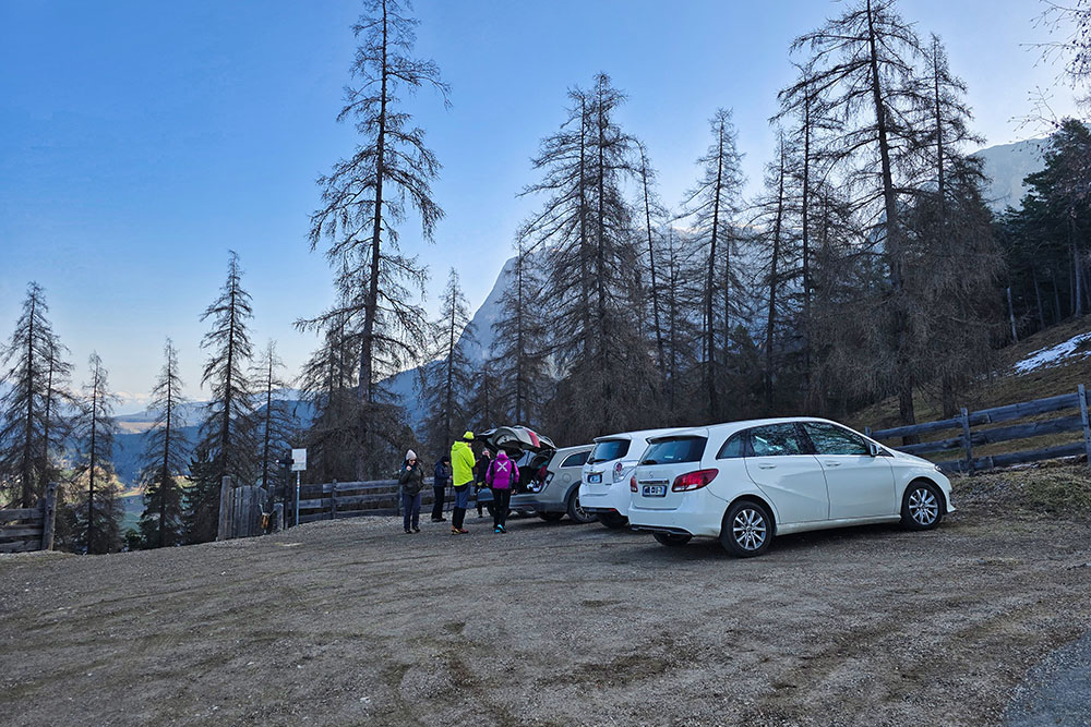
Parcheggio Wanderparkplatz
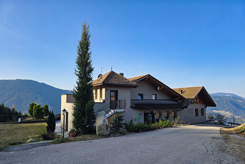
L'Albergo Schönblick
Si sale per la strada sterrata segnavia 7
Panorama verso Fiè allo Sciliar
Lasciamo il segnavia 7 per il 4
Continuiamo sul 4
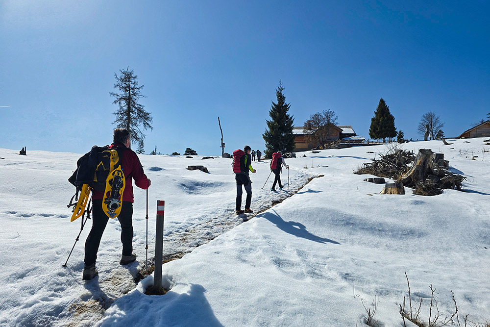
Si arriva al Rifugio Monte Cavone
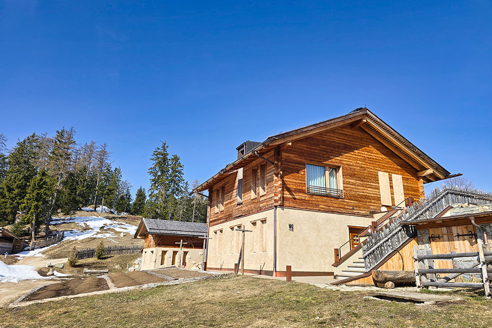
Rifugio Monte Cavone
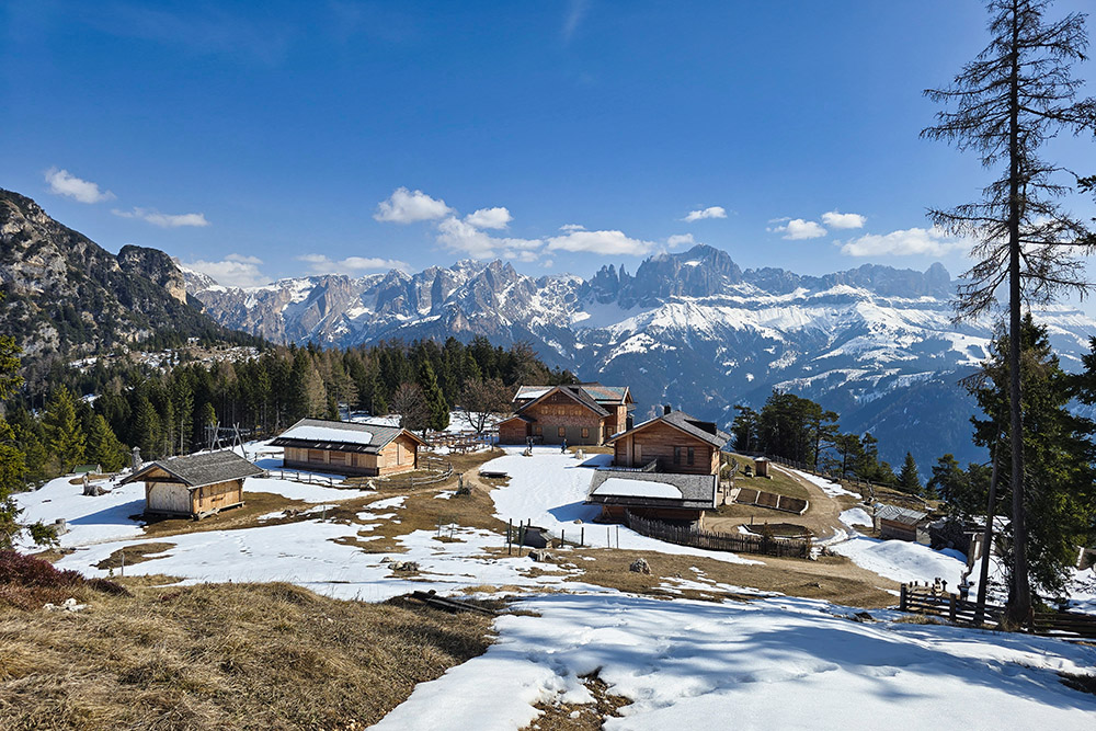
Rifugio Monte Cavone
Seguiamo il segnavia 9
In vetta al Monte Balzo
Monte Balzo - Secondo punto panoramico
Monte Balzo - Terzo punto panoramico
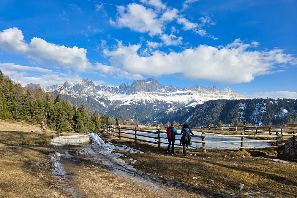
Laghetto Wuhnleger
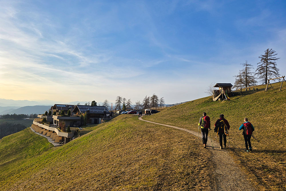
Ritornati all'Albergo Schönblick


