


![]()


Durata
 3:35 h
Distanza
 7,4 km
 Ascesa
 340 m
340 mDiscesa
 340 m
340 mH Max
 1782 m
H Min
 1464 m
Malga Grugola from Lake Calaita
DESCRIPTION
Lozen Valley with snowshoes: an easy loop hike among lake, woods, and malghe in eastern Trentino.
Geographic location
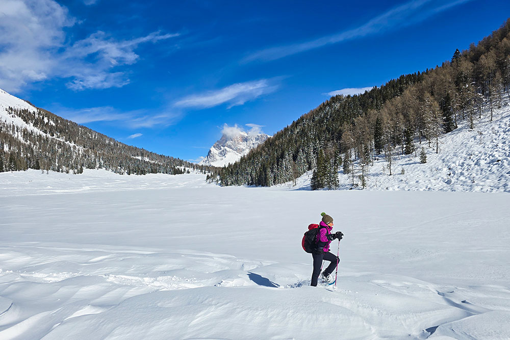
Lake Calaita is located at 1605 meters above sea level in the Lozen Valley, in eastern Trentino, within the Paneveggio - Pale di San Martino Natural Park . This small alpine basin occupies a wide grassy plateau surrounded by spruce and larch forests, in an open position that offers a privileged view of the Pale di San Martino and the Feltre peaks. The lake is about 20 km from Fiera di Primiero and 12 km from Canal San Bovo.
Hike
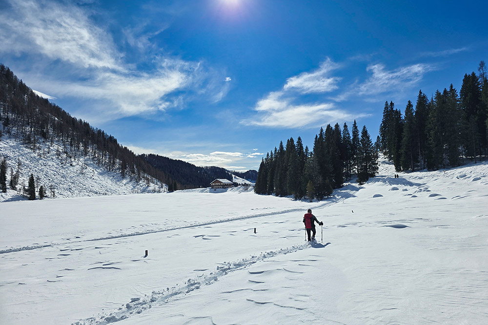
The winter itinerary around Lake Calaita is an ideal choice for those who want to approach snowshoeing without facing significant technical difficulties. The elevation gain is modest and the overall length remains accessible even to hikers with limited experience on snow .
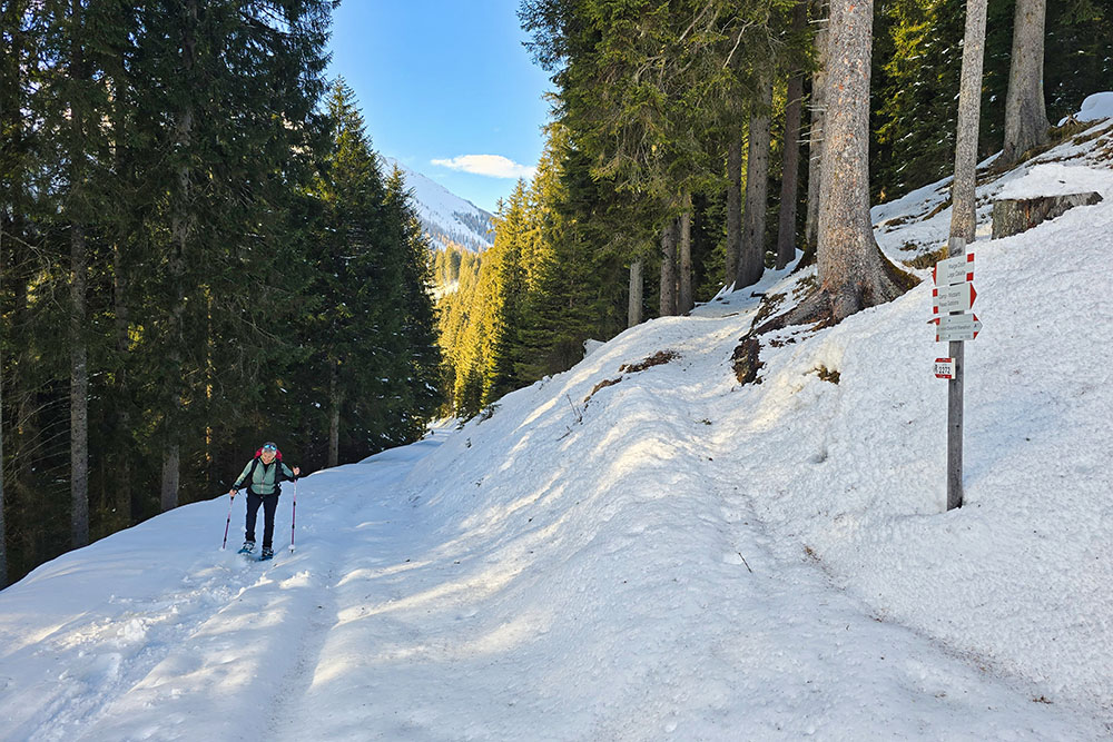
The route winds through clearings and woods, alternating flat sections with climbs. The environment is typically alpine: silent in winter, with the lake often frozen and the meadows covered by a thick blanket of snow. The view of the Pale di San Martino accompanies most of the hike, offering a constant scenic reference.
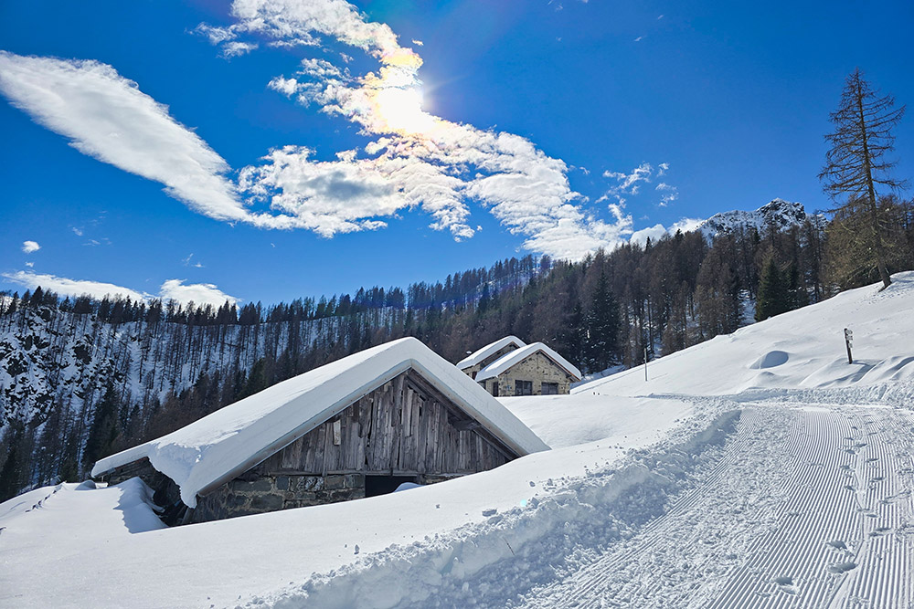
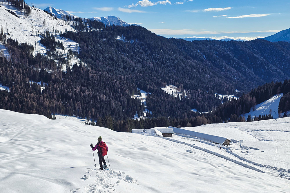
The malghe along the way - Malga Grugola and Malga Lozen - are closed during the winter season; it is therefore necessary to bring water and food. The loop around the lake, at the beginning or at the end of the snowshoe hike, allows you to fully appreciate the breadth of the plateau and the Dolomite frame that surrounds it.
History and curiosities
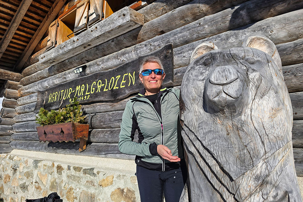
Malga Lozen, located at 1,497 meters, operates as an educational farm during the summer season . Here they offer itineraries dedicated to alpine pasture life, ancient crafts related to haymaking and milking, and the milk transformation cycle into cheese. The activities are aimed especially at school groups and organized groups, with covered and equipped spaces.
ITINERARY
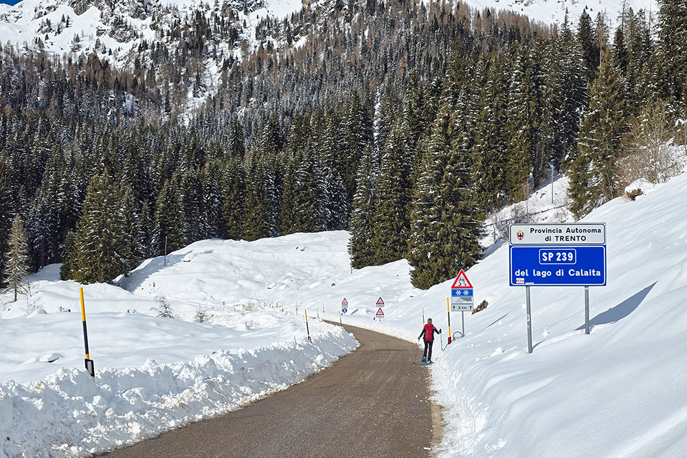
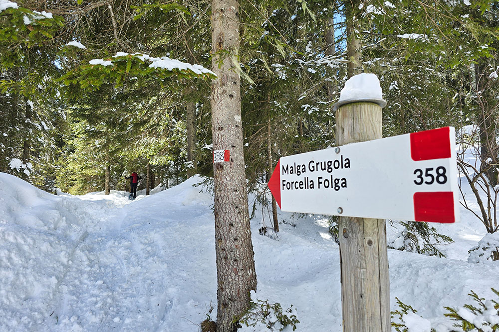
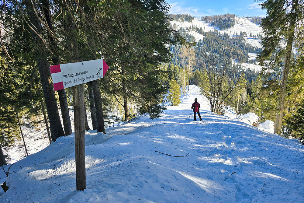
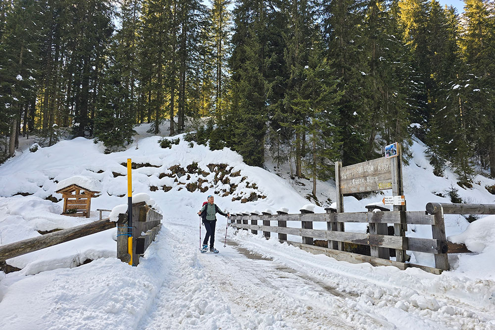
From the Hotel Restaurant Miralago Calaita (1608 m), you walk along the eastern shore of Lake Calaita, then return along the western shore, completing the circuit around the lake. Initially, you follow a short stretch of paved road, then take trail marker 347 and subsequently 358.
After reaching Malga Grugola (1782 m), you retrace your steps for a short distance and continue on a dirt road towards the second malga. Upon reaching Malga Lozen (1497 m), you continue following trail marker 358. Once you return to the paved road, turn left, climb for about twenty meters, then turn right, resuming trail marker 358. After about 400 meters of ascent, on the left, take an unnumbered path with the sign indicating Lago di Calaita, which leads back to the starting point.
EXCURSION DATE
February 20, 2026
STARTING POINT
Lake Calaita
REFRESHMENT POINT
None
AUTHOR'S SUGGESTIONS
In winter, always check the avalanche bulletin before setting out.
SAFETY ADVICE
The stability of the snowpack is subject to rapid and unpredictable changes. For your safety, always consult the avalanche bulletin, because the snowpack is subject to rapid changes, and ask for information from the local competent authorities. Our GPX tracks are only indicative, meaning the route was completed under the best snow and weather conditions of that day. Therefore, always assess the situation on site.
Also, remember to evaluate the route based on your physical abilities, training, and the equipment you have.
It is advisable to let someone know your intended route.
Remember that the emergency number is 112.
EQUIPMENT
It is recommended to have the appropriate gear: avalanche self-rescue kit (consisting of ARVA transceiver, shovel, and probe), snowshoes, poles, crampons, goggles, sunscreen, trekking boots, winter clothing, gloves, hat, backpack with warm drinks.
RECOMMENDED MAPS
Tabacco 022 Pale di San Martino
INTERESTING LINKS
https://www.miralagocalaita.it/
HOW TO ARRIVE
From Canal San Bovo, take the SP79 and in the locality of Revedea, turn left following the signs for Zortea and Calaita. Continue for 8.6 km.
PARKING AREA
Lake Calaita Parking Lot
GPS Coordinates: 46.201591, 11.792726
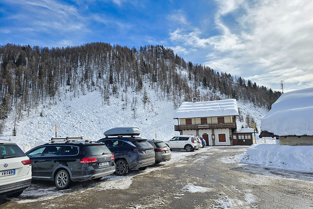
Parcheggio al Lago di Calaita
Iniziamo il percorso
Siamo arrivati in fondo al lago
Breve tratto su asfalto
Inizia il sentiero
Arrivati a Malga Grugola
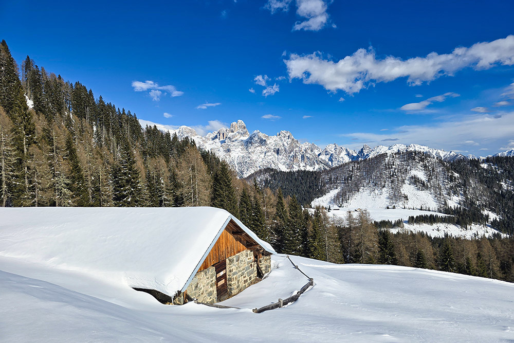
La malga con il panorama alle spalle
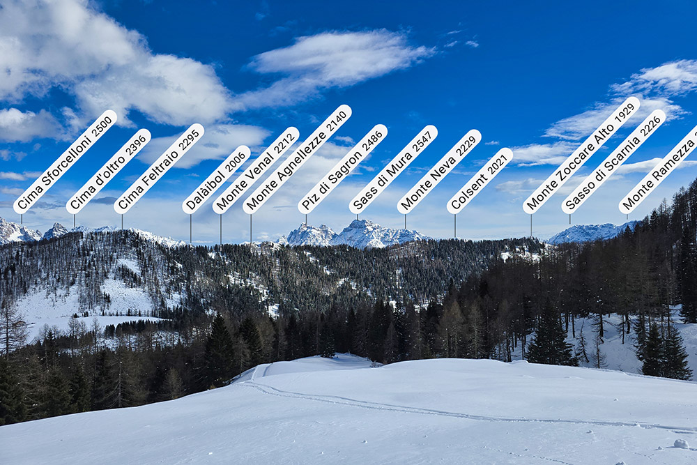
Vista verso le vette feltrine
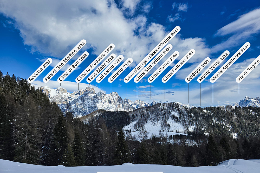
Vista verso le Pale di San Martino
Si scende verso Malga Lozen
Siamo quasi arrivati
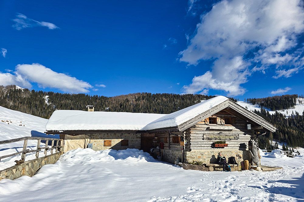
Malga Lozen
Malga Lozen
Si continua il giro ad anello
Ultimo bivio per ritornare al Lago Calaita


