


![]()


Durata
 4:05 h
Distanza
 10,2 km
 Ascesa
 526 m
526 mDiscesa
 526 m
526 mH Max
 1694 m
H Min
 1185 m
Hiking up Val Ciamin to Rechter Leger
DESCRIPTION
Val Ciamin in winter: a walk between the Sciliar and Catinaccio.
Geographic location
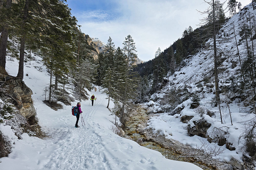
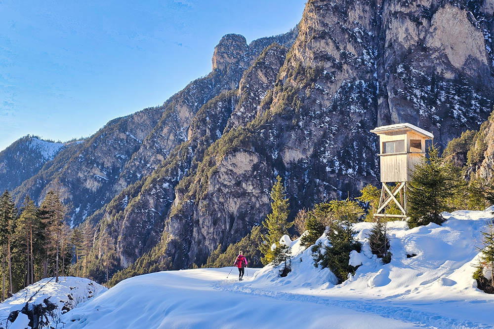
Val Ciamin - in German Tschamintal - is a Dolomite valley in South Tyrol that extends from the hamlet of Bagni di Lavina Bianca (Weisslahnbad), in the municipality of Tires (BZ), to the Principe Pass. It winds between the Sciliar and Catinaccio mountain groups, following the course of the Rio Ciamin (Tschaminbach), and is entirely within the Sciliar-Catinaccio Nature Park.
Hike
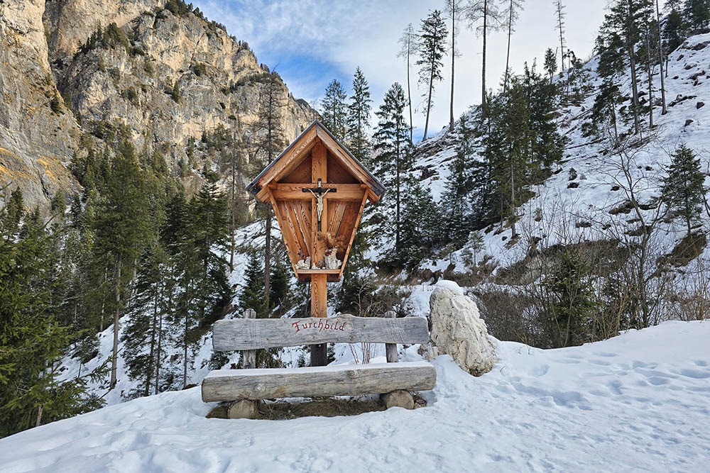
This itinerary is a moderately easy walk, ideal in the winter season, leading from Bagni di Lavina Bianca to the small hut of Rechter Leger - a German place name that literally translates as the pasture lying on the right slope. Throughout the outward route, you are constantly accompanied by the Rio Ciamin, which flows lively through the woods. The valley wedges itself between two Dolomite groups of extraordinary beauty: the Sciliar and the Catinaccio, offering strikingly panoramic views.
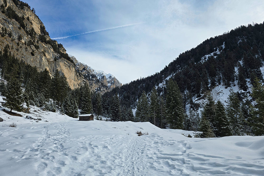
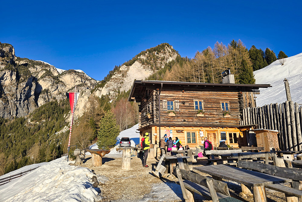
The destination, Rechter Leger, provides a broad visual sweep over the eastern peaks of the Catinaccio: the Grasleiten Towers (Cima Grasleiten), the Tschamin Peak (Cima Tschamin), and Valbona Peak (Cima di Valbona) stand out sharply on the horizon. On the way back, those wishing to take a gastronomic break can stop at Malga Untertrumpedeller for a coffee and something sweet.
History and curiosities
The name Bagni di Lavina Bianca - in German Weisslahnbad - derives from a white gravel quarry in the area and a thermal spring that in the past attracted vacationers seeking cures.
At the entrance to Val Ciamin is the information point of the Sciliar-Catinaccio Nature Park, housed in the historic Steger Säge: a Venetian water-powered sawmill, dating back about four hundred years, today among the rarest examples of this type still existing in South Tyrol. The building has been carefully restored and the sawmill has been partially put back into operation. Inside, visitors can discover Alpine artisan traditions through the original saw and the reconstructed living quarters of the sawyer - living room, kitchen and bedroom - which tell the daily life and work of those who processed timber in the mountains.
ITINERARY
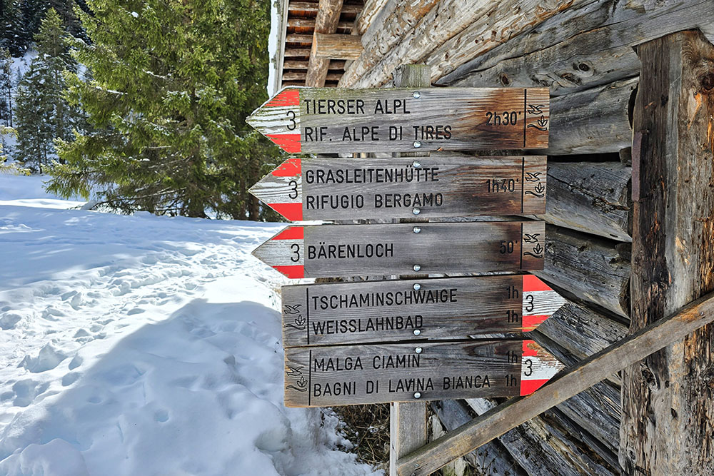
From Bagni di Lavina Bianca (1199 m) you reach the Sciliar-Catinaccio Visitor Centre (1185 m), where Malga Ciamin is also located, and take path no. 3. Climbing up, you pass the Schwarzer Letten (1427 m) and Hohen Steg (1513 m) springs. Once you reach Rechter Leger (1607 m), a small hut with a lovely meadow and adjacent picnic area, you cross the Ciamin Torrent and take the dirt road that leads back down the valley. The road first climbs to the maximum altitude of 1694 m, then descends to rejoin trail marker 3. Continue for 200 metres, then at the junction keep left, continuing on the dirt road that leads directly to Malga Untertrumpedeller (1350 m). From here, return to Malga Ciamin and the starting car park following paths 13A, 13B and 3 in order.
EXCURSION DATE
February 15, 2026
STARTING POINT
Bagni di Lavina Bianca (Weisslahnbad)
REFRESHMENT POINT
Malga Untertrumpedeller
AUTHOR‘S SUGGESTIONS
In winter, always check the avalanche bulletin before setting out.
SAFETY TIPS
The stability of the snowpack is subject to sudden and unpredictable changes. For your safety, always consult the avalanche bulletin, as the snowpack is subject to rapid changes, and ask for information from the local competent offices. Our GPX tracks are for guidance only, meaning the route was done under the best snow and weather conditions of that day. Therefore, always assess what to do on site.
Also, remember to evaluate the route based on your physical abilities, training, and the equipment you have.
It is advisable to let someone know the itinerary you intend to follow.
Remember that the emergency number is 112.
EQUIPMENT
It is recommended to have suitable equipment: avalanche self-rescue kit (consisting of ARTVA beacon, shovel, and probe), snowshoes, trekking poles, crampons, sunglasses, sunscreen, trekking boots, winter clothing, gloves, hat, backpack with hot drinks.
RECOMMENDED MAPS
Tabacco 029 Sciliar - Catinaccio – Latemar
INTERESTING LINKS
https://www.untertrumpedellerschwoaga.com/it.html
HOW TO ARRIVE
A22 motorway, Bolzano Nord exit, take SS12 towards Brennero. At Prato Isarco, take the road to Tires and once in Tires, continue to the locality of Bagni di Lavina Bianca (Weisslahnbad).
PARKING AREA
At Bagni di Lavina Bianca (Weisslahnbad)
GPS Coordinates: 46.478492, 11.558912
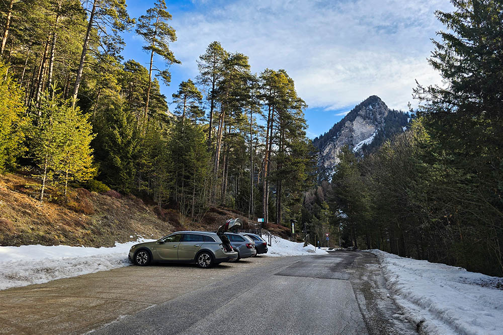
Parcheggio a Bagni di Lavina Bianca
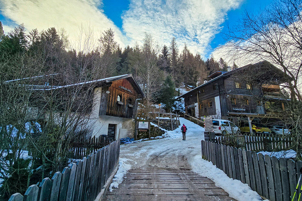
Centro visite Sciliar-Catinaccio e Malga Ciamin
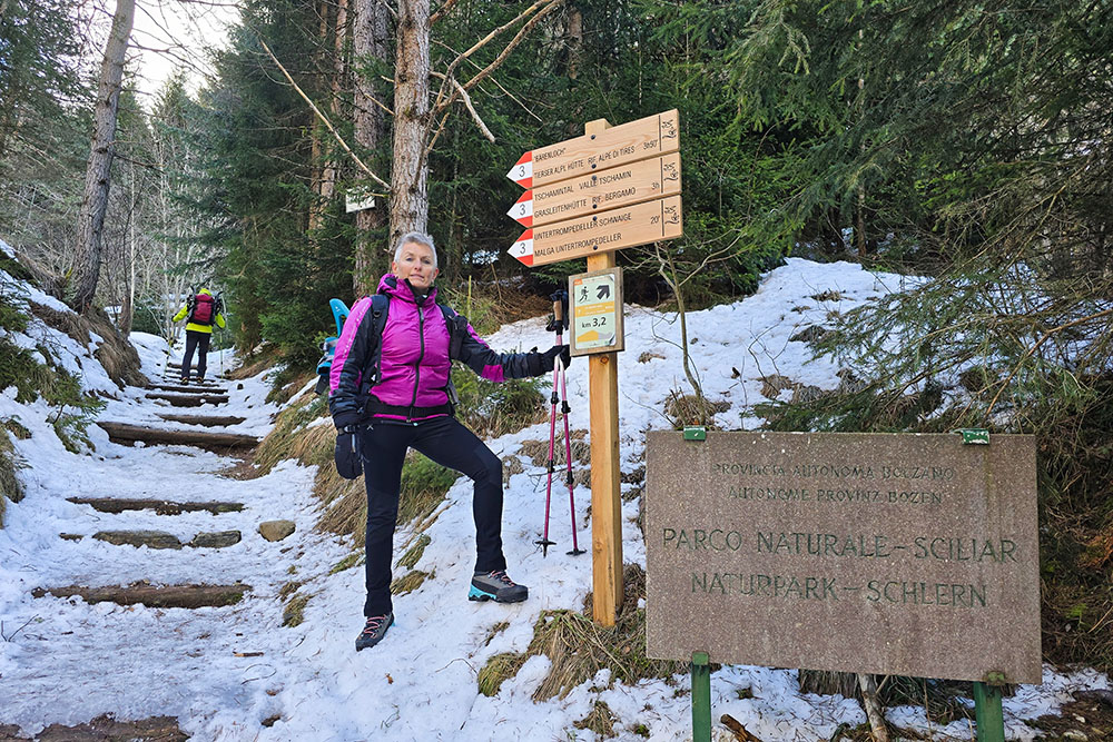
Inizia il sentiero
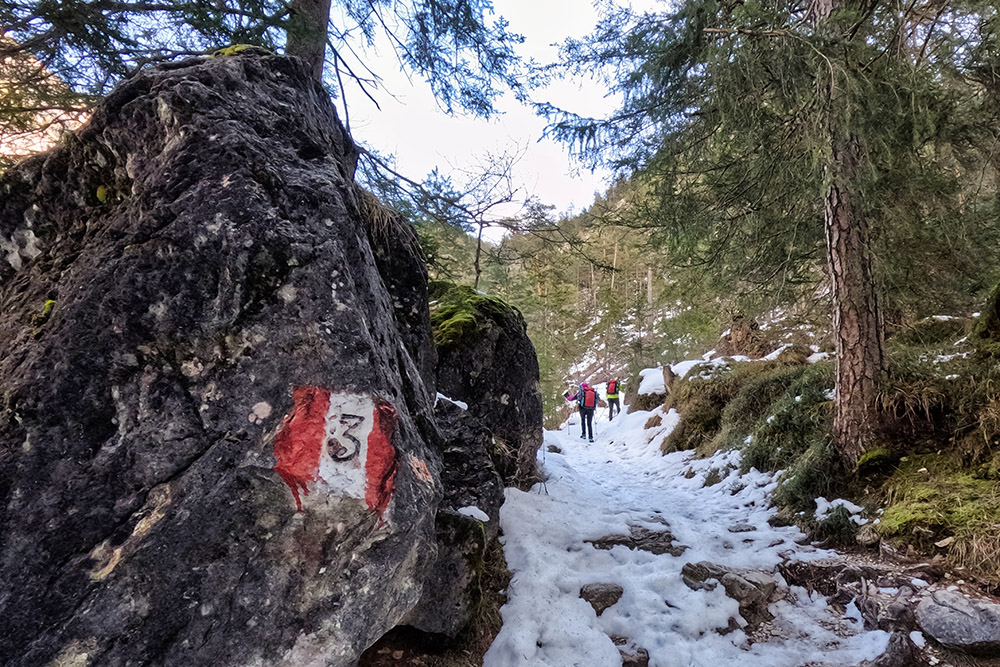
Saliamo seguendo il sentiero n 3
Arrivati sulla strada sterrata
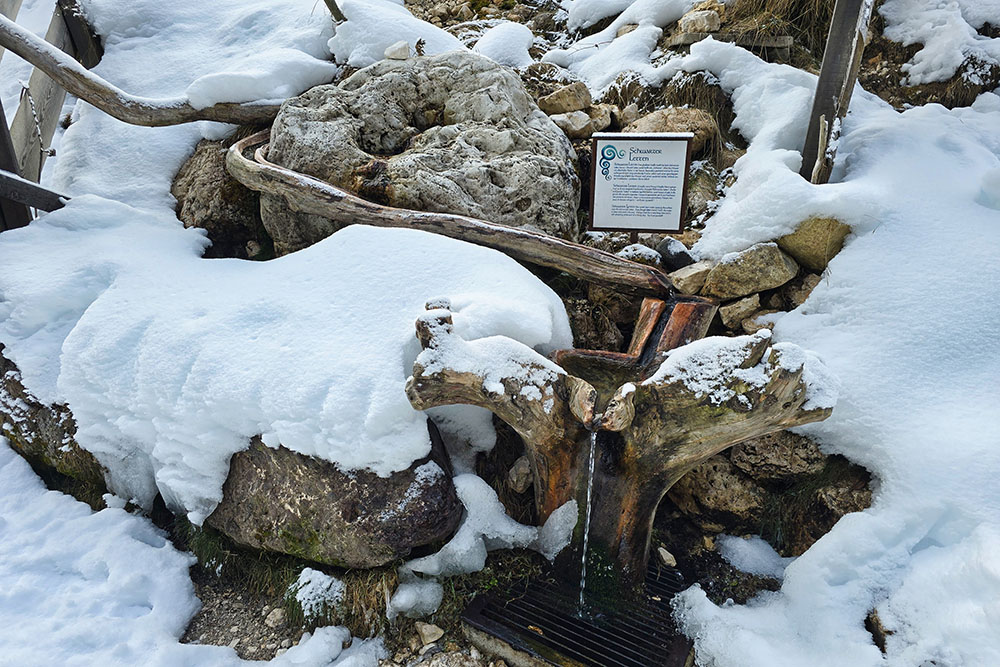
Sorgente Schwarzer Letten
Il torrente Ciamin
La radura di Schaferleger
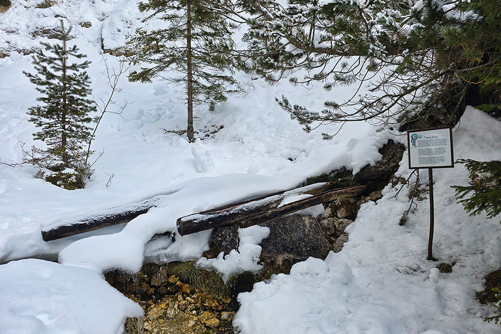
La sorgente Hoher Steg
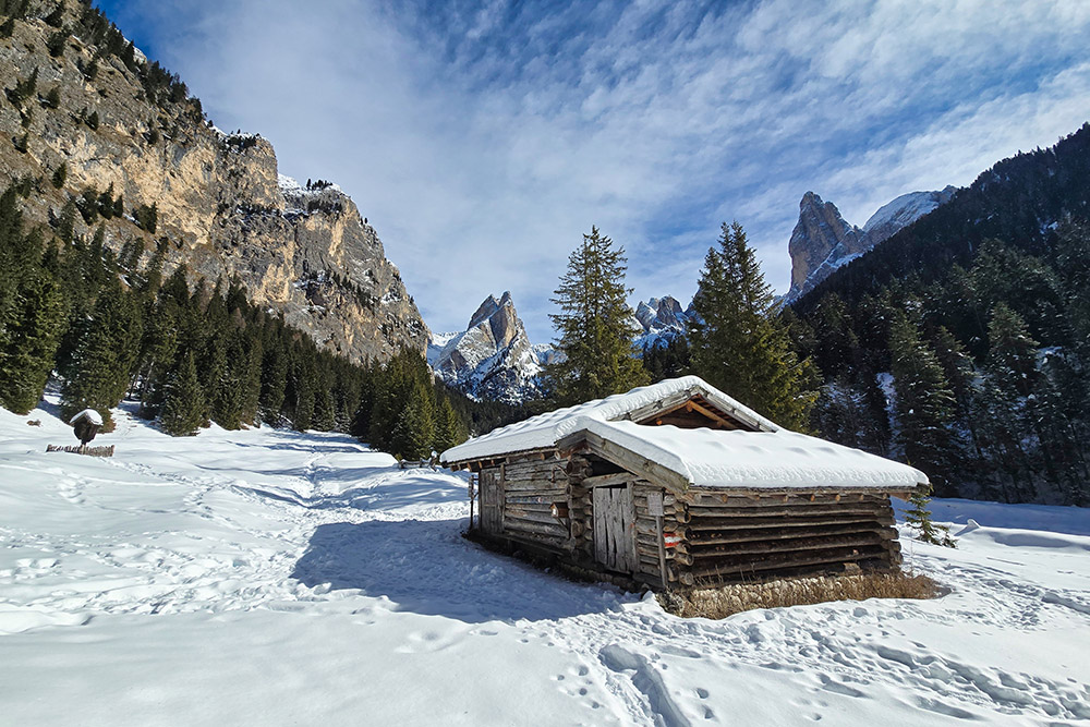
Raggiunto il Rechter Leger
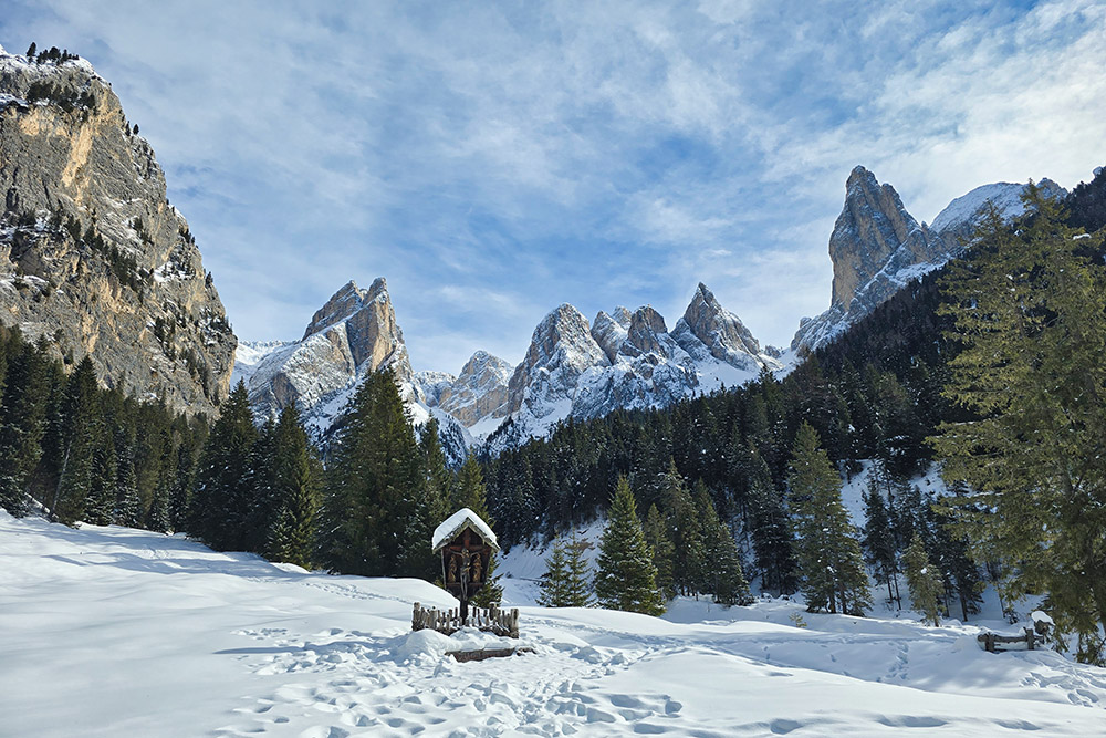
Panorama dal Rechter Leger
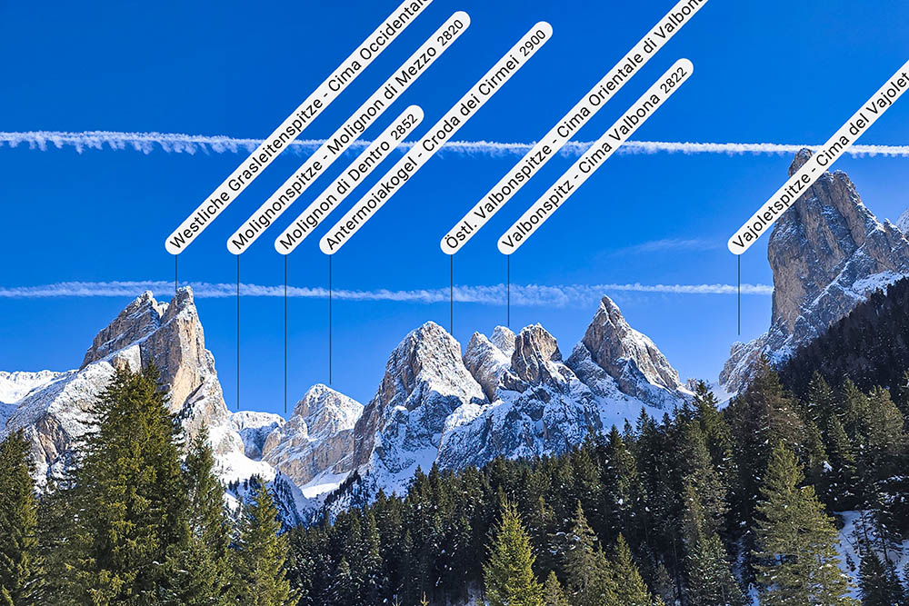
Cime del Catinaccio
Il Rechter Leger come punto di partenza
Si ritorna a valle
La Malga Untertrumpedeller


