


![]()


Durata
 5:45 h
Distanza
 9,9 km
 Ascesa
 950 m
950 mDiscesa
 950 m
950 mH Max
 1736 m
H Min
 822 m
822 mBailoni Bivouac and Marzola South Peak
DESCRIPTION
Hike to Marzola: from Bailoni Bivouac to 360-degree panoramas.
Geographical Location
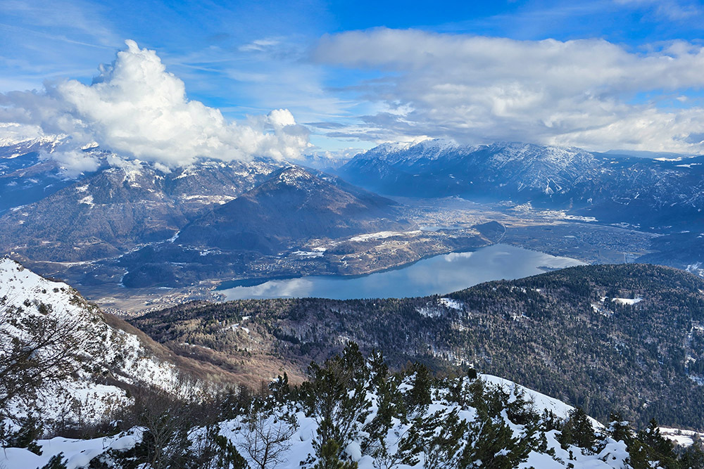
Marzola (North Peak 1738 m, South Peak 1736 m) is the mountain that separates the Adige Valley from Valsugana, in eastern Trentino. The massif extends across the municipalities of Trento, Pergine Valsugana, and Vigolo Vattaro, in the province of Trento.
Despite its modest altitude, Marzola's strategic position between the Trento basin and upper Valsugana makes it an exceptional panoramic viewpoint overlooking the heart of the Eastern Alps. Important communication routes run along its slopes, including the Valsugana railway line connecting Trento to Venice.
The Hike
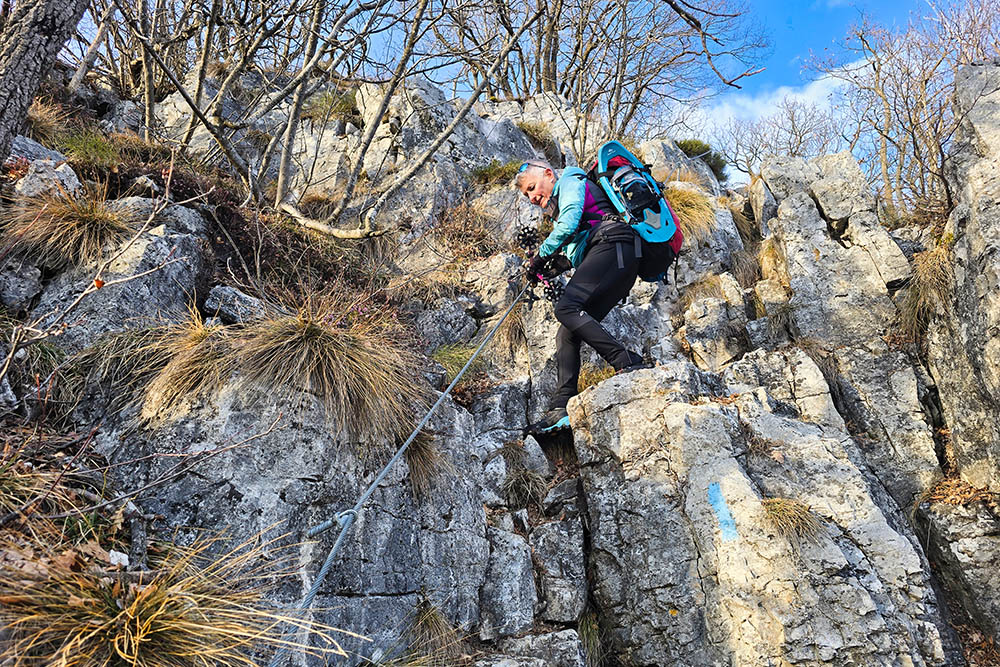
The itinerary to Marzola, feasible in both summer and winter, is challenging due to the overall elevation gain and requires good physical preparation. The greatest difficulty is concentrated on the descent trails 438 and 440, which cross exposed sections and feature two equipped passages with steel cables. In the presence of snow or ice, it is essential to carefully assess the safety of the descent; the prudent alternative is to return along the same outward route.
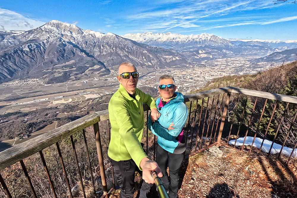
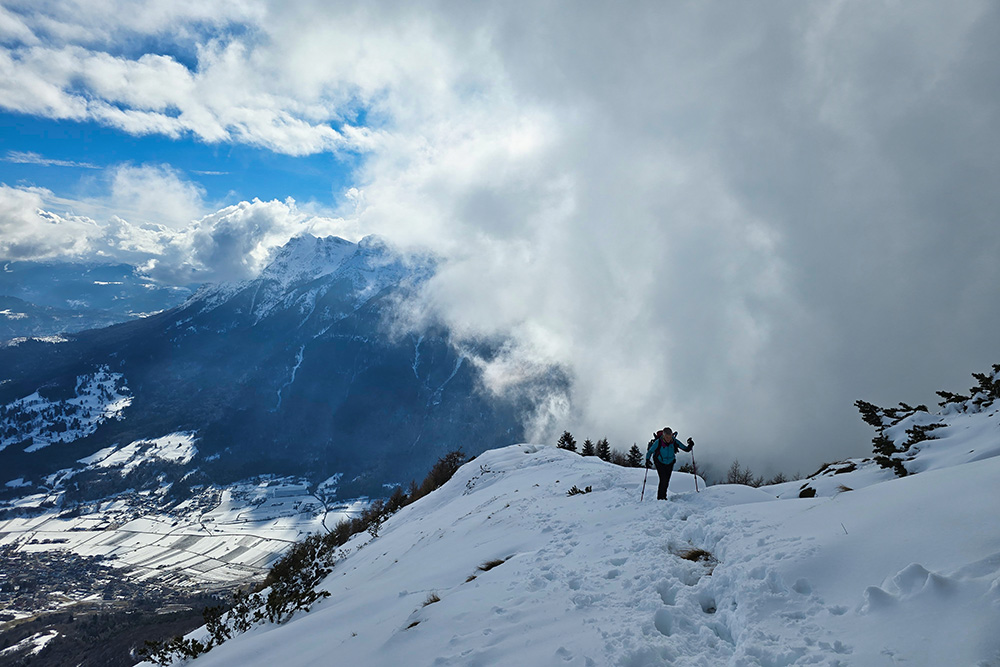
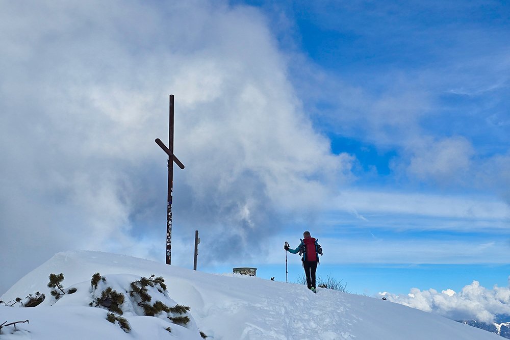
From a landscape perspective, Marzola offers an extraordinary 360-degree panorama spanning most of Trentino's mountain groups. From the summit, the view embraces the Brenta Group, the Lagorai chain, Carè Alto, Mount Stivo, Monte Baldo Massif, Mount Bondone, Vigolana Group, Paganella, and Pasubio. Towards the east, vistas open onto Alta Valsugana and the lakes of Caldonazzo and Levico. For those unfamiliar with the alpine skyline, an observation point equipped with orientation sights has been installed on the south peak to facilitate recognition of the surrounding summits.
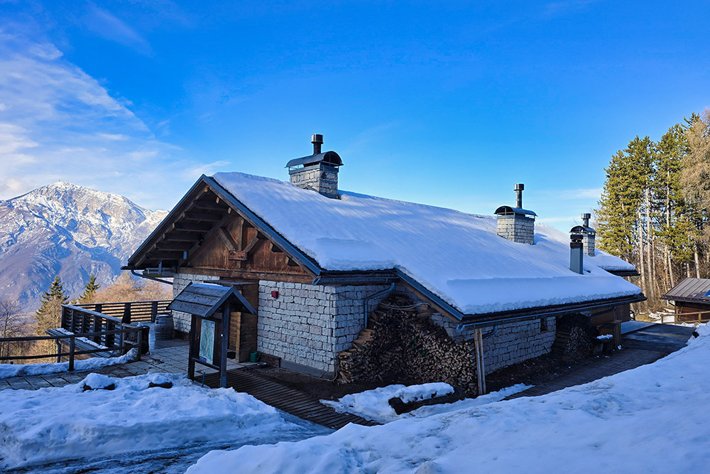
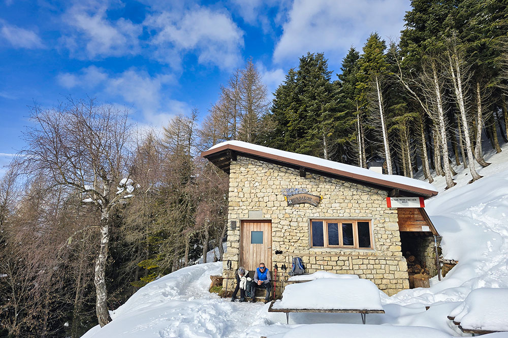
The Raffaele Bailoni Bivouac, always open and unstaffed, has 6 sleeping berths on a mezzanine, a wood stove, and a kitchenette.
History and Curiosities
During World War I, Marzola represented a crucial element in the defensive system of the city of Trento. The massif was tasked with blocking any Italian advances coming from Valsugana, operating in synergy with the Brusaferro and Doss Fornas forts, positioned in the Valsorda valley below. The mountain's bulk also protected the city from potential shelling from Italian positions located at Campomolon, south of the Folgaria and Lavarone plateaus.
The defensive transformation of Marzola reached its peak between September 1914 and May 1915, when the extensive Chegul-Marzola-Maranza fortified line was created: 19 kilometers of trenches, approximately 300 tunnels carved into the rock, 100,000 square meters of barbed wire entanglements, and numerous artillery positions.
Despite the imposing defensive apparatus, Marzola was never attacked. Nevertheless, numerous testimonies from those years are still visible along the trails: trenches, tunnels (the stoi of Chegul), positions, and ruins of fortifications that nature and time have only partially erased.
The Raffaele Bailoni Bivouac owes its name to a tragic story. The structure was built in the early 1960s as part of the Fanfani Law, a measure that promoted reforestation of Trentino's mountains through work programs. Raffaele Bailoni was one of the workers assigned to the construction: he died tragically, run over by his tractor while heading to the construction site. The structure, completed despite the accident, bears his name in memory of his sacrifice.
ITINERARY
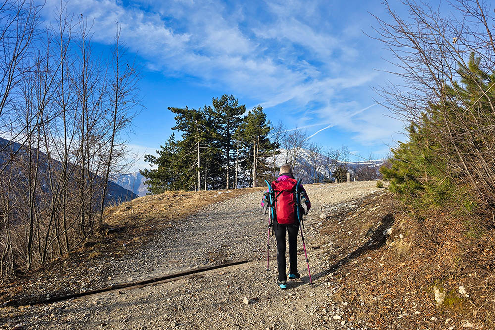
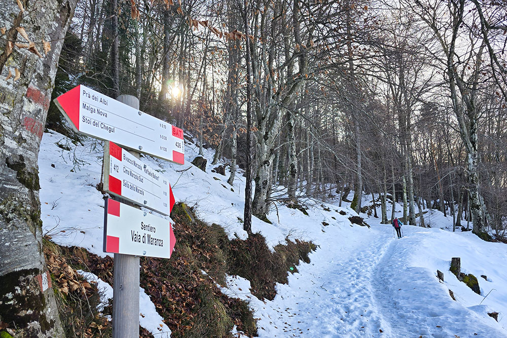
From the parking area (822 m) ascend along a dirt road following trail marker 429. At the locality of Mas del Pasolot (961 m), the dirt road becomes a path, continuing to climb through the woods. Near the Maranza mountain hut, just before reaching it, there is a deviation to the right leading to the viewpoint overlooking the Adige Valley.
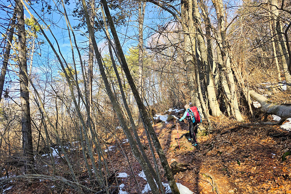
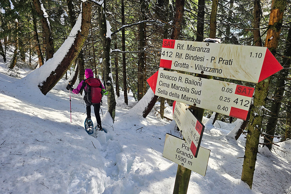
From Maranza mountain hut (1080 m), take trail marker 412 towards Bailoni Bivouac. The path ascends with frequent switchbacks. After approximately one and a half hours of walking, you reach Bailoni Bivouac (1623 m).
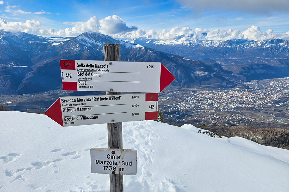
From the bivouac, continue on trail 412 to reach Marzola South Peak (1736 m) in about 20 minutes. The route gradually leaves the woods and opens onto summit meadows.
After returning to the bivouac, continue the loop downhill. The path first descends to Prà Grando (1590 m), where you take trail 438. Subsequently, at Prà Picol (1390 m), trail 438 ends and trail 440 begins, known as Croz de le Ore. This is an equipped path featuring two short sections with steel cables and some exposed passages, crossing ancient World War I walkways and trenches. Trail 440 finally leads back to the starting point, completing the loop.
EXCURSION DATE
February 8, 2026
STARTING POINT
Vigolo Vattaro
REFRESHMENT POINT
None in winter
AUTHOR'S SUGGESTIONS
Always check the avalanche bulletin before setting out.
SAFETY TIPS
The stability of the snowpack is subject to sudden and unpredictable changes. For your safety, always consult the avalanche bulletin, because the snowpack is subject to rapid changes; ask for information from the competent local offices. Our GPX tracks are only indicative, meaning the route was carried out under the best snow and weather conditions of that day. Therefore, always assess what to do on site.
Also remember to evaluate the route based on your physical abilities, training, and equipment.
It is advisable to let someone know the itinerary you intend to follow.
Remember that the emergency number is 112.
EQUIPMENT
It is recommended to have suitable equipment: avalanche self-rescue kit (consisting of ARVA transceiver, shovel, and probe), snowshoes, trekking poles, crampons, goggles, sunscreen, trekking boots, winter clothing, gloves, hat, backpack with hot drinks.
RECOMMENDED MAPS
Tabacco 062 Altopiano di Pinè - Valli di Cembra e Dei Mocheni
INTERESTING LINKS
http://www.trentinograndeguerra.it/context.jsp?area=101&ID_LINK=250&id_context=1122
HOW TO ARRIVE
A22 Trento Sud: at the first roundabout turn right. At the second roundabout take the 4th exit onto Via Marinai d'Italia, at the third roundabout take the 3rd exit onto Via Edmund Mach. Continue uphill until merging onto SS349. Upon reaching Vigolo Vattaro, turn left at the intersection (there is a large stone cross) onto Via Fontanelle and ascend for 1.9 km until you reach the parking area.
PARKING AREA
Free at the end of Via Fontanelle
GPS Coordinates: 46.009376, 11.176700
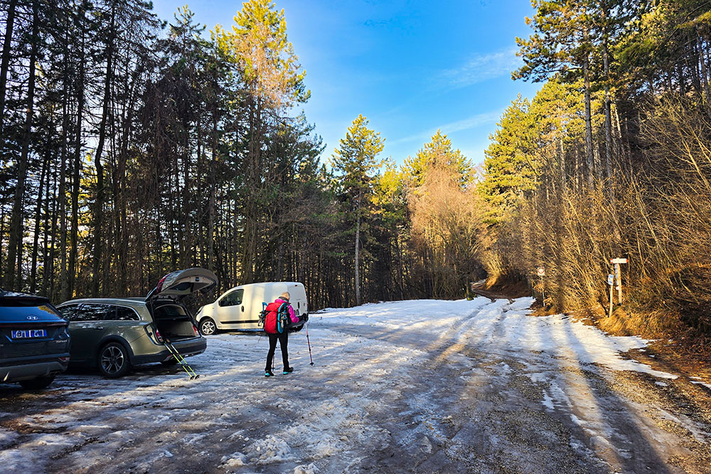
Parcheggio a Vigolo Vattaro
Primo tratto di strada sterrata
Inizio sentiero
Punto panoramico sulla Valle dell'Adige
Rifugio Maranza
Si continua sul sentiero 412
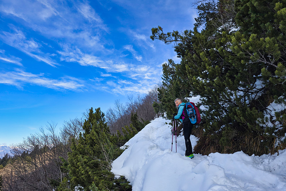
Il manto nevoso aumenta
Ultimo tratto
Arrivati in vetta alla Cima Marzola Sud
Vista verso la Valsugana
In vetta con il Brenta alle spalle
Il Bivacco Bailoni
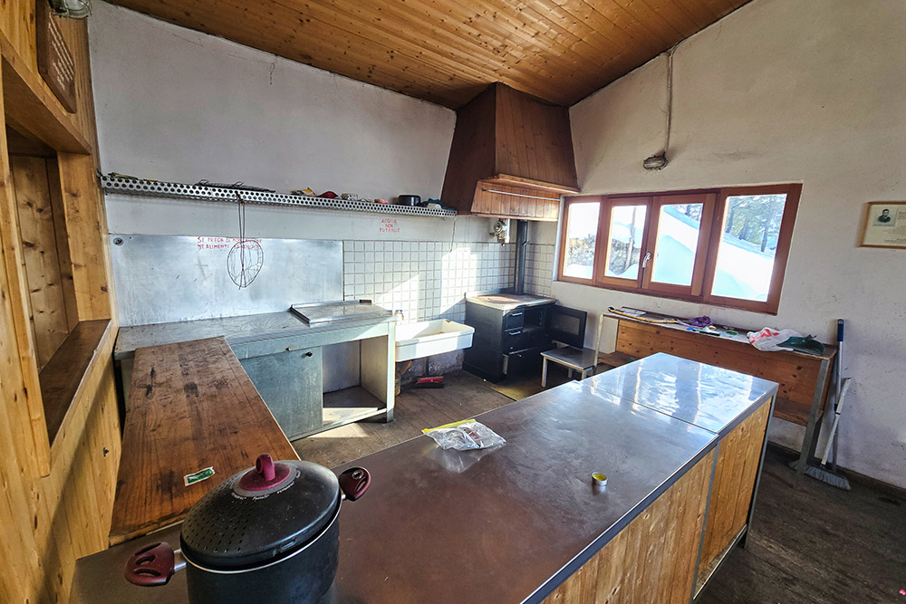
All'interno del bivacco
Ritorniamo a valle
Sul sentiero Croz de le Ore


