


![]()


Durata
 4:08 h
Distanza
 9,6 km
 Ascesa
 354 m
354 mDiscesa
 354 m
354 mH Max
 1601 m
H Min
 1375 m
Forest Hut, Val di Ròda, and Malga Civertaghe
DESCRIPTION
Following the trail of Malga Civertaghe: a winter hike in the Paneveggio-Pale di San Martino Nature Park.
Geographical location
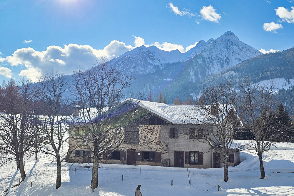
San Martino di Castrozza is located in the Upper Primiero Valley, in eastern Trentino, at an altitude of 1,450 meters. This inhabited center is part of the municipality of Primiero San Martino di Castrozza and lies in a wide grassy basin, completely surrounded by the Paneveggio-Pale di San Martino Nature Park. The park protects three geographical-landscape units of exceptional value: the large Norway spruce forest (Paneveggio Forest), the Dolomite complex of the Pale di San Martino, and the Lagorai mountain range.
Hike
This loop itinerary is one of the most rewarding hikes starting from the town of San Martino di Castrozza. The route is particularly suitable during the winter season when it can be tackled with snowshoes: the beauty of the snowy landscape and its relative ease make it accessible even with abundant snow cover.
The entire path develops at a low altitude, between 1,375 and 1,600 meters, winding completely inside the woods. This characteristic ensures a very low, if not non-existent, avalanche risk, making the hike safe even on winter days. No particular technical skills are required, but a minimum level of fitness is advisable to comfortably handle the elevation changes.
It's important to note that there are no open refreshment points along the route. Throughout the entire itinerary, you can enjoy a wide panorama of the Pale di San Martino to the east, with their characteristic Dolomite towers that turn pink at sunset, and of the Lagorai Group to the west, with its dark volcanic rocks.
History and curiosities
San Martino di Castrozza owes its origins to the ancient Hospice of Saints Martin and Julian, probably founded in the 12th century to welcome pilgrims crossing the Rolle Pass.
ITINERARY
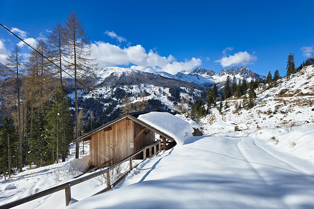
From San Martino di Castrozza (1462 m), follow the asphalt road towards Maso Còl. Before reaching the farmhouse, on the left, take trail no. 23 leading towards Malga Val di Roda. Upon reaching Prati Còl (1500 m), deviate onto trail 22 and ascend to the Forest Hut Malga Val di Roda (1551 m).
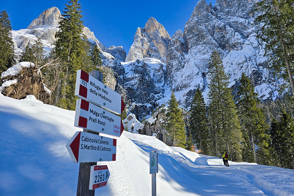
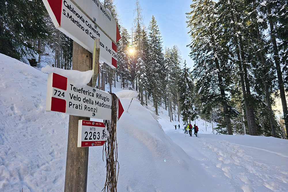
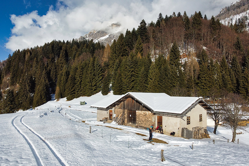
From the forest hut, continue up the Val di Roda valley, joining trail 721. At the junction for the Velo della Madonna mountain hut, leave trail 721 and descend, reaching in a few hundred meters the Sora Ronz forest road that leads to the ruins of Malga Sora Ronz (1580 m). From here, following trail 713, descend to Malga Civertaghe (1375 m).
From Malga Civertaghe, proceed north along a section of the forest road in the direction of San Martino di Castrozza, following trail marker 23. After about 300 meters, ascend again on trail 23 which leads back to Prati Còl. From here, return to the starting point by following the initial track in reverse back to San Martino di Castrozza.
EXCURSION DATE
February 1, 2026
STARTING POINT
San Martino di Castrozza
REFRESHMENT POINT
None
AUTHOR’S SUGGESTIONS
In winter, always check the avalanche bulletin before departure.
SAFETY ADVICE
The stability of the snowpack is subject to sudden and unpredictable changes. For your safety: always consult the avalanche bulletin, as the snowpack is subject to rapid changes, and ask for information at the local competent offices. Our GPX tracks are only indicative, meaning the route was completed under the best snow and weather conditions of that day. Therefore, always assess on-site what to do.
Also, remember to evaluate the route based on your physical abilities, fitness level, and the equipment you have available.
It is advisable to inform someone of the itinerary you intend to follow.
Remember that the emergency number is 112.
EQUIPMENT
It is recommended to have suitable equipment: avalanche rescue kit (consisting of an avalanche transceiver, shovel, and probe), snowshoes, poles, crampons, snow goggles, sunscreen, trekking boots, winter clothing, gloves, hat, backpack with hot drinks.
RECOMMENDED MAPS
Tabacco 022 Pale di San Martino
INTERESTING LINKS
https://www.sanmartino.com/it
HOW TO ARRIVE
From Borgo Valsugana, take the SS47 to Primolano. Here, take the SS50bis, then the SR50, and finally the SS50.
PARKING AREA
Free in San Martino di Castrozza
GPS Coordinates: 46.260143, 11.808978
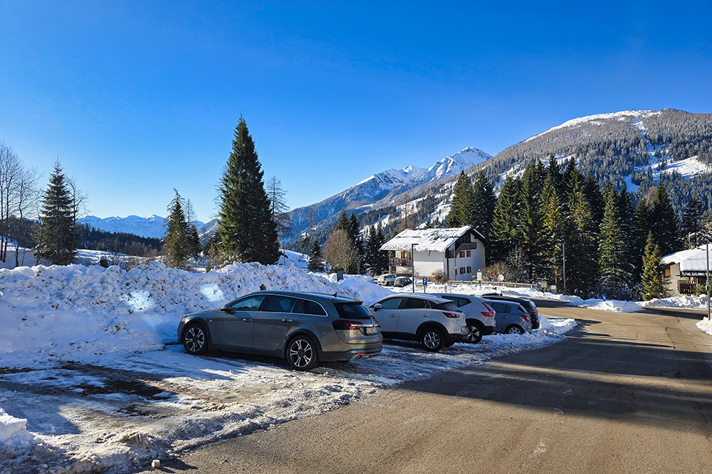
Parcheggio a San Martino di Castrozza
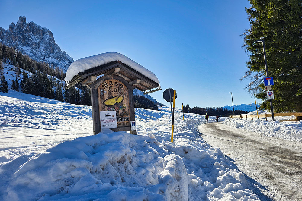
Si va verso Maso Col
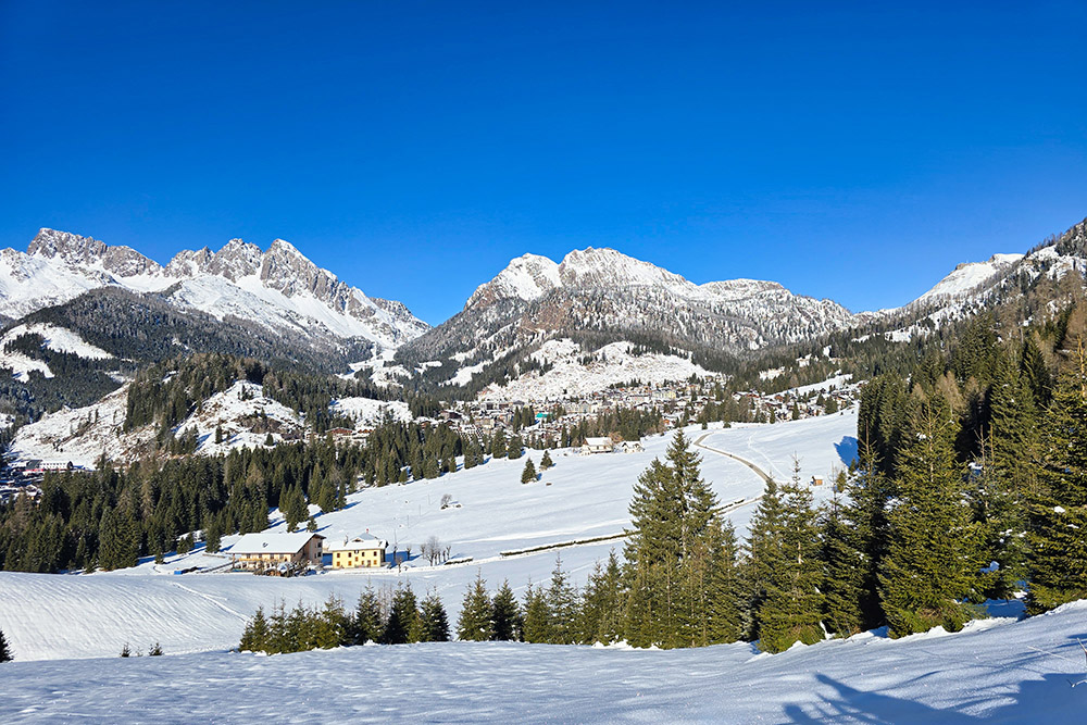
Panorama verso San Martino di Castrozza
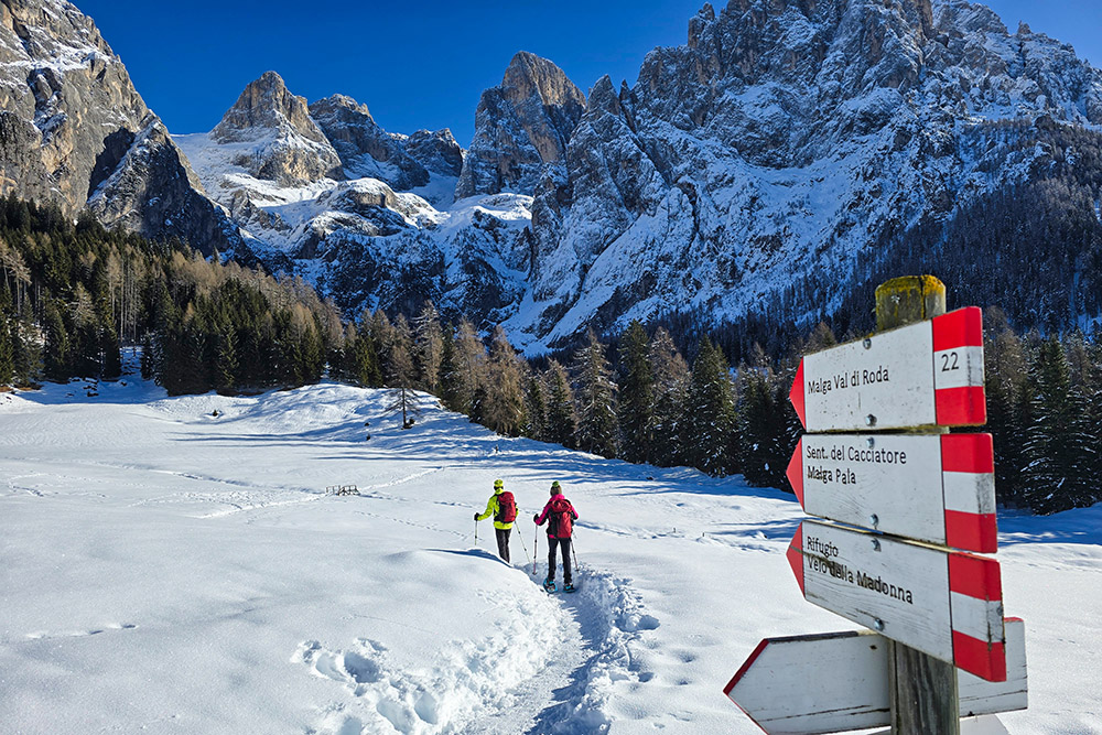
Deviazione per la Malga Val di Roda
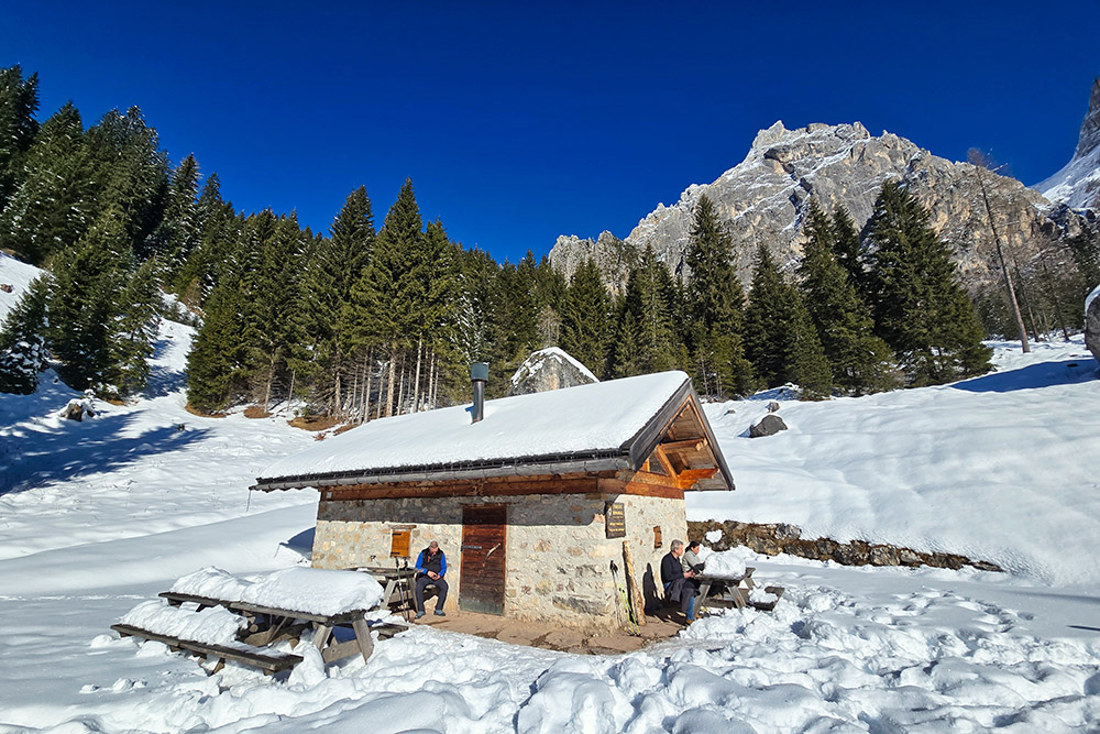
Arrivati al Rifugio Forestale Malga Val di Roda
Continuiamo a salire la Val di Roda
Ora si scende verso la Strada Sora Roda
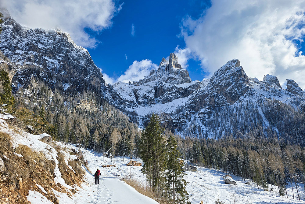
Bellissimo panorama
Stazione a valle della teleferica del Rifugio Velo della Madonna
Malga Civertaghe
Bacino idrico vicino alla malga

Si continua sul 23
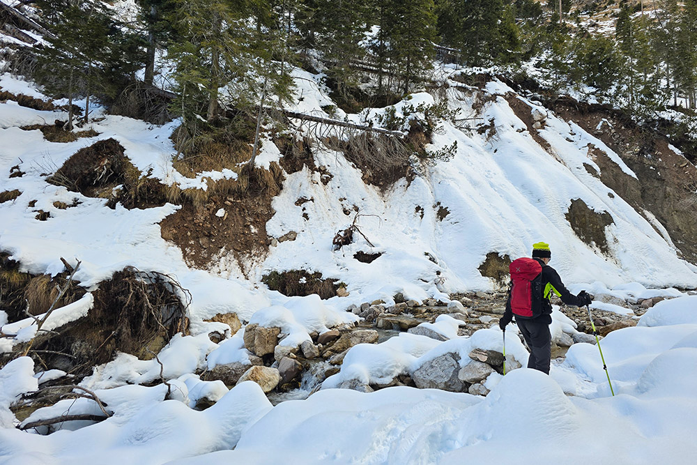
Attraversamento Rio Val di Roda
Ritornati ai Prati Col
Le Pale al tramonto


