


![]()


Durata
 3:55 h
Distanza
 8,9 km
 Ascesa
 276 m
276 mDiscesa
 276 m
276 mH Max
 1549 m
H Min
 1321 m
Cimbrian Imagination Trail and Campo Luserna Fort
DESCRIPTION
Between Cimbrian legends and Great War fortresses.
Geographical Location
Luserna (Lusérn in the Cimbrian language) is located at 1333 meters above sea level in southeastern Trentino, along the border with Veneto. The village is part of the Magnifica Comunità degli Altipiani Cimbri, together with the municipalities of Folgaria and Lavarone, and is situated on the southern sector of the plateau overlooking the Val d'Astico.
Hike
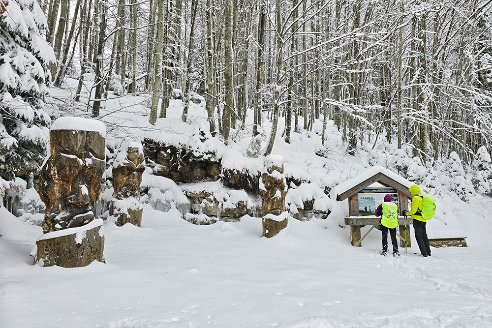
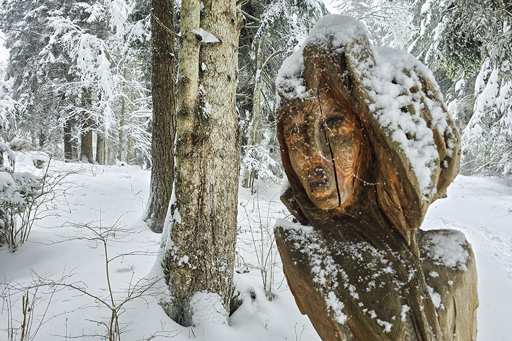
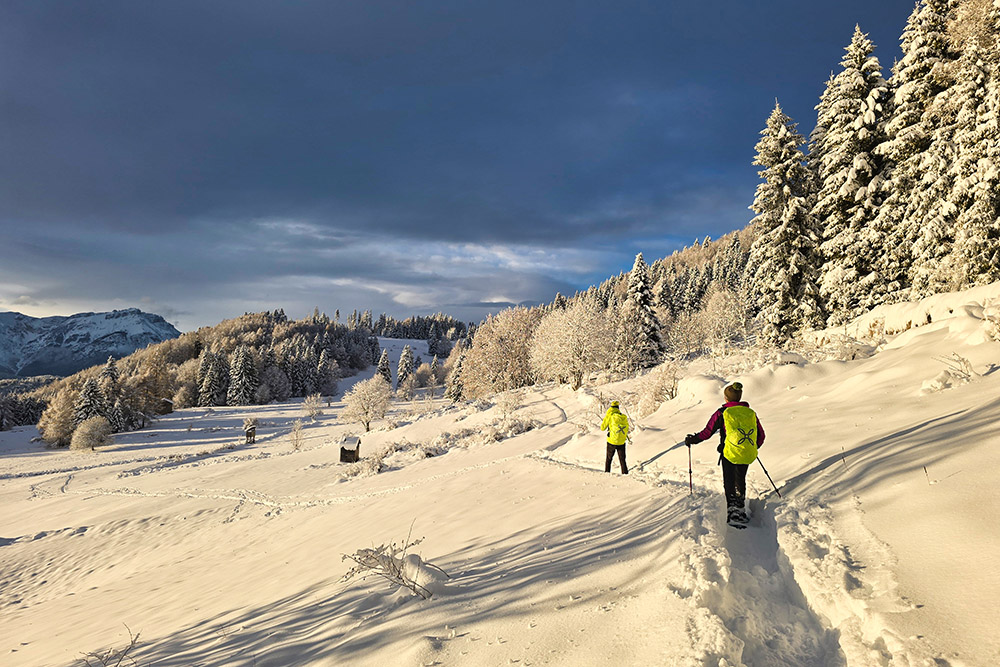
The Cimbrian Imagination Trail is one of the most fascinating walks on the Alpe Cimbra. This loop trail of about 7 kilometers winds through meadows and fir forests, offering breathtaking glimpses of the Val d'Astico and guiding hikers to discover Cimbrian folklore through wooden sculptures and illustrative panels.
The trail has a very gentle slope and runs for about 4.5 kilometers to the Malga Campo mountain hut, which can be covered in about two hours.
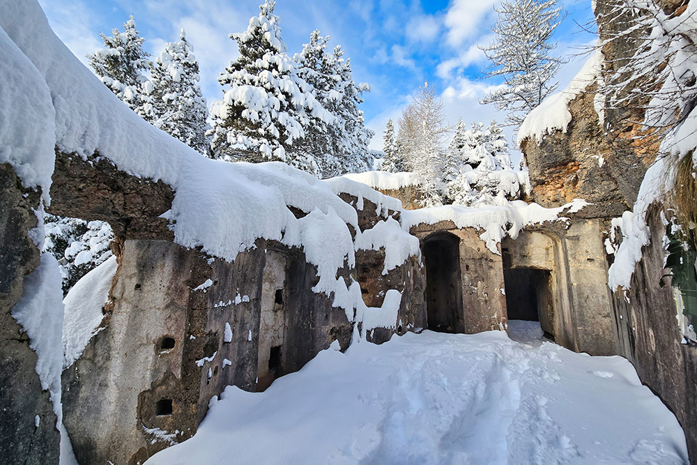
Those who wish to delve into the history of the Great War can add a detour of about 2.5 kilometers to the fortified complex of Forte Campo Luserna, maintaining the same accessibility characteristics as the main trail. The fort can be visited along with the two military outposts of Oberwiesen and Viatz, connected by a 100-meter underground tunnel dug into the rock.
History and Curiosities
Luserna preserves a unique cultural heritage: it is the last enclave in Trentino where the Cimbrian language is still fluently spoken by about 90% of the population. This ancient idiom, derived from medieval Bavarian, was brought here by Germanic settlers who arrived between the 10th and 13th centuries. Linguists consider Cimbrian the oldest existing peripheral spoken language of the German linguistic domain and the southernmost in the Alps.
Between 1907 and 1912, the Austro-Hungarian Empire built seven imposing fortresses between Folgaria and Vezzena, representing the cutting-edge military technology of the time. The fortified complex of Campo Luserna, nicknamed Il Padreterno (The Almighty) by Italian soldiers for its grandeur, was armed with 4 x 10 cm howitzers in rotating armored domes, 2 x 8 cm rapid-fire cannons, and 19 machine guns distributed between the main structure and the two outposts. Besides Forte Campo, other testaments to this historical period in the Luserna area are Forte Verle and the Fortified Observatory of Cima Vezzena.
ITINERARY
From the center of Luserna (1333 m), take Via Cima Nora heading south, joining the Cimbrian Imagination Trail. The path climbs gently through meadows and wooded areas, encountering sculptures and panels dedicated to characters from Cimbrian legends. After about 4.5 kilometers, you reach the Malga Campo mountain hut (1452 m), located in a sunny clearing surrounded by fir forests.
Those wishing to visit the fortified complex leave the Cimbrian Imagination Trail here and follow the signs for Forte Campo di Luserna. After reaching the fort (1549 m), briefly head back to visit the Oberwiesen Outpost (1510 m). Near the outpost, take the underground tunnel that leads directly to the Viatz Outpost (1500 m). Once the visit to the fortified complex is complete, return to the mountain hut and resume the Cimbrian Imagination Trail, which crosses wide meadows and forests, leading easily back to Luserna.
EXCURSION DATE
January 25, 2026
STARTING POINT
Luserna
REFRESHMENT POINT
Malga Campo mountain hut
AUTHOR’S SUGGESTIONS
Bring a flashlight.
SAFETY ADVICE
Snowpack stability is subject to sudden and unpredictable changes. For your safety, always check the avalanche bulletin, as snow conditions can change rapidly; ask for information at local competent offices. Our GPX tracks are only indicative, meaning the route was completed under the best snow and weather conditions of that specific day. Therefore, always evaluate the situation on-site.
Furthermore, remember to assess the route based on your physical abilities, training, and the equipment you have.
It is advisable to inform someone of the itinerary you intend to follow.
Remember that the emergency number is 112.
EQUIPMENT
It is recommended to have suitable equipment: avalanche rescue kit (consisting of an avalanche transceiver, shovel, and probe), snowshoes, trekking poles, microspikes/crampons, sunglasses, sunscreen, hiking boots, winter clothing, gloves, hat, backpack with warm drinks.
RECOMMENDED MAPS
Tabacco Map 057 Levico - Altopiani di Folgaria Lavarone e Luserna
INTERESTING LINKS
https://www.trentino.com/it/trentino/alpe-cimbra-folgaria-lavarone-luserna-vigolana/luserna/
HOW TO ARRIVE
From Levico Terme, follow the SP133dir, SP133, and SP9 to Luserna.
PARKING AREA
In Luserna
GPS Coordinates: 45.922169, 11.322742
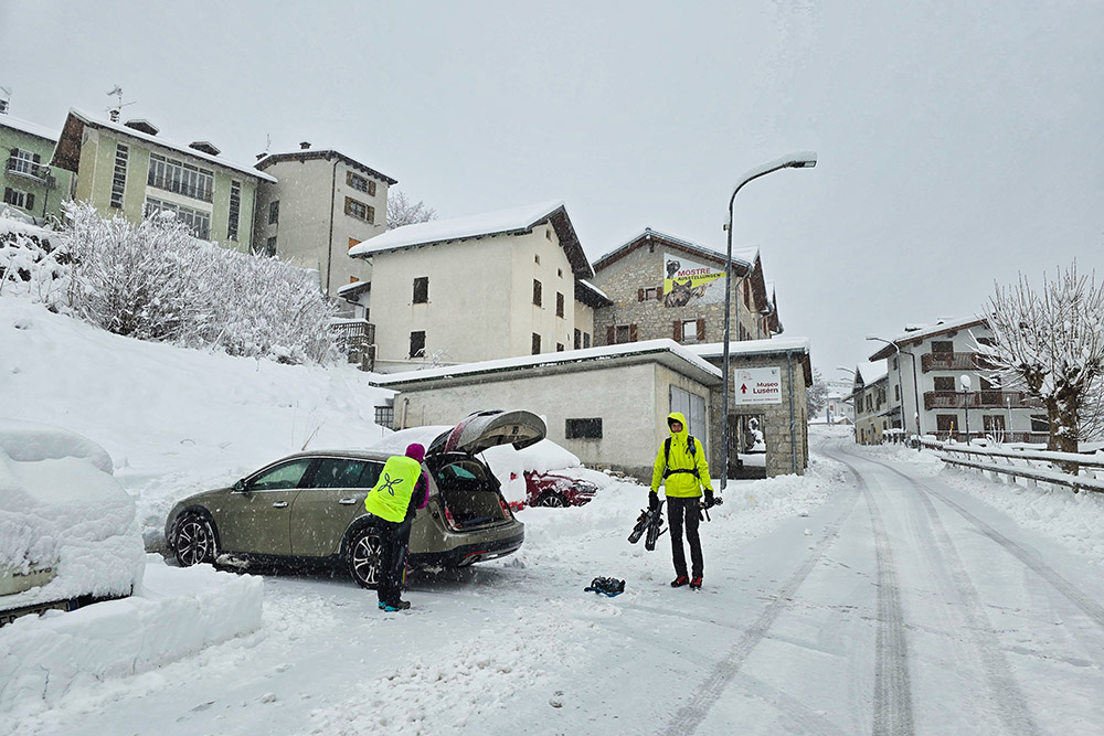
Parcheggio a Luserna
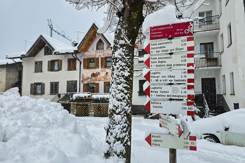
Indicazioni in Piazza Cesare Battisti
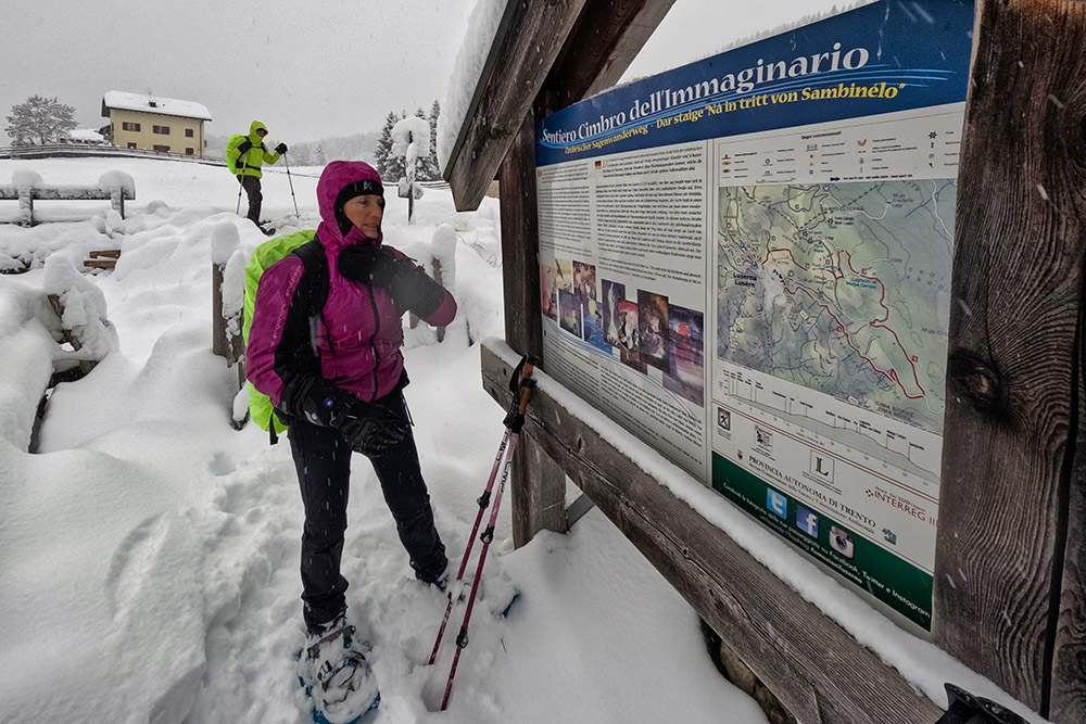
Inizio del Sentiero Cimbro dell'Immaginario
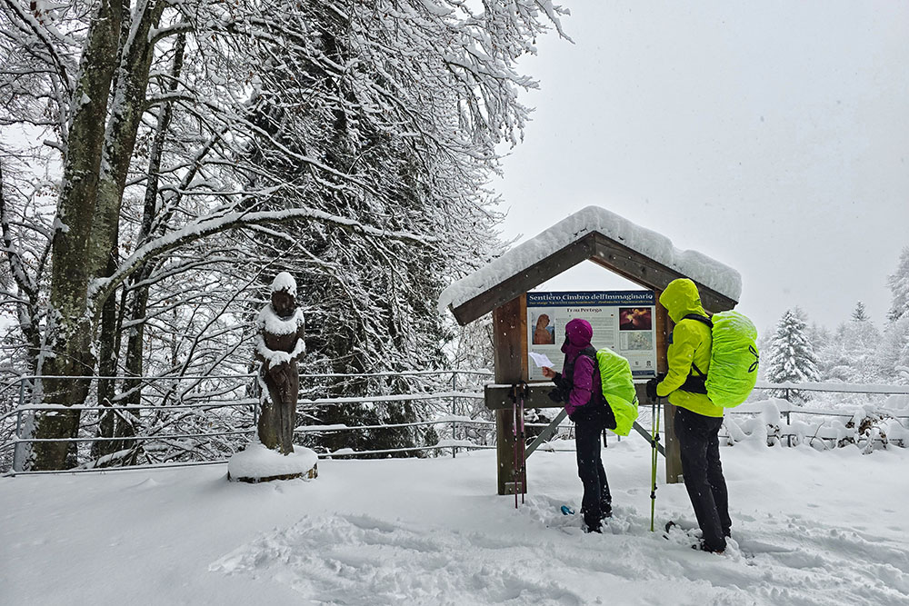
Prima scultura - Frau Pertega
Seconda scultura
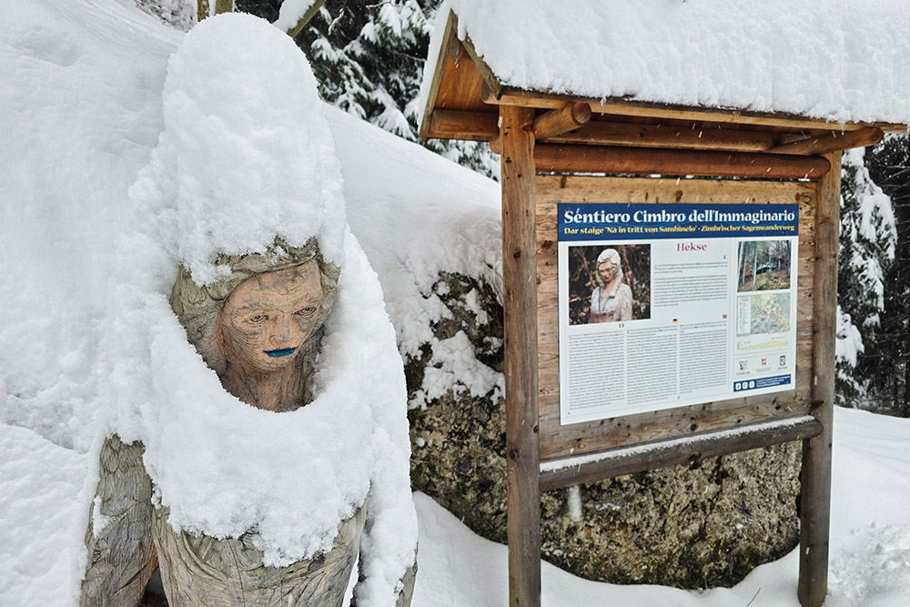
Hèkse
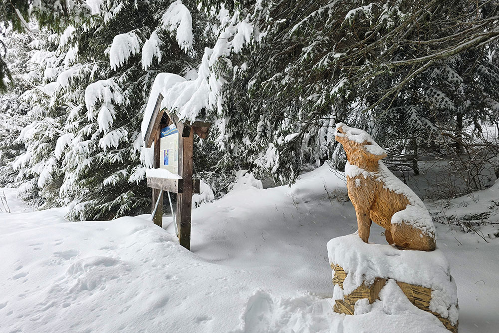
Il Lupo
Trut
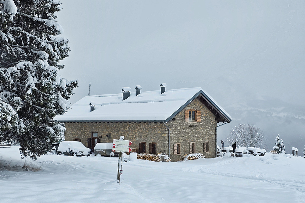
Rifugio Malga Campo

Gustoso piatto della malga
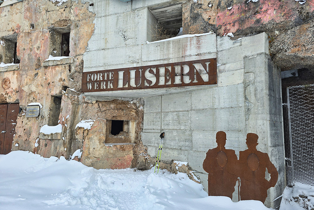
Forte Campo di Luserna
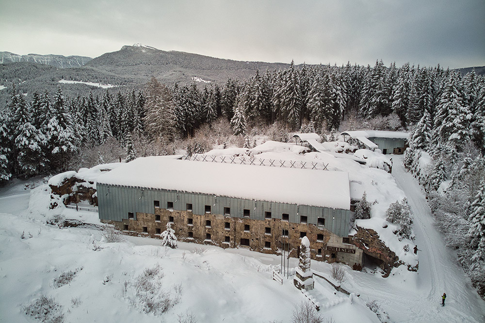
Il forte visto dall'alto
Avamposto Oberwiesen
Avamposto Oberwiesen
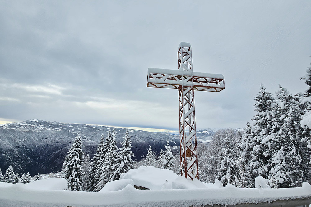
Si rientra con il sole


