


![]()


Durata
 3:45 h
Distanza
 9 km
9 km Ascesa
 626 m
626 mDiscesa
 626 m
626 mH Max
 2137 m
H Min
 1676 m
Monte Sam and Malga Öttenbacher
DESCRIPTION
A winter hike through the sunny pastures of the Sarentino Valley.
Geographical Location
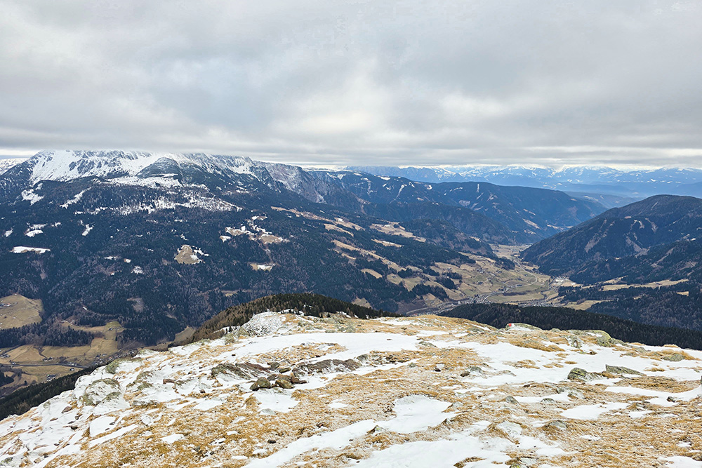
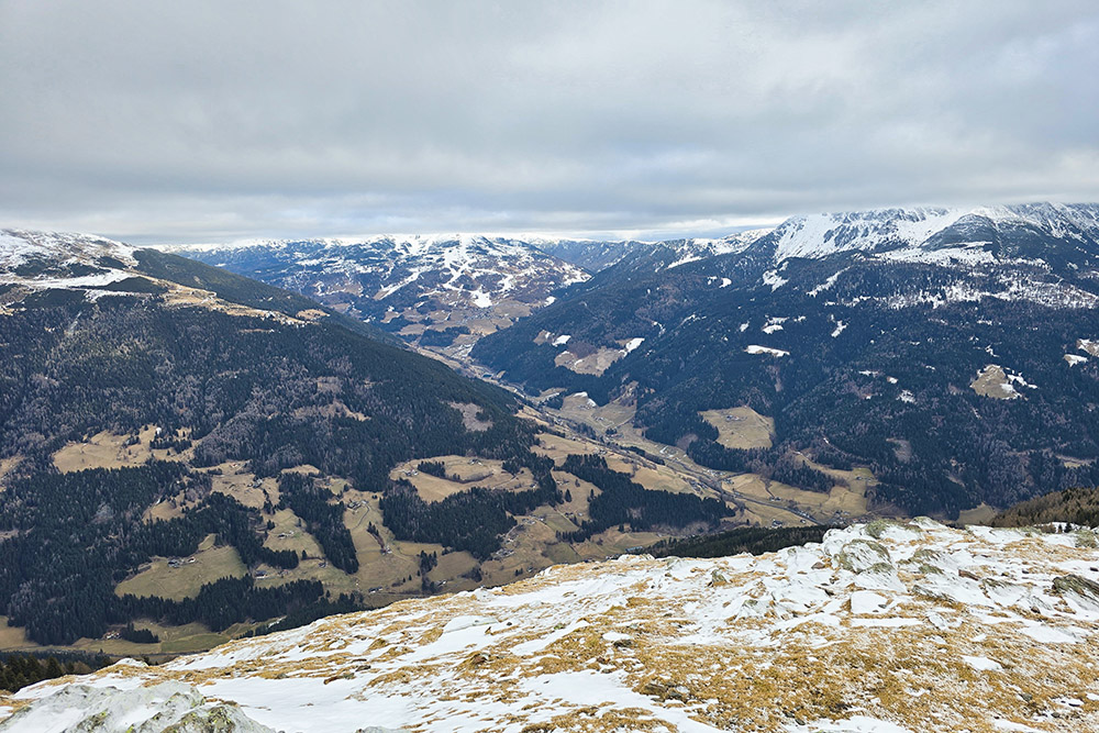
Monte Sam, or Öttenbacher Berg, is located in the Sarentino Valley, to the north/west of the town of Sarentino in South Tyrol. It is part of the Sarntal Alps, the mountain group that surrounds the Sarentino Valley in a horseshoe shape. The summit of Sam, at an altitude of 2137 meters, is situated in a panoramic position between the Sarentino Valley and the Merano 2000 hiking and skiing area, reachable by cable car from Merano and Avelengo.
The Hike
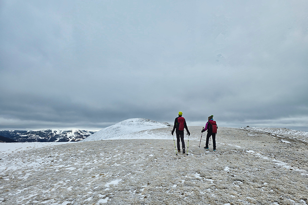
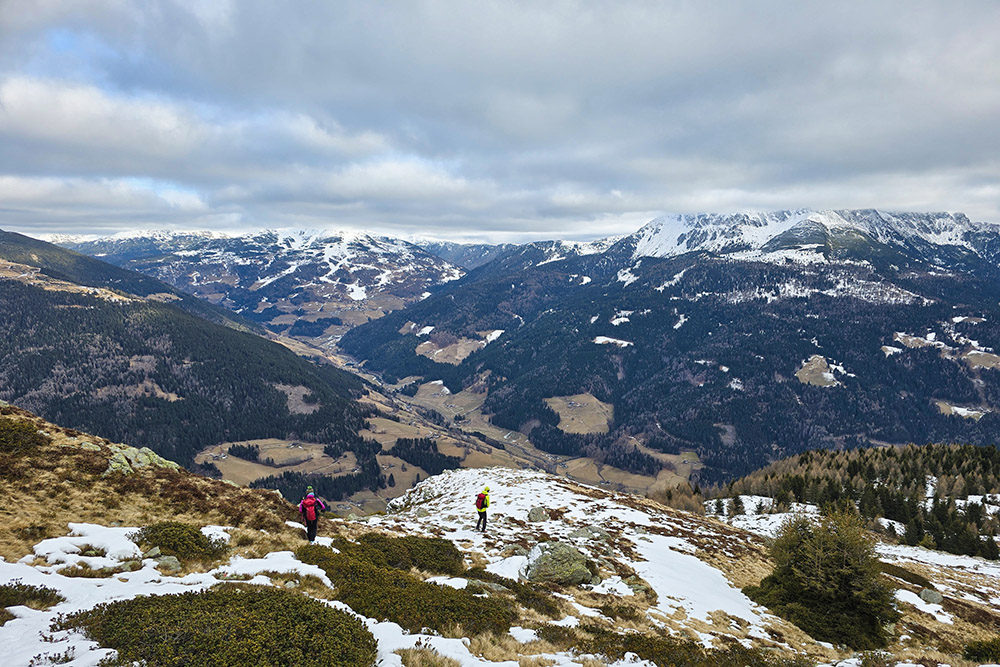
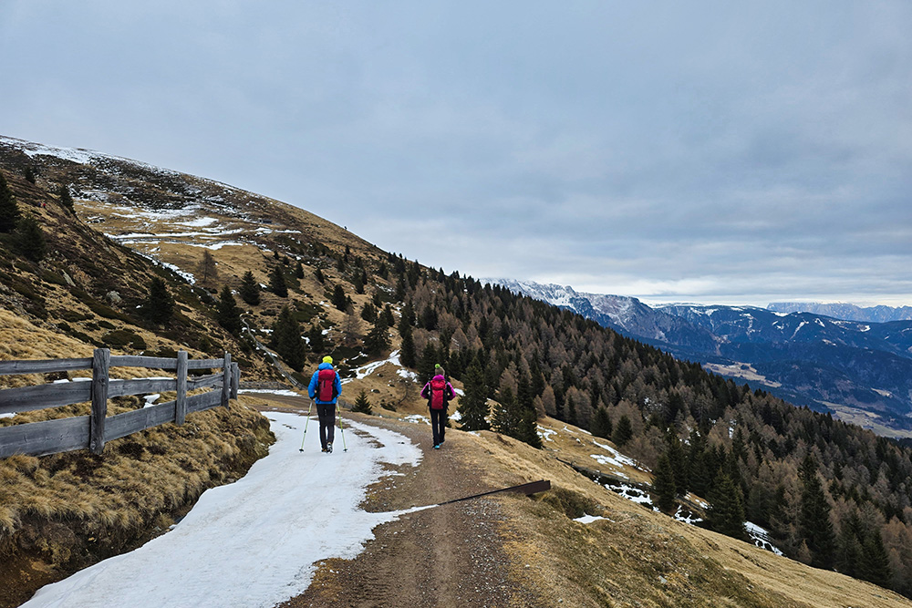
This winter hike leads to the Öttenbacher Berg, more commonly called Sam, a grassy peak overlooking the town of Sarentino. The route is distinguished by its favourable sun exposure, which guarantees pleasant conditions throughout the day, and by its tranquil and uncrowded environment, despite the proximity to the Merano 2000 ski area.
The itinerary winds through wide alpine pastures. The ascent is technically simple and represents an ideal hike even for those wishing to go up with snowshoes.
For those wishing to extend the hike, under safe conditions and with good preparation, there is the possibility of crossing the summit and descending the southern slope, reaching the Malga Öttenbacher again via the Öttenbacheralmweg trail. This variant requires about an additional 1.5 hours and allows for a wider loop.
History and Curiosities
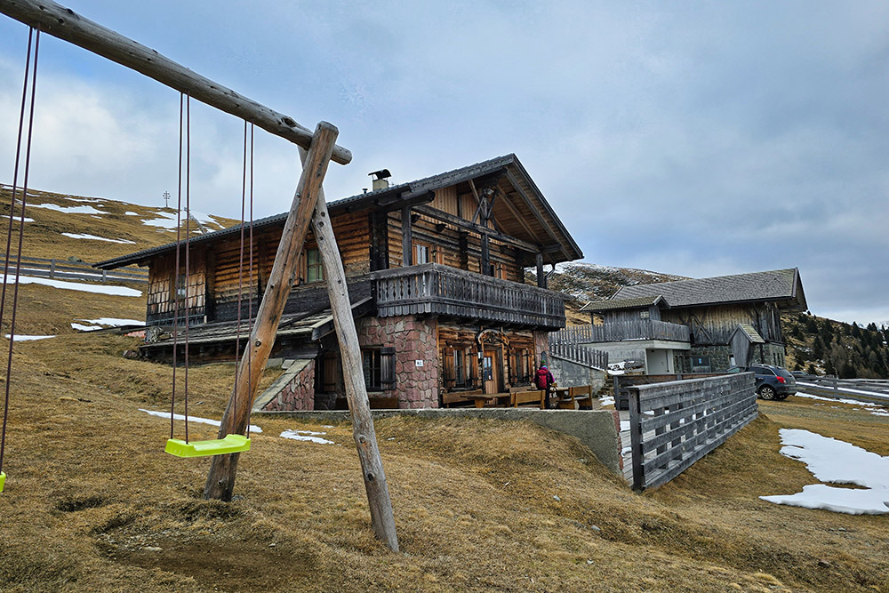
The Malga Öttenbacher (Öttenbacher Alm), located at 1942 meters above sea level, represents one of the historical landmarks of the Sarentino Valley. The malga stands on one of the most extensive pastures in the valley, an alpine environment that comes alive in the summer months with livestock grazing and traditional agricultural activities.
ITINERARY
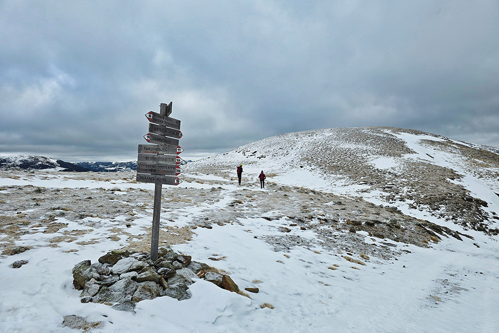
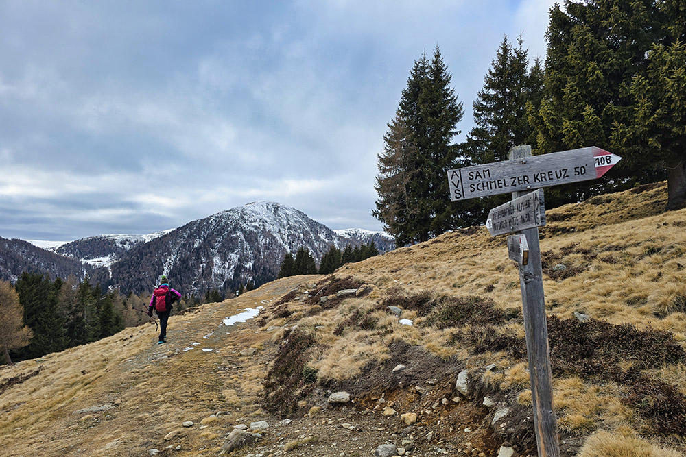
From the Öttenbach parking area (1684 m), take trail number 15 for a short stretch, then turn right onto trail 2A and subsequently continue uphill following trail 10A. The path initially crosses through the forest before opening onto pastures, offering wide panoramic views.
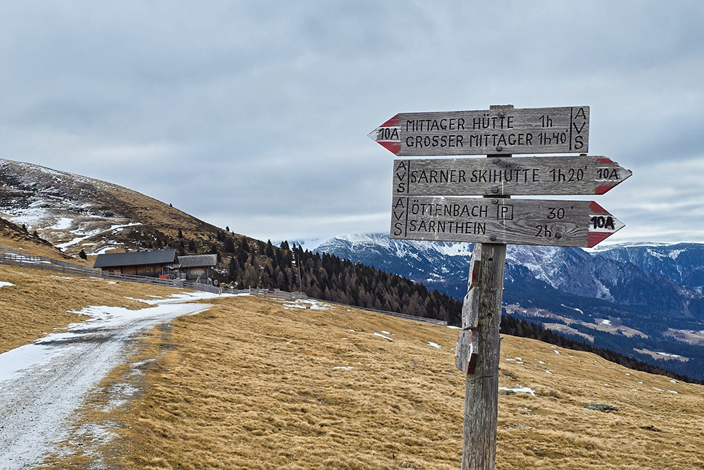
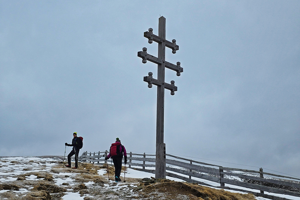
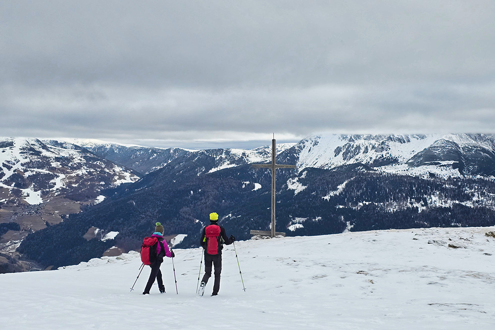
You pass near the Malga Öttenbacher (1942 m) and continue climbing until you reach a fork at about 2045 meters above sea level. Here you proceed on trail 10B towards the summit of Sam. Once you reach the summit of Monte Sam (2137 m), where a wooden cross is located, you can admire the 360-degree panorama over the Sarntal Alps.
For the return, you continue the loop by descending the southeast slope, still following marker 10B. Upon reaching the intersection with trail 10, turn right and climb back up to the Malga Öttenbacher (1942 m). From here, return to the starting point by following the comfortable unpaved road that leads back to the parking area.
EXCURSION DATE
17 January 2026
STARTING POINT
Öttenbacher Parkplatz parking area
REFRESHMENT POINT
Malga Öttenbacher
AUTHOR’S SUGGESTIONS
In winter, always check the avalanche bulletin before setting off.
SAFETY ADVICE
Snowpack stability is subject to sudden and unpredictable changes. For your safety, always consult the avalanche bulletin, as the snowpack is subject to rapid changes; ask for information at the competent local offices. Our GPX tracks are only indicative, meaning the route was done under the best possible snow and weather conditions of that day. Therefore, always evaluate on-site what to do.
Also, remember to assess the route based on your physical abilities, training, and available equipment.
It is advisable to inform someone of the itinerary you intend to follow.
Remember that the emergency number is 112.
EQUIPMENT
It is recommended to have suitable equipment: avalanche self-rescue kit (consisting of an avalanche transceiver, shovel, and probe), snowshoes, trekking poles, crampons, sunglasses, sunscreen, trekking boots, winter clothing, gloves, hat, backpack with hot drinks.
RECOMMENDED MAPS
Tabacco Map 040 Monti Sarentini / Sarntaler Alpen
INTERESTING LINKS
https://www.sarntal.com/it/
HOW TO ARRIVE
From Bolzano, take the SS5 8 and climb into the Sarentino Valley to the town of Sarentino. Just past the town, turn left and follow the sign for Öttenbach/Riodeserto for 7.7 km.
PARKING AREA
Öttenbacher Parkplatz parking area
GPS coordinates: 46.664518, 11.308206
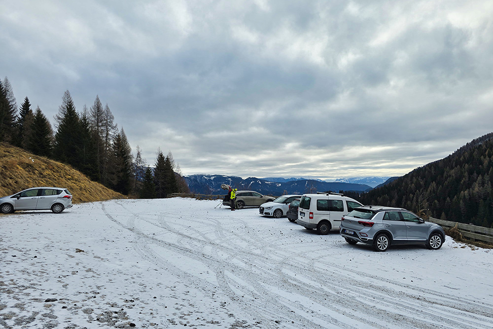
Öttenbacher Parkplatz
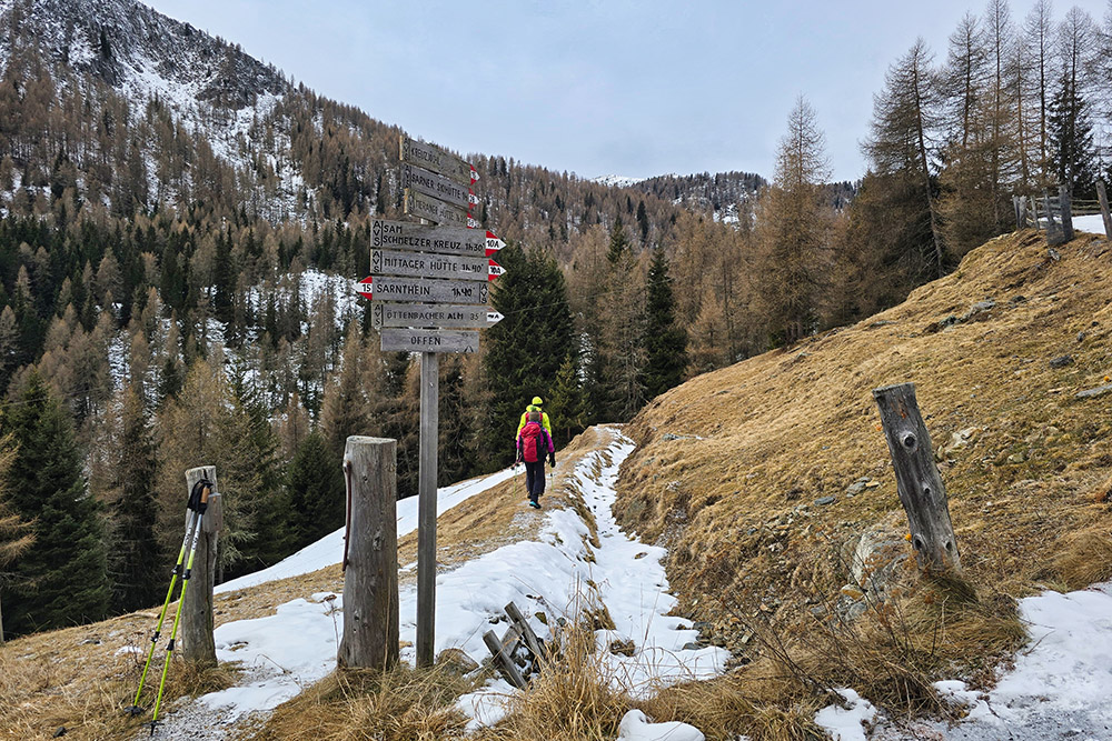
Partiamo seguendo il segnavia 15
In prossimità della malga continuiamo sul 10A
Croce sopra la Malga Öttenbacher
Deviamo sul 10B
Verso la vetta del Monte Sam
Arrivati in vetta

La vetta del Monte Sam

Il Monte Sam
Vista verso sud-est
Vista verso nord-est
Si scende sul versante meridionale
Seguiamo il sentiero Öttenbacheralmweg
Arrivati alla Malga Öttenbacher
Si ritorna a valle


