


![]()


Durata
 4:15 h
Distanza
 9 km
9 km Ascesa
 838 m
838 mDiscesa
 838 m
838 mH Max
 2054 m
H Min
 1220 m
Monte Stivo from Passo Santa Barbara
DESCRIPTION
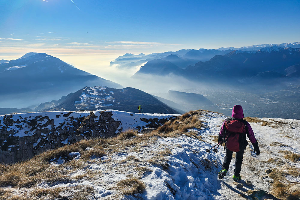
A beautiful balcony overlooking Lake Garda.
Geographical Location
Monte Stivo (2054 m a.s.l.) is a mountain in the Brescia and Garda Prealps located in southern Trentino, between the towns of Arco and Rovereto. Its strategic position makes it a privileged panoramic point over Upper Garda, the Sarca Valley, and Vallagarina.
Hike
The hike to Monte Stivo has unique characteristics that make it particularly appreciated by hikers. The southwestern side of the mountain forms a genuine natural balcony over Lake Garda, which from this perspective resembles the morphology of a fjord. The itinerary requires good physical preparation: with an elevation gain of over 800 meters, it is not suitable for beginners, especially in the presence of snow. In foggy conditions, orientation can be problematic, requiring some hiking experience.
From the summit, at 2054 meters, you can admire a 360-degree panorama: to the west, Presanella and Carè Alto can be distinguished; to the north, the Brenta Dolomites rise; to the east, the Piccole Dolomiti, the Lagorai chain, and Pasubio. To the southwest stretches Lake Garda in all its magnificence. At the summit, there is a cross and a panoramic installation that allows you to identify the surrounding peaks.
History and Curiosities
The construction of the mountain hut on Monte Stivo originated from an idea by Dr. Vittorio Stenico who, in 1904, decided to intervene with the S.A.T. (Società degli Alpinisti Tridentini) by purchasing the building rights on the pastures of the Finotti brothers located on the summit of Stivo. The hut was inaugurated on October 7, 1906, and was named after Prospero Marchetti, co-founder in 1872 along with Nepomuceno Bolognini and other Trentino locals of the S.A.T., and also its first president.
Monte Stivo was a second-line area during the Great War; you can still see remains of barracks, trenches, caves, and the arrival station of the imposing cableway that ascended from Arco for over 4 kilometers in length before splitting towards Monte Creino. There are still the communication trenches that led to the artillery positions; a radiotelegraph station was also installed on Stivo.
The origin of the name Stivo is debated between two etymological hypotheses: the first derives it from the German Stief (itself from the Latin obstipus), meaning steep; the second proposes a derivation from aestivus, meaning mountain for summer pasture.
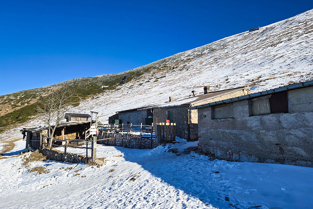
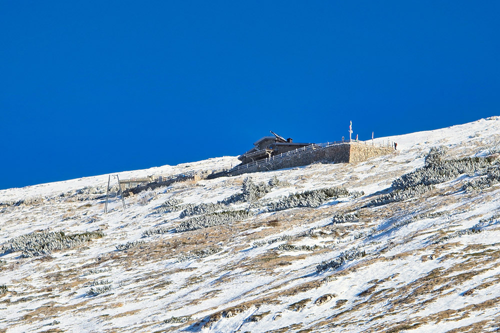
The Rifugio Prospero Marchetti, located at 2012 meters just below the summit, represents one of the most significant chapters in Trentino mountaineering history. Its construction was the result of what was called the war of the huts: in 1904, Dr. Vittorio Stenico, fearing that the Arco Section of the DuOeAV (German Alpine Club) would build its own structure, convinced the S.A.T. to move ahead of time. After purchasing the building rights on the pastures of the Finotti brothers, the project was entrusted to Carlo Marchetti (then mayor of Arco) and the construction work to Giacomo Martinelli's company. The hut was inaugurated on October 7, 1906, and dedicated to Prospero Marchetti. In 2006, it celebrated its centenary, and in 2017, after a complete renovation, it was reopened with new management.
During the First World War, Monte Stivo was a second-line area but played an important strategic role. In the area, remains of barracks, trenches, caves, and the arrival station of an imposing cableway are still visible; it ascended from Vignole (near Arco) for over 4 kilometers before splitting towards Monte Creino. Along the mountain ran communication trenches leading to artillery positions, and a radiotelegraph station was also installed.
ITINERARY
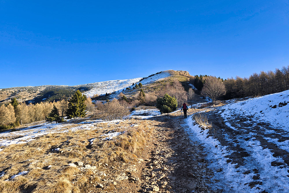
From the parking area (1220 m), follow the sign for trail SAT 608B, initially on an asphalt road that continues onto a dirt road. At the hamlet of Le Prese, at 1487 meters and after about 2 kilometers, continue towards Malga Stivo following trail SAT 608. Upon reaching the malga (1748 m), continue ascending first towards the Rifugio Marchetti (2012 m) and subsequently to the summit of Monte Stivo (2054 m). The return to the starting point is by descending the ridge trail to the hamlet of Le Prese, then retracing trail 608B.
EXCURSION DATE
January 3, 2026
STARTING POINT
Parking area in the hamlet of S. Antonio
REFRESHMENT POINT
Rifugio Prospero Marchetti on Stivo
AUTHOR’S SUGGESTIONS
In case of avalanche danger, take the ridge trail.
SAFETY ADVICE
Snowpack stability is subject to sudden and unpredictable changes. For your safety, always consult the avalanche bulletin because the snowpack can change rapidly; ask for information at the local competent offices. Our GPX tracks are only indicative, meaning the route was completed under the best snow and weather conditions of that day. Therefore, always evaluate on-site what to do.
Also, remember to assess the route based on your physical abilities, training, and the equipment you have available.
It is advisable to inform someone of the itinerary you intend to follow.
Remember that the emergency number is 112.
EQUIPMENT
It is recommended to have suitable equipment: avalanche rescue kit (consisting of an avalanche transceiver, shovel, and probe), snowshoes, poles, crampons, goggles, sunscreen, hiking boots, winter clothing, gloves, hat, backpack with hot drinks.
RECOMMENDED MAPS
Tabacco Map 063. Monte Baldo - Malcesine - Garda
INTERESTING LINKS
https://rifugiostivo.it/
HOW TO ARRIVE
Passo Santa Barbara (Santa Barbara Pass) can be reached from the SS88 of Val di Gresta. From the pass, go right uphill for about 500 m towards the hamlet of S. Antonio.
PARKING AREA
Hamlet of S. Antonio
GPS Coordinates: 45.900420, 10.943160
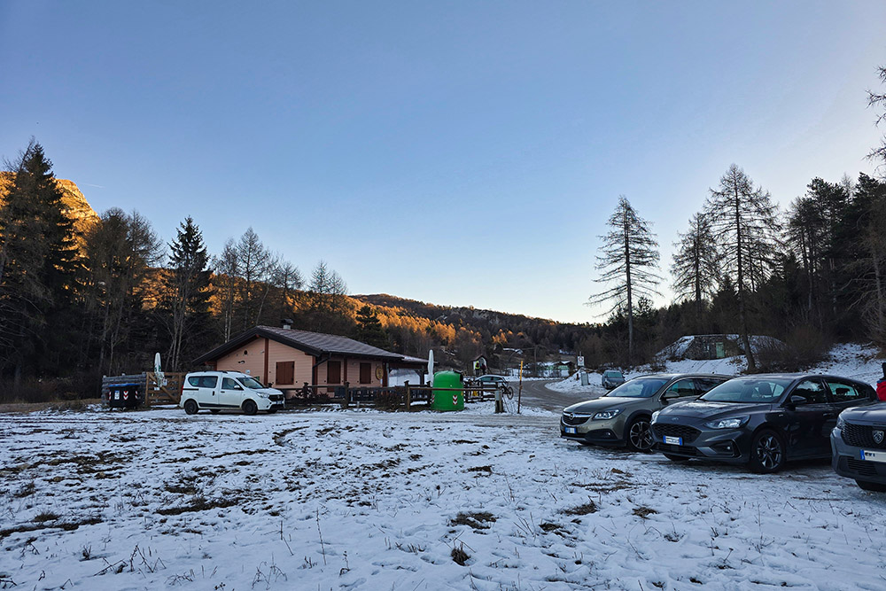
Parcheggio in località S. Antonio
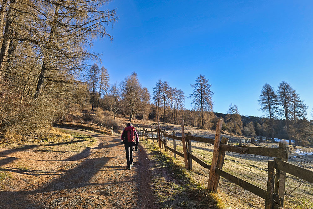
Si sale per strada sterrata
Appena superato località Le Prese
La Malga Stivo
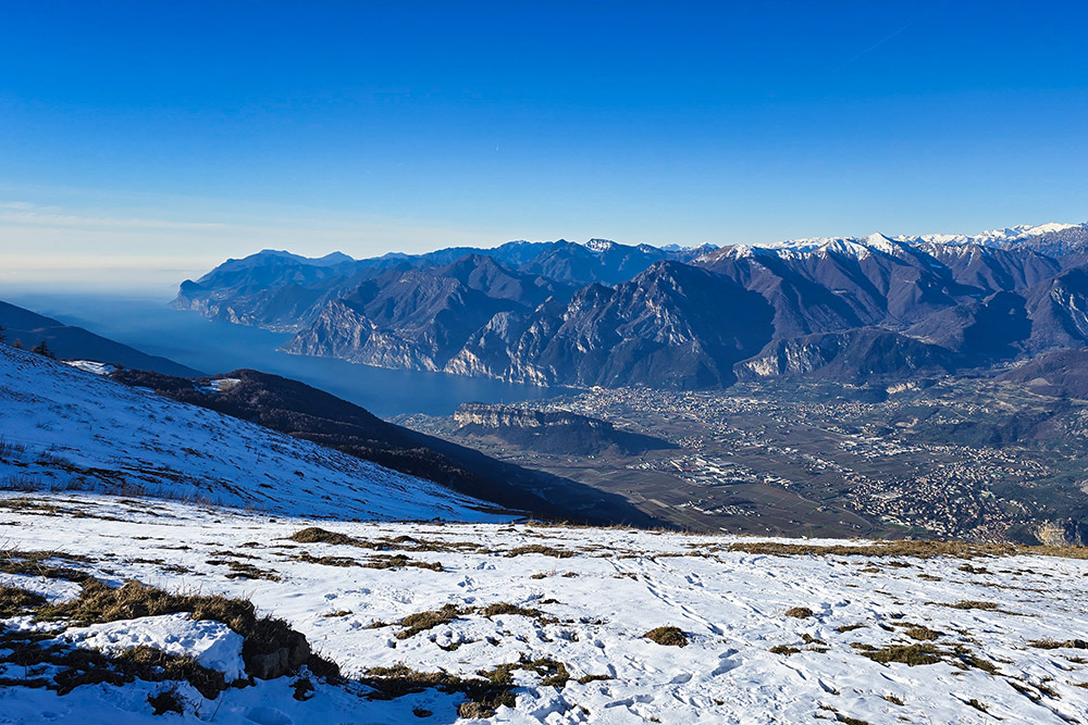
Vista verso il Lago di Garda
Il Rifugio Marchetti dalla malga
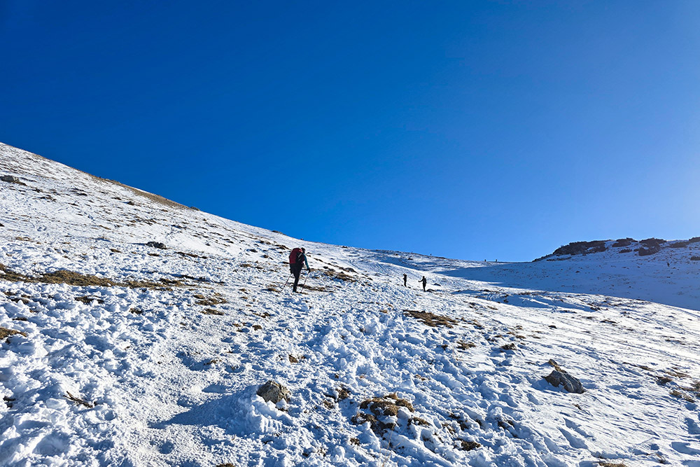
Si sale per la via invernale
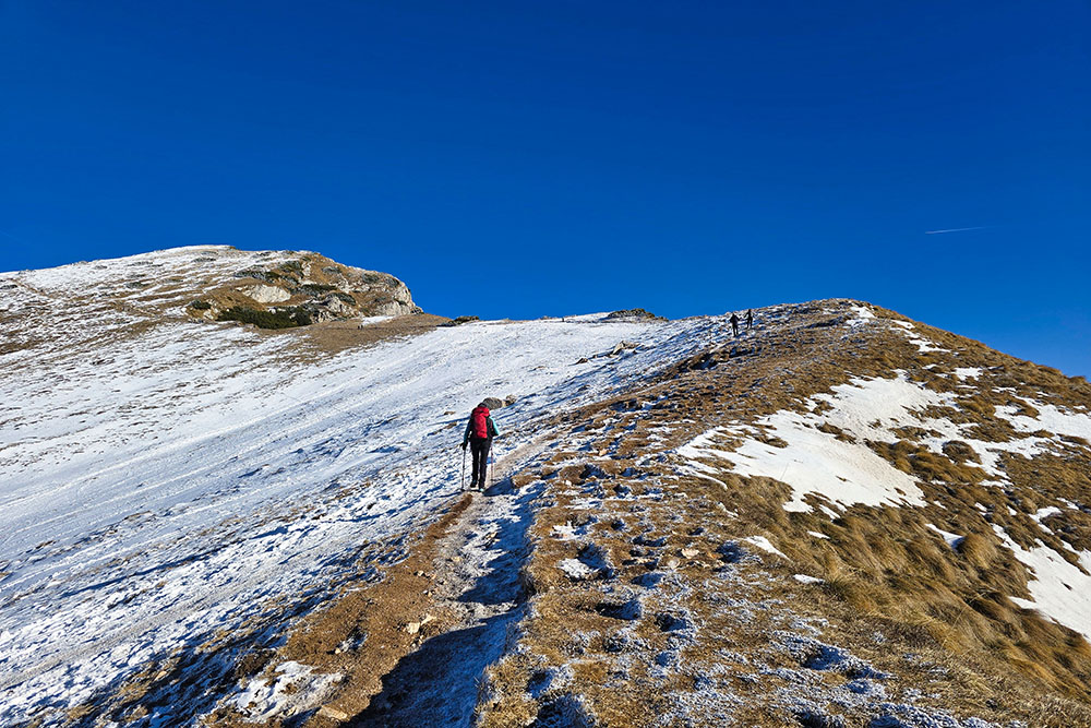
Tratto in cresta
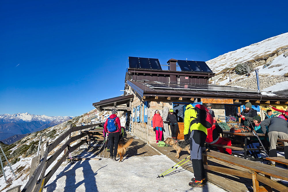
Il Rifugio Marchetti allo Stivo
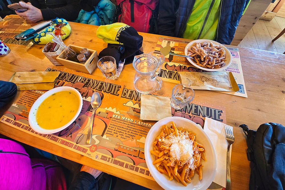
Pranzo al rifugio

Lasciamo il rifugio
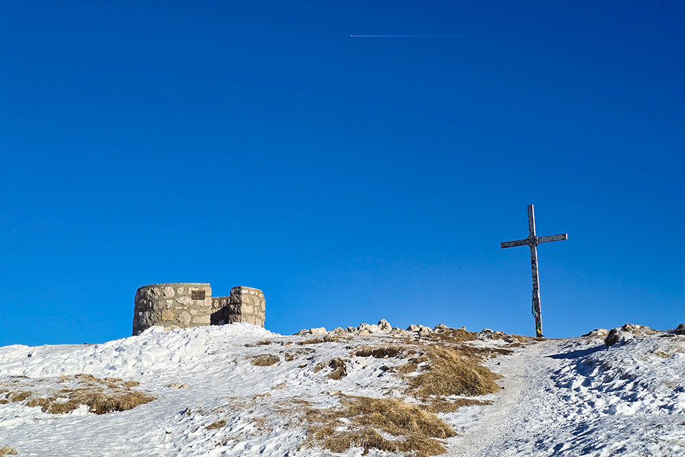
In vetta al Monte Stivo

In vetta al Monte Stivo
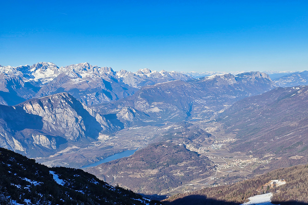
Vista verso i laghi di Cavedine e Toblino
Si ritorna per il sentiero in cresta


