


![]()


Durata
 5:25 h
Distanza
 8,4 km
 Ascesa
 860 m
860 mDiscesa
 860 m
860 mH Max
 2200 m
H Min
 1410 m
Cima Telegrafo from Novezza
DESCRIPTION
Cima Telegrafo: winter ascent from the eastern side of Monte Baldo.
Geographic Location
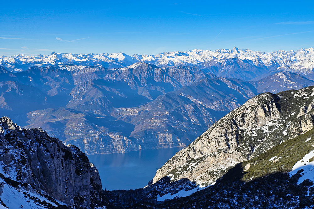
We are on Monte Baldo in Veneto, one of the most fascinating mountain massifs of the Garda Prealps. This chain, approximately forty kilometres long, stretches like a natural bridge between the Vallagarina valley and Lake Garda. Cima Telegrafo, at 2200 meters, is the third highest peak of Monte Baldo, after Cima Valdritta and Cima Fontanelle.
We are on Monte Baldo, one of the most characteristic massifs of the Garda Prealps, in Veneto. This mountain ridge extends for about forty kilometres in a northeast/southwest direction, forming a natural bridge between the Vallagarina valley to the east and Lake Garda to the west. The territory is divided between the provinces of Verona and Trento, involving the municipalities of Ferrara di Monte Baldo, Brentonico, Malcesine, and Brenzone.
Cima Telegrafo, with its altitude of 2200 meters, represents the third highest peak of the entire Monte Baldo group, preceded only by Cima Valdritta (2218 m) and Cima Fontanelle (2208 m). The mountain hut is located slightly lower, at an altitude of 2147 meters.
Hike
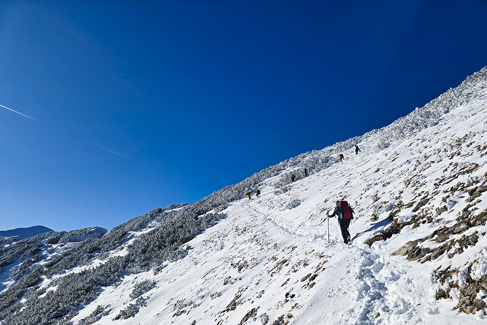
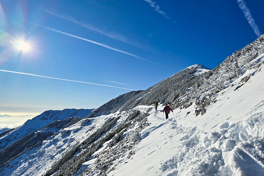
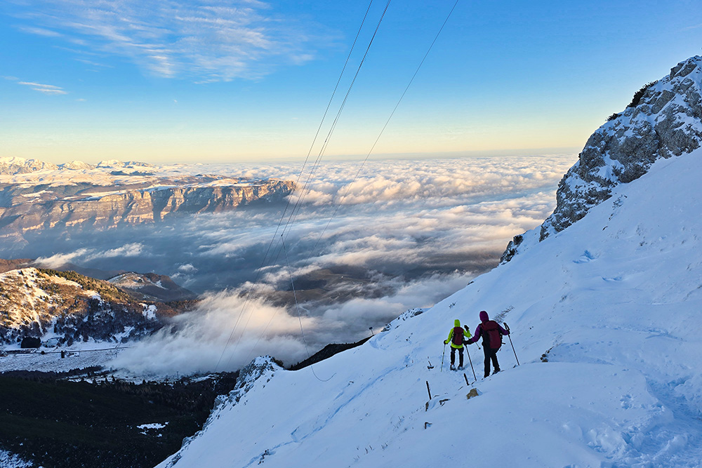
The proposed itinerary unfolds along one of the most panoramic and demanding routes on Monte Baldo, ideal for experienced and properly equipped hikers. The ascent from the malga Baito Novezza (1416 m) follows steep trail no. 66, which covers about 730 meters of elevation gain in just 2.4 kilometres, with an average gradient close to 30%. It is therefore a short but particularly steep path that requires good physical condition and surefootedness.
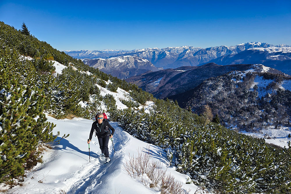
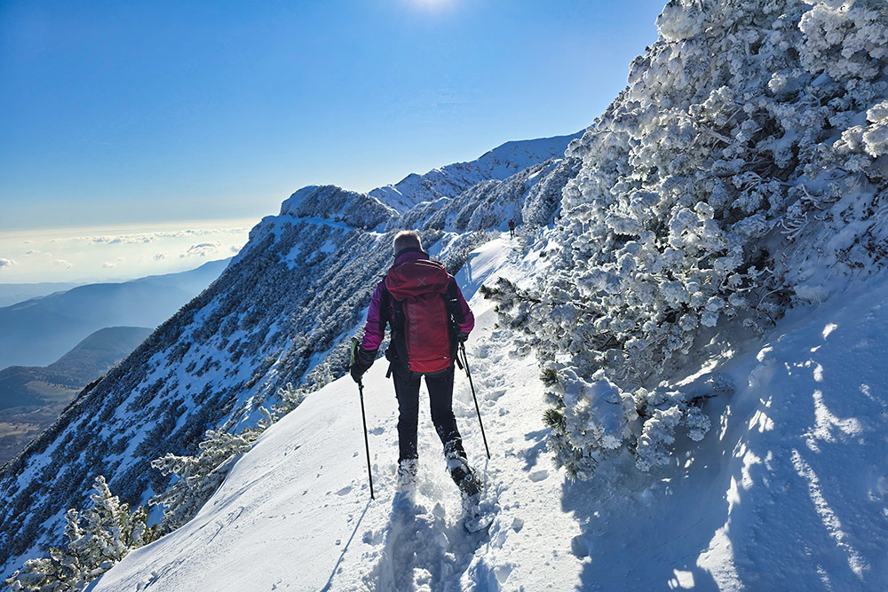
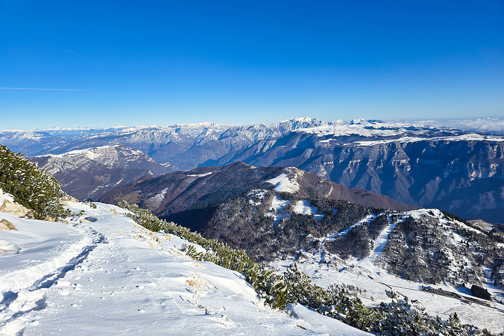
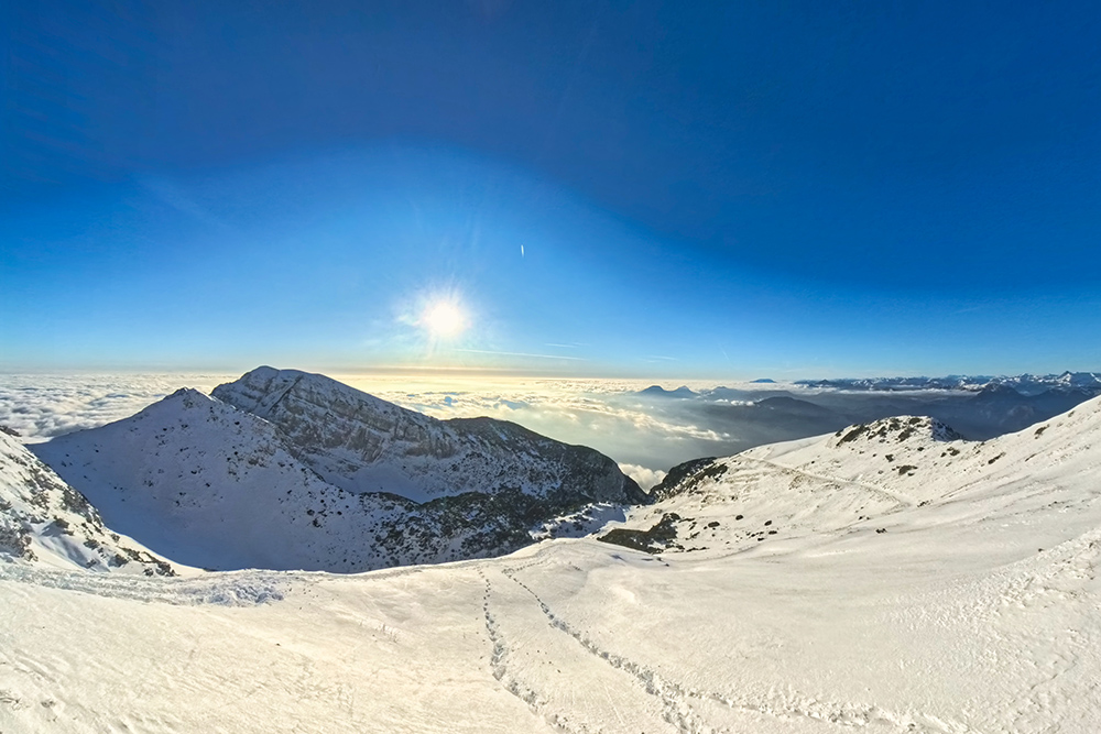
Once at higher altitude, you continue along the Alta Via del Monte Baldo (trail no. 651), the famous route that traverses the entire ridge of the mountain group, always staying high. This privileged position offers extensive panoramic views on both sides: to the west, Lake Garda; to the east, the Brentonico Plateau and the Adige Valley.
During the winter season, Monte Baldo receives abundant snowfall despite its pre-Alpine location and the mitigating influence of the lake. Therefore, it is essential to consult the avalanche bulletin of the Autonomous Province of Trento before undertaking the hike and to have adequate equipment. The best period for this winter ascent is from late December to March, with consolidated snow conditions.
History and Curiosities
The place name Telegrafo (Telegraph), which characterizes both the peak and the hut, has precise and fascinating historical origins. During the Napoleonic campaigns, the French army installed an optical telegraph on the summit, a long-distance communication system based on visual signals that allowed messages to be transmitted along the Alpine defensive line.
The name Baldo has ancient roots and derives from the medieval German Bald, in modern German Wald, which means forest.
The Telegrafo Gaetano Barana Mountain Hut (2147 m) is the highest mountain hut on Monte Baldo and represents an important support point for hikers and mountaineers.
ITINERARY
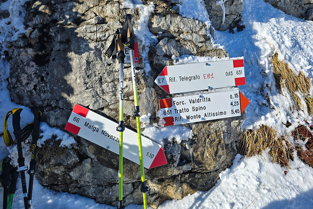
From the parking area at the malga Baito Novezza (1410 m), you begin the ascent following steep trail no. 66, which climbs decisively up the eastern side of Monte Baldo.
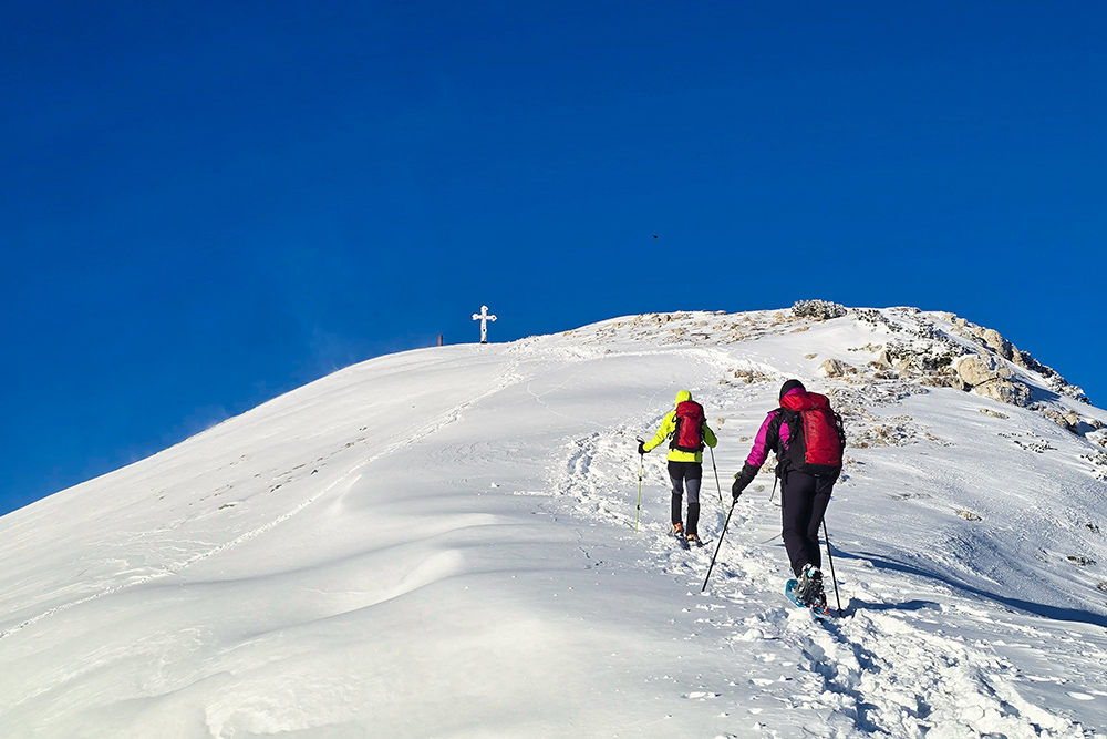
After about two hours of sustained climbing, you reach the junction with the Alta Via del Monte Baldo (trail no. 651), the famous ridge route that crosses the entire ridge of the mountain group. At this point, you turn south and continue along the Alta Via, walking on easier but still high-altitude terrain, among mountain pines and rocky outcrops.
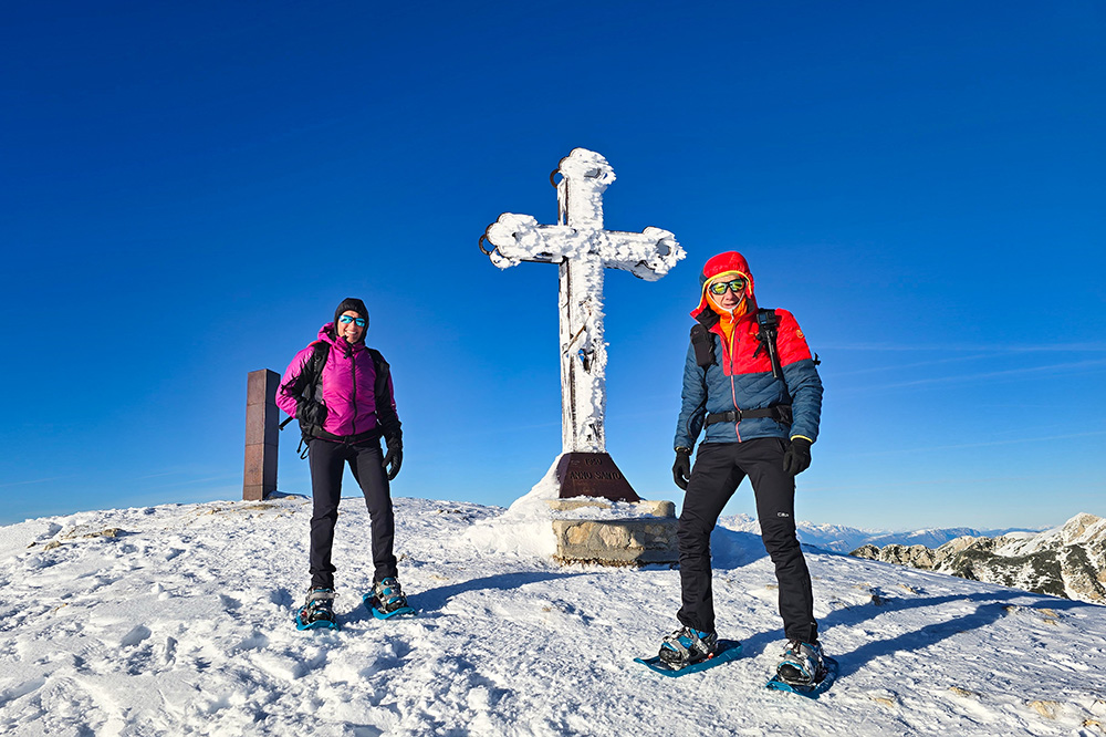
Following trail no. 651, you reach Cima Telegrafo (2200 m), where a metal cross marks the summit, and then descend to the nearby Telegrafo Gaetano Barana Mountain Hut (2147 m).
For the return, you descend following trail no. 652 and then take trail no. 66 again, which leads back to the starting point at the malga Baito Novezza, completing the loop.
EXCURSION DATE
December 26, 2025
STARTING POINT
Malga Baito Novezza
REFRESHMENT POINT
None in winter
AUTHOR’S SUGGESTIONS
Trail no. 652 is very steep; we recommend returning via the same itinerary used for the ascent.
SAFETY ADVICE
Snowpack stability is subject to sudden and unpredictable changes. For your safety, always consult the avalanche bulletin because snow conditions can change rapidly; ask for information from the relevant local offices. Our GPX tracks are only indicative, meaning the route was done under the best snow and weather conditions of that day. Therefore, always assess on-site what to do.
Also, remember to evaluate the route based on your physical abilities, training, and the equipment you have.
It is advisable to inform someone of the itinerary you intend to follow.
Remember that the emergency number is 112.
EQUIPMENT
It is recommended to have suitable equipment: avalanche rescue kit (consisting of a transceiver, shovel, and probe), snowshoes, poles, crampons/microspikes, goggles, sunscreen, trekking boots, winter clothing, gloves, hat, backpack with hot drinks.
RECOMMENDED MAPS
Tabacco 063. Monte Baldo - Malcesine - Garda
INTERESTING LINKS
https://www.equipenatura.it/rifugio-telegrafo-monte-baldo-lago-di-garda/
HOW TO ARRIVE
From November to May, the SP3 road remains closed at the San Valentino locality. Therefore, our starting point is only accessible via the SP8 road from the Veneto side.
PARKING AREA
At the malga Baito Novezza (VR)
GPS Coordinates: 45.710288, 10.860568
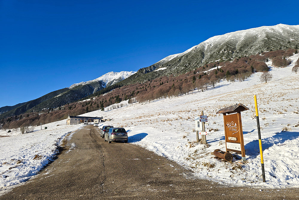
Parcheggio località Novezza
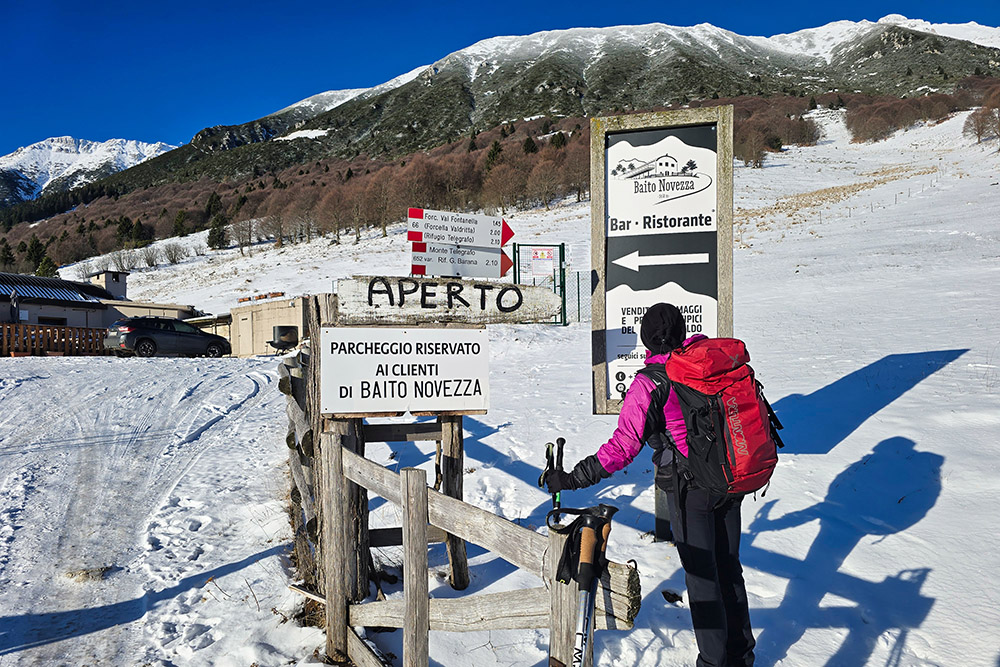
Partenza sentiero 66
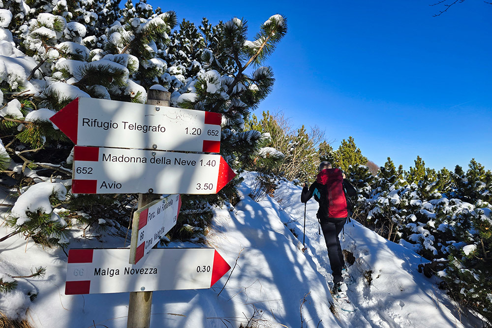
Primo bivio
Si sale attorniati dai pini mughi
Siamo quasi in cresta
Arrivati al Sentiero di cresta
Proseguiamo verso la Cima Telegrafo
Vista verso nord-est
L'Alta Via del Monte Baldo
Scorcio sul Garda
In vista della croce di vetta
Arrivati alla Cima Telegrafo
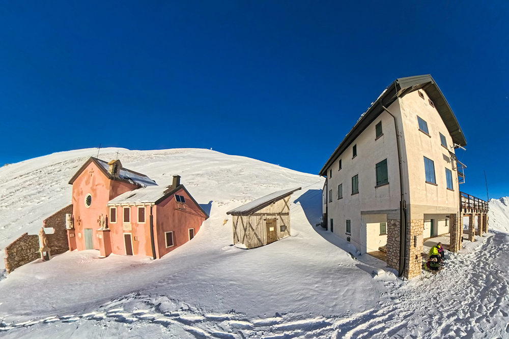
Rifugio Telegrafo Gaetano Barana
Vista verso il Lago di Garda
Si rientra


