


![]()


Durata
 4:20 h
Distanza
 12,9 km
 Ascesa
 497 m
497 mDiscesa
 497 m
497 mH Max
 1738 m
H Min
 1500 m
From Lake Calaita to Malga Crel
DESCRIPTION
A panoramic itinerary in the Paneveggio - Pale di San Martino Park.
Geographic Location
Lake Calaita is a small alpine lake of natural origin located at 1605 meters above sea level in the Lozen Valley, in eastern Trentino. The lake basin sits on a wide plateau, is entirely within the territory of the Paneveggio - Pale di San Martino Natural Park and is 20 km from Fiera di Primiero and 12 km from Canal San Bovo.
Hike
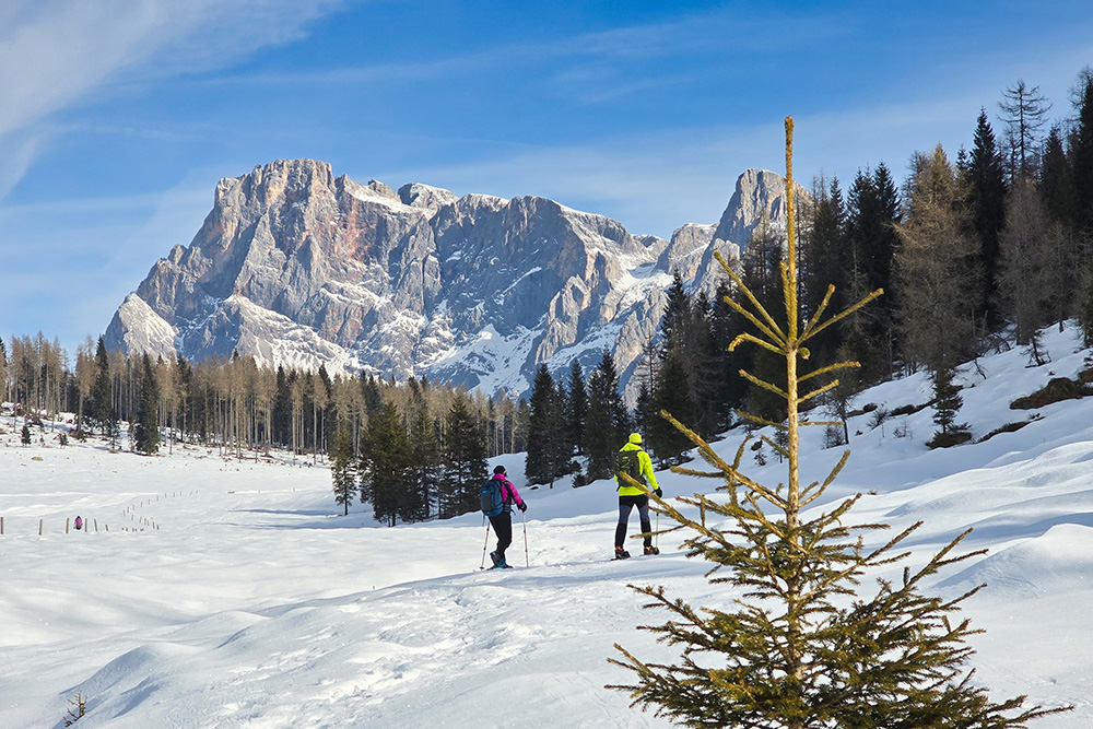
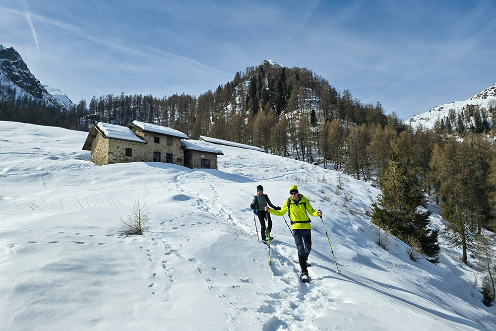
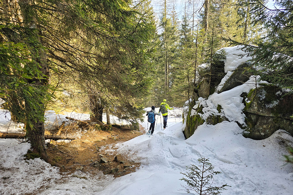
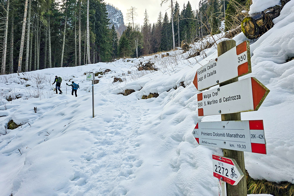
Among the most panoramic hikes in the Primiero area, the one leading from Lake Calaita to Malga Crel, with a possible detour to Malga Scanaiol, offers spectacular views of the Pale di San Martino. The itinerary follows the CAI trail 350, a path that crosses larch and spruce forests, alternating flat sections with gentle ups and downs. With a total length of about 13 kilometers and a not particularly demanding elevation gain, the hike still requires good physical endurance, especially if done in winter with snowshoes.
During the winter season, the lake freezes completely and disappears under a blanket of snow, offering a completely different but equally evocative scenario. The area is also frequented by cross-country skiers and ski mountaineers. For those who desire a shorter itinerary, it is possible to skip the detour to Malga Scanaiol, significantly reducing the overall length of the route. The best period for this hike is from June to October for summer conditions, while December to March is ideal for snowshoeing, with the Miralago mountain hut open on weekends.
ITINERARY
From the Miralago Calaita Hotel Restaurant (1608 m), follow the eastern side of Lake Calaita until reaching Calaita Pass (1663 m). From here continue following the 350 trail marker towards San Martino di Castrozza. After about 900 meters, turn left following the sign for Malga Scanaiol.
From Malga Scanaiol (1738 m), descend about 200 meters in elevation and resume trail 350. Once you reach Malga Crel (1600 m), return to the starting point following the same trail in the opposite direction.
EXCURSION DATE
February 22, 2025
STARTING POINT
Lake Calaita Parking Area
REFRESHMENT POINT
None in winter
AUTHOR'S SUGGESTIONS
In winter, always consult the avalanche bulletin before departing.
SAFETY ADVICE
The stability of the snow cover is subject to sudden and unpredictable changes. For your safety, always consult the avalanche bulletin, because the snow cover is subject to rapid changes, and ask for information from the competent local authorities. Our GPX tracks are only indicative, meaning the route was completed in the best conditions with the snow and weather of that day. Therefore, always evaluate what to do on site.
Also remember to evaluate the route based on your physical abilities, training, and available equipment.
It is advisable to inform someone of the itinerary you intend to take.
Remember that the emergency number is 112.
EQUIPMENT
It is recommended to have suitable equipment: avalanche self-rescue kit (consisting of avalanche transceiver, shovel and probe), snowshoes, poles, crampons, sunglasses, sunscreen, trekking boots, winter clothing, gloves, hat, backpack with hot beverages.
RECOMMENDED MAPS
Tabacco 022 Pale di San Martino
INTERESTING LINKS
https://www.miralagocalaita.it/
HOW TO ARRIVE
From Canal San Bovo take the SP79 and in Località Revedea turn left following the signs for Zortea and Calaita. Continue for 8.6 km.
PARKING AREA
Lake Calaita Parking Area
GPS Coordinates: 46.201590, 11.792691
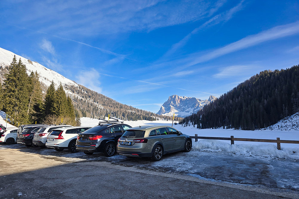
Parcheggio
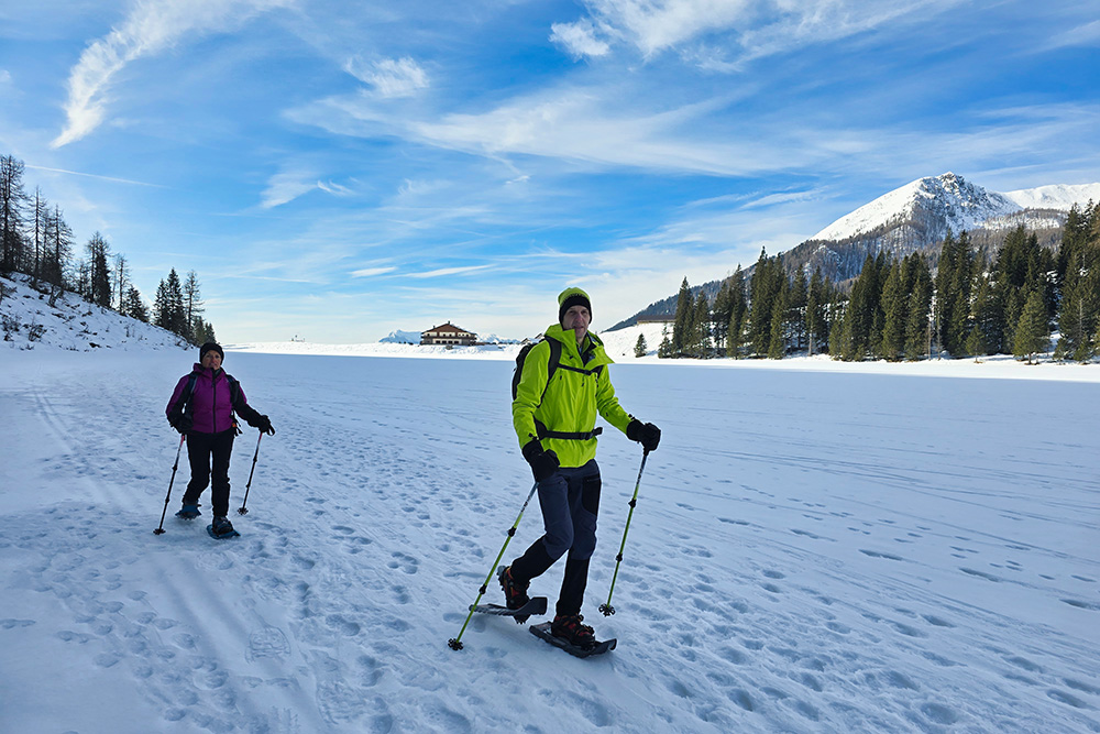
Camminiamo sul lago ghiacciato
Iniziamo la salita
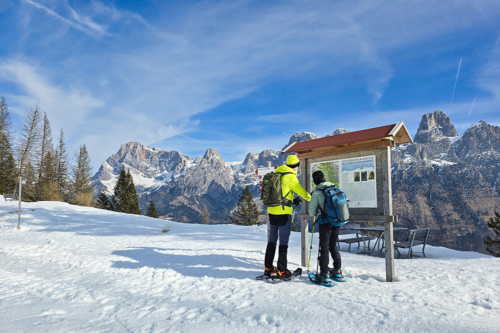
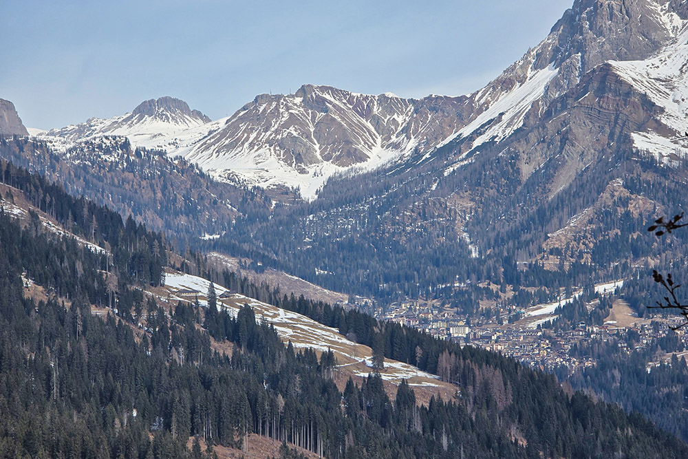
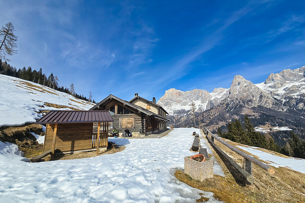
Punto panoramico sulle Pale di San Martino
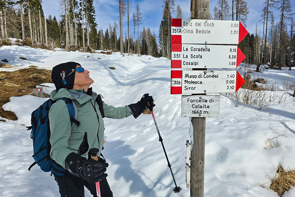
Arrivati alla Forcella di Calaita
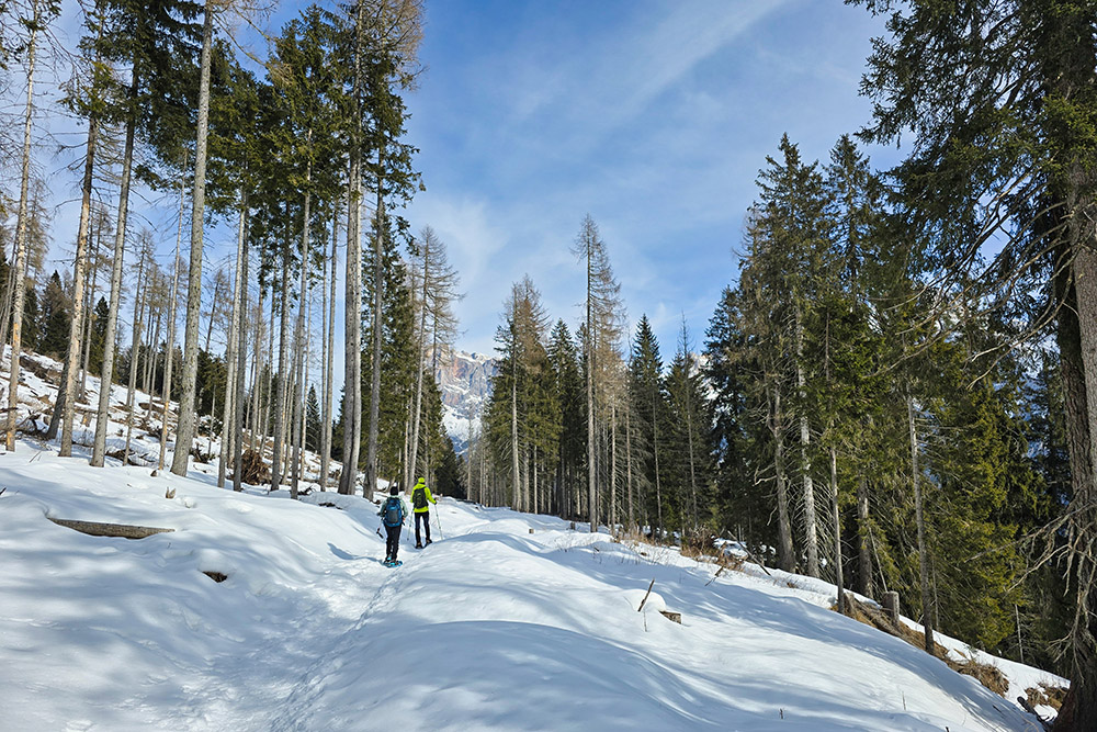
Stiamo percorrendo il sentiero 350
In valle San Martino di Castrozza
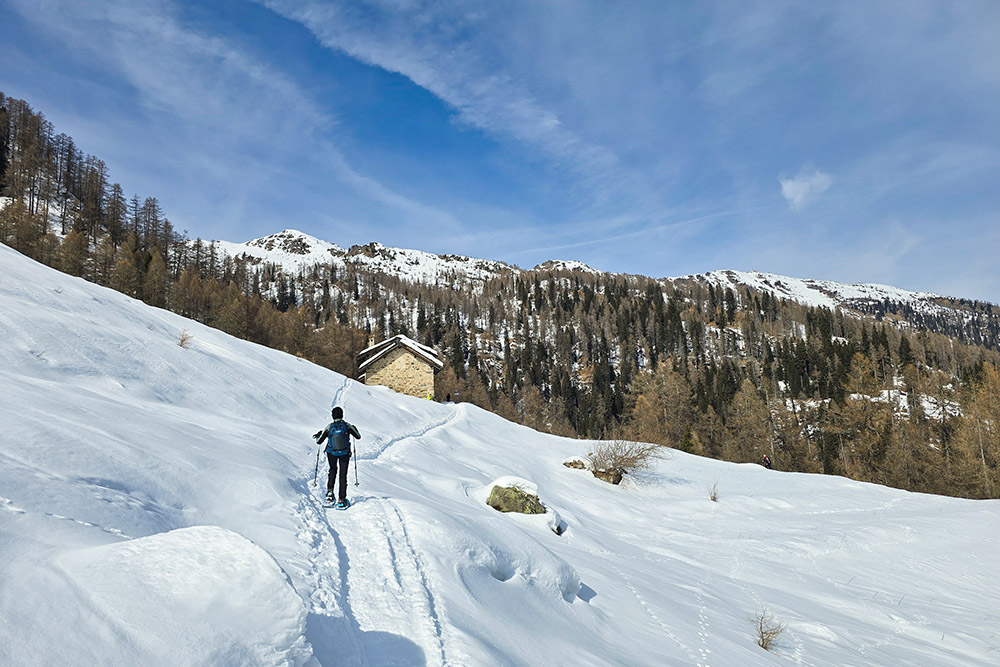
Stiamo arrivando alla Malga Scanaiol
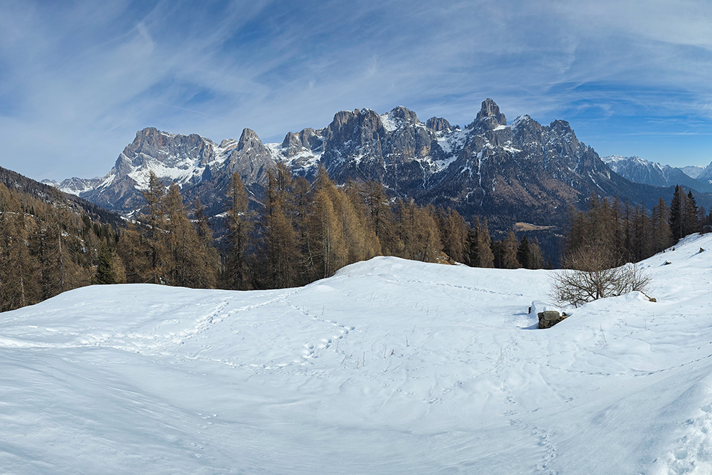
Panorama verso le Pale di San Martino
Lasciamo Malga Scanaiol
Adesso si scende
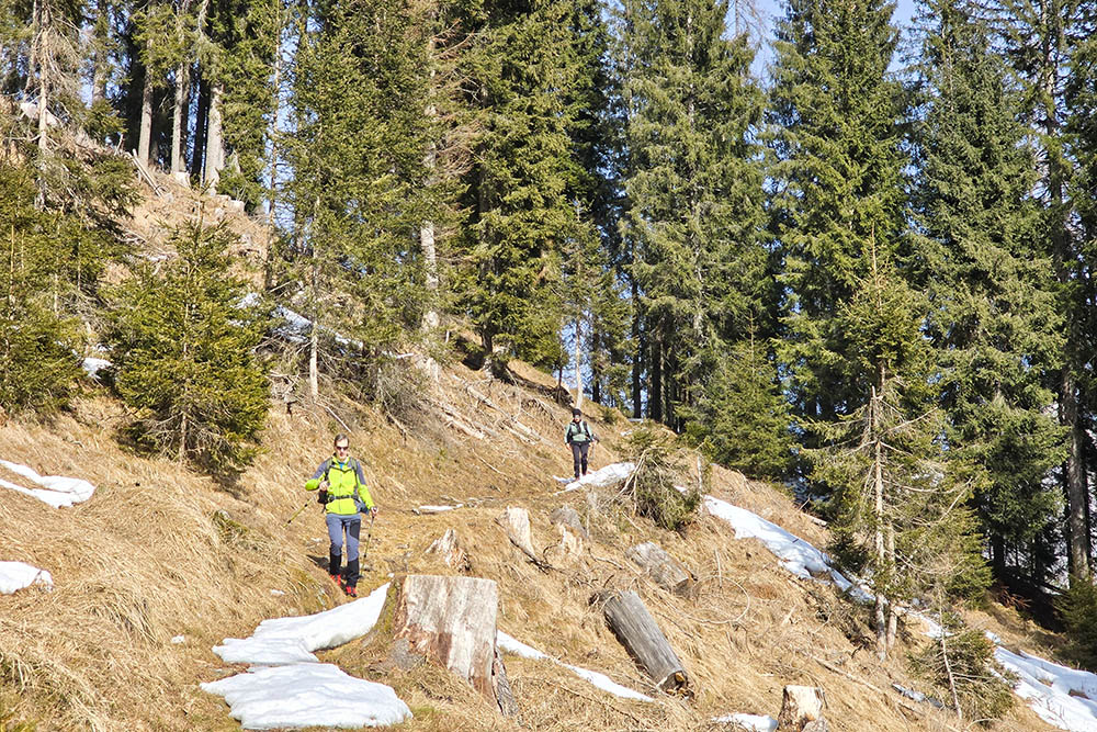
Tratto senza neve
Malga Crel
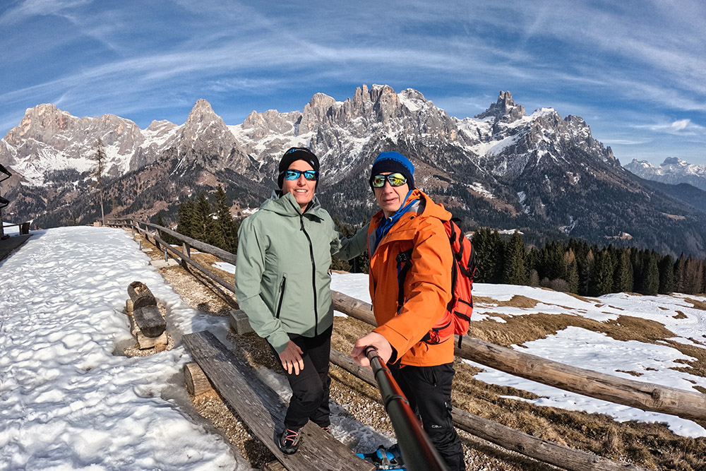
Selfie alla malga
Si ritorna al Lago Calaita


