


![]()


Durata
 4:00 h
Distanza
 7,8 km
 Ascesa
 627 m
627 mDiscesa
 471 m
471 mH Max
 485 m
485 mH Min
 15 m
15 mAmalfi Coast: Nerano - Termini #6
DESCRIPTION
In the footsteps of Ulysses: from Nerano to the promontory of Punta Campanella.
Geographic Location
The itinerary develops in the Sorrento Peninsula, within the Monti Lattari Regional Park, between the municipalities of Massa Lubrense and Positano. The Punta Campanella promontory divides the Gulf of Naples from the Gulf of Salerno, forming the extreme tip of the Sorrento coast that stretches towards the island of Capri. The area falls administratively within the Metropolitan City of Naples, in Campania.
Hike
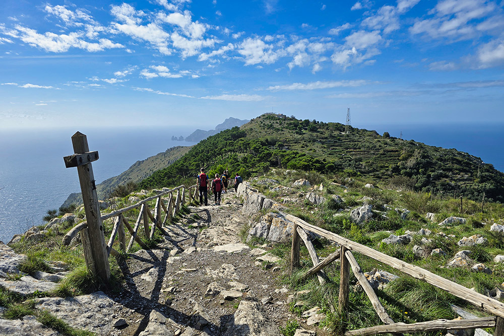
The loop trail is 7.8 km long with a walking time of about 4 hours, and represents the sixth stage of the Amalfi Coast trek. This hike offers 360-degree panoramic views stretching from the Gulf of Naples to the Gulf of Salerno, featuring Mount Vesuvius and the islands of Capri, Ischia, and Procida. The most spectacular viewpoints are reached from the summit of Monte San Costanzo and by walking along the ridge descending towards Punta Campanella, from where the view embraces the Bay of Ieranto and the crystal-clear waters of the Tyrrhenian Sea.
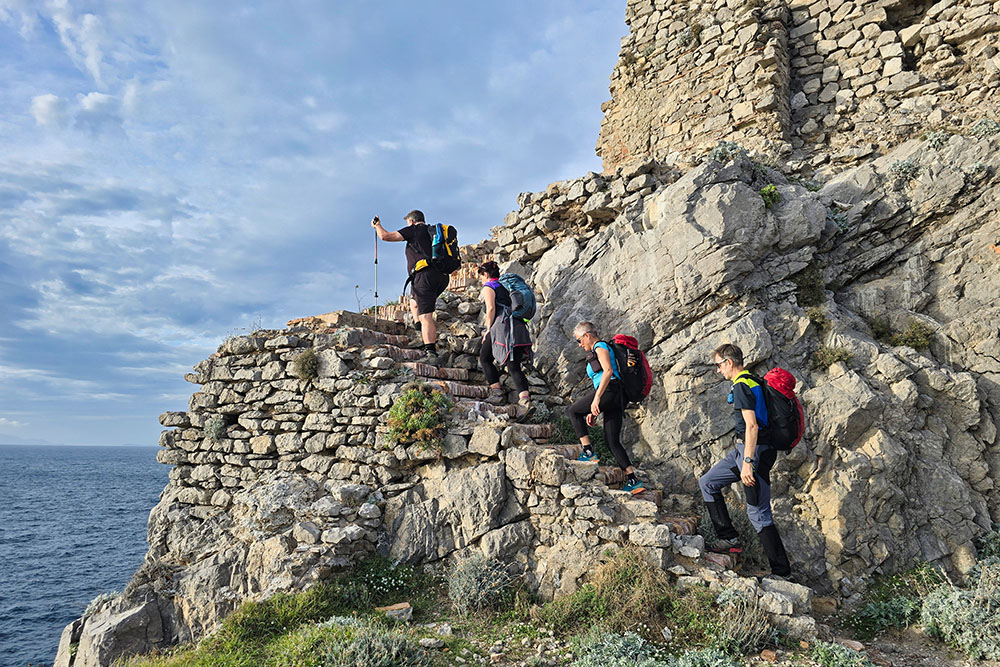
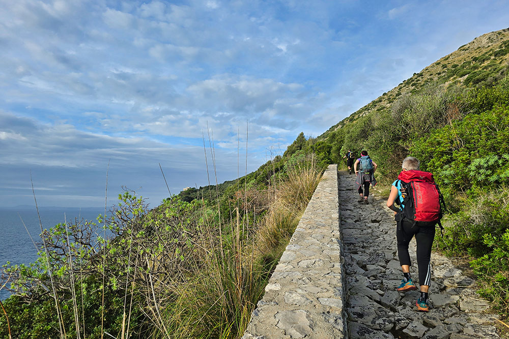
Like the fifth stage, this one also unfolds mainly in a natural and sparsely populated environment, away from the more touristy spots. The difficulty is rated E (for hikers) by CAI Outdoor Campania, with steep slopes both uphill and downhill. The section between the pine forest and Punta Campanella has exposed passages requiring particular attention. The route alternates between dirt paths, ancient paved mule tracks, and short sections on stone staircases.
History and Curiosities
In 1986, Ilva donated the entire area of the Bay of Ieranto to the Fondo Ambiente Italiano (FAI), totaling 47 hectares. The area, which had been exploited as a limestone quarry until the 1950s, now stands as a virtuous example of landscape restoration, with the recovery of the original Mediterranean scrub and the reconstruction of the 19th-century mining village. The bay is now recognized as a Site of Community Importance and included in the FAI's Punta Campanella Marine Protected Area.
On the Punta Campanella promontory, the Greeks built a temple to the goddess Athena, whose mythical foundation is attributed to Ulysses. According to tradition reported by Strabo, the Sirens lured sailors here. The Greek cult was later assimilated by the Romans, who dedicated the site to the goddess Minerva. The temple's presence is attested in literary sources in 172 BC.
The Minerva Tower, also called the Tower of Punta Campanella, was commissioned by Robert of Anjou in 1334 and rebuilt in 1566. Strategically located, it served to sight pirates and was part of a system of watchtowers built along the entire coast of the Sorrento Peninsula. The name Punta Campanella (meaning Cape of the Little Bell) derives from the bell that was rung in the tower to sound the alarm in case of pirate ship sightings.
The small church of San Costanzo on the mountain's summit dates back to the second half of the 1500s and was founded by some local families. Dedicated to Saint Costanzo, the 7th-century Bishop of Capri, it is usually closed to the public, except for the procession on May 14th, when hundreds of faithful climb up from the small square in Termini for Holy Mass.
ITINERARY
From Nerano (170 m), take the CAI 300 trail towards the Bay of Ieranto. After a few hundred meters, leave the main path by taking a not very visible trail on the right that climbs towards the western saddle of Monte San Costanzo. The first part crosses a dense forest with a very steep climb; afterwards, the trail opens up, where the path is often overgrown with vegetation and sometimes faint underfoot.
Upon reaching the ridge (446 m), turn right towards the summit. At the top of Monte San Costanzo (485 m) stands the namesake white chapel, offering a complete panorama of the two gulfs. Then return to the saddle and descend towards Punta Campanella (15 m), crossing a pine grove and walking a panoramic stretch along the ridge. From the lowest point of the promontory, where the Minerva Tower and the lighthouse are located, climb back up along the ancient Via Minerva, a Greco-Roman origin mule track paved with basalt stones. The path, walked on a constant uphill, finally leads to the village of Termini (323 m), the endpoint of the hike.
EXCURSION DATE
October 25, 2025
STARTING POINT
Nerano
REFRESHMENT POINT
None
AUTHOR’S SUGGESTIONS
Walk the route following our GPX track.
SAFETY ADVICE
The viability of the proposed itinerary, like all mountain terrain, is subject to environmental changes due to natural events and weather conditions. Therefore, before setting out, consult the relevant tourist offices and/or the reference mountain huts.
Our GPX tracks are only indicative, meaning the route was completed under the best trail and weather conditions of that day. Therefore, always assess on-site what to do.
Also, remember to evaluate the route based on your physical abilities, training, and available equipment.
It is advisable to inform someone of the itinerary you intend to follow.
Remember that the emergency number is 112.
EQUIPMENT
It is recommended to have equipment suitable for the route, weather conditions, and season: windproof and/or rain jacket, map and/or GPS device, sunglasses, sunscreen, hiking boots, first aid kit, appropriate clothing, gloves, backpack with food and water.
RECOMMENDED MAPS
CAI, Monti Lattari. Penisola sorrentina. Costiera amalfitana. Isola di Capri. Trail map scale 1:25000
INTERESTING LINKS
https://www.altaviadeimontilattari.it/la-penisola-sorrentina/
HOW TO ARRIVE
From Vico Equense take SS145 to Piano di Sorrento. Here take SS163 and in San Pietro take SS145 until just before Sant’Agata sui Due Golfi, then follow in order: Via dei Campi, Via Leucosia, Via Capo D'Arco, and SP138 to Nerano.
PARKING AREA
Nerano (paid parking)
GPS Coordinates: 40.586858, 14.347755
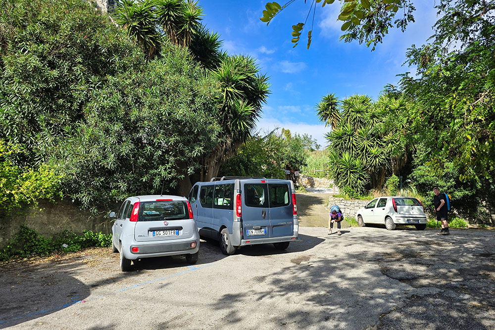
Parcheggio a Nerano
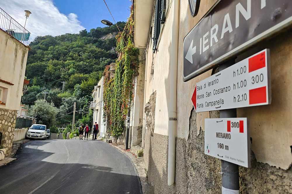
Seguiamo il sentiero 300
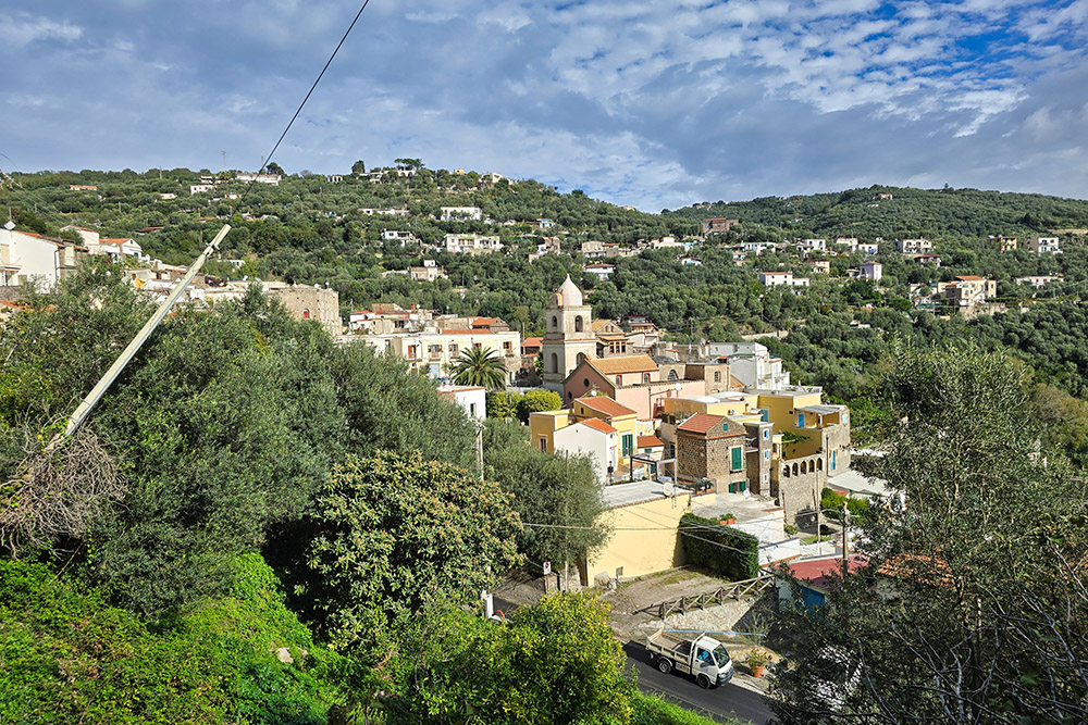
Vista verso Nerano
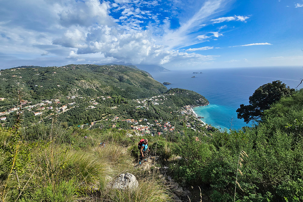
Panorama sulla costa
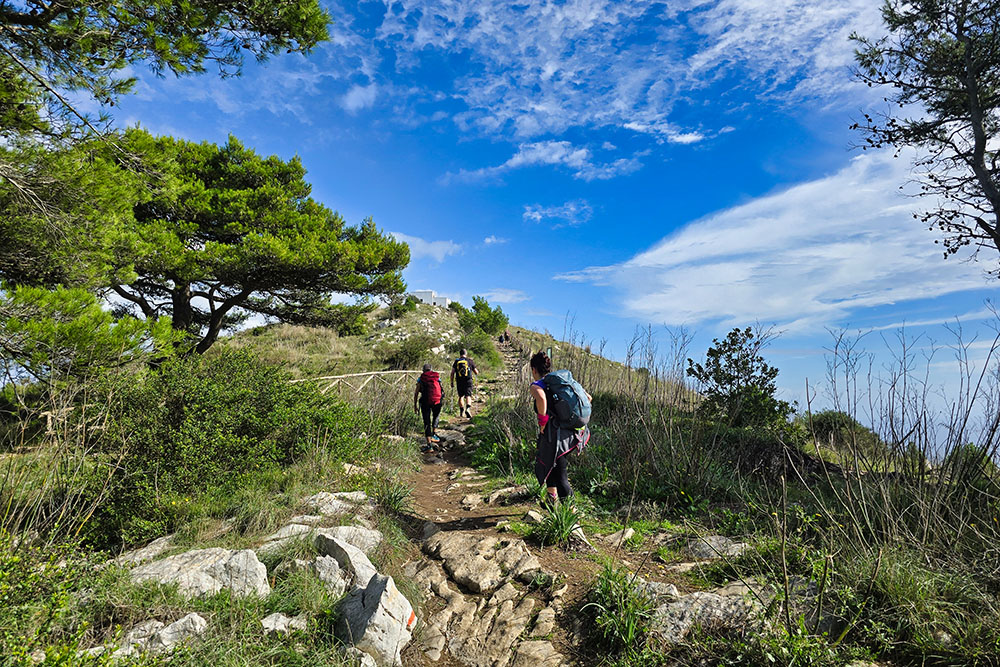
Manca poco alla Chiesa di San Costanzo
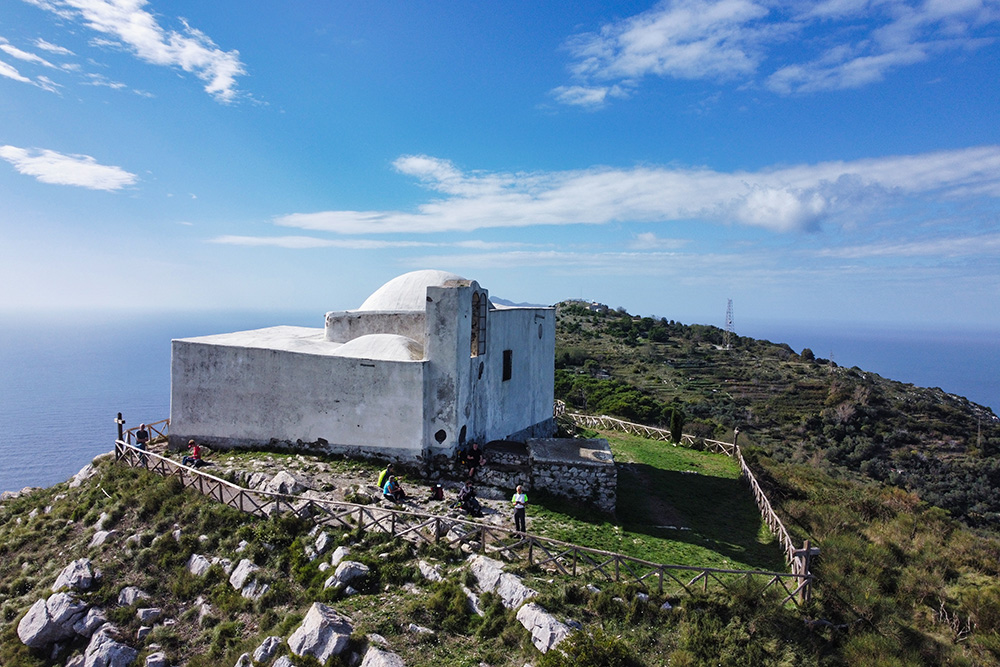
Chiesa di San Costanzo
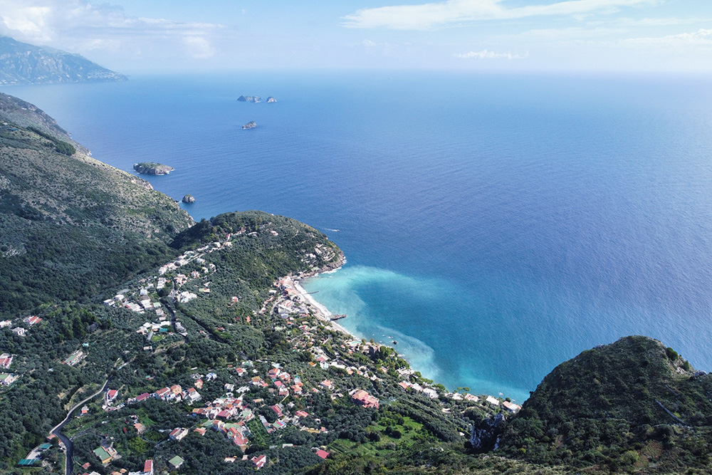
Vista su Marina del Cantone
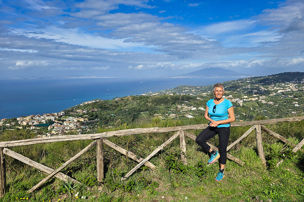
Vista verso Napoli
Si va verso Punta Campanella
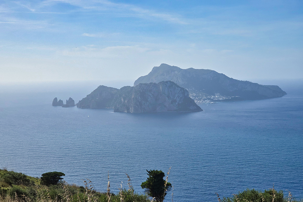
In lontananza l'isola di Capri
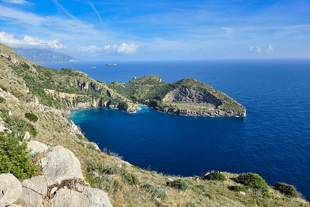
La Baia di Jeranto
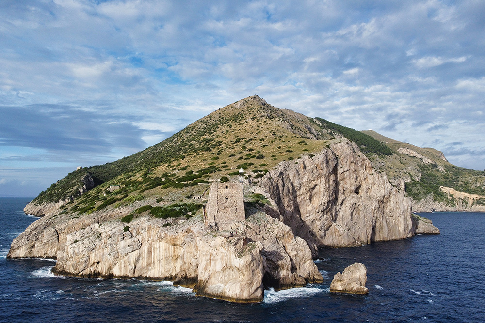
Torre Minerva
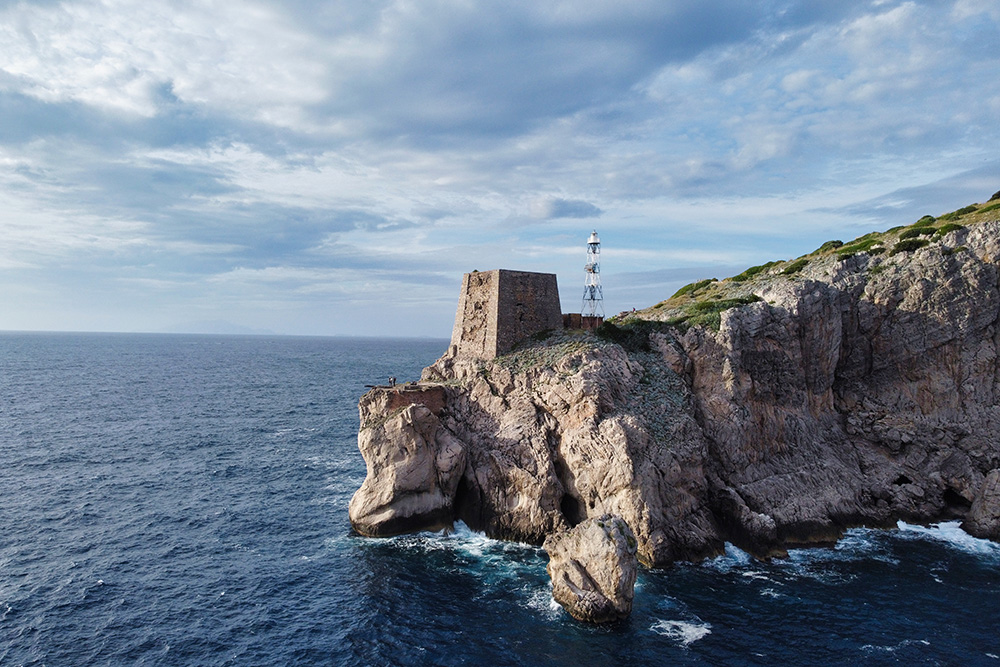
Punta Campanella
Si riparte
L'antica via Minerva


