


![]()


Durata
 4:55 h
Distanza
 10 km
10 km Ascesa
 273 m
273 mDiscesa
 897 m
897 mH Max
 671 m
671 mH Min
 9 m
9 mAmalfi Coast: Path of the Gods #4
DESCRIPTION
The Path of the Gods: an ancient farmers' path turned into a legendary hike.
Geographical Location
The Path of the Gods winds through the Amalfi Coast, in the province of Salerno, connecting Agerola to Nocelle, a hamlet of Positano.
The Hike
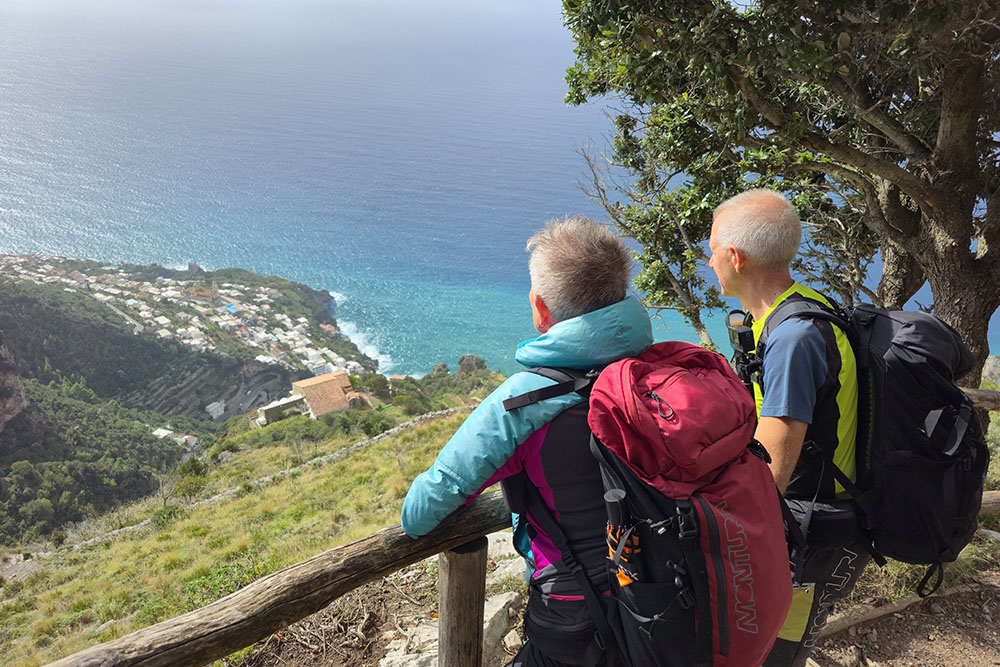
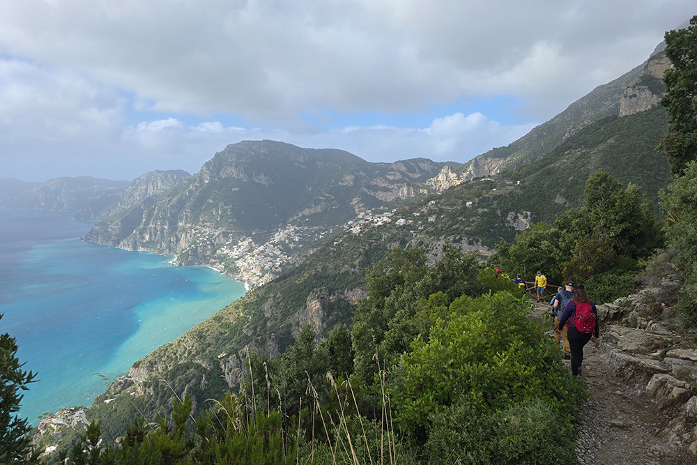
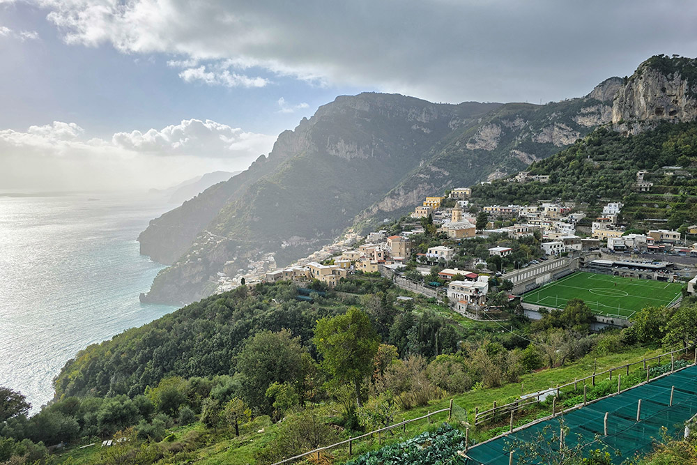
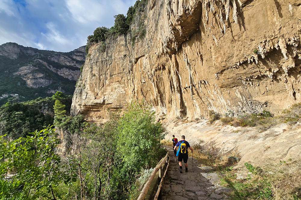
The Path of the Gods is one of the most famous hiking trails in Italy and the world, following the ridge of the Lattari Mountains with panoramic views of the Amalfi Coast, the Li Galli archipelago, and the island of Capri. The trail is classified as easy, although it has some exposed sections not recommended for those who suffer from vertigo.
The trail is marked by the Italian Alpine Club (CAI) with the number 327 and features a downhill elevation loss of 1055 meters starting from Bomerano towards Nocelle. The beauty of the path lies in its essentially natural character: human intervention is limited to protective barriers in the most exposed points and effective signage. The route passes through environments of Mediterranean scrub, rich in typical shrub species such as myrtle, rosemary, Phoenician juniper, rockrose, broom, and heather, alternating with terraced cultivations of vines and lemons that bear witness to centuries of strenuous agricultural work.
The best time to hike it is from April to October, with particular preference for spring (April-May) and autumn (September-October), when temperatures are milder and tourist numbers are lower.
History and Curiosities
The Path of the Gods is first and foremost an ancient communication route. For centuries, before the construction of the coastal state road commissioned by the Bourbons in the 19th century, these paths were the only links between the villages of the Amalfi Coast. Farmers and shepherds walked them daily with their mules loaded with tools, agricultural products, and building materials, reaching the terraced fields, pastures, or descending towards the coastal towns.
The evocative name Path of the Gods is actually a successful modern invention, born in the 1970s-80s to promote hiking tourism in the area. Before that, it was simply one of the many mountain paths used for daily necessities.
However, the name was so well chosen that it became legendary, connecting perfectly with classical mythology.
ITINERARY
From the parking area (633 m), proceed towards the S. Matteo sports field, then turn right following the sign for Sentiero degli Dei, CAI 327. Once you reach the official starting point, the trail gradually descends to Colle la Serra (578 m), where there is a fork. Keeping to the left, continue towards Nocelle (440 m).
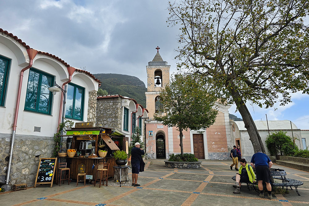
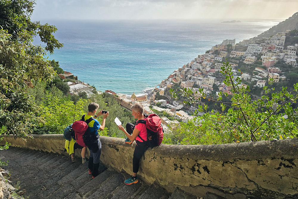
Upon reaching Nocelle, in the characteristic little square dominated by an ancient oak tree and the Santa Croce church, you can refresh yourself with a lemonade made from the famous sfusato lemons of the Amalfi Coast. From here, you can choose to descend to Positano (9 m) by walking down about 1,500 steps that lead to the Arienzo area on the SS163 road, or, as we did, continue for about one kilometer to the hamlet of Montepertuso (340 m), from where another staircase descends to the center of Positano.
EXCURSION DATE
October 24, 2025
STARTING POINT
Bomerano, a hamlet of Agerola
REFRESHMENT POINT
There are many refreshment points along the itinerary.
AUTHOR’S SUGGESTIONS
Best undertaken during periods of low visitor numbers.
SAFETY ADVICE
The viability of the proposed itinerary, like all mountain terrain, is subject to environmental changes due to natural events and weather conditions. Therefore, before setting off, consult the relevant tourist offices and/or the reference mountain huts.
Our GPX tracks are only indicative, meaning the route was recorded to the best of our ability based on the trail and weather conditions on that day. Always assess on-site what to do.
Also, remember to evaluate the route based on your physical abilities, training, and the equipment you have.
It is advisable to inform someone of the itinerary you intend to follow.
Remember that the emergency number is 112.
EQUIPMENT
It is recommended to have equipment suitable for the route, weather conditions, and season: windproof and/or rainproof jacket, map and/or GPS device, sunglasses, sunscreen, hiking boots, first aid kit, specific clothing, gloves, backpack with food and drinks.
RECOMMENDED MAPS
CAI, Monti Lattari. Penisola sorrentina. Costiera amalfitana. Isola di Capri. Trail map scale 1:25000
INTERESTING LINKS
https://costieraamalfitana.com/positano/
HOW TO ARRIVE
From Salerno, take the SS18. At Vietri sul Mare, continue on the SS163. After Amalfi, at the fork, take a right towards Agerola on the SS366 and continue for about 13 km until the hamlet of Bomerano.
PARKING AREA
Free Parking - Sentiero degli Dei a Bomerano.
GPS Coordinates: 40.628335, 14.542030
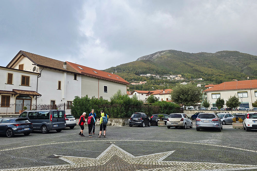
Parcheggio a Bomerano
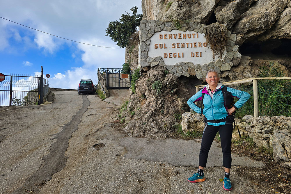
Punto di partenza del Sentiero degli dei
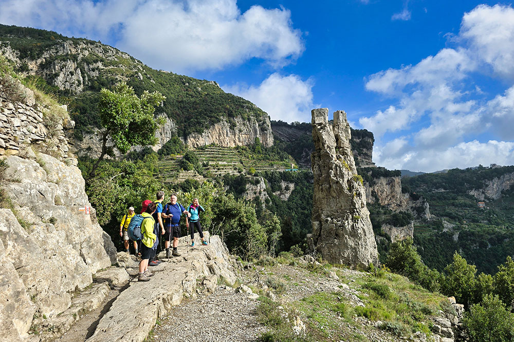
Lungo il percorso
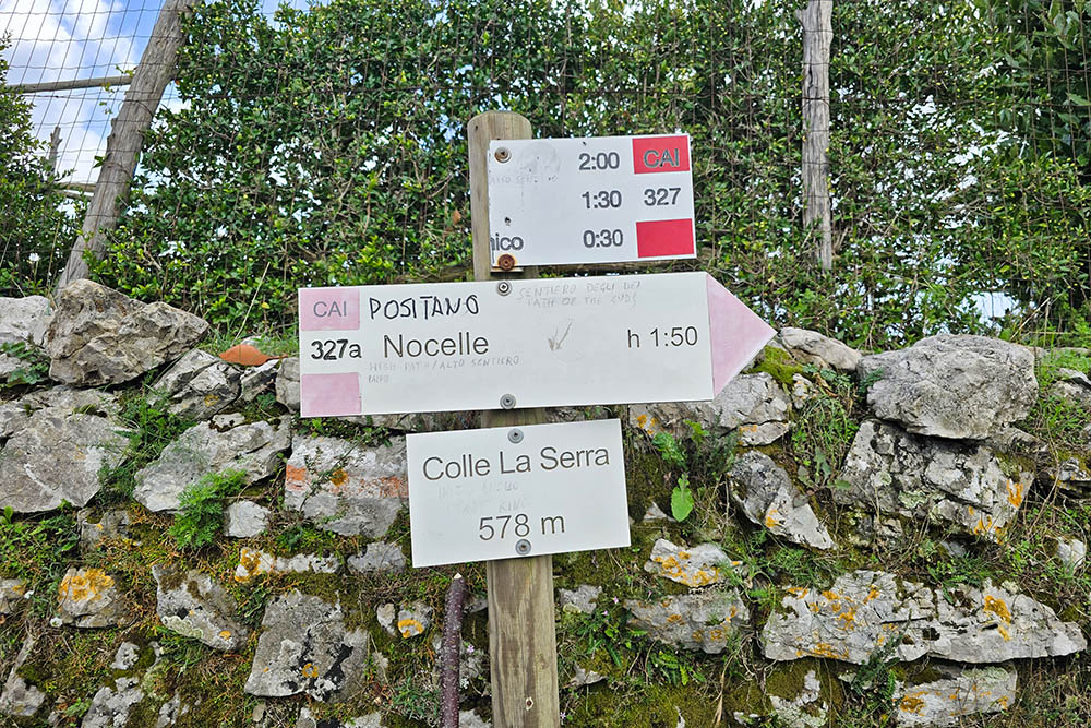
Bivio località Colle Serra
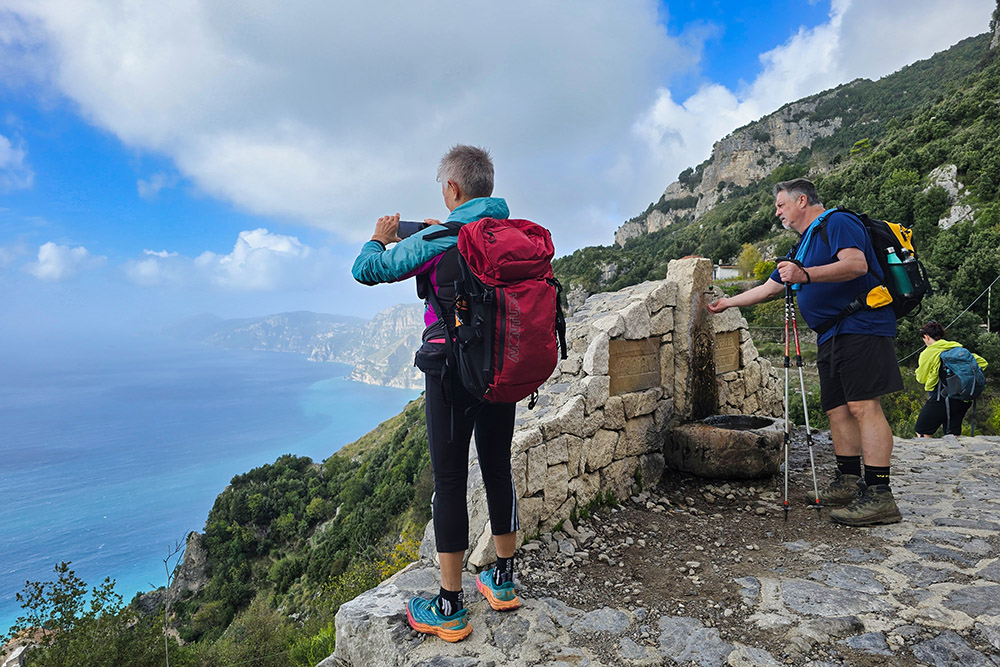
Fontalella per rifornimento idrico

Uno dei punti ristoro
Panorama
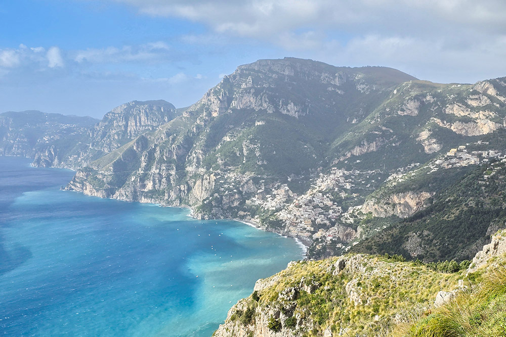
Panorama
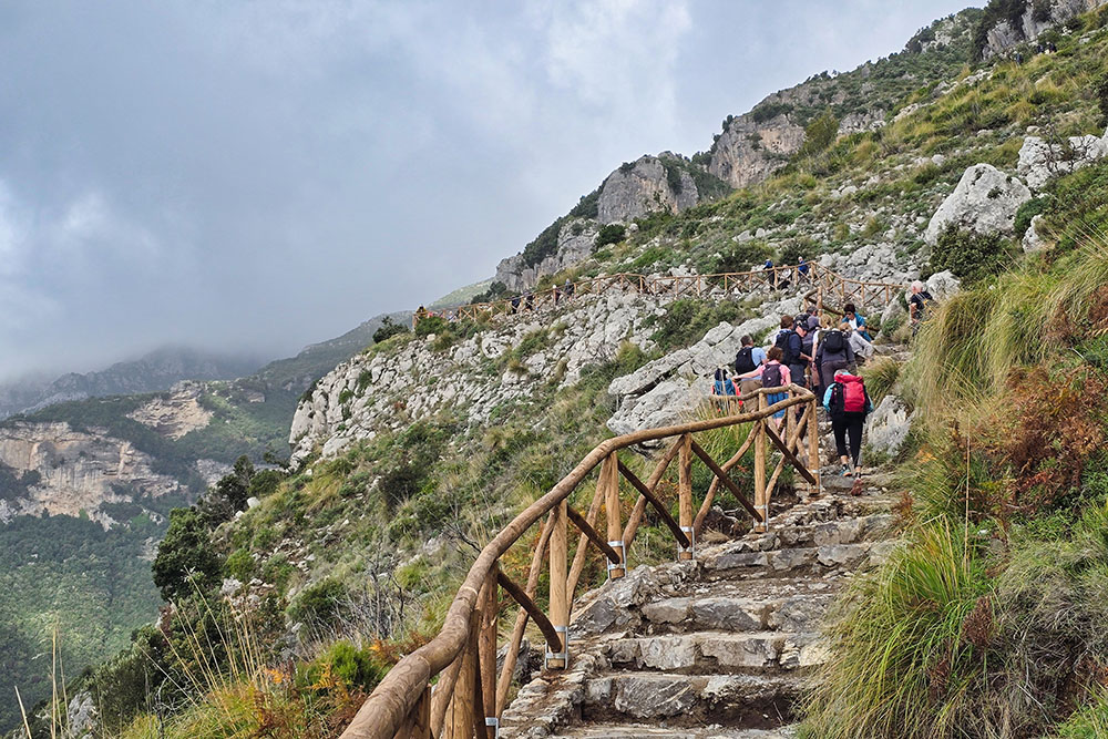
Tratto con staccionata
Vista verso Positano
Piazza a Nocelle
Montepertuso
Scendiamo
Sopra Positano
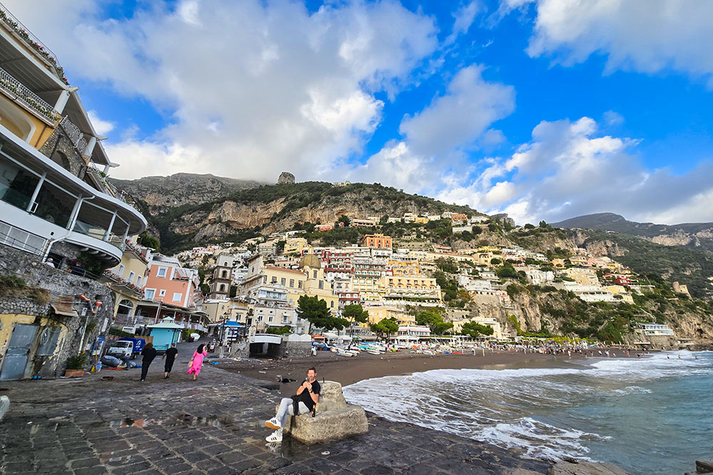
Siamo arrivati alla spiaggia di Positano


