


![]()


Durata
 4:45 h
Distanza
 8,7 km
 Ascesa
 905 m
905 mDiscesa
 905 m
905 mH Max
 1035 m
H Min
 188 m
188 mMonte Cunicolo from Marone
DESCRIPTION
Monte Cunicolo loop: 900 meters of elevation gain between Marone and Zone on Lake Iseo.
Geographic location
Marone is located on the eastern shore of Lake Iseo, in the province of Brescia, at approximately 200 meters above sea level. The municipality extends along the coast between Sulzano to the north and Sale Marasino to the south.
Hike
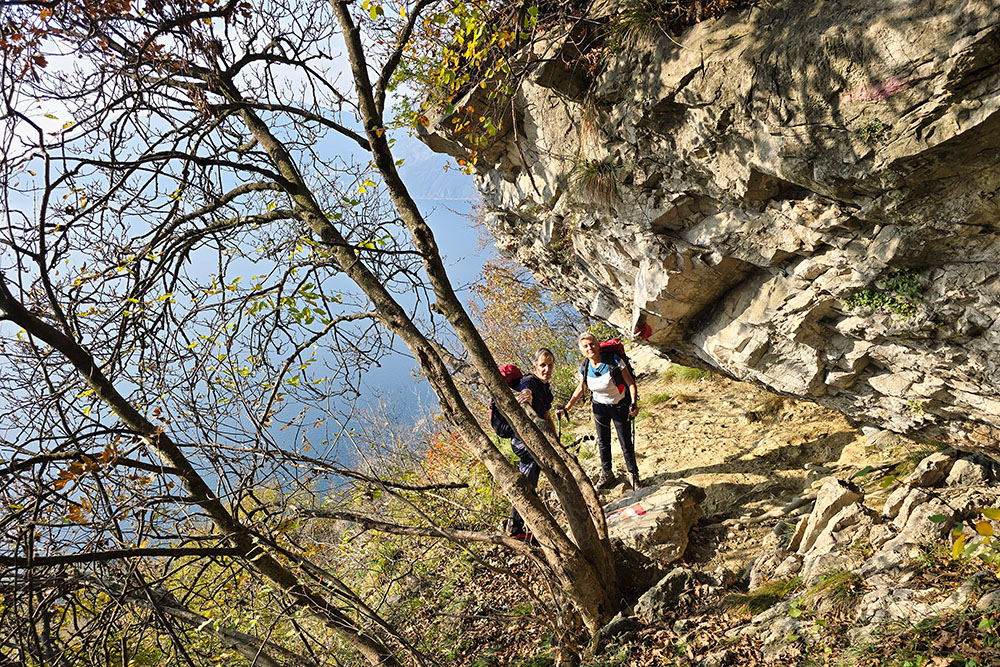
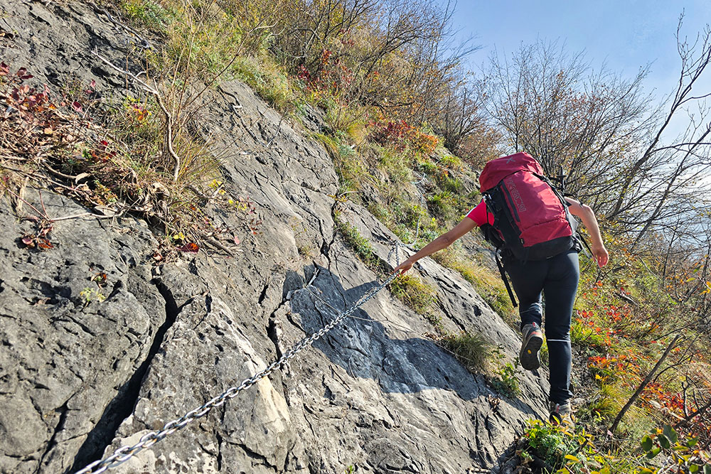
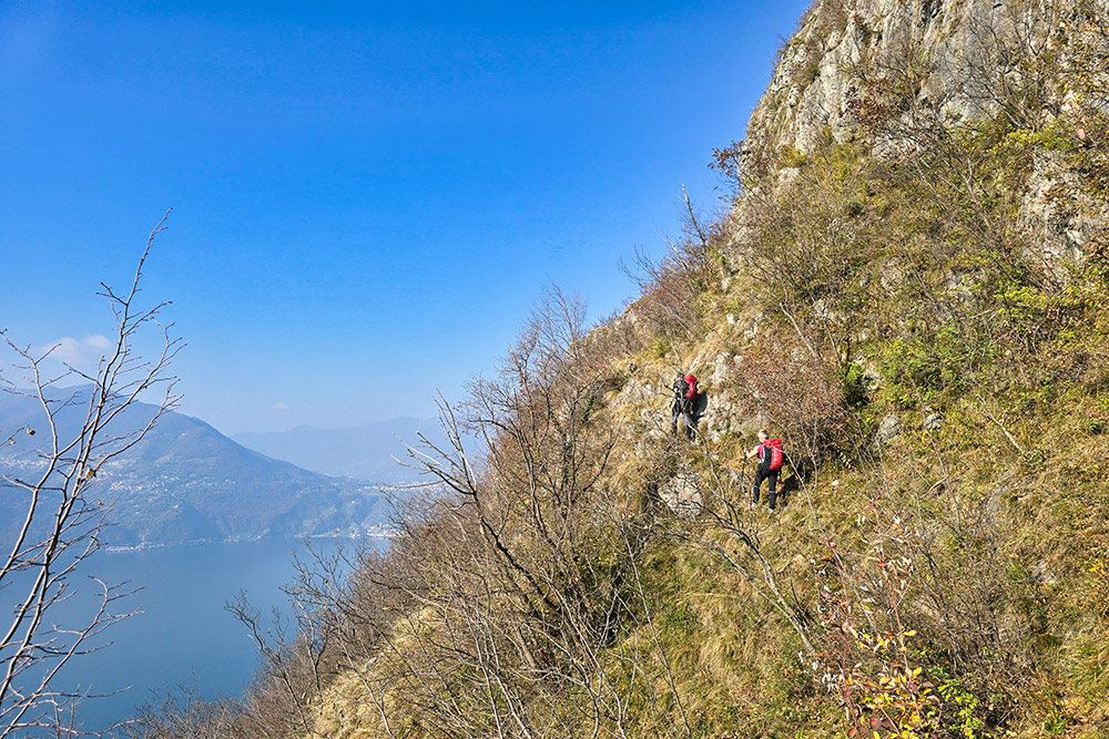
This loop itinerary represents a challenging route, rarely frequented precisely due to its technical characteristics: 900 meters of elevation gain concentrated on very steep slopes, a central section of equipped trail with metal cables, and exposed passages in the summit area. This is a route reserved exclusively for experienced hikers, with good physical fitness and no fear of heights.
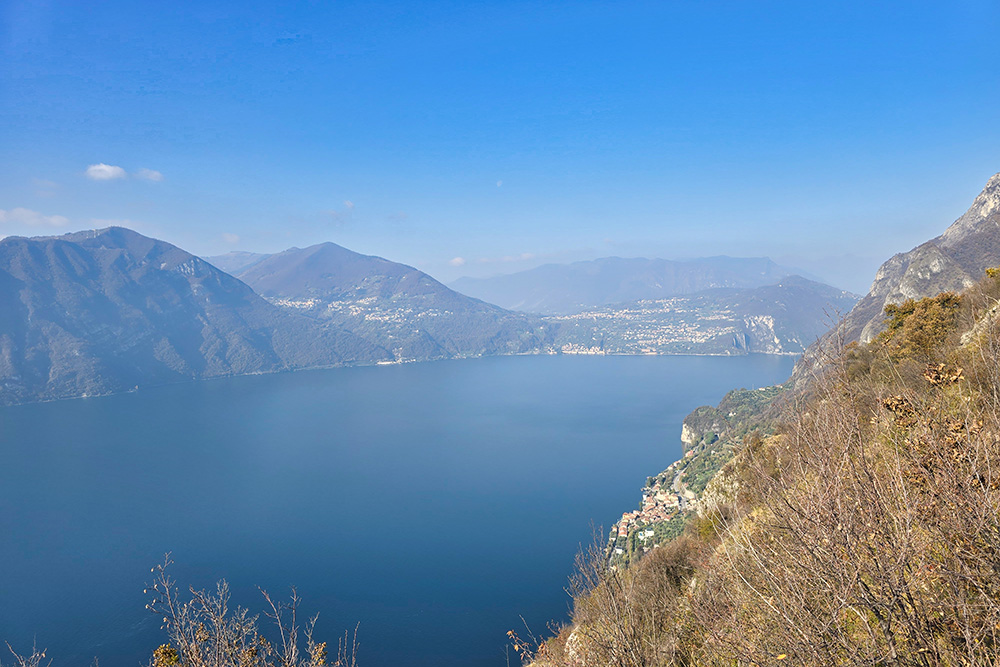
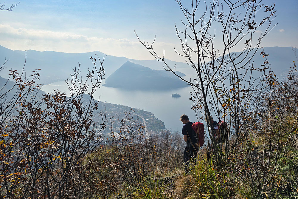
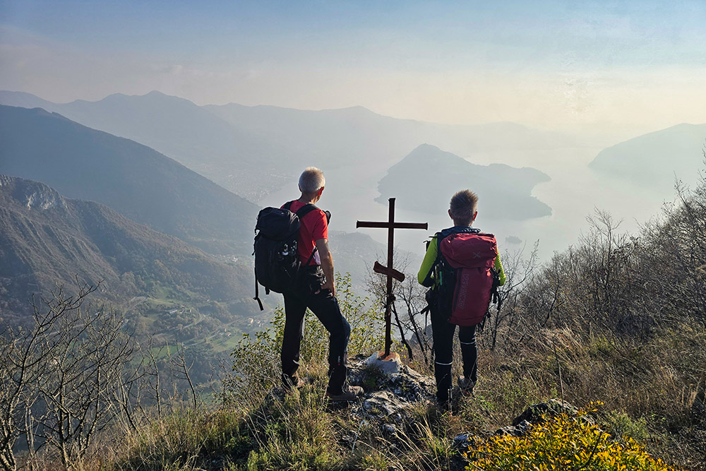
Nevertheless, the effort is amply rewarded by the exceptional panorama that accompanies the entire ascent: the view spans across Lake Iseo, Monte Isola with its villages, the mountains on the Brescia side (Monte Guglielmo, Corna Trentapassi), and those on the Bergamo side.
There are no refreshment points along the route: it is essential to bring an abundant water supply, especially during summer months, and a packed lunch. Recommended period: spring (March-May) and autumn (October-November), avoiding the hottest months and rainy days due to the presence of slippery equipped sections.
History and curiosities
Marone has its roots in Roman times, when the territory was crossed by the Via Valeriana, an important consular road that connected Brescia to Valle Camonica following the eastern coast of Lake Iseo. Traces of this ancient Roman road are still visible at various points in Valcamonica and along the Sebino coast.
Monte Isola, which stands before Marone, is the largest lake island in Italy, with an area of 12.61 km² and a perimeter of about 9 km.
Monte Cunicolo (1035 m), the destination of this hike, probably owes its name to the presence of tunnels or galleries, perhaps of military or mining origin.
The Pietra del Lago, a viewpoint along the route, is a characteristic rock outcrop from which one enjoys a privileged view.
ITINERARY
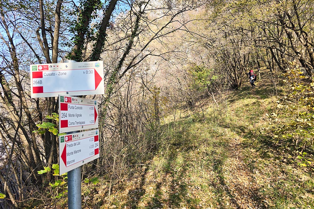
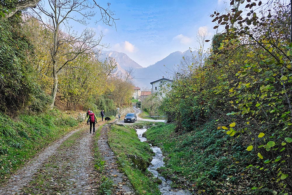
From the parking area located in Marone (188 m), take Via Risorgimento and then Via Monte Marone. Before reaching the Monte Marone locality, leave the cobblestone road and turn left (370 m) onto CAI trail 264.
At 500 meters elevation, pass by the Pietra del Lago, a viewpoint where it's worth stopping to admire the lake below. Continue along the equipped section with metal cables, which requires attention but presents no mountaineering difficulties. After passing this section, reach the Anticima della Punta Cunicolo (768 m).
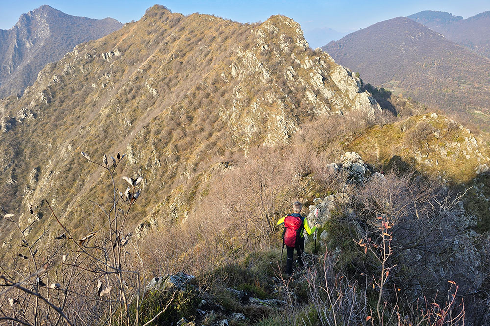
From here, descend losing about 50 meters of elevation, then climb along a steep and exposed trail, which requires sure footing and no fear of heights, to the summit of Monte Cunicolo (1035 m), the culminating point of the hike.
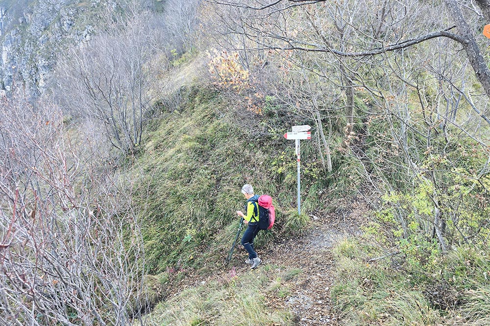
From the summit, descend toward the Forcellino di Gadol (938 m), where you leave trail 264 to take trail 229, which descends more gently toward the town of Zone (700 m). Here continue on the road, following trail marker 264A, and return to the starting point.
EXCURSION DATE
November 9, 2025
STARTING POINT
Marone (BS)
REFRESHMENT POINT
None
AUTHOR'S SUGGESTIONS
For climatic reasons, it is advisable to do the hike in spring or autumn.
SAFETY ADVICE
The feasibility of the proposed itinerary, like all mountain morphology, is subject to environmental changes due to natural events and weather conditions. Therefore, before departing, consult the relevant tourist offices and/or reference mountain huts.
Our GPX tracks are only indicative, meaning the route was completed to the best of our ability given the trail and weather conditions on that day. Therefore, always evaluate what to do on site.
Additionally, remember to evaluate the route based on your physical abilities, training, and available equipment.
It is advisable to inform someone of the itinerary you intend to follow.
Remember that the emergency number is 112.
EQUIPMENT
It is recommended to have equipment suitable for the route, weather conditions, and season: windproof and/or waterproof jacket, map and/or GPS device, sunglasses, sunscreen, hiking boots, first aid kit, specific clothing, gloves, backpack with food and beverages.
RECOMMENDED MAPS
4LAND, Lake Iseo 1:25,000
INTERESTING LINKS
https://visitlakeiseo.info/
HOW TO ARRIVE
A4 Exit Brescia centro. Follow the Tangenziale Sud SP11, then the SP510 and exit at Vello/Marone/Sale Marasino/Sulzano.
PARKING AREA
Piazzale Avieri d'Italia, in front of the Municipal Library
GPS Coordinates: 45.740308, 10.091514
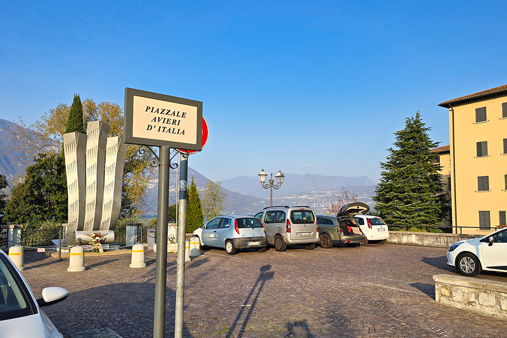
Parcheggio a Marone
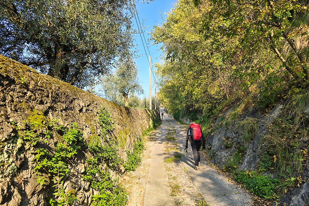
Saliamo a Monte Marone
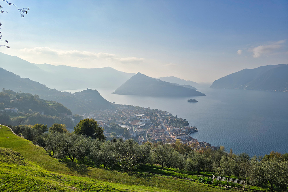
Vista verso Marone
La Pietra del Lago
Vista verso la sponda bergamasca
Tratto attrezzato
Vista dell'Anticima Punta Cunicolo
Si ritorna a salire
Il sentiero diventa ancora più impervio
In vetta al Monte Cunicolo
Si scende verso Zone
Passiamo dal Forcellino di Gadol
Arrivati a Zone
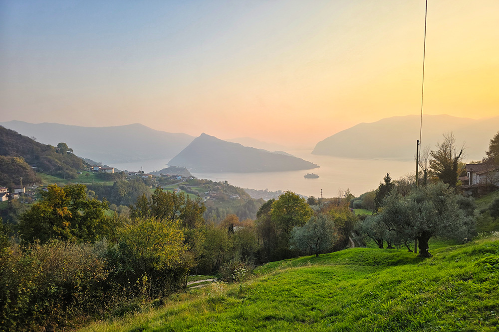
Panorama all'imbrunire
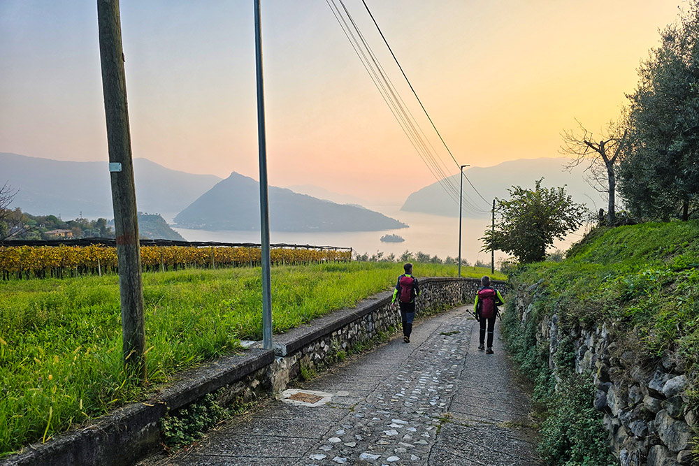
Ritorniamo a Marone


