


![]()


Durata
 4:30 h
Distanza
 11,3 km
 Ascesa
 356 m
356 mDiscesa
 772 m
772 mH Max
 978 m
978 mH Min
 516 m
516 mChestnut Trail, Barbiano - Chiusa #3
DESCRIPTION
Through chestnut groves and leaning bell towers: a hike from Barbiano to Chiusa.
Geographical Location
The third stage of the Chestnut Trail is located in South Tyrol, along the eastern side of the Isarco Valley, connecting Chiusa to Barbiano. The Keschtnweg, as it is known in German, is a hiking trail of approximately 90 kilometres that traverses the valley's ancient chestnut groves, starting from Bolzano and reaching as far as Novacella Abbey near Bressanone.
The area is characterised by a rich and varied environmental mosaic: centuries-old chestnut groves, orderly apple orchards, mixed forests, terraced vineyards, and small, well-kept rural villages, dotted with isolated farmsteads and historically significant architecture.
Hike
The third stage of the Chestnut Trail leads the hiker from Chiusa to Barbiano along a low-difficulty itinerary, also suitable for families with children who are used to walking. The path mostly runs at altitude, with an up-and-down profile between 700 and 978 metres above sea level, before concluding with a gradual descent towards Barbiano, at 516 metres.
The route alternates between minor asphalted roads, well-marked paths, and ancient paved mule tracks, treating hikers to a succession of panoramic views over the Isarco Valley and the traditional agricultural landscapes. The trail is marked with specific signs that facilitate navigation.
The ideal period for this hike is from the end of September to the beginning of November, when the chestnut groves take on warm autumn hues and the tradition of Törggelen animates the local farmsteads and inns. During this period, the woods offer an intense colour spectacle and the fresh mountain air invites long walks.
To return to the starting point, you can use the local bus connections or organise with two cars, leaving one at the destination. It is advisable to check public transport timetables before departure, especially in the autumn months when services may be less frequent.
History and Curiosities
Barbiano is an ancient village in South Tyrol whose origins are lost in the centuries. The first documented mention of the village dates back to the year 855 AD, bearing witness to the long history of this rural settlement in the Isarco Valley.
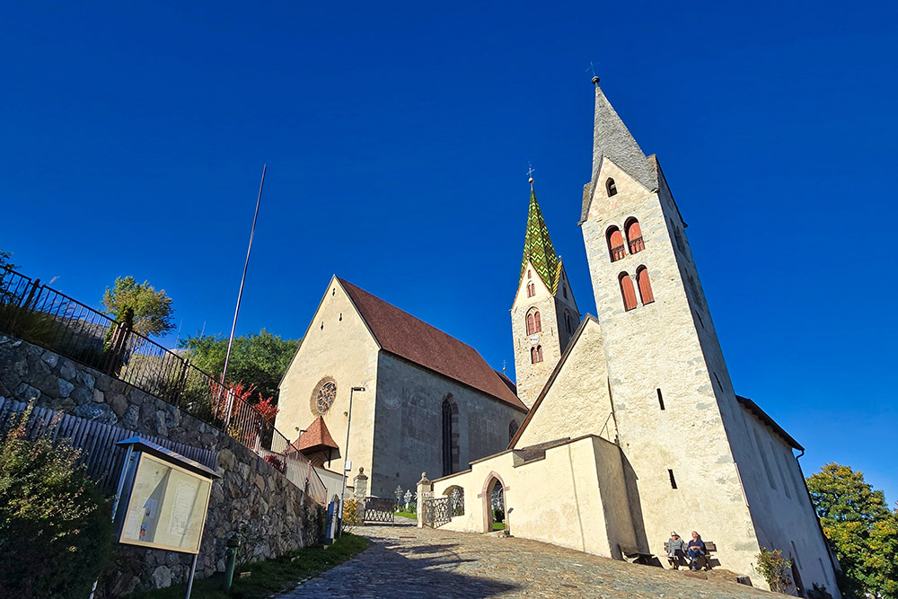
The village is best known for its parish church, dedicated to Saint James the Greater, the patron saint of pilgrims. The sacred building, constructed around 1100 in Romanesque style, preserves a very particular architectural element: the 37-metre high octagonal bell tower is visibly leaning. The spire of the bell tower has an inclination of 1.57 metres from the vertical, even surpassing the famous Leaning Tower of Pisa. This unique characteristic has earned Barbiano the nickname of the village with the leaning tower. The bell tower is the only original part of the building, while the church has undergone expansions and modifications over the centuries, particularly in 1472 when Gothic elements were added.
Continuing towards the nearby Villandro, one encounters further evidence of the area's historical and cultural richness. The parish church of Saints Stephen and Lawrence and the small church of Saint Michael in the cemetery are important examples of local religious architecture. The latter is now used as a mortuary chapel and retains an atmosphere of recollection and spirituality.
The cemetery of Villandro is considered one of the most characteristic and fascinating in South Tyrol, famous for its particular, finely wrought wrought-iron grave crosses. These crosses have a unique feature: they are placed at the foot of the burial mound and not behind or at the head, as is common practice. The reasons for this stylistic and cultural choice are not entirely clear, and no historical documentation provides certain explanations, but this very particularity makes the cemetery a place of great ethnographic interest.
A final historical note concerns the Lords of Villandro, one of the most powerful aristocratic families of medieval Tyrol. These wealthy farmers, who resided in large farmsteads similar to manor houses, considerably expanded their possessions and played a significant role in the local history of the Isarco Valley during the central centuries of the Middle Ages.
ITINERARY
From the small square in front of the Church of San Giacomo in Barbiano (839 m), take the road ascending on the left. After about 250 metres, keep left again until reaching a bend, where the trail marked by signs 3/11 begins.
Near the sports fields, keep to the right; at the first junction, turn left and immediately after, turn right again, following the sign for Villandro with marker 11. From this point onward, consistently follow the signs for the Chestnut Trail.
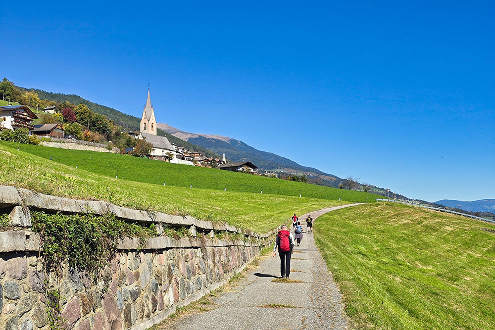
The path passes by the small Church of San Maurizio and climbs up to Villandro (882 m). Continue at altitude for about 3 kilometres, then descend towards Chiusa (516 m) through the Tinne Valley.
EXCURSION DATE
October 12, 2025
STARTING POINT
Barbiano
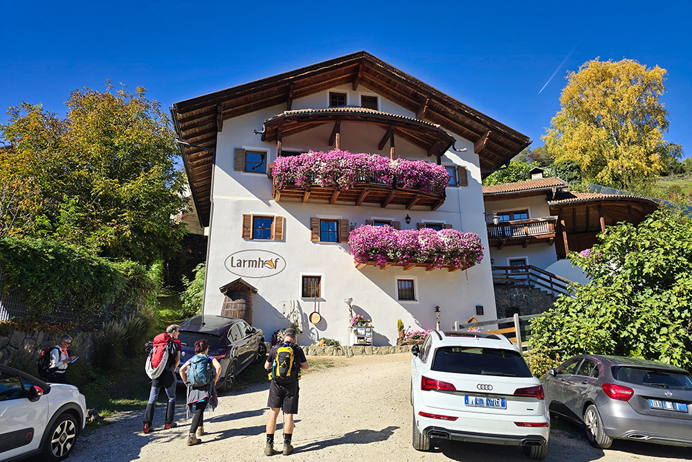
REFRESHMENT POINT
Larmhof
AUTHOR’S SUGGESTIONS
If you go during the autumn period, try the typical Törggelen.
SAFETY ADVICE
The viability of the proposed itinerary, like all mountain terrain, is subject to environmental changes due to natural events and weather conditions. Therefore, before setting out, consult the relevant tourist offices and/or the reference mountain huts.
Our GPX tracks are only indicative, meaning the route was recorded under the best trail and weather conditions of that day. Therefore, always assess on-site what to do.
Furthermore, remember to evaluate the route based on your physical abilities, training, and the equipment you have.
It is advisable to inform someone of the itinerary you intend to follow.
Remember that the emergency number is 112.
EQUIPMENT
It is recommended to have equipment suitable for the route, weather conditions, and season: windproof and/or rainproof jacket, map and/or GPS device, sunglasses, sunscreen, hiking boots, first aid kit, specific clothing, gloves, backpack with food and drinks.
RECOMMENDED MAPS
Tabacco Map 030 Brixen - Villnössertal / Bressanone - Val di Funes
INTERESTING LINKS
https://www.larmhof.it/
HOW TO ARRIVE
A22 motorway, Bolzano Nord exit. Proceed north on SS12. Upon reaching Ponte Gardena, turn left uphill towards Barbiano and continue to the village centre.
PARKING AREA
Free parking in Barbiano
GPS Coordinates: 46.601289, 11.518876
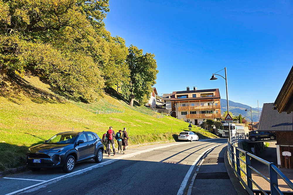
Parcheggio a Barbiano

La chiesa di Barbiano

Vista verso Villandro

Si cammina nel bosco
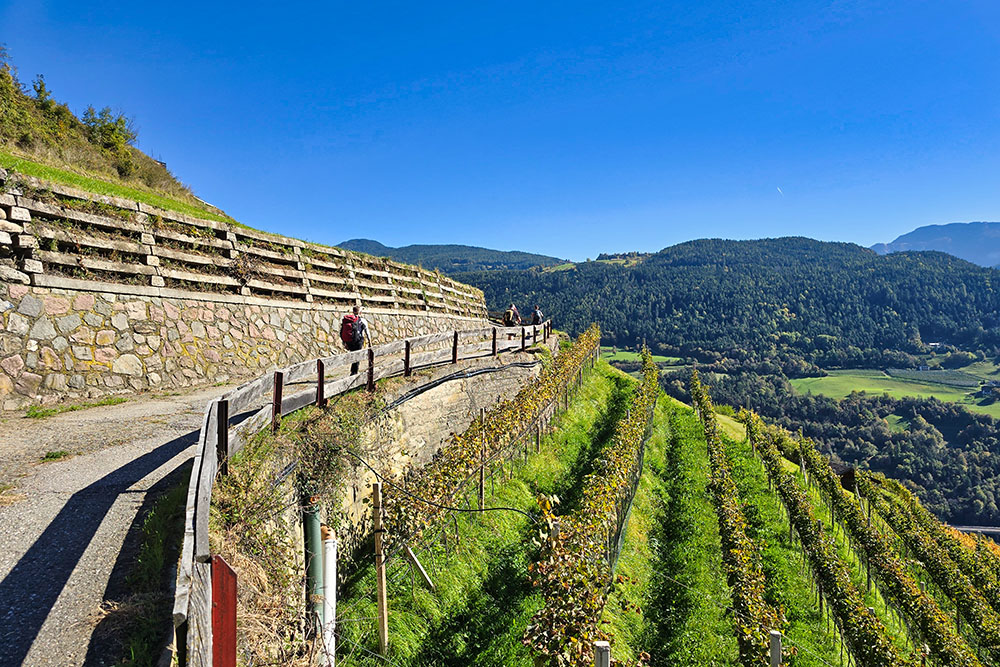
I bei vegneti della zona
Arriviamo a San Maurizio
Ci fermiamo a pranzo
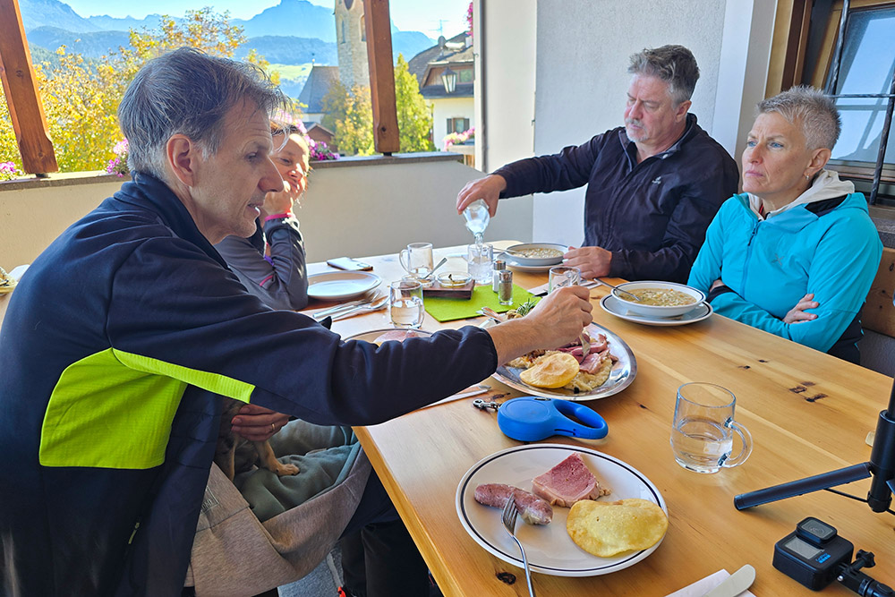
Un ottimo pranzo
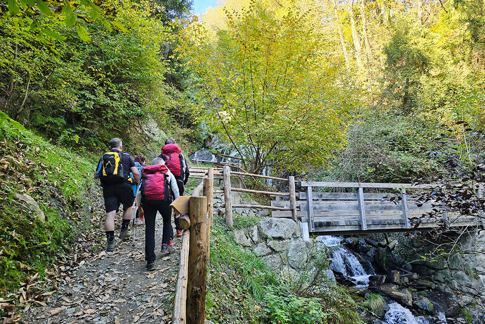
Si riprende il bosco
Arrivati a Villandro
Saliamo alle due chiese
San Stefano e San Michele
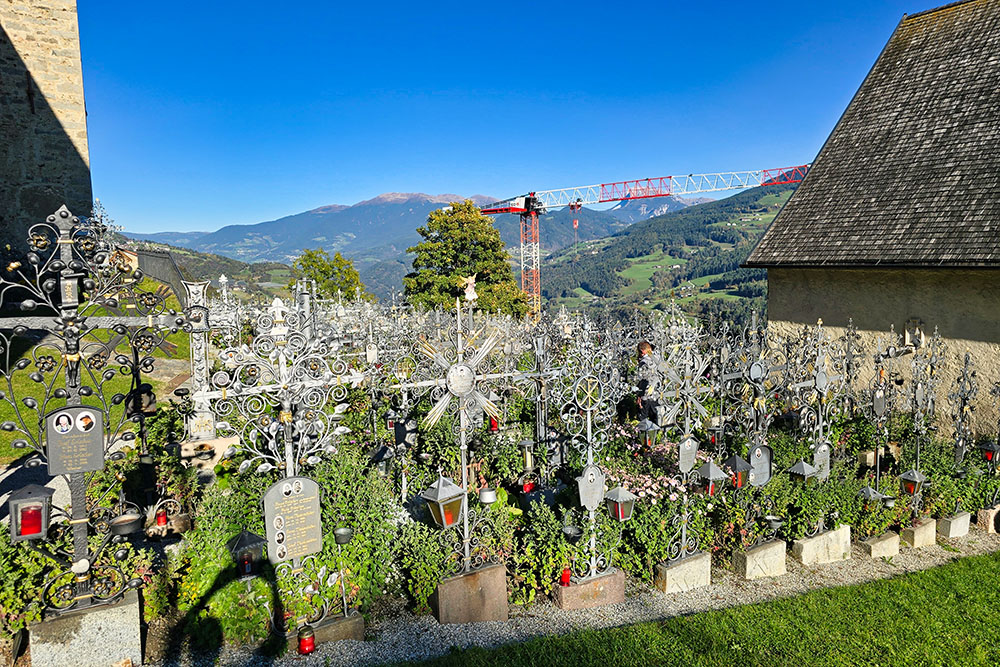
Il caratteristico cimitero di Villandro
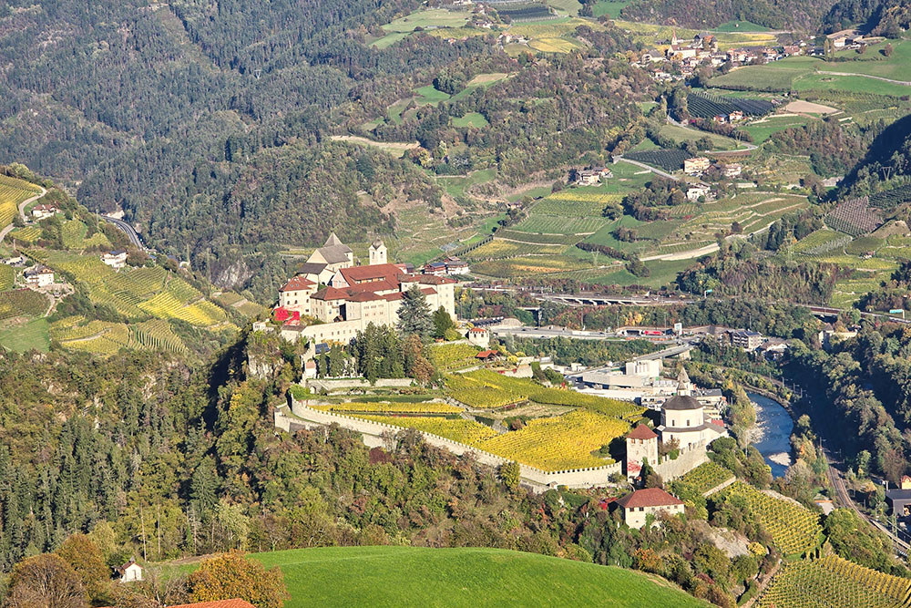
Vista sul Monastero di Sabiona
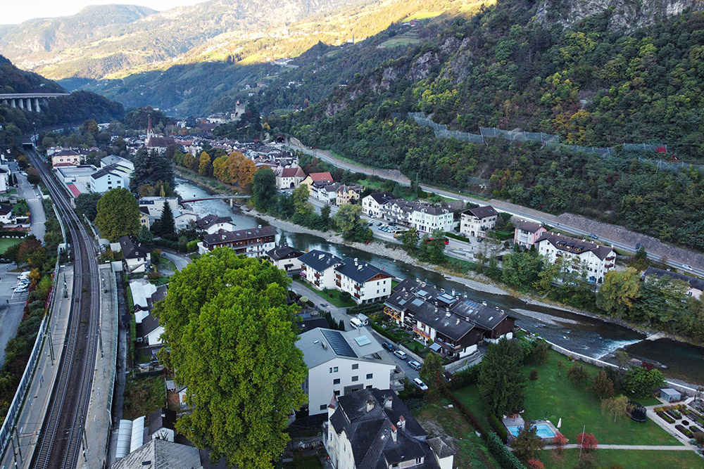
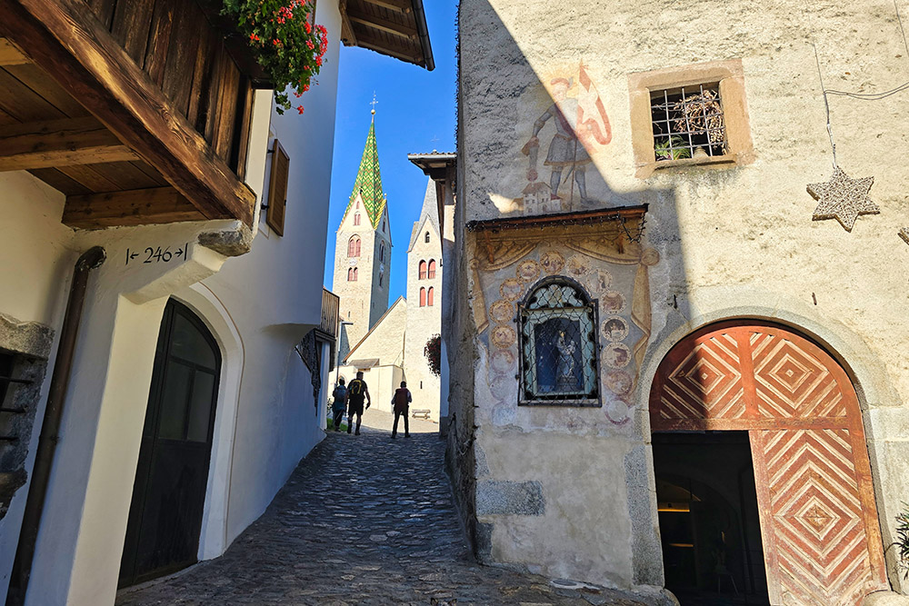
Il paese di Chiusa


