


![]()


Durata
 4:30 h
Distanza
 12,8 km
 Ascesa
 861 m
861 mDiscesa
 861 m
861 mH Max
 2426 m
H Min
 1577 m
To Piz Lun from Mazia
DESCRIPTION
Piz Lun and Tartscherkreuz: an easy hike through breathtaking landscapes.
Geographical Location
Piz Lun, also known as Spitzige Lun, is one of the most scenic peaks in Upper Val Venosta, despite its modest height. The mountain is located above the village of Malles, between the Mazia Valley, Val Venosta, and the Planol Valley.
Hike
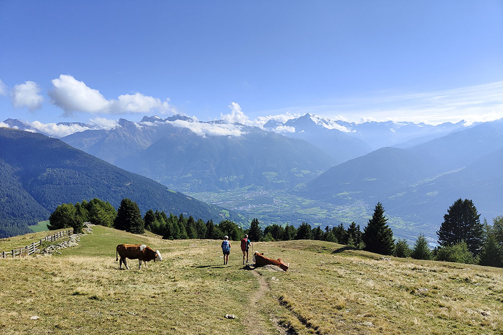
This relatively easy hike allows you to reach one of the most panoramic peaks in the area. The first 2.3 km are on a road that starts paved and later becomes a dirt road, followed by a well-marked trail. Before continuing to the summit of Piz Lun, it is recommended to take a detour to the right to reach Tartscherkreuz, a viewpoint well worth a stop.
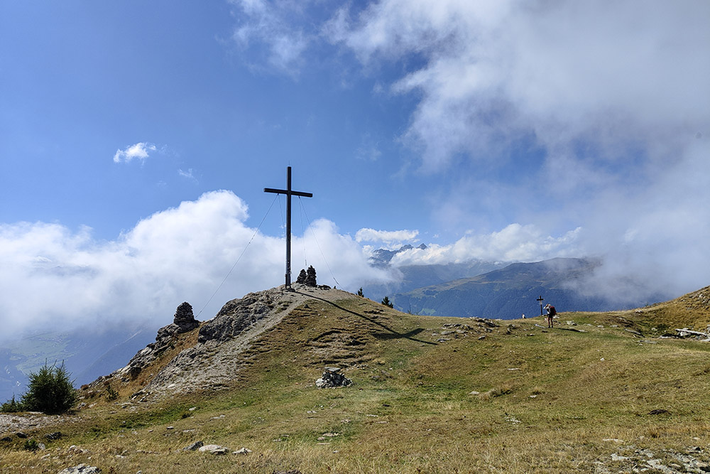
From the summit of Piz Lun, you will enjoy a spectacular view of the Ortler Group, the Swiss and Austrian mountains, as well as Lake Haidersee (Lake della Muta) and Lake Reschensee (Lake Resia).
ITINERARY
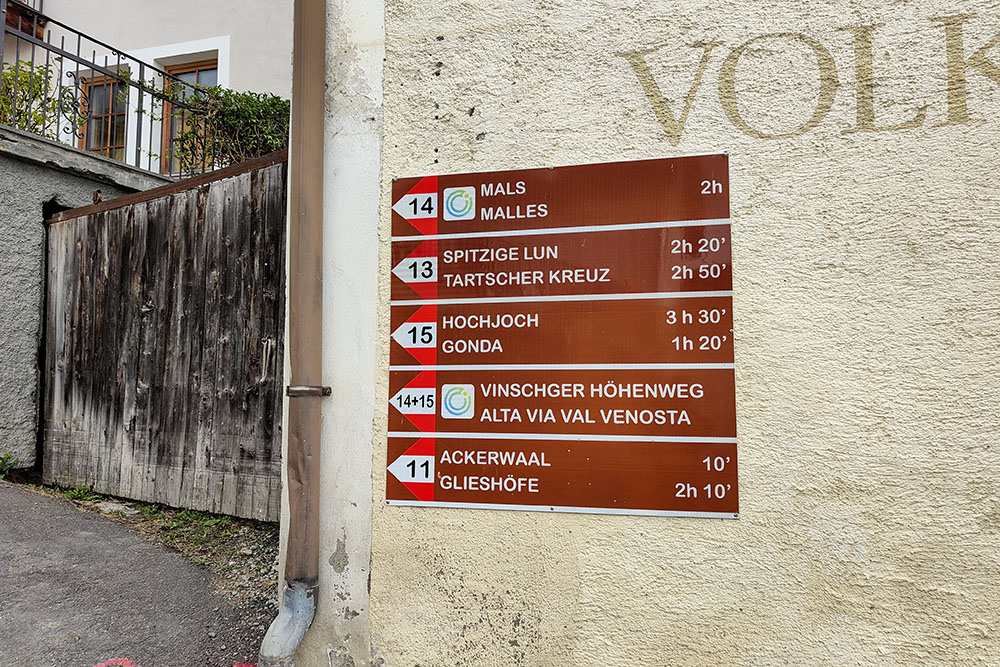
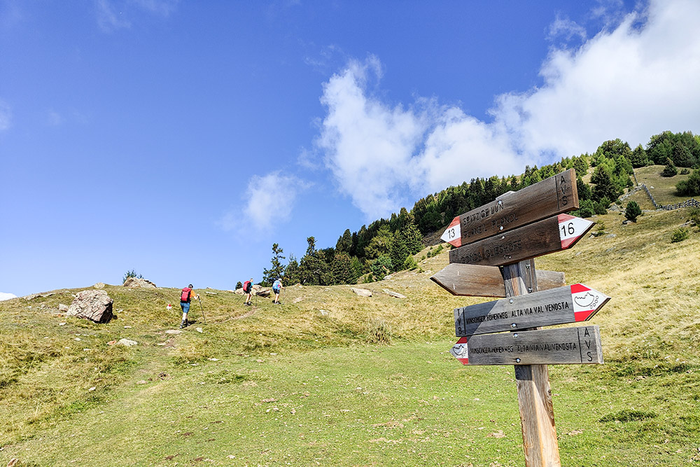
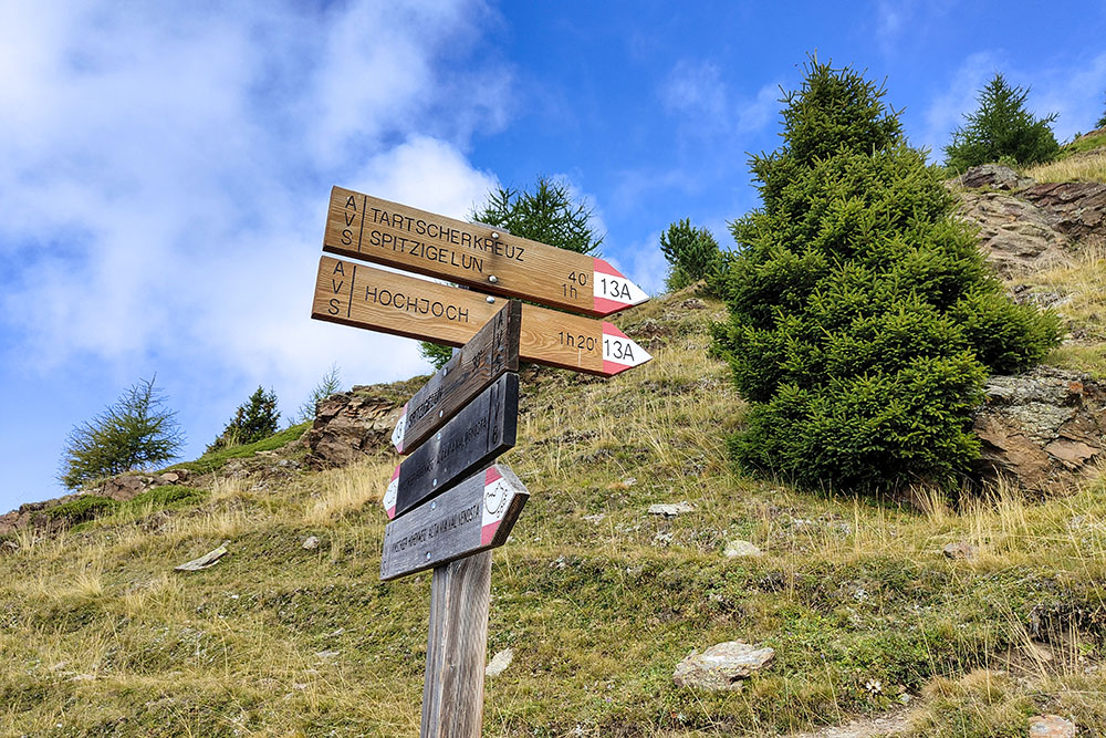
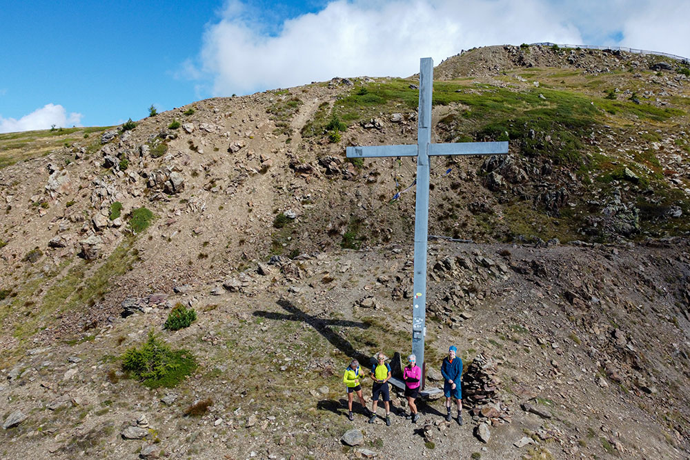
From the center of Mazia (1577 m), follow trail no. 13 towards Piz Lun. The route starts on a paved road and then continues on a dirt road. After a while, turn left and continue on the trail marked with the number 13, passing the location of Plantavillas (2040 m). From here, take trail 13A to climb to Tartscherkreuz (2408 m). Then, continue until you reach trail 15, coming from Hochjoch/Giogo Alto, which leads to the summit of Piz Lun (2324 m). The return follows trail no. 13 back to the starting point.
EXCURSION DATE
September 7, 2024
STARTING POINT
Mazia
REFRESHMENT POINT
None
AUTHOR’S SUGGESTIONS
It is advisable to arrive in Mazia early in the morning, as parking spaces are limited.
SAFETY TIPS
The accessibility of the proposed itinerary, like all mountain terrain, is subject to environmental changes due to natural events and weather conditions. Therefore, before setting off, consult the relevant tourist offices and/or the mountain huts.
Our GPX tracks are for guidance only, meaning the route was completed under the best possible trail and weather conditions on the day. Always assess the situation locally.
Also, remember to evaluate the route according to your physical abilities, fitness level, and available equipment.
It is advisable to inform someone of the itinerary you intend to take.
Remember that the emergency number is 112.
EQUIPMENT
It is recommended to have appropriate equipment for the route, weather conditions, and season: windproof and/or rain jacket, map and/or GPS device, sunglasses, sunscreen, hiking boots, first aid kit, specific clothing, gloves, backpack with food and drinks.
RECOMMENDED MAPS
Tabacco 044 Vinschgau - Mals - Sesvenna/Val Venosta - Malles
INTERESTING LINKS
https://www.suedtirolerland.it/it/alto-adige/val-venosta/
HOW TO ARRIVE
From Merano, take the SS38 to Spondigna, continue on the SS40 and in Tarces turn right onto the SP105 and head up to the village of Mazia.
PARKING AREA
In the village of Mazia
GPS Coordinates: 46.692537, 10.615595
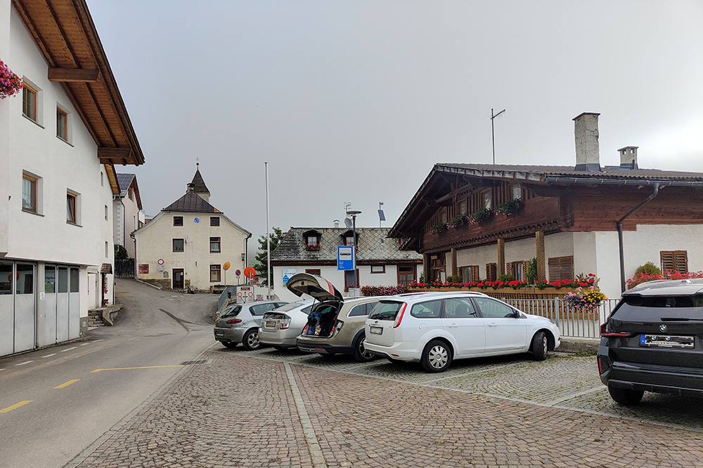
Parcheggio a Mazia
Punto di partenza dell'itinerario
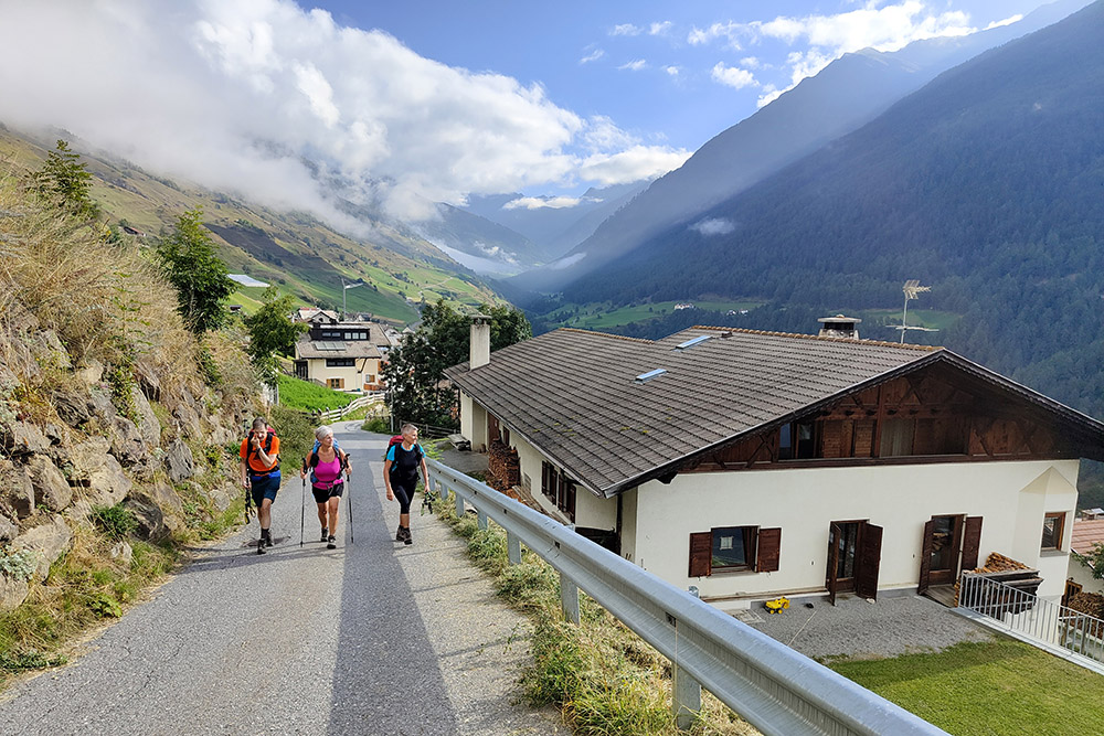
Lasciamo l'abitato di Mazia
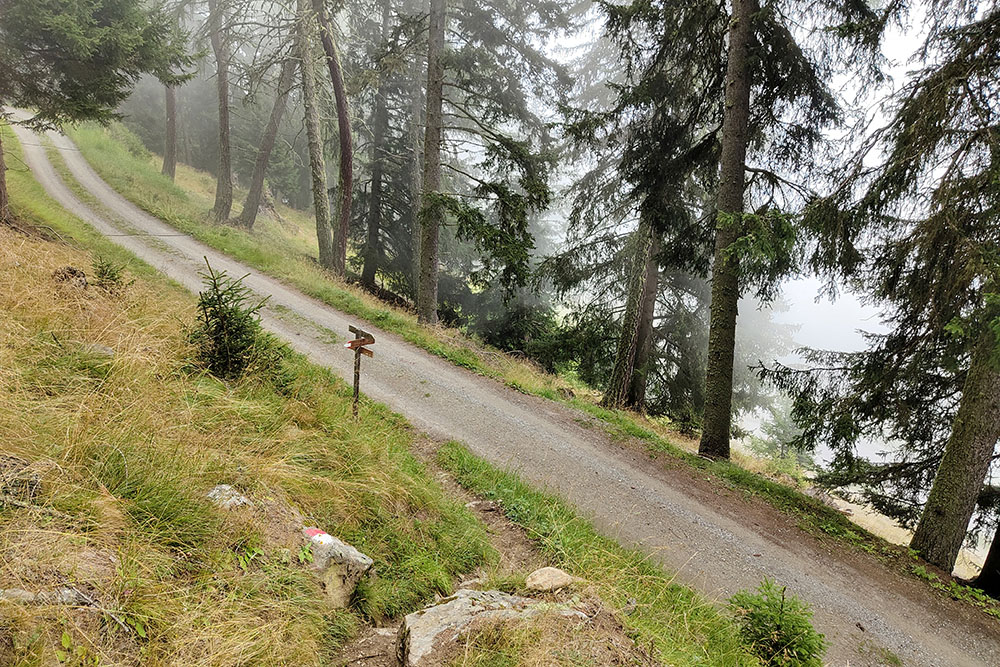
Dalla strada sterrata si passa la sentiero
In lontananza si vede la cina dell'Ortles
Si sale seguendo il segnavia 13
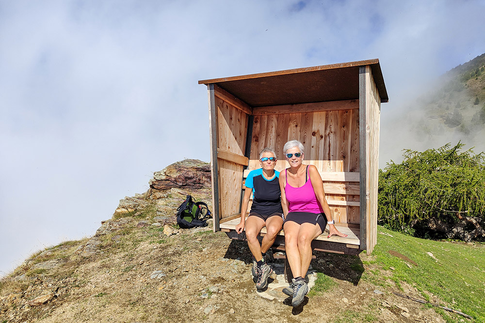
Una simpatica panca rotante
Bivio per il sentiero 13A
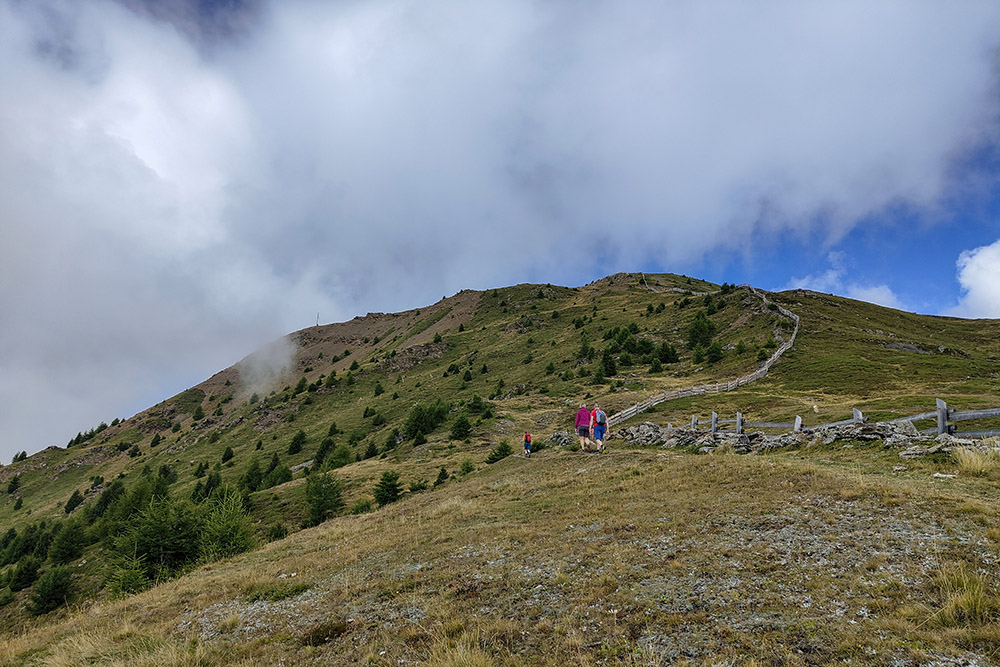
Si sale verso la Tartscherkreuz
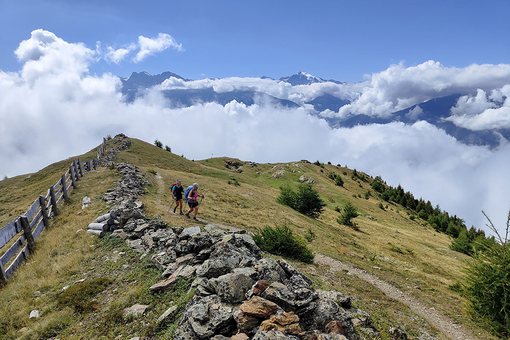
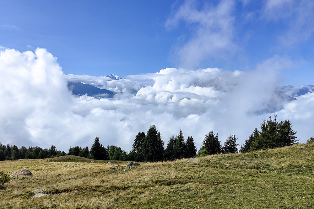
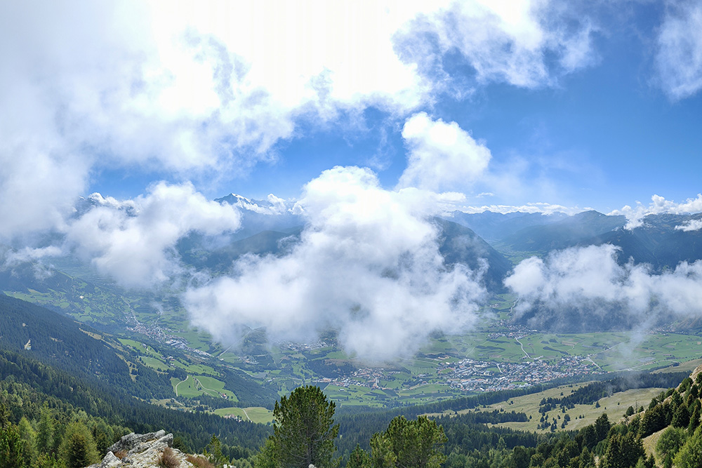
Il panorama è avvolto nelle nuvole
Arrivati alla Tartscherkreuz
Croce del Piz Lun
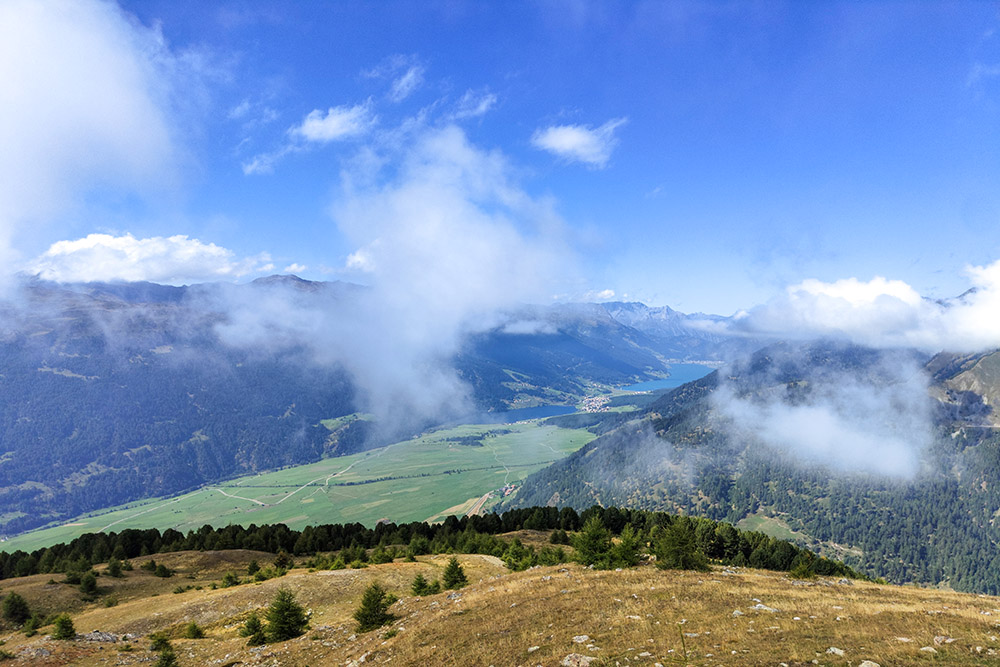
In lontananza si vedono i laghi di Resia
Panorama verso l'Ortles
Si ritorna a Mazia


