


![]()


Durata
 7:00 h
Distanza
 15,8 km
 Ascesa
 1261 m
Discesa
 1261 m
H Max
 3016 m
H Min
 1809 m
Saldura Lakes and Oberettes Mountain Hut
DESCRIPTION
Loop itinerary in the upper Matsch Valley between lakes and glaciers.
Geographic location
The Saldura Lakes (Saldurseen in German) represent one of the most spectacular natural jewels of South Tyrol. These alpine water mirrors hide at the top of the Matsch Valley, one of the most remote lateral valleys of the upper Vinschgau Valley, set in a glacial amphitheater.
Located between Oberettes Peak and the majestic Saldura Group, in the eastern Ötztal Alps, the lakes are distributed on a plateau ranging from 2750 to 2900 meters above sea level. Each lake basin presents unique characteristics: the waters vary from the purest crystal clear to emerald green, creating a natural kaleidoscope that harmoniously blends with the surrounding landscape of glaciers, rocky peaks and alpine meadows.
Hike
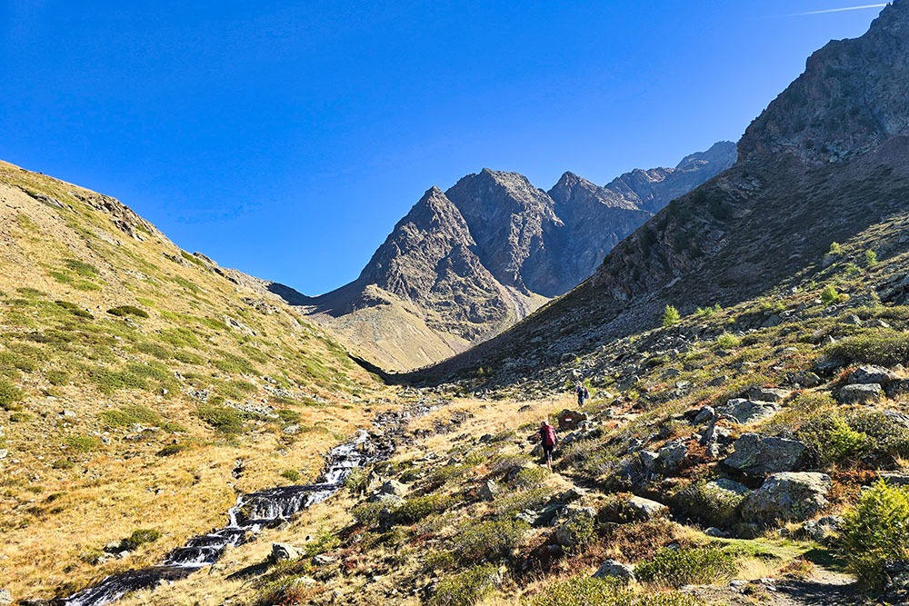
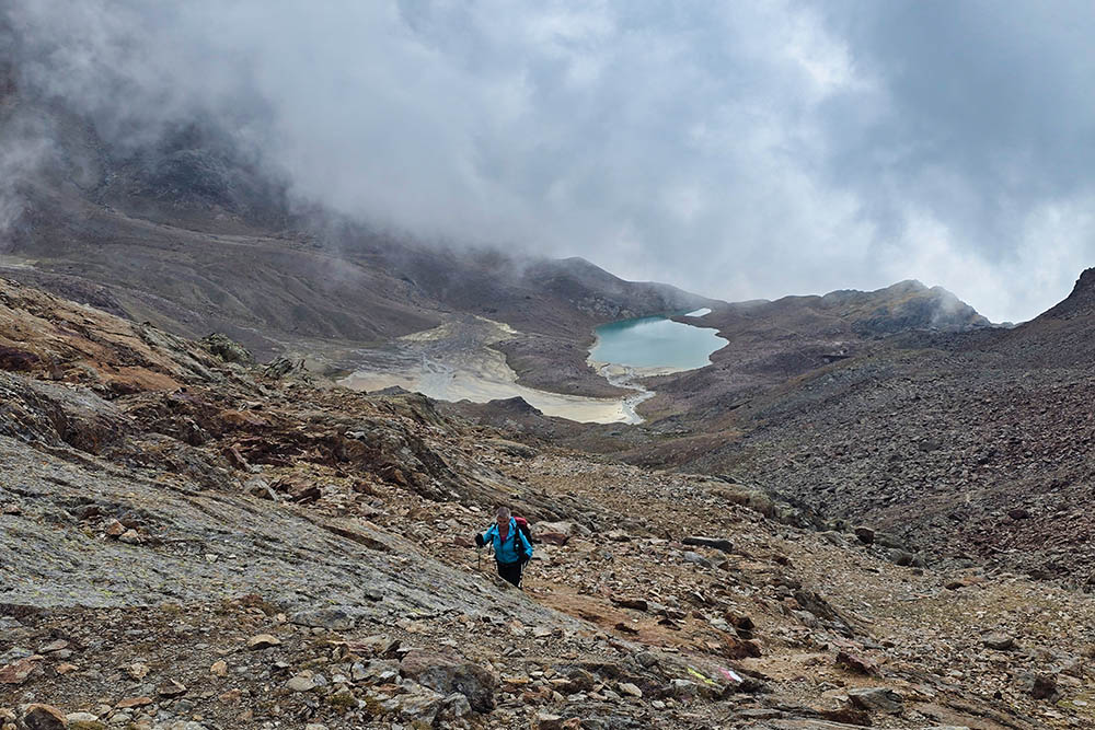
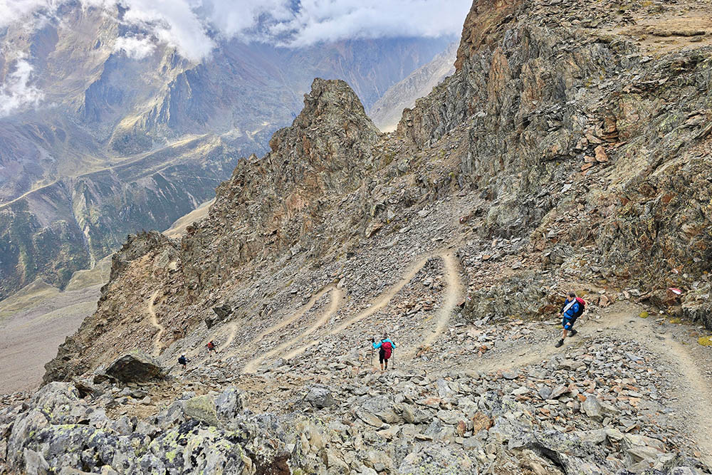
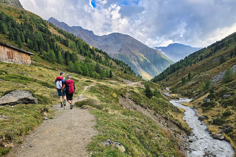
The route, which initially follows trail no. 1, winds through coniferous forests and alpine pastures for about 15 kilometers total, with a positive elevation gain of almost 1300 meters. After crossing a first phase in the forest, the trail emerges onto the pastures of the Matscher Alpe, where the real challenge begins: a steep ascent through scree and rocks to the first lake.
The charm of the hike grows progressively. Beyond Malga Matscher, the landscape transforms radically: the alpine meadows give way to an almost lunar environment, where stone and eternal ice dominate. Here, as described by the former mountain hut guardian Roman Burgo: Five high-altitude alpine lakes of rare beauty adorn a grandiose alpine scenery: in their crystalline waters are reflected the white and steep glaciers of Lazaun and Saldur, the blue sky above Matsch and the ancient reddish glaciers of the southern Ötztal valleys. An almost Tibetan atmosphere hovers over the plateau...
The Oberettes Mountain Hut, which stands at 2670 m, is maintained by the AVS Matsch section and represents a fundamental stage of the route. The mountain hut not only offers refreshment and accommodation, but also constitutes the base for the ascent to Weißkugel (White Ball) and other peaks of the group.
The itinerary requires consolidated mountaineering experience, sure footing and absence of vertigo.
History and curiosities
The Saldura Lakes area has a mountaineering history that has its roots in the 19th century. A first simple mountain hut already existed in 1883, later renovated by the Prague section of the Alpine Club. A fire destroyed the mountain hut in 1945, subsequently rebuilt in the 80s of the last century. From that moment on it bore the name of Oberettes.
The name Saldura derives from the German-Tyrolean term indicating the slopes exposed to the sun, a geographical characteristic that distinguishes this high mountain zone. The lakes are the result of the millennial action of glaciers, which carved the rocky basins that subsequently filled with water during the post-glacial glacier retreat.
The Glieshof, starting point of the hikes, represents a piece of history of alpine hospitality. The Glieshof is located in the upper Matsch Valley 7 km from the village of Matsch. It is a mountain hotel at 1824m. This structure has always constituted a bridge between valley floor civilization and high mountains, offering 19th and 20th century mountaineering pioneers a safe refuge before great ascents.
ITINERARY
From the parking area (1809 m) you reach Gasthof Glieshof (1824 m), official starting point of trail no. 1. Continuing along this route you arrive at Malga Mazia di Dentro 2022 m, where you deviate following trail marker no. 4 that leads directly to the Saldura Lakes, located between 2750 and 2900 meters altitude.
The itinerary continues with an ascent to Little Tibet Pass (3016 m), the highest point of the hike. From here begins the descent along trail no. 1, which leads to Oberettes Mountain Hut (2670 m). The return to the starting point occurs following the same trail marker no. 1, thus completing this magnificent high mountain loop.
EXCURSION DATE
September 21, 2025
STARTING POINT
Glieshof
REFRESHMENT POINT
Oberettes Mountain Hut (2670 m)
AUTHOR'S SUGGESTIONS
It is essential to pay particular attention in the first summer weeks, when snow can still cover the higher trails, making progression treacherous.
SAFETY ADVICE
The walkability of the proposed itinerary, like all mountain morphology, is subject to environmental changes due to natural events and weather conditions. Therefore, before departure, consult the competent tourist offices and/or reference mountain huts.
Our GPX tracks are only indicative, that is, the route was carried out at best with the trail and weather conditions of that day. Therefore always evaluate on site what to do.
Also remember to evaluate the route based on your physical capabilities, training and available equipment.
It is advisable to inform someone of the itinerary you intend to do.
Remember that the emergency number is 112.
EQUIPMENT
It is recommended to have equipment suitable for the route, weather conditions and season: windproof and/or waterproof jacket, map and/or GPS device, glasses, sunscreen, boots, first aid kit, specific clothing, gloves, backpack with food and drinks.
RECOMMENDED MAPS
Tabacco 044 Vinschgau - Mals - Sesvenna/Val Venosta - Malles
INTERESTING LINKS
https://www.oberettes.it/
HOW TO ARRIVE
From Merano follow the SS38 to Spondinig, continue on the SS40 and at Tartsch turn right onto the SP105, climb to the village of Matsch and continue to the Glieshof.
PARKING AREA
At the Glieshof in Matsch Valley
GPS Coordinates: 46.726531, 10.683472
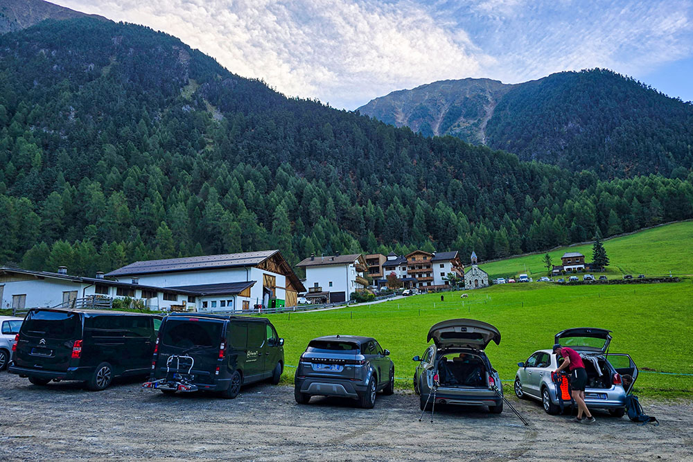
Parcheggio ai Masi Glieses
La Malga Mazia di Dentro
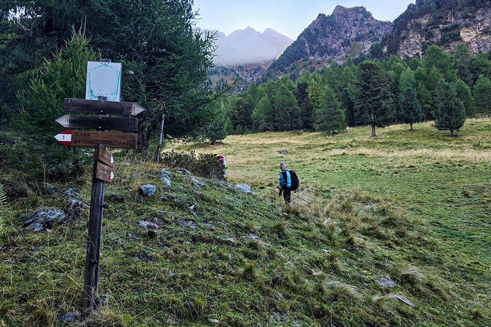
Bivio sentiero 4
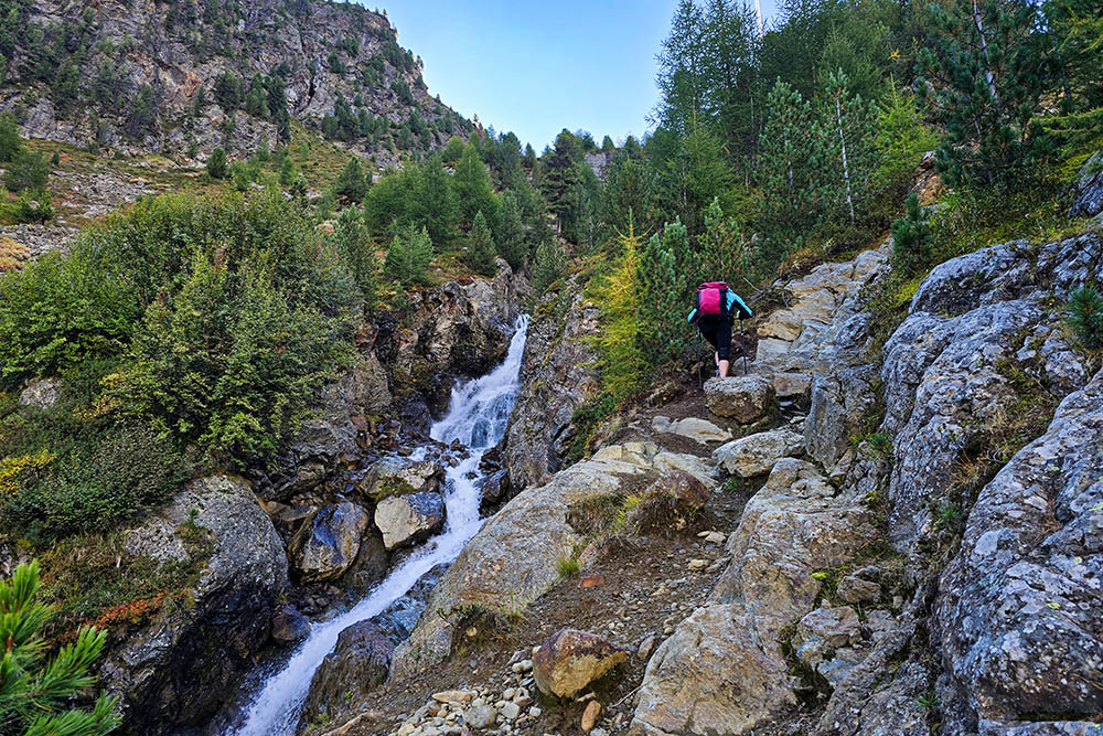
Si sale con un bel torrente a fianco
Il sentiero si fa meno ripido
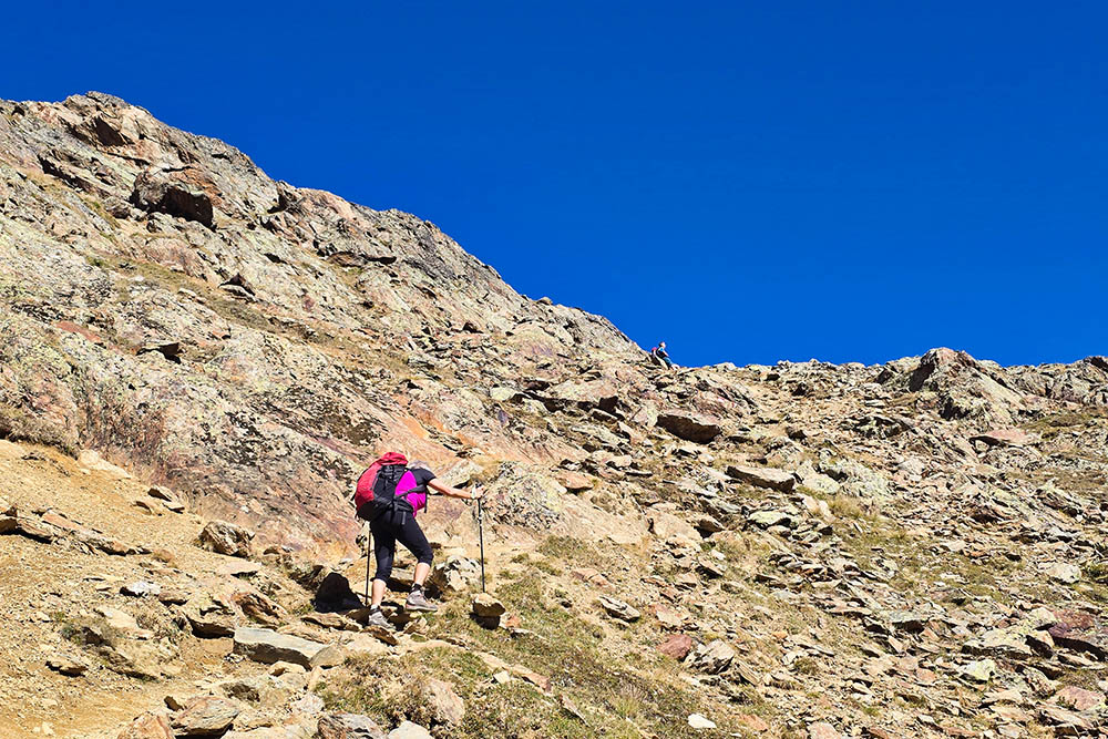
Tratto pietroso
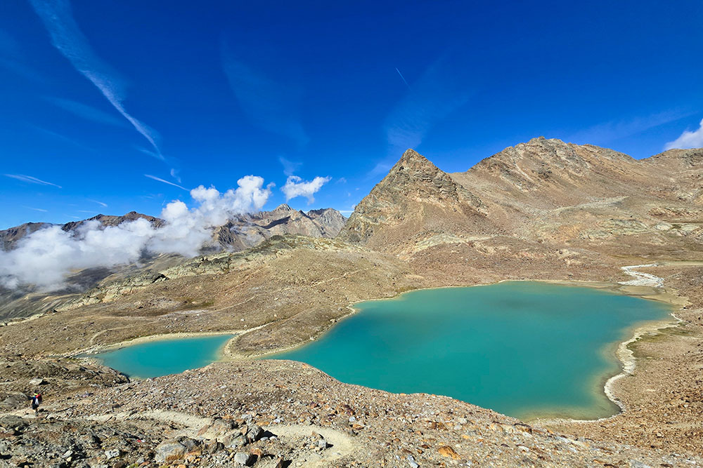
Arrivati ai Laghi di Saldura
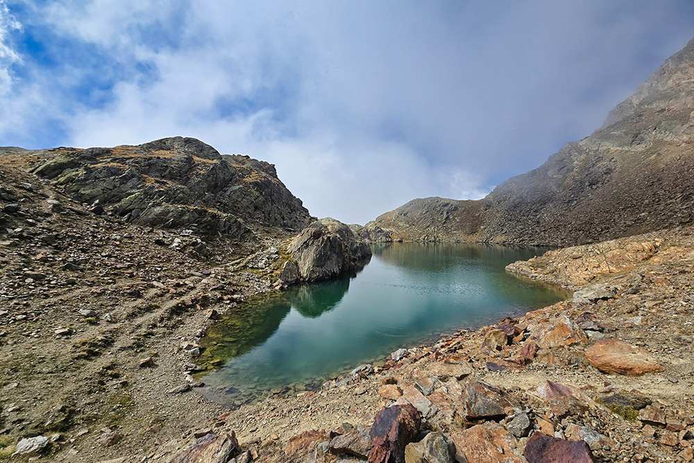
Secondo lago
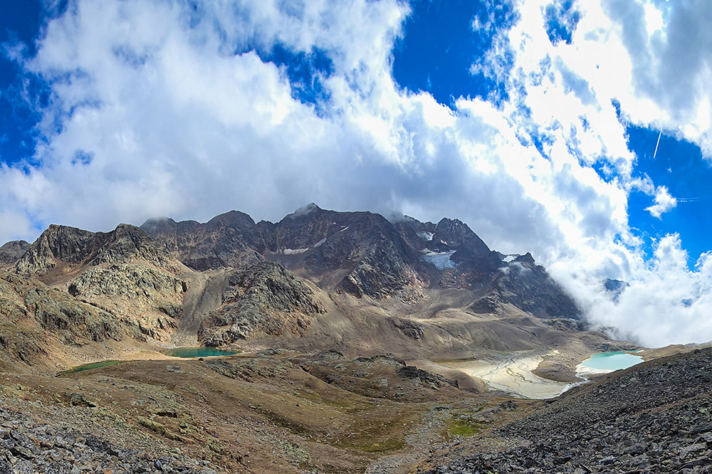
La conca glaciale dei laghi
Ci alziamo di quota
Ultimo lago
Arrivati al Piccolo Tibet 3016 m
Adesso si scende rapidamente
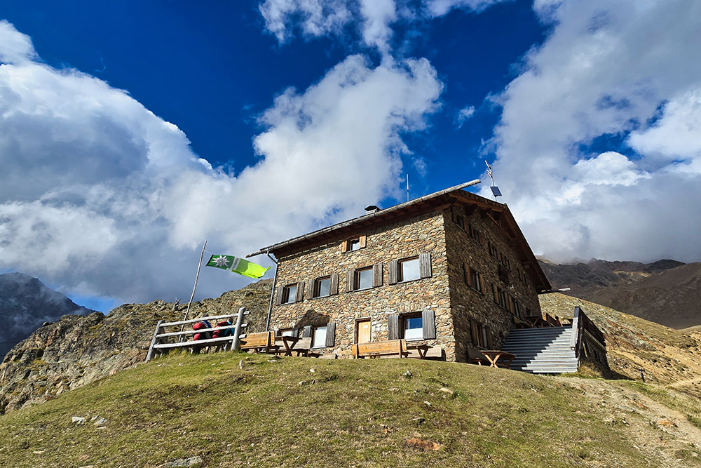
Il Rifugio Oberettes
Si ritorna ai Masi Glieses


