


![]()


Durata
 4:00 h
Distanza
 50,3 km
 Ascesa
 130 m
130 mDiscesa
 268 m
268 mH Max
 287 m
287 mH Min
 65 m
65 mBike Ride from Trento to Riva del Garda
DESCRIPTION
Trento-Riva del Garda: the great cycle tourism itinerary of Trentino.
Geographical Location
The itinerary crosses the Autonomous Province of Trento, connecting the capital city to the northern shores of Lake Garda. The route mainly unfolds in the Vallagarina valley, first following the course of the Adige River and then heading towards the Garda Trentino area.
Hike
The journey begins from the stunning Piazza del Duomo in Trento, surrounded by elegant Renaissance façades and framed by the mountains that define the valley. The path winds along two important cycle routes: the Ciclabile Valle dell'Adige (Adige Valley Cycle Path) and the Ciclabile Adige-Garda (Adige-Garda Cycle Path), which are part of a network of over 490 km of cycle tourism paths in Trentino.
The road surface is completely asphalted and maintained in excellent condition, while the signage is clear and well-placed. The itinerary is also accessible with traditional bicycles thanks to the limited gradient and elevation gain.
Going into detail, the route has an altitude profile ranging from 194 meters in Trento to 65 meters in Riva del Garda, touching the highest point of 287 meters at Passo San Giovanni (San Giovanni Pass). The total distance is about 50 kilometers, which can be comfortably covered in one day.
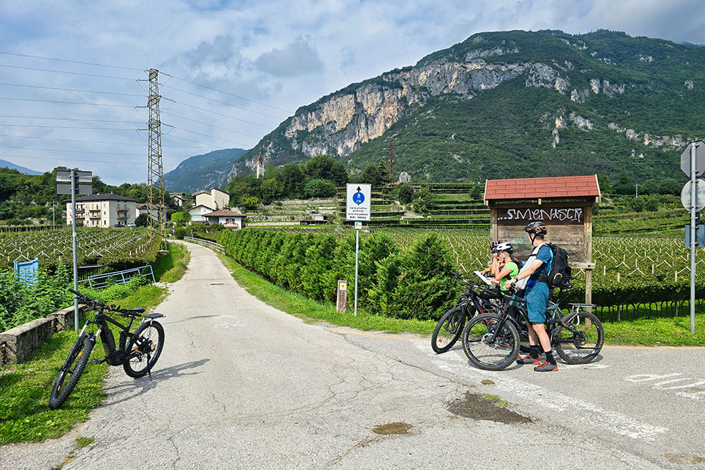
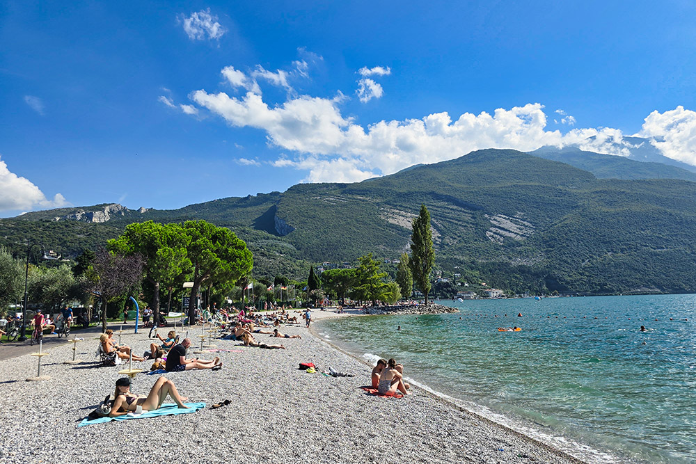
Along the way, numerous historical and natural points of interest follow one another, including the historic centers of Rovereto with its famous Mart (Museum of Modern and Contemporary Art), Mori with its medieval evidence, and the suggestive Lake Loppio. Lake Garda is the final destination of this extraordinary journey: during the summer season, it is worth bringing a swimsuit and a towel to enjoy a refreshing swim in its cool waters.
History and Curiosities
The crossed territory safeguards evidence of centuries of history and culture. Borgo Sacco was once an important river port on the Adige, a crucial crossroads for trade between the Germanic world and the Po Valley, a tradition still celebrated today with the festival Un Borgo e il suo Fiume (A Village and Its River) and the characteristic Palio delle zattere Borgo Sacco (Borgo Sacco Raft Race).
Mori preserves traces of its glorious medieval past when it was a strategic node for controlling the communication routes between the Adige Valley and the Garda basin.
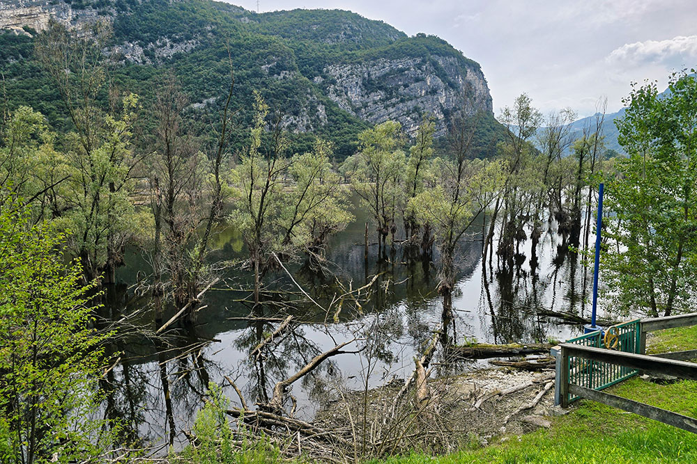
Lake Loppio hides a particularly fascinating history: originally known as Lake Sant'Andrea from the small island where a small church was consecrated in 1138, it was accidentally drained in 1956 during the construction works of the Adige-Garda tunnel. Today, this marsh area, which became a protected biotope in 1987, is the largest wetland in the province and occasionally refills during periods of heavy rainfall.
The island of Sant'Andrea still preserves the remains of a fortified settlement from the Late Antiquity and Early Middle Ages, evidence of the strategic importance of this territory since ancient times.
Nago-Torbole still bears the indelible marks of the Great War: the entire town was completely evacuated as it was directly on the front line, becoming the scene of fierce clashes between Austro-Hungarian and Italian forces.
ITINERARY
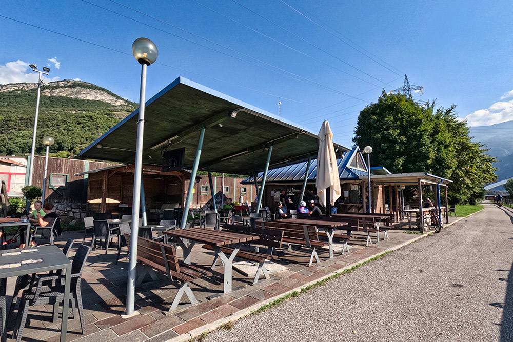
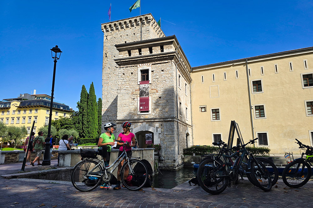
The route starts from the historic Piazza del Duomo in Trento (194 m), from where you take Via Verdi to reach the Ciclabile della Valle dell'Adige (Adige Valley Cycle Path). After a few kilometers of cycling, you meet the first refreshment point at Bici Grill Trento.
Continuing south, you pass through Mattarello and reach Calliano. Here, look up and admire the imposing Castel Beseno, one of the largest fortified complexes in Trentino-Alto Adige. The trail continues to Nomi, where the Bicigrill Asgard (179 m) is located, then arriving at the characteristic Borgo Sacco (172 m). Here it is worth exploring the streets of the historic village or taking a break at the nearby Bicigrill Rovereto (172 m), located a few hundred meters away.
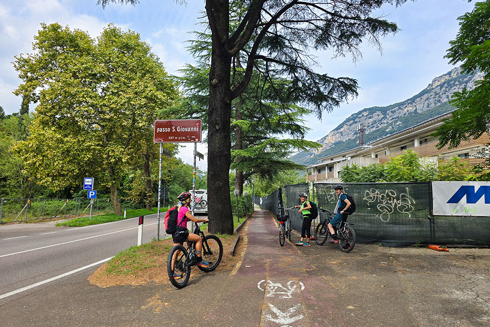
At the height of Mori, the second part of the itinerary begins: you leave the Ciclabile della Valle dell'Adige to take the Ciclabile Adige-Garda (Adige-Garda Cycle Path). The route crosses the town of Mori (200 m) and continues towards Lake Loppio (222 m), a biotope of particular naturalistic interest. From here, a short climb leads to the highest point of the entire journey: Passo San Giovanni (San Giovanni Pass, 287 m).
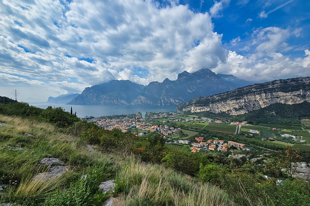
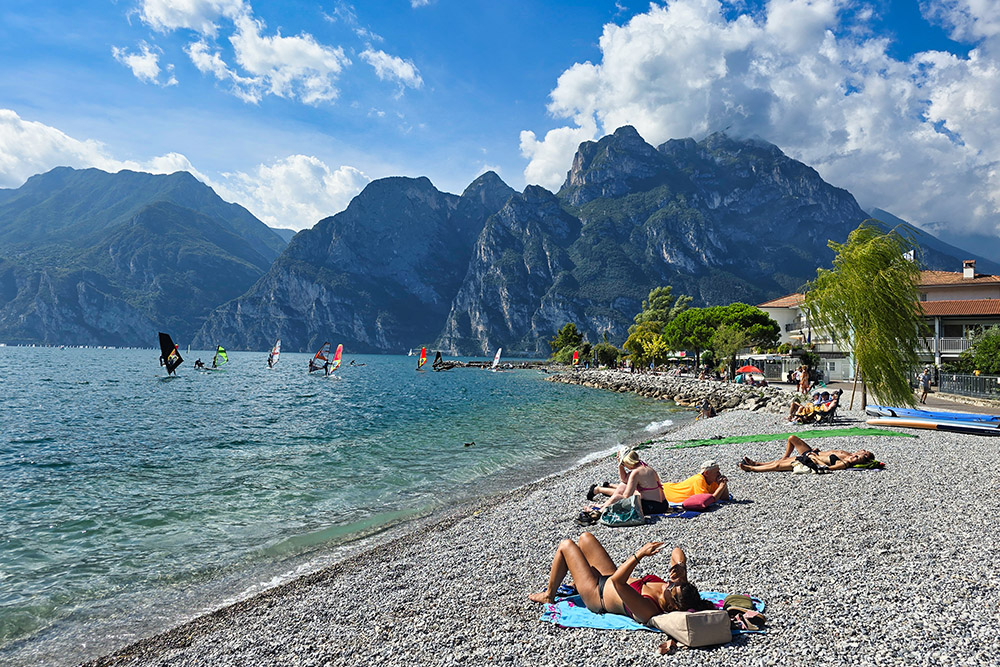
After the pass, a pleasant descent begins, leading to Nago (211 m), where a stop at the viewpoint offering an extraordinary view of Lake Garda is a must. The final descent leads to Torbole (67 m), a characteristic lakeside village famous for windsurfing. From here, a relaxing ride along the lakefront accompanies cyclists to the final destination: Riva del Garda (66 m).
EXCURSION DATE
September 14, 2025
STARTING POINT
Piazza del Duomo, Trento
REFRESHMENT POINT
Bici Grill Trento, Bicigrill Asgard in Nomi, and Bicigrill Rovereto
AUTHOR’S SUGGESTIONS
There are some water fountains along the route to get water.
SAFETY ADVICE
Our GPX tracks are only indicative, meaning the route was done to the best of our ability given the road and weather conditions of that day. Therefore, always assess on-site what to do.
Also, remember to evaluate the route based on your physical abilities, training, and the equipment you have.
For e-bike owners: carefully consider the kilometers and elevation gain in relation to the battery power and the cyclist's weight.
It is advisable to tell someone the itinerary you intend to do.
Remember that the emergency number is 112.
EQUIPMENT
It is recommended to have equipment suitable for the route, weather conditions, and season: helmet, windproof and/or rain jacket, map and/or GPS device, glasses, helmet and/or handlebar light (an unforeseen event can lengthen travel time), sunscreen, MTB shoes, first aid kit, bike repair kit, specific clothing, whistle or bell, bike wheel reflectors, gloves, backpack with food and drinks.
RECOMMENDED MAPS
Tabacco 055 Arco - Valle del Sarca - Valle dei Laghi
INTERESTING LINKS
https://www.visittrentino.info/it/articoli/outdoor-estate/piste-ciclabili-trentino
HOW TO ARRIVE
A22 Motorway, Trento Nord or Sud exit
PARKING AREA
Parcheggio Duomo - P5.
GPS Coordinates: 46.066921, 11.114725
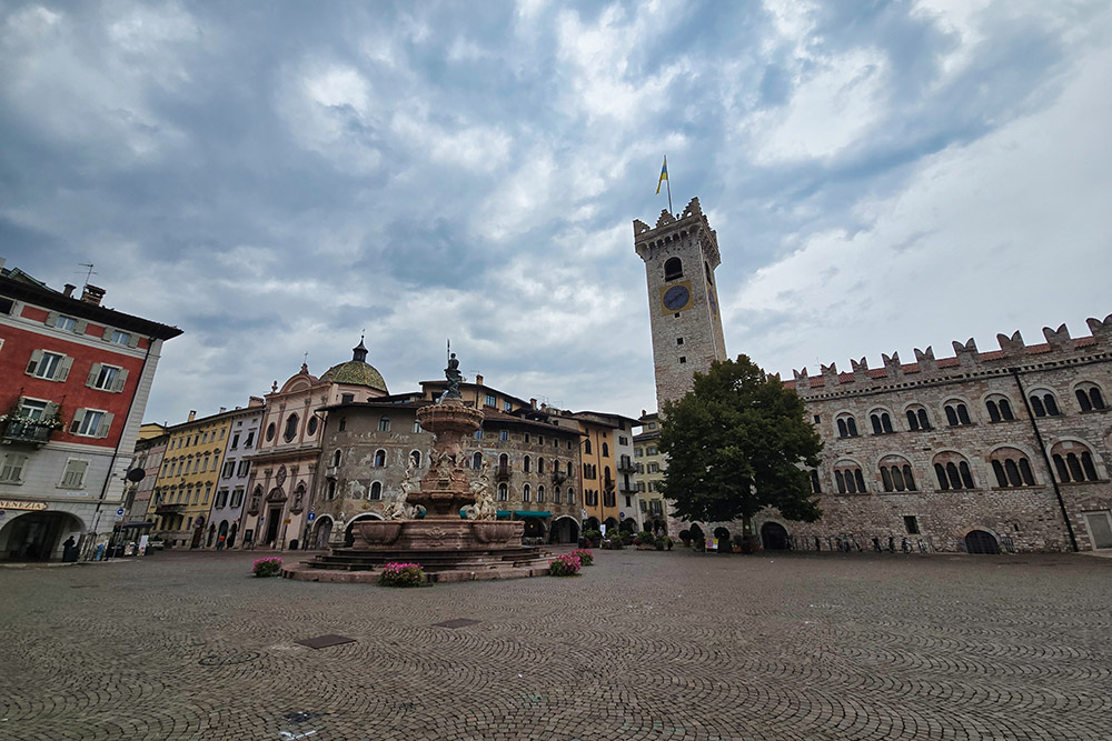
Piazza del Duomo a Trento
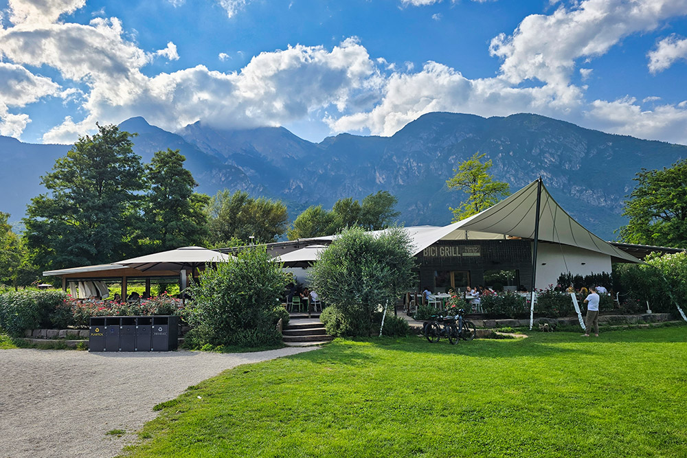
Bici Grill Trento
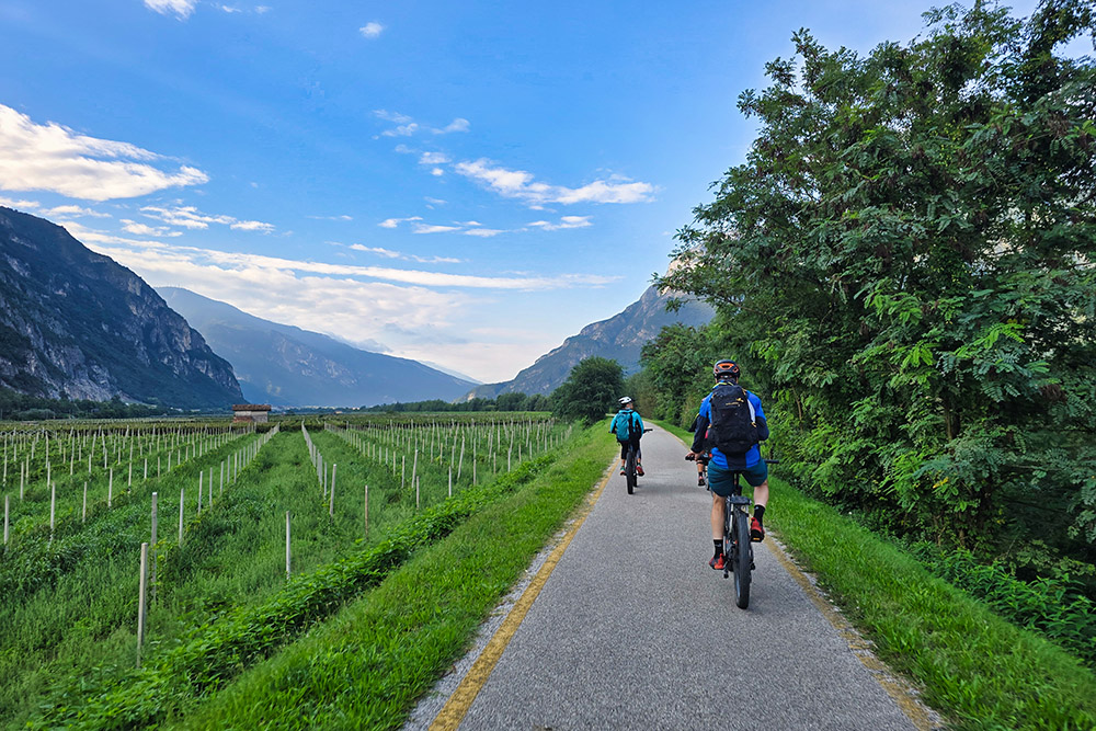
Percorriamo la Ciclabile della Valle dell'Adige
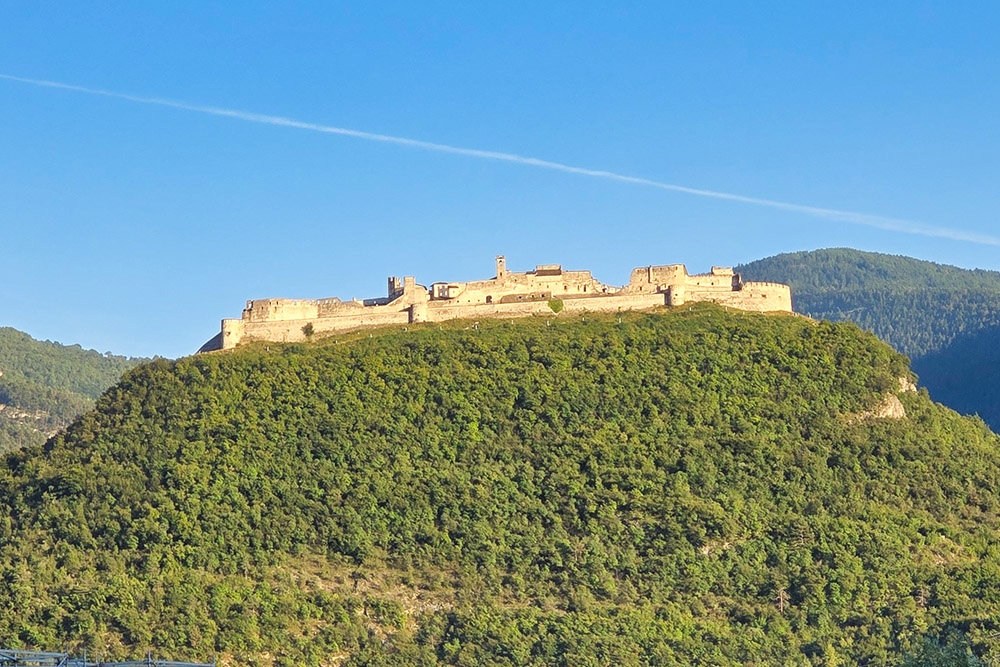
Il Castel Beseno
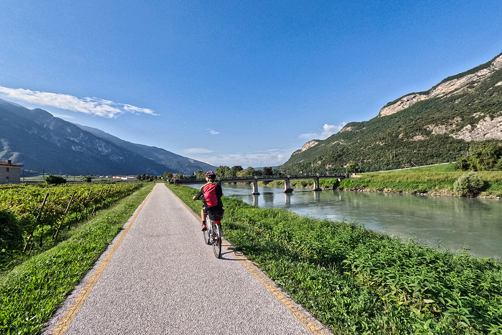
La ciclabile segue il corso dell'Adige
Bicigrill Asgard di Nomi
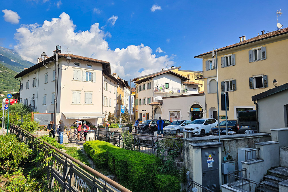
Borgo Sacco
Bicigrill Rovereto
Bivio di inizio della ciclabile Adige - Garda
Il Lago di Loppio
Il Passo San Giovanni
Vista dal belvedere di Nago
Spiaggia di Torbole
Lungolago di Torbole
Arrivati a Riva del Garda


