


![]()


Durata
 4:40 h
Distanza
 11,3 km
 Ascesa
 790 m
790 mDiscesa
 790 m
790 mH Max
 2228 m
H Min
 1554 m
Tour to the Seven Lakes from the Serot Mountain Hut
DESCRIPTION
Panoramic hike to the Seven Lakes in the Lagorai range, featuring ridges and alpine lakes.
Geographical Location
The Seven Lakes area is located in Trentino, in the western part of the picturesque Lagorai range. Nestled at the foot of little-known peaks such as Cima Hoabonti and Monte Cola, this area is a tranquil oasis, far from the more crowded destinations. Here, nature expresses its wild beauty with landscapes that range from Dolomite peaks to stretches of green meadows.
Hike
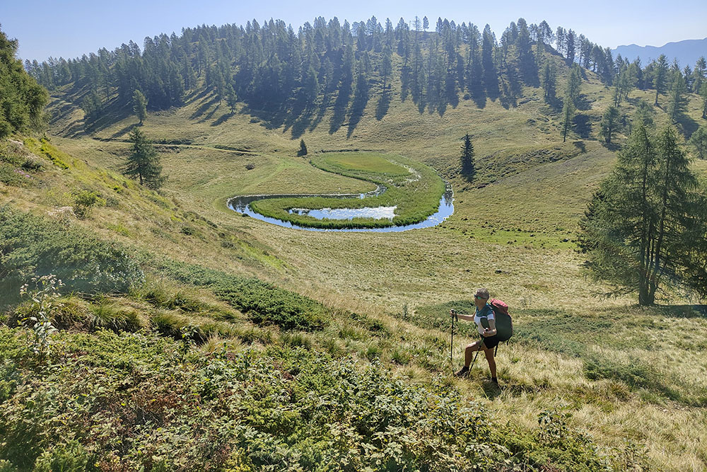
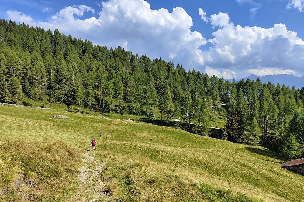
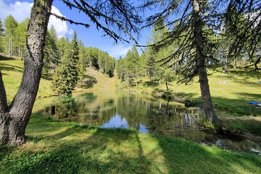
The itinerary starts from the Serot Mountain Hut, following a counterclockwise loop that winds through green pastures and wide clearings. The trail leads us to a picturesque alpine basin where the Seven Lakes are located, small bodies of water that reflect the surrounding peaks, creating a magical atmosphere.
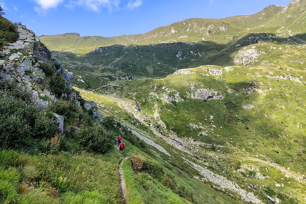
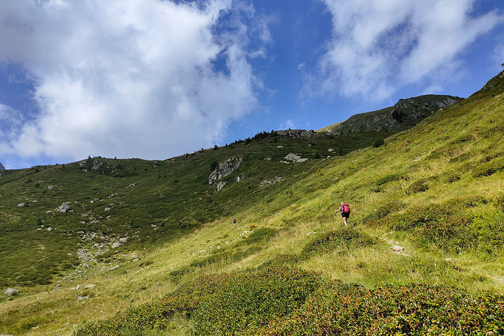
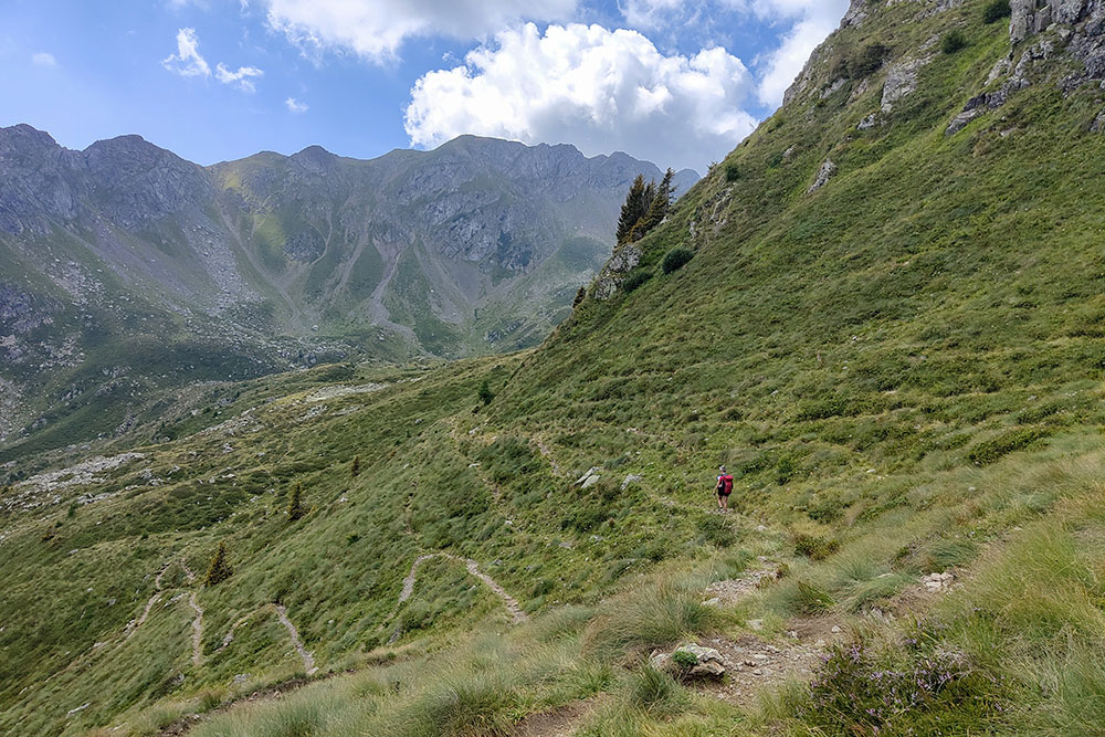
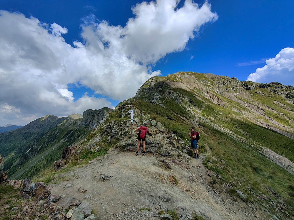
The route does not present significant difficulties, except for a short equipped section along the ridge, where surefootedness and a head for heights are required. The length of the itinerary, combined with the elevation gain, requires a good level of physical fitness.
The hike takes place in a quiet and less frequented environment, offering the opportunity to immerse oneself in the peace of nature. The excursion ranges in altitude from 1,554 to 2,228 meters, guaranteeing spectacular views of unspoiled landscapes where marmots, eagles, and a rich variety of alpine flora can be encountered. This route is ideal for those seeking an authentic experience, far from mass tourism, in one of the most hidden and fascinating corners of Trentino.
ITINERARY
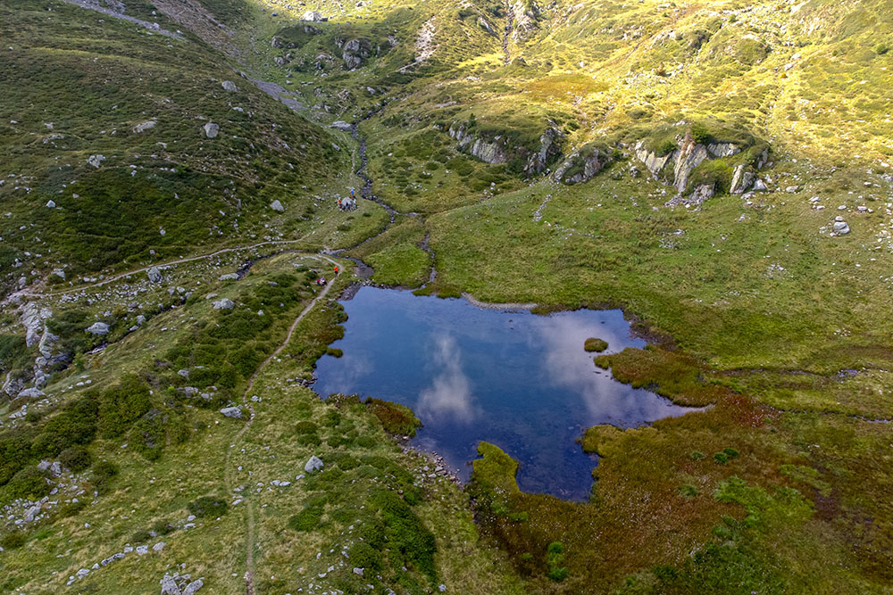
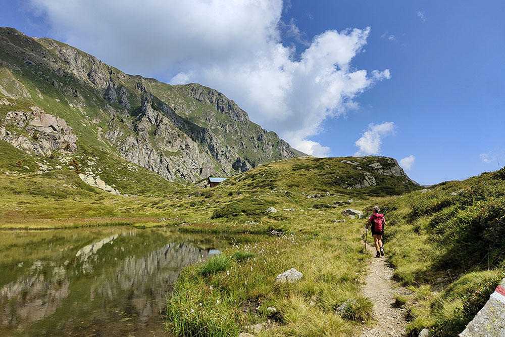
From the Serot Mountain Hut (1,572 m), follow trail marker 323. Pass Malga Trenca, and at Trenca (1,669 m), before the small bridge on the left, continue on trail 323 leading to Lago delle Carezze (1,764 m). Continuing on, pass Col del Sète (1,868 m), Busa di Casa Pinello (1,841 m), and reach the Seven Lakes area (1,969 m) at a small lake. Now, continue to climb and before Forcella del Lago, turn left onto an unmarked and unnumbered path leading to the Seven Lakes basin (2,069 m). Ascend towards the ridge, follow a short equipped trail no. 325, and reach Passo della Portela (2,152 m). Now descend through Val Portela, following trail marker 371, first reaching Lago delle Prese (1,616 m) and then returning to the Serot Mountain Hut.
EXCURSION DATE
August 25, 2024
STARTING POINT
Serot Mountain Hut
REFRESHMENT POINT
None
AUTHOR’S SUGGESTIONS
Download the GPX track.
SAFETY TIPS
The feasibility of the proposed itinerary, like all mountain terrain, is subject to changes due to environmental conditions caused by natural events and weather conditions. Therefore, before setting out, consult the relevant tourist offices and/or nearby mountain huts. Our GPX tracks are for reference only, meaning the route was followed under the best trail and weather conditions on that day. Always assess the situation on site.
Additionally, evaluate the route based on your physical abilities, fitness level, and available equipment. It is advisable to inform someone of the itinerary you intend to follow. Remember that the emergency number is 112.
EQUIPMENT
It is recommended to have equipment suitable for the route, weather conditions, and season: windproof and/or waterproof jacket, map and/or GPS device, sunglasses, sunscreen, boots, first aid kit, specific clothing, gloves, backpack with food and drinks.
RECOMMENDED MAPS
Tabacco 058 Valsugana - Tesino - Lagorai - Cima d’Asta
USEFUL LINKS
https://www.visitvalsugana.it/
HOW TO ARRIVE
From Trento, take the SS47 of Valsugana to the Roncegno exit. From Roncegno (about 11 km in total), follow SP65 towards Ronchi Valsugana. After a while, turn left onto the road with signs for Le Pozze and Serot Mountain Hut. The road is steep and narrow.
PARKING AREA
At the Serot Mountain Hut
GPS Coordinates: 46.073722, 11.388114
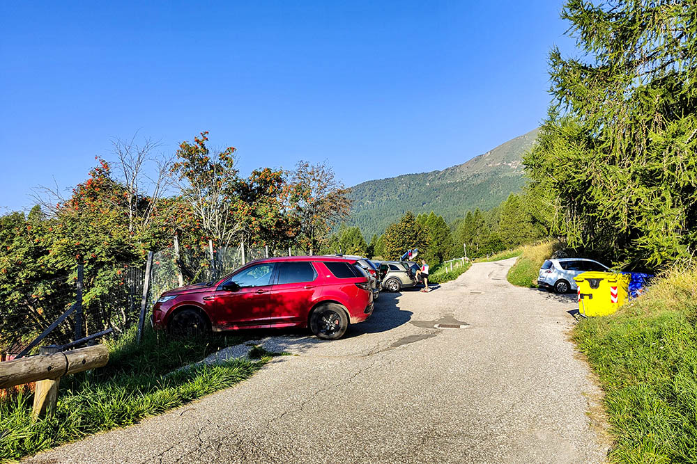
Parcheggio presso il Rifugio Serot
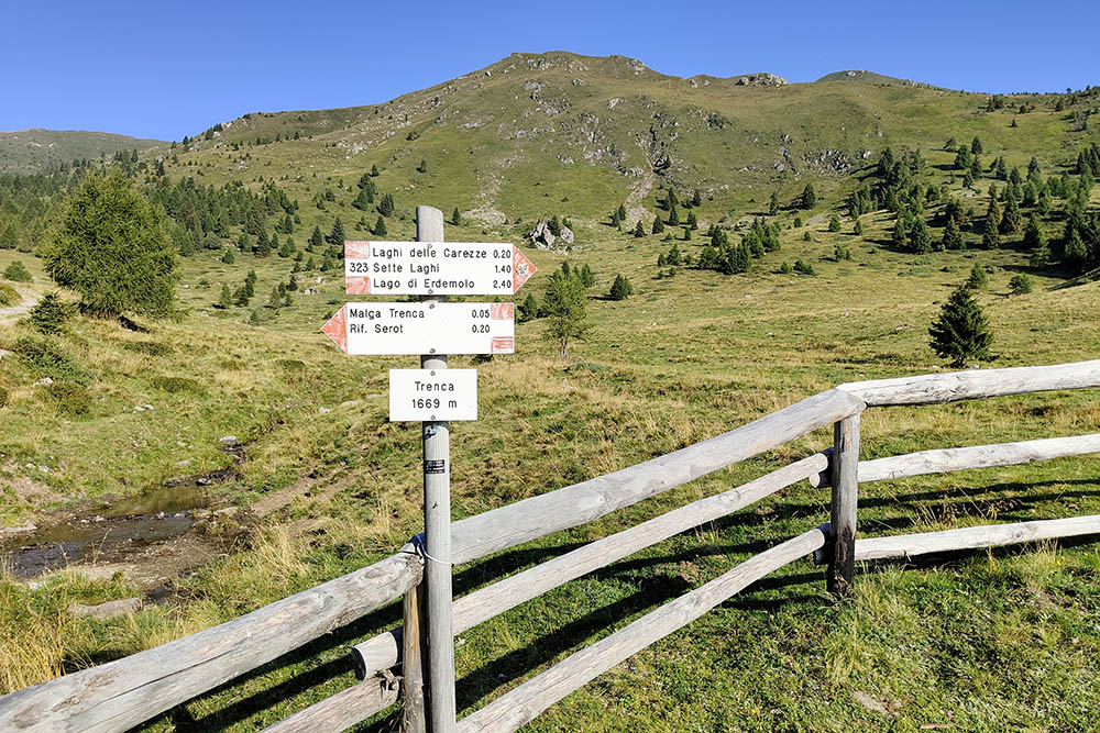
Bivio in Località Trenca
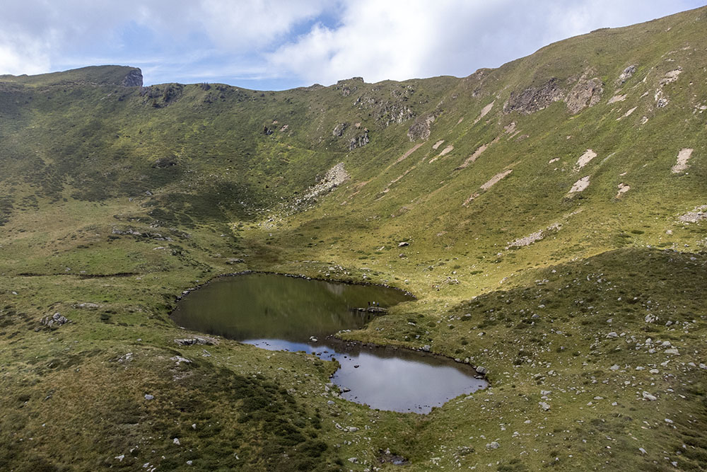
Lago delle Carezze
Si sale in direzione Passo del Lago
Arrivati in Località Sette Laghi
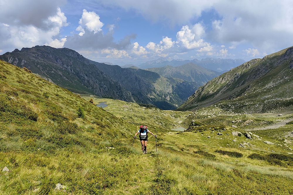
Si continua il tour
Si sale sempre in direzione Passo del Lago
Bivio per i laghi
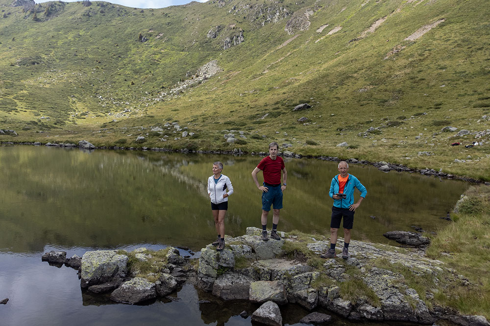
Arrivati nella Conca dei Sette Laghi
Arrivati nella Conca dei Sette Laghi
Si sale verso Passo della Portela
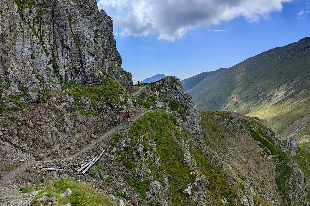
Sentiero in cresta
Passo della Portela
Si scende per la Val Portella
Lago delle Prese


