


![]()


Durata
 6:00 h
Distanza
 3,5 km
 Ascesa
 1003 m
Discesa
 146 m
146 mH Max
 2950 m
H Min
 2050 m
Via Ferrata of the Cadore Brigade at Punta Serauta, called Eterna
DESCRIPTION
Eterna Via Ferrata: The adventure with no escape routes on the Queen of the Dolomites.
Geographical Location
The Marmolada, the majestic Queen of the Dolomites, rises on the border between the provinces of Trento and Belluno as the most imposing mountain group in the Dolomites of Fassa. With its Punta Penia reaching 3,343 meters, it is the highest peak in the entire Dolomite massif, dominating the entire surrounding alpine landscape with its glacial presence.
Hike
The Eterna Via Ferrata is a high-mountain adventure lasting approximately 5 hours, with 800 meters of elevation gain, which fully justifies its name through a route of extraordinary continuity and length. The itinerary is divided into three distinct sections, each with unique characteristics that give the via ferrata its unmistakable personality.
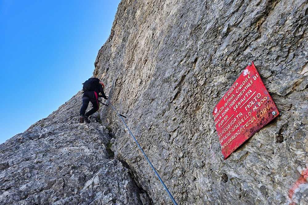
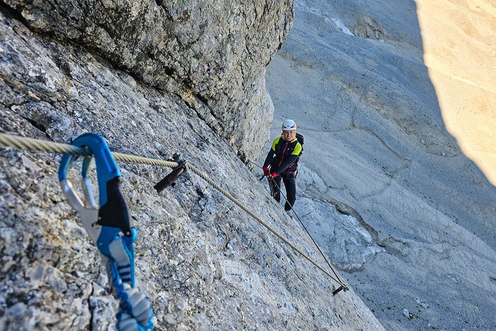
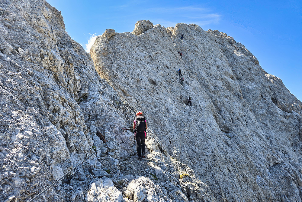
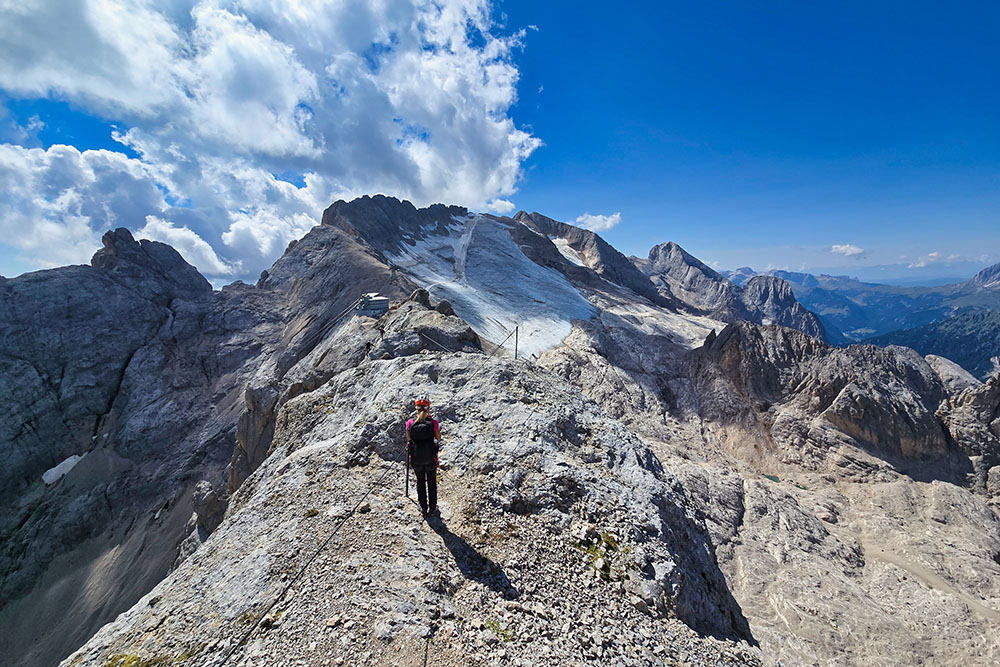
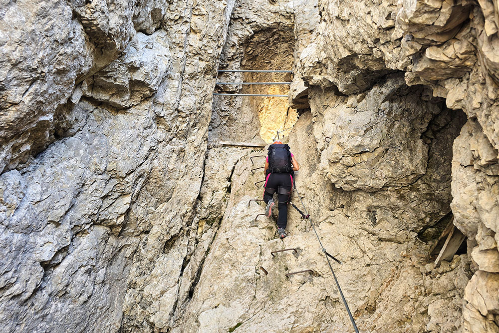
The first section represents the most technically demanding challenge: short but intense, it requires concentration and mountaineering skills to overcome the most athletic passages of the ascent. The second segment develops along an extensive rock slab, characterized as the least technically difficult section but the most demanding for endurance, given its considerable length. The final ridge section constitutes the heart of the experience: long, airy, and spectacular, it offers the most exciting moments of the entire ascent with some athletic downhill passages that increase the overall difficulty.
The via ferrata is classified as difficult, with no intermediate exits, a characteristic that makes it suitable only for experienced mountaineers in excellent physical condition. The continuous steel cable, always perfectly taut, accompanies hikers along the entire route without the possibility of early abandonment. This peculiarity, combined with the considerable length of the itinerary, makes a careful assessment of one's physical abilities and weather conditions essential before undertaking the ascent.
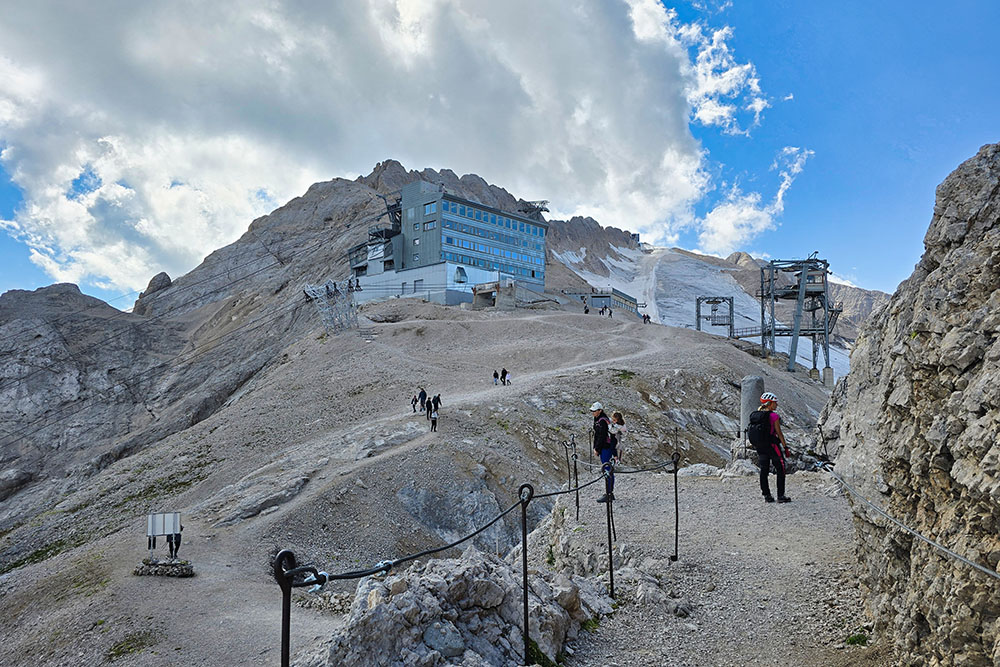
From Punta Serauta, which coincides with the intermediate station of the Marmolada Glacier cable car, mountaineers can choose between different return options: continue to Punta Rocca, descend to Passo Fedaia by crossing the glacier, or use the cable car for a comfortable return to Malga Ciapela.
The panoramic component of the hike is one of its main attractions. From the first steps, the gaze ranges over spectacular peaks, while the progressive ascent reveals ever wider and more suggestive panoramas. Once the ridge is reached, the view embraces an infinite horizon of Dolomite peaks, offering an unforgettable 360-degree visual experience.
History and Curiosities
The Eterna Via Ferrata was conceived and equipped in 1972 by Gilberto Salvatore, a highly experienced mountaineer and long-time president of the CAI (Italian Alpine Club) section of Livinallongo. His vision was to create a route that could challenge the most prepared mountaineers while offering a complete experience of the high-altitude Dolomite environment.
Originally named Via Ferrata della Brigata Cadore, the itinerary pays homage to one of the five alpine brigades of the Italian Army, headquartered in Belluno, operational until its dissolution in 1997. The current name, Eterna, eloquently emphasizes both the exceptional length of the route and its uninterrupted continuity, characteristics that make it an ideal testing ground for trained and determined mountaineers.
The end of the via ferrata coincides with an area of extraordinary historical interest: the Sacred Monumental Area of Punta Serauta, established by law in 1975 under the jurisdiction of the Commissariato Generale Onoranze Caduti in Guerra (General Commissariat for the Honoring of War Dead). This site commemorates the men who fought on the Marmolada during the years 1915-1917, in the course of the First World War, with the significant inscription War divided them, remembrance unites them carved on a marble column.
In 1916, Italian troops occupied Forcella Serauta, transforming it into a veritable stronghold where they lived from May 1916 to November 1917. The Marmolada is particularly famous for its Ice City: a complex system of tunnels and shelters dug directly into the ice to protect soldiers during surface combat. Today, caves, trenches, machine gun positions, and cableway stations have been made accessible to visitors, offering tangible evidence of one of the most arduous and spectacular fronts of the Great War.
The area represents a unique case in Alpine military history, where soldiers clashed for the first time among the peaks and glaciers of the Alps, strategic positions fundamental for controlling the valleys below. Visiting these historical sites enriches the mountaineering experience with a deep reflection on the history and sacrifice of those who fought in extreme conditions on these Dolomite peaks.
ITINERARY
From the Passo Fedaia mountain hut (2057 m) the hike begins by following the ski slope until a deviation on the left is encountered, marked by an indication written on the rock. The trail, although not very distinct, leads directly to the start of the via ferrata in about an hour's walk.
The actual adventure unfolds through the three characteristic sections of the route: first, the most exposed and technically challenging section is tackled, then you proceed along the wide rock slab, and finally conclude with the spectacular ridge segment, the most fascinating part of the entire route.
At the end of the via ferrata, an equipped trail leads gradually downhill to the evocative Sacred Monumental Area of Serauta and to Forcella Serauta (2875 m), finally reaching the cable car's upper station (2910 m), where this extraordinary mountaineering experience concludes.
EXCURSION DATE
August 26, 2025
STARTING POINT
Passo Fedaia mountain hut (Rifugio Passo Fedaia)
REFRESHMENT POINT
Restaurant at the cable car's upper station
AUTHOR’S SUGGESTIONS
If not equipped with ice axes and crampons, one must return using the cable car.
SAFETY ADVICE
The viability of the proposed itinerary, like all mountain morphology, is subject to environmental changes due to natural events and weather conditions. Therefore, before setting out, consult the relevant tourist offices and/or the reference mountain huts.
Our GPX tracks are only indicative, meaning the route was completed to the best of our ability given the trail and weather conditions on that day. Therefore, always assess the situation on-site.
Also remember to evaluate the route based on your physical abilities, training, and the equipment you have available.
It is advisable to inform someone of the itinerary you intend to follow.
Remember that the emergency number is 112.
EQUIPMENT
It is recommended to have suitable equipment: technical mountain clothing, hiking boots with Vibram or similar soles, via ferrata set, harness, helmet, via ferrata gloves, sunglasses, sunscreen, backpack with drinks.
RECOMMENDED MAPS
Tabacco 07 Alta Badia - Arabba - Marmolada
INTERESTING LINKS
http://www.trentinograndeguerra.it/
HOW TO ARRIVE
From Val di Fassa SS641, from Alleghe SR203, SP 563 and SP641
PARKING AREA
Free, near the Passo Fedaia mountain hut (Rifugio Passo Fedaia)
GPS Coordinates: 46.454046, 11.886617
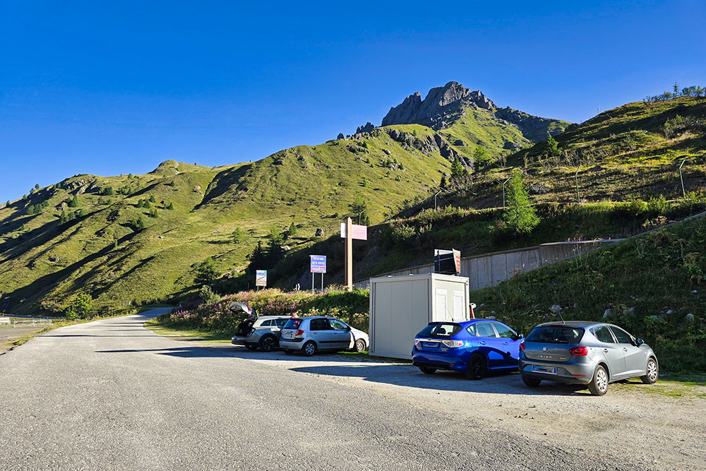
Parcheggio presso il Rifugio Passo Fedaia
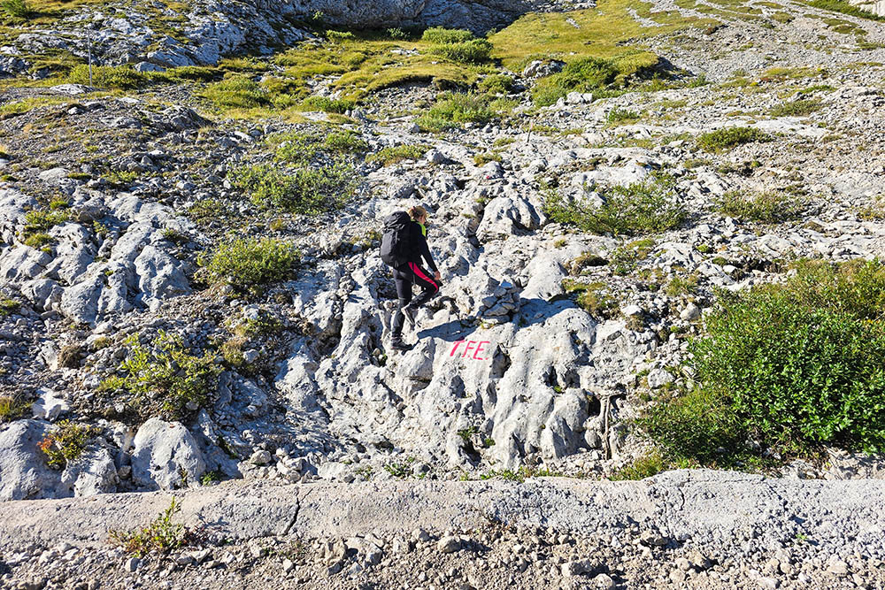
Bivio per la ferrata
Attacco della ferrata
Primo tratto tecnico
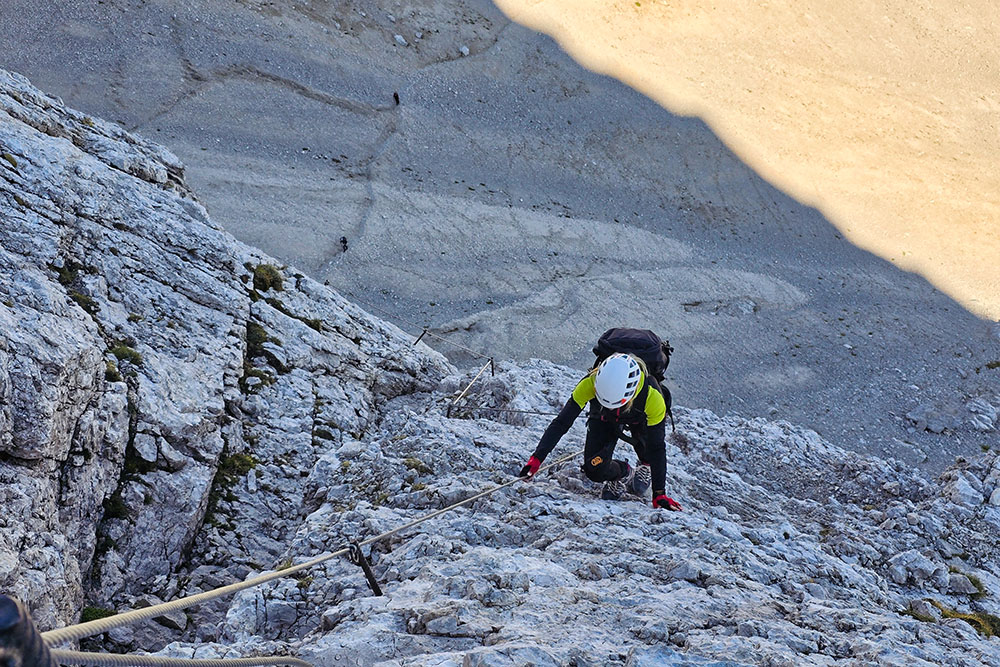
Primo tratto il più esposto
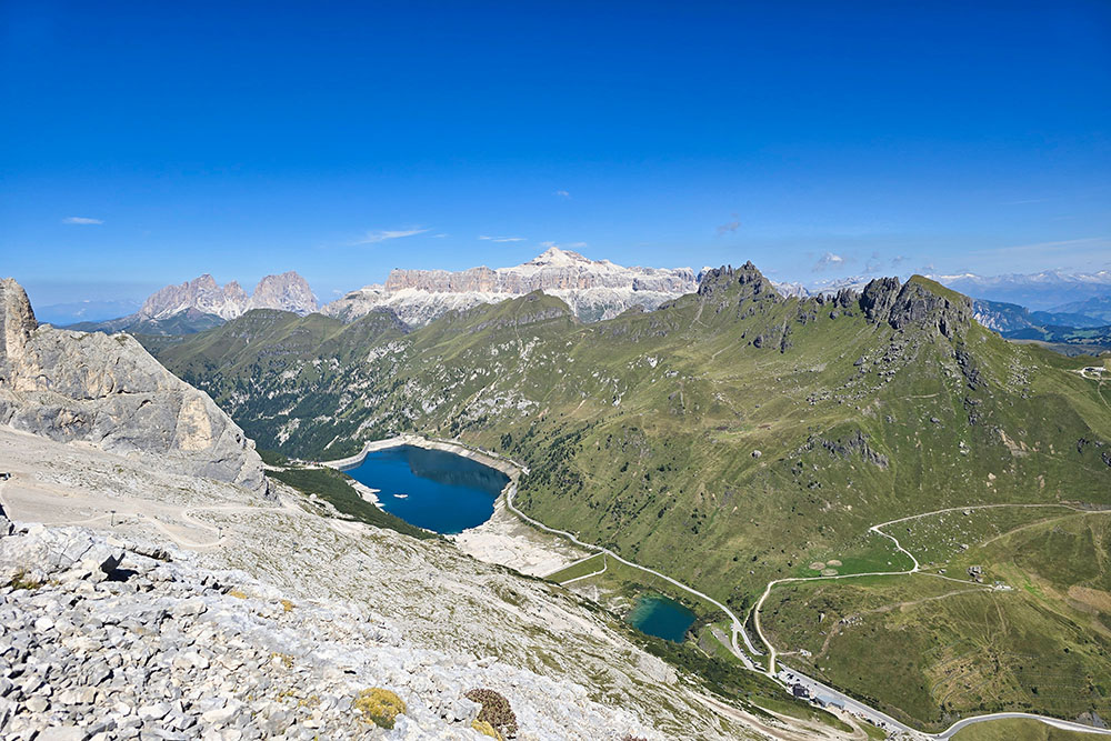
Panorama verso il Lago fedaia e il Gruppo del Sella
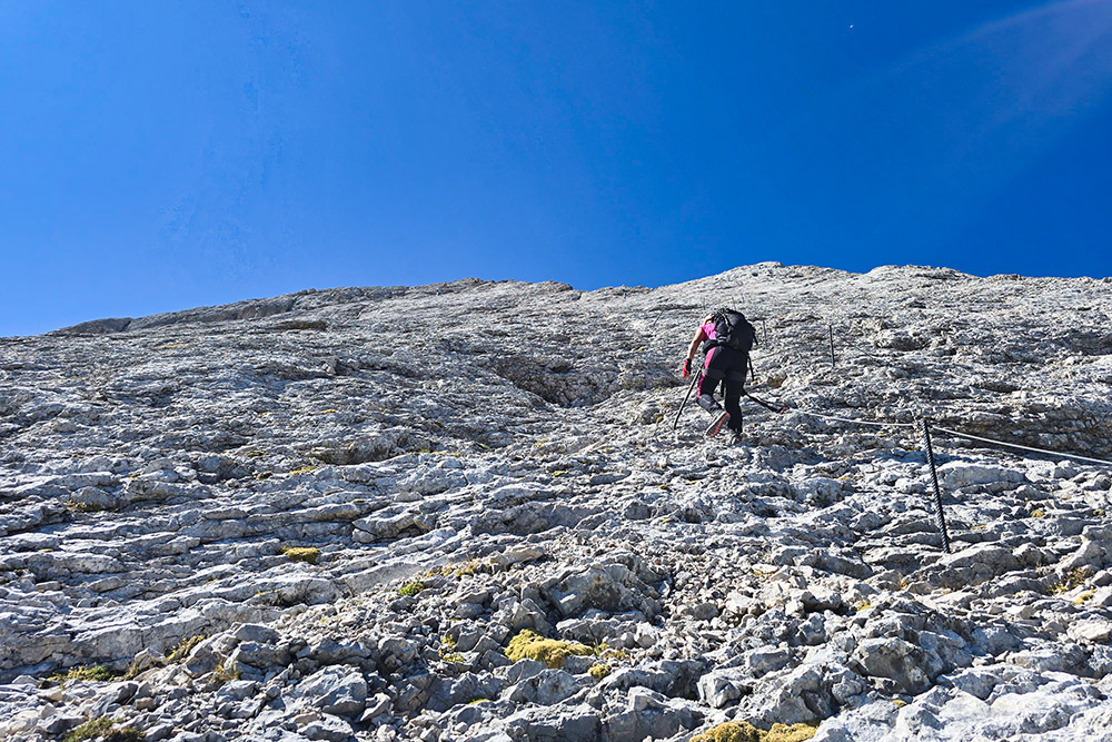
Secondo tratto, il lastrone
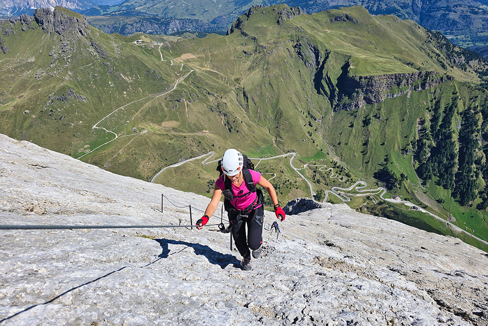
Il lastrone visto dall'alto
Terzo tratto, le creste
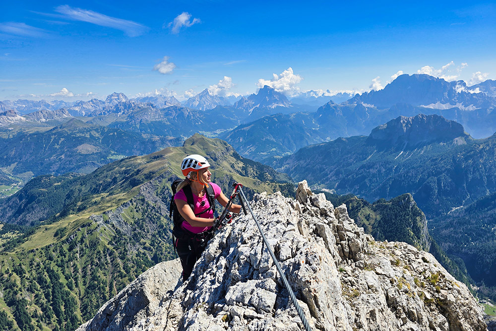
Questo tratto è molto panoramico
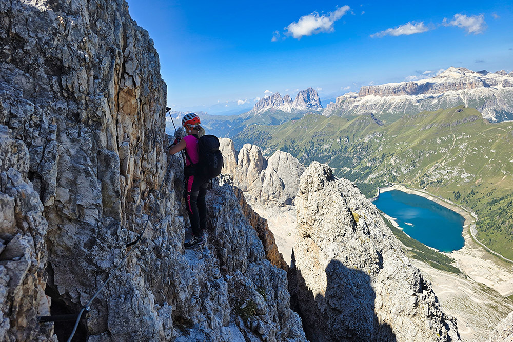
Vista verso il Lago Fedaia
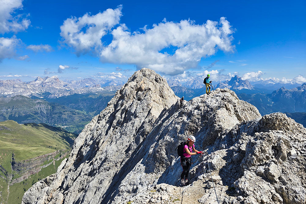
Il terzo tratto è un saliscendi
Ormai vediamo tutto il ghiacciaio della Marmolada
Fine della Ferrata Eterna
Siamo arrivati alla Zona Sacra del Serauta


