


![]()


Durata
 6:30 h
Distanza
 15,2 km
 Ascesa
 1560 m
Discesa
 1560 m
H Max
 2302 m
H Min
 949 m
949 mTacca del Cridola
DESCRIPTION
E-bike and trekking in the heart of Cridola: a hybrid adventure in the Friulian Dolomites.
Geographic Location
The Mount Cridola Group is located in the Eastern Alps, in the Friulian Dolomites and d'Oltrepiave, straddling the municipalities of Lorenzago di Cadore, Forni di Sopra and Domegge. The mountain group is part of the Friulian Dolomites Natural Park.
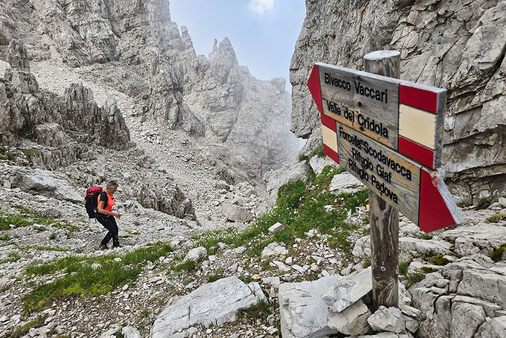
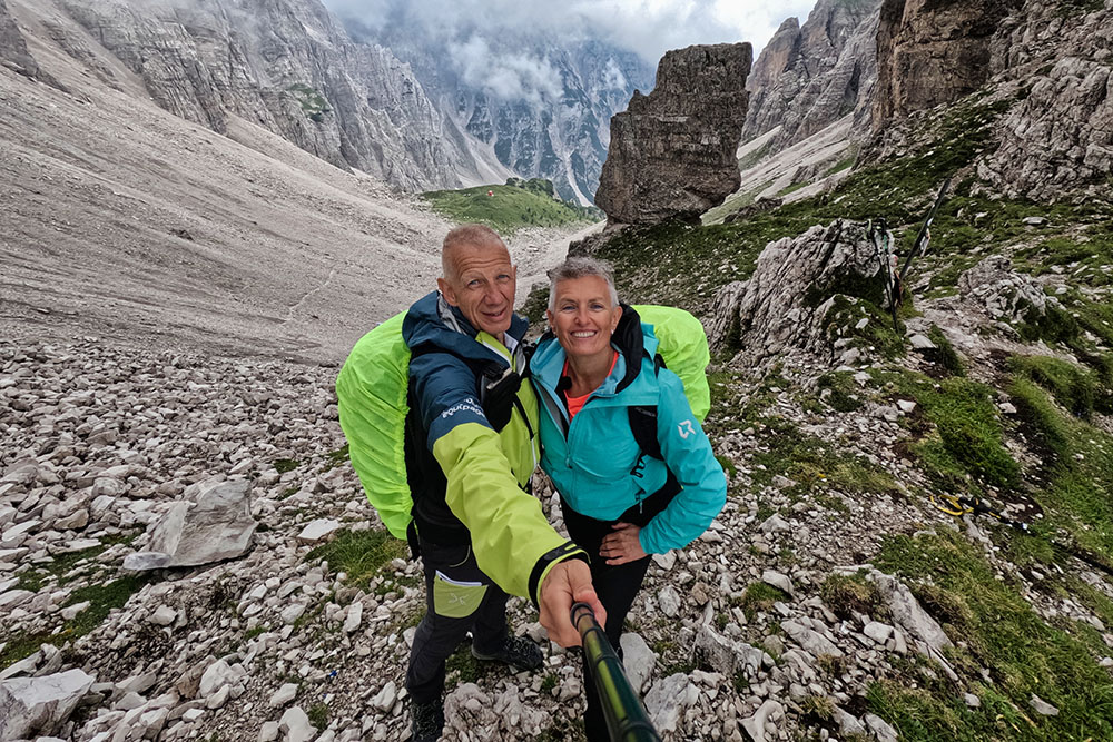
The Tacca del Cridola, nestled in the heart of the eponymous mountain group at 2,302 meters altitude, represents one of the most fascinating passages of these mountains. The most direct access is from the southern slope, starting from Forcella Scodavacca (2,043 m).
Hike
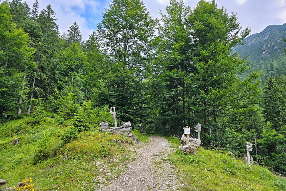
The itinerary offers an innovative experience that perfectly combines sustainable mobility and traditional hiking. The first part of the route develops on e-bike along an alpine mule track, characterized by significant gradients reaching 30% and sections with gravelly and unstable ground, up to the enchanting Rifugio Giaf mountain hut.
From here begins the magnificent hiking loop that represents the heart of the experience. The itinerary touches some of the most spectacular panoramic points of the Friulian Dolomites: from Forcella Scodavacca it continues towards the Tacca del Cridola, the culminating point of the hike, and then reaches the renovated Vaccari Bivacco. The route continues through Forca del Cridola and culminates on Monte Boschet, offering a continuous sequence of exceptional panoramic views.
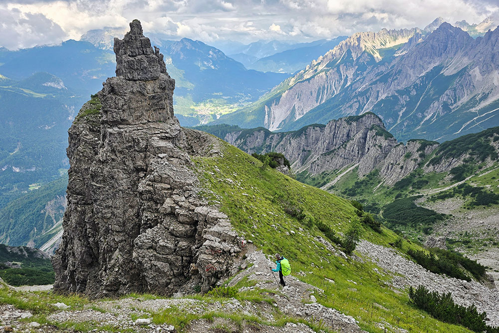
The most technical and challenging section develops between Forcella Scodavacca and the descent from Forca del Cridola. The trail winds through steep scree slopes surrounded by spectacular towers and spires, where often the track is barely visible and signage may be lacking. It is essential to pay attention to possible landslides and use appropriate expert hiking equipment.
For more ambitious mountaineers, from Tacca del Cridola starts the normal route, a challenging route, which leads to the summit of Monte Cridola (2,581 m), one of the most beautiful ascents in the Carnic Alps in a wild and pristine dolomitic environment.
History and Curiosities
The Vaccari Bivacco represents a piece of history of Friulian and Veneto mountaineering. Erected in 1978 through the collaboration of the CAI sections of Lorenzago and Montebelluna, it was originally dedicated to Aldo Vaccari, dynamic mountaineer and famous sports footwear industrialist. In 2001 the dedication was extended to Miranda Vaccari, Aldo's cousin and CAI member, who died tragically in 1998.
In July 2025 the old bivouac was replaced with a structure built with modern and sustainable materials, maintaining its essential function as shelter for mountaineers and hikers.
ITINERARY
From the parking area at the beginning of Val di Giaf (963 m) climb the valley on E-MTB up to Rifugio Giaf mountain hut (1,400 m). Here proceed on foot on trail 346, direction Forcella Scodavacca. Climb on a comfortable trail going up the entire Val di Giaf arriving at Forcella Scodavacca (2,043 m). Here climb to the right on a very steep scree slope: the trail has no numbering. Having reached the Tacca del Cridola (2,302 m) descend on the other side, always on very steep scree and reach the Vaccari Bivacco (2,050 m). Now proceed on trail 340 arriving at Forca del Cridola (2,172 m). Descend on the Vallonut di Forni side, always following trail marker 340, on steep scree and passing through Monte Boschet (1,707 m) return to Rifugio Giaf mountain hut. Take the E-MTBs and quickly return to the starting point.
EXCURSION DATE
July 23, 2025
STARTING POINT
Parking area at the beginning of Val di Giaf
REFRESHMENT POINT
Rifugio Giaf mountain hut
AUTHOR'S SUGGESTIONS
Use e-bikes to save energy and time.
SAFETY RECOMMENDATIONS
The practicability of the proposed itinerary, like all mountain morphology, is subject to environmental changes due to natural events and weather conditions. Therefore, before leaving, consult the competent tourist offices and/or reference mountain huts.
Our GPX tracks are only indicative, meaning the route was carried out to the best of our ability with the trail and weather conditions of that day. Therefore, always evaluate what to do on site.
Furthermore, remember to evaluate the route based on your physical capabilities, training and equipment available.
It is advisable to inform someone of the itinerary you intend to take.
Remember that the emergency number is 112.
EQUIPMENT
It is recommended to have equipment suitable for the route, weather conditions and season: windproof and/or waterproof jacket, map and/or GPS device, sunglasses, sunscreen, hiking boots, first aid kit, specific clothing, gloves, helmet, backpack with food and drinks.
RECOMMENDED MAPS
Tabacco 02 Forni di Sopra - Ampezzo - Sàuris - Alta Val Tagliamento
INTERESTING LINKS
https://www.rifugiogiaf.it/
HOW TO ARRIVE
From the center of Forni di Sopra follow state road 52 towards Passo della Mauria for 3 km to locality Chiandarens (962 m). On the left you can see the parking area and the small road of Val di Giaf.
PARKING AREA
Free parking at the beginning of Val di Giaf
GPS Coordinates: 46.434022, 12.548563
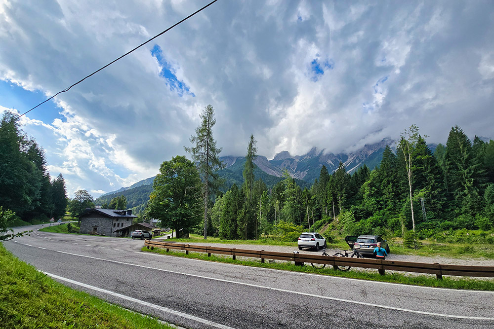
Parcheggio all'inizio della Val di Giaf
Si sale in bici
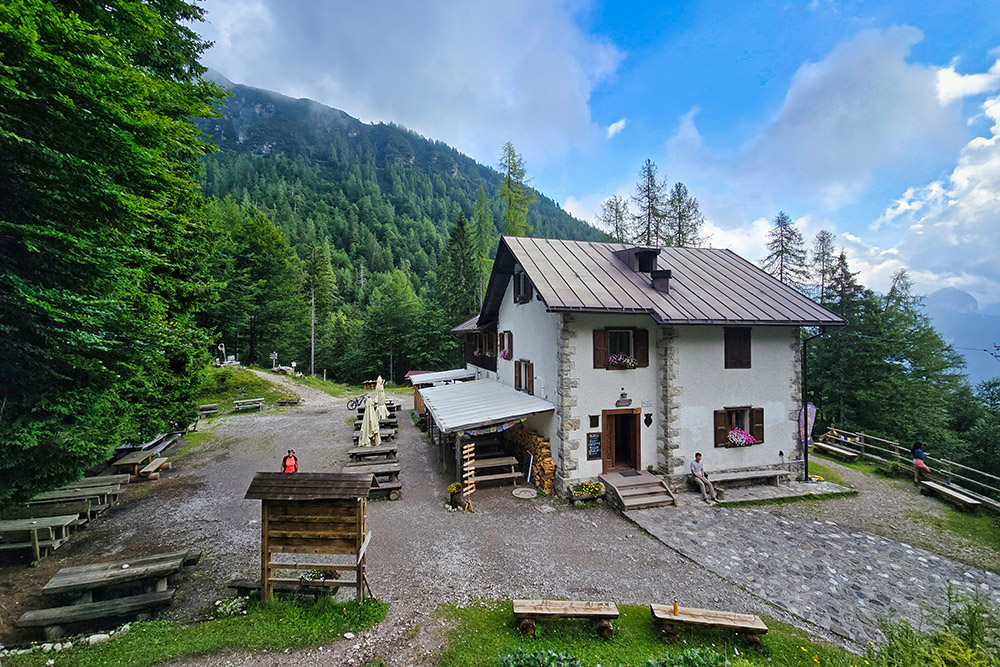
Arrivati al Rifugio Giaf
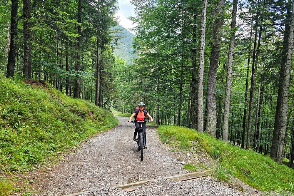
Ora si continua a piedi
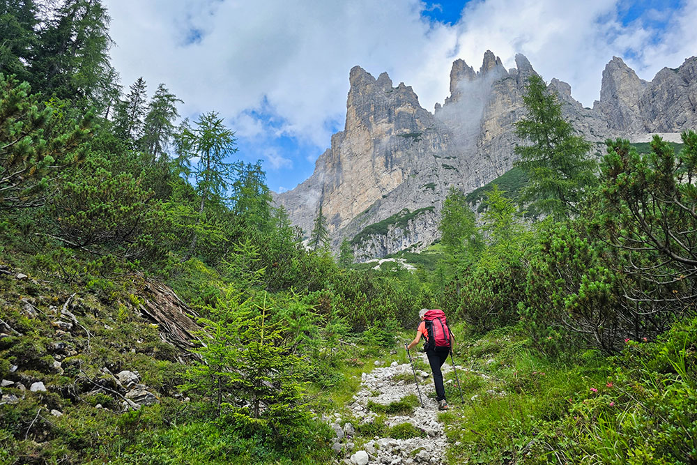
Si sale la Val di Giaf
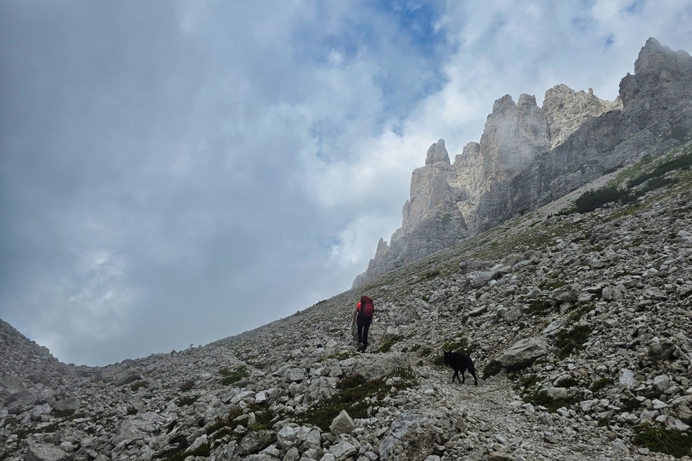
Siamo in prossimità della Forcella Scodavacca
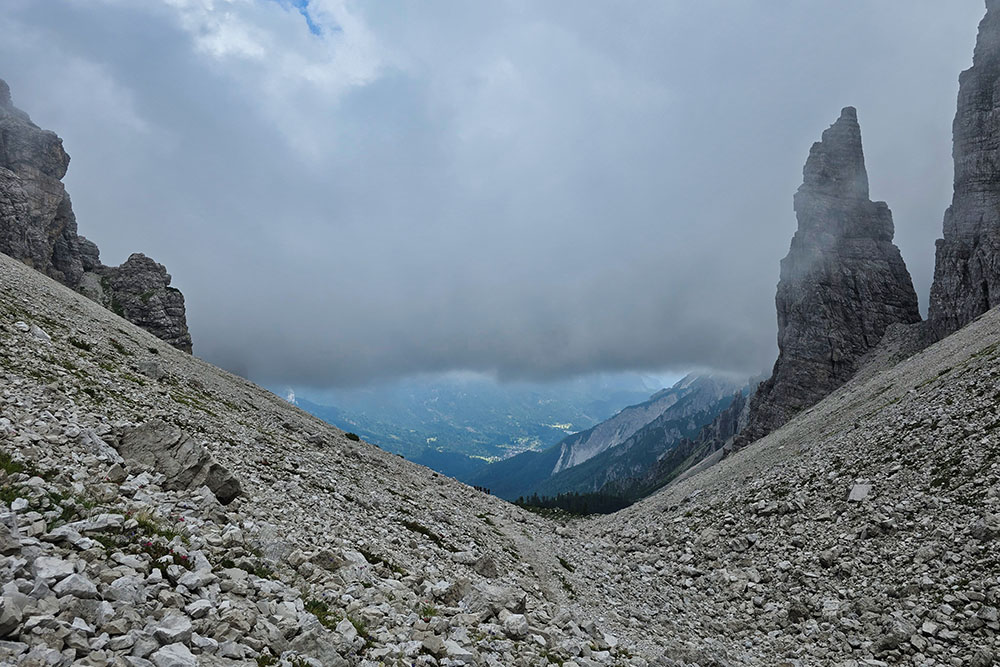
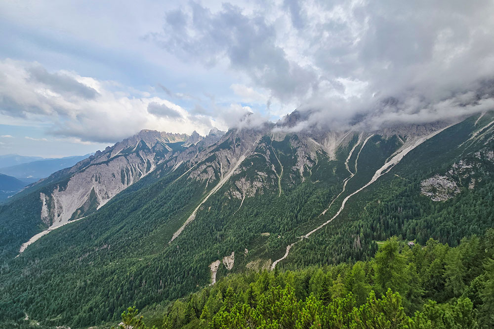
Panorama verso Forni di Sopra
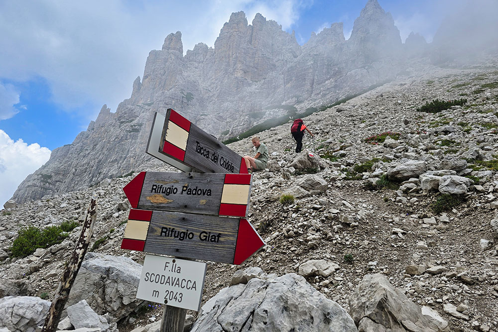
Dalla Forcella Scodavacca si sale alla Tacca del Cridola
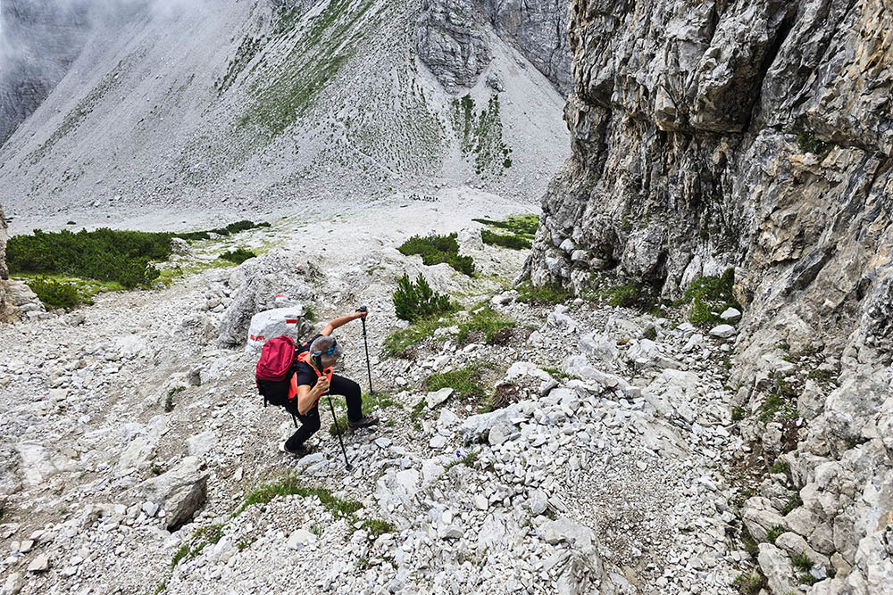
La salita è molto ripida
Arrivati alla Tacca del Cridola scendiamo
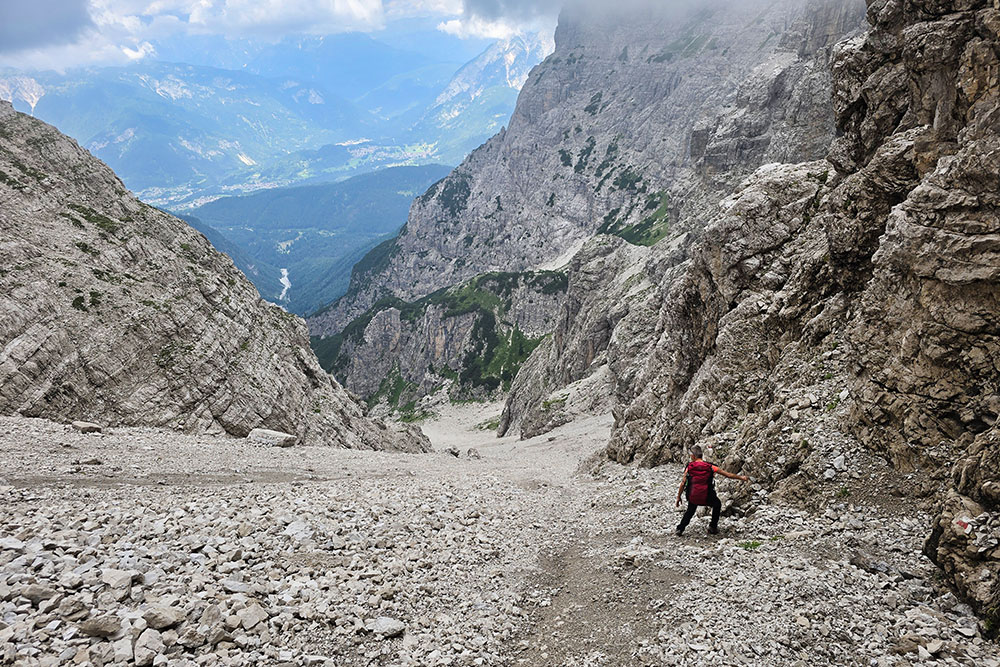
Altro ghiaione ripido
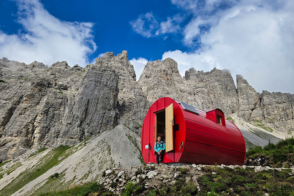
Il Bivacco Aldo e Miranda Vaccari
Alla Forca del Cridola
Si ritorna al Rifugio Giaf
Vista dal Monte Boschet


