


![]()


Durata
 3:40 h
Distanza
 8,7 km
 Ascesa
 690 m
690 mDiscesa
 690 m
690 mH Max
 2222 m
H Min
 1737 m
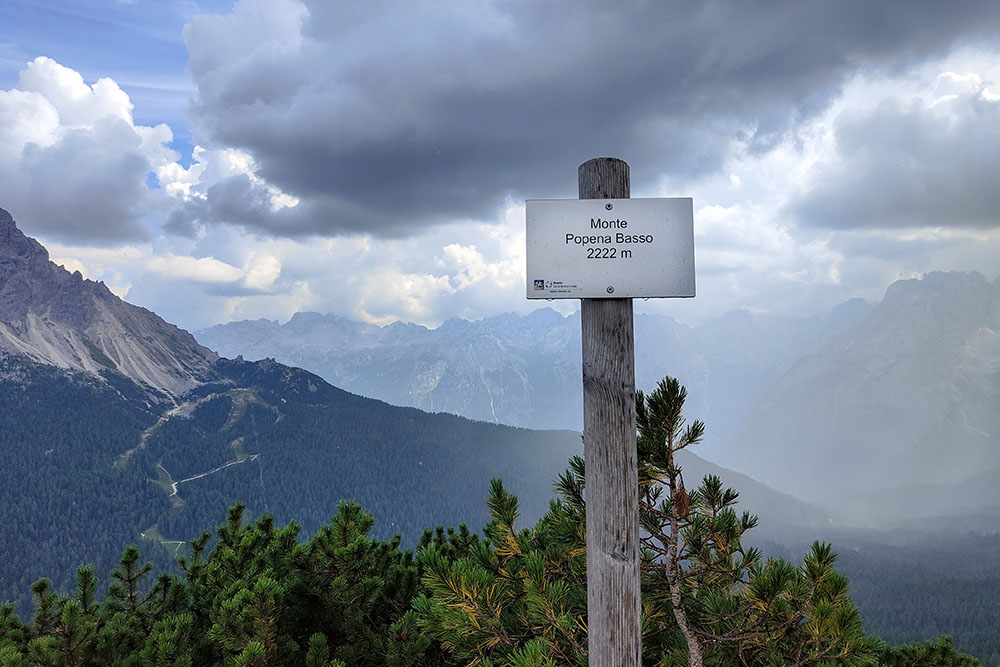
Monte Popena (Popena Basso) - 2222 m
DESCRIPTION
A panoramic adventure among the Dolomites and the story of a lost mountain hut.
Geographical Location
Monte Popena, also known as Popena Basso, is a peak located in Veneto, overlooking Lake Misurina to the east and the Val Popena to the west. With its rounded profile and sparse pastures, it fits perfectly into the context of the Dolomites, offering a stunning natural backdrop.
Hike
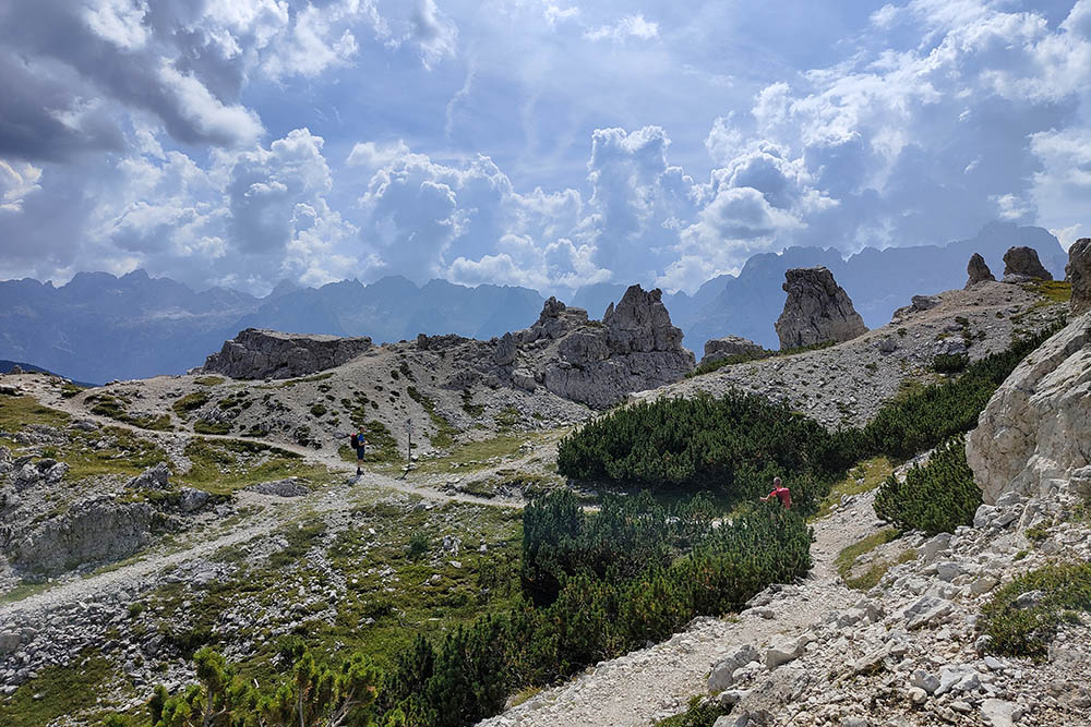
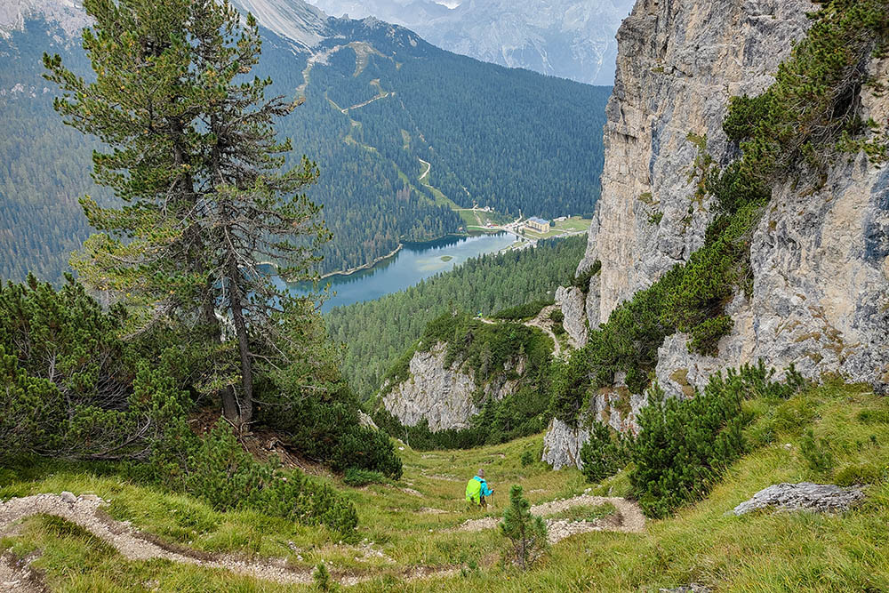
The circular hike on Monte Popena follows a well-preserved military trail and unfolds in a solitary and extraordinarily scenic environment. The route, of moderate difficulty, is not particularly long, and the elevation gain is moderate, but it still requires experience and preparation. The ascent and descent feature steep slopes and exposed sections, where signage can sometimes be sparse or even absent.
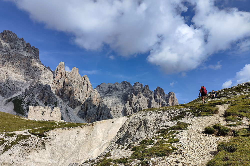
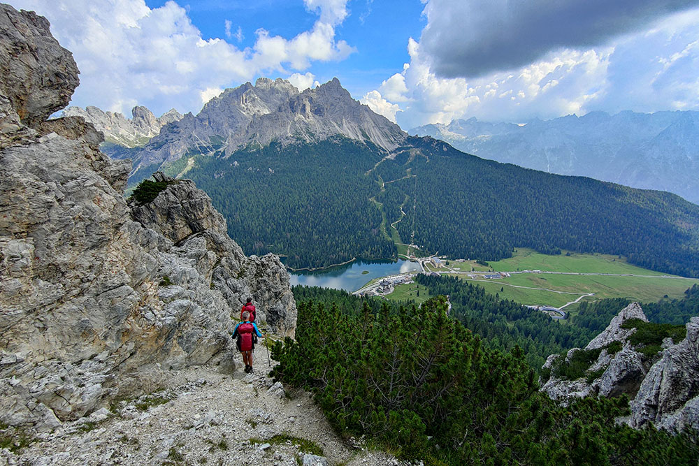
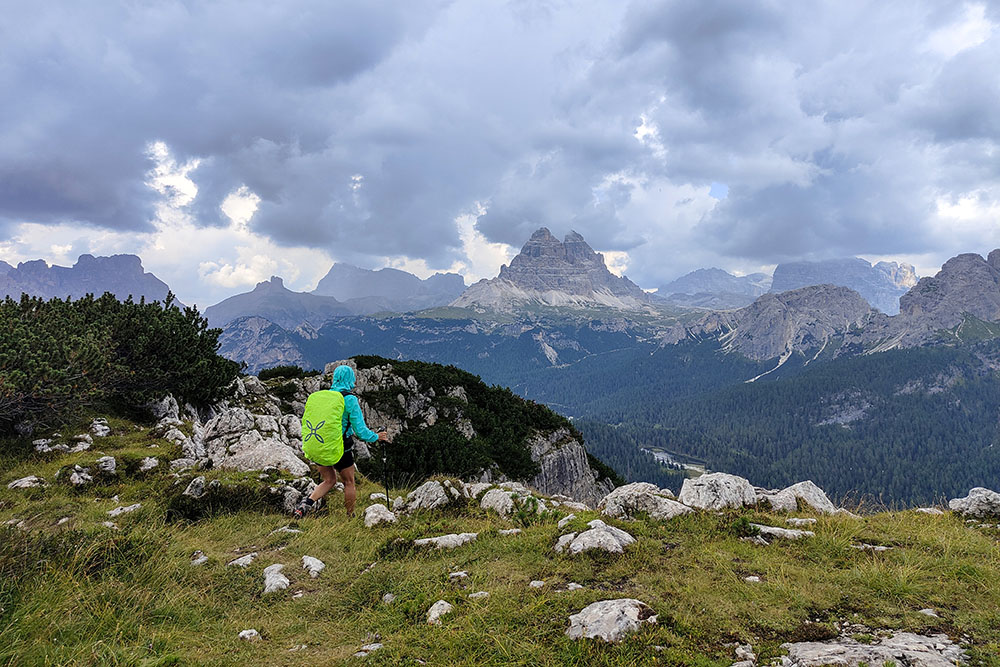
During the ascent, there are continuous views of the Cadini di Misurina and the Cristallino di Misurina, while proceeding towards the summit of Monte Popena, the panorama widens to embrace Lake Misurina, the Tre Cime di Lavaredo, Sorapìss, and many other surrounding peaks. This uniquely beautiful natural context makes the hike particularly rewarding, despite the technical challenges of the route.
History
Lino Conti, born on July 1, 1908, in Bolognano d’Arco, Trento, moved to Misurina for work. A great mountain enthusiast, Lino dreamed of building his own mountain hut in this beautiful area. He chose the location of Forcella Popena and began construction in 1934. In 1937, after marrying his beloved companion Giulia, he inaugurated the refuge, which soon became a landmark for climbers in the area.
Despite the hardships of World War II, the mountain hut remained open, although with fewer visitors. After the war, Lino enthusiastically resumed his activities, but in 1948, the hut was devastated by a fire caused by vandals. Despite his efforts, Lino could not rebuild it due to lack of financial resources.
ITINERARY
From the parking area (1737 m), head towards Lake Misurina. After about 300 meters, turn left and ascend toward the Malga di Misurina (1790 m). Here, the trail begins, marked as 224, which later becomes 224b, leading to Forcella Popena (2214 m), where the ruins of the Rifugio Popena are located. At this point, descend slightly into Val Popena, keeping to the right towards the Pale di Misurina, and then ascend to Forcella delle Pale di Misurina (2129 m). Follow the trail 224 for about a hundred meters, then turn right onto an unmarked and barely visible path. Upon reaching another pass, descend via a steep trail, and after about 100 meters, take trail 224A that leads to the summit of Monte Popena (2222 m). The return is along trail 224A down to Lake Misurina and then back to the starting point along the lakeside path.
EXCURSION DATE
August 31, 2024
STARTING POINT
Lake Misurina
REFRESHMENT POINT
At the last stretch of the trail along the lakeside.
AUTHOR’S SUGGESTIONS
Download the GPX track.
SAFETY TIPS
The passability of the proposed itinerary, like all mountain morphology, is subject to environmental changes caused by natural events and weather conditions. Therefore, before departing, consult the relevant tourist offices and/or mountain huts.
Our GPX tracks are only indicative, meaning the route was followed as best as possible under the trail and weather conditions of that day. Therefore, always evaluate the situation on-site.
Also, remember to assess the route based on your physical abilities, training, and available equipment.
It is advisable to inform someone of the itinerary you intend to take.
Remember that the emergency number is 112.
EQUIPMENT
It is recommended to have the appropriate equipment for the trail, the weather conditions, and the season: windproof and/or waterproof jacket, map and/or GPS device, sunglasses, sunscreen, hiking boots, first aid kit, specific clothing, gloves, and a backpack with food and beverages.
RECOMMENDED MAPS
Tabacco 03 Cortina d'Ampezzo - Dolomiti Ampezzane
INTERESTING LINKS
https://auronzomisurina.it/misurina/
HOW TO ARRIVE
From Cortina d’Ampezzo, follow the SR48, pass the Tre Croci Pass, then take the SP49 and continue to Lake Misurina.
PARKING AREA
Along the SP49 road in Misurina
GPS coordinates: 46.575582, 12.249968
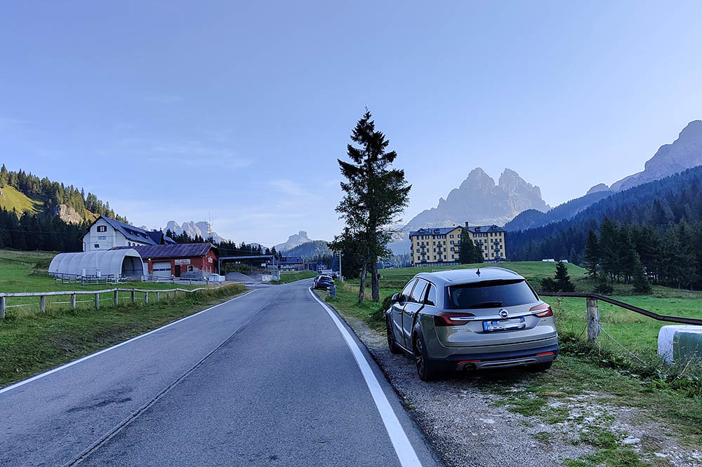
Parcheggio lungo la strada
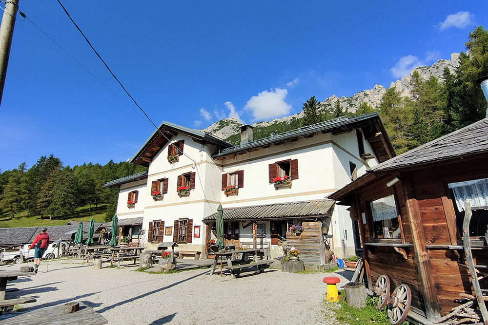
La Malga di Misurina
Si sale per il sentiero 224b
Manca poco alla Forcella Popena
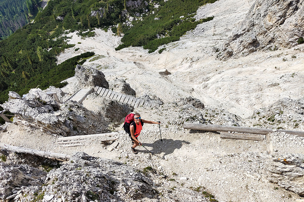
Scale in legno
Arrivati alla Forcella Popena
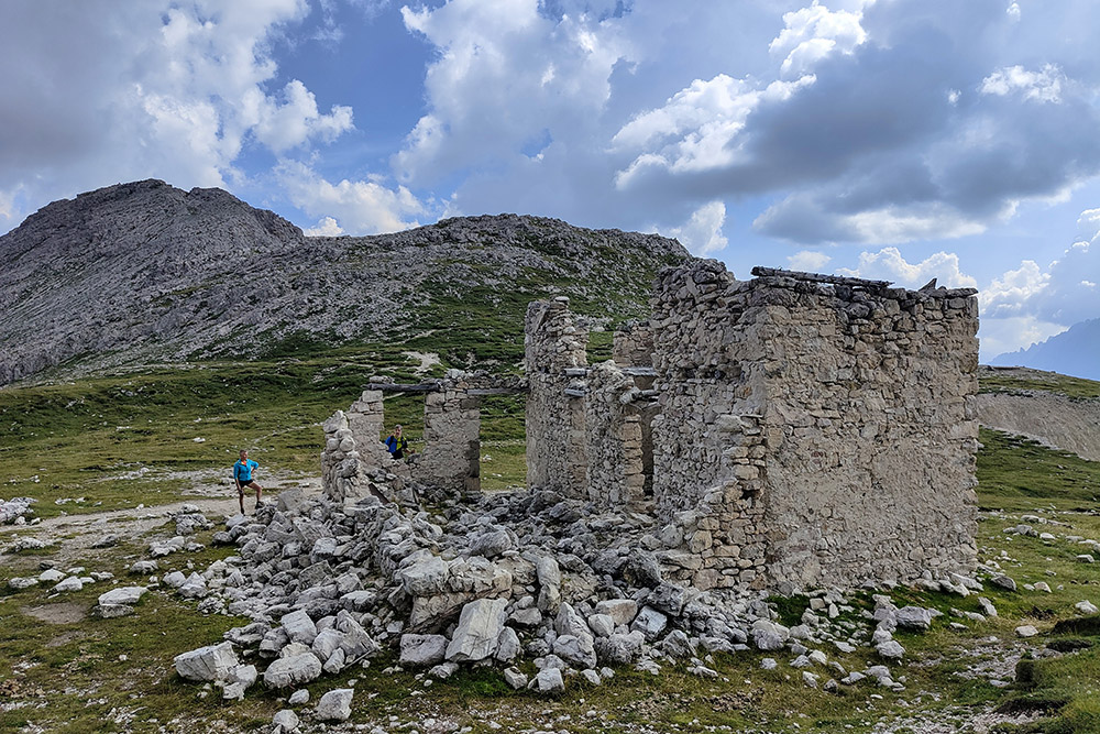
L'ex Rifugio Popena
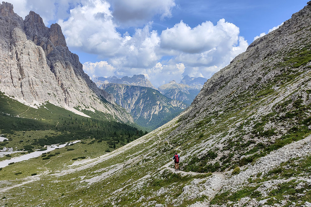
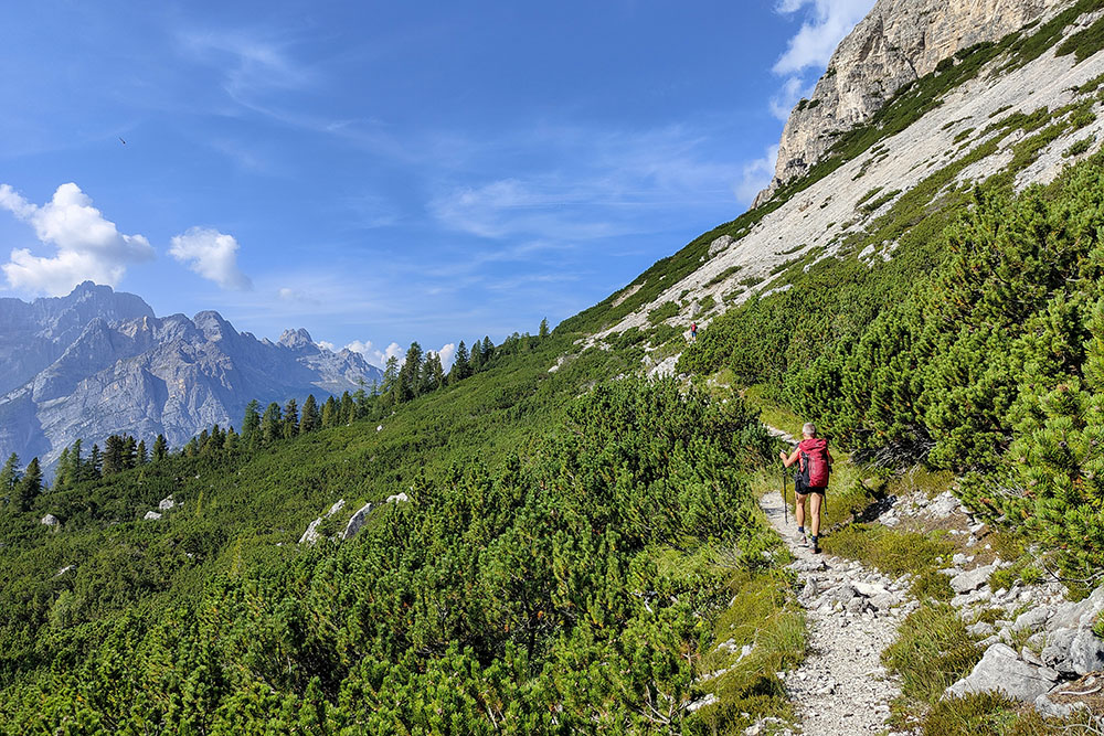
Sentiero in Val Popena
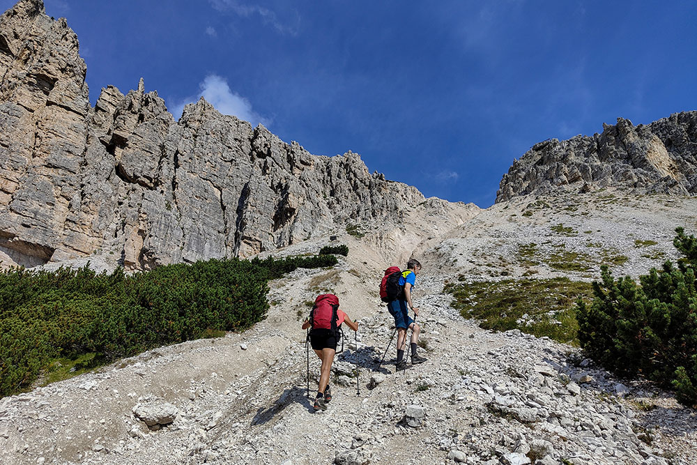
Forcella delle Pale di Misurina
Si inizia a vedere il Lago di Misurina
Arrivati alla vetta del Monte Popena
Vista verso le Tre Cime di Lavaredo
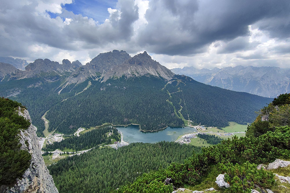
Vista verso il Lago e i Cadini di Misurina
Si scende lungo il sentiero 224A
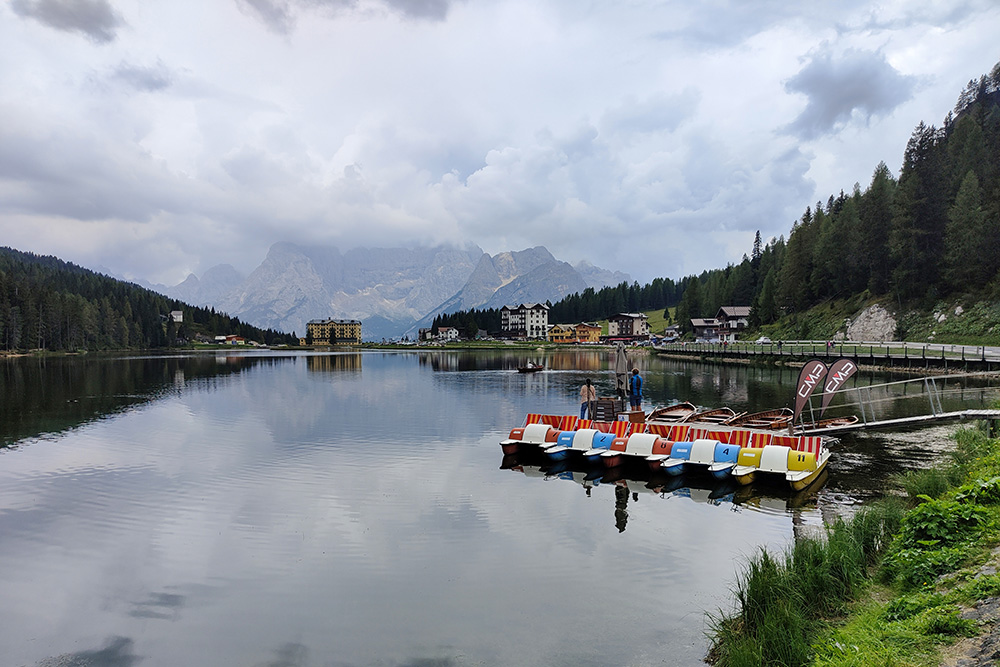
Arrivati al Lago di Misurina


