


![]()


Durata
 5:45 h
Distanza
 24 km
24 km Ascesa
 1393 m
Discesa
 1393 m
H Max
 2839 m
H Min
 1446 m
Picco di Vallandro (Dürrenstein)
DESCRIPTION
An adventure by e-bike and on foot through Dolomite trails with spectacular views.
Geographical location
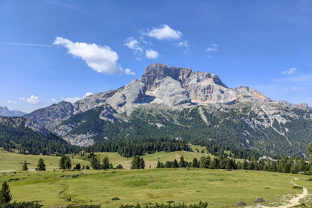
Picco di Vallandro (2,839 m a.s.l.), also known as Dürrenstein, is a mountain in the Braies Dolomites, located in the province of Bolzano, between Val di Landro and Valle di Braies. This peak represents the highest point of a mountain range stretching approximately 12 kilometers, which runs alongside the Rienza River from Carbonin to Val Pusteria. The mountain has two very different sides: the western side, gentle and grassy, is crossed by an easy trail starting from Prato Piazza or the Rifugio Vallandro; the eastern side, however, is steep and rugged, with rocky walls plunging 1,500 meters down to the Val di Landro.
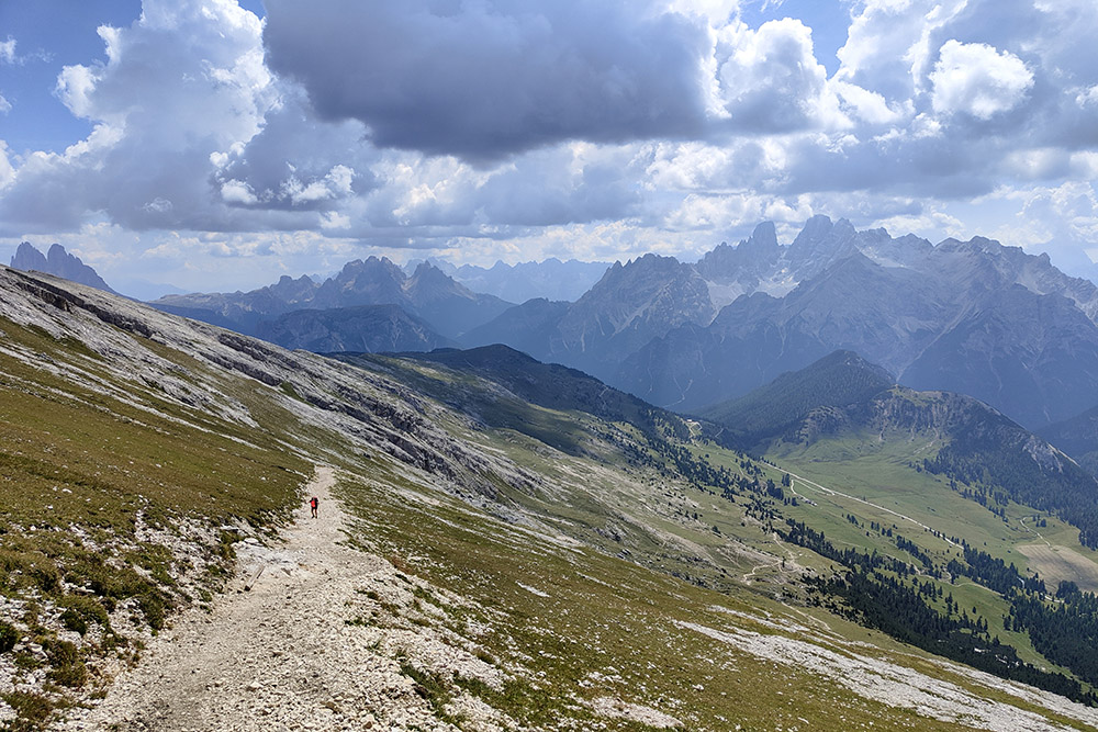
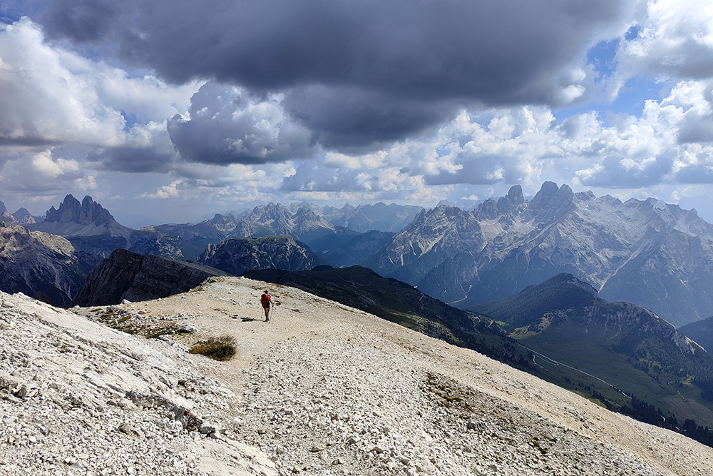
The summit of Picco di Vallandro is renowned for its 360° panoramic view, offering spectacular vistas of some of the most iconic peaks in the Dolomites, including the Croda Rossa d'Ampezzo, Monte Cristallo, Cadini di Misurina, the Tre Cime di Lavaredo, and the Croda del Becco, as well as the Puster Alps.
Hike
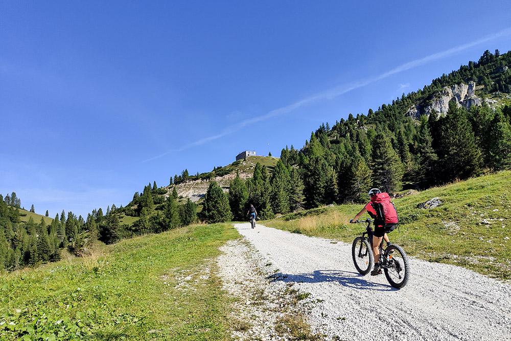
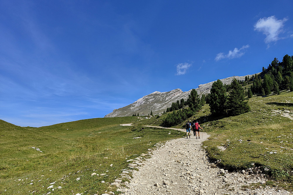
The proposed route combines 14.6 km on an e-MTB with 9.4 km on foot. The first part of the excursion is on a well-maintained dirt road with a constant incline, classified as S0 for its ease.
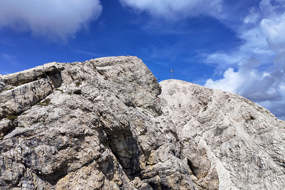
Picco di Vallandro is one of the most fascinating peaks of the Dolomites due to the panoramic views from its summit. Starting from Rifugio Vallandro/Dürrensteinhütte, located at an altitude of 2,040 meters, the ascent to the summit is relatively short, despite its considerable height of 2,839 meters. Except for a short exposed section just before the summit, the hike is accessible to hikers of varying levels. However, it is crucial to have a sure footing and not suffer from vertigo to tackle the final section.
The hike is also suitable for older children, provided they have good physical endurance and some hiking experience. Picco di Vallandro offers not only a chance for direct contact with Dolomitic nature but also a splendid opportunity to admire some of the most famous peaks in the Alps.
ITINERARY
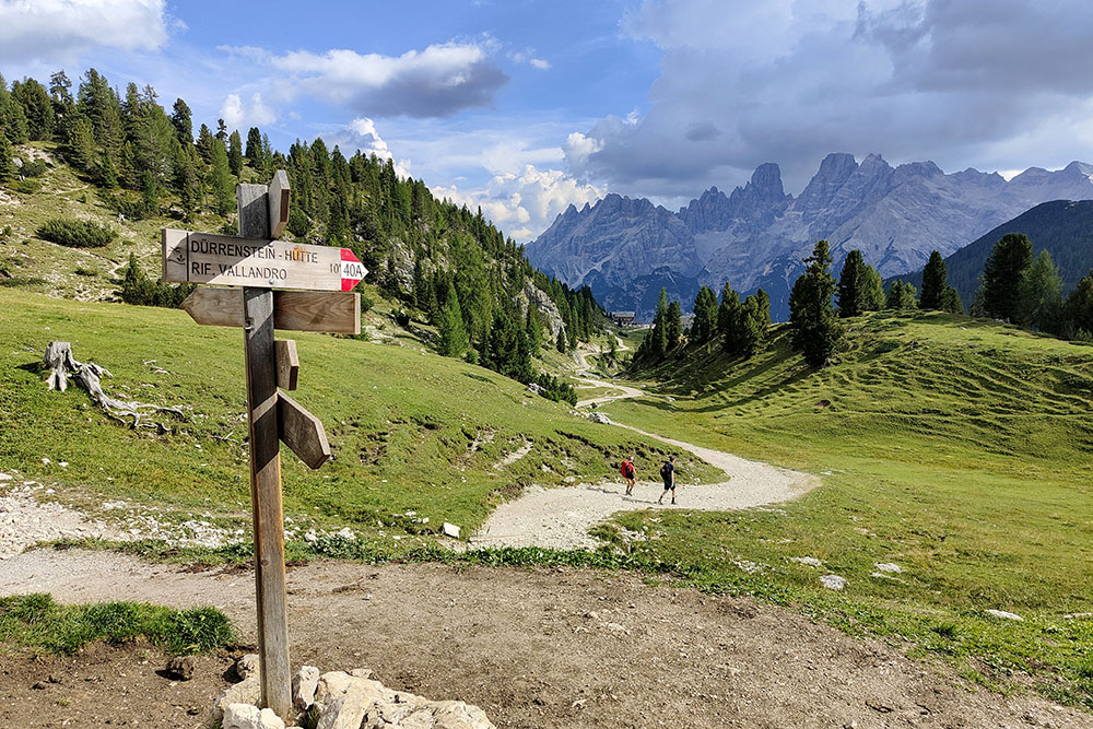
From the parking area in Località Carbonin/Schluderbach (1,446 m), begin the route on e-MTB by riding a few meters on an asphalt road towards Passo Cimabanche. Then turn right onto a dirt road, trail marker 37, which leads to Rifugio Vallandro/Dürrensteinhütte (2,040 m). Here, leave the bike and continue on foot. Follow the trail with markers 40A and 40 to the summit. Upon reaching the sub-summit, you'll have a view towards the north and encounter a brief exposed section equipped with metal chains. From the summit of Picco di Vallandro/Dürrenstein (2,839 m), return by following the same route.
EXCURSION DATE
August 30, 2024
STARTING POINT
Località Carbonin/Schluderbach
REFRESHMENT POINT
Rifugio Vallandro/Dürrensteinhütte (2,040 m)
AUTHOR’S SUGGESTIONS
At Rifugio Vallandro/Dürrensteinhütte, you can recharge your batteries.
SAFETY TIPS
The passability of the proposed itinerary, like all mountainous terrain, is subject to environmental changes due to natural events and weather conditions. Therefore, before setting off, consult the relevant tourist offices and/or mountain huts.
Our GPX tracks are only indicative, as the route was completed under the best conditions of the trails and weather on that day. Always assess the situation locally before proceeding.
Additionally, remember to evaluate the route according to your physical abilities, training, and equipment. It is advisable to inform someone of your intended route.
Remember, the emergency number is 112.
EQUIPMENT
It is recommended to have the proper equipment for the route, weather conditions, and season: windproof and/or rain jacket, map and/or GPS device, sunglasses, sunscreen, hiking boots, first aid kit, specialized clothing, gloves, backpack with food and drinks.
RECOMMENDED MAPS
Tabacco 031 Dolomiti di Braies - Marebbe
INTERESTING LINKS
https://www.vallandro.it/
HOW TO ARRIVE
From Dobbiaco, take the SS51 Alemagna. Pass Lago di Dobbiaco and Lago di Landro, and you will reach Carbonin, about 13 km away.
PARKING AREA
Free parking in Località Carbonin/Schluderbach
GPS Coordinates: 46.620926, 12.211885
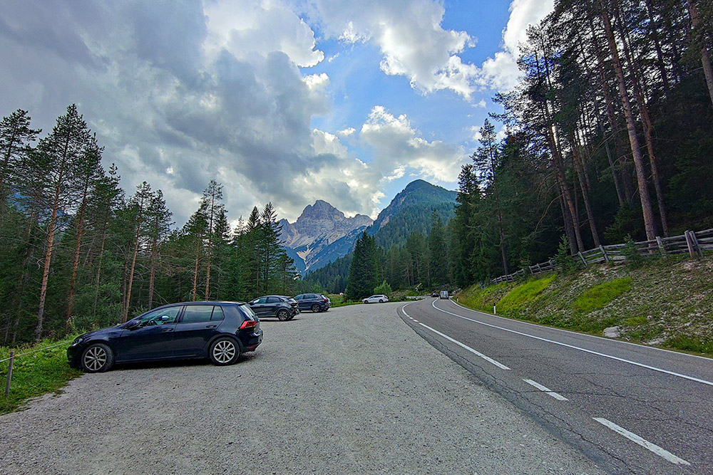
Parcheggio a Carbonin
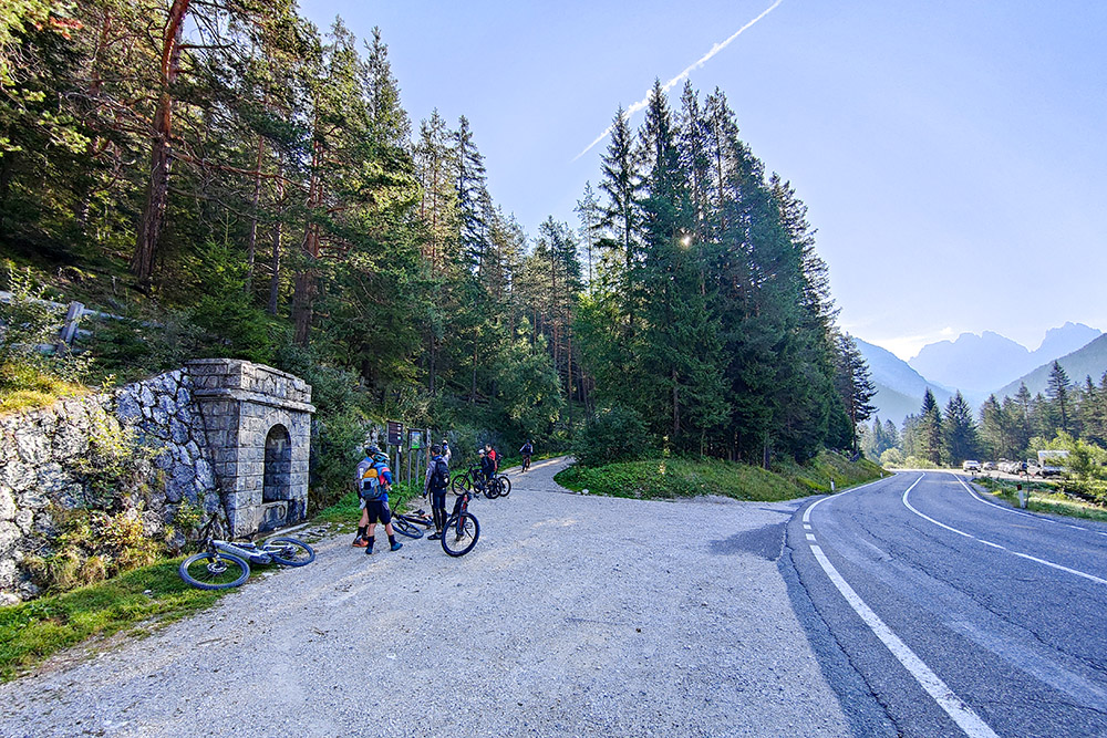
Primo bivio
Si sale in e-MTB su strada sterrata
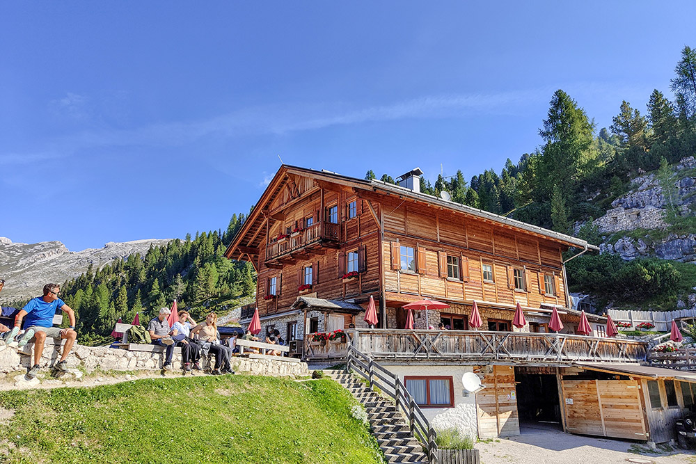
Arrivati al Rifugio Vallandro
Si percorre il sentiero 40A
Croda Rossa d'Ampezzo
Si sale sul sentiero 40
Si vede la croce di vetta
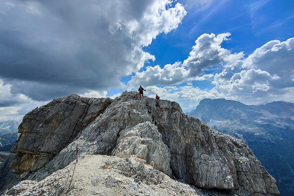
Breve tratto attrezzato
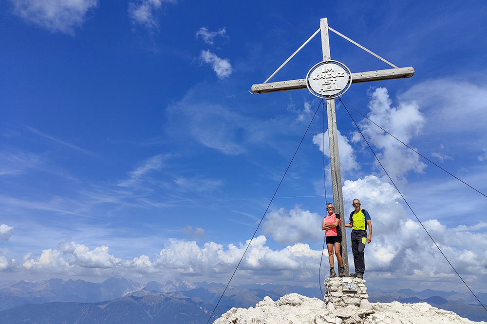
Arrivati in cima al Picco di Vallandro
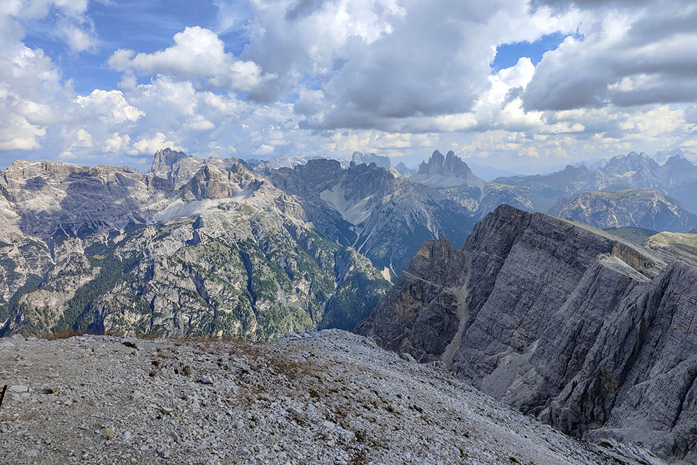
Panorama verso le Tre cime di Lavaredo
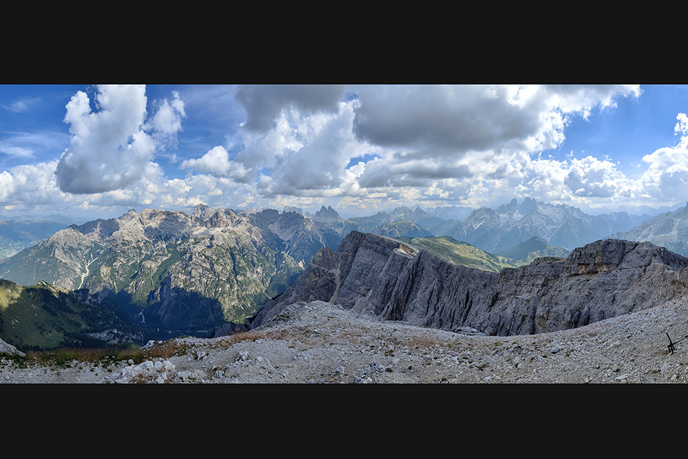
Panorama a 180°
Si ritorna con una magnifica vista
Manca poco al Rifugio Vallandro
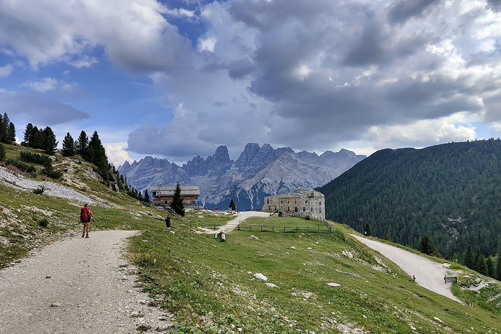
Ritornati al rifugio


