


![]()


Durata
 10:00 h
Distanza
 16,4 km
 Ascesa
 1480 m
Discesa
 1480 m
H Max
 2664 m
H Min
 1453 m
Via Ferrata Alpini Route
DESCRIPTION
Spectacular circular hike between history and fantastic panoramas.
Geographical Location
The Alpini Route, also known as the Alpini Trail or in German Alpinisteig, winds through the majestic Sexten Dolomites, in the heart of Trentino-Alto Adige, autonomous province of Bolzano. This famous equipped route originates in the suggestive Fiscalina Valley (Fischleintal in German), within the Three Peaks Nature Park, representing one of the most renowned itineraries of the entire Alpine arc.
Hike
The via ferrata follows a spectacular itinerary that ascends the eastern slope of the upper Fiscalina Valley, connecting the Zsigmondy-Comici Mountain Hut to Forcella Undici through a circular route of considerable length and significant elevation gain. Despite its reputation as a classic trail, this route requires careful weather preparation and a good level of physical fitness.
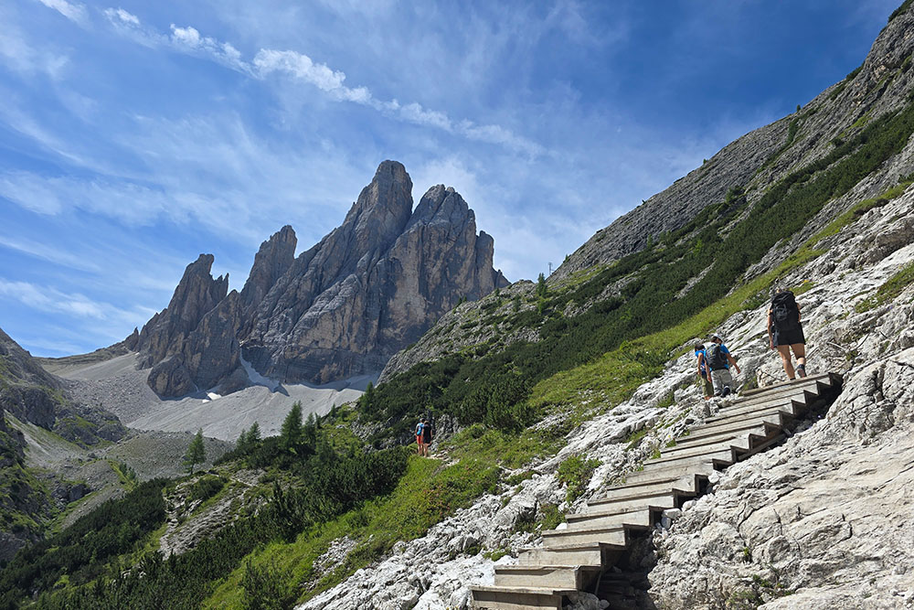
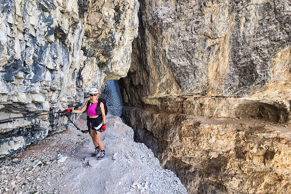
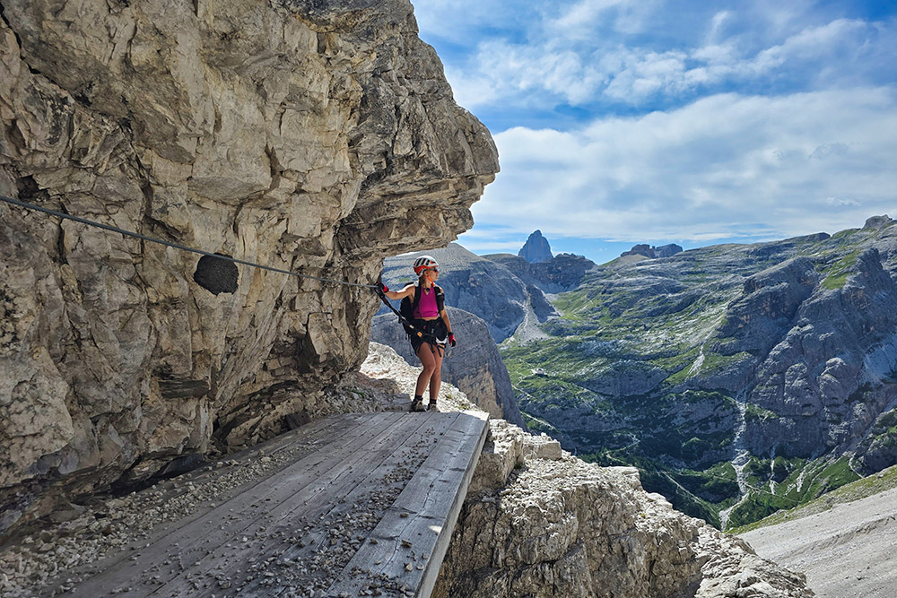
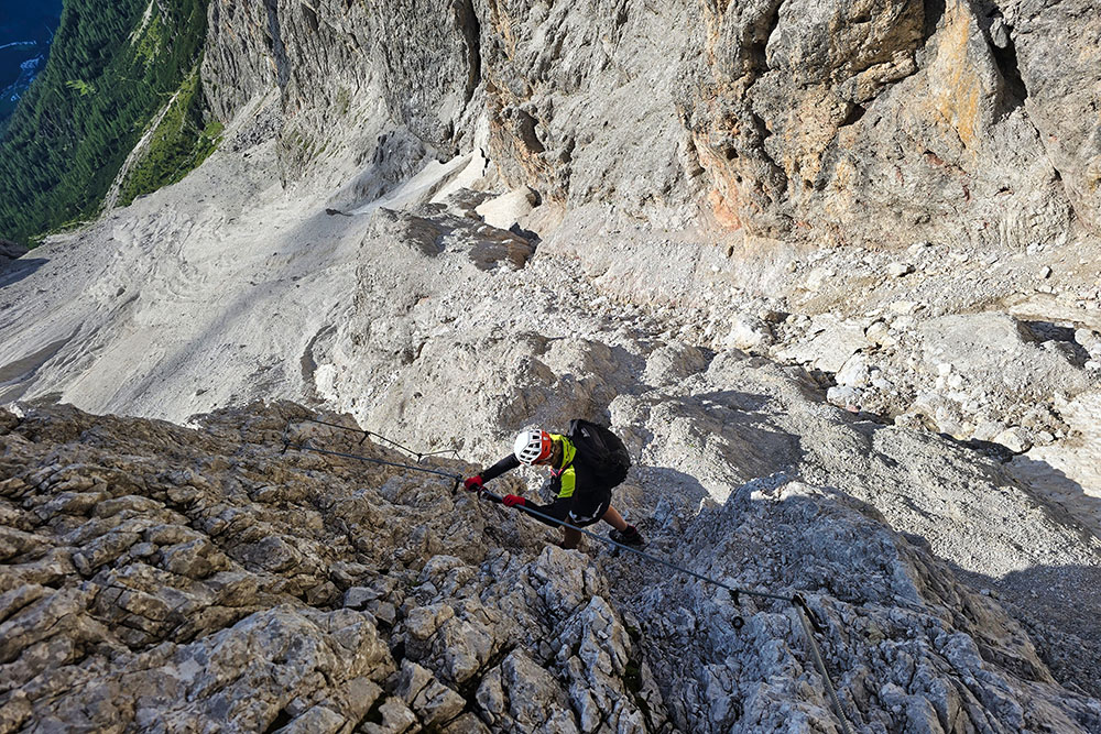
The first section of the ascent, known as Cengia della Salvezza (Salvation Ledge), offers a unique experience along a spectacular passage carved into the rock wall. Here the technical difficulties remain contained, allowing you to fully enjoy the beauty of the surrounding landscape. The route develops mainly on well-equipped natural ledges, characterized by exposure that, while significant, does not present insurmountable obstacles for experienced hikers.
The second section, which leads to Forcella Undici, maintains a panoramic and accessible character, following the western flanks of Cima Undici through ancient military trails. It is precisely in this stretch that you most perceive the historical character of the route, more similar to a challenging hike on war traces than a true alpine climb.
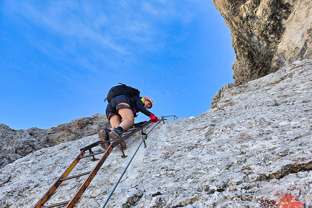
The actual difficulties manifest in the third segment, from Forcella Undici to the descent through the Sentinella Via Ferrata, in the Sentinella Valley. Here the route presents some vertical passages and more demanding sections, requiring greater attention and technique, especially during the descent. The steep equipped descent that leads into the valley, while well designed and equipped with safe holds, can present dangers related to falling rocks.
The entire route is characterized by the absence of support points after the Comici Mountain Hut, making accurate planning of supplies and travel times essential. The metal cables and fixed equipment guarantee safety along the entire route, allowing you to experience an unforgettable aerial experience between history and nature.
History and Curiosities
The historical roots of the Alpini Route are deeply embedded in the dramatic events of the Great War, when this bold path served as a strategic connection between Forcella Giralba and the western terrace of Cima Undici. The famous Salvation Ledge was initially born as a natural formation, subsequently widened and made passable by the Italian Alpini for military purposes.
During the conflict, this passage was of crucial importance for reaching and fortifying the positions on the ridge of Cima Undici, preparing the attack on the Sentinella Pass, which at the time marked the border between the Kingdom of Italy and the Austro-Hungarian Empire. The traces of this military presence are still visible today and give the route an aura of respect and historical memory.
At the end of the First World War, it was Francesco Meneghello, an alpinist of the CAI, who brought this magnificent war itinerary back to light, transforming the ancient military trail into an alpine route accessible to hikers. In 1932, the CAI of Padua officially inaugurated the trail equipped with metal cables and ladders, creating a connection that crossed the old state border.
The original route extended from the Sentinella Pass to the Zsigmondy-Comici Mountain Hut (initially called Rifugio Mussolini), continuing towards the Olivo Sala Mountain Hut at Popèra, thus crossing from the province of Bolzano to that of Belluno. The final section, from Forcella Undici to the Sentinella Pass, was equipped by the CAI of Padua in the seventies, completing the itinerary we know today.
The Zsigmondy-Comici Mountain Hut, a fundamental reference point for the hike, has an equally interesting parallel history. Originally built by the Austrian Alpenverein, it was destroyed during the First World War and subsequently rebuilt in 1928. Today it bears the name of two famous alpinists, Emil Zsigmondy and Emilio Comici, and maintains an authentic mountain atmosphere that represents the true essence of alpine hospitality.
ITINERARY
The hike begins from the Fiscalina Valley Parking at 1453 meters altitude. From here you take trail 103, which leads through a pleasant ascent to the Fondovalle Mountain Hut (1548 m), perfect for a first brief stop.
The route continues along trail 103, gaining altitude through increasingly spectacular panoramas until reaching the Comici Mountain Hut at 2224 meters.
Continuing in the direction of Forcella Giralba, you encounter the first fork where you need to turn left taking trail 101, better known as the Alpini Trail. It is precisely along this stretch that the via ferrata adventure begins, when you reach the famous Salvation Ledge.
The ascent continues to Forcella Undici (2628 m), a panoramic point from which you follow the indication for the Sentinella Pass. Here begins the second exciting equipped section of the via ferrata.
Once you arrive below the Sentinella Pass, the route changes direction: you descend through the third and final via ferrata section, the spectacular Sentinella Via Ferrata, which ends in the scree of the Sentinella Valley.
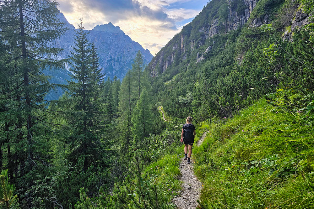
The return takes place following trail 124, which through a circular route comfortably brings you back to the starting point, completing this magnificent hike in the Sexten Dolomites.
EXCURSION DATE
July 18, 2025
STARTING POINT
Fiscalina Valley Parking
REFRESHMENT POINT
Fondovalle Mountain Hut (1548 m) and Comici Mountain Hut (2224 m)
AUTHOR'S SUGGESTIONS
The Via Ferrata is not difficult, but it is always appropriate to wear the via ferrata kit.
SAFETY ADVICE
The passability of the proposed itinerary, like all mountain morphology, is subject to environmental changes due to natural events and weather conditions. Therefore, before departing, consult the competent tourist offices and/or reference mountain huts.
Our GPX tracks are only indicative, meaning the route was carried out under the best conditions of trails and weather on that day. Therefore, always evaluate on site what to do.
Also remember to evaluate the route based on your physical capabilities, training, and available equipment.
It is advisable to tell someone the itinerary you intend to take.
Remember that the emergency number is 112.
EQUIPMENT
It is recommended to have suitable equipment: technical mountain clothing, boots with Vibram sole or similar, via ferrata set, harness, helmet, via ferrata gloves, sunglasses, sunscreen, backpack with beverages.
RECOMMENDED MAPS
Tabacco 010 Dolomiti di Sesto / Sextener Dolomiten
INTERESTING LINKS
https://www.zsigmondyhuette.com/it/baita-a-sesto.html
HOW TO ARRIVE
From Sexten SS52 to Moos, then take towards Fiscalina Valley and continue to the end of the valley.
PARKING AREA
Fiscalina Valley Parking, paid parking.
GPS Coordinates: 46.666794, 12.353391
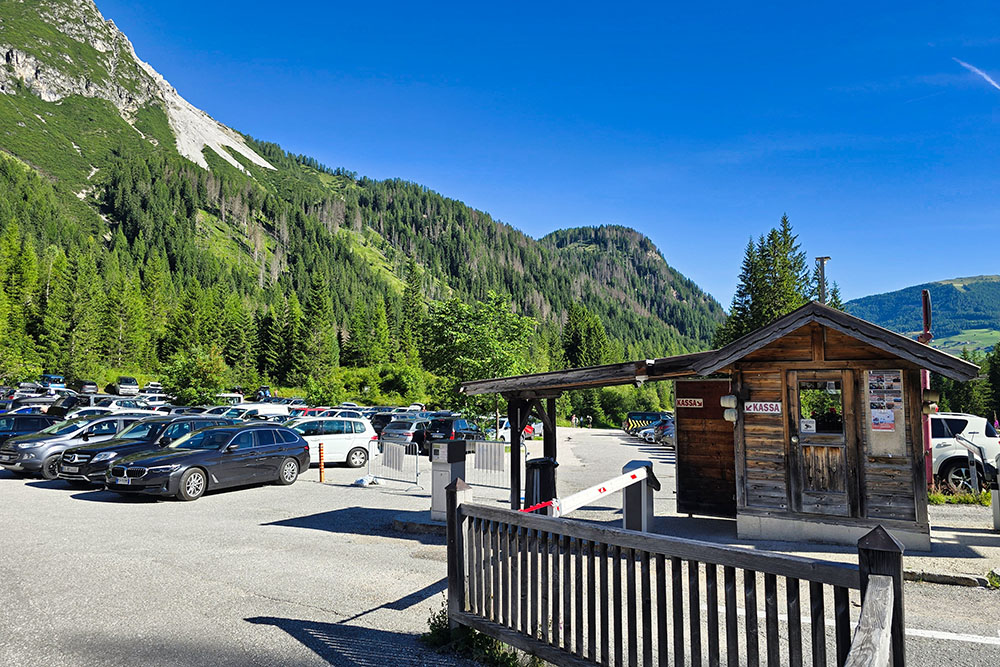
Parcheggio Val Fiscalina
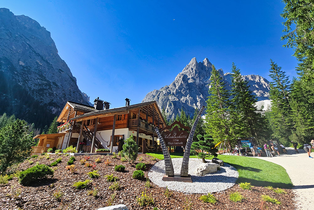
Arrivati al Rifugio Valfiscalina
Si sale sul sentiero 103
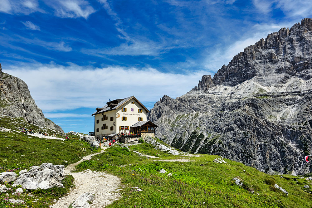
Il Rifugio Zsigmondy-Comici
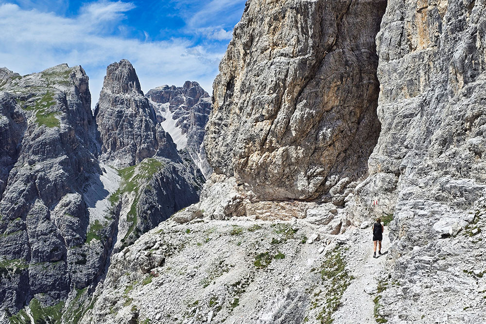
Siamo arrivati sulla Cengia della Salvezza
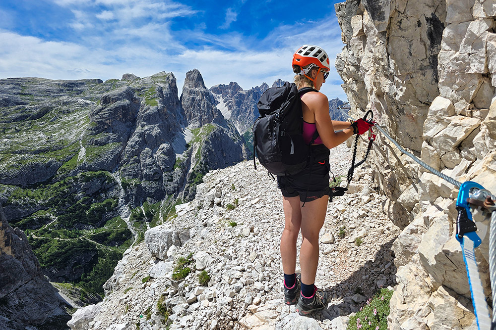
Inizia la ferrata
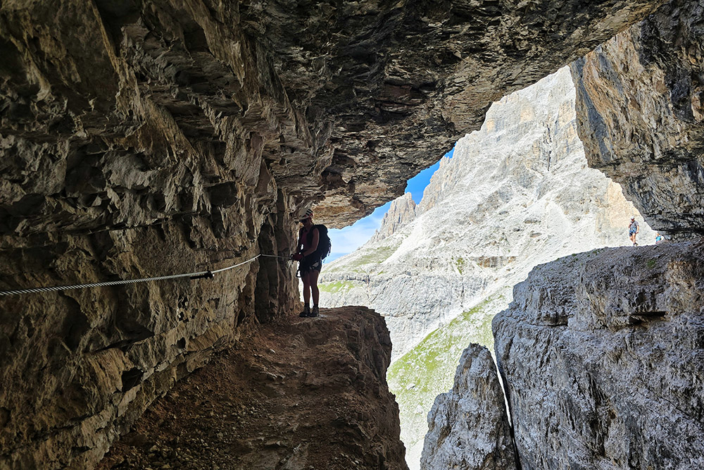
Un passaggio spettacolare
Abbiamo superato un tratto con neve
Si continua sulla Cengia della Salvezza
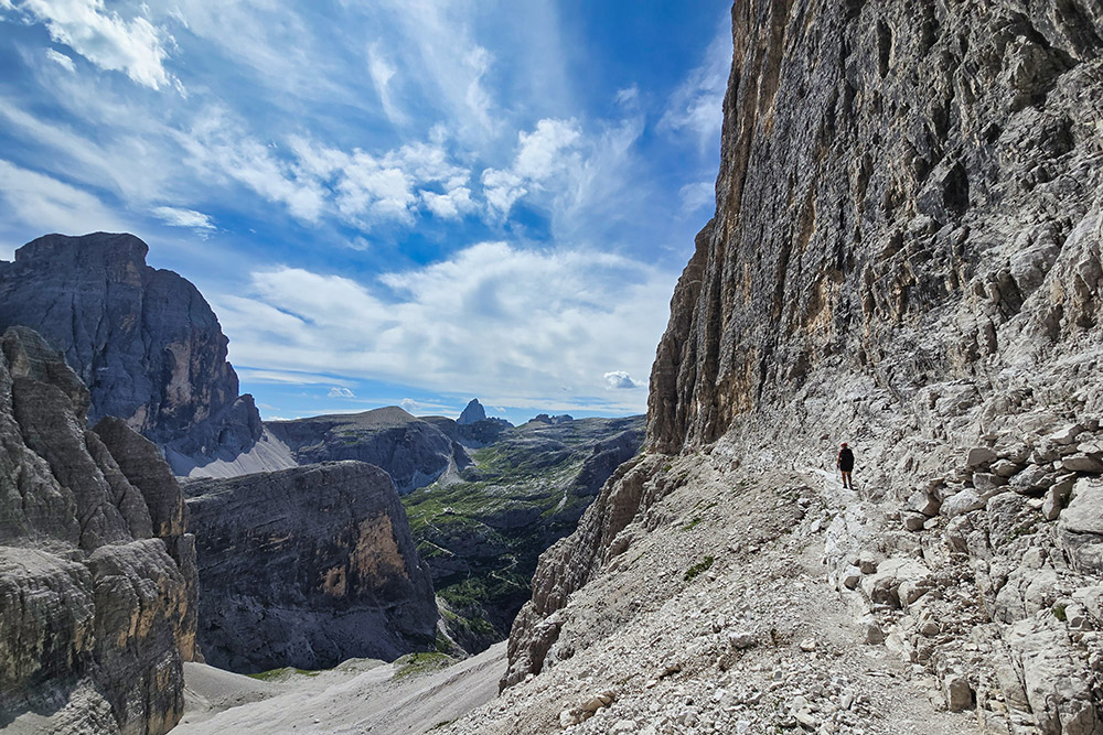
Ora si punta alla Forcella Undici
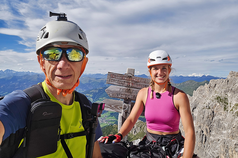
Arrivati a Forcella Undici
Si va verso Passo della Sentinella
Si scende per la Ferrata della Sentinella
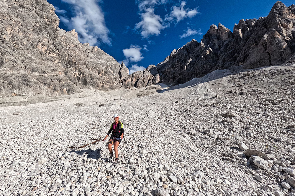
Il lunghissimo giaione del Vallon della Sentinella
Si ritorna per il sentiero 124


