


![]()


Durata
 5:30 h
Distanza
 14,1 km
 Ascesa
 864 m
864 mDiscesa
 864 m
864 mH Max
 2475 m
H Min
 1618 m
Puez Mountain Hut from Vallunga
DESCRIPTION
From the trails of Vallunga to the Puez Mountain Hut: a splendid itinerary.
Geographical Location
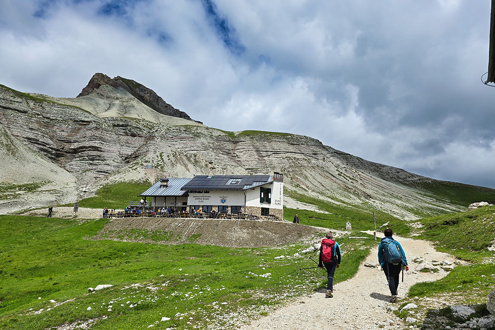
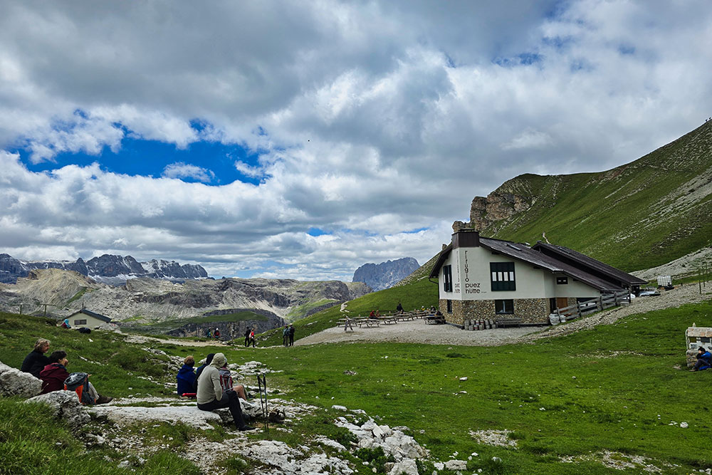
The Puez Mountain Hut (Utia de Puez in Ladin) stands majestically at 2,475 meters above sea level, nestled in a picturesque grassy valley at the foot of the imposing peaks of the Puez Group.
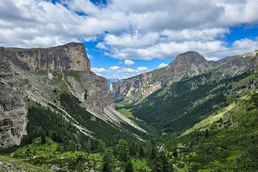
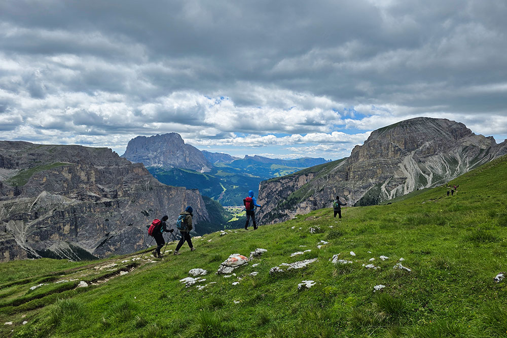
The stunning Vallunga branches off from the renowned Val Gardena near Selva di Val Gardena, stretching northeast to embrace the Puez Group. The area is framed by a spectacular amphitheater of peaks: to the northwest rise Monte Stevia, Col dala Pieres, and Piz Duleda, while the summits of Piz de Puez and Col de Puez complete this natural scenery. The southeastern slope is dominated by the ridges of the Cir Group, Mont de Sëura, and Col Turont.
Both destinations lie within the Puez-Odle Nature Park, a protected area of extraordinary beauty spanning over 10,700 hectares in the Autonomous Province of Bolzano.
Hike
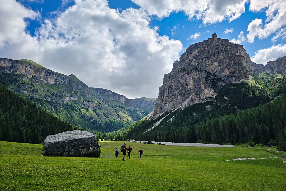
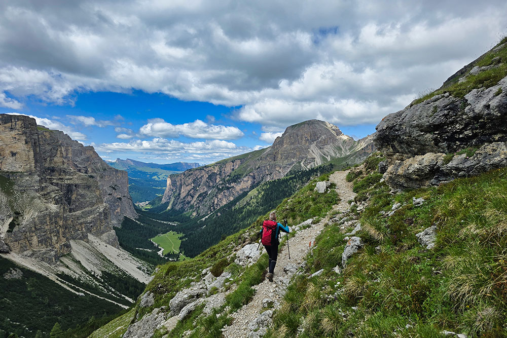
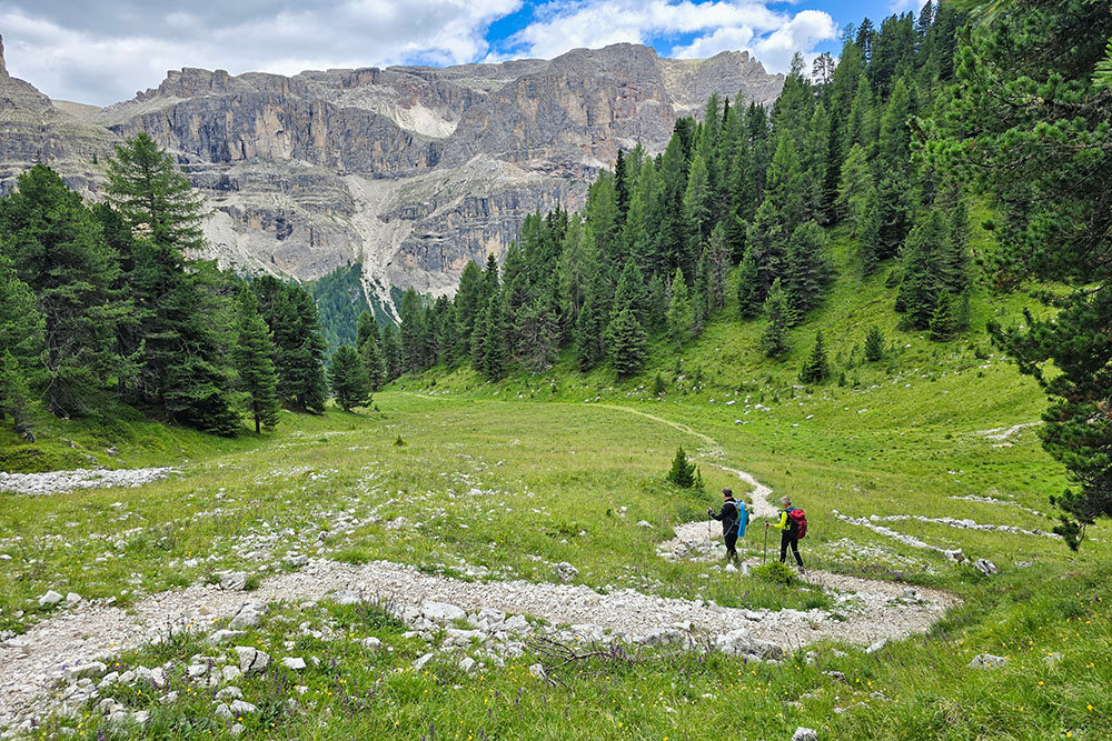
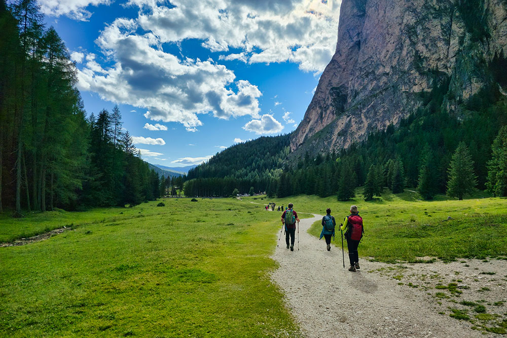
The loop hike to the Puez Mountain Hut is an accessible yet challenging adventure, perfect for those who wish to immerse themselves in the Dolomites' nature without excessive technical difficulties. The initial path through Vallunga offers moments of pure tranquility: the flat mule track, classified as tourist-friendly, is so gentle that it's even passable with strollers, making it ideal for families.
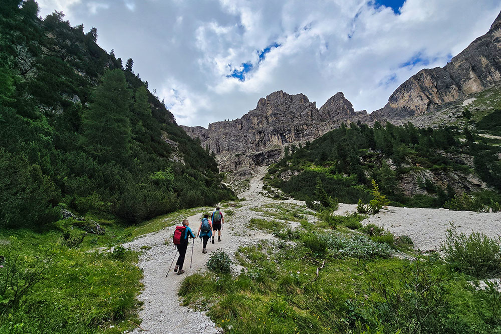
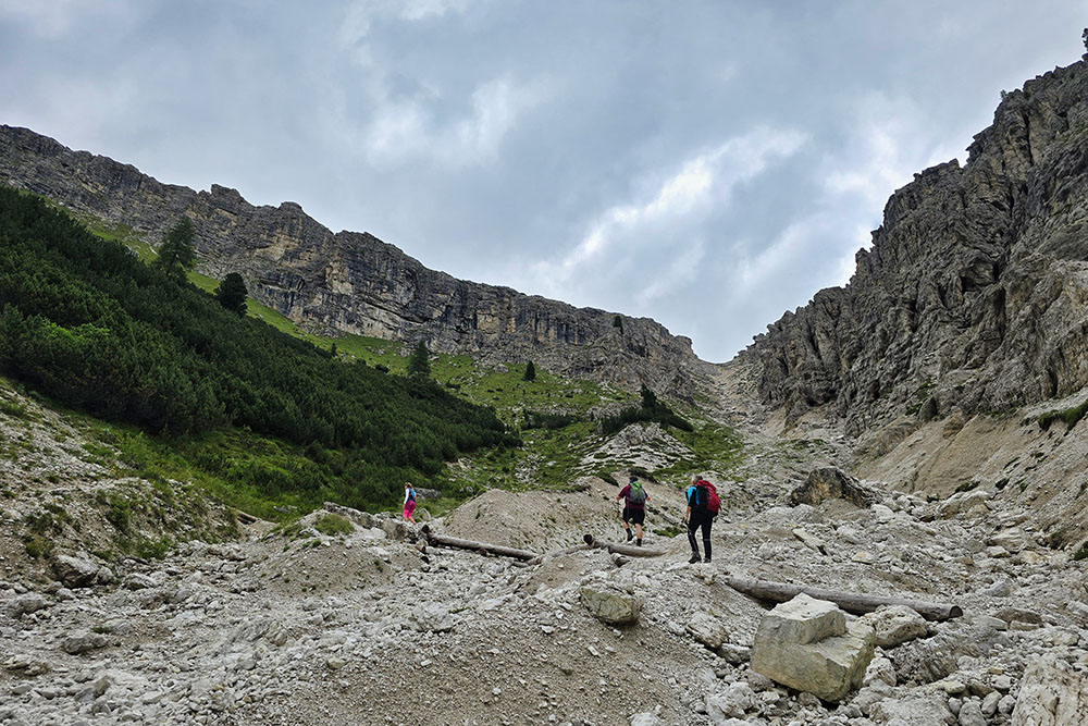
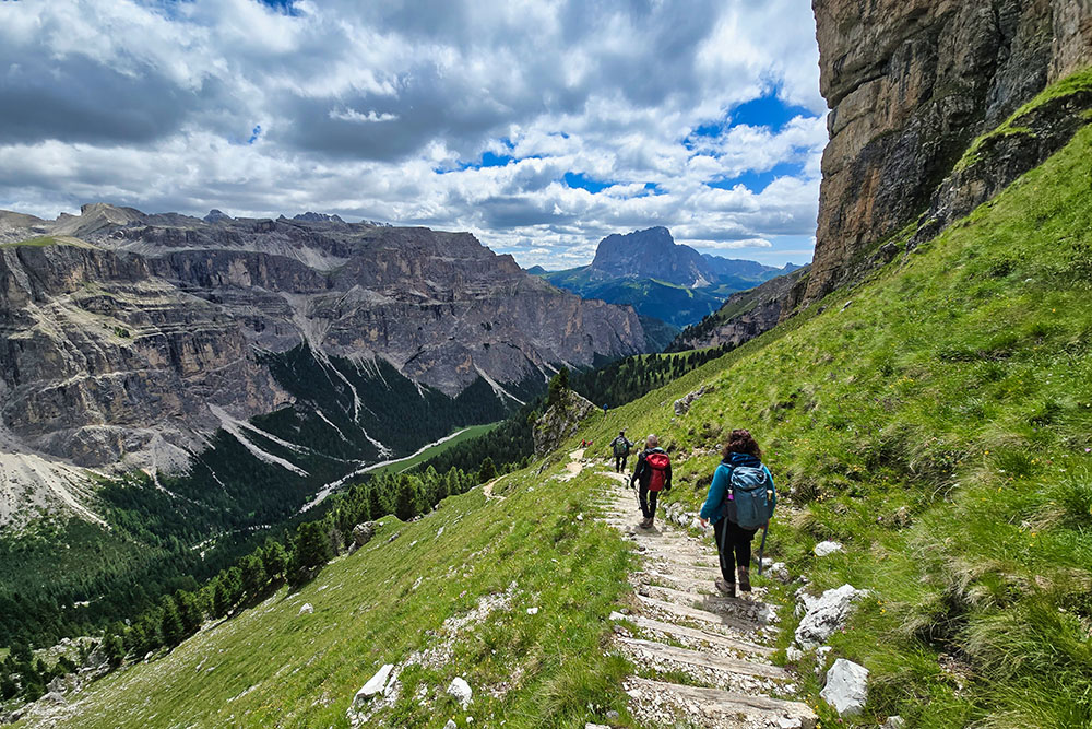
The atmosphere changes dramatically when the real ascent begins. Both Trail 14 and Trail 16 are rated E (for experienced hikers), requiring adequate physical preparation. The main challenge lies in the route's overall length and the concentration of elevation gain in a single, demanding climb.
The full itinerary covers 864 meters of elevation gain over 14.1 kilometers, with an estimated duration of 5 hours and 15 minutes. The recommended strategy is to use Trail 14 for the ascent and Trail 16 for the descent—a choice dictated by the need to protect joints, as the former is steeper and more challenging on the way down.
Once you reach the destination, the 360-degree view of the surrounding mountains in a lunar-like landscape more than compensates for the effort, especially when enhanced by seasonal colors.
History and Curiosities
The history of the Puez Mountain Hut dates back to the mountaineering tradition of the late 19th century. On June 22, 1889, the Ladin section of the DuÖAV (the Austrian equivalent of the Italian Alpine Club) inaugurated a basic shelter for mountaineers at Alpe del Puez—a spartan but essential structure accommodating 14 people.
The shelter evolved in 1903, transforming into a proper mountain hut renamed Puezhütte, reflecting the cultural and linguistic ties of the region to the Austro-Hungarian Empire at the time.
World War I left deep scars: during the conflict, the hut suffered considerable damage, a silent testament to the tragedy that unfolded in these mountains. After the war ended in 1918, the structure was expropriated from the Ladinia section and assigned to the CAI's Bolzano branch, marking the transition to Italy.
The Bolzano CAI section immediately began restoring the damaged building, reopening it to the public in 1934. However, the current hut is much more modern: the new Puez Mountain Hut was inaugurated on August 8, 1982—a contemporary construction offering comfort and services meeting today's standards.
ITINERARY
The hike starts at the paid Vallunga parking area (1,618 m), where you take Trail No. 14. You'll cross the entire valley—a pleasant stretch through meadows and forests—before ascending to the Puez Mountain Hut (2,475 m). After a well-deserved break, continue on the scenic Trail No. 2, offering splendid views of the surrounding peaks.
For the return, descend via Trail No. 16 until you re-enter Vallunga. The final stretch follows Trail No. 14 again, leading comfortably back to the starting point.
EXCURSION DATE
July 9, 2025
STARTING POINT
Vallunga parking area
REFRESHMENT POINT
Puez Mountain Hut (2,475 m)
AUTHOR’S SUGGESTIONS
Hike the loop counterclockwise.
SAFETY ADVICE
The feasibility of this itinerary, like all mountain terrain, is subject to environmental changes due to natural events and weather conditions. Before setting out, consult the relevant tourist offices or mountain huts.
Our GPX tracks are only indicative—the route was recorded under optimal trail and weather conditions. Always assess the situation on-site.
Evaluate the hike realistically based on your fitness level, experience, and equipment. Inform someone about your planned route.
Emergency number: 112.
EQUIPMENT
Bring gear suitable for the route, weather, and season: wind/rain jacket, map/GPS device, sunglasses, sunscreen, hiking boots, first-aid kit, appropriate clothing, gloves, and a backpack with food and water.
RECOMMENDED MAPS
Tabacco Map 05 Val Gardena/Alpe di Siusi
INTERESTING LINKS
http://www.rifugiopuez.it/
HOW TO ARRIVE
From SS242 (Val Gardena road), near Selva di Val Gardena, head toward Vallunga.
PARKING AREA
Paid Vallunga parking
GPS coordinates: 46.563920, 11.773171
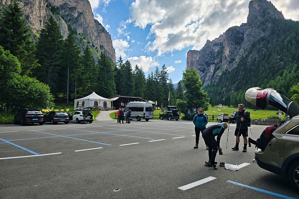
Parcheggio di Vallunga
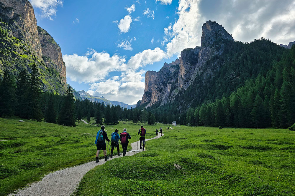
Si parte seguendo il segnavia 14
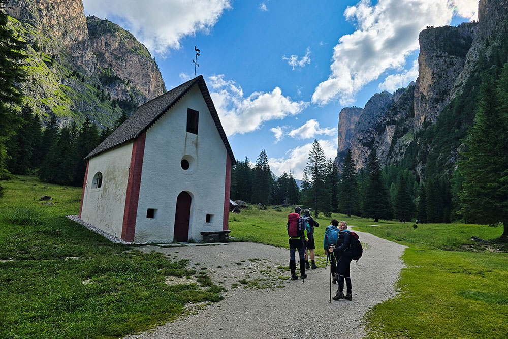
Chiesetta di San Silvestro
La strada è molto comoda
Il punto più largo della valle
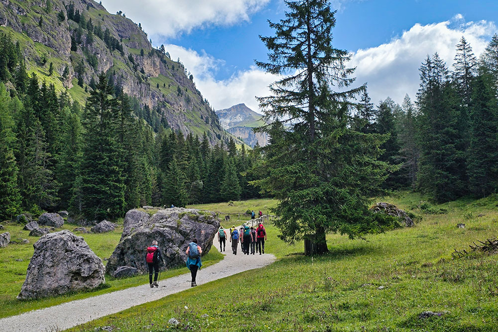
Si inizia a salire
Percorriamo sempre il sentiero 14
Vista dall'alto della Vallunga
Ormai siamo in quota
Arrivati al Rifugio Puez
Il Rifugio Puez
Percorriamo il sentiero panoramico n 2
Scendiamo per il sentiero 16
Siamo quasi in valle
Si ritorna al punto di partenza


