


![]()


Durata
 6:30 h
Distanza
 20,6 km
 Ascesa
 1476 m
Discesa
 1476 m
H Max
 2745 m
H Min
 1550 m
Gronton Via Ferrata and Cima Bocche
DESCRIPTION
Dolomites and World War I: Exploring the Gronton Via Ferrata.
Geographical Location
The Gronton Via Ferrata is located in the heart of the Paneveggio - Pale di San Martino Nature Park, within the Dolomites. It lies in the Lusia-Bocche mountain range, which stretches between the San Pellegrino Valley and the Fiemme Valley. Cima Bocche is the highest peak in this mountain group.
Excursion
The excursion to the Gronton Via Ferrata can be divided into two distinct phases. The first part involves an ascent on e-MTB to the Passo Lusia Refuge along easy dirt roads with no technical difficulties (classified S0). Alternatively, you can reach the refuge using the ski lifts.
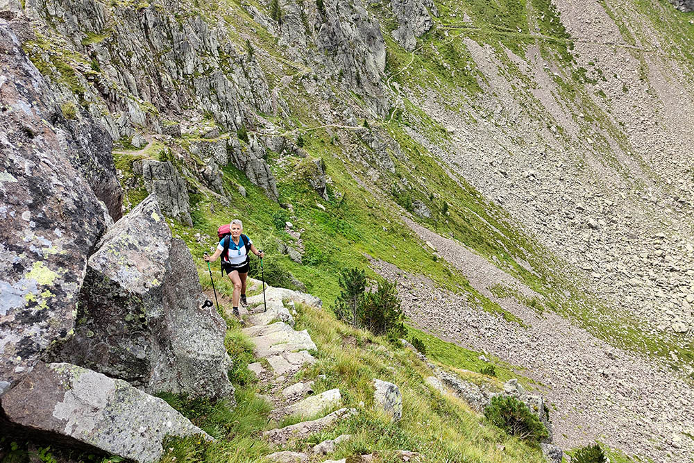
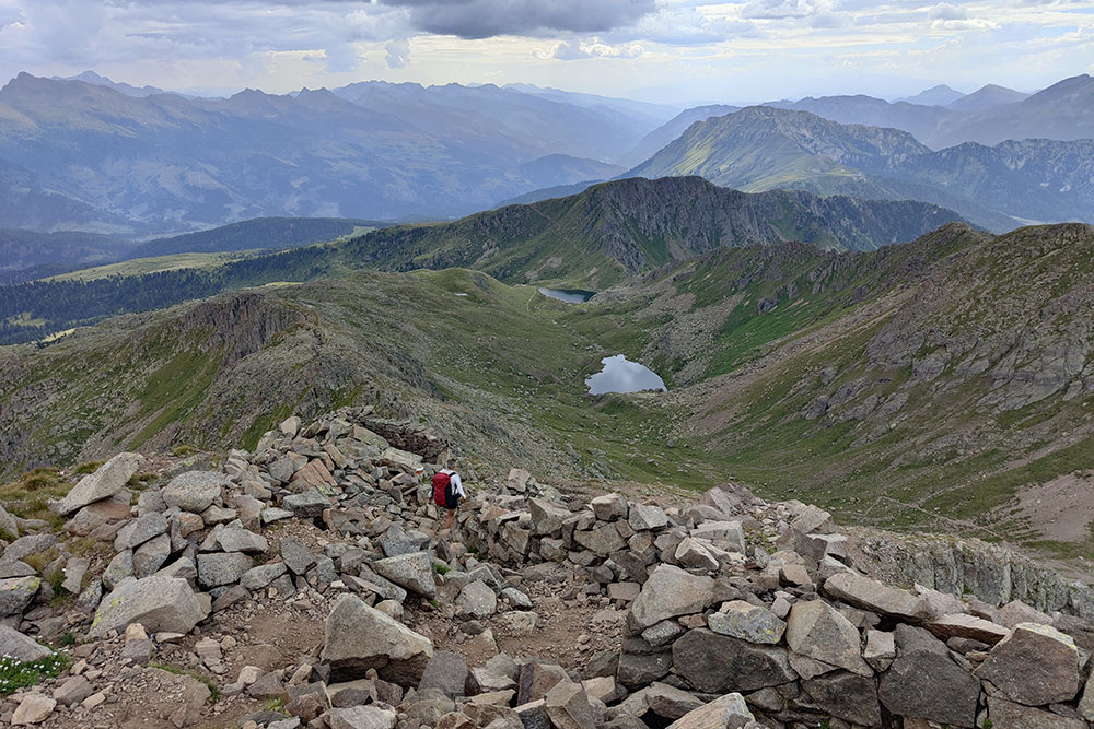
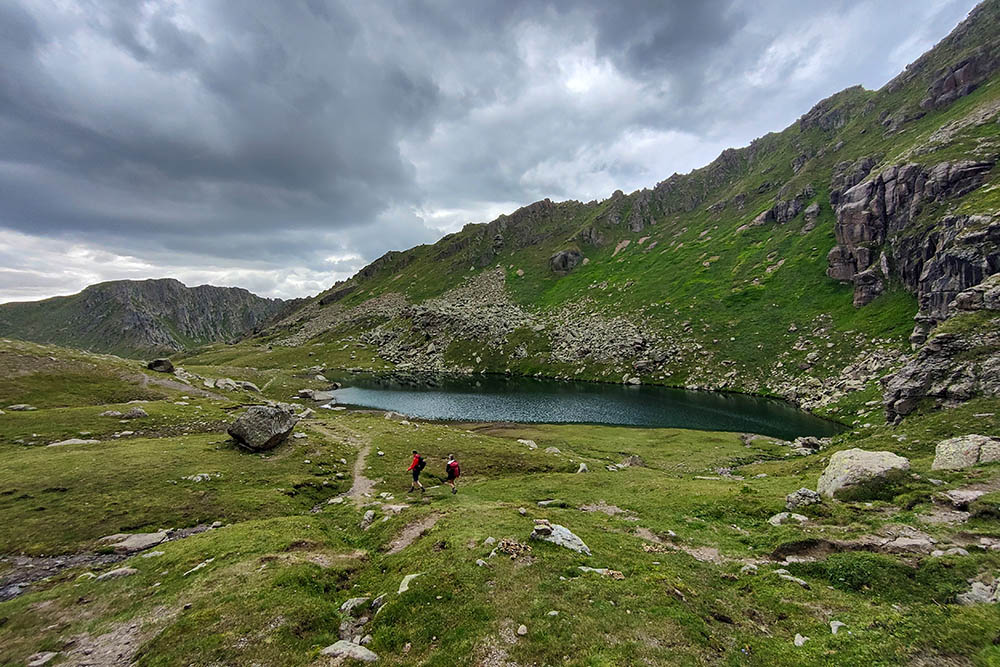
The second part of the itinerary starts on foot from Passo di Lusia Refuge, following trail no. 633 towards Cima Bocche and the Lusia Lakes. Passing through gentle summer pastures, the trail offers breathtaking views of the Lagorai, Monzoni, Latemar, and Catinaccio mountain groups. After about an hour of walking, you reach Forcella Lusia, where a panoramic view of the Lusia lakes and the majestic Pale di San Martino Group opens up.
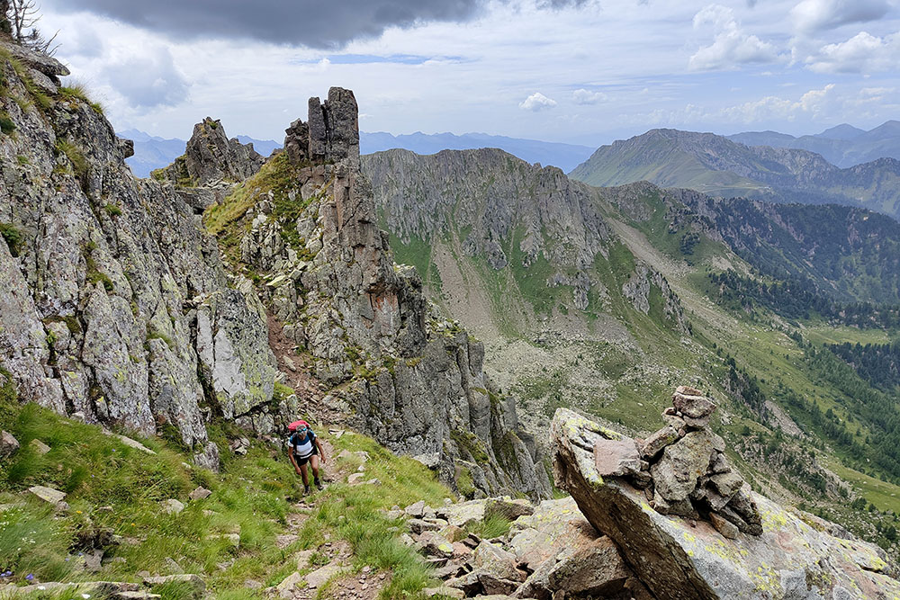
The Gronton Via Ferrata, which takes about an hour to complete, is characterized by large volcanic rock blocks and remnants of World War I military posts. Although not a traditional via ferrata, the route includes some secured sections for safety on exposed passages. While the hike has no technical difficulties, it requires experience and caution due to several exposed sections. This itinerary is ideal for those seeking a technical and panoramic hike without the typical challenges of classic via ferrata routes.
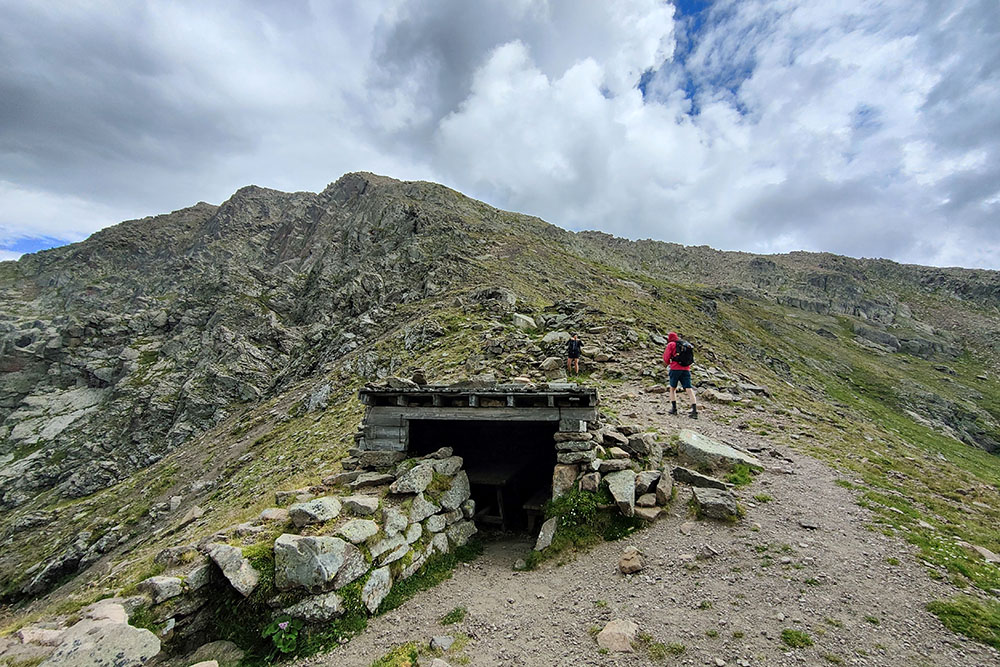
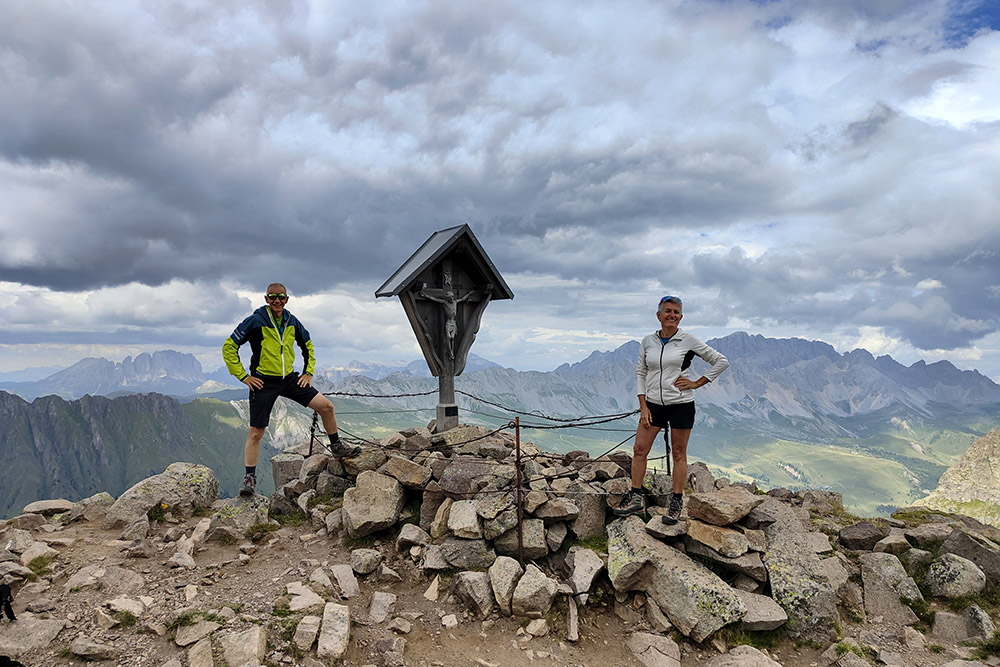
After completing the Gronton Via Ferrata, you can continue the ascent to Cima Bocche. Though the climb is rocky and requires caution, the summit rewards you with an extraordinary view of the surrounding Dolomite peaks.
The route can also be taken in reverse.
History
The Gronton Via Ferrata follows an old Austrian military path dating back to World War I. Built to connect the fortified ridge from Forcella Caserin to Cima Gronton, this trail is enriched by numerous military posts and trenches that testify to the strategic importance of the area during the conflict. The excursion thus allows you to immerse yourself not only in the scenic beauty of the Dolomites but also in the history that deeply marked these mountains.
ITINERARY
From the parking area at Castellir di Bellamonte (1550 m), ascend via a dirt road to Baita Bucaneve (1752 m), Baita Ciamp de le Strie (1938 m), and Passo di Lusia Refuge (2056 m). Here, take trail 633, passing by Baite di Lastè (2327 m) and La Trincea (2425 m) to reach the Sandro Redolf Bivouac (2333 m) and Lago di Lusia Inferiore (2330 m). Then, take trail 634 to arrive at Forcella di Lusia or Caserin Pass (2363 m). The Gronton Via Ferrata begins here and ends at Cima Gronton (2622 m). After the via ferrata, descend to Forcella Bocche (2543 m) and then ascend to Cima Bocche (2745 m) via trail 633. After returning to Forcella Bocche, continue on trail 633 and descend to the Lusia lakes, Superiore (2375 m) and Inferiore (2330 m). Return to the starting point by following the same route.
By e-MTB: 8.8 km - 1 hour - 506 meters elevation gain
On foot: 11.8 km - 5:30 hours - 970 meters elevation gain
EXCURSION DATE
August 17, 2024
STARTING POINT
Castelir di Bellamonte Parking Area
REFRESHMENT POINT
Baita Bucaneve (1752 m), Baita Ciamp de le Strie (1938 m), and Passo di Lusia Refuge (2056 m)
AUTHOR'S SUGGESTIONS
Pay attention to exposed sections on the Gronton Via Ferrata.
SAFETY TIPS
The itinerary, like all mountain terrain, is subject to changes due to natural events and weather conditions. Therefore, before starting, consult local tourist offices and/or nearby refuges. Our GPX tracks are for reference only, reflecting the conditions on the day of the hike. Always assess the route on-site.
Also, consider your physical abilities, training, and equipment when planning. It is advisable to inform someone of your intended route.
Remember, the emergency number is 112.
EQUIPMENT
It is recommended to have equipment suitable for the route, weather conditions, and season: windproof and/or rainproof jacket, map and/or GPS device, sunglasses, sunscreen, hiking boots, first aid kit, appropriate clothing, gloves, backpack with food and drinks.
RECOMMENDED MAPS
Tabacco 06 Val di Fassa and Dolomiti Fassane
USEFUL LINKS
https://www.rifugiolusia.com/
HOW TO ARRIVE
SS48 to Predazzo, SS50 towards Passo Rolle - Passo Valles. After passing Bellamonte, turn left and follow the signs for Località Castelir.
PARKING AREA
Free parking at Castelir di Bellamonte
GPS Coordinates: 46.0112481, 11.1286750

Parcheggio in località Castellir
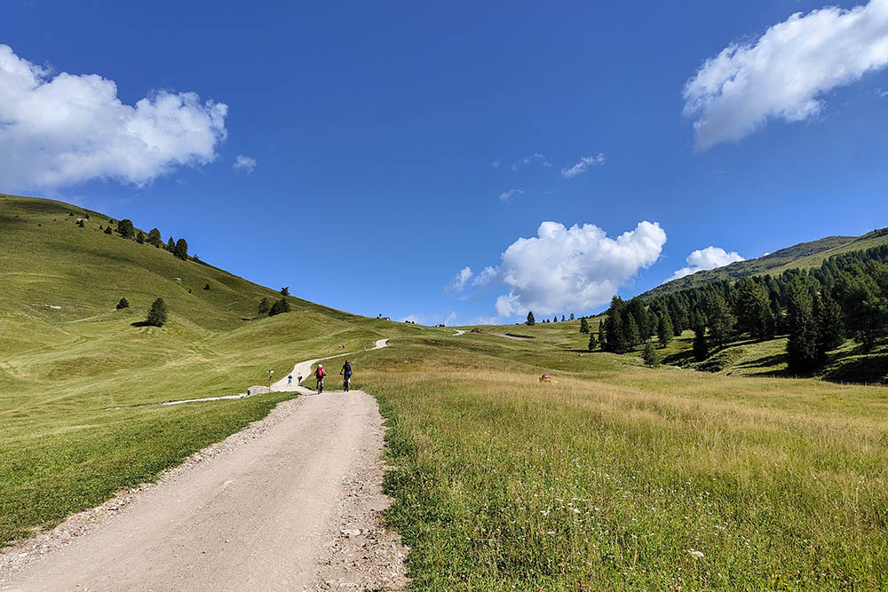
Si sale con le e-MTB
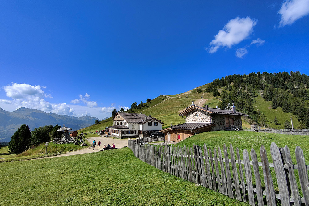
Rifugio Passo Lusia
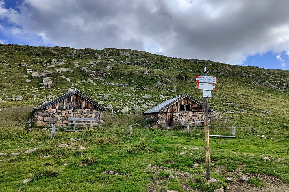
Baite di Lastè
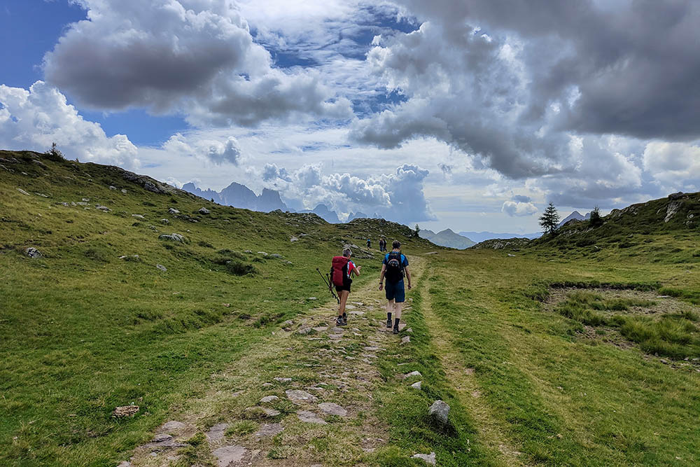
Si prosegue su prati
Forcella La Trincea
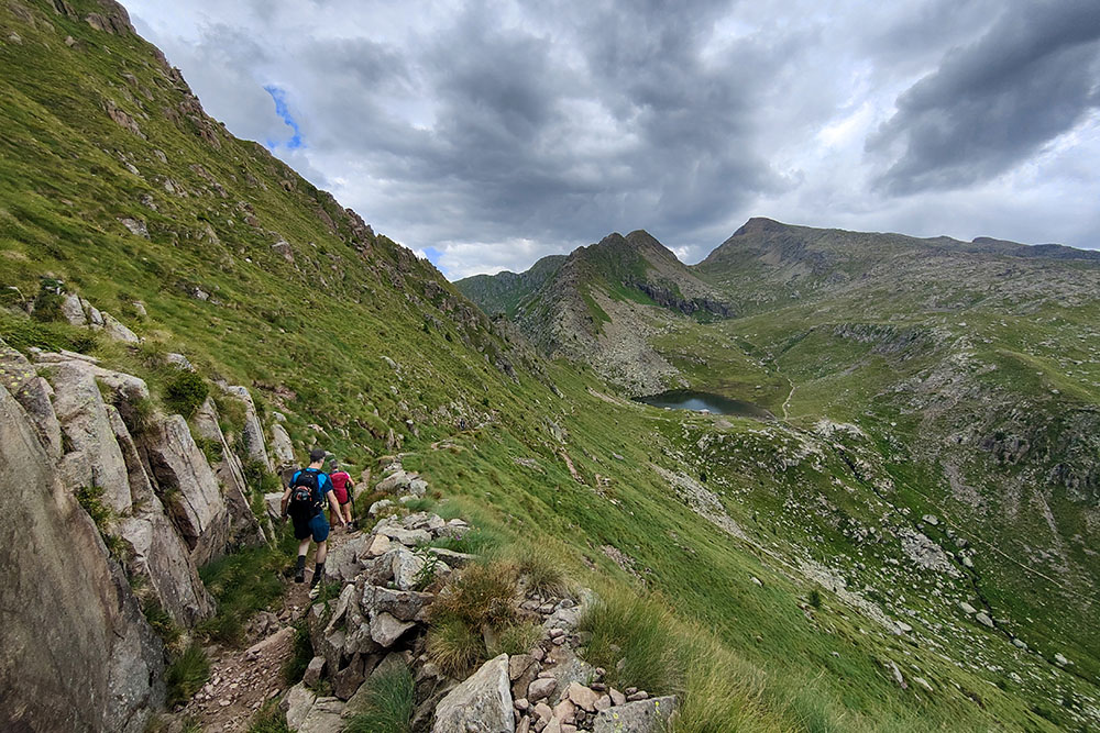
Si scende ai laghi di Lusia
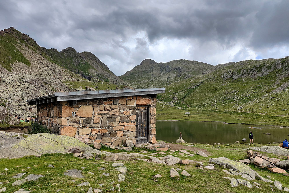
Il Bivacco Sandro Redolf
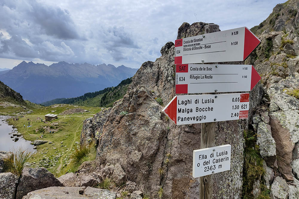
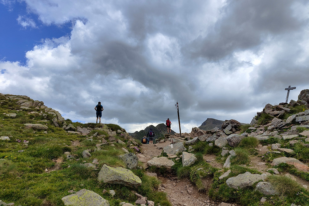
Forcella di Lusia o del Caserin
Sentiero Gronton
Sentiero Gronton
Forcella Bocche
Cima Bocche
Si ritorna alla Forcella Bocche
Lago Lusia Superiore


