


![]()


Durata
 7:40 h
Distanza
 11,1 km
 Ascesa
 1016 m
Discesa
 1603 m
H Max
 2750 m
H Min
 1739 m
Santner Via Ferrata
DESCRIPTION
Santner Via Ferrata: An adventure among the peaks of the Catinaccio (Rosengarten).
Geographical Location
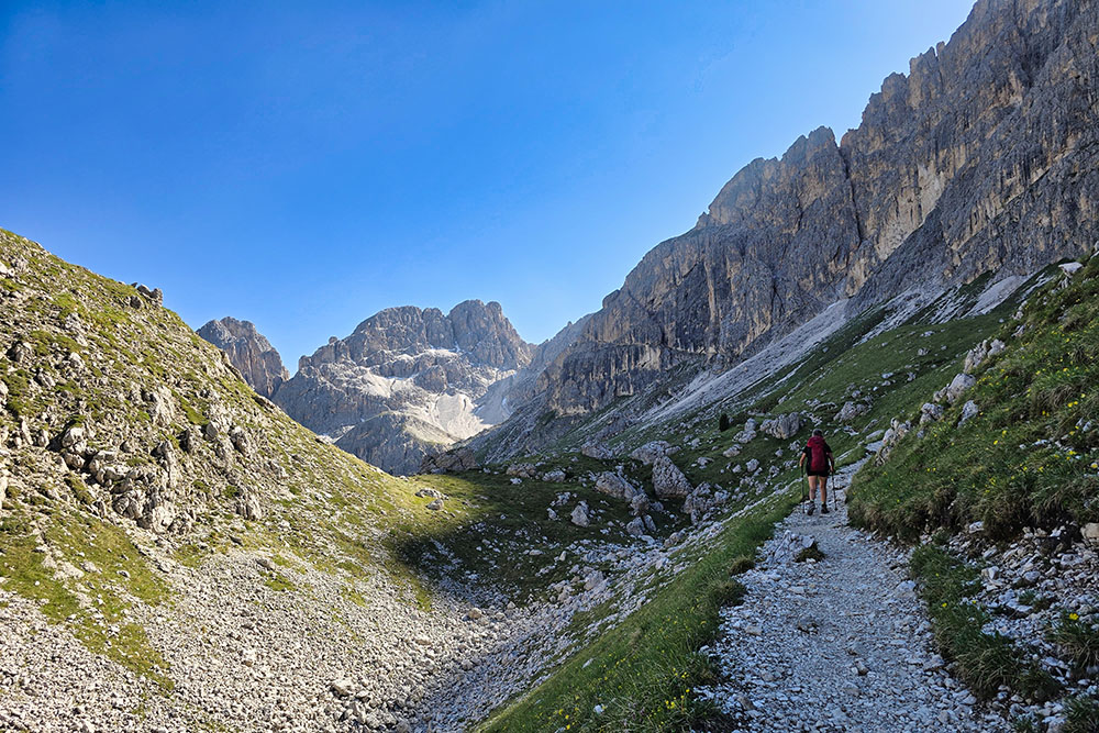
The Santner Via Ferrata runs along the western side of the majestic Catinaccio (Rosengarten), elegantly following the natural weak points of the Dolomite rock. This secured route connects the Fronza alle Coronelle mountain hut with the Passo Santner mountain hut, offering an alpine experience in the heart of the Dolomites.
The Catinaccio group, known in German as the Rosengartengruppe, is one of the most precious gems of the Dolomite heritage. Located in Trentino-Alto Adige, it stretches between the Tires Valley, Eggen Valley (Val d'Ega), and Fassa Valley, entirely within the scenic Schlern Nature Park. The journey to this natural wonder begins at the upper station of the Re Laurino cable car, the ideal starting point for the adventure.
Hike
This loop itinerary is much more than just a via ferrata—it’s a journey into the beating heart of the Catinaccio. The actual via ferrata makes up only a small portion of the route, while most of the experience unfolds along spectacular trails leading to the famous Gartl basin, where the Re Alberto I mountain hut stands surrounded by the iconic Vajolet Towers, then onward to the Vajolet mountain hut and finally to the Coronelle Pass.
The Santner Via Ferrata, named after the legendary Tyrolean mountaineer Johann Santner, is of moderate difficulty but should not be underestimated. Although it can be traversed in both directions, the best experience is achieved by starting from the Fronza mountain hut, allowing for a gradual appreciation of the increasingly stunning Dolomite landscape.
The route includes sections that require special attention and mountain experience.
In the first part of Trail 542, small rocky passages demand steady footing and concentration, though they pose no insurmountable obstacles for those with basic mountaineering skills.
The famous snow gully of the via ferrata requires particular caution: while technically manageable under normal conditions, it can become treacherous in snow or ice. Early in the season, the safety cable may be buried under snow, requiring extra care.
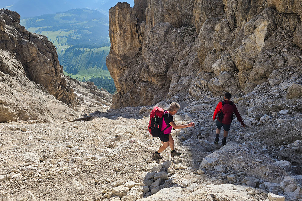
The descent from the Re Alberto I mountain hut down the debris-filled gully toward the Vajolet and Preuss mountain huts presents its own challenges, as does the descent from the Coronelle Pass. The latter, though steep, has been made safer by wooden steps and metal fixtures installed in the most exposed and slippery sections of the scree gully.
History and Curiosities
Johann Santner, the Tyrolean mountaineer after whom this via ferrata is named, was a legendary figure in Dolomite mountaineering. Considered the most successful explorer of the western Dolomites during the classical era, he recorded over 50 new routes. He discovered the access path from the Tires Valley to the central massif of the Catinaccio, opening the way to the Gartl through the gorge that now bears his name.
The mountain huts along this route tell fascinating stories of Dolomite mountaineering.
The Vajolet mountain hut is a true piece of history: built in 1897 by the Leipzig section of the German and Austrian Alpine Club, it holds the honor of being one of the first huts constructed in the Catinaccio group.
The Re Alberto I mountain hut, erected in 1929, continues to offer hospitality to mountaineers in the picturesque Gartl basin.
The Passo Santner mountain hut, originally built in 1956, has recently undergone a complete renovation, preserving its historical charm while providing modern comforts for hikers.
ITINERARY
From the Fronza alle Coronelle mountain hut (2,337 m), the ascent begins along Trail 550, with some rocky passages. At the first junction, take Trail 542, where after a while, the first metal fixtures mark the official start of the via ferrata. After completing the secured section, you reach the Santner Pass, where the Passo Santner mountain hut (2,734 m) is located.
The descent continues on Trail 542 toward the Re Alberto I mountain hut (2,620 m) and further down to the Vajolet and Preuss mountain huts (2,243 m). From here, follow Trail 541, which connects to Trail 550, allowing you to reach the Coronelle Pass (2,630 m) and complete the loop by returning to the Fronza mountain hut.
EXCURSION DATE
June 22, 2025
STARTING POINT
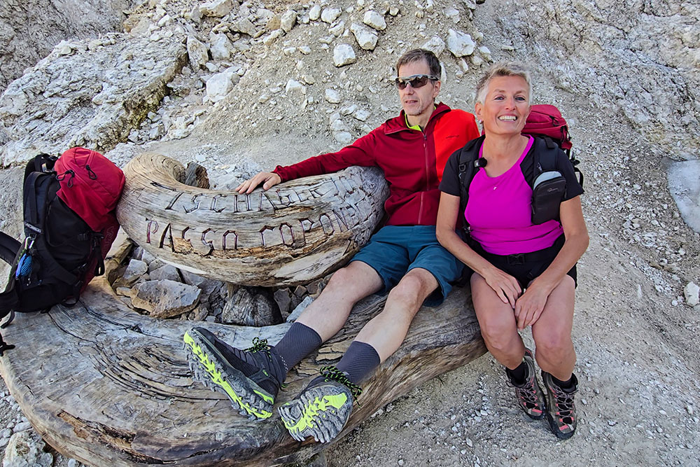
Fronza alle Coronelle mountain hut
REFRESHMENT POINT
Passo Santner mountain hut, Re Alberto I mountain hut, Vajolet mountain hut, and Preuss mountain hut
AUTHOR’S SUGGESTIONS
Hike the loop clockwise.
SAFETY ADVICE
The feasibility of the proposed itinerary, like all mountain terrain, is subject to environmental changes due to natural events and weather conditions. Before setting out, consult the relevant tourist offices and/or reference mountain huts.
Our GPX tracks are only indicative—the route was completed under the best trail and weather conditions of that day. Always assess the situation on-site.
Additionally, evaluate the route based on your physical fitness, training, and equipment.
It is advisable to inform someone of your planned itinerary.
Remember, the emergency number is 112.
EQUIPMENT
Proper gear is essential: technical mountain clothing, hiking boots with Vibram soles or similar, via ferrata kit, harness, helmet, via ferrata gloves, sunglasses, sunscreen, and a backpack with drinks.
RECOMMENDED MAPS
Tabacco Map 06 – Val di Fassa and Dolomiti Fassane
INTERESTING LINKS
https://www.santnerpass.com/
HOW TO ARRIVE
A22 motorway, Bolzano Nord exit. Take the SP241 (Eggen Valley). After passing Carezza, just before the Costalunga Pass, turn left and follow the signs for Laurin.
PARKING AREA
At the valley station of the Re Laurino cable car (fee required).
GPS coordinates: 46.444026, 11.588347
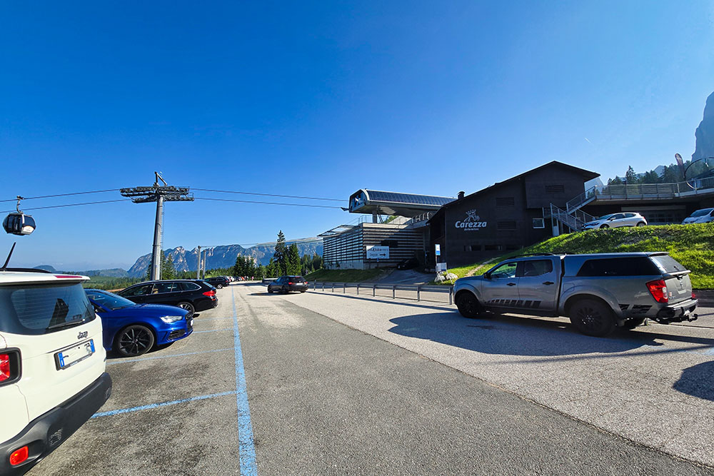
Parcheggio
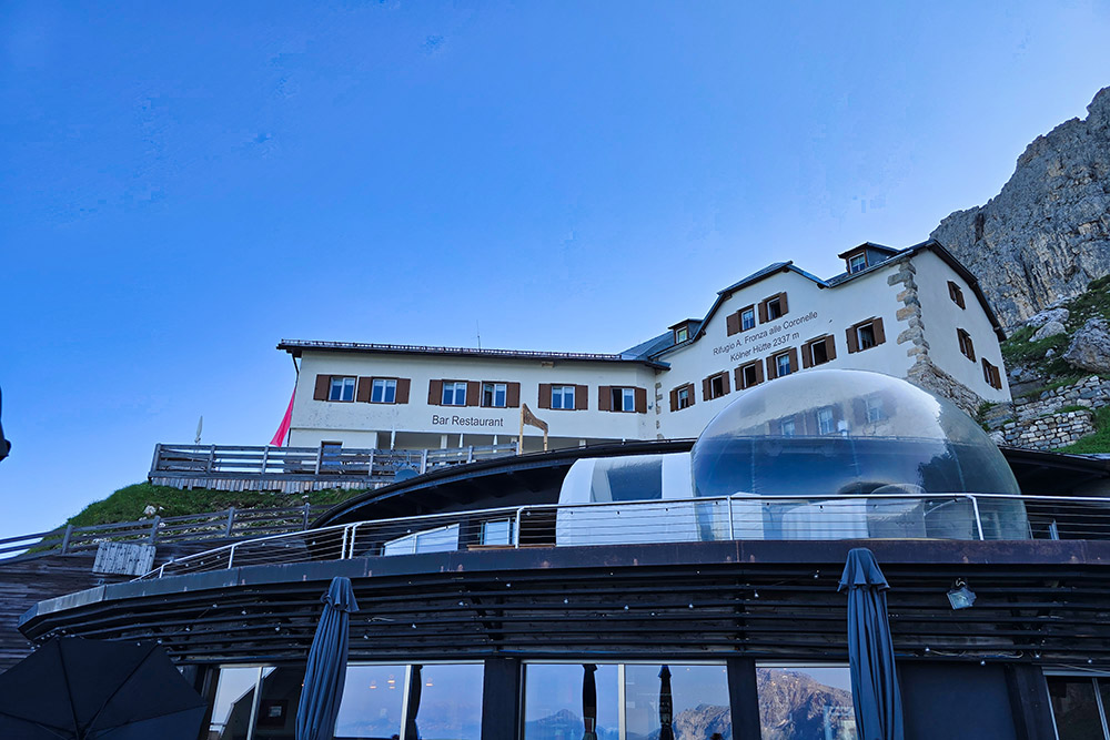
Il Rifugio Fronza alle Coronelle
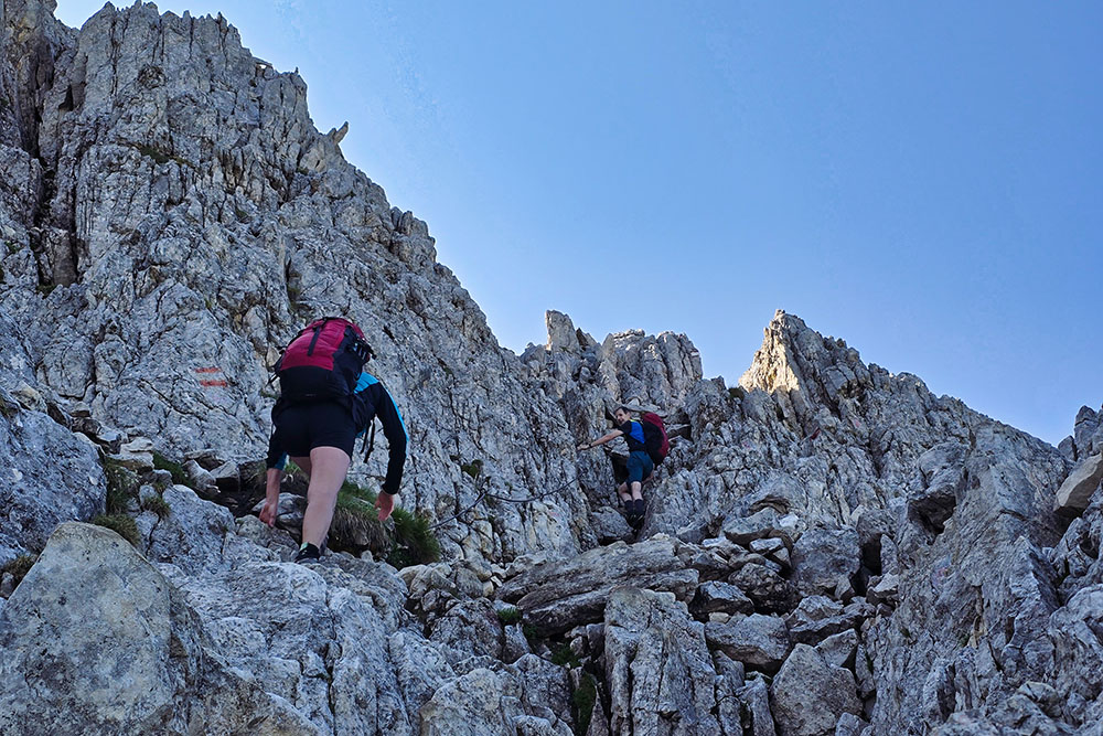
Inizio su roccette del sentiero 542
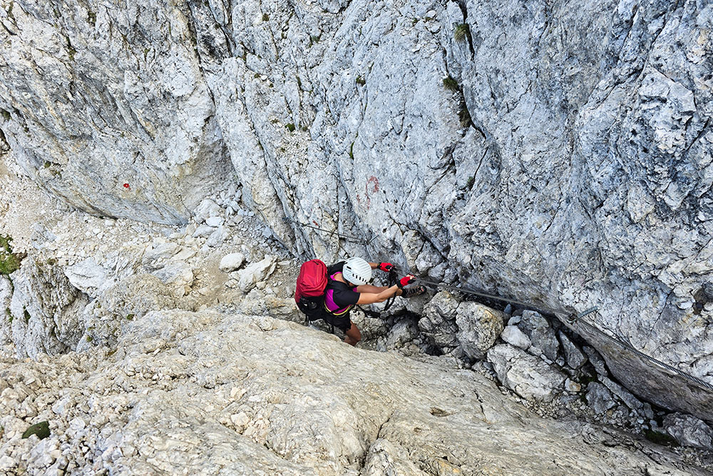
Inizio della Ferrata Santner
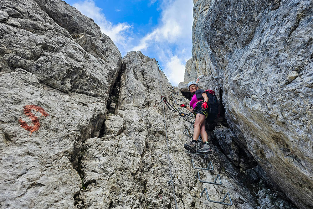
Passaggio su staffe
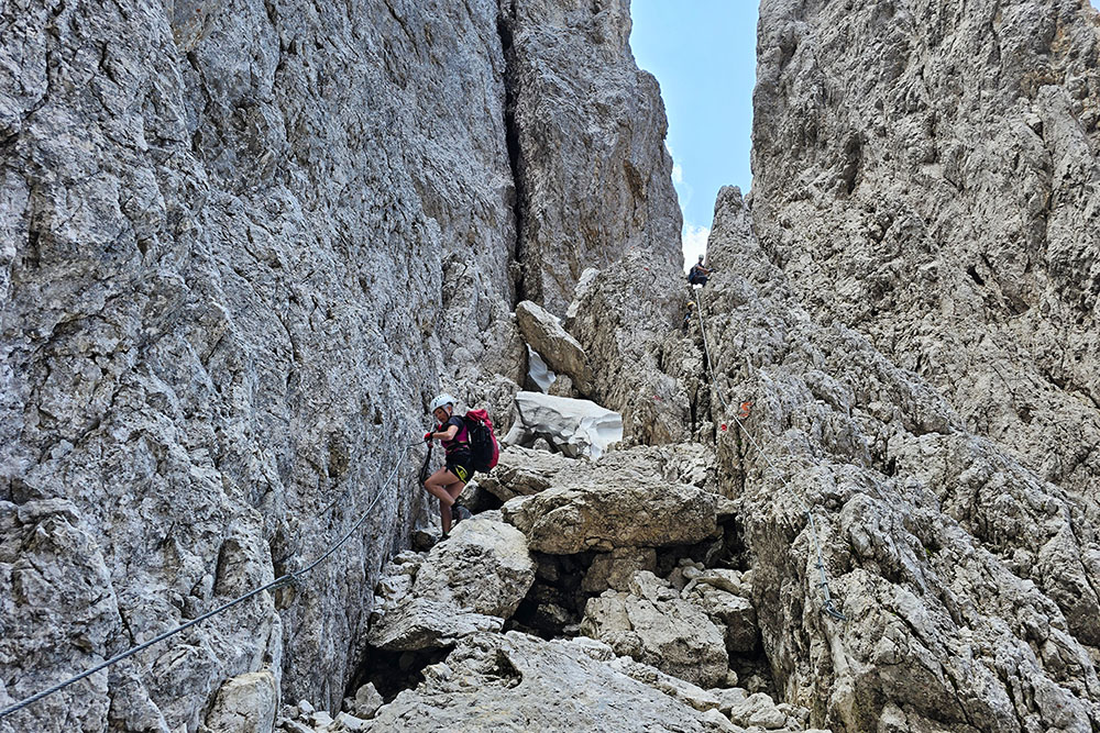
Si continua a salire
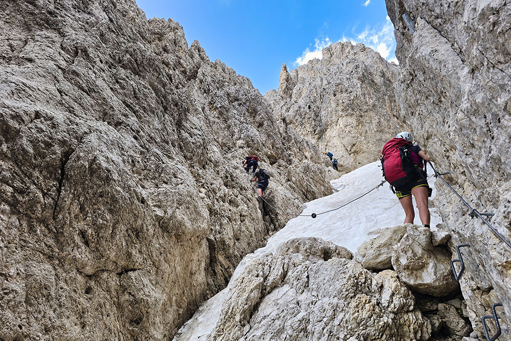
Passaggio canalone con neve
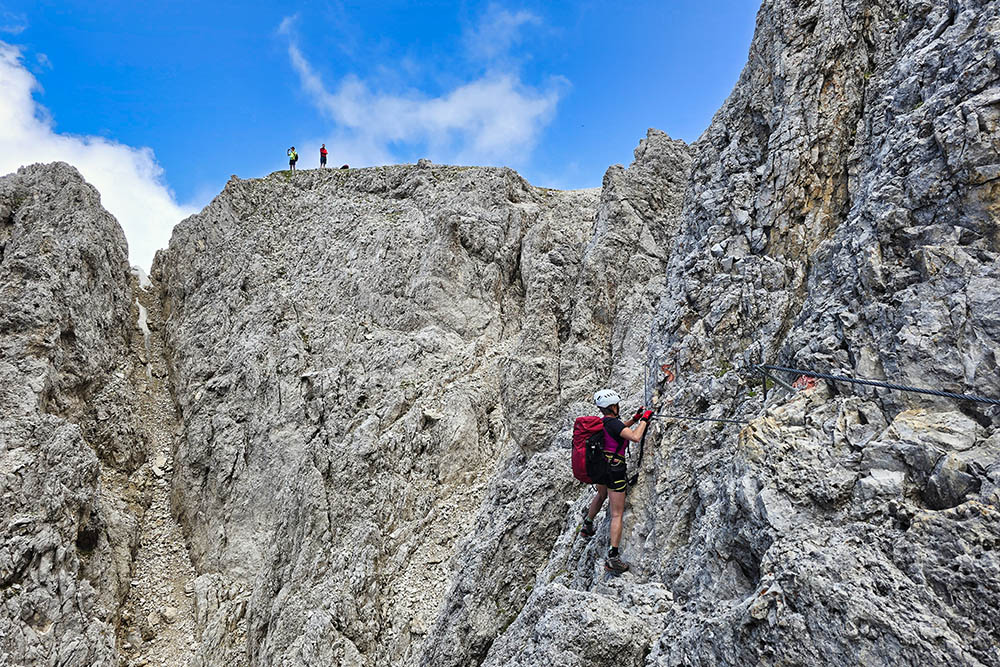
Siamo alla fine
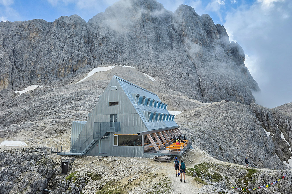
Il Rifugio Passo Santner
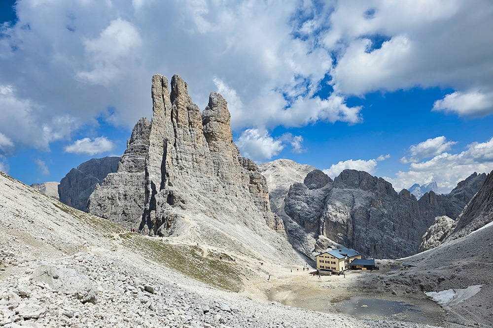
Il Rifugio Re Alberto I
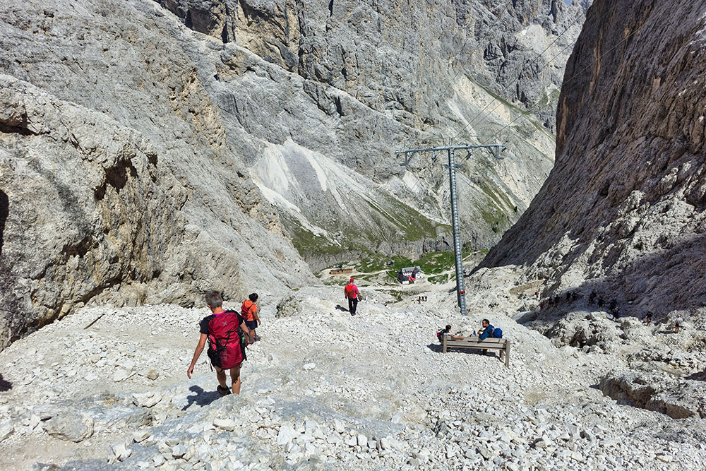
Si scende per sentiro ripido
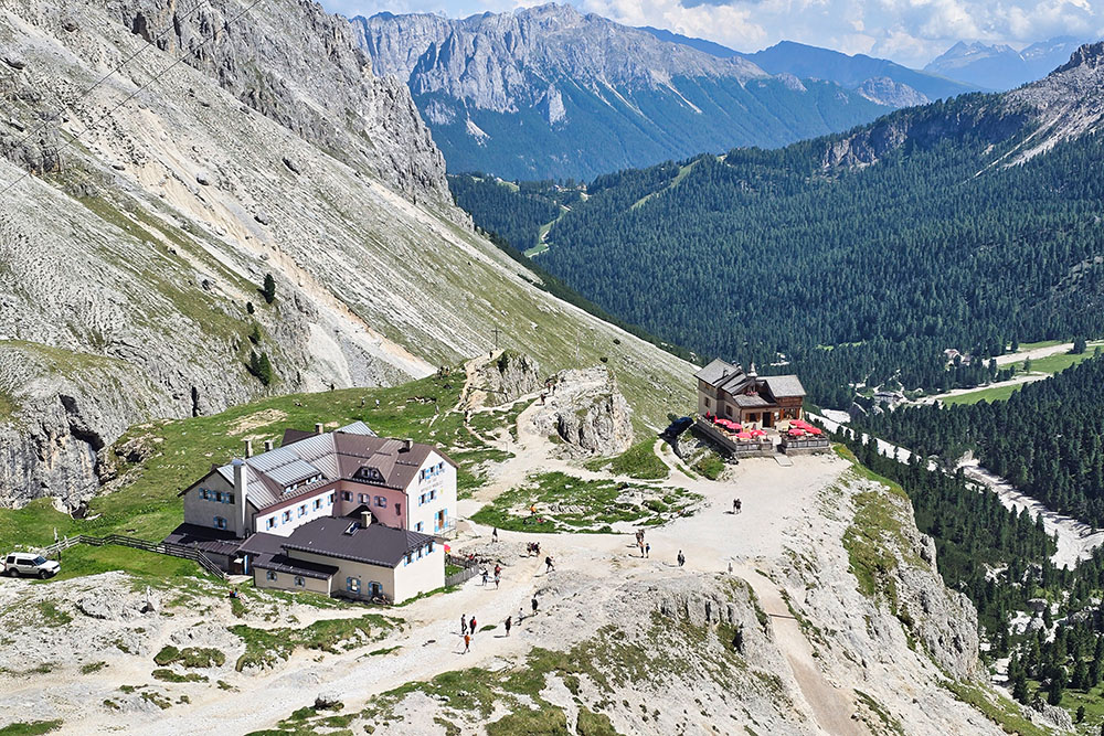
Rifugio Vajolet e Rifugio Preuss
Sul sentiero 541
Passo delle Coronelle
Si ritorna al Rifugio Fronza alle Coronelle


