


![]()


Durata
 5:00 h
Distanza
 14,1 km
 Ascesa
 541 m
541 mDiscesa
 541 m
541 mH Max
 1136 m
H Min
 670 m
670 mPassirio Gorge Trail
DESCRIPTION
Passerschluchtweg: The perfect family hike in Val Passiria.
Geographical Location
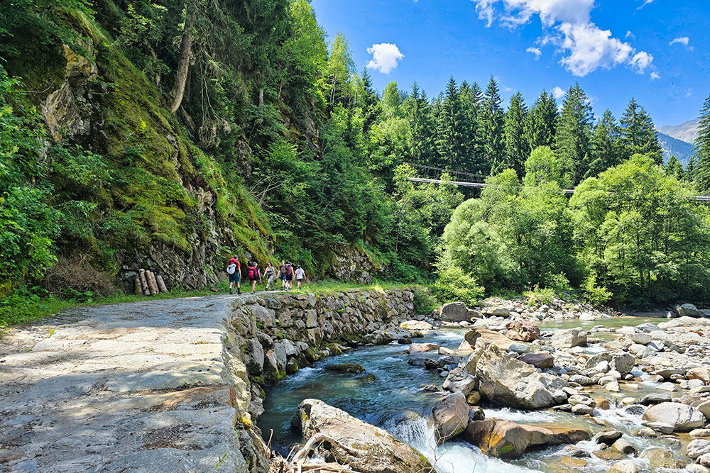
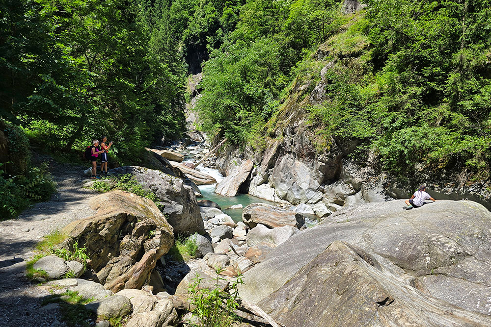
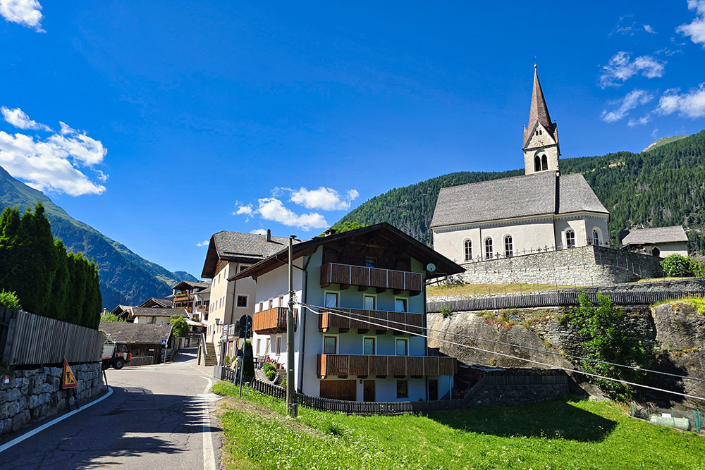
We are in South Tyrol, in the heart of Val Passiria (Passeiertal), a stunning Alpine valley located northeast of Merano, nestled between the Ötztal Alps and the Stubai Alps. The valley is carved by the Passirio stream, which flows down toward Merano and joins the Adige River. The Passerschluchtweg trail—known in Italian as Gola del Passirio—winds along this rocky gorge, starting from San Leonardo in Passiria (St. Leonhard in Passeier) and reaching Moso (Moos). The landscape features sculpted gorges, waterfalls like Stulles and Stieber, glacial formations, and lush forests, including sections within the Texel Group Nature Park.
Hike
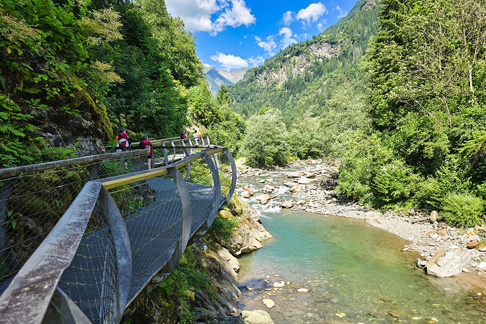
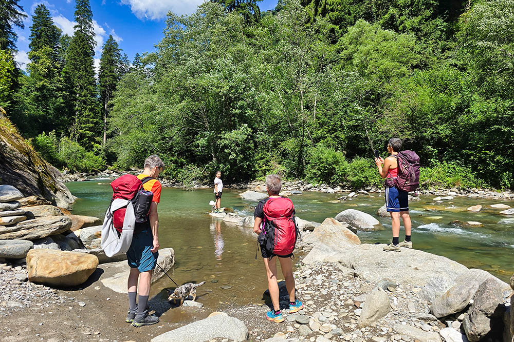
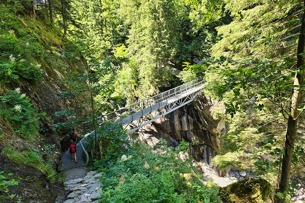
The Passirio Gorge Trail is undoubtedly one of the most famous and popular hikes in all of Val Passiria. The route has no technical difficulties, and thanks to modern metal walkways, it is always completely safe. The loop trail offers two completely different experiences: on the way out, you walk alongside the Passirio stream, immersed in the sound of rushing water between the rocks, while on the return, you gain altitude and enjoy majestic views over the entire valley.
This is a perfect tour for everyone, ideal for families with children and even for those who want to bring their four-legged friends. The beauty of this trail lies in its accessibility—anyone can enjoy the natural spectacle of the gorge without facing any particular technical challenges.
For those who prefer to avoid walking back, there is an excellent alternative: once you reach the village of Plata (Platt), you can take bus line 240, which passes through Moso and conveniently returns to San Leonardo in Passiria.
History and Curiosities
The history of the Passirio Gorge Trail is relatively recent but fascinating. Until 2015, this natural wonder remained inaccessible to visitors. The trail only became passable after three years of intensive work, which led to the creation of a hiking path equipped with safe metal bridges and walkways.
The project began in 2008 as part of environmental measures linked to the construction of the Enerpass power plant. The goal was to create a pedestrian connection between San Leonardo and Moso, giving life to what is now considered one of the most scenic water trails in the area. These paths were built around Moso to highlight the fundamental role that water and ice have played in shaping this valley’s landscape over millennia.
But Val Passiria is not only famous for its natural beauty. Just two kilometers from the start of the trail is the MuseumPasseier, located in the historic Sandhof farmhouse, birthplace of Tyrolean hero Andreas Hofer (1767–1810). Spanning 500 square meters, the museum tells the story of Hofer’s myth and the 1809 Tyrolean struggle for freedom against Napoleon’s French troops.
ITINERARY
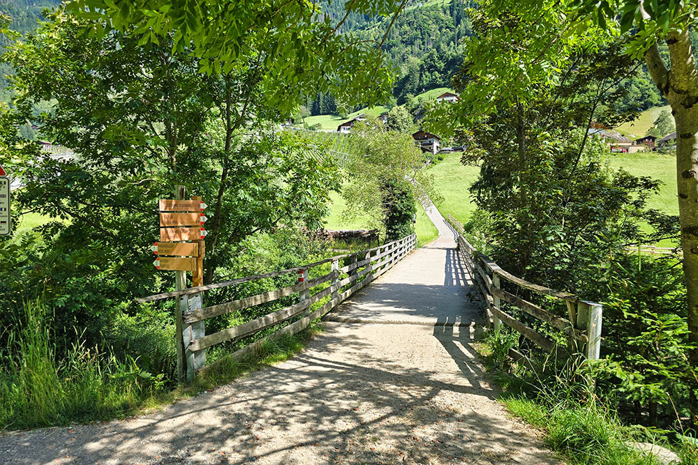
From the parking area (673 m), head north on the paved road, passing the soccer fields and swimming pool while following trail marker no. 1. Upon reaching the hamlet of Gomion, cross the bridge (698 m) and switch to the right side of the Passirio stream. Continue on the orographic right side, passing an automatic refreshment point and a former hydroelectric plant (785 m). Then briefly switch to the left side before returning to the right. Now you’ve reached the end of the Passirio Gorge Trail (927 m). Turn left and follow marker 1B to the village of Plata (1136 m). Here, you have the option to return by bus. Continue following markers 6 and 30 until reaching the Gomion bridge. Then return to the starting point by following marker no. 1.
EXCURSION DATE
June 28, 2025
STARTING POINT
San Leonardo in Passiria (St. Leonhard in Passeier)
REFRESHMENT POINT
Gasthof Breiteben
AUTHOR’S SUGGESTIONS
For those who are not very fit, we recommend returning via bus line 240.
SAFETY TIPS
The feasibility of this itinerary, like all mountain terrain, is subject to environmental changes due to natural events and weather conditions. Therefore, before setting out, check with local tourist offices and/or reference mountain huts.
Our GPX tracks are only indicative—the route was recorded under optimal trail and weather conditions. Always assess the situation on-site.
Additionally, evaluate the hike based on your physical fitness, experience, and equipment.
It is advisable to inform someone of your planned route.
Remember, the emergency number is 112.
EQUIPMENT
We recommend bringing gear suitable for the trail, weather, and season: windproof and/or rainproof jacket, map and/or GPS device, sunglasses, sunscreen, hiking boots, first-aid kit, appropriate clothing, gloves, and a backpack with food and water.
RECOMMENDED MAPS
Tabacco 039. Val Passiria/Passeiertal
INTERESTING LINKS
https://www.merano-suedtirol.it/it/val-passiria/natura-cultura/luoghi-d-interesse/attrazioni.html
HOW TO ARRIVE
From Merano, take the SS44 toward Val Passiria. After about 20 km, you’ll reach San Leonardo in Passiria.
PARKING AREA
Paid parking in San Leonardo in Passiria
GPS coordinates: 46.813857, 11.243441
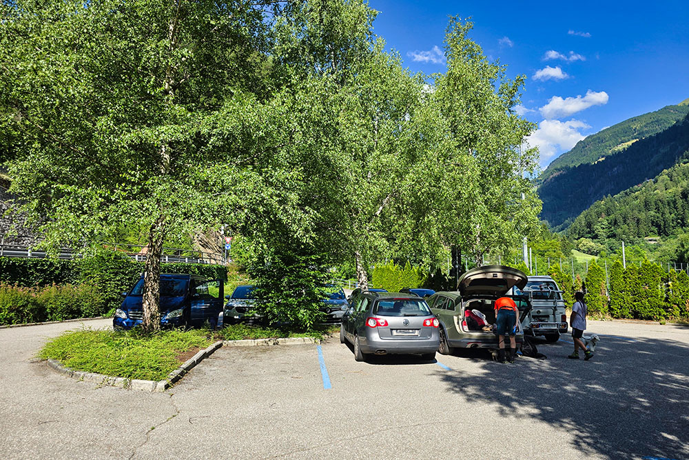
Parcheggio a San Lorenzo in Passiria
Si passa sul lato destro
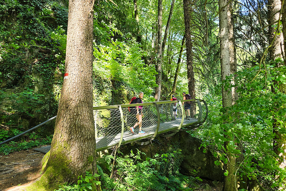
Iniziano le passarelle metalliche
Si è sospesi sul torrente
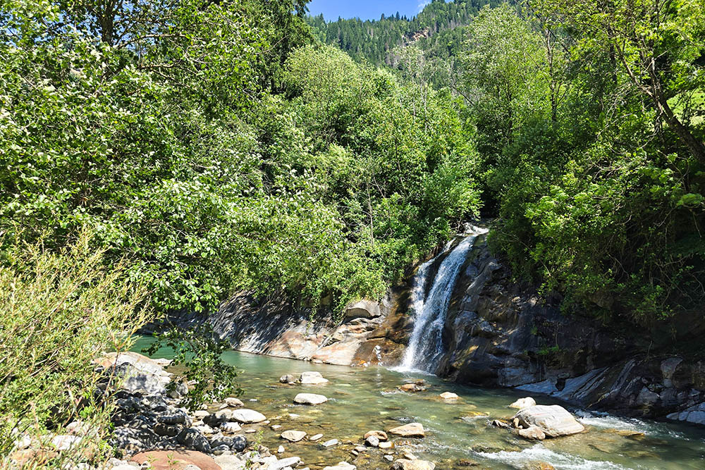
Cascate lungo il Passirio
Scendiamo per le foto
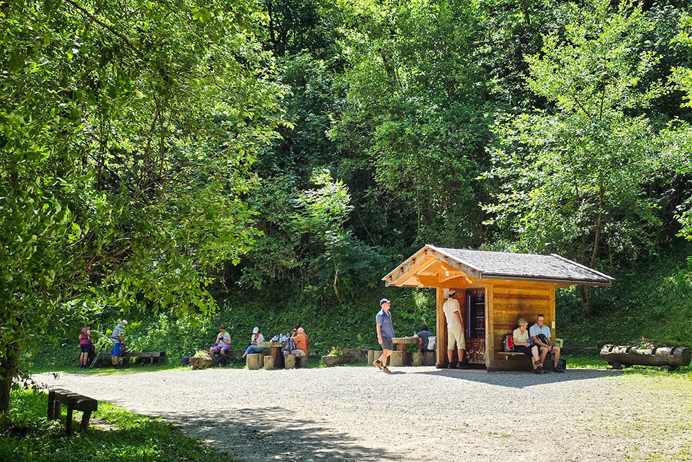
Punto ristoro con distributore automatico
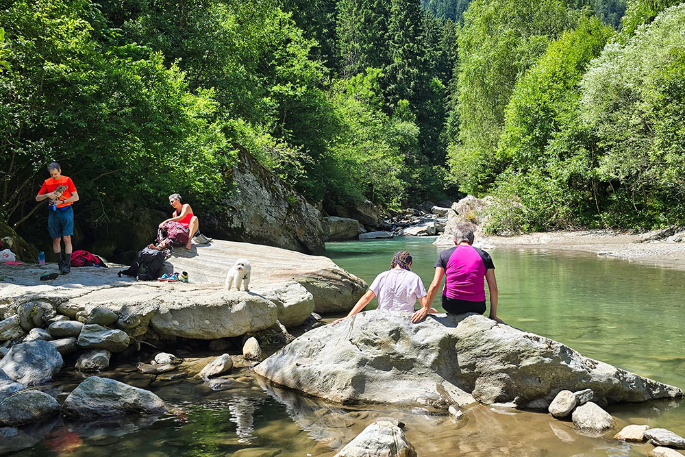
Momento di pausa
Si riprende il cammino
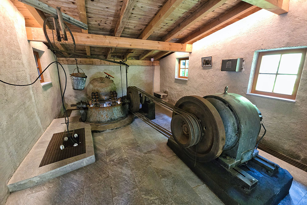
Polt Werk - ex centrale idroelettrica
La valle si restringe
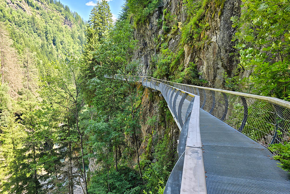
Tratto in sospensione
Si ritorna sulla sinistra orografica
Il paesino di Plata
Merenda


