


![]()


Durata
 5:25 h
Distanza
 12,5 km
 Ascesa
 883 m
883 mDiscesa
 883 m
883 mH Max
 2180 m
H Min
 1522 m
The Three Peaks of Bondone
DESCRIPTION
The Three Peaks Trail: Cornetto, Doss d'Abramo and Cima Verde.
Geographical Location
Located in the immediate western hinterland of Trento, Monte Bondone rises majestically among the Garda Prealps. This mountain massif serves as a natural watershed between the Adige Valley and Valle dei Laghi, dominating the Trentino landscape with its imposing presence.
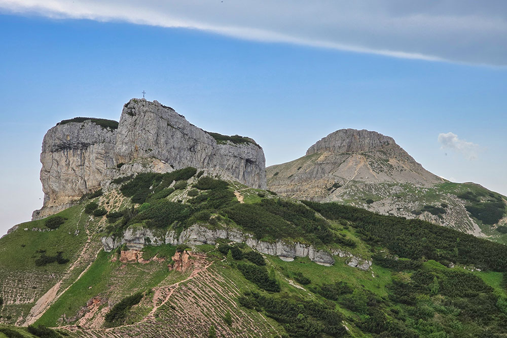
The heart of the mountain group is the Viote Plateau, a vast grassy expanse surrounded by the most significant peaks: Palon and the famous Three Peaks that give the hike its name. Cornetto, Doss d'Abramo and Cima Verde stand like silent sentinels around this natural basin, creating an alpine landscape of rare beauty. The area occupies a small glacial valley stretching from the Viote plain to the peaks within the State Forest, offering a protected natural environment of exceptional value.
Hike
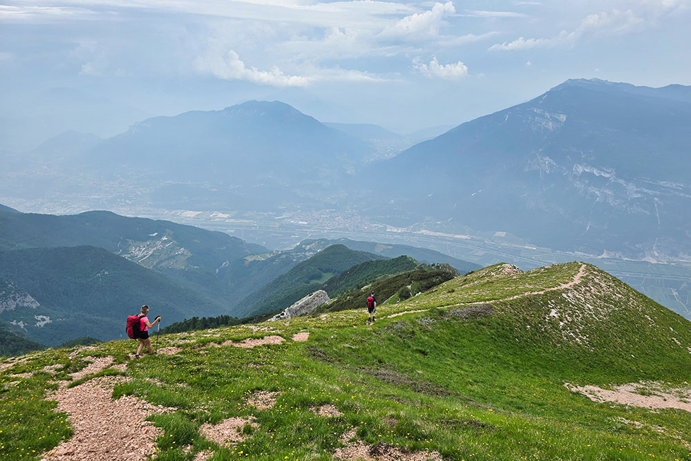
The Three Peaks Loop is the most famous and popular hiking trail in the entire area, winning the hearts of thousands of mountain enthusiasts year after year. This circular route takes hikers on an exciting journey across the three main peaks, offering unforgettable views of Trentino's most important mountain groups.
The trail winds through ever-changing landscapes - from alpine meadows to more challenging rock formations - with privileged views of the Brenta Group, Adamello, Presanella and Carè Alto. The vista extends over Val del Sarca, Vallagarina and Val d'Adige, turning the hike into a true panoramic balcony over Trentino.
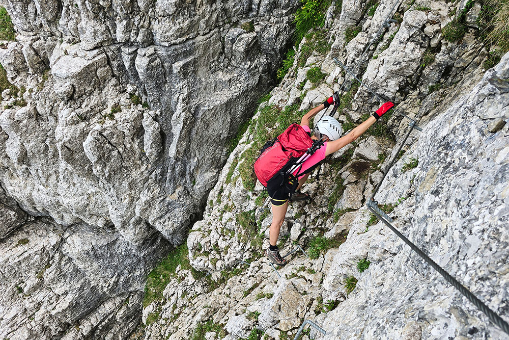
The itinerary includes two technically more challenging sections requiring special attention. On the ascent to Doss d'Abramo and the descent along Sentiero degli Sparavei, there are sections equipped with steel cables. These segments, rated A/B difficulty, require sure footing and no vertigo. For those without specific alpine experience, full via ferrata equipment is highly recommended. The descent from Cornetto also deserves respect, with steep sections requiring caution and proper technique.
The rest of the route remains moderately difficult, making it accessible to hikers with good basic fitness and adequate mountain experience. During summer, the protected natural area transforms into a multicolored carpet of millions of alpine flowers, adding further charm to the experience.
History and Curiosities
The history of Monte Bondone has its roots in ancient times and is intertwined with Trentino's history. In the 16th century, the territory belonged to the Prince-Bishop of Trento who used it as hunting grounds, before later being donated to the communities of Sopramonte, Sardagna, Garniga, Cavedine, Baselga di Bondone and Vigolo Baselga.
During the 19th century, the area began to be used for pastoral farming, eventually becoming a strategic military base with some barracks still visible today. These historical structures testify to the massif's strategic importance during the World Wars, when its peaks served as observation and control posts.
Monte Bondone is closely linked to the history of skiing in Trentino and throughout the Alps, representing one of the pioneering areas for winter sports development in the region. Today the area hosts one of Trentino's most significant nature reserves, comprising 223 hectares of protected environment where meadows and spruce forests dominate at lower altitudes, giving way to mountain pine and alpine heath habitats up to the grassy formations of the peaks.
ITINERARY
From Ristorante Capanna Viote (1566 m) take trail 607 passing Terrazza delle Stelle (1565 m), Malga Fragari (1570 m) and Costa dei Cavai (1796 m) to the foot of Monte Cornetto. Then ascend Monte Cornetto (2180 m) on an unmarked trail. Descend the opposite side via a steep trail to Fontana delle Rogiole (2060 m). Follow trail marker 636 to the first junction. Here climb to Dos d'Abramo following marker 638A - equipped trail. After reaching the summit cross of Dos d'Abramo (2140 m), return to the junction. Follow marker 636 to Cima Verde (2102 m). Then take Sentiero Sparavei, marker 630 - equipped trail. Upon reaching Acqua del Mandret (1780 m), take Sentiero delle Pozze, marker 630B and return to the starting point.
EXCURSION DATE
June 14, 2025
STARTING POINT
Ristorante Capanna Viote
REFRESHMENT POINT
None
AUTHOR'S SUGGESTIONS
There are no mountain huts or refreshment points along the trail, so bring your own food and drinks for breaks.
SAFETY ADVICE
The feasibility of the proposed itinerary, like all mountain terrain, is subject to environmental changes due to natural events and weather conditions. Therefore, before setting out, consult the relevant tourist offices and/or reference mountain huts.
Our GPX tracks are only indicative, meaning the route was completed under the best trail and weather conditions of that day. Always evaluate on site what to do.
Also remember to assess the route based on your physical abilities, training and available equipment.
It's advisable to inform someone about your intended itinerary.
Remember the emergency number is 112.
EQUIPMENT
Recommended to have suitable equipment for the route, weather conditions and season: windproof and/or waterproof jacket, map and/or GPS device, sunglasses, sunscreen, hiking boots, first aid kit, specific clothing, gloves, backpack with food and drinks, via ferrata kit.
RECOMMENDED MAPS
Tabacco 055 Arco - Valle del Sarca - Valle dei Laghi
INTERESTING LINKS
https://www.trentino.com/it/trentino/trento-e-dintorni/monte-bondone/
HOW TO ARRIVE
From Trento SP85 to Le Viote
PARKING AREA
Free parking at Ristorante Capanna Viote
GPS coordinates: 46.020604, 11.042700
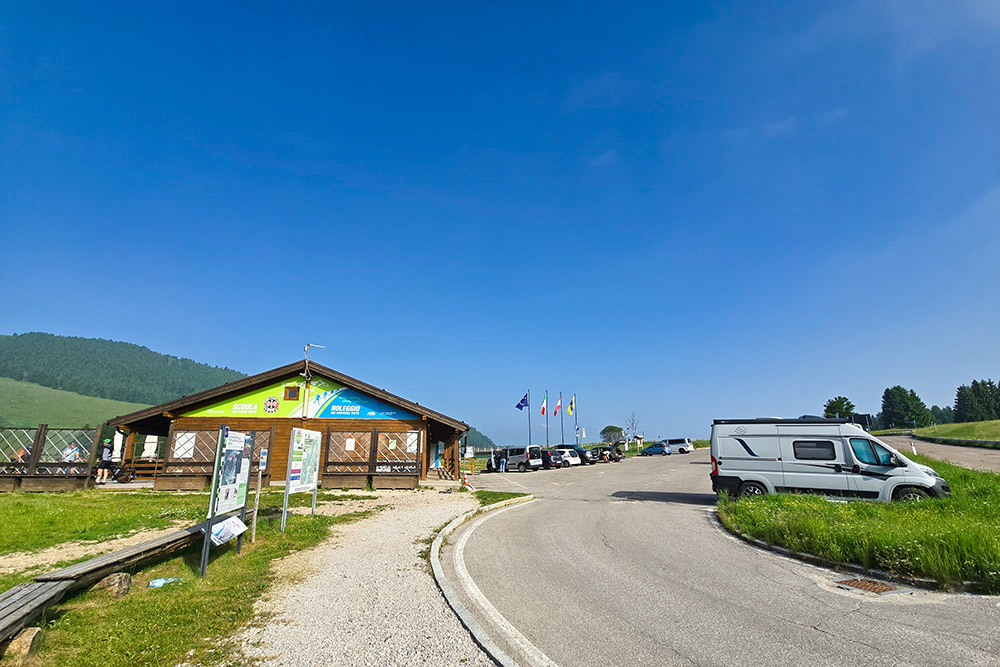
Parcheggio alla Viote
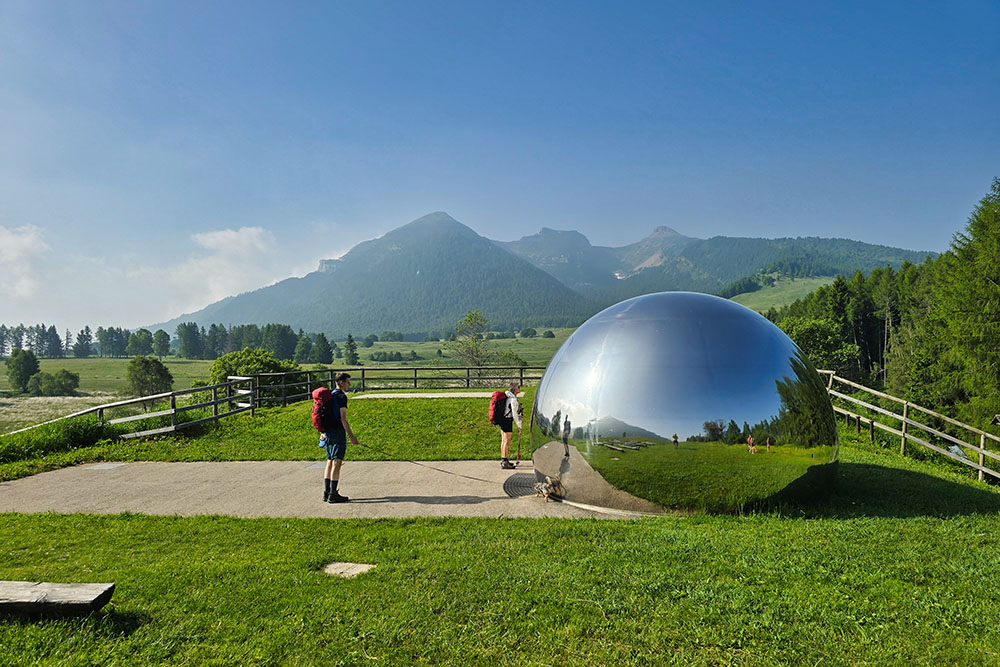
La Terrazza delle Stelle
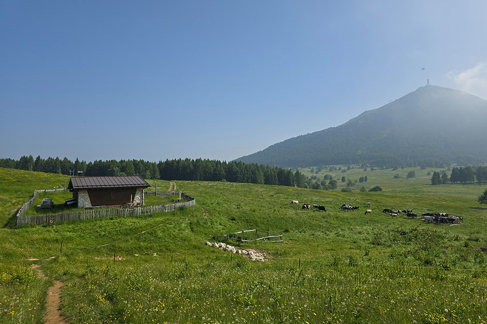
Malga Fragari
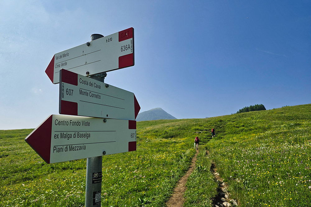
Seguiamo il segnavia 607
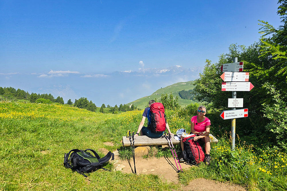
Costa dei Cavai
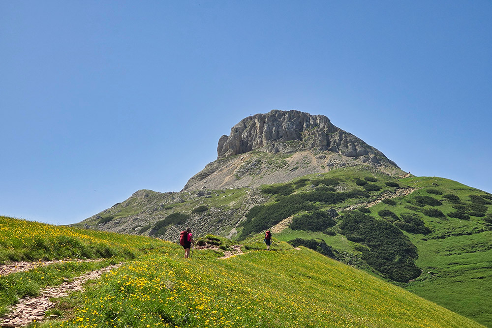
Si sale verso Cima Cornetto
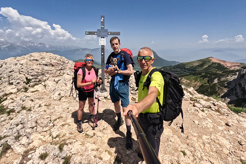
Cima Cornetto
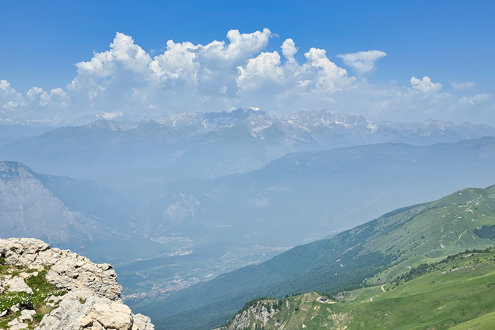
Vista verso il Gruppo del Brenta
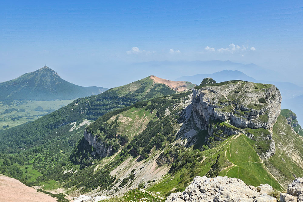
Vista verso il Dos d'Abramo e Cima Verde
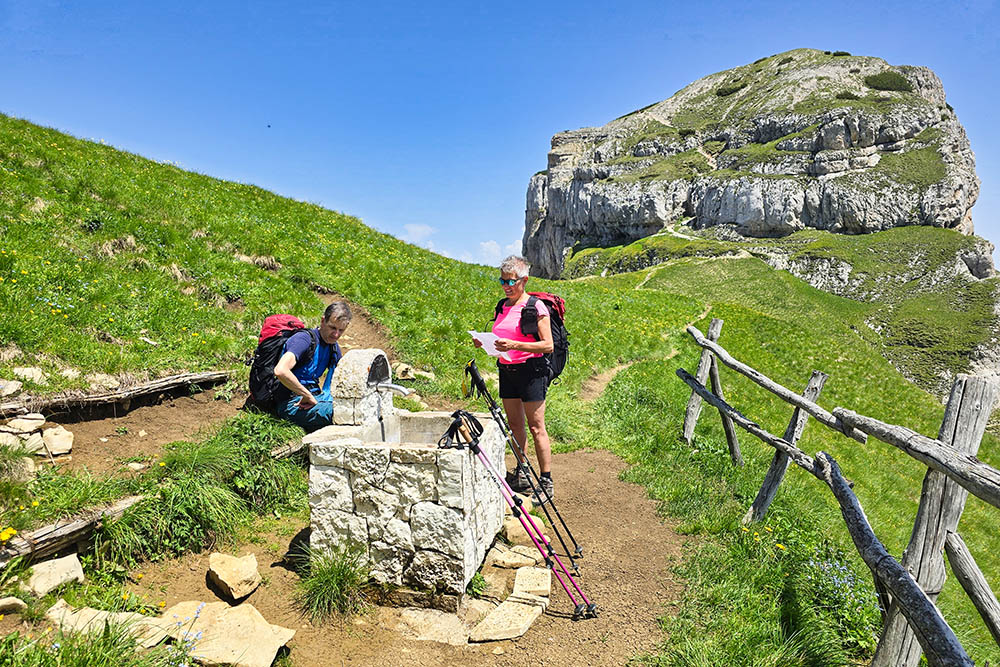
La Fontana delle Rogiole
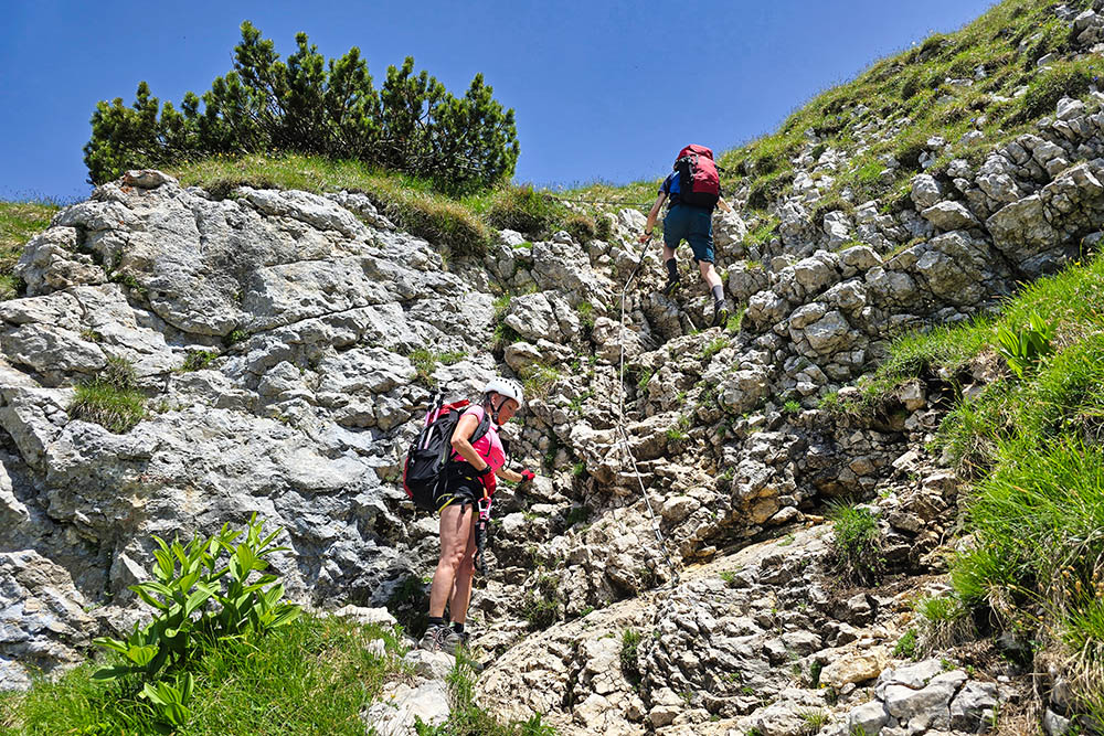
Tratto attrezzato per salire sul Doss d'Abramo
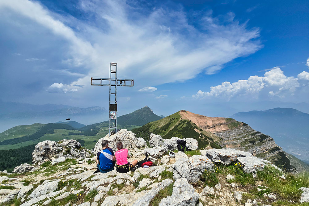
Croce del Doss d'Abramo
Vista del Doss d'Abramo e del Cornetto dalla Cima Verde
Sentiero Sparavei n 630
Tratti attrezzati del Sentiero Sparavei


