


![]()


Durata
 5:00 h
Distanza
 15 km
15 km Ascesa
 670 m
670 mDiscesa
 670 m
670 mH Max
 2185 m
H Min
 1534 m
Pralongià from San Cassiano
DESCRIPTION
Pralongià - a terrace in the Dolomites.
Geographical Location
The Pralongià Plateau is located in the heart of the Dolomites, in Val Badia (South Tyrol), nestled between the villages of Corvara, La Villa, and San Cassiano. This vast natural terrace, spanning the Ladin valleys, is an ideal starting point to explore some of the most breathtaking landscapes of the UNESCO World Heritage Site.
Hike
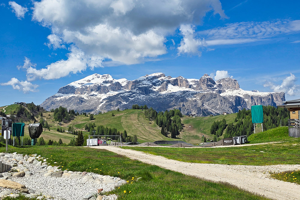
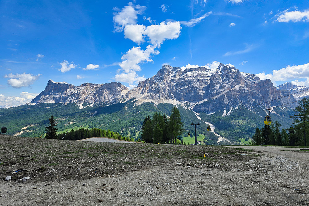
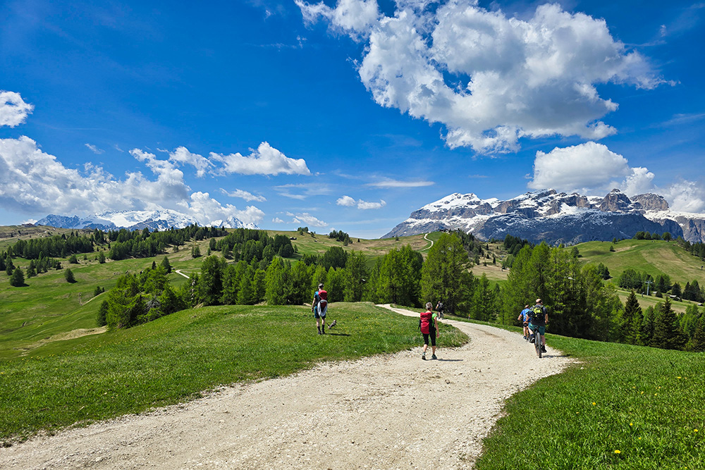
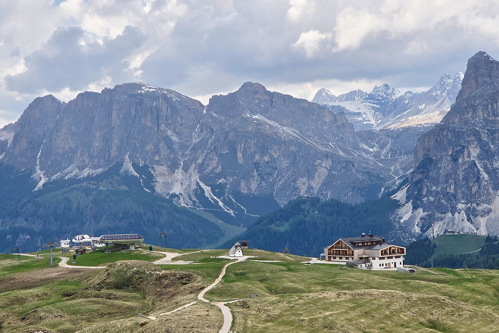
A circular route, suitable for experienced hikers, winds through the Pralongià Plateau, nicknamed the Amphitheatre of the Dolomites due to its privileged position at 2,100 meters. From here, the view embraces some of the most stunning peaks: the Fanes Group with the majestic Piz Cunturines, the Puez Group dominated by Sassongher, and the imposing Marmolada Glacier, the Queen of the Dolomites. The panorama is further enriched by glimpses of the Sella and Lagazuoi massifs.
This area is ideal in every season: in summer for relaxing walks or mountain bike trails, in winter for snowshoeing in fresh powder. Two famous routes intersect here: the Alta Via dell’Alta Badia, a 6-day trek through Ladin treasures, and the Alta Via delle Dolomiti No. 9, which connects Bolzano to Santo Stefano di Cadore.
History and Highlights
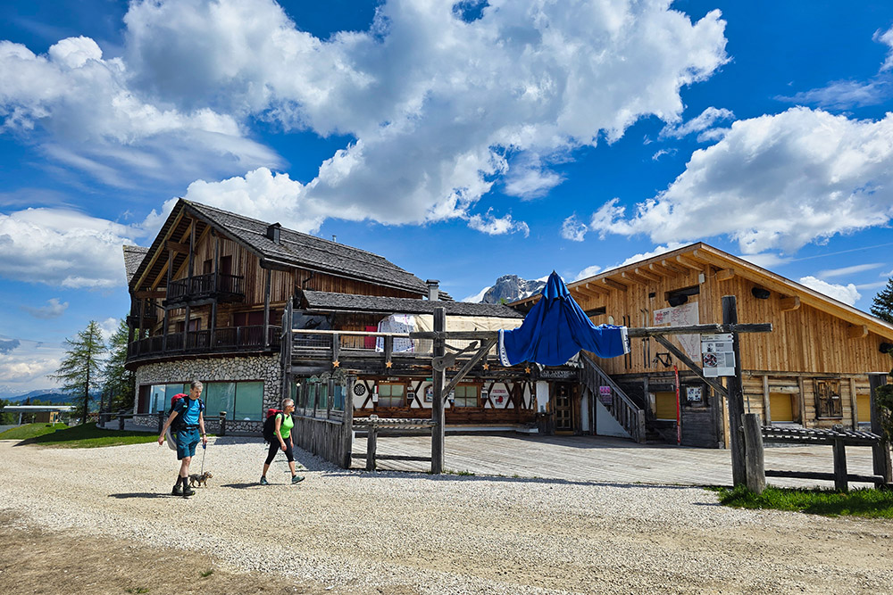
Since 1932, the Pralongià Mountain Hut has been a landmark for hikers and bikers. Located along the two High Routes, this historic wooden and stone building tells decades of Dolomite adventures. Its position, almost suspended between sky and earth, makes it perfect for a break with a view of the rocky ridges turning red at sunset. Fun fact: near the hut, in summer, you can spot marmots and deer, while in winter, tracks in the snow reveal the passage of mountain hares.
ITINERARY
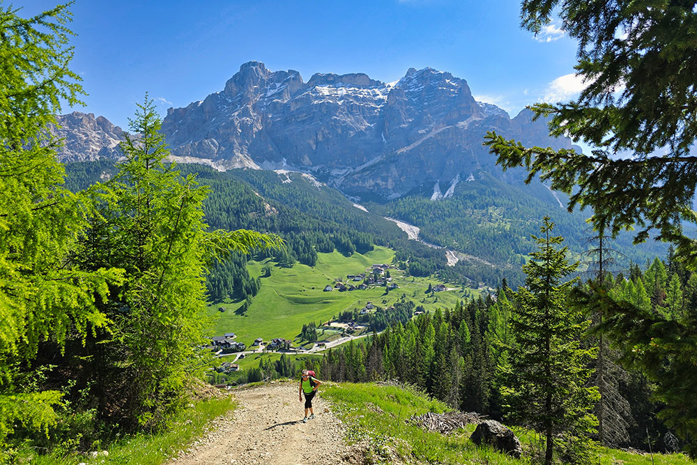
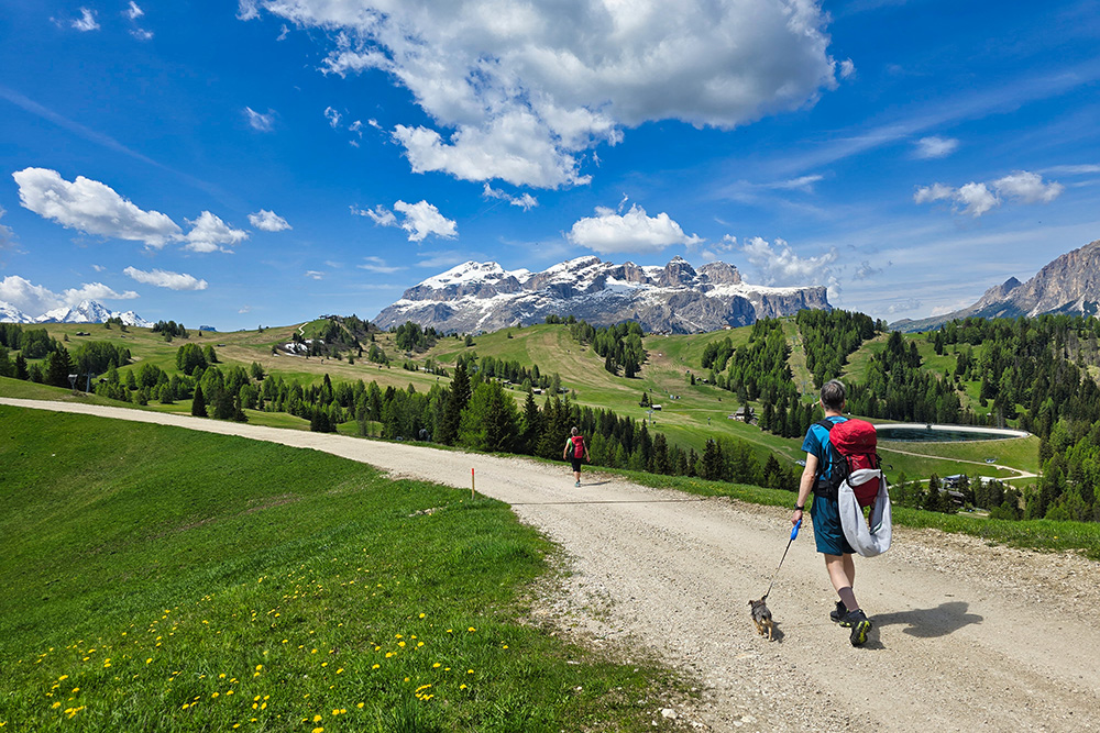
The hike starts at the Piz Sorega Cableway parking area (1,556 m). Following trail marker 21A, you first reach the Piz Sorega Mountain Hut (2,003 m), then continue to the nearby Las Vegas Mountain Hut (2,005 m). The path then follows a gentle trail through scenic alpine meadows leading to the Ütia Bioch Mountain Hut (2,079 m). Here, turn left and take trail No. 23, heading south along the mountain ridge until you reach the Pralongiá Alpine Hotel (2,135 m). The final ascent follows marker 24 up to Cima Störes, which at 2,185 m is the highest point of the entire hike. To return to San Cassiano, follow a clear sequence of markers: first 24A, then 18A, and finally 11, which leads back to the starting point.
EXCURSION DATE
June 1, 2025
STARTING POINT
San Cassiano
REFRESHMENT POINTS
Piz Sorega Mountain Hut, Las Vegas Mountain Hut, Bioch Mountain Hut, and Pralongià Mountain Hut
AUTHOR’S SUGGESTIONS
To shorten the hike, take the Piz Sorega Cableway uphill.
SAFETY TIPS
The feasibility of this itinerary, like all mountain terrain, is subject to environmental changes due to natural events and weather conditions. Before setting out, check with local tourist offices and/or reference mountain huts.
Our GPX tracks are only indicative—the route was completed under optimal trail and weather conditions. Always assess the situation on-site.
Additionally, evaluate the hike based on your physical fitness, training, and equipment.
Inform someone about your planned route.
The emergency number is 112.
EQUIPMENT
Bring gear suitable for the trail, weather, and season: windproof/waterproof jacket, map and/or GPS device, sunglasses, sunscreen, hiking boots, first-aid kit, appropriate clothing, gloves, and a backpack with food and water.
RECOMMENDED MAPS
Tabacco Map 07 - Alta Badia, Arabba, Marmolada
INTERESTING LINKS
https://www.altabadia.org/it/info-service/paesi/san-cassiano-alta-badia
HOW TO ARRIVE
Take the A22 motorway, exit at Bressanone Nord. Follow the SS49 (Pustertal State Road) to San Lorenzo di Sebato, then turn right onto SS244 towards Val Badia/Gadertal. In La Villa, turn left onto SP37 and continue to San Cassiano.
PARKING AREA
San Cassiano, near the Piz Sorega Cableway (paid parking).
GPS coordinates: 46.566632, 11.938716
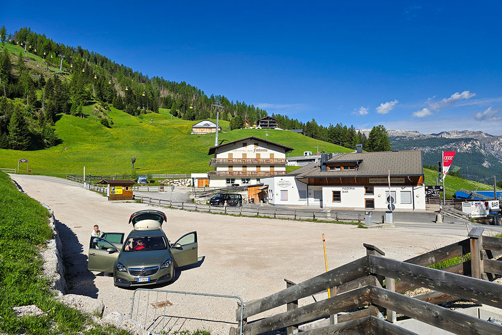
Parcheggio Cabinovia Piz Sorega
Si sale per il sentiero 21A
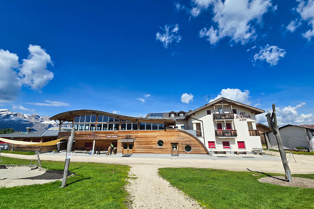
Il Rifugio Piz Sorega
Vista verso il Gruppo del Sella
Vista verso il Gruppo delle Conturines
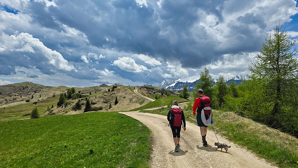
Ora il sentiero è quasi in piano
Il Rifugio Las Vegas
Siamo sull'Altopiano del Pralongià
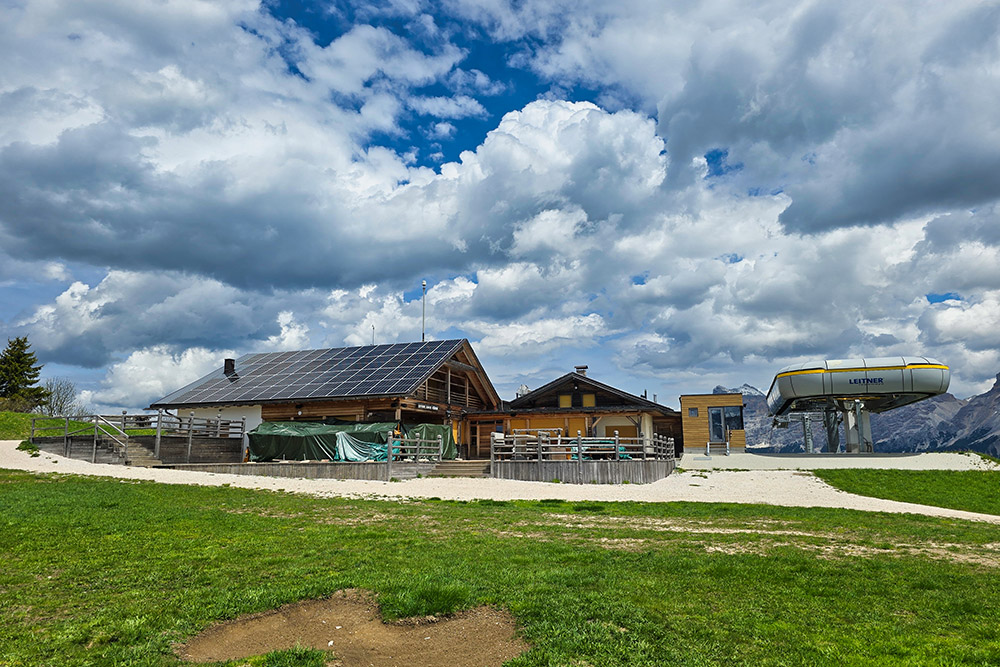
Il Rifugio Bioch
In lontananza il Rifugio Pralongià
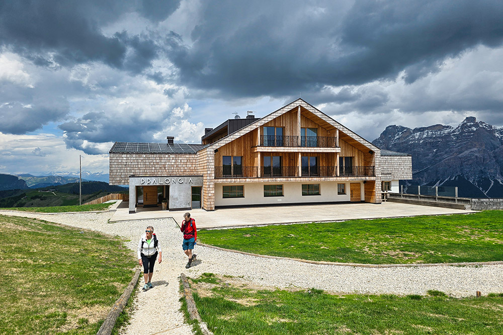
Il Rifugio Pralongià
Lasciamo il Rifugio Pralongià
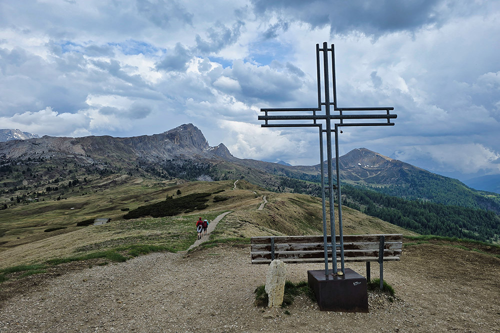
Il punto più alto, la Cima Störes
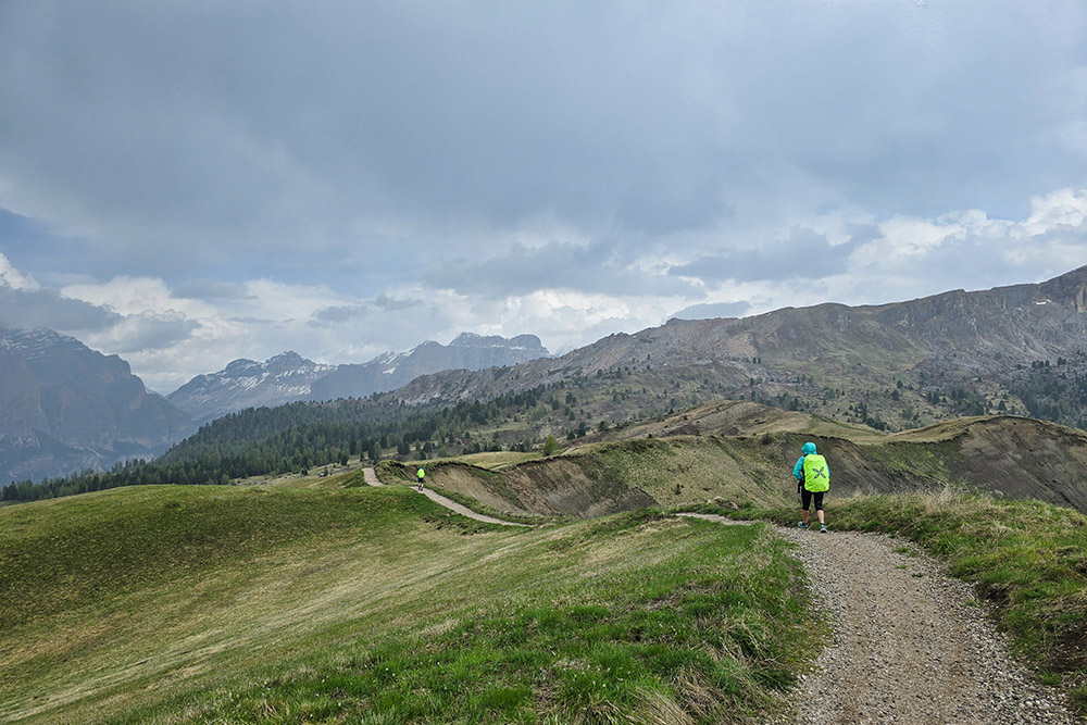
Continuiamo sul sentiero 24A
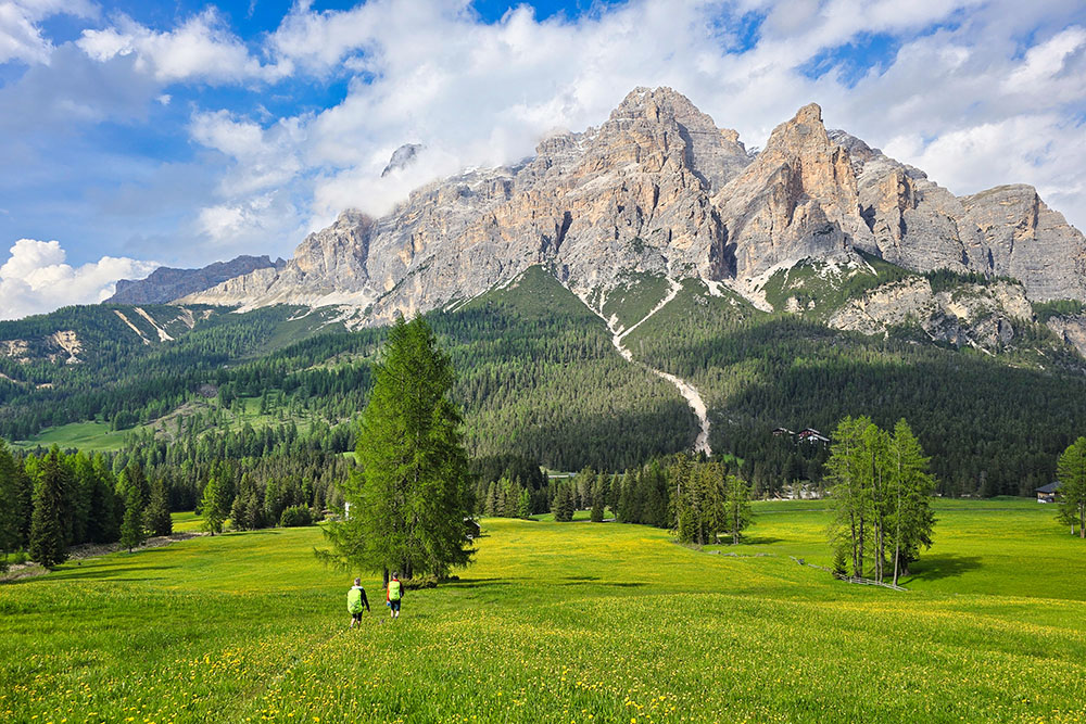
Favolosa fioritura dei prati


