


![]()


Durata
 6:15 h
Distanza
 19,3 km
 Ascesa
 343 m
343 mDiscesa
 780 m
780 mH Max
 1345 m
H Min
 885 m
885 mThe Sun Trail in Upper Venosta Valley
DESCRIPTION
Discovering the Sun Trail and its hidden treasures.
Geographical Location
Burgeis, Mals, and Spondigna are located in the Upper Venosta Valley, a stunning alpine valley in the far west of South Tyrol. The valley stretches along the upper course of the Adige River and is surrounded by towering mountain massifs exceeding 3,000 meters in altitude, including the Ortles-Cevedale group.
HIKE
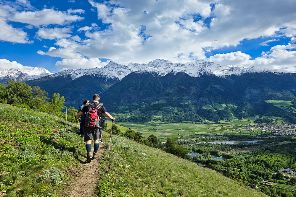
The Sun Trail is one of the most fascinating hiking routes in the entire Venosta Valley, winding for about 20 kilometers through landscapes of rare beauty. The trail connects Burgeis to Spondigna, with a total elevation gain of 343 meters and a descent of 780 meters. It starts at 1,350 meters at the Benedictine Abbey of Monte Maria and ends at 885 meters at Spondigna’s train station.
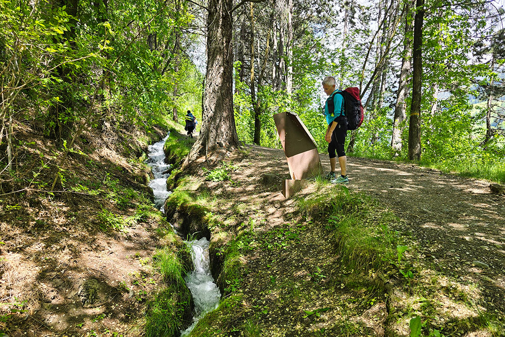
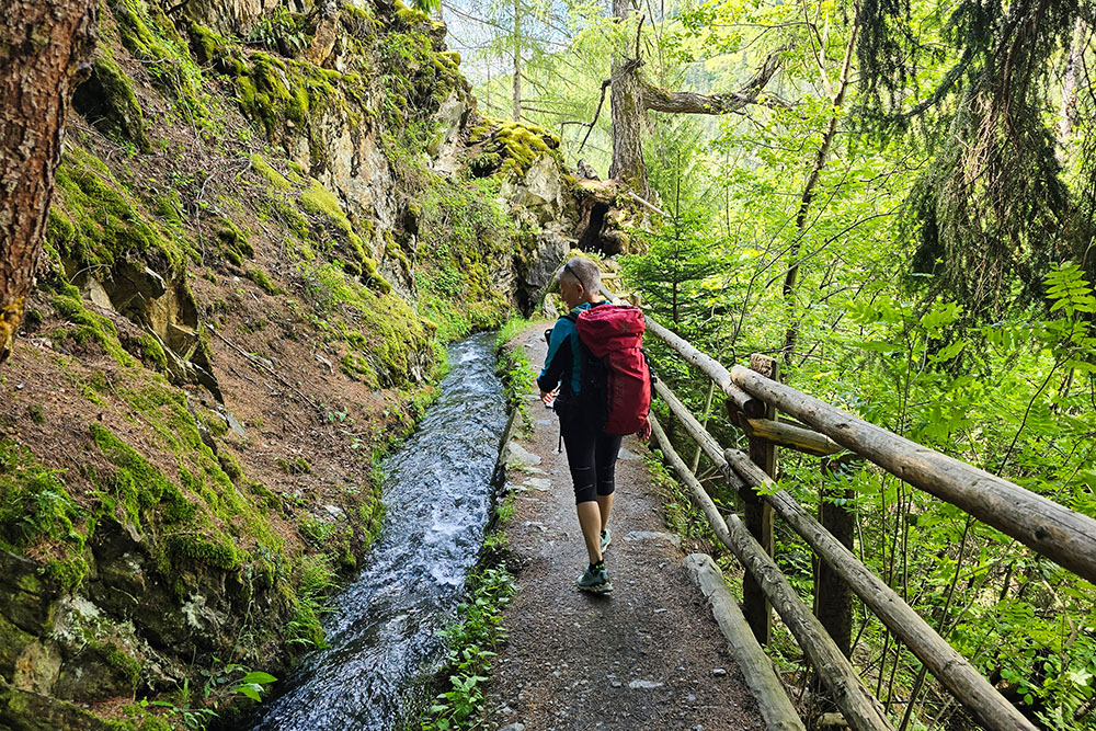
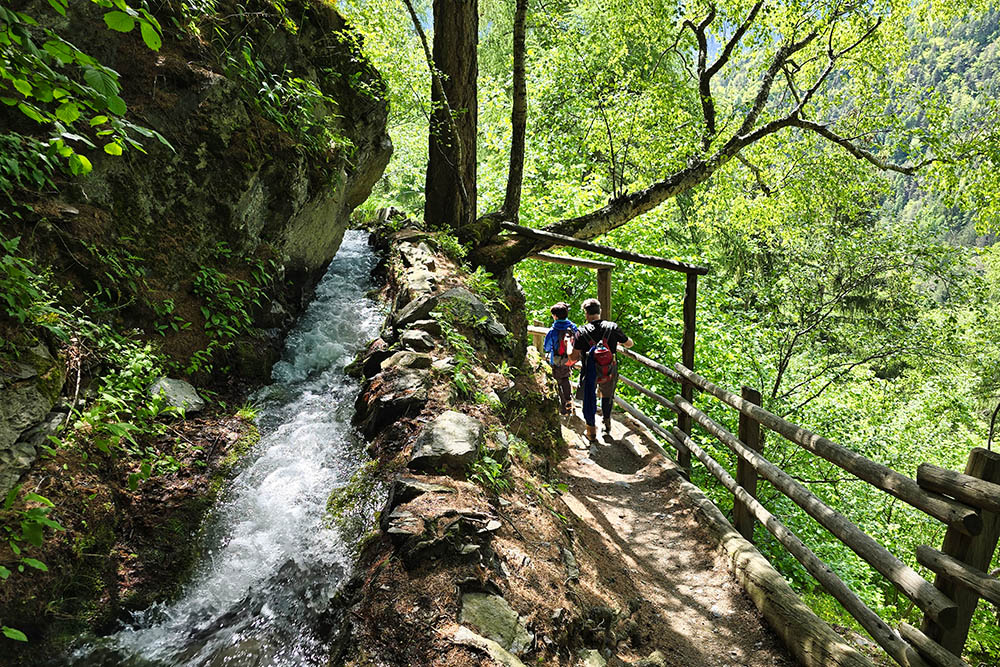
The route mainly follows three historic Waalwege, the characteristic irrigation channels of South Tyrol: the Oberwaal, Leitenwaal, and Berkwaal. These ancient artificial irrigation channels, called Waale in German, are a medieval engineering heritage still in perfect working order. The system was developed starting in the 12th century to bring water from mountain streams to the valley’s farmlands, and today it forms a vast network of over 1,000 kilometers across South Tyrol.
The trail is particularly suitable for hikers of all levels due to its features: wide, well-maintained paths, clear signage, and no technically challenging sections. The only requirement is good physical fitness, given the trail’s length, which takes about 6-7 hours of actual walking.
History and Curiosities
The Benedictine Abbey of Monte Maria, known in German as Marienberg, holds the record as the highest-altitude Benedictine monastery in Europe, standing majestically at 1,335 meters. It was founded in 1150 by the noble Tarasp family and over the centuries became the main cultural and intellectual center of the Upper Venosta Valley.
The monastery played a key educational role in the region, providing schooling for generations of young people and keeping the Benedictine monastic tradition alive. Today, the resident monks still maintain a renowned library and continue their pastoral work. The abbey also houses precious Romanesque frescoes and a 12th-century crypt of great artistic value.
Near the abbey stands the Prince’s Castle, locally known as Fürstenburg, built between 1272 and 1282. This fortress, with its imposing square tower, has a particularly eventful history: it initially served as the residence of the Prince-Bishops of Chur, who ruled the area with both spiritual and temporal authority. Over the centuries, the building had various uses, serving as a courthouse, emergency shelter, military barracks, prison, and even a brewery. Its fate changed definitively in 1952 when it was carefully restored and converted into the German-language Professional School for Agriculture, a role it still holds today.
ITINERARY
Always follow the Sun Trail (Trail No. 17). From the Benedictine Abbey of Monte Maria (1,335 m), descend to Burgeis (1,200 m), then head north of Mals along the historic Oberwaal channel. From there, continue towards Sluderno, passing two more irrigation channels: the Leitenwaal and Berkwaal. The hike ends with the descent to Spondigna’s train station (885 m).
EXCURSION DATE
May 24, 2025
STARTING POINT
Benedictine Abbey of Monte Maria in Burgeis
REFRESHMENT POINT
There are several refreshment points along the way.
AUTHOR’S SUGGESTIONS
The trail is best suited for the shoulder seasons (spring and autumn).
SAFETY TIPS
The feasibility of the proposed itinerary, like all mountain terrain, is subject to environmental changes due to natural events and weather conditions. Before setting out, check with local tourist offices or mountain huts.
Our GPX tracks are only indicative—the route was recorded under optimal trail and weather conditions. Always assess the situation on-site.
Evaluate the hike based on your physical fitness, training, and equipment.
Inform someone about your planned route.
Remember, the emergency number is 112.
EQUIPMENT
Bring appropriate gear for the trail, weather, and season: windproof/rainproof jacket, map/GPS device, sunglasses, sunscreen, hiking boots, first aid kit, suitable clothing, gloves, and a backpack with food and water.
RECOMMENDED MAPS
Tabacco Map 044 – Vinschgau - Mals - Sesvenna / Val Venosta - Malles
INTERESTING LINKS
https://www.marienberg.it/it/home.html
HOW TO ARRIVE
From Merano: Take SS38 to Spondigna, then SS40 to Burgeis.
PARKING AREA
Free parking at the Benedictine Abbey of Monte Maria in Burgeis
GPS Coordinates: 46.704607, 10.521567
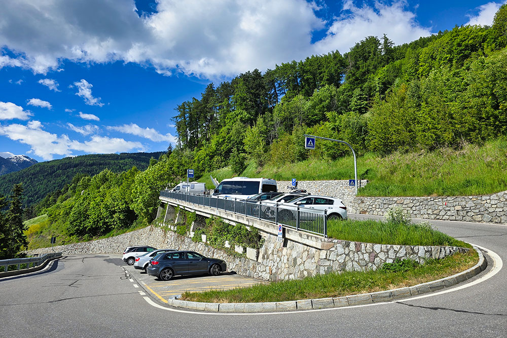
Parcheggio dell'Abbazia di Monte Maria
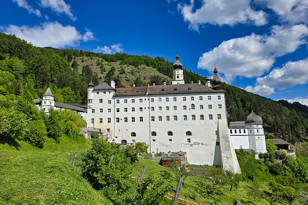
Abbazia di Monte Maria
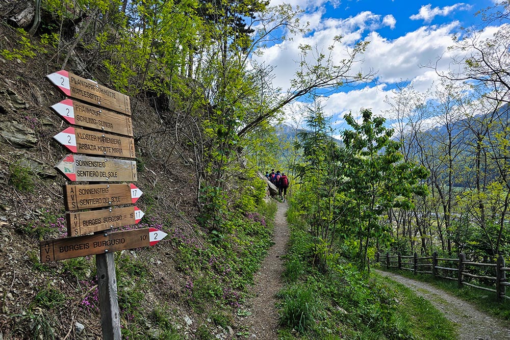
Inizia il Sentiero del Sole
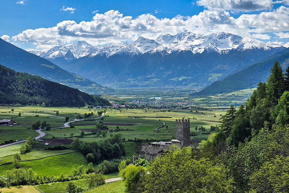
Castello del Principe e sullo sfondo Malles Venosta
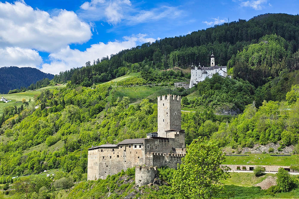
Il Castel Principe e L'Abbazia di Monte Maria
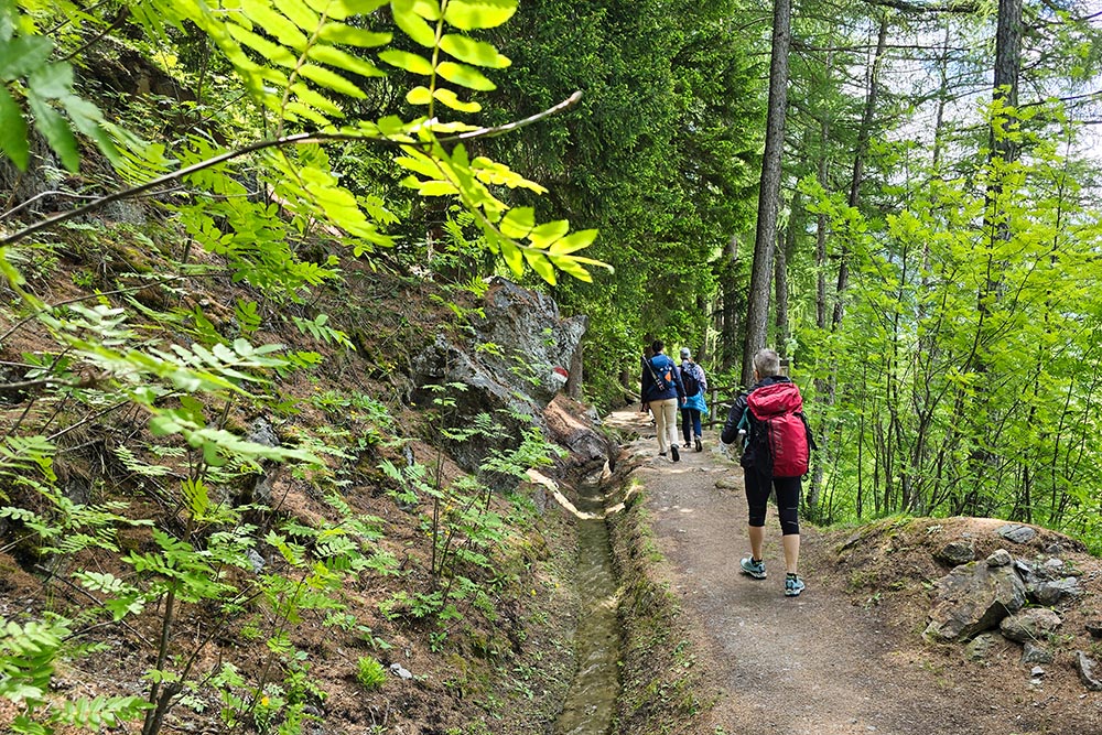
Roggia Oberwaal
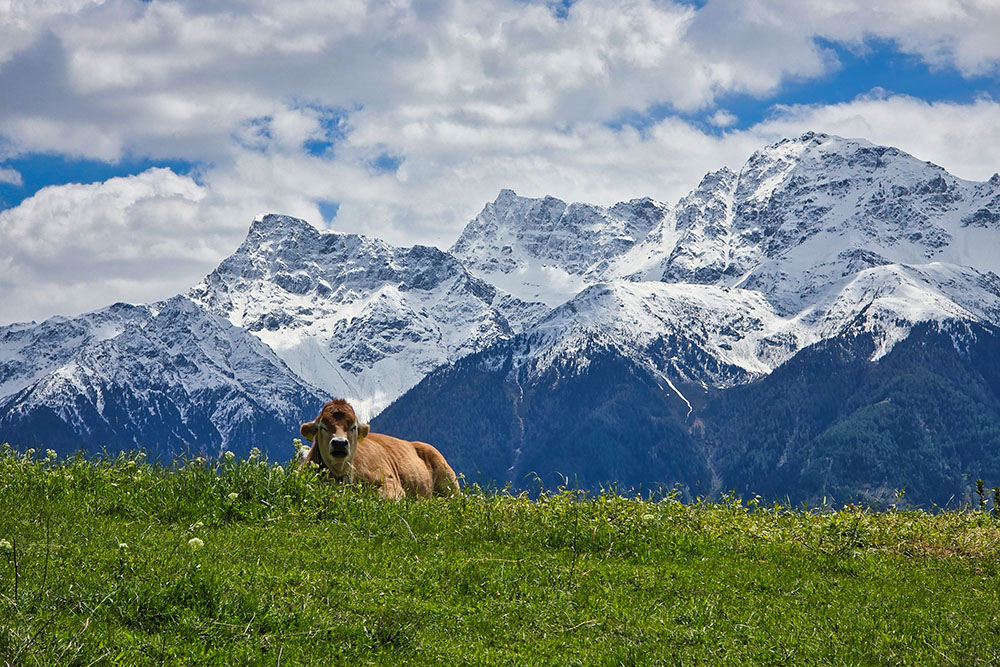
Bellissime cime innevate
La roggia Leitenwaal
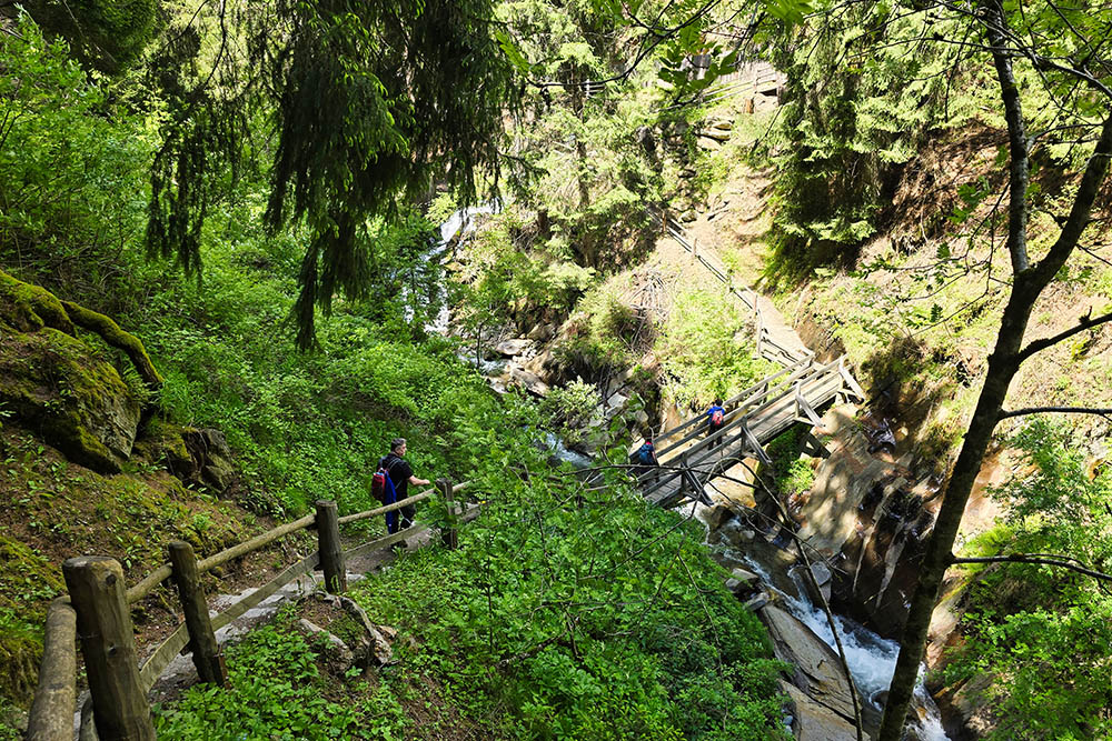
Ponte sul Rio Saldura
Roggia Berkwaal
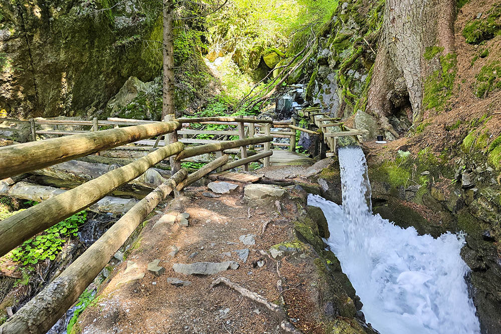
Roggia Berkwaal
Roggia Berkwaal
Sopra Sluderno
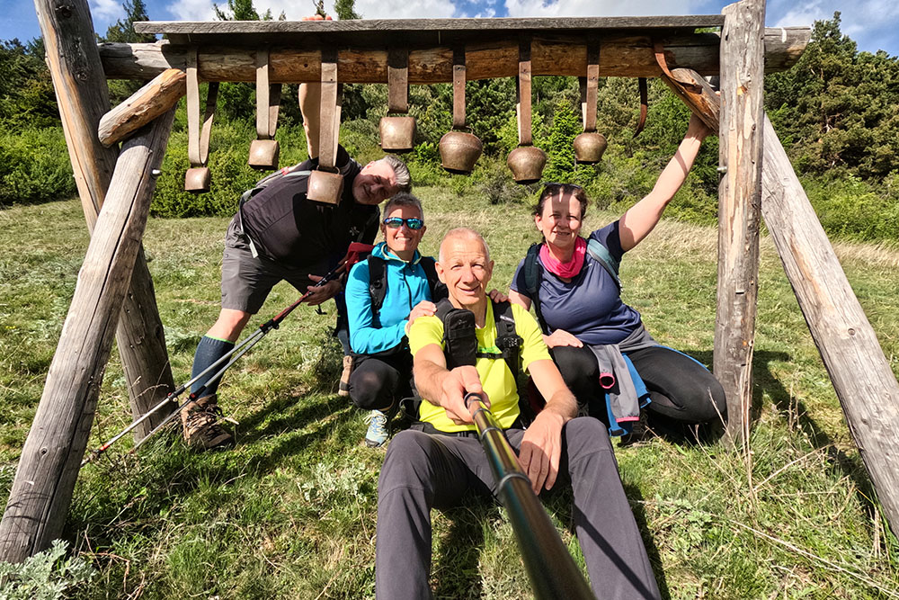
Campanacci delle mucche
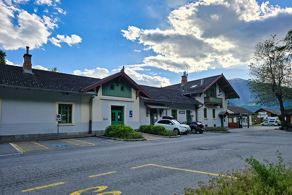
Punto di arrivo, stazione di Spondigna


