


![]()


Durata
 6:00 h
Distanza
 12,3 km
 Ascesa
 954 m
954 mDiscesa
 954 m
954 mH Max
 1425 m
H Min
 633 m
633 mMonte Zenone from Polsone
DESCRIPTION
A historic hike with fantastic views of Lake Garda.
Geographical Location
Monte Zenone is located in the Parco Alto Garda Bresciano, in Lombardy, just above the picturesque village of Tremosine on the western shore of Lake Garda. This area, suspended between lake and mountains, offers landscapes of great natural charm.
Hike
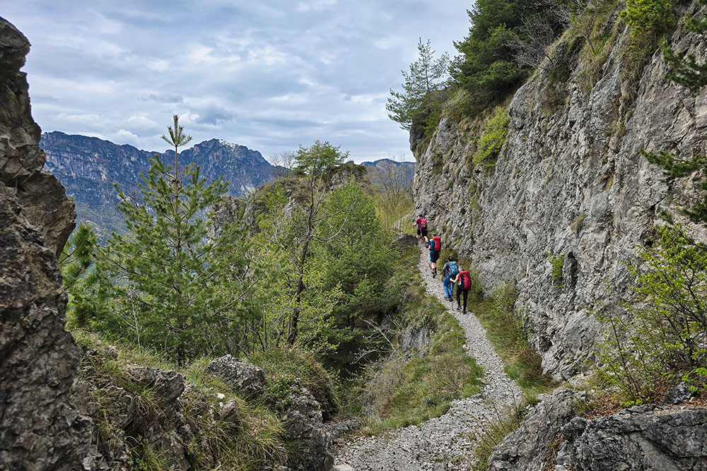
Those who choose to tackle this itinerary will traverse a fascinating mix of country roads, ancient mule tracks, and military paths dating back to the Great War. The Italian army used this area as a second defensive line, leaving behind tunnels carved into the rock and military roads with their characteristic gentle slopes.
The route presents no major technical difficulties for most of its length, but it includes two short sections classified as EE (for Expert Hikers): the ascent to the summit of Monte Zenone and the descent from Cima Cocca along a ridge. Both segments, though more exposed, offer extraordinary views of Lake Garda, Malcesine, Monte Baldo, the hamlets of Tremosine, and the peaks of the Garda Bresciano mountains.
This climb is one of the lesser-known but most rewarding routes in the Parco Alto Garda. Though slightly removed from the lakeshore, the area stands out for its significant historical and scenic value, providing an immersive experience in unspoiled nature.
Given the length and elevation gain of about 1,000 meters, the hike is recommended for experienced hikers. The best seasons to attempt it are spring and autumn to fully enjoy the surroundings. For those seeking an authentic hiking experience off the beaten path, Monte Zenone is a perfect choice.
History and Curiosities
During the Great War, the Brescia region was the scene of important military events. The front line stretched from the northern ridges of Val Camonica and the side valleys within the boundaries of Stelvio National Park, crossing Valtrompia and Valsabbia, all the way to the western shore of Lake Garda.
Today, walking along these paths, you can still sense the echoes of that wartime past, which shaped the landscape and memory of these mountains.
ITINERARY
From Polsone (634 m), follow trail marker 168, initially on a short path that continues onto a military dirt road. Upon reaching Cocca (953 m), turn left and stay on the military road. Near a small farmhouse (1,160 m), the trail begins, passing close to Cima Mughera before reaching a fork. Here, turn right, leaving trail marker 168 behind, to ascend to the summit of Monte Zenone (EE-rated section). After reaching the peak (1,425 m), continue along the ridge northward, descending until rejoining trail marker 168. Past Cima delle Volte, turn right onto trail 169, which leads to Passo della Cocca (964 m) and Monte Cocca (994 m), then descend via an unmarked path back to the starting point.
EXCURSION DATE
April 26, 2025
STARTING POINT
Polsone
REFRESHMENT POINT
None
AUTHOR’S SUGGESTIONS
The most beautiful and scenic sections are those marked as EE.
SAFETY ADVICE
The feasibility of this itinerary, like all mountain terrain, is subject to environmental changes due to natural events and weather conditions. Before setting out, check with local tourist offices or mountain huts for updates.
Our GPX tracks are only indicative—they were recorded under the specific trail and weather conditions of that day. Always assess the situation on-site.
Evaluate the route based on your physical condition, fitness level, and equipment. Inform someone of your planned itinerary. The emergency number is 112.
EQUIPMENT
Bring appropriate gear for the route, weather, and season: wind/rain jacket, map/GPS device, sunglasses, sunscreen, hiking boots, first-aid kit, suitable clothing, gloves, and a backpack with food and water.
RECOMMENDED MAPS
Tabacco 071 Garda Prealps – Tremalzo – Ledro Valley – Lake Idro
INTERESTING LINKS
https://infotremosine.com/cosa-vedere-a-tremosine-sul-garda/
HOW TO ARRIVE
From Limone sul Garda, take SP115 toward Tremosine, then SP38 to the parking area.
PARKING AREA
Polsone, located at the intersection of the road to S. Michele.
GPS coordinates: 45.782814, 10.724855
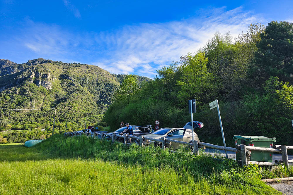
Parcheggio a Polsone
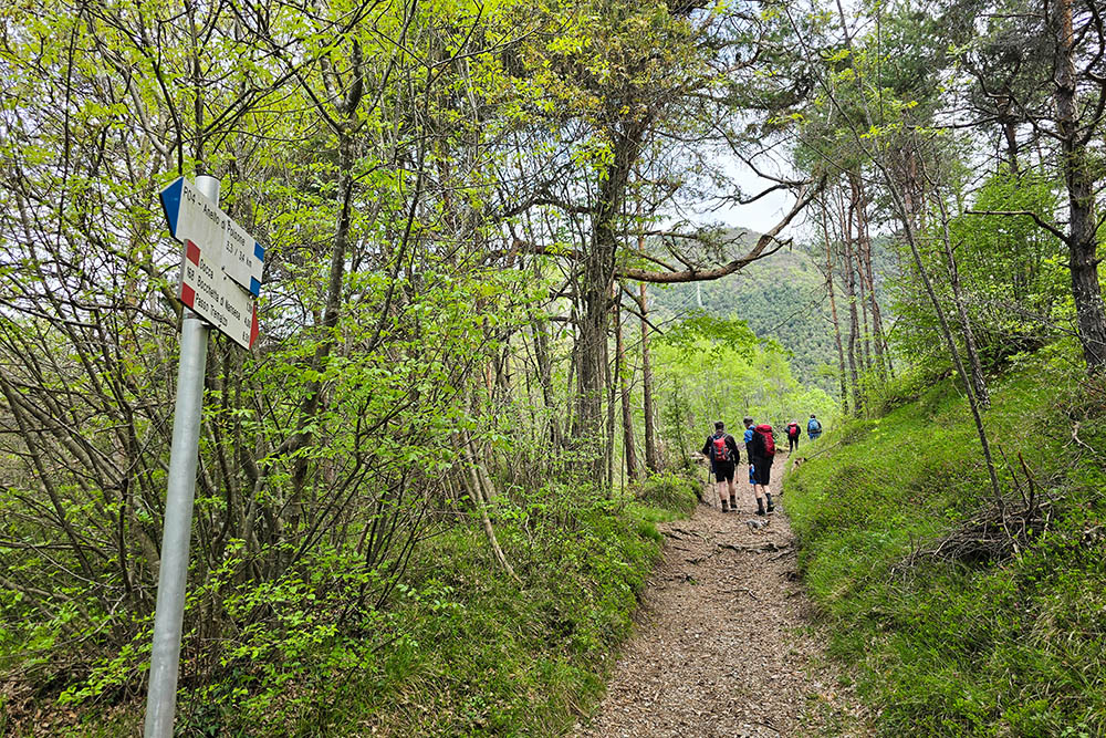
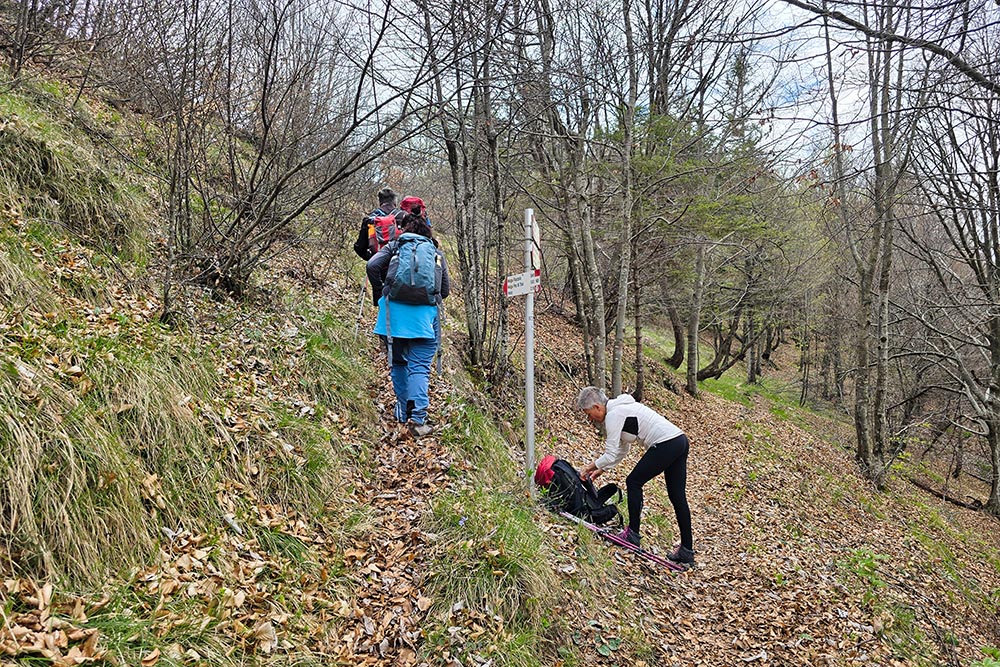
Si sale per il sentiero 168
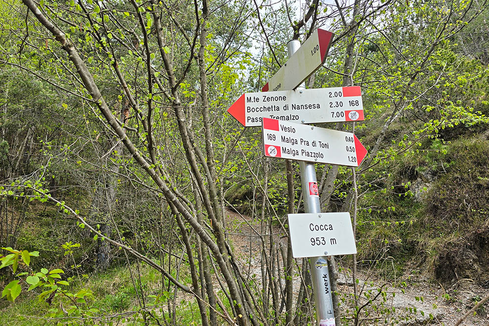
Segnaletica in località Cocca
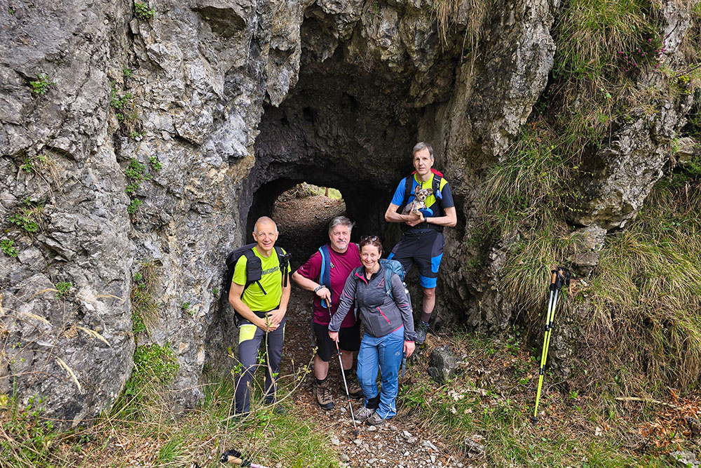
Prima Galleria
Si continua sul sentiero militare
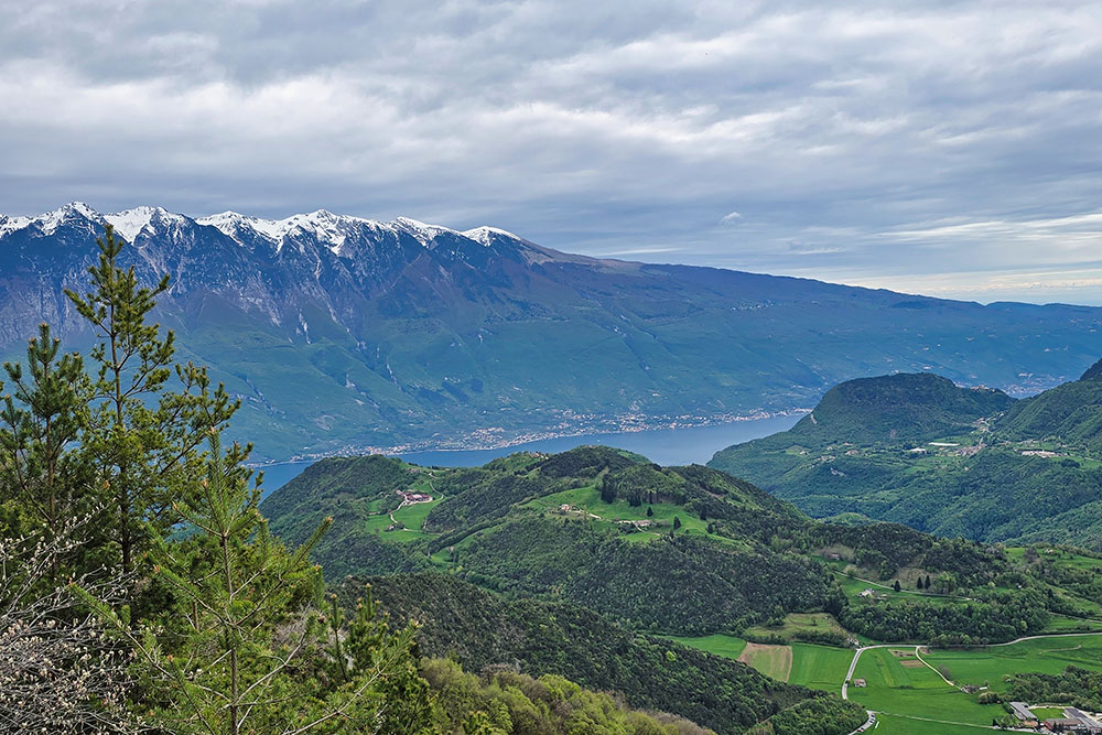
Si inizia a vedere il Lago di Garda
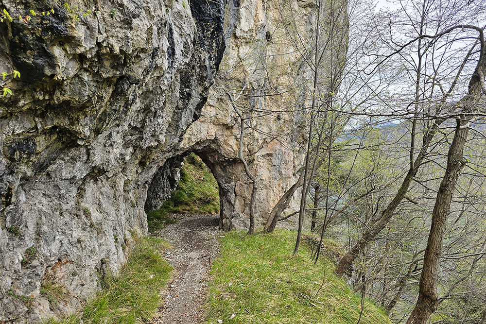
Seconda Galleria
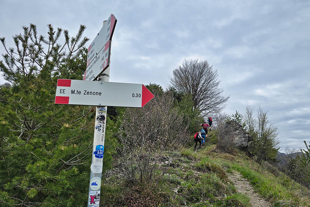
Tratto EE
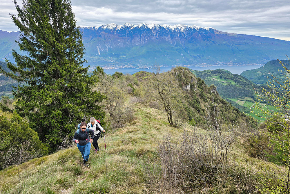
Siamo quasi in vetta
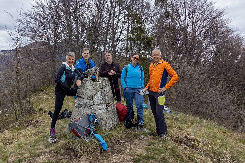
In vetta a Monte Zenone
Il cippo di vetta
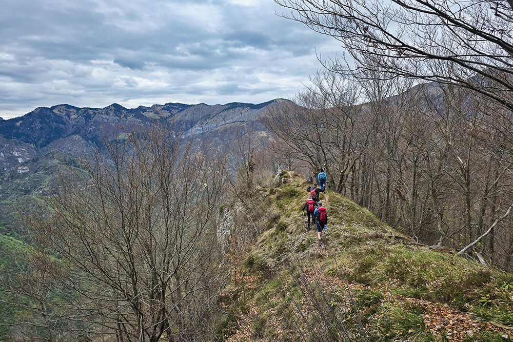
Continuiamo in cresta
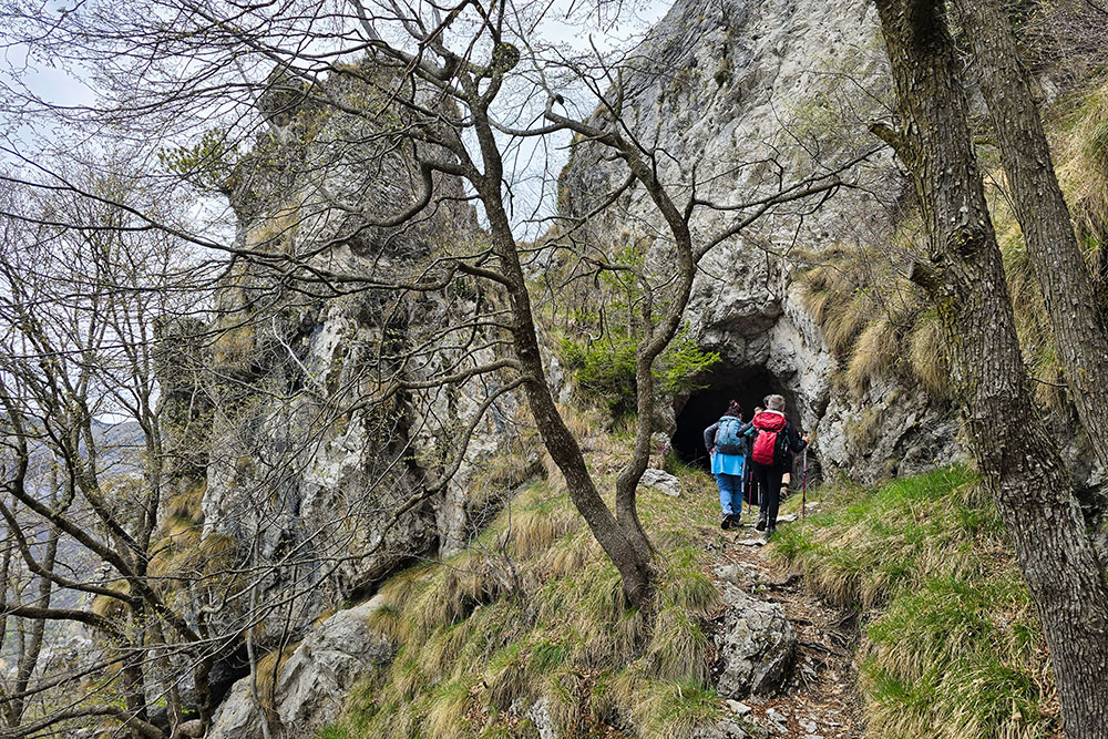
Terza galleria
Siamo al giro di boa, ora seguiamo il 169
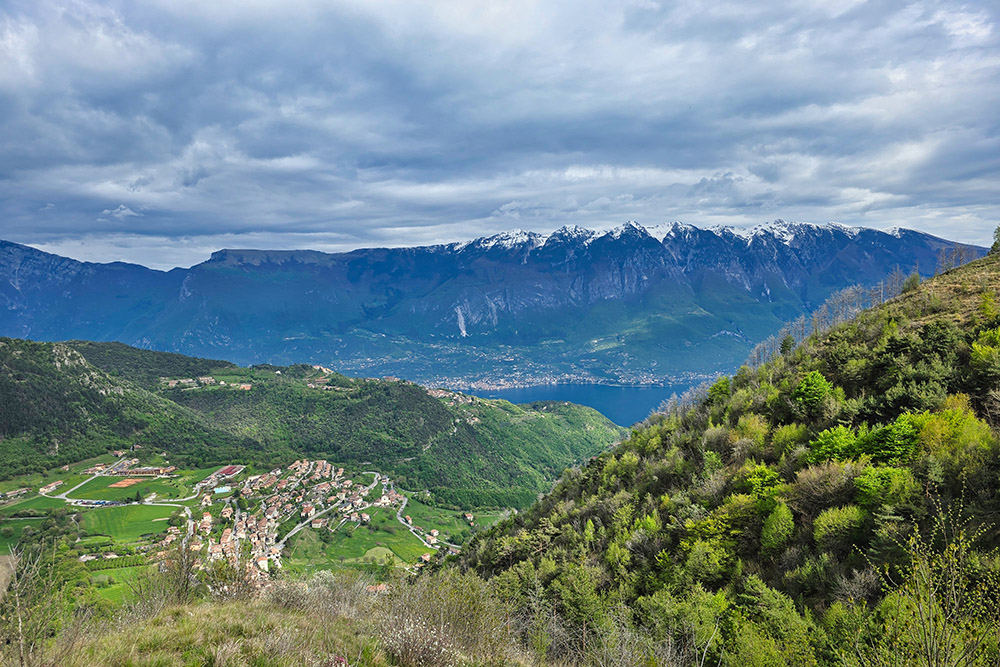
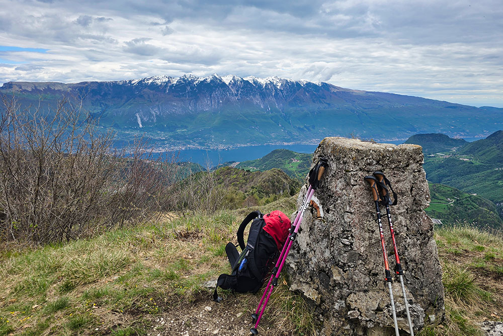
Panorama dalla Cima Cocca


