


![]()


Durata
 4:40 h
Distanza
 11,1 km
 Ascesa
 848 m
848 mDiscesa
 848 m
848 mH Max
 659 m
659 mH Min
 1 m
1 mMonte Cofano: Between Nature, History, and Unique Landscapes
DESCRIPTION
From the gulfs to the summit: the complete hike to Monte Cofano in Sicily.
Geographical Location
Monte Cofano rises majestically along the northwestern coast of Sicily, in the municipality of Custonaci, province of Trapani. This imposing limestone promontory, with its distinctive triangular shape plunging steeply into the sea, reaches a height of 659 meters and acts as a natural watershed between the Gulf of Bonagia and the Gulf of Cofano.
Part of the Monte Cofano Nature Reserve, the area is a true paradise for nature lovers. Its rocky cliffs host rich Mediterranean vegetation, including dwarf palms, helichrysum, and various endemic species, while the skies are graced by the majestic flight of peregrine falcons and kestrels.
Hike
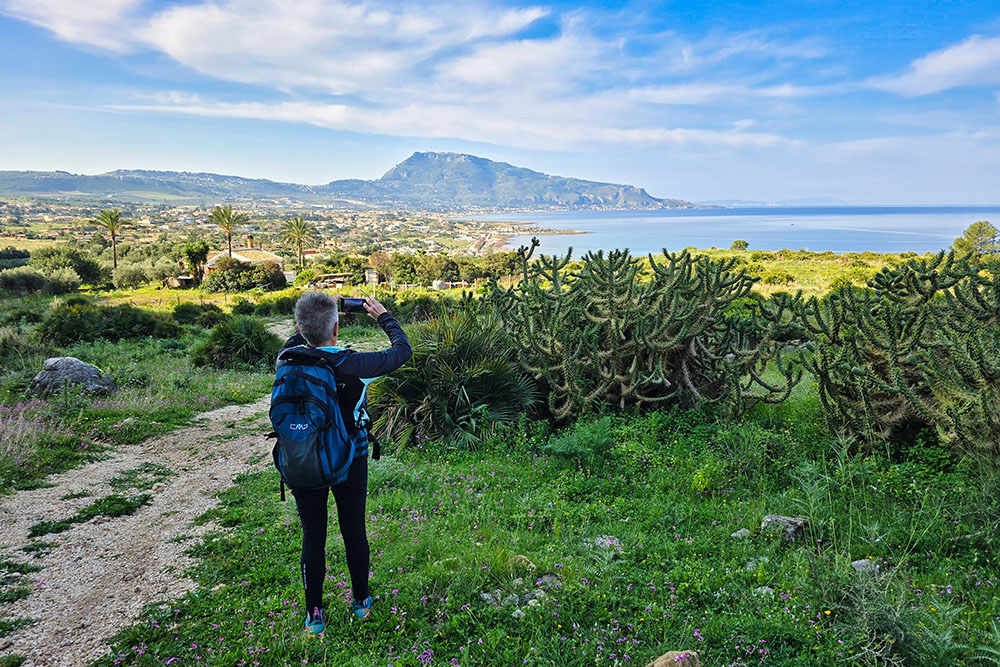
The full loop around Monte Cofano offers one of the most rewarding hiking experiences in western Sicily. The circular route, which runs counterclockwise, allows hikers to admire in succession the views over the Gulf of Bonagia with its historic tuna fisheries and the wilder Gulf of Cofano, where crystal-clear waters lap against picturesque coves.
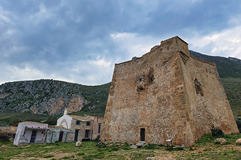
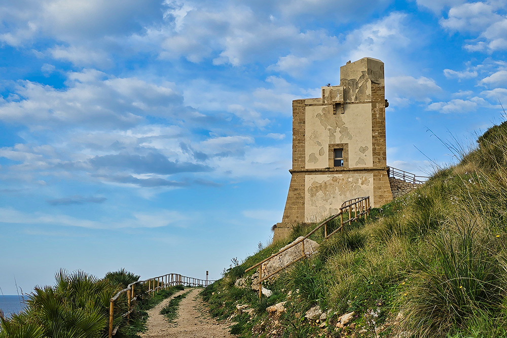
Along the way, you’ll encounter important historical landmarks, such as the 16th-century Torre di San Giovanni, part of the coastal defense system built by the Spanish, and the unique Torre Tono, the only one in Sicily with a distinctive star-shaped layout. Recently restored, the tower now houses an interesting permanent exhibition on the coastal watchtower system.
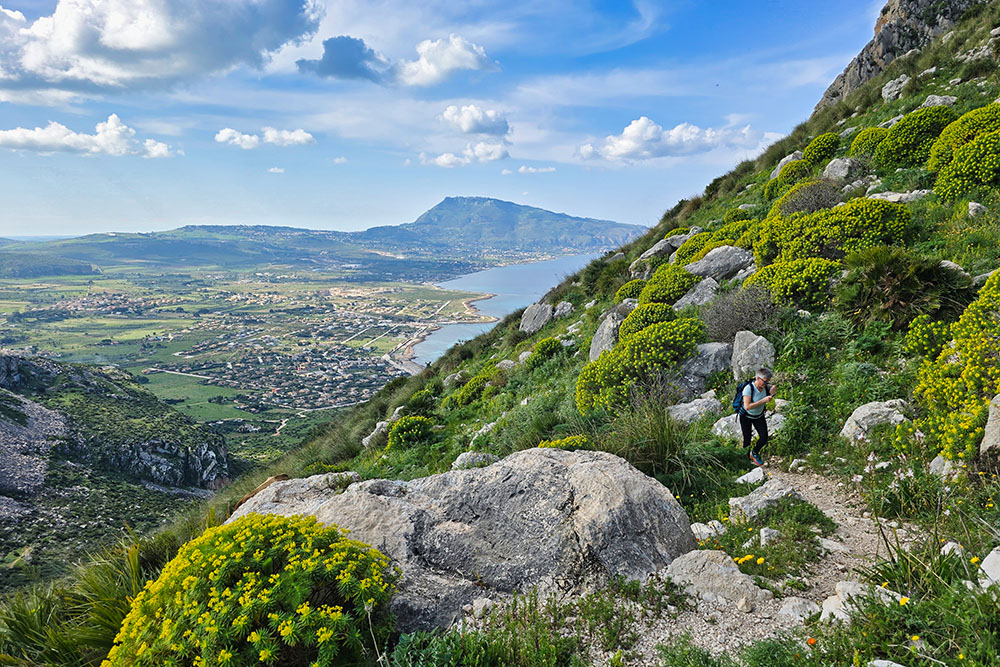
The ascent to the summit, though not technically difficult, requires good physical fitness. The final stretch, equipped with a fixed rope to overcome a short rocky passage, delivers an adrenaline rush before reaching the top. From here, the view stretches freely from the imposing Monte Erice to the Aegadian Islands, from the plains of Castelluzzo to the white beaches of San Vito Lo Capo.
History and Curiosities
The mountain’s summit preserves the ruins of an ancient watchtower dating back to the 15th century. This outpost was part of a broader defensive system that included coastal towers built between the 16th and 17th centuries to protect the coast from pirate raids.
The caves of Monte Cofano hold important archaeological evidence. The Grotta del Crocefisso has yielded artifacts confirming human presence since the Neolithic period, while the Grotta Perciata is a true stratified archive of history, with artifacts ranging from the Upper Paleolithic to the Middle Ages.
Completing the picture are the evocative Cappella del Crocefisso and the nearby Edicola di San Nicola di Bari, small gems of popular religious architecture that testify to the deep devotion of local communities.
ITINERARY
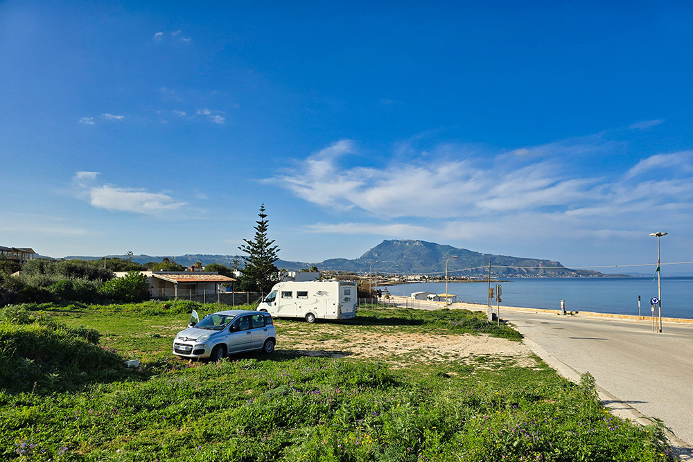
The hike begins in Cornino (7 m), opposite the picturesque Cala Buguto. From the large dirt parking area, take the trail heading north toward Baglio Cofano.
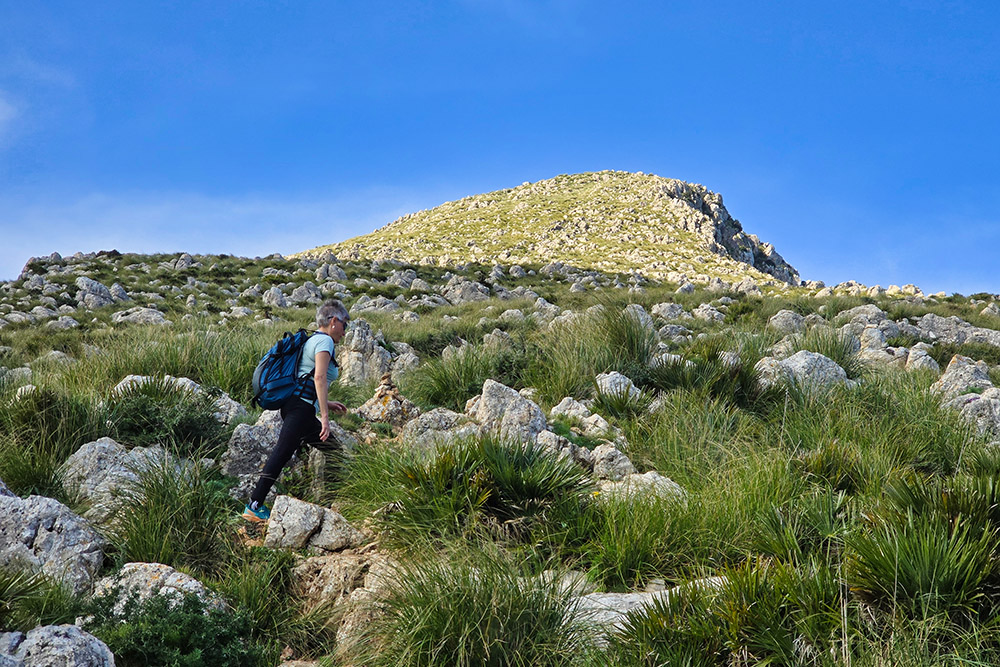
Upon reaching the mountain saddle (252 m), turn left to tackle the final climb to the summit of Monte Cofano (659 m). After a break to admire the scenery, descend back to the saddle and continue downhill westward, reaching the distinctive Torre della Tonnara di Cofano (5 m), overlooking the sea.
The trail continues along the shoreline southward. At Punta del Saraceno, a detour to the left leads up to the Grotta Perciata (120 m), an important archaeological site. Returning to the coastal path, continue past the Cappella del Crocifisso (41 m) and the Torre di San Giovanni (37 m), finally completing the loop back to the starting point in Cornino.
EXCURSION DATE
March 5, 2025
STARTING POINT
Cornino
REFRESHMENT POINT
None
AUTHOR’S SUGGESTIONS
The best time for this hike is from October to May, avoiding the hottest summer months. It’s advisable to start early in the morning, bring at least two liters of water per person, and wear hiking boots with good grip.
SAFETY TIPS
The feasibility of this itinerary, like all mountain terrain, is subject to environmental changes due to natural events and weather conditions. Before setting out, check with local tourist offices or mountain huts.
Our GPX tracks are only indicative, as the route was completed under the best trail and weather conditions of that day. Always assess the situation on-site.
Evaluate the hike based on your physical fitness, experience, and equipment. Inform someone about your planned route.
Emergency number: 112
EQUIPMENT
Bring appropriate gear for the trail, weather, and season: windproof and/or rain jacket, map and/or GPS device, sunglasses, sunscreen, hiking boots, first-aid kit, suitable clothing, gloves, and a backpack with food and water.
RECOMMENDED MAPS
We found no printed maps-use the Outdoor.Active or Komoot apps.
INTERESTING LINKS
https://riservamontecofano.com/
HOW TO ARRIVE
From Trapani: SP20 and SP18
PARKING AREA
In Cornino, paid parking from May 1 to September 30
GPS coordinates: 38.094582, 12.663989
Parcheggio a Cornino
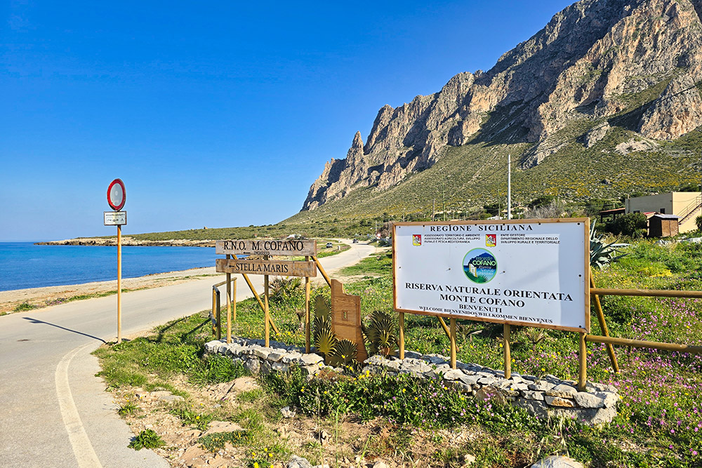
Entrata Riserva Monte Cofano
Iniziamo a camminare su strada sterrata
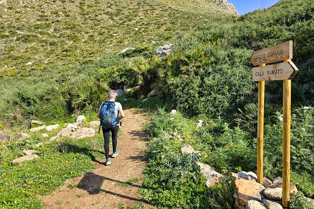
Si sale seguendo segnavia Baglio Cofano
Si sale su sentiero verso la vetta del Monte Cofano
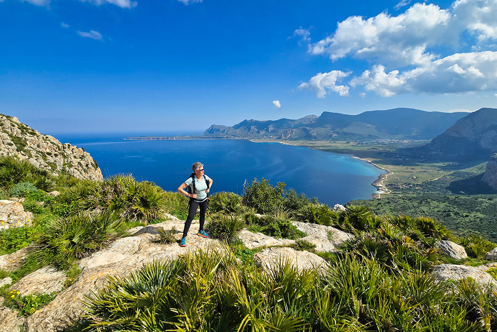
Bel panorama verso San Vito Lo Capo
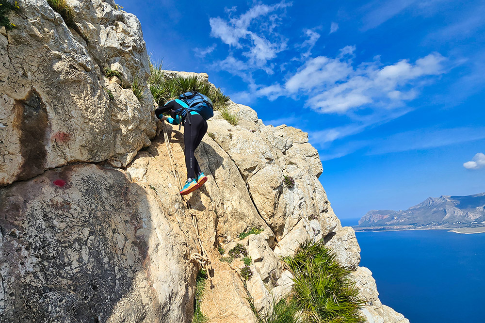
Passaggio con funi
Si sale per il sentiero
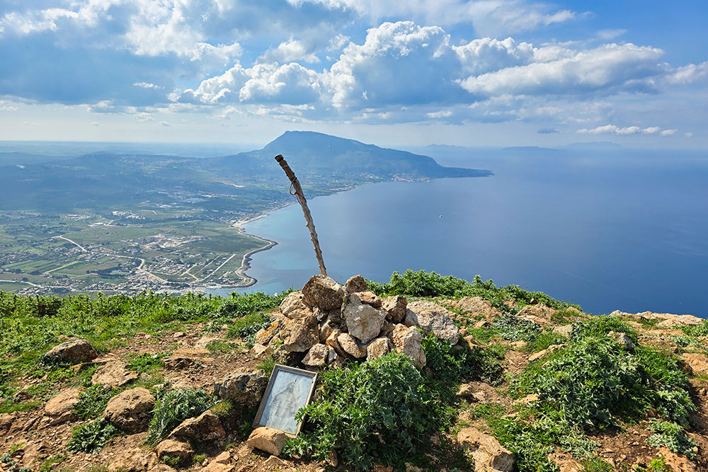
In vetta al Monte Cofano
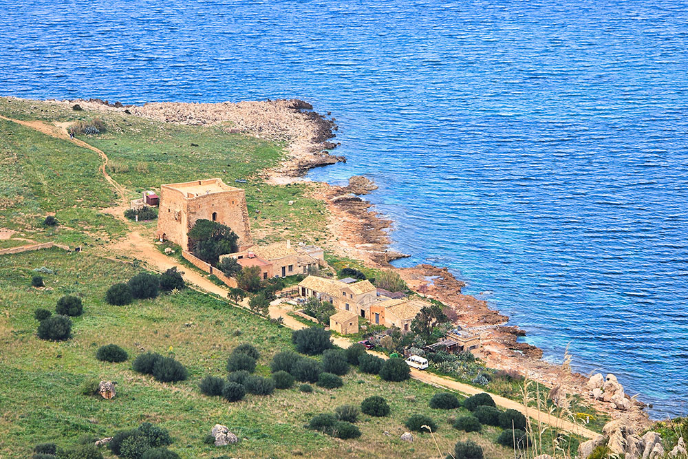
La Torre della Tonnara di Cofano vista dall'alto
La Torre della Tonnara di Cofano
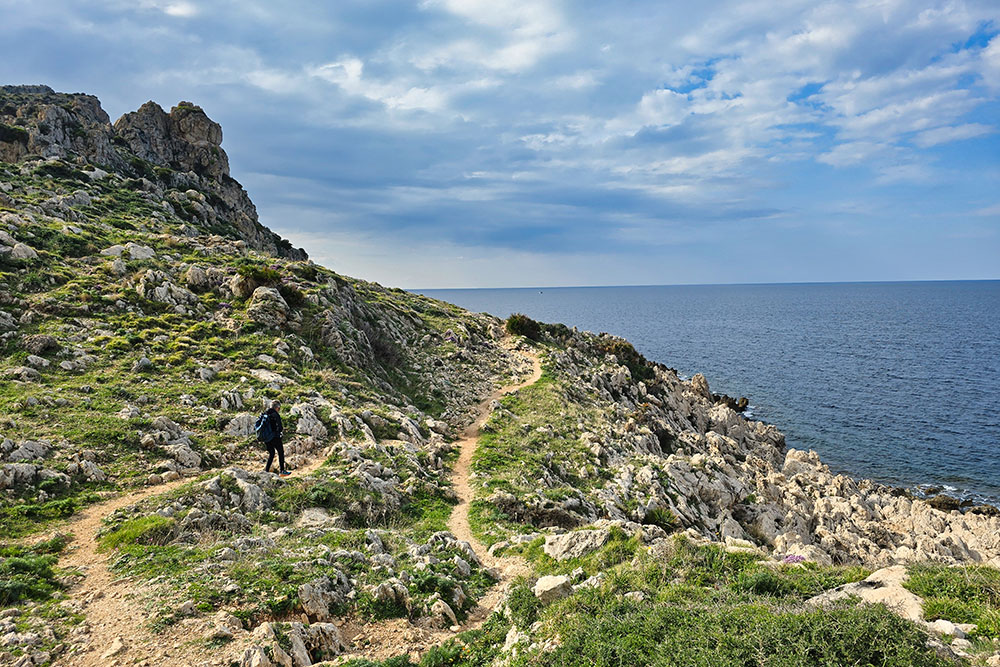
Si segue il sentiero lungo la costa
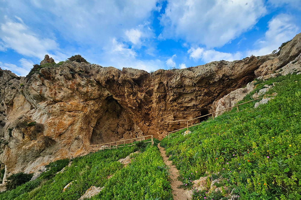
La Grotta Perciata
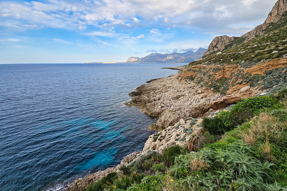
Bellissimo scorcio di costa
La Torre di San Giovanni


