


![]()


Durata
 7:00 h
Distanza
 14 km
14 km Ascesa
 1140 m
Discesa
 1140 m
H Max
 2602 m
H Min
 1829 m
Ascent to Colbricon East and West
DESCRIPTION
Hike to Colbricon: between crystal-clear lakes and wartime memories.
Geographical Location
We are in the heart of the Paneveggio - Pale di San Martino Natural Park, one of the most fascinating protected areas in the Dolomites. Our starting point is a short distance from Passo Rolle, where the twin peaks of Colbricon rise majestically. Part of the Lagorai Group, these peaks mark the northeastern boundary of the group, set in a mountain landscape of rare beauty.
Hike
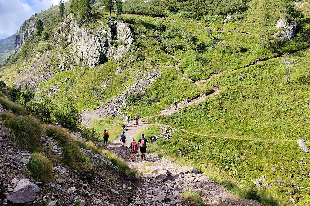
This exciting circular hike offers a unique trekking experience, requiring surefootedness, especially on the summit sections, and is recommended for experienced hikers. The views along the route are extraordinary, characterized by the sharp contrast between the dark granite rocks of the Lagorai and the lighter tones of the surrounding Dolomites. The panorama ranges from the nearby Pale di San Martino to the Latemar, Catinaccio groups, and even the Sassopiatto and Sassolungo. The normal route leading to the two peaks winds along the northern slope, crossing scree and first-grade rocks, adding a touch of adventure to the hike. The two Colbricon Lakes encountered along the way are worth a stop: their crystal-clear waters, framed by mountains, offer a spectacle of rare serenity.
History
The hike to Colbricon is not just a journey into nature but also a deep dive into the history of World War I. The route passes through ancient military positions, fortified settlements, and rock-carved tunnels, bearing witness to the fierce battles that took place on these peaks. Here, the Italian and Austro-Hungarian armies faced each other bitterly, often resorting to bayonets and mines. In the summer of 1916, the Italian army, guided by the invaluable advice of the Primiero mountain guide Michele Bettega, managed to conquer the strategic peaks of Colbricon East and Cavallazza. The capture of Colbricon West, achieved with daring climbing actions in October of the same year, further highlighted the importance of high-altitude operations. In 1917, mine warfare reached its peak on these mountains: the first Italian mine exploded in April, followed by others, while the Austrians responded with sudden and lightning-fast attacks. Despite the devastation and numerous casualties, the positions remained unchanged until the Italian retreat in October 1917, following the defeat at Caporetto.
ITINERARY
From the Malga Rolle parking area (1898 m), cross the paved road and take trail 348. Shortly after, you’ll reach Busa Ferrari (1880 m), where the La Baita refreshment point is located. Continue on to the Colbricon mountain hut with its two namesake lakes (1930 m). Circumnavigate the larger lake and arrive at Passo di Colbricon (1908 m). Now follow trail marker 349, and at around 2350 m, turn left, where the “Sentiero attrezzato Achille Gadler” begins. Pay attention at the junction, as it is not well-marked and can be hard to spot. After reaching the summit of Colbricon East (2602 m), retrace your steps for a short distance and then turn left. Head towards Colbricon West. Pay attention to the junction that ascends to the left; the only sign is a rock with the inscription “Targa Aldo.” After reaching the summit (2602 m), return to the junction and turn left towards Forcella di Ceremana (2428 m). Before reaching the pass, you’ll need to climb a 10 m metal ladder and traverse a section equipped with a metal rope. From the pass, descend via trail 337 to the Punta Ces mountain hut (2230 m) and then descend into Val Bonetta. At the junction, keep to the left and return to Passo di Colbricon, the Colbricon Lakes, and the starting point via trail markers 10 and 348.
EXCURSION DATE
August 10, 2024
STARTING POINT
Malga Rolle
REFRESHMENT POINT
Colbricon mountain hut
AUTHOR’S SUGGESTIONS
To climb both peaks, you need a steady step, no fear of heights, and a basic ability to scramble on rocks.
SAFETY TIPS
The feasibility of the proposed itinerary, like all mountain terrain, is subject to environmental changes due to natural events and weather conditions. Therefore, before setting out, consult the relevant tourist offices and/or nearby refuges.
Our GPX tracks are only indicative; the route was completed under the best conditions of trails and weather on that day. Always assess the situation on-site.
Additionally, remember to evaluate the route based on your physical abilities, training, and equipment.
It is advisable to inform someone of the itinerary you intend to follow.
Remember that the emergency number is 112.
EQUIPMENT
It is recommended to have suitable equipment for the route, weather conditions, and season: windproof and/or waterproof jacket, map and/or GPS device, sunglasses, sunscreen, boots, first aid kit, specific clothing, gloves, backpack with food and drinks.
RECOMMENDED MAPS
Tabacco 06 Val di Fassa e Dolomiti Fassane
INTERESTING LINKS
https://www.trentinograndeguerra.it/
HOW TO ARRIVE
From Predazzo, take the SS50 to Malga Rolle (1.2 km before Passo Rolle)
PARKING AREA
At Malga Rolle
GPS coordinates: 46.295927, 11.776282
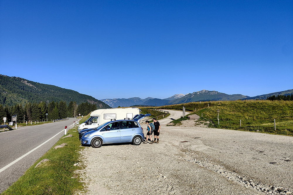
Parcheggio presso Malga Rolle
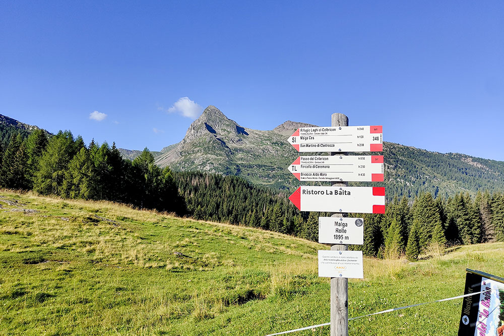
Inizio del percorso
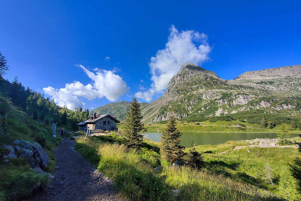
Arrivati al Rifugio Colbricon e agli omonimi laghi
Passo del Colbricon
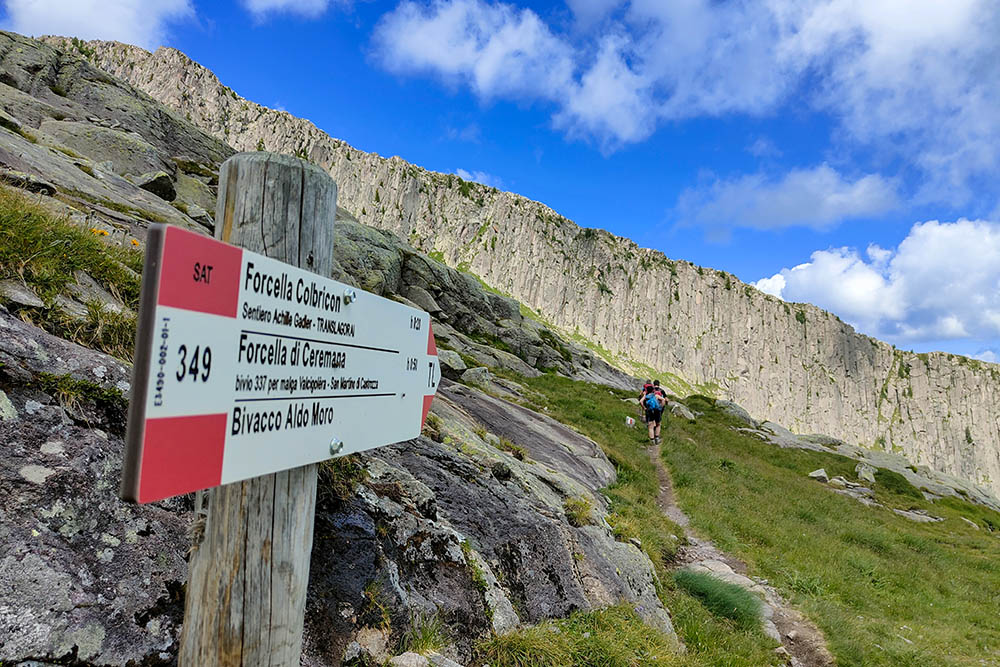
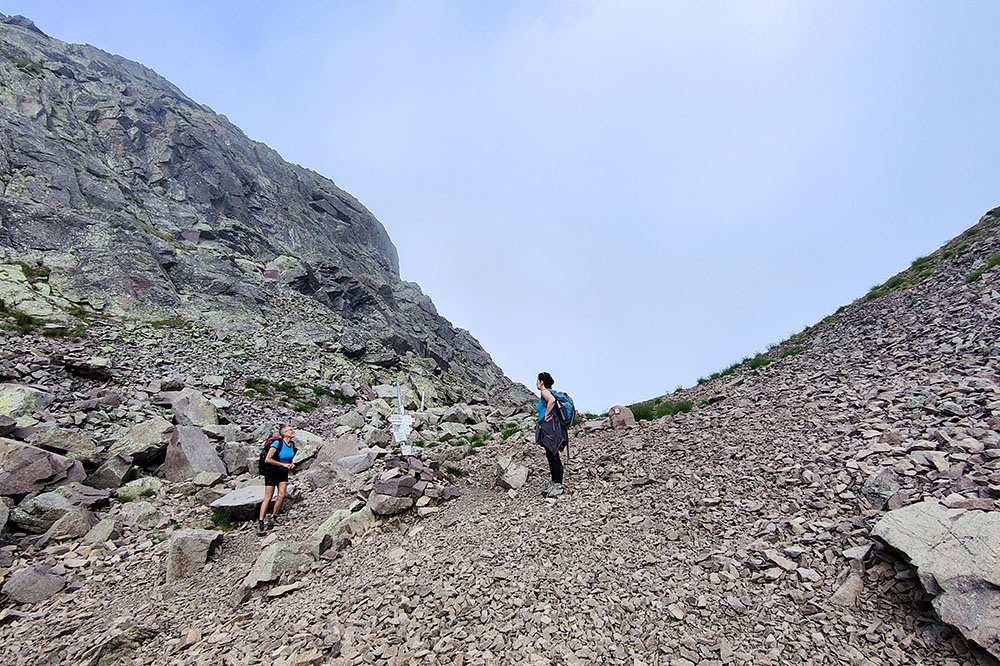
Si sale sul sentiero 349
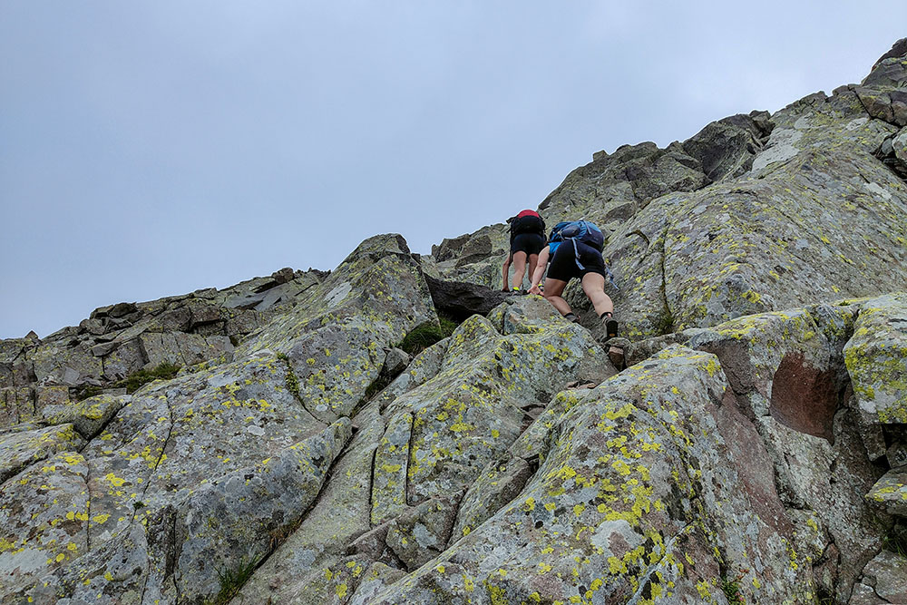
Ultimo tratto per la Cima Colbricon Est
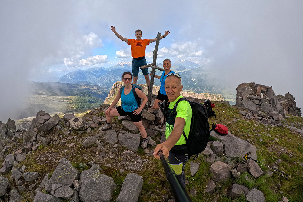
In cima alla vetta del Colbricon Est
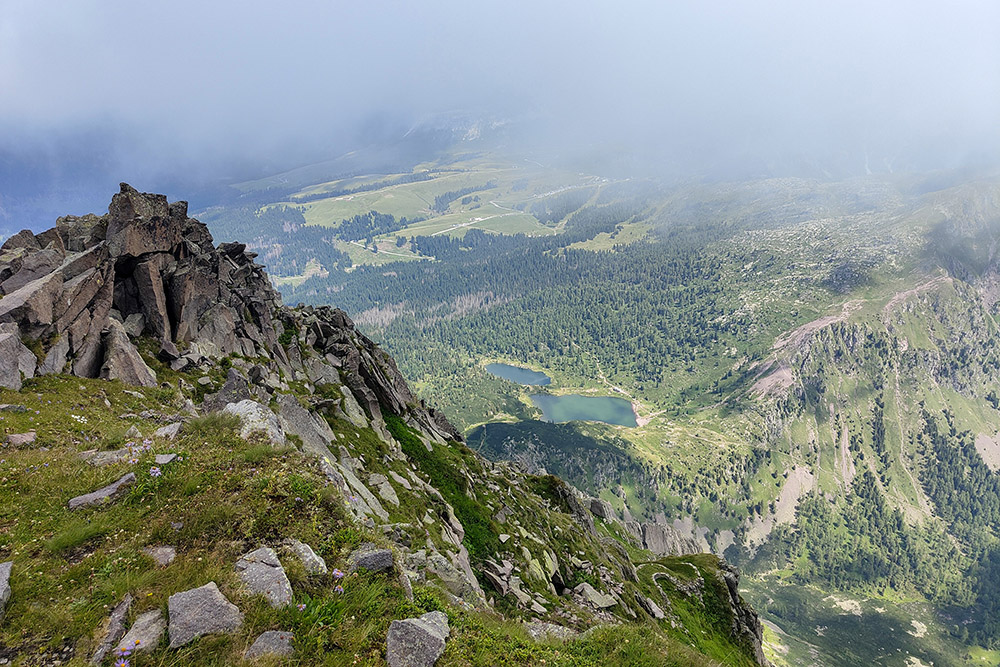
Vista verso i Laghi di Colbricon
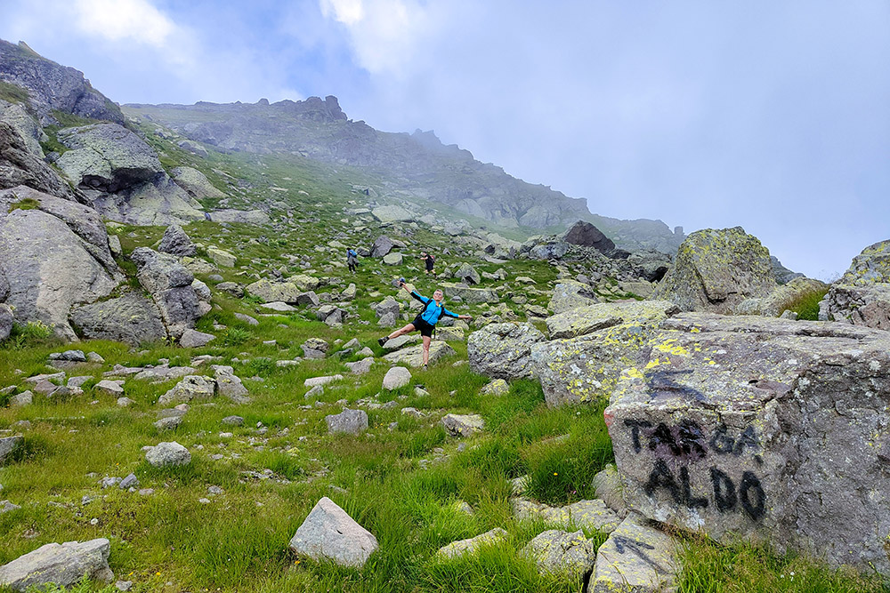
Bivio per salire alla Cima Colbricon Ovest
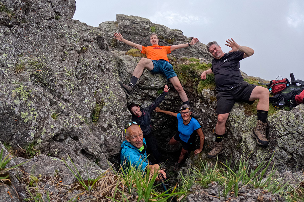
Arrivati in vetta al Colbricon Ovest
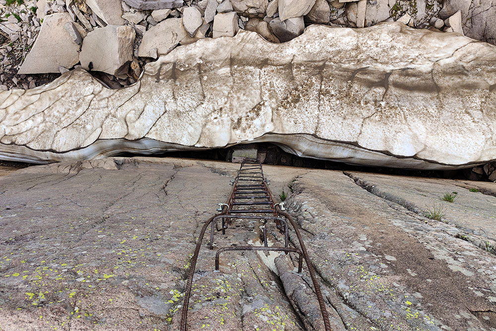
Scaletta in ferro di circa 10 m
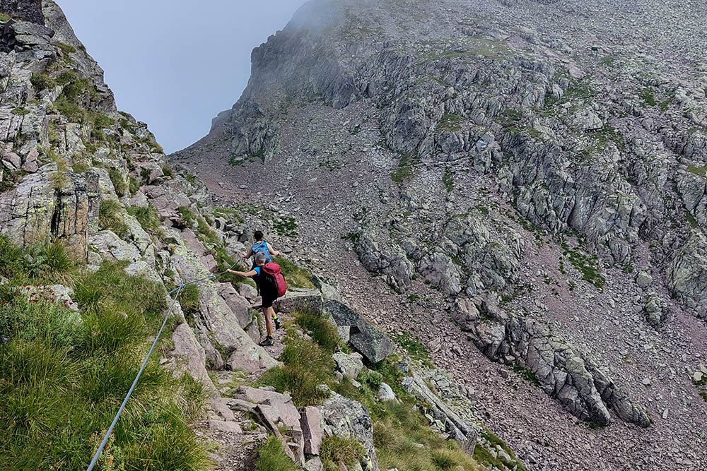
Tratto semplice con cordino
Forcella di Ceremana
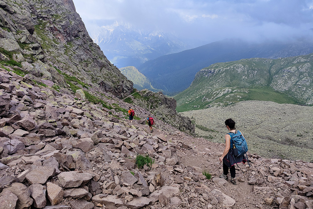
Si scende sempre sul 349
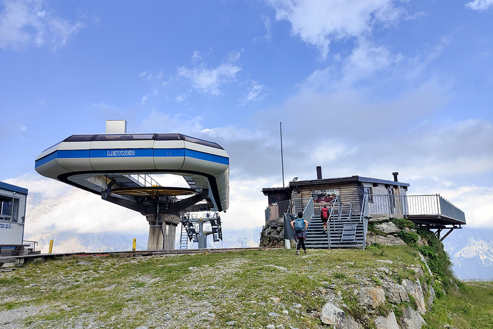
Rifugio Punta Ces


