


![]()


Durata
 3:15 h
Distanza
 4,7 km
 Ascesa
 570 m
570 mDiscesa
 570 m
570 mH Max
 1493 m
H Min
 938 m
938 mFerrata Croce di Fai on the Paganella Plateau
DESCRIPTION
A vertical adventure just steps away from Trento.
Geographic location
Fai della Paganella is a charming village in Trentino, located at 960 meters above sea level on a natural terrace overlooking the Piana Rotaliana. The village sits at the foot of the majestic Cima Paganella and is surrounded by woods and pastures that make it a perfect destination for those seeking tranquility, nature, and outdoor activities. Its strategic position makes it an ideal destination for both winter sports enthusiasts and hiking lovers in summer, being a short distance from the city of Trento and easily accessible from the A22 Brenner highway.
Hike
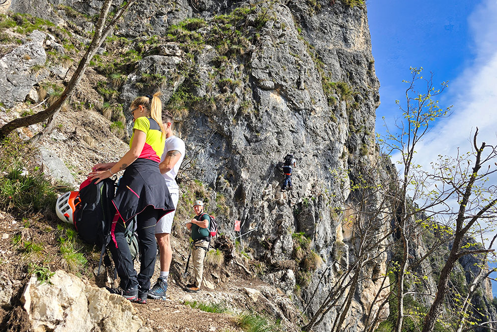
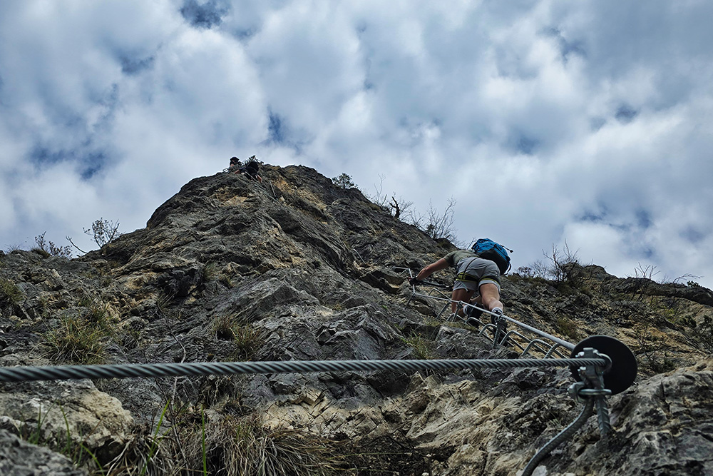
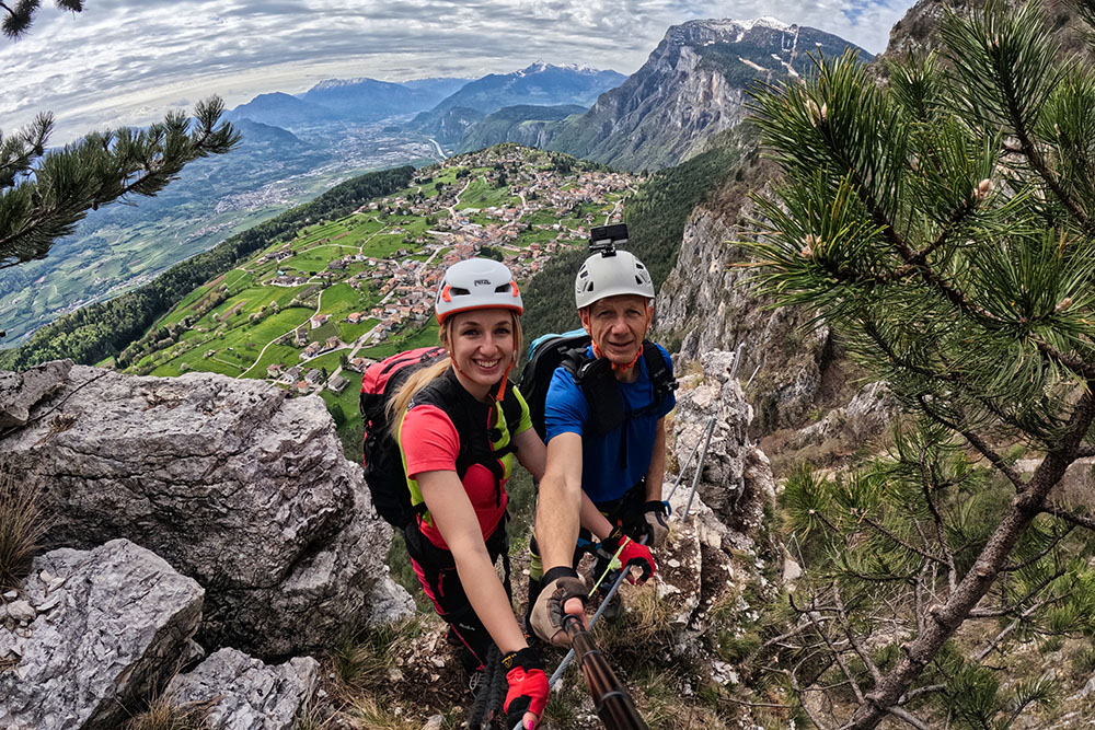
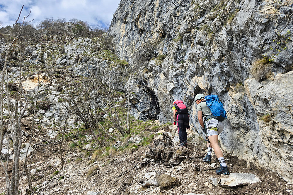
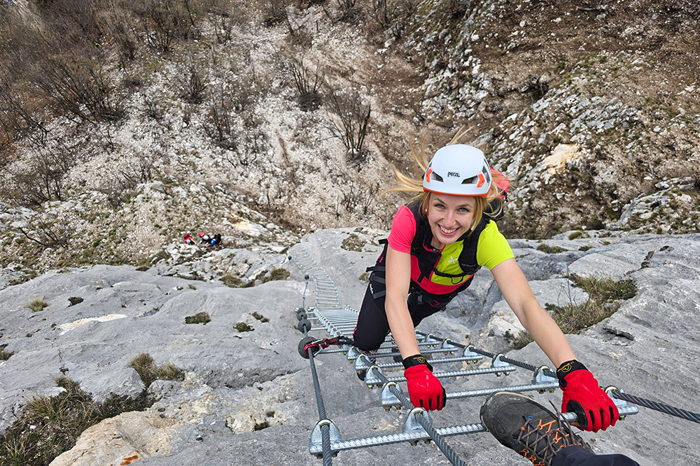
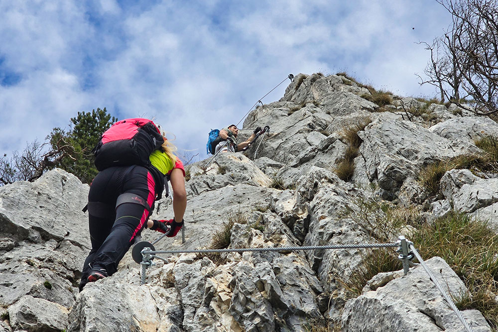
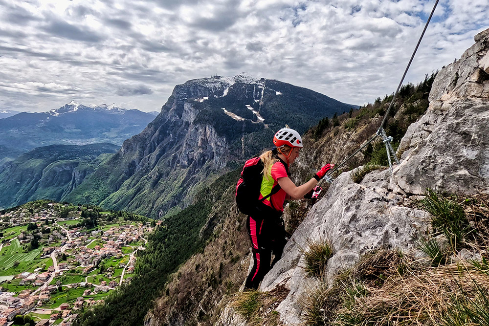
The Ferrata Croce di Fai extends along the southern face of Monte Fausior, the mountain that overlooks the village of Fai della Paganella. It covers an elevation gain of about 300 meters from the starting point to the summit, plus about 200 meters of approach trail. The route consists of two equipped sections on the two rock pillars that characterize the face, and a connecting path that crosses the detrital ledge.
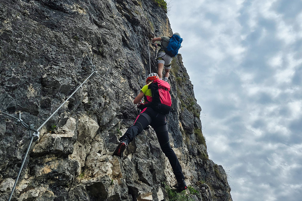
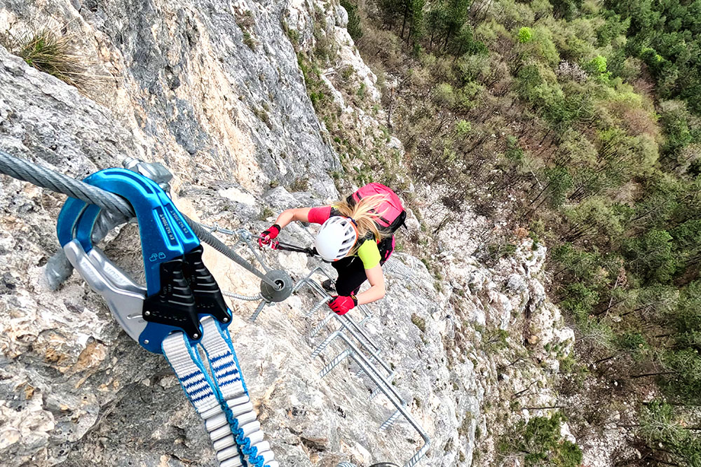
The via ferrata is predominantly vertical, with highly exposed sections and technical difficulties of level C (on a scale from A to F). Therefore, it is classified as moderately difficult, suitable for hikers with decent experience in equipped routes and good physical condition.
The route has been designed with modern criteria, including numerous brackets and anchors that facilitate progression in the most challenging sections. The southern exposure makes the via ferrata particularly suitable for mid-seasons when weather conditions are more favorable.
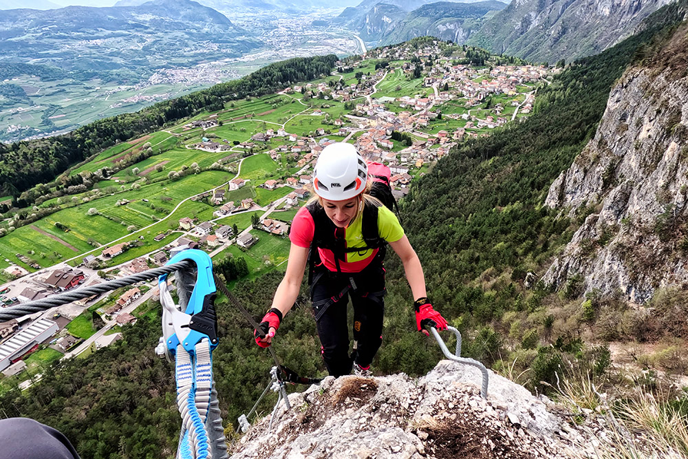
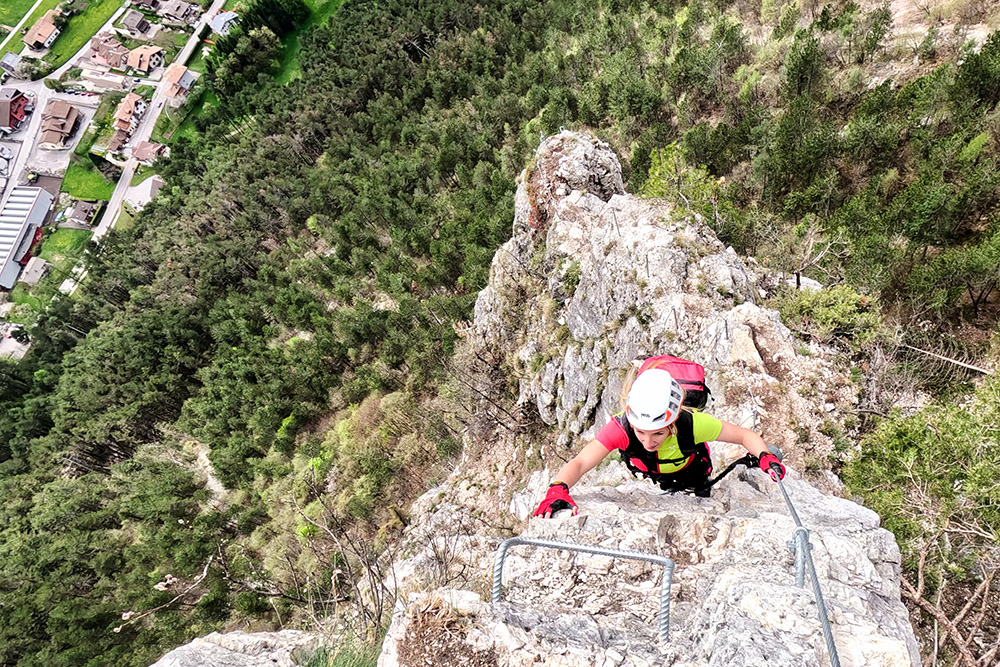
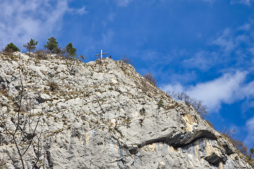
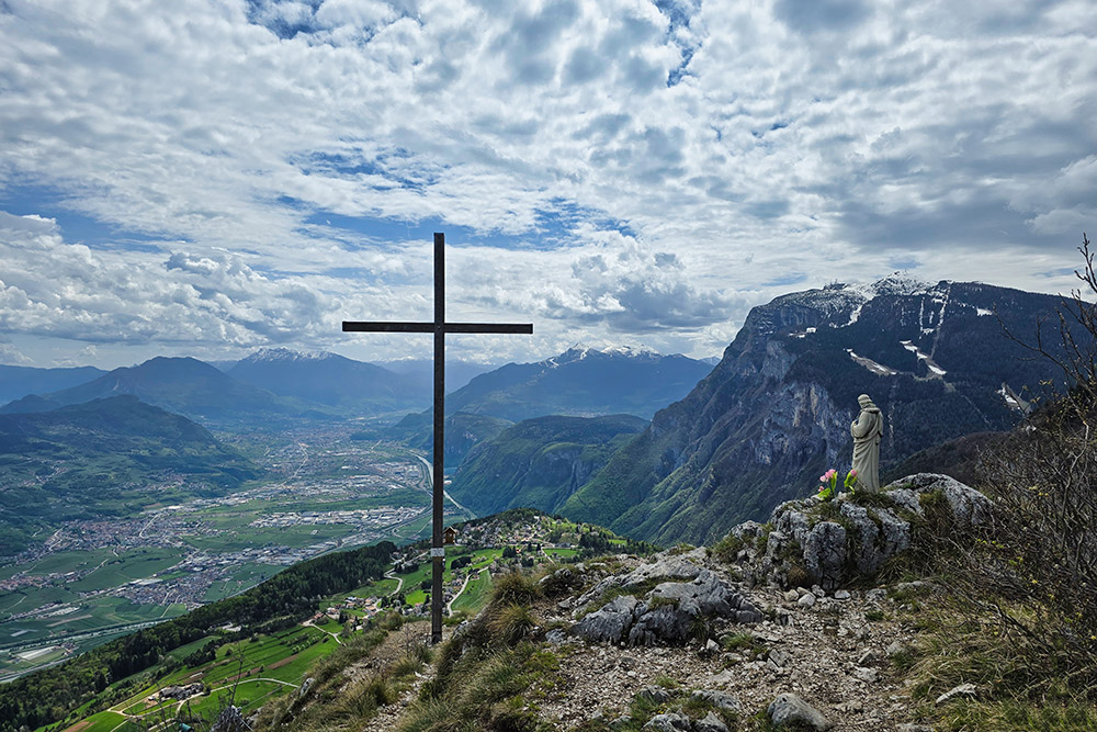
At the end of the via ferrata, you reach the Croce di Fai. This is a wonderful viewpoint perched above Fai della Paganella that offers a 180-degree panorama over the Adige Valley, the Paganella, Bondone, Vigolana, Marzola, and the Lagorai Group.
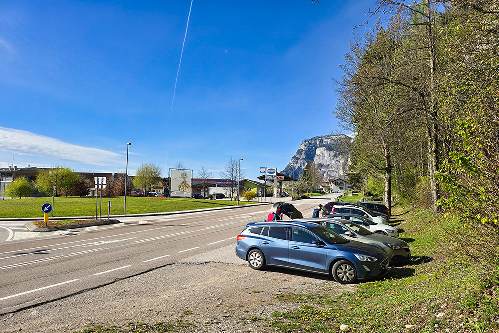
The route can be started from the center of the village, convenient for tourists staying there - this way, users can complete the hike without needing to move from the village by car - or from the dedicated parking area located in front of the Tamoil gas station.
The return can be made on two tracks, depending on the starting point. From the end of the via ferrata near the Croce di Fai, follow the short path that in a few meters leads to the forest road. Here you can go left in the direction of Laston - Santel which will take you back to the village, or right in the direction of Bocca delle Scalacce which will take you back to the parking area near Tamoil.
Time required: 3 hours and 15 minutes, broken down as follows: 35 minutes for the approach, 1 hour and 40 minutes for the ascent, and 1 hour for the descent.
History and curiosities
Completed in the summer of 2024 with a municipal investment of 250,000 euros, this via ferrata represents an important addition to the local tourist offerings. The intervention aimed to combine the enhancement of the territory with the creation of new opportunities for outdoor activity enthusiasts.
The Cross that gives the via ferrata its name has historical significance for the local community, having been erected at the beginning of the twentieth century as a reference point and symbol of protection for travelers.
ITINERARY
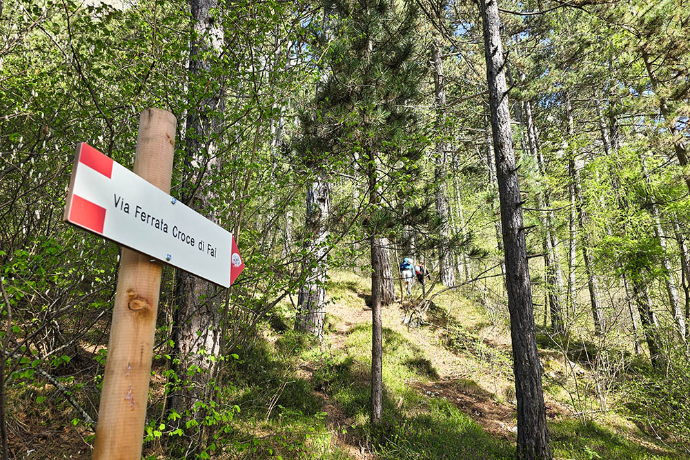
From the parking area (938 m) near the Tamoil station, follow the Via Ferrata Croce di Fai sign heading southwest, with a slight ascent through the forest until you intersect the path to the via ferrata start on the right.
Arriving at the starting point (1165 m), climb the first equipped section, characterized by a rocky wall with good natural holds integrated with metal brackets at the most challenging points. After overcoming this first pillar, continue on a panoramic path that crosses the vegetated ledge, offering a moment to catch your breath and the opportunity to admire the surrounding landscape.
The second equipped section presents a more technical climb with some vertical passages that require good coordination. This segment finally culminates at the Croce di Fai (1465 m). For the return, follow path 604 Bocca delle Scalacce and then path 603 Fontana Bianca - Fai della Paganella.
EXCURSION DATE
April 22, 2025
STARTING POINT
Fai della Paganella
REFRESHMENT POINT
None
AUTHOR'S SUGGESTIONS
Obviously not recommended for people who suffer from vertigo.
SAFETY ADVICE
The practicability of the proposed itinerary, like all mountain morphology, is subject to environmental changes due to natural events and weather conditions. Therefore, before departing, consult the relevant tourist offices and/or reference mountain huts.
Our GPX tracks are only indicative, meaning the route was completed in the best possible way given the trail and weather conditions of that day. Always evaluate the situation locally.
Also, remember to evaluate the route based on your physical abilities, training, and available equipment.
It is advisable to inform someone about the itinerary you intend to take.
Remember that the emergency number is 112.
EQUIPMENT
It is recommended to have suitable equipment: technical mountain clothing, boots with Vibram or similar soles, via ferrata set, harness, helmet, via ferrata gloves, sunglasses, sunscreen, backpack with drinks.
RECOMMENDED MAPS
Tabacco 067 Paganella Plateau - Adige Valley – Trento
INTERESTING LINKS
https://www.visitpaganella.it/
HOW TO ARRIVE
A22 Exit San Michele all'Adige - Mezzocorona. Take the SS43, direction Mezzolombardo. After passing Mezzolombardo, take the SP64 and continue to Fai della Paganella.
PARKING AREA
In Fai della Paganella, in front of the Tamoil gas station.
GPS Coordinates: 46.187011, 11.074426
Parcheggio a Fai della Paganella
Sentiero per l'attacco della ferrata
Attacco della ferrata
Primo tratto
Primo tratto
Primo tratto
Primo tratto
Primo tratto
Fine del primo tratto di ferrata
Croce di Fai con l'ultimo tratto di ferrata
Secondo attacco
Secondo tratto molto esposto
Secondo tratto
Sullo sfondo la Paganella
Croce di Fai e fine della ferrata


